
[This walk was completed on the 4th July 2022]
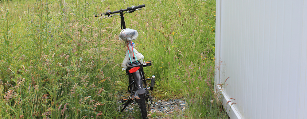
I chain my e-bike behind a shed near the petrol station in Laide. Today, I’m walking eastwards along the A832. It’s a late start – nearly 2pm – before I get going.
My B&B doesn’t do breakfast and so, earlier this morning, I drove my campervan to a high view point along the road, and brewed up some breakfast. It was windy. Too windy to pop up the roof. After I’d finished my coffee, I sat reading while the van shook and the rain drove sideways across the windscreen.
Eventually, the rain eased off, but I decided it was too dangerous to ride my bike in the gale.
Driving a little way back along the road, I found a more sheltered place to park, pulled out my Scooty bike, and set off back to Laide. There were some steep hills on the way – tough for both the bike and for me. In retrospect, it was a good job I’d shortened the route, because we just made it back to the petrol station before the battery died.
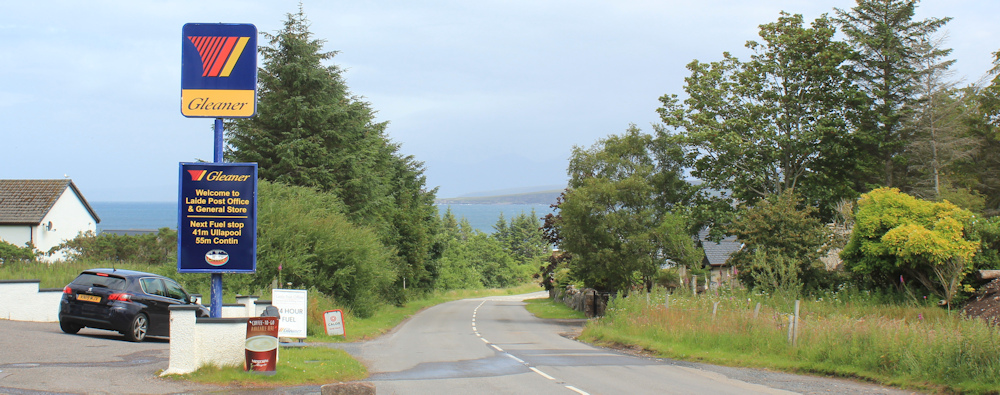
Luckily, the wind seems to have dropped and the rain has stopped. I set off walking in watery sunshine, passing the turn off to the campsite in Laide (the one I nearly stayed at).

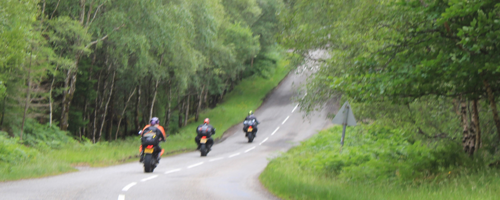
I was worried about traffic, because this is a main A road and part of the NC 500 route, but I needn’t have been concerned. Traffic is surprisingly light. Perhaps the bad weather has put everybody off?
I’m leaving Laide behind. Look at the dark rain clouds to the east. I hope they’re not coming my way.

It’s hard to belief I was buffetted by the wind during breakfast. There is still a strong breeze, but the walking is easy along the road. Wild flowers line the verges.

I stop to take photographs of the views. Dramatic, with dark clouds, over there. Sunny over here.
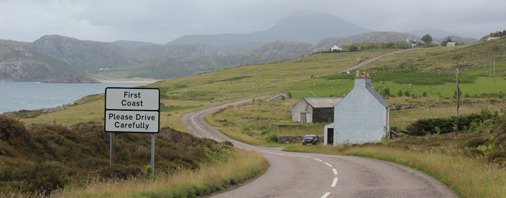
This little hamlet is called First Coast. I love the simplicity of the name. The hill that seemed so steep when I cycled up it earlier, now seems a gentle incline.
Walking through First Coast (it’s tiny), I soon come to the next hamlet, which is called… Second Coast (it’s even tinier).

In fact, it’s hard to spot any houses in Second Coast. The few I do see are set back from the road and look as if they’ve been recently renovated. Maybe holiday homes? This one is very attractive and overlooks the bay.

There is an honesty box by the side of the road. Fresh eggs for sale. I hesitate. Tempting, because I could cook myself eggs for breakfast in my van – but I would have to buy some oil, and a pan, and then there is washing up to do…

… I think I’ll just stick with muesli and bread rolls. Onwards.
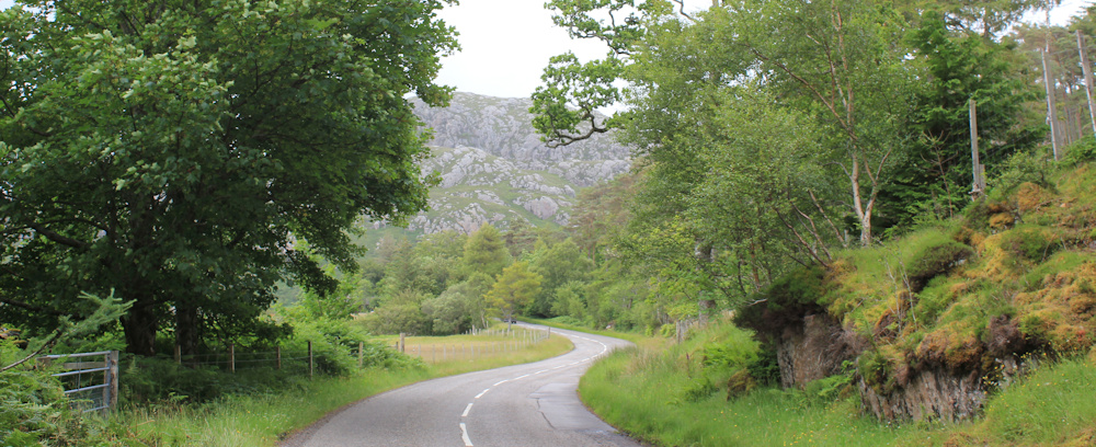
Beyond Second Coast, the road turns inland and rises up towards higher ground in a series of looping curves. There are craggy rocks on either side, and the landscape takes on a wilder feel.

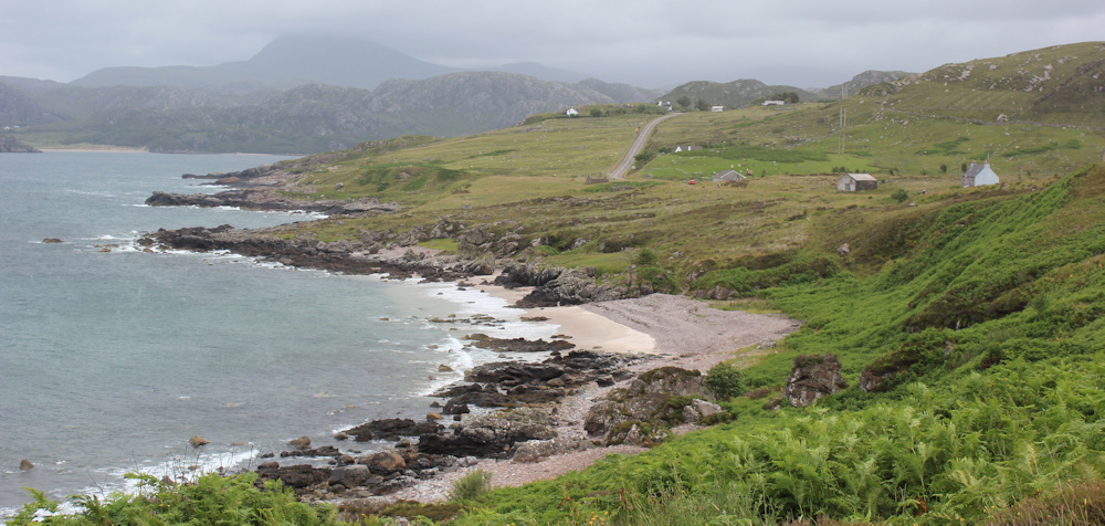
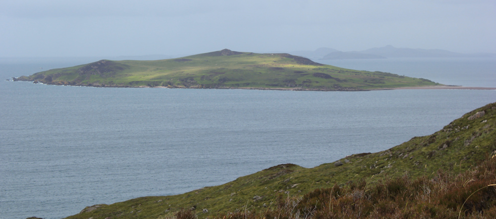
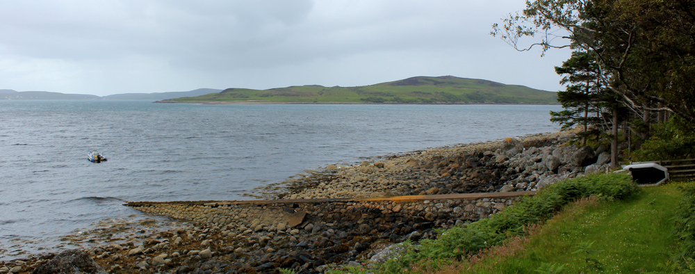
The sky is cloudy and threatening rain again. I look down across Gruinard Bay, where I get an excellent view of Gruinard Island, which is dotted with bright splashes of intermittent sunshine.
I reach the brow of the slope. Warning signs – falling rocks, a steep curve, and a 12% slope. But, wow, the views are great.
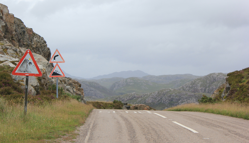
There is a little path beside the road which leads to an even higher spot. I climb up and spend a few minutes there. Have a drink and a snack. Enjoy the views. Take plenty of photographs. Look at that lovely beach down there.

Time to hit the road again. I climb down from my vantage point and set off down the hill. This is the 12% slope mentioned in the warning signs. A couple of touring cyclists are puffing up towards me – woman in front, man behind.
“Is it far to the top?” he yells. “No,” I shout back, “only 20-30 yards.”
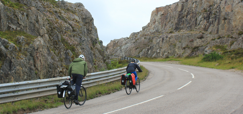
“Keep going!” I hear him yell at the woman in front. They disappear around the bend, and I never do see if they make it or not.
I remember this hill from before, when I struggled up here on my Scooty bike. It really is STEEP. I ran out of gears on the last bend, and had to push my bike that last 20 yards. E-bikes are wonderful most of the time, but they are heavy little devils when you have to push them!
On, I go, down the hill. It’s much more enjoyable walking down than cycling up.
At the bottom of the hill is a place called Little Gruinard, where a couple of buildings are tucked away among trees, and I cross over a little river. Acutally, quite a raging little river. It cascades under the roadbridge in a series of rapids.

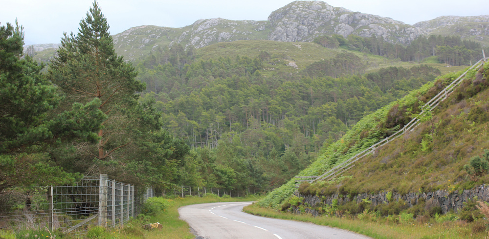
It’s flatter down here. The road winds gently through trees and open meadows.The shore is close by, on my left.
Out of the corner of my eye, I’m startled by a group of flapping black birds… no… just washing on the line.

I reach another river and another bridge. I use the stone parapet to perch my camera and take a self-portrait. Looking very glamorous in my high-vis jacket, at least I remember to pull off my beanie cap.

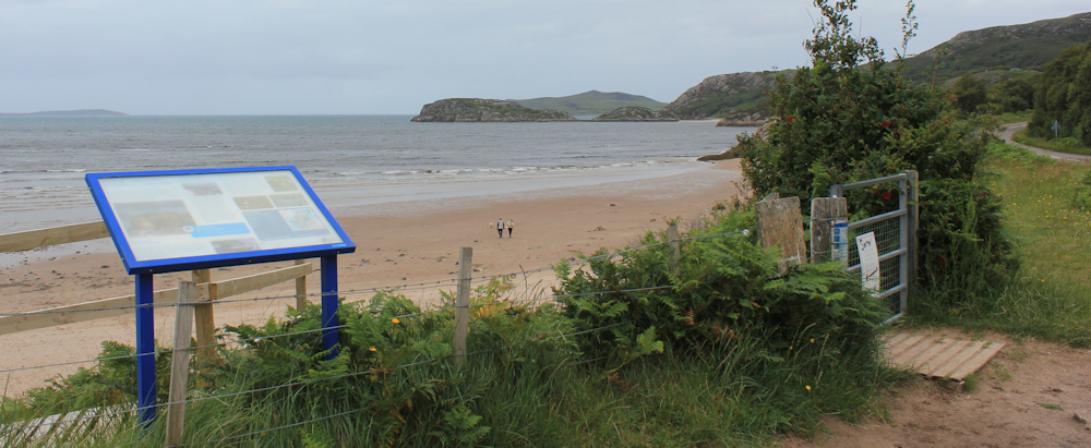
Now the road runs beside the shore, which has opened out into a beautiful bay, lined by a sandy beach. This beach has no name on my map, but I believe it is called Little Gruinard Beach. Anyway, it’s beautiful.

I pass a rather hand-made sign pointing out a path to the beach, and further along the road I find a small car park and an information board. Here there is an official looking gate and path, but a warning sign tells me the boardwalk leading down to the beach has been washed away in a storm.
I stand and admire the view. The little car park was empty when I cycled past earlier, but is now filling up. A trio of minibuses arrive, and young people begin spilling out, and I find myself surrounded.
Hurriedly, I get out of their way and carry on along the road, stopping to take a photo of the beach – you can see the minibuses parked above the path.

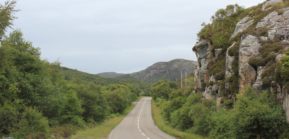
The road winds around a series of rocky outcrops, heading steadily upwards.
Here is another pretty beach – actually a continuation of the beach I’ve just left. There are several walking trails leading dowwards… tempting… but I satisfy myself with taking photographs instead.

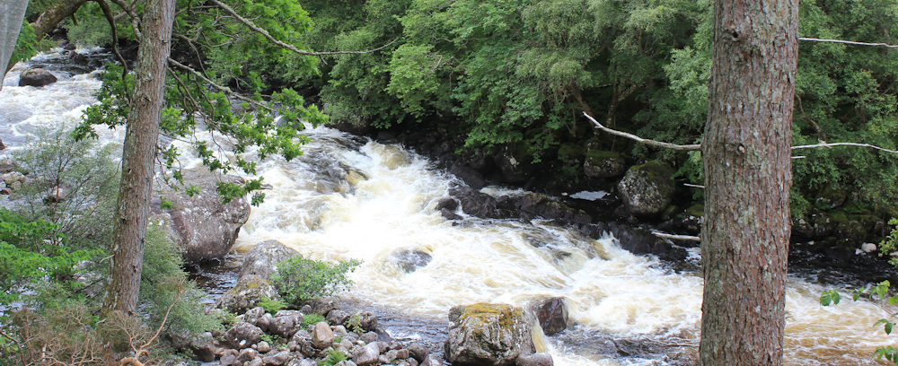
Up, through a rocky landscape, and down again. The countryside opens out into a broad river valley. This is the Gruinard River. Beside it, a Core Path runs inland to a place called Loch na Sealga 9km away. It would be a lovely walk, I’m sure, but heading in the wrong direction for me.
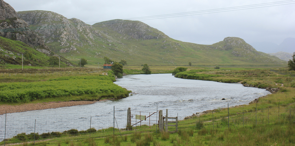
That view of the wide slow-flowing river is deceptive. The banks narrow and become rockier so, by the time I reach the road bridge, the river has become a steep set of rapids. Next to the bridge, there is a viewing platform above the water – where I stop and take photographs.

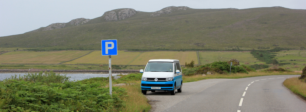
Onwards, along a gentle road, lined by trees. The rain has held off, and the better weather seems to have brought out the tourers. Campervans, caravans, and motorbikes.
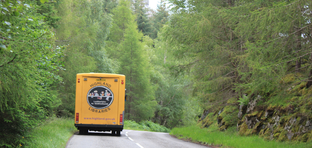
A big yellow bus trundles past – ah, a library bus. A good idea in scattered rural communities. We had several similar buses that meandered around the villages when I lived in Lincolnshire.
The river is still with me. I can hear its rushing waters through the trees to my left. There are ‘No fishing’ signs tacked to the trees, and even one ‘You are being watched!’ sign.

Who is watching and why? Maybe they’re trying to spot illegal fishermen?
I stop to take photos of the waters running below me. Always hard to capture in a photograph – the foliage is too dark, or the white foam is too white – either way, you lose the details. I admire professional photographers who work out how to take good shots of flowing water.
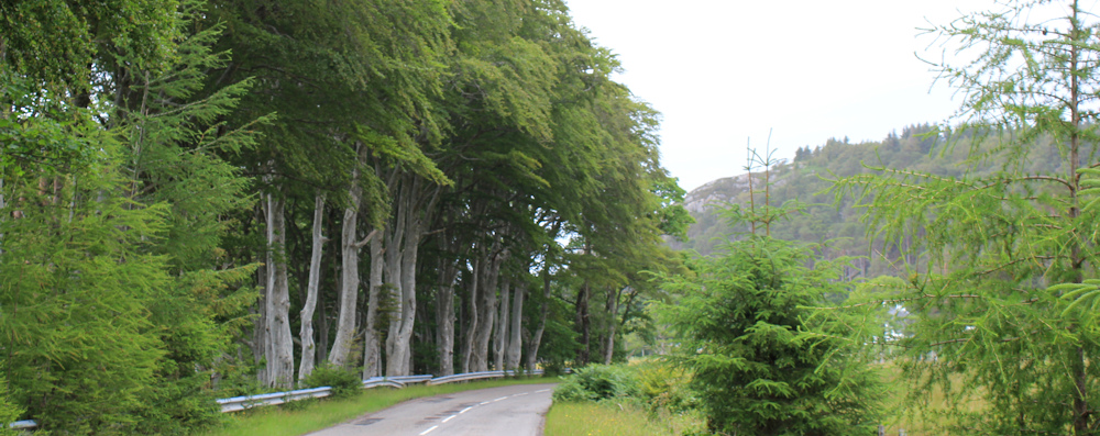
The river, finally, leaves me and empties into the bay. I’m walking along a line of beautiful trees. Pale trunks and brilliant green foliage. Don’t know what they are, but I noticed them earlier on my bike. Impressive.
The landscape opens out and the sight of felled trunks comes as a bit of a shock. These are harvested conifers, not my beautiful trees, but I’m always saddend to see the decimated slopes and carcasses of trees.

(Yes, I know, I’m much too attached to trees, which I almost regard as sentient beings.)
Nearby is another resting place – this one is for human remains. A walled burial ground. I would have crossed the road to investigate, but I’m growing tired and keen to get back to my van.

I’ve passed a large building – set back among the trees and closer to the shore. That must be Gruinard House. I wonder if the burial ground was once part of a large private estate, or whether there used to be a proper village here.
A few agricultural buildings are scattered about, but also what seems to be the remains of a larger settlement. There’s a telephone box, for instance, although it seems set firmly on private land. Well, maybe not so firmly, it has a definite lean!
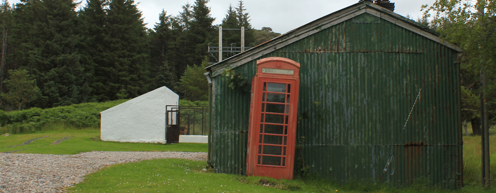
I would have gone to see if the phone was still working, but a fierce barking puts me off. There is a guard dog (in the white-walled enclosure in the photo above) who seems to object to my presence.
Nearby, a solitary fuel pump stands on its own. Love the old thing. Wonder if it still works, although the holes in its battered blue carcass suggests it doesn’t hold fuel any more.

A little further on, and signs warn me that ‘This is not a public jetty and the structure is unsound.’ I can’t see any sign of a jetty, and so I assume it has collapsed into the bay, until I walk a bit further on and spot this narrow little strip of a jetty. More a wide wall, than a jetty, to be honest.
The road hugs the shore, climbing a little higher, until I reach a wide bend. Here, in the shelter of the higher land to the east, is my little parking place – and there is my lovely van.
Well, it’s been a shorter walk than I had planned, with a frustrating beginning and a delayed start. But I didn’t get wet, the scenery was beautiful and tomorrow, as they say, is another day.
Miles walked today = 6.5 miles
Total around coast = 4,753.5 miles
Route:


A pretty walk. I love all those gushing rivers. Following your journey on my OS maps app, it looks so exciting when I have Lincolnshire to face next! I imagine all long distance walkers are in love with trees. I was stroking the bark of my magnolia today. 🙂
Lincolnshire is difficult after the joys of Scotland! I have a magnolia too, which has quite outgrown my tiny garden – but what can you do? Love trees.
I don’t know if you are going to mention it later in your walk, or whether you are aware of it but Gruinard Island has a scary history from WWII days. It is infamous. I won’t spoil it for others if you mention it later, but if not – look it up! In fact there is some interesting history from almost current days too – all related to the original deeds!!!
Oooh, no, I had no idea. I must look it up. Thank you.
Such a particularly beautiful walk. Love the First Coast and Second Coast names for the hamlets too.
I too was going to mention the drama of Gruinard Island but as Chris Elliot has suggested keeping it as a mystery to be researched I will not add a spoiler. The huge mountain you can see in the distance to the north is probably An Teallach, one of the more challenging Munros.
Laide beach. Lovely memories from taking it in during a complete tour around 2007/8 in our campervan around the the Scottish coast. Way before the NC500! I assume you know that Gruinard Island was contaminated with experimental anthrax from I think WW1 until a clean up in the 80s. As a newly married in the early 80s, I hired a cottage directly opposite it. You could just make out the “Danger, keep out” sign from the mainland.
What a delightful walk with much variety of scenery and weather. You captured a great atmosphere in the photos with the dark clouds and the river with the rushing waters and rapids. I also like the rocky outcrops and had a chuckle at the washing that looked like flapping birds! I also love trees and do think that in some ways they have some traits of sentient beings – read The Hidden Life of Trees by Peter Wohlleben.
That book is wonderful, isn’t it. Such a revelation about trees and how they communicate and seem to learn. It makes the brutal sight of logged slopes even harder to bear.
That book is wonderful, isn’t it. Such a revelation about trees and how they communicate and seem to learn. It makes the brutal sight of logged slopes even harder to bear.