
[This walk was completed on the 15th July 2022]
I cycle along the “wee mad road” from Lochinver to the parking spot overlooking Loch Buine Moire. Leave my bike chained up behind a gorse bush…
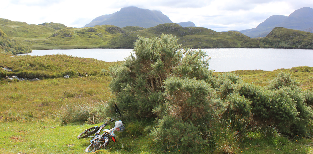
… pull on my hi-vis vest, and manage to snap a selfie. (I’m getting good at these!)
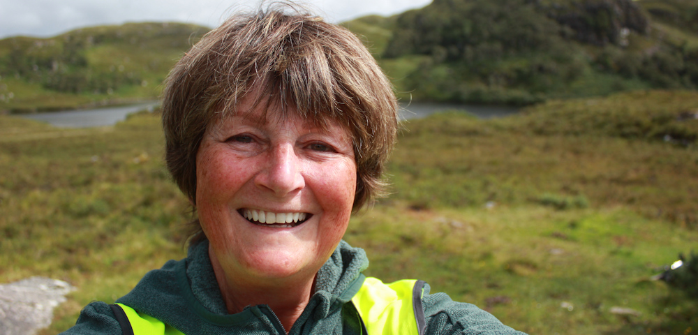
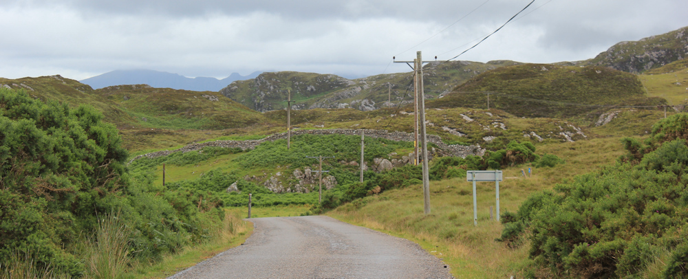
It’s a rare day of sunny intervals, and I’m in a happy mood. Fantastic views in all directions. Apart from the road, this line of electricity poles provides the only man-made structure in sight.

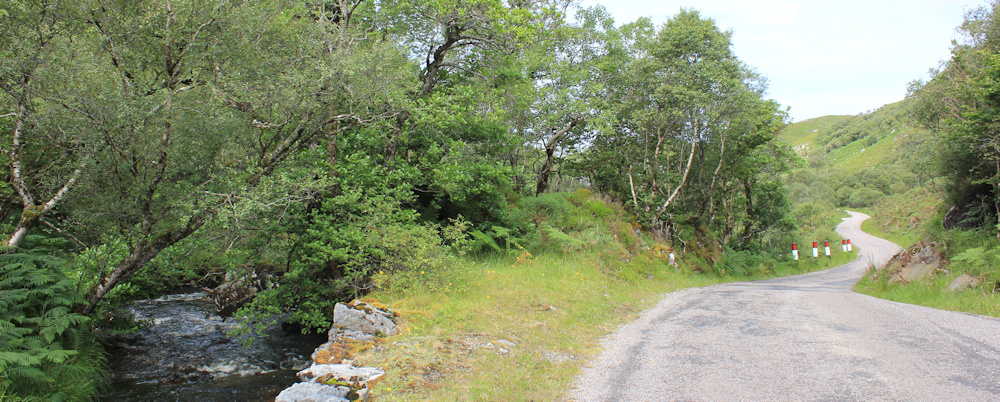
Leaving the loch behind, the road slips around the slopes of a hillock (Creag Dhubh on my map), following a narrow valley downwards. I’m walking alongside a little river – with the snappy name of Allt Gleann an t-Strathain – which drains the loch into the sea.
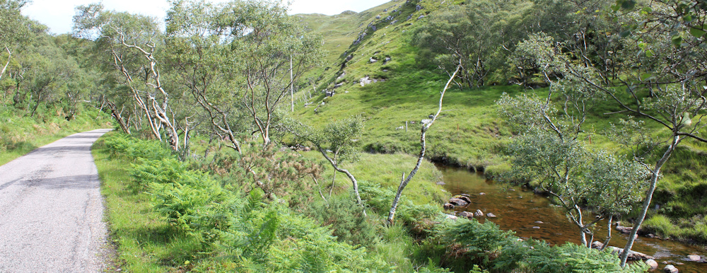
It’s a pretty walk, with wooded slopes, the brown water of the stream moving slowly over gentle rocks, and virtually no traffic.
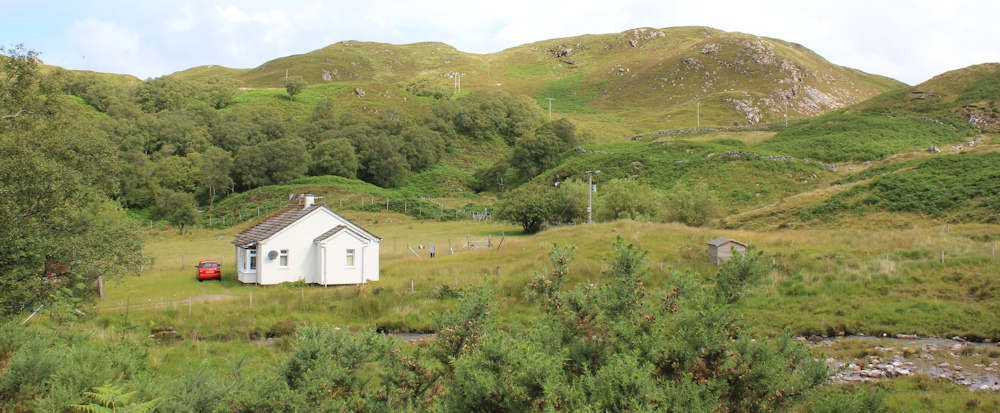
Love this little cottage. Earlier, while cycling along here, I saw a family walking across the fields towards this place, but now only the parked car indicates the presence of humans. In Scotland, even the smallest cottages feature on the OS map – Rhegreanoch is written above a small square indicating a building.
The road crosses over the stream, which now runs on my left. Down the valley we go.
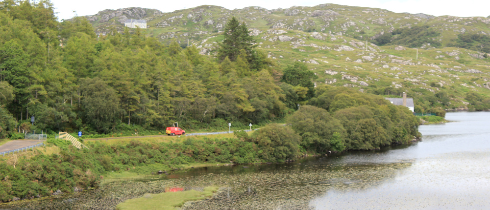
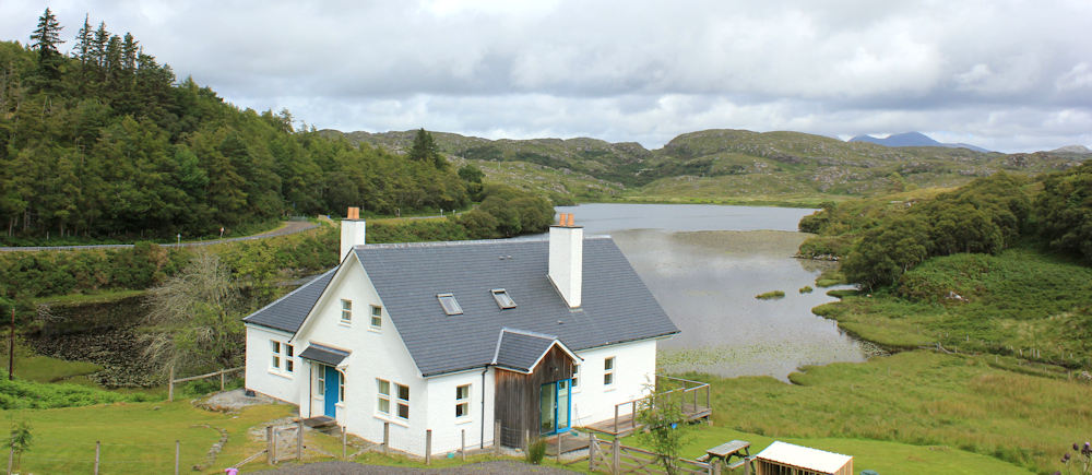
A couple of miles later, and I reach the bay where the stream empties into the sea. Loch an Eisg Brachaidh.What a beautiful view! There’s a little white house on the far side of the bay – must be a lovely place to live.
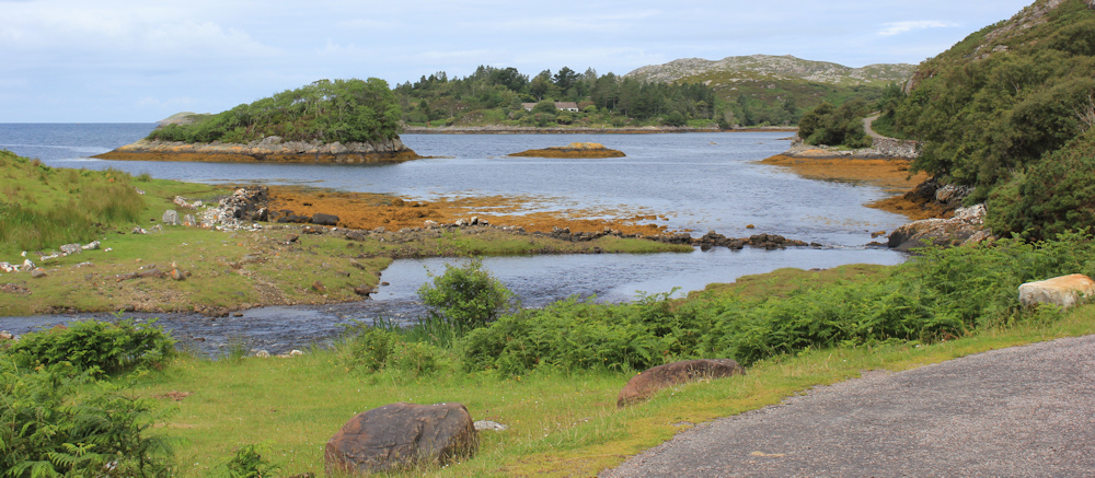
Beside me, the stream has widened into a river, and has picked up pace. Rushing waters fall over a wall of rocks. The wall doesn’t look natural – in fact it looks like a man-made dam.

[Later, I wonder if this is the place where the walk past Inverpolly Lodge would emerge. If so, I’m glad I didn’t try to follow that path. If those are supposed to be stepping stones… they don’t look safe!]
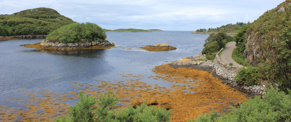
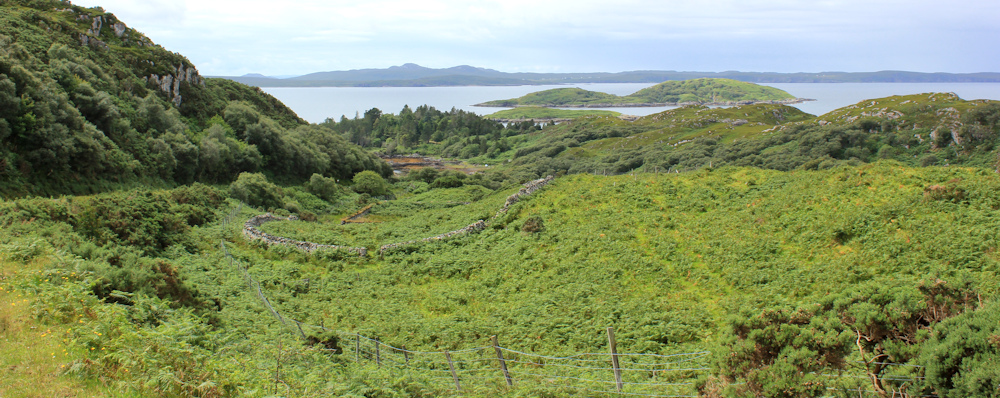
The loch is very pretty, and surrounded by promontories which almost completely encircle the quiet waters of the bay. The island in the middle has no name. My road curves around the shore, hemmed by stone walls and water on one side, and by rocky slopes on the other.
When I cycled along here earlier, this was probably the scariest part of the road and I was worried about meeting a vehicle. In fact, I met no traffic at all, but now I hear a roar and crunch of gears behind me. Step aside to let a white motorhome chug past. It eases, cautiously, around the bends.

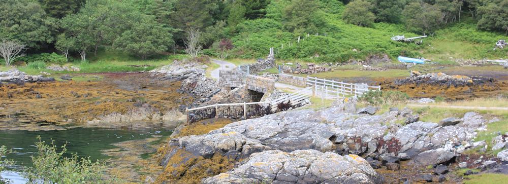
At the far side of the bay, a track leaves the road and crosses over a little stream to reach the furthermost promontory. It must lead to the house I saw earlier. the only building indicated on the map. What a place to live.
A cyclist overtakes me. He has been freewheeling down the river valley and cruising round the curves of the bay, but I know he is going to have to start working hard in a moment, because I know what’s round the next corner…
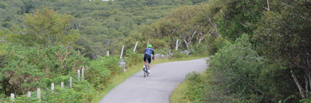
… a steep hill. Earlier, I sped down here on my e-bike, clinging onto the brakes and praying I wouldn’t meet a car coming towards me. Now, I puff my way up the hill.
I stop to catch my breath, and to snap a photo of the cows looking down on me. Hello cattle. I give them a wave, glad they’re far away. “Yes. Stay up there,” I shout.
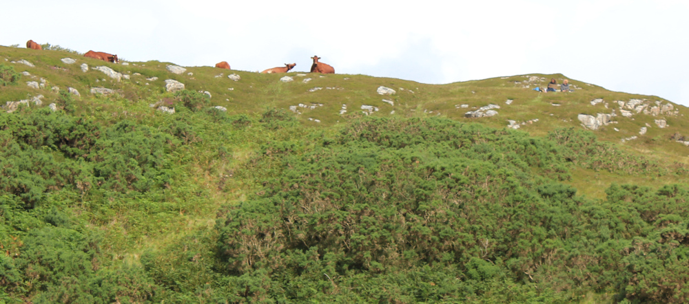
Only later, as I get closer to the top of the hill, do I spot the human figures sitting on the ridge (you can just seem them to the right of the photo above.) Two women are having a picnic. They give me a self-conscious wave as I pass below them. And I wave back – too far away to explain that I was really waving and shouting at the cows earlier, not at them.
The view down the hill is amazing. There’s the bay in the distance, and the valley where the bridge leads to the little white house – now hidden behind the trees.
I reach the top of the hill and am glad when the road begins to dip down again. Spot another white house, through the trees. It’s getting positively crowded round here!

My road approaches a bridge, where I’m surprised to see a gaggle of people are congregated. The first walkers I’ve met all day. A couple of ladies come towards me. “Are the waterfalls along this road?” they ask.
I explain I haven’t seen any waterfalls, and pull out my map, but can’t see any waterfalls marked. My Garmin is more helpful. “You need to turn right on the other side of the river,” I tell them. “And follow the track up the river valley.”
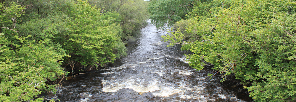
After they’ve left, and I’ve put my map and Garmin away, I stop to take some photographs of the river from the bridge.
Crossing the bridge, the road swings around a bend, and I realise why there are so many people here. A car park, of course! When I cycled past here earlier there were only a couple of campervans parked on the tarmac, now there are three vans, and a group of cars. A popular place.
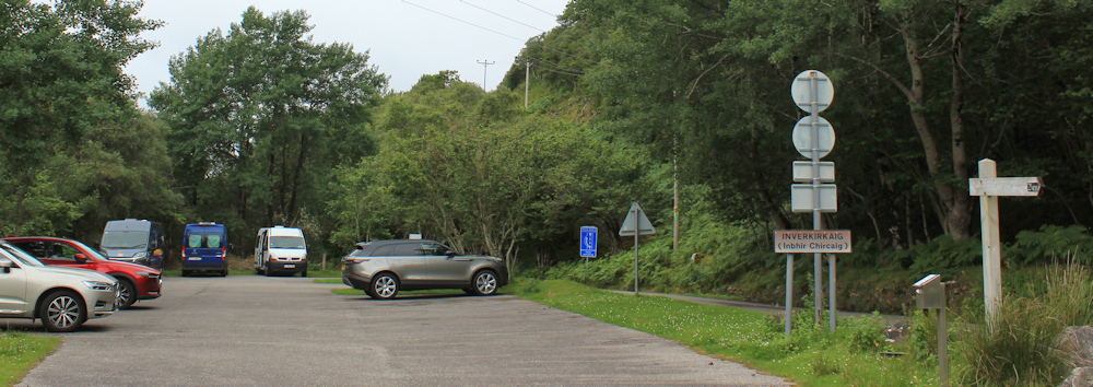
A sign points towards the “Falls of Kirkaig” with a sign that has had the mileage altered to read 2 and a 1/4 miles. I wonder if people complained it was further than 2 miles, and they must amend the sign.
Can now see why the two ladies were confused. That unfriendly gate has an off-putting “Private Road” sign across it. At first glance, you might not notice the little pedestrian gate beside it – which is the path you need to take to visit the waterfalls.

It’s tempting to visit the waterfalls too, but I decide a 4.5 mile detour is too far for me. Onwards.
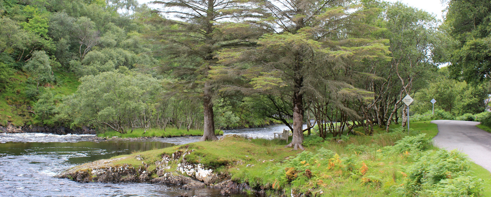
The road runs alongside another river. Broad and shallow. Here, I meet a fisherman in full regalia, including green wellies and nets. I wonder if he’ll catch anything today?

It’s nearly 1:30pm, and I’m hungry. Can’t resist the opportunity when I spot a bench – just under the tree on a patch of grass beside the river. A really pretty spot.
Of course, as soon as I’ve sat down and pulled out my sandwiches… it begins to rain. I take a few hasty bites and then pack up my things as the rain gets heavier.
The rain starts bucketing down. I sit on the bench and pull on my waterproof trousers. Hate wearing the things, but I don’t want to get soaking wet. Down the road, only a few hundred yards, and the rain stops again – of course. I sit on the verge to pull OFF my waterproof trousers. Wish the weather would make its mind up!
Round the corner, I reach another pretty bay. This one is edged by houses, and the place is called Inverkirkaig – meaning a place where rivers meet, I think, in English.
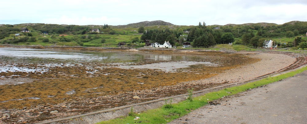
Earlier, when I was cycling along here, the tide was high, and a mother was standing waist deep in water while encouraging her child who was learning to swim. With legs thrashing and splashing, his little body was held suspended under blown-up water wings. Now, with the tide out, the bay is empty.
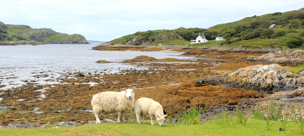
Another mother and her child stand on the shore – but this mother is a sheep.
Round the bay, past some pretty cottages and a telephone box (yes, it is in working order, I stop to check) and the road rises up the hill. I pass a half-built extension to a cottage, where a post office van is parked. The post man is, in fact, a post lady.

I do love to see post vans. They are a reminder of how interconnected we all are, despite the apparent remoteness of these scattered highland communities.
Over the top of the hill, and the road drops down into the next valley.
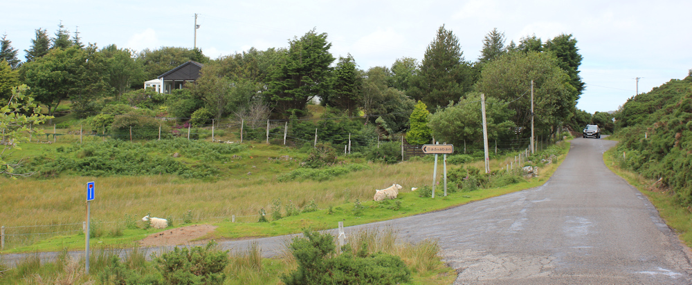
Past some more cottages, and more sheep, I reach the turn-off to Badnaban. Noticed this place-sign earlier on my cycle ride, and so I now realise I’ve nearly finished my walk.
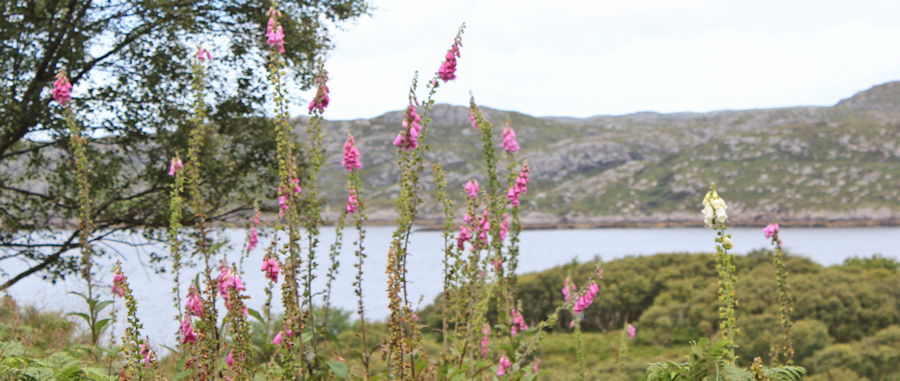
I’m walking just inland of the shore. Can see the water of Loch Inver beyond a fringe of vegetation – bushes and trees, and the occasional bright spash of foxgloves.
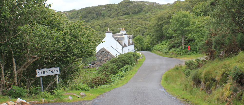
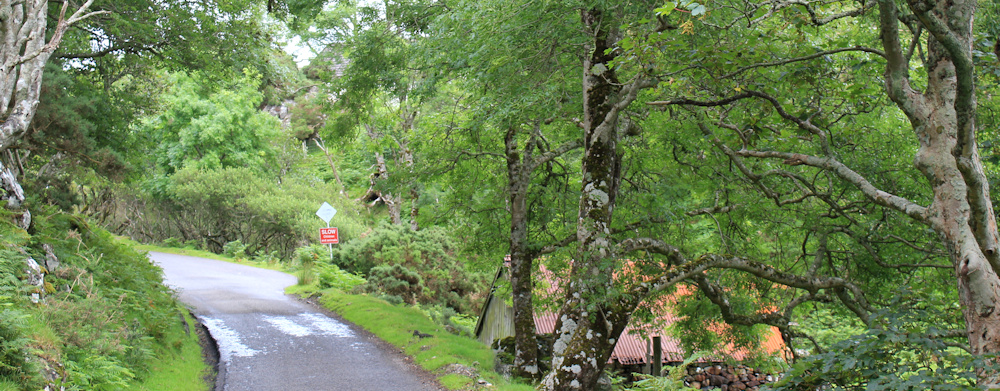
I reach a place called Strathan. It consists of a few cottages along the road, a post box, and not much else. But the traffic has hotted up…
… a couple of motorcyclists roar past. This road isn’t even a B road, and it isn’t officially part of the main N500 route, but is one of the possible “detours” you can take.

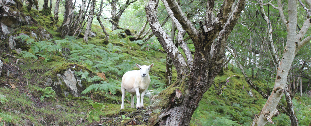
Past the turn-off to some holiday lodges, and a few ramshackle sheds. Down into a valley, with wooded slopes on either side. Hello sheep! He obviously thinks he’s a mountain goat.
I walk past more sheep, as sign that says “SLOW LAMBS”, a car-come-truck that is being used as a storage shed, and a working farm. The slopes are steep, but the road is gentle, and I’m walking on the level with the rooftop of a cottage just below me.
Up another rise, towards the sign that marks the end of the village of Strathan, and a white cottage perched near the top of the hill.
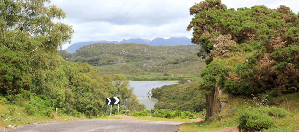
What a view, looking down onto Loch Culag, as the road twists around and drops down one last steep slope.
As I get further down the hill, the post-office van overtakes me, and I snap a photo as it passes along the road beside the loch.
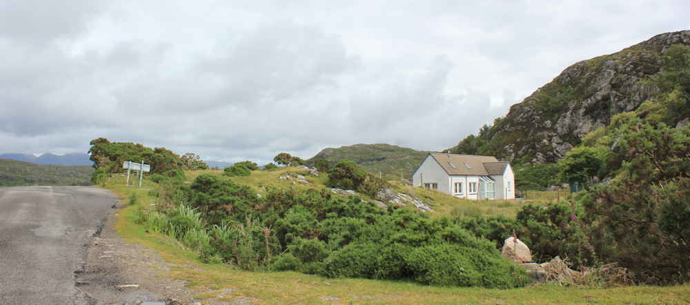
Where the road corkscrews round another bend, there is another pretty house. Looks newly renovated and overlooks the waters of the loch. Great place to live, but I wonder if it’s just another holiday home.
Onwards, down the hill towards Lochinver, and I reach a wide parking area. No cars or vans now (there were a couple of campers parked here when I cycled past earlier). A sign tells me this is Woodside Car Park, and requests that only one van camp here at time, to leave room for other visitors.
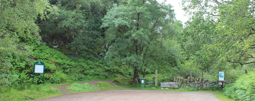
Another sign tells me this is Culag Wood, and a map shows the walking trails you can take. I wasn’t sure what I was going to do at this point, but the encouraging sign helps to make up my mind. I’ve nearly reached Lochinver, but now I’m going to leave the road and walk through the woodland.
To be continued…
Route so far:


What a pretty walk, the views are lovely 🙂
Yes, this was a memorable walk. Beautiful.
One of your best-ever blogs. It makes me want to do it myself.
Ah, thank you.
As ever Ruth your Blogs make me smile, and what a good account of the walk this was.
Also as over the UK , the supermarkets are now telling us Easter is upon us (sic!) I was wondering if you could not start a different treasure hunt – Search for Scooty in Scotland !! – well I’ll leave you to organise that one – Cheers Russ
If that was the stepping stones to the Inverpolly path, then I’m glad I didn’t do it either! It was in spate on the day for me, but even in the more clement conditions in your photo, it looks more like a cold splash across!
Looks like you had a lovely day for it – bright, but not blazing.
What a delightful walk and your beautiful photos make it so special for your readers.