
[This walk was completed on the 31st August 2022]
I leave my Scooty bike chained to a signpost in the parking spot above Drumbeg. What a beautiful view for my bike to admire, while he waits for me to finish my walk and return.
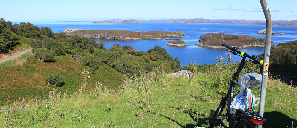
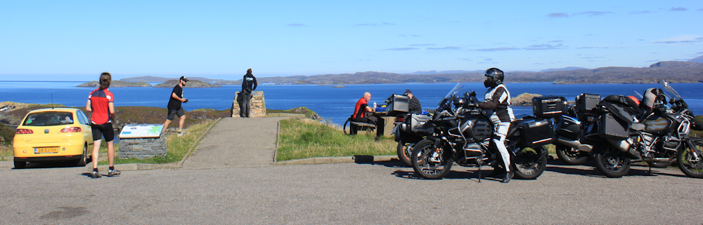
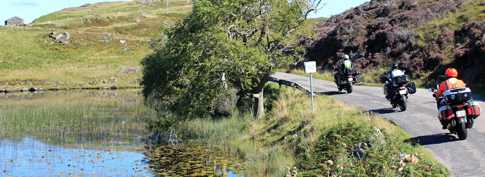
It is another stunning summer’s day, with clear blue skies and great visibility. I’m not the only one admiring the view this morning – a bevy of motorbikes has arrived, and a couple of touring cyclists are having breakfast on one of the picnic benches.
I set off walking down the road and find the Drumbeg Stores, and a hotel. There is even a crossroads, and a working telephone box, and I see a sign for the not-so-secret “Secret Tea Garden”. Tempting, but I’ve barely started my walk!

Turns out that Drumbeg is a surprisingly large settlement, with a heavy emphasis on the passing tourist trade – thanks to the NC500 running smack through the middle of it.
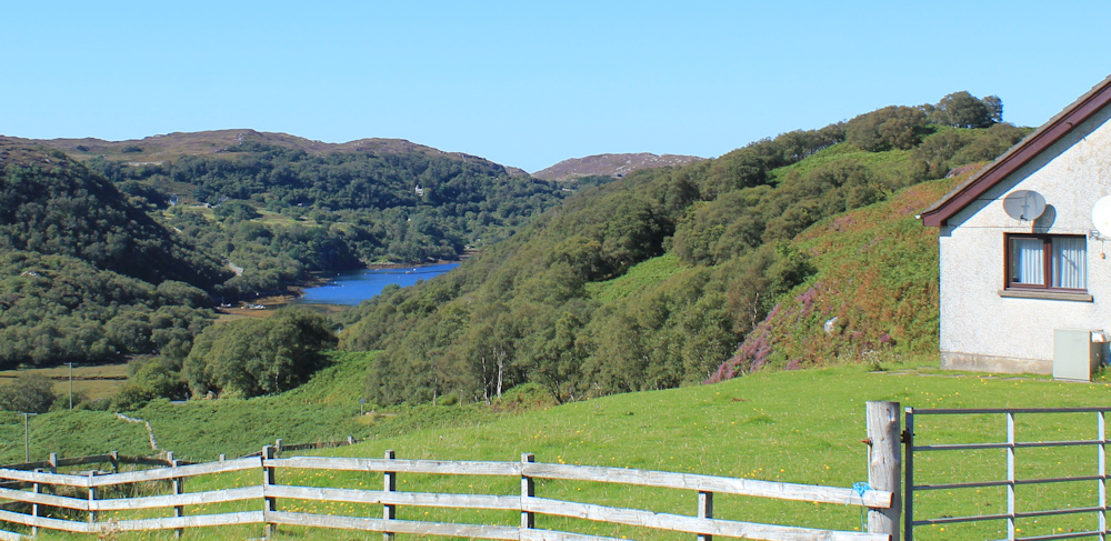
The road dips down, and then rises again. Ah, here’s a boat in somebody’s garden. A renovation job, I presume. Wonder if they will ever get the thing back into the water?

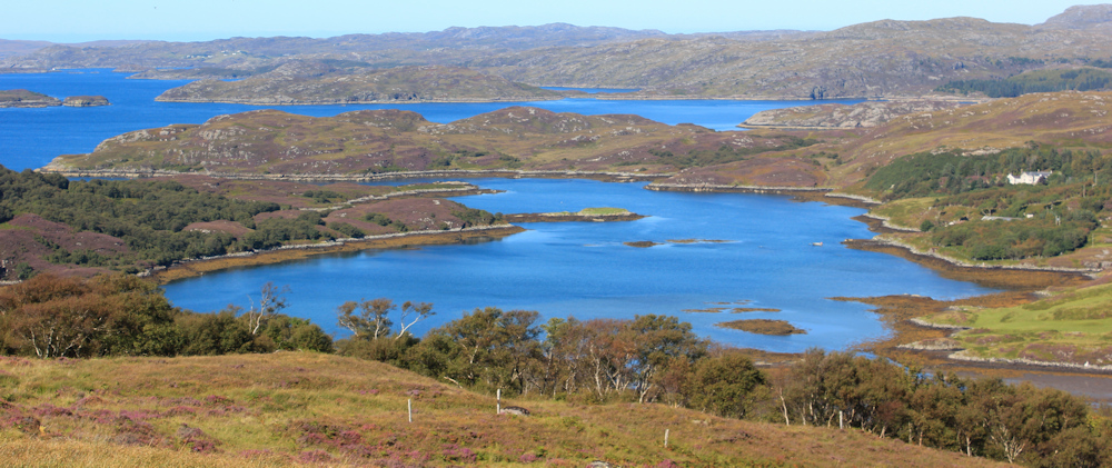
I’m leaving Drumbeg behind, and the landscape opens up to reveal a pretty loch and a series of mountains beyond.
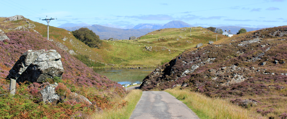
Check my map. The loch is called Loch Ruighean an Aitin, but the mountains are off the map, so I don’t know what they are. On the way down to the loch, I’m overtaken by a couple of cyclists…
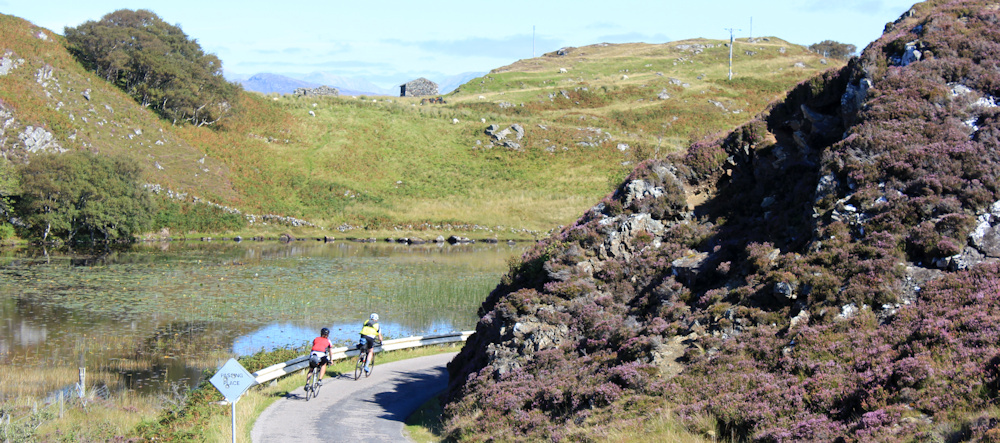
… and, a few minutes later, a group of motorcyclists roar past.
Beyond the water, and climbing the hill on the other side, I come across a mini traffic jam. Pity the poor red car that has to reverse to find the passing space and let the van past.
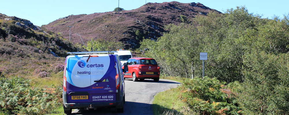
The “wee mad road” is less mad in this section – no sheer cliffs and dizzy drops into the sea – but is still hard to navigate. At least there are plenty of passing places around here.
I’m approaching a cattle grid and a sign warns me of… hang on, PIGS!

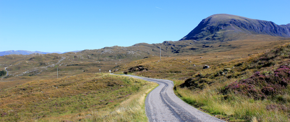
Over the cattle grid, and over the brow of the hill, and the view opens up again. Look at that wonderful moutain range! It’s the same set of peaks that I admired yesterday on my way to Drumbeg. Looks like I will be passing close to the northern flanks of the range.

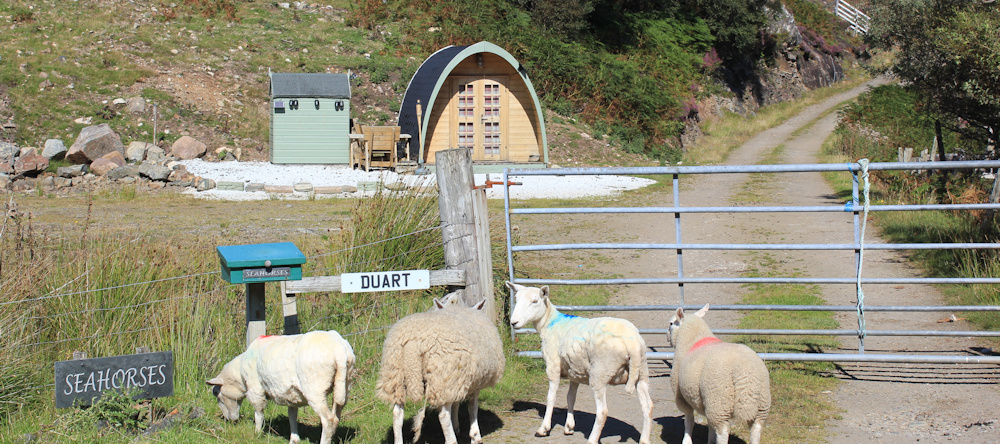
I reach a place called Nedd. On my map, the name “Nedd” is giving the same prominence as the name “Drumbeg”, but this is a very different, quieter kind of place, with a few cottages off the main road, and a few holiday residences.
Look at this “Shepherd’s hut”. Very quaint, but my van probably has more room inside. The sheep by the side of the road seem a bit confused – maybe they should they be inside the gate? Where’s the “shepherd”?
Nedd has a telephone box too. The centre of the village!

Beyond Nedd, the road dips sharply down into a tree-lined valley. (In fact, my walk today seems to be constant up and down hill climbs.) There’s the mountain range ahead. Still looks far away.

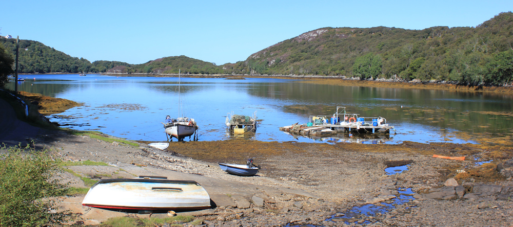
Round a bend, and a stretch of water opens up before me. This is actually a sea loch, so technically I’m walking by the coast again. Loch Nedd. At the top of the loch is an untidy collection of fishing equipment and a few small boats pulled up on the shore.
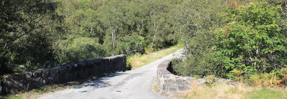
The road runs beside the little stream that feeds into the loch, skirting a marshy area, and curving round to cross over the water via a bridge.

A sign tells me that this land is owned by the “North Assynt Estate”. I wonder who the lucky landowner is who owns all this wonderful countryside?
On the other side of the bridge is another hill to climb. Up I go. Reach a cottage perched on the hillside, and stop to catch my breath and admire the views. There’s Loch Nedd, again, below me.
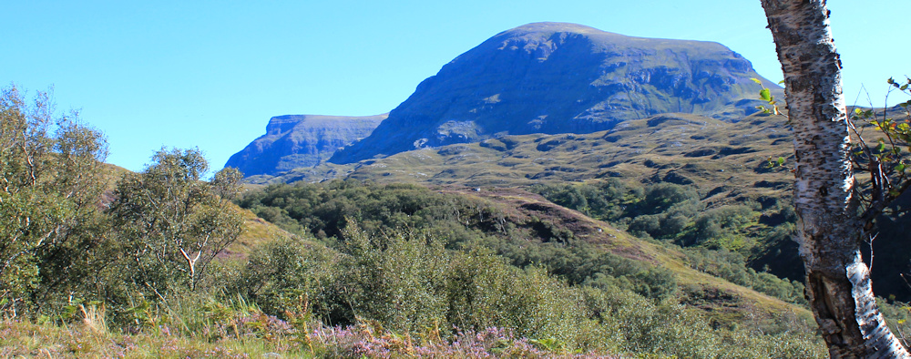
The countryside is open here. The road keeps winding upwards, and that mountain range is getting nearer. I’m definitely approaching the northernmost flank – with a rounded peak that is just visible on my OS map, and seems to be called Sail Ghorm.
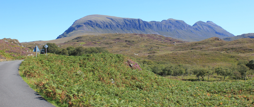
[Later, I learn that “sail” in Scottish gaelic means either “beam” or “heel”. Both appear to accurately describe this section of the range.]
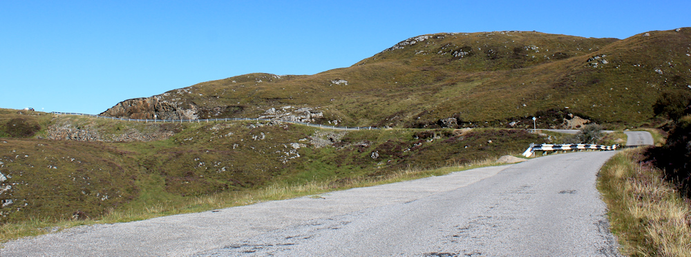
A signpost shows a path leading off to my right – a public footpath to somewhere called Tumore, 4.5 miles away. Another sign tells me that CCTV is watching me, for “wildlife management” purposes. Is that to deter hunters? I’m not sure I really believe there are cameras present, but I hope the deterence works anyway.

The path looks tempting, but must surely be heading in the wrong direction. Inland. I pull out my map and trace the route with my finger, following the dotted lines that indicate a path on the Scottish maps. To my suprise, Tumore turns out to be a tiny place (probably just a farm) on the main road to Lochinver.
Wow! I’ve really walked in a huge semicircle and am not far away from Lochinver… despite all the miles I’ve covered.
Onwards. Along the road, which is climbing steadily again in a series of curving loops.

I’m very thirsty and keep looking for a place to sit down, but there are no decent rocks when you need one – just prickly vegetation and marshy-looking tussocks of grass.
At the top of the hill, I spot a pile of old gritting sand in the grass beside a lay by. It’s quite windy up here, and the pile of sand has hardened with the weather – so it is not the most comfortable of seats. But, I can use my coat as a cushion and it’s better than nothing.

The seat may be a tad uncomfortable, but the view is amazing. Wow! This has really turned out to be one of the best days of walking ever – despite being all on the road.
Of couse, five minutes after I sit down, the wind drops and the sun goes in. And the midges begin to arrive. I quickly pack up my drink and my snacks. Time to get moving again.
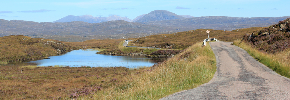
The road runs along the side of a loch with a strange name and a strange shape, like an inverted comma. Loch nan Claidhmhnean. Very beautiful.

Beyond the loch, and up another rise… and there’s the sea! Wow. Another incredible view. Shame the heat of the day has caused a haze and my photographs don’t really do it justice.

I’m still quite a way inland, and road continues to meander across the open countryside. Beside a small knoll, a collection of cars is parked in a lay by, and people are strolling about on the grass. What are they all doing here?
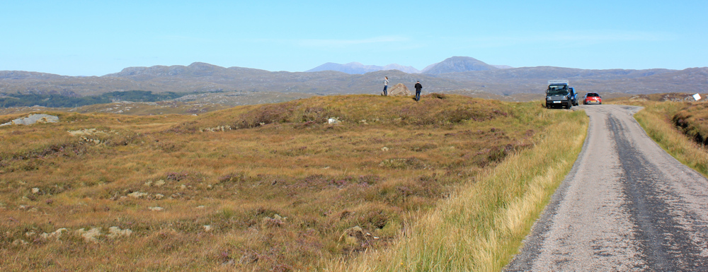
When I get nearer, I realise why. It’s a fantastic viewpoint over the loch below and the sea beyond. The couple on the raised knoll are setting up a camera, so I don’t disturb them. But, a little further along the road, I stop to take my own photographs.
Beautiful Loch Ardbhair, and the sea inlet of Loch a Chairn Bain beyond. I take dozens of photos of the view, before continuing along the road.
Looking inland, I see that I’m passing the northernmost point of the mountain range. Will be interesting to see what it looks like from the other side.
This road is amazing. The landscape is vast and empty. What an incredible place and how lucky I am to be here. Just look at the views.

Down into a little valley, where the trees give a welcome break from the openness that surrounds me, and I reach a bridge. This crosses the Allt na Claise, which feeds into Loch Ardbhair

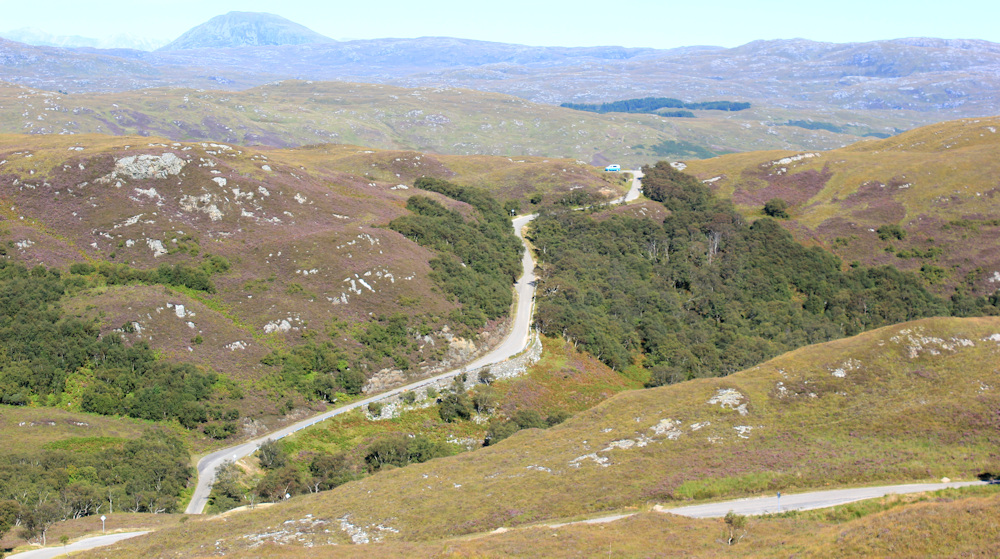
Onwards, and out into the open again. The road rises up the slope in a series of hair-pin bends.
I reach the top. This is, I think, the highest point in my walk today. Beware of skidding, warns a sign. But, I’m excited by what I see ahead. My lovely van is a blue and white speck on the top of the next rise. So close. I’m almost there…

Except, I’m not almost there. A photo from the next bend gives a true indication of the vastness of the landscape and the fact I have another valley to negotiate before I reach my van.
Down the hill I go. Punishingly steep on the knees – I must say, I now prefer going uphill to coming down! At the bottom of the valley, surrounded by trees, is another river – the Allt Ardbhair – and another bridge.
The climb out of the valley is very, very steep. Did I really say I prefer going uphill a moment ago?!
I stop for a breather and look at the view. Ah. There is Sail Ghorm, and I realise I have finally rounded the corner and am seeing it from the other side.
Onwards. Upwards. There’s my van. Keep going.

At the top, I pause for breath, and then open up the van and brew myself a cup of tea. While I’m recovering, another van pulls in beside me, the doors open, and several adults clamber out, followed by an assortment of teenagers and a dog.
We get chatting. Yes, the weather is beautiful. Yes, the road is incredible, but it takes hours to get anywhere. No, I don’t know how far it is to somewhere-or-other or whether or not you’ll get there before it closes. Yes, it is ambitious to attempt the NC500 in 4-5 days.
Sometimes, I’m glad I’m walking slowly and have no timescale in mind. It saves a lot of stress!
After they’ve gone, I walk along the road to see what the nearby sign is warning about. Oh, the hill I’ve just climbed has a gradiant of 25%. One in four!! I think that’s the steepest road I’ve ever climbed and no wonder I found it tiring.
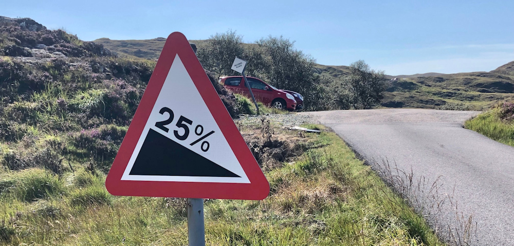
The two red cars, parked in the lay by opposite mine, must belong to walkers. I hope they’re enjoying their day as much as I’ve enjoyed mine.
Later, with access to Bing Maps, I discover that Sail Ghorm is part of an impressive range called Quinag, now managed by the John Muir Trust and part of a project to restore natural landscapes to the over-grazed region.
I was relieved to discover that the North Assynt Estate is not owned by some rich and absent landlord, but is part of a huge area owned by the community trust – The Assynt Crofters’ Trust – who are also part of the scheme to restore the landscape in this area of Scotland.
Pigs seen = 0
Miles walked today = 6 miles (mainly uphill, or so it seems)
Total around coast = 4,853 miles
Route taken:


What a gorgeous day for hiking. The lochs are such a deep blue. I’m very envious, currently confined to my tent in another downpour outside Newborough Forest. ☔️
Oh dear. Stay safe. The weather in Manchester is awful at the moment.
Another lovely walk with some fantastic scenery, I love the view of Loch Nedd with the fishing dinghies, and the view over Loch Ardbhair and the sea loch is stunning. Pigs seen = 0 made me laugh 🙂
I still can’t work out whether there really were free range pigs about, or whether it was a weird Scottish joke. The sign looked very official though.
As good scenery to be seen anywhere else I know of, especially with that heather in bloom. My own walks are restricted to half a mile there and half a mile back at the moment, so I gain much enjoyment from the memories and am thankful that I know I have covered a lot of that terrain in the past.
Sorry to hear your distances are restricted Conrad. I think of you a lot while out in Scotland, knowing that you’ve climbed many of these mountains.
Absolutely spectacular views and photos. The colours are glorious. What a wonderful walk (or climb, up that steep hill)! I definitely couldn’t have done it. We do get free roaming pigs in the New Forest during pannage season – and they can be quite aggressive. I’ve been chased round and round my friend’s car while she tried to find her keys so we could first get the dogs inside and then jump in ourselves. It sounds like something from a sitcom and we did laugh afterwards – but not at the time!