
[This walk was completed on the 1st May 2023]
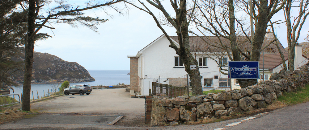
After my very unhealthy lunch of teacake with jam, I walk back up the hill to the turn off to Oldshoremore, where there is another hill to climb. Near the top I pass the Kinlochbervie Hotel. Great views!
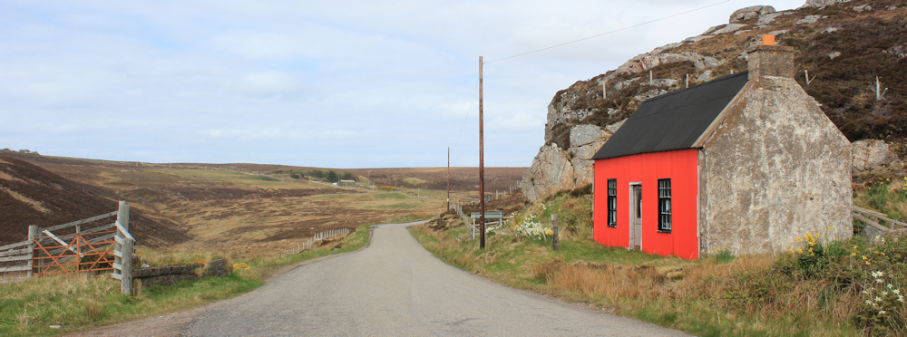
At the top of the hill, the road narrows. I pass a cottage with its front wall painted bright orange – an unusual colour for a wall, although I have seem many orange/red roofs in Scotland.
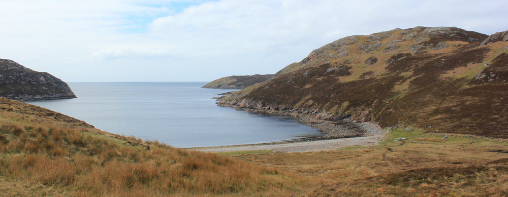
I also get my first view of the sea for some time. Loch Clash, according to my map, with a shingly beach. It’s further away than it looks.
The road goes downhill, swinging past Loch Innis (ah, the lazy shortened form of Loch Innis na Ba Buidhe). There’s a core path around the loch, which joins up with Manse Road on the other side of Kinlochbervie. Looks appealing… but it’s going the wrong way for me!

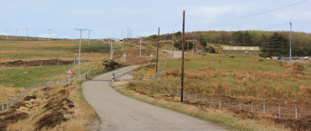
I stick to the road, which slowly winds its way uphill towards a place called Oldshoremore. Only two miles from Kinlochbervie, according to the initial road sign, but feels much longer in reality.
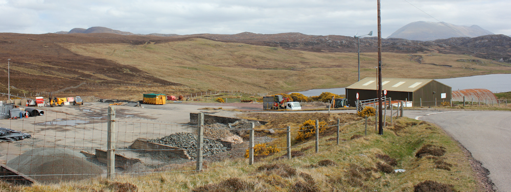
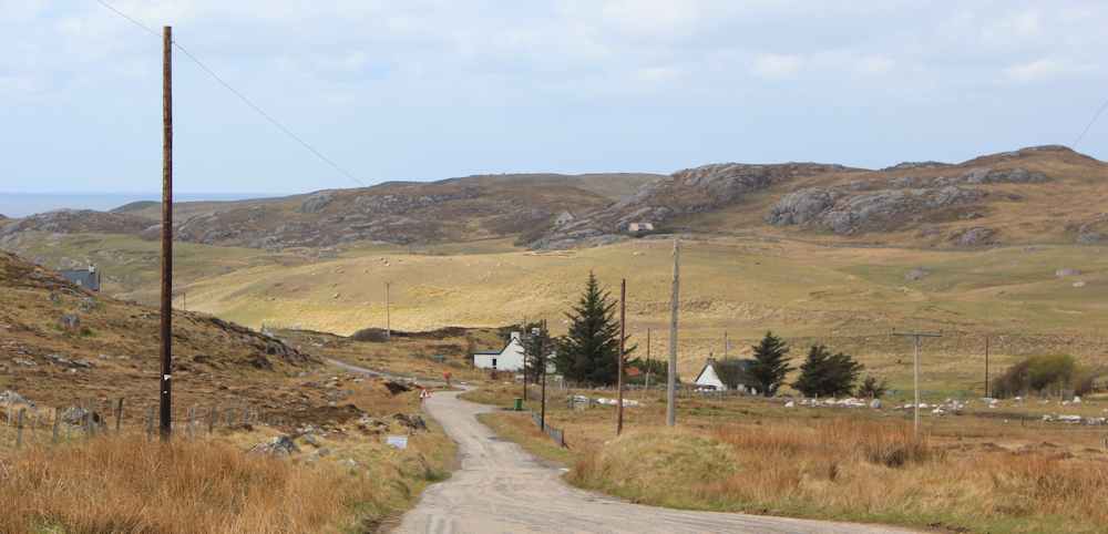
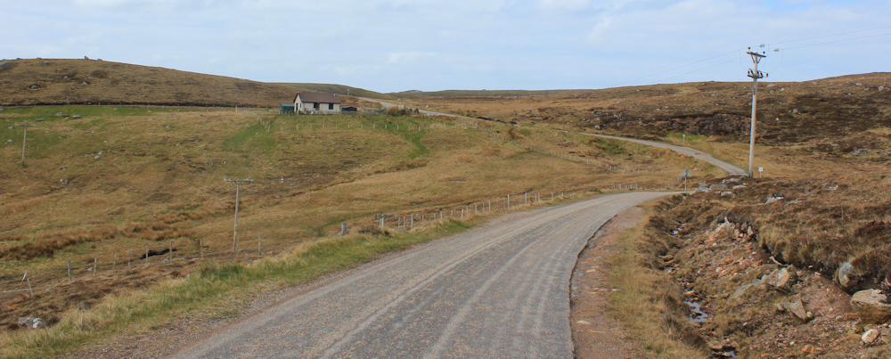
On my right is another one of those storage yards with piles of gravel and pieces of machinery. This one has a very faded sign, “Serving Sutherland, Kinlochbervie Depot”. I stop at the top of the rise, and take a photograph looking back down the road and over the depot. There is snow on the upper slopes of the mountains in the distance.
Note to self: I must remember to hunt down a pair of gloves for my cycle rides.
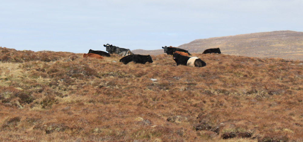
The countryside looks empty, but there are quite a few scattered crofts and houses dotted about, and in reality every inch of land seems to be fenced off. This ‘field’, for example, contains a group of Angus and Belted Galloway cattle.
I was wondering about trekking off the road, but the sight of herds of cows always makes me nervous.
This field, apparently, contains pigs. “Do not feed the pigs,” says a sign on the gate. The ground looks churned up into a huge pig-friendly wallow, but I see no sign of actual pigs.

The road climbs steadily. I’m growing tired. My previous fitness appears to have deserted me – perhaps it was the Covid a few weeks ago, or perhaps I’m just growing older!
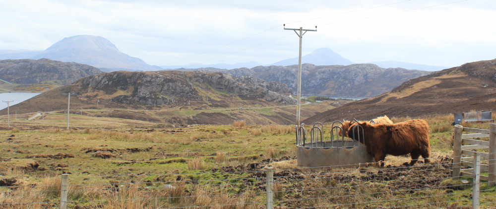
Near the top of the incline, I turn to take a photo of these two cuddly-looking highland cattle. In the distance… is that little peak Ben Stack?
The road dips, before climbing again. A farmer roars by on a small quad bike with a trailer – and a sheep dog seated in the trailer. Ahead is some sort of construction. An agricultural building I guess, judging by the blocky shape and sheer size of the footprint of the scaffolding that’s been erected.

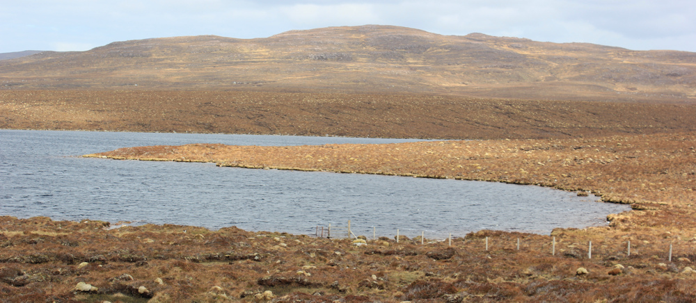
On my right is Loch Aisir Mor. Desolate looking, with featureless hills behind. No trees. No bushes. Empty – except for fences.
“Please do not feed the goats.” I stand at the gate and stare across the empty landscape. Where are the goats? I never do see one.

Near the top of the hill is a new-looking bungalow with flags waving in the driveway. “Highland Charcuterie and Smokehouse” says a banner attached to a fence. Oh, no! Is this where the pigs have ended up? And what about the goats?

I remember I’m short of food for packed lunches. Wonder if it’s worth calling in on my return jouney, but wonder also if they do small packs? I don’t want to feel pressurised into buying loads of cured meats to cart around in my van. In the end, I decide to give the smokehouse a miss.
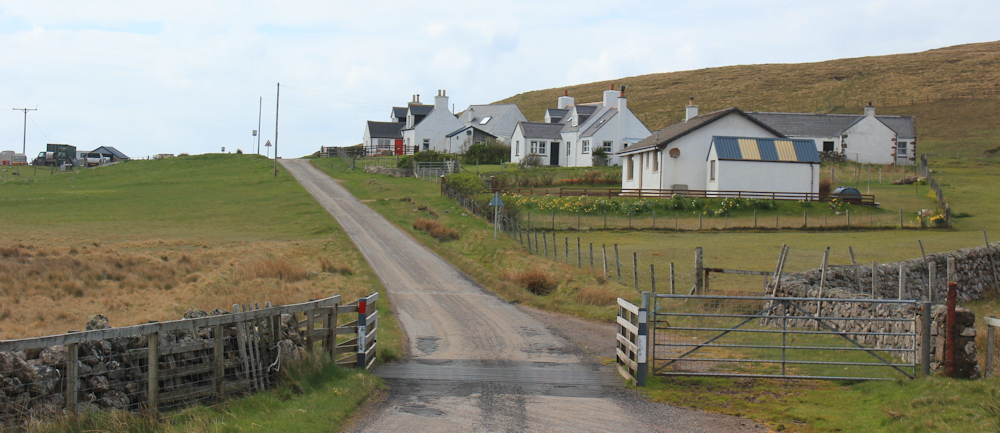
I’ve nearly reached the top of the hill. Oldshoremore (Aisir) says a place sign, although there is nothing in sight. Then, just over the brow of the hill, I see some houses below me. Ah, that must be Oldshoremore.
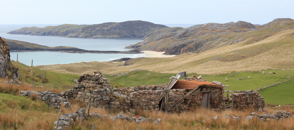
Oldshoremore features prominently on my map – by which I mean it is written in letters that rival Kinlochbervie in size. But the reality is very different. Oldshoremore is basically a spaced-out collection of crofter’s cottages and converted barns – some more converted than others! At least I can see the sea again. What a pretty little bay.
According to my map, there are a number of dead-end roads that lead down to the shore with car parks at the end of each road. I was planning on going down, and then following the coast round to a place called Droman. But the sight of so many fences and walls puts me off.
I decide to stick to the main road. It stretches out ahead, dipping down to pass over a little stream, before rising on the other side.

I pass an information sign. “Improving biodiversity on Croft 148,” followed by information about the great yellow bumblebee. I heartily agree with improving biodiversity, and Scotland could certainly do with more trees and bushes, and bumblebees. But why not give the place a name? “Croft 148” sounds very soulless.
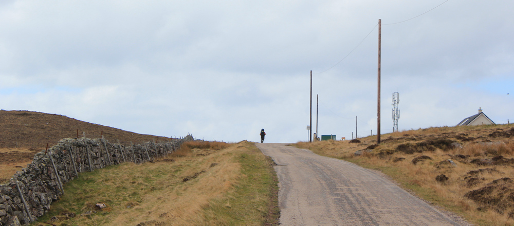
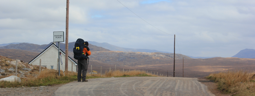
There is a walker ahead of me. The first real hiker I’ve seen on my trip so far. He is carrying an enormous back pack and, for a brief moment, I envy his professionalism. Perhaps he is completing the last legs of the Cape Wrath Trail? A proper walker, not a road-stroller like me!
But, I soon realise I am walking faster than he is. This is most unusual because I rarely overtake anybody (yes, I really am a very slow walker). I catch up with him near the top of the hill, where he appears to be taking photos of the view with a tiny camera. He’s an older gentleman, not a youngster. Of course, I stop and we have a chat.
No, he isn’t doing the Cape Wrath Trail, he has been staying in Ullapool, and this is his third attempt to get to Sandwood Bay, he tells me. He plans to stay the night on the beach, and return tomorrow. How far do I think it is?
I have to confess I’m not going as far as Sandwood Bay today – I’m saving that adventure for tomorrow. We discuss whether he will make it before nightfall. He is probably 1/2 mile away from the start of the path, and then there is another 4 miles trek across country. I don’t know what the terrain is like, but he seems optimistic that the path is easy. It’s already 4pm, but the nights are short this far north, and he should have a good 6-7 hours of daylight left. Plenty of time.
He looks enviously at my Canon, and explains he left his camera in the car of a woman who gave him a lift earlier. So, he has been trying to take photos of the view with his tiny GoPro. What a shame.
I leave him fiddling with his tiny camera, and walk on, passing a mobile-phone mast. A sign tells me this is part of the Scottish 4G Infil Programme, which aims to extend 4G coverage across Scotland.

This scheme probably explains why my phone signal has been very good, despite my initial fears that I would lose contact with the outside world in this remote part of Scotland.
The final stretch of road lies ahead. A gentle curve, and then another climb.
Near the top of the climb, I pass a couple of walkers – strollers, not hikers, and take a photo of their backs. You can see my fellow hiker trudging along the road below – with his huge rucksack. Slow progress. I begin to worry that he won’t make it to Sandwood Bay, after all.

Over a cattle grid (is it there to keep animals in, or animals out? – I’m never sure) and the final climb, passing a row of rather nice cottages with great views.
Here is the beginning of the path to Sandwood Bay (or Camas Shannabhalt). It’s a relief to see a proper sign – which implies there is a proper path and bodes well for my adventure tomorrow. Although the sight of an ambulance in the car park is a little worrying!

There are public toilets here, and information boards that explain that the car park, and the path to Sandwood Bay, are maintained by the John Muir Trust. You are encouraged to make a small donation to the upkeep of these facilities.

I dump my backpack in my van, and get myself a drink and a snack, then spend some time taking photographs of a series of plaques that are attached to the back of a seating area. They are about the life-cycle of salmon and seem to be based on illustrations by local school children. What a nice idea.

While I’m resting and taking photographs, my fellow hiker finally arrives. He refills his water bottles and we have another brief chat. Last chance for a lift back to civilisation, I tell him. He laughs, says thank you, but he will press on to Sandwood Bay.
On the drive back, I stop at the Post Office shop is Kinlochbervie, which seems to be a mini hardware store in disguise. They stock EVERYTHING a hiker could possibly want – and I buy a warm pair of gloves and some new bungee cords for strapping my backpack to my bike. Then, it’s back to my hotel for a glass of cider and a lovely meal.
I’m glad I’ve got a warm room and a comfortable bed because, much as I like to pretend I’m an intrepid hiker, I’m actually very attached to my creature comforts! While I’m sipping my evening whisky in front of the fire, I can’t stop thinking of the walker I met earlier. Did he ever make it to Sandwood Bay?
Miles walked today = 8.5 miles
Total miles around coast = 4,902.5 miles
Route (black in the morning, red in the afternoon)


So glad to read of your intention to visit Sandwood Bay. I’ve never researched the way ahead from there to Cape Wrath and the CW Trail didn’t exist as a named route when I was last in that part of Scotland, so I will not have a look, rather follow you and learn along the way. Your overall achievement to date is impressive. Not far now to that right turn.
Just writing this up now…
I never visited Sandwood Bay, partly due to my knee playing up and partly due to simply not feeling like it at the time, so I am following your progress with interest. I did walk out to Kinlochbervie, though, but never wrote that side-trip up.
I am very intrigued to see what you do after reaching Sandwood Bay – will you treat it as a dead end, or blaze a trail to Cape Wrath? (Please don’t spoil; I’m enjoying the anticipation!)
Poor old pigs! It seems to me that pigs have made a crucial and crippling evolutionary mistake by being so extremely tasty. Still, becoming charcuterie is a noble sacrifice on their part and it seems only right to eat as much of it as possible so that their deaths were not in vain.
Poor pigs indeed. Sandwood Bay is fabulous. If you’re ever back that way it’s worth a trip.
Another lovely walk finished and the top of Scotland grows ever closer, I feel excited for you! I feel sorry for the gentleman who left his camera in the car that gave him a lift, presumably he will never get it back. I hope he made it to Sandford safely. I’m glad you had your creature comforts at the hotel. I must admit, I am now beyond camping and lying on an airbed on the ground!