
[This walk was completed on the 3rd May 2023]
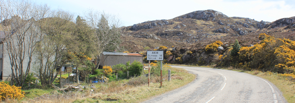
Today, I’m walking towards Durness. It’s only 14 miles, according to this road sign, but I won’t be doing the whole distance in one go. What was once an easy task (walking a mere 14 miles), now seems quite daunting. Of course, I also have to cycle the same distance… but I really am slowing down with old age!
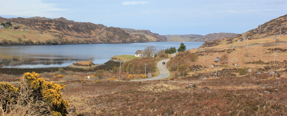
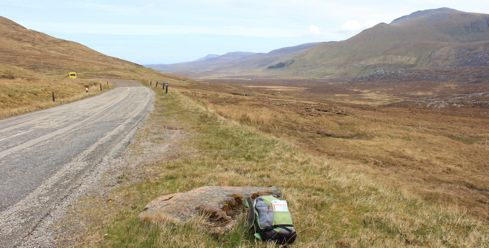
The road takes me, gently, uphill. From a higher viewpoint, I stop to take photos looking across to Loch Inchard. There’s the road I walked along a couple of days ago, when I was on my way through Kinlochbervie and, eventually, to the car park for Sandwood Bay.
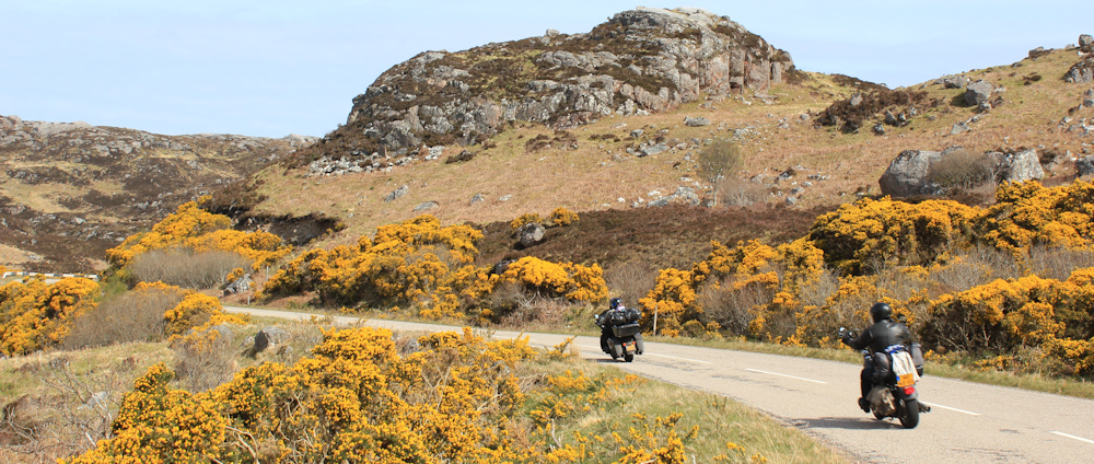
A roar behind me. The good weather has brought the traffic out along the NC500 route, including touring motorcyclists.
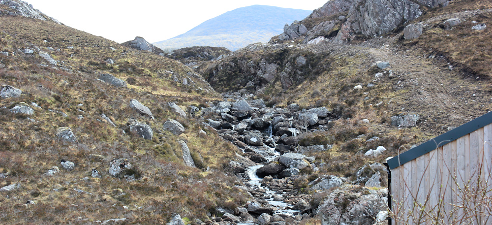
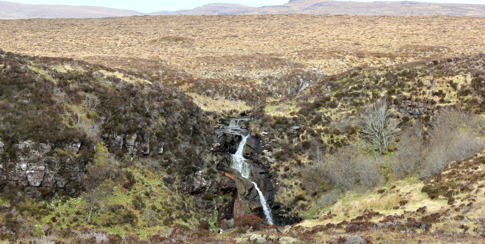
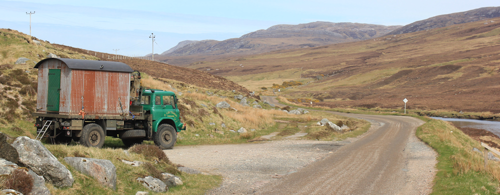
I pass a sign to an old landfill site, now closed, walk past a mysterious green barn, and then – at the top of the incline – the road crosses over a bridge. This little river (Alt an Easain Ghairbh) drains a series of higher lochs and empties, eventually, into Loch Inchard. The map promises me waterfalls. I’m tempted to follow the track and go and take a look – but content myself with taking photos of the tumbling river instead.
On my right is the craggy mass of hill called Creag Gharbh Mhor. Ahead, the landscape opens out as the road slowly descends. The highway narrows to single-track, and this causes mini-traffic jams as cars and minivans jostle to use the passing spaces.
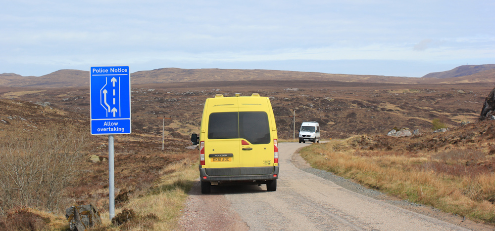
A yellow camper van, which has just overtaken me, pulls into a parking spot ahead. I guess he is admiring the view.
And what a view it is! I’m looking over a wide valley and Achriesgill Water, a confluence of little rivers. No human habitation as far as the eye can see – only a few scattered sheep.
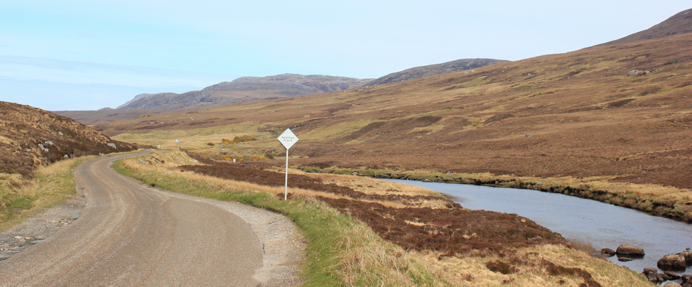
A little further along, and I spot a footpath sign. This would take me down to the river and along the edge of another valley to the settlement of Achriesgill East, where I would join the road to Kinlochbervie.
The path is going in the wrong direction, of course. So, I stick to the main road.
The yellow camper van overtakes me.
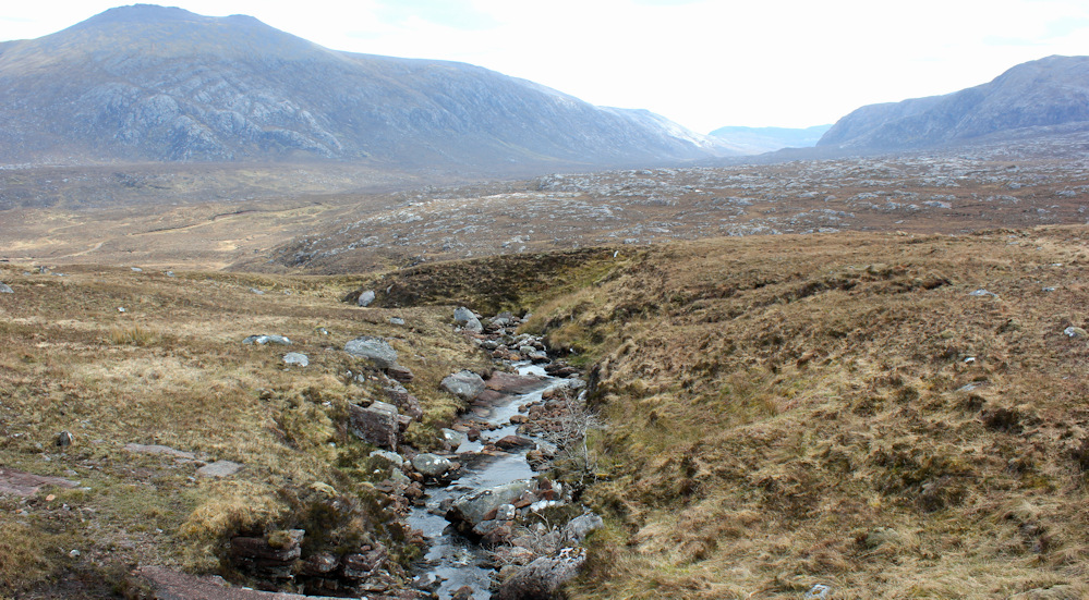
Oh look, another little waterfall, draining a wide plateau of empty land. Beyond the plateau, over the hills, and across several more miles of empty land, is Sandwood Bay. Keep going as the crow flies, and some more miles later, you would get to Cape Wrath.
But, my focus today is this road, which is rising again. A female cyclist come past, labouring up the incline. Followed by her slower friend.
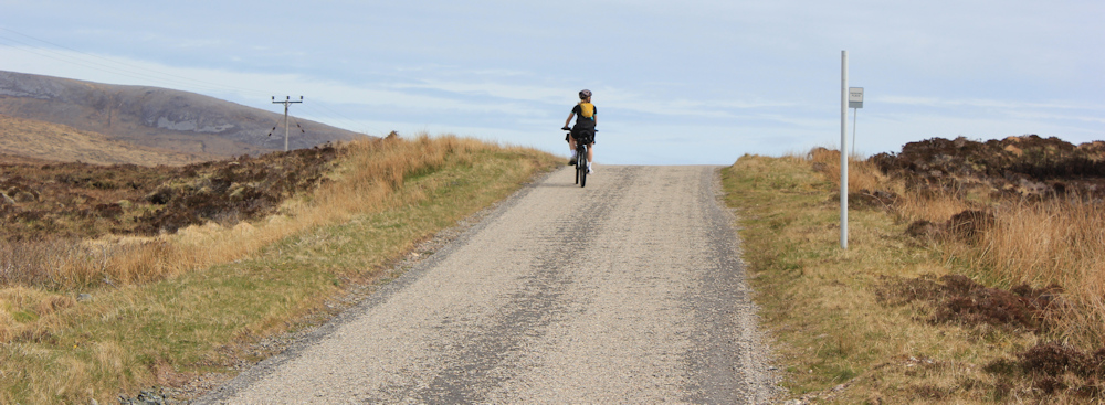
They must have stopped to catch their breath because, when I come over the brow of the hill, I can spot them a hundred yards ahead of me. A huge tanker lumbers by, and I am mindful of how small and vulnerable we are, pedestrians and cyclists alike.
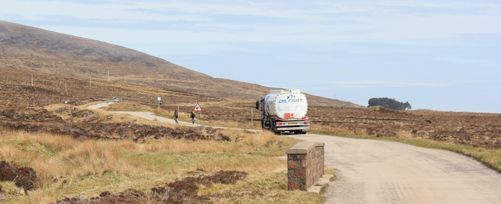
They slow down and pull into a passing space to let the tanker roar past. Perhaps slightly unnerved by the encounter, they take their time setting off again. Look, I’ve nearly caught up with them!
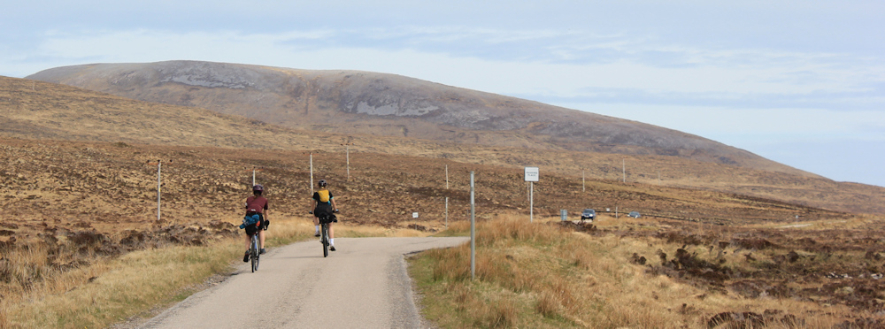
That’s the last I see of them, though, as the road winds across a flattish plain towards a distant loch.
Can’t resist stopping to take this photo using my zoom lens. A rusted orange digger against a backdrop of cool-grey water and the soft blue-green of distant mountains.
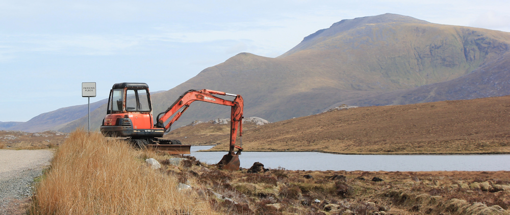
A long time ago, I became quite a proficient amateur watercolour painter. Can’t help choosing the colours I would use to paint this scene from an imaginary palatte. A wash of burnt sienna, cerulean blue, and yellow ochre for those mountains. Chrome orange on the digger. Sometimes I wish I carried a little paint set with me – but then I really would get nowhere fast!
As I draw level with the digger, the view loses its charm. Oh dear. Look at this churned up land. Oviously they’ve been digging for peat – blocks are stacked up and, presumably, waiting for collection. What a mess!
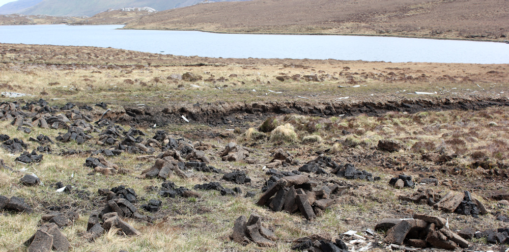
I know digging for peat is an ancient Scottish tradition, and many landowners have the absolute right to extract peat from their own land. But, it does seem a rather destructive activity.
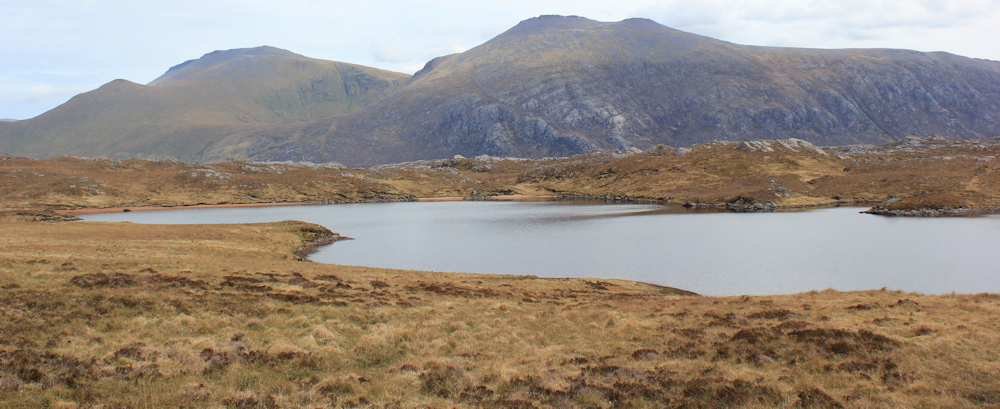
Further along, past the peat trenches, and harmony is restored. This is Loch Tarbhajdh. The road winds to the left and above the loch, heading towards a little spinny of trees. Unusual to see any trees in this landscape, so they become an important landmark as I head towards them.
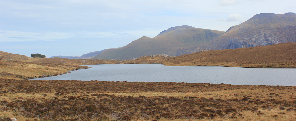
Slow progress. I keep stopping to take photos of the loch and the very-photogenic mountains behind. The sun keeps lighting up different areas, so the view is constantly changing in character, even if the mountains remain solidly the same.
I’m nearly at the spinny now. It hides a house. “Gualin House, only” says a sign on a drive way.

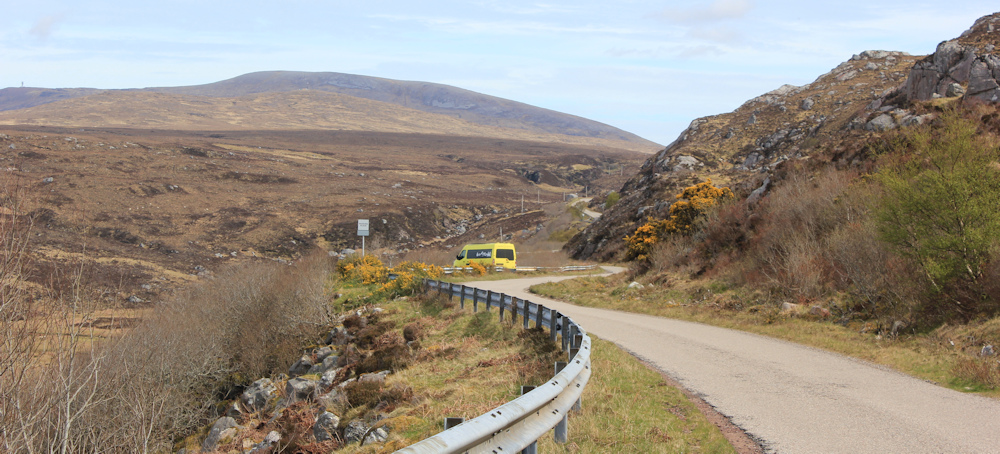
I never do see the house, but the road widens at this point and I walk past the spinney, climb the last section of hill, and round a curve, to where the road begins a gradual descent. Wow. Look at this valley! What a view.
It’s two pm and I’m hungry, so I take a seat on a rock beside the road, unsling my backpack, and pull out my lunch. Only then do I notice something else about the view. A yellow camper van in a parking space ahead.
Uh, oh. It’s the same camper van I saw earlier. Is it stalking me?
Now, I rarely worry about walking alone… well, not strictly true… I worry about getting lost, turning my ankle, falling off a cliff… all the usual anxieties shared by lone walkers. But, I rarely worry about walking alone as a woman. But, something about this camper van with its blacked-out windows unnerves me. I don’t fancy walking past it, and so creating the potential for it/someone to sneak up on me from behind.
It’s a relief when a man appears over the brow of a little hill, and makes his way down the slope towards the van. Even bigger relief when he drives off.

My map shows a feature on the slope above. “Pile of stones.” Perhaps that is what the driver went to look at? Anyway, he clearly wasn’t stalking me at all! How silly am I?
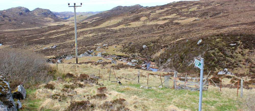
The next section of the walk is wonderful. Hard to show in the photographs, as I’m pointing the camera directly into the sun, but this valley is vast. This river is the Allt na Gualainne. The mountain beyond is Cranstackie (which I later learn is 800 metres high and the most northerly mountain in Scotland, along with its smaller brother Beinn Spionnaidh.)
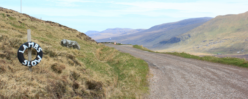
“LAMBS. SLOW.” The signs are hard to miss – white paint on black tyres – stuck up at regular intervals along the road. Only one problem… no sign of any sheep, and definitely no lambs.
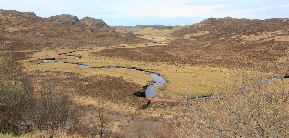
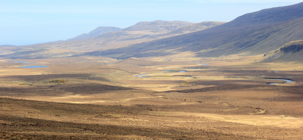
This amazing valley! Strath Dionnard.
The only problem with the road is the traffic. Not exactly dense, as the photos show, but I have to be constantly on the lookout for traffic ahead, while listening out for traffic behind. A lovely gentle downhill slope though, so I make rapid progress.
Ah, another “LAMBS. SLOW.” sign. But where are the lambs?

I noticed this stone structure when I cycled up here earlier on my bike. Now, I can stop and take a good look at it. My map simply says “Trough”, which is rather unromantic. It’s actually a roadside well, with a inscription placed by Peter Lawson, a surveyor, in 1883.
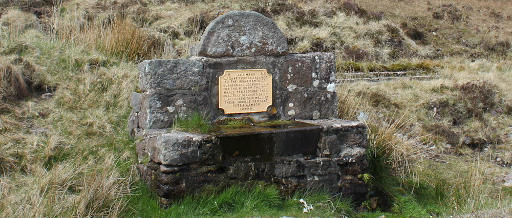
“As a mark of gratitude and respect to the inhabitants of Durness and Eddrachillis for their hospitality while projecting this road.” I suspect there is a complicated story behind this inscription.
I make use of a nearby stone to take a self-portrait. My high-vis vest isn’t exactly flattering, but I wear it when road-walking to keep myself from being flattened. So far, it seems to have worked.
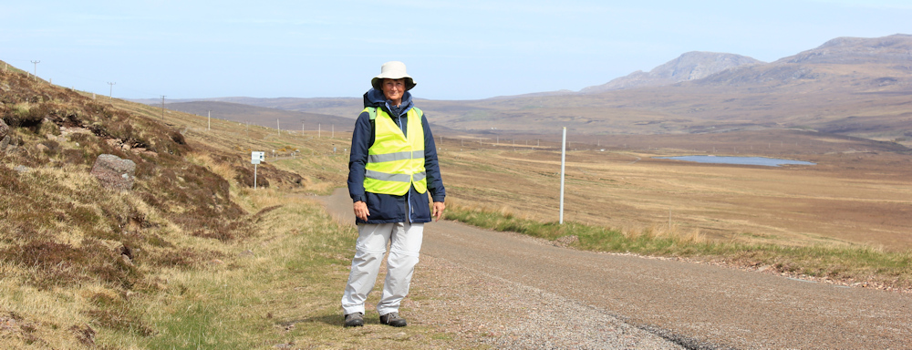
(Thank you to Alan Palin, author of Walking the Coast of Great Britain blog, for this useful tip.)
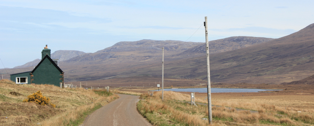
I notice this weirdly-coloured house from some distance away. Now, I’ve nearly reached it, but can’t work out if it is a real home or a holiday let. Either way, it’s in a very isolated spot.
On the plus side, in a field next to the green house, I finally see some sheep and baby lambs. Lovely bouncy things.

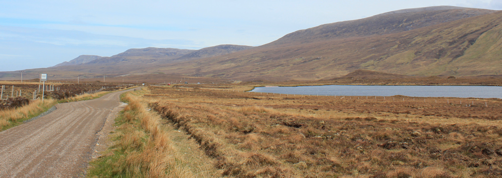
I’ve reached the floor of the valley, and the road flattens out. I walk past yet another loch – Lochan na Glamhaichd (possibly this translates as The Glamourous Loch? – although sometimes I think Google translate is having a laugh!)
At the end of the loch, the valley narrows and the road runs beside a river. This is the River Dionard, after which the valley is named. I pass a hut on a truck. Weird. Is it a homemade version of a camper van?
I’m growing tired now, and looking forward to finishing the walk. Although the river is very beautiful, the road seems never-ending.
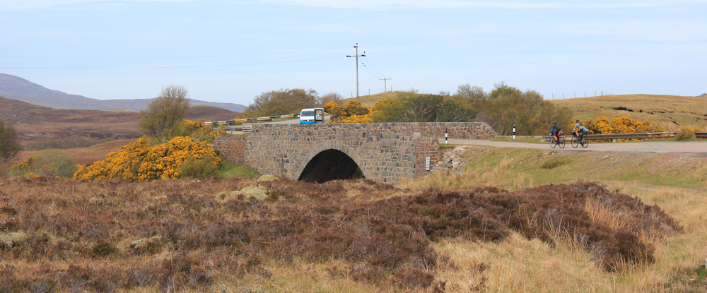
Ah, here’s a bridge. And, there’s my van. This place is marked on my map as “Drochaid Mhor” or Large Bridge (these names really do sound better in Gaelic!) and only consists of the bridge and a telephone box, beside a parking area.
A few more miles would take me to Durness. But I’m going to return to Rhiconich tonight. It’s my last night in my lovely hotel before I move to the Durness campsite tomorrow.
Now, here is something I learnt in the hotel last night. The ferry between Durness and the Cape Wrath area is not running yet. Another group on a walking trip (three men, with their wives in tow as ‘back up’) were planning to walk overland through Sandwood Bay to Cape Wrath, stay in the hostel there, and walk on to catch the ferry. But, with no ferry running, they were planning on walking over rough country to join the road, adding miles to their trek. They should be back tonight… I wonder if they made it.
Postscript: they did make it, but didn’t arrive back at the hotel until well after 8pm, looking utterly exhausted and very muddy.
Miles walked today = 9 miles
Total distance around coast = 4,921 miles
Route:


Absolutely fantastic photos Ruth, especially the one of Strath Dionnard valley….beautiful.
Just a note of congratulations – you have finished the west coast of Scotland with all its inlets, and are about to start on the north coast. You even managed to take in some of the islands. The photos have been glorious with their vast open landscapes, lochs and remote communities. Thank you for sharing all this, and best wishes for the continuing journey! The Wales coast path through Anglesea must seem a distant memory now…
I have been following you virtually since you passed by arnside. I can’t believe how well you are doing and reading your posts it is like being with you. I used to walk the wild places but for some time have not been able to. Thank you.
What I remember of this stretch of road was constant traffic (early June). It’s wonderful to see photos where it’s only countryside.
Hi Ruth! Your walks commentary continues to give me hope that one day I will achieve the same! I note your walk started on 3/5/23 which coincided with me receiving a diagnosis for non-hodgkin lymphoma for which I am half way through chemo now! So keep on walking and entertaining all of us who are a bit limited in getting out and doing natural things! Our time will come when remission arrives!!
I’m so sorry to hear this Chris. Good luck with the chemotherapy, which I know can be pretty gruelling but is worth it. My daughter found fasting for a day or so before each session was very helpful – just water and herbal teas. Yes, your time will come after the treatment and I’m sure you will be out and walking shortly. My very best wishes.
Ah I drove that road quite a few times but never walked in it. Then there were both those signs warning of sheeps/lambs but also sheep to be seen quite a few times.
It’s a very pretty road but yes unfortunately you can never truly relax when walking on main roads.
I expect you already know really but the Hut on a Truck is actually an old Shepards Hut. Maybe someone used it whilst lambing. Love your blogs and have been following them for ages. You are a very brave lady.
Soon s bit of flat along the north coast then “downhill” all the way.
I noted that one your followers has been recently diagnosed with Non Hodgkin’s Lymphoma.
I have had it, ( twice) and finished Chemotherapy in November 2017.
It’s a dreadful condition, if not treated promptly.
However, I go on walks on the SW Coast Path, so you mustn’t let it define you!
I wish that chap well with his treatment.
Ruth, I’m enjoying reading about your progress on the walk, and the photos look pretty good. Onwards!
Wonderful wide open landscapes. I love it when the light constantly changes and sweeps across the mountains and valleys – you’ve captured it so well in your photos.