
[This walk was completed on Wednesday 17th May, 2023]
I wasn’t expecting much today, just lots of road walking again. But it turned into a fabulous day of adventures.
After chaining up my bike behind the public toilets opposite the Melvich Hotel, I walk down the little road towards a place called Portskerra.

I came here yesterday, to pick up a parcel from the post office (a book to read for my book group). But, now I am planning on doing a little circuit of Portskerra before heading back to Melvich Bay.
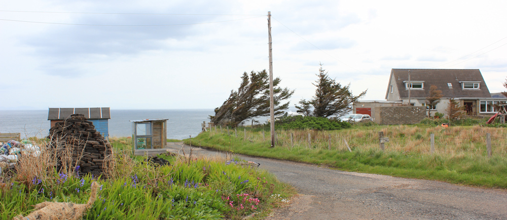
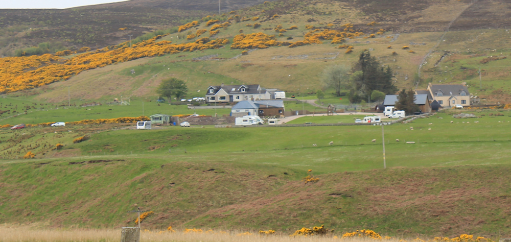
Portskerra is built around circular road – well, more of a triangle than a circle, to be honest – and it is a suprisingly mundane sort of place. Old people’s bungalows line the street, which could be anywhere in suburbia.

But, when the bungalows end, there is a fabulous view across fields and over the sea. Love the little lambs – and the one black one among all its snowy cousins. You can see the continuation of the road below the field.

At around this point, a little car crammed with four occupants stops beside me. Maybe Dutch tourists, guessing from their accents.
“Do you know where The Purrfins are?”
“No, sorry,” I say, thinking they mean a B&B or maybe a glamping site. Only later do I realise they meant puffins!
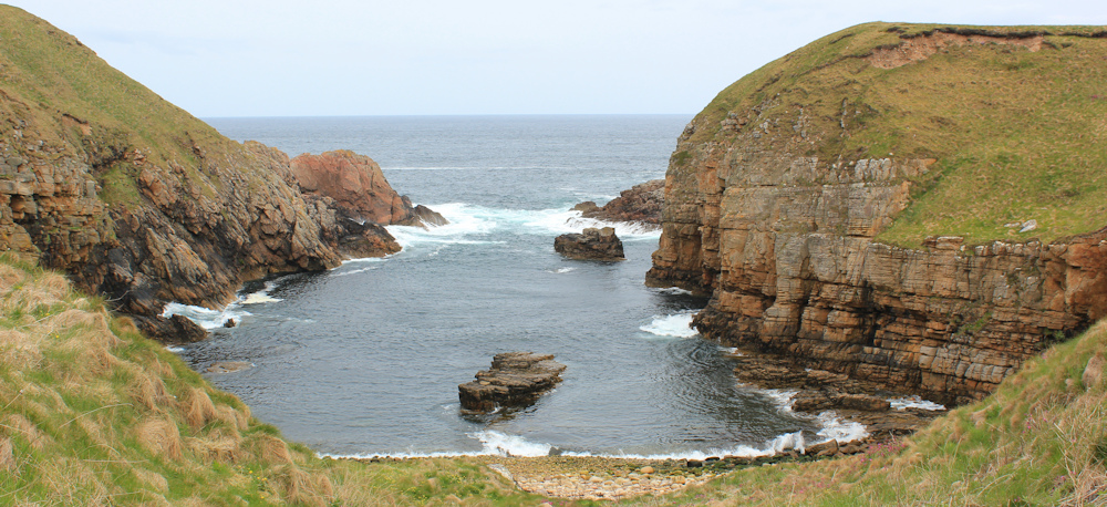
I reach the end of this side of the triangle road, where there are glimpses of a little rocky inlet. Here is a memorial stone – “Dedicated to the memory of those lost on The Snow Admiral of Sunderland.” I’m misled by its modern appearance, thinking it must be a recent shipwreck. In fact, this ship went down in 1842.

The shore below is very rocky and must have been a dangerous place to navigate, but I wonder why there is such a recent memorial for such an old wreck?
Now, I’m heading down the short side of the triangle, towards the eastern shore.

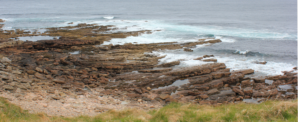
Here is another narrow inlet. Looks deceptively like a safe little harbour, but with dangerous rocks lurking just under the water.
I’m not walking up the other side of the triangular road, but heading off down a track towards Portskerra Harbour, where the start of a Core Path is indicated on my map. Look at those bushes – blown sideways by the force of the winter winds.
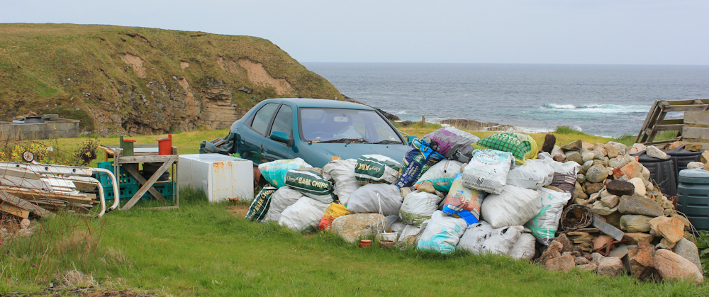
I pass one of those little dumping grounds that seem so common in the Highlands. Some sort of landscaping or building project? The usual wrecked car is acting as a shed.
There is a little car park at the end of the track. “Portskerra Harbours Association” says the sign, and “No overnight parking”.
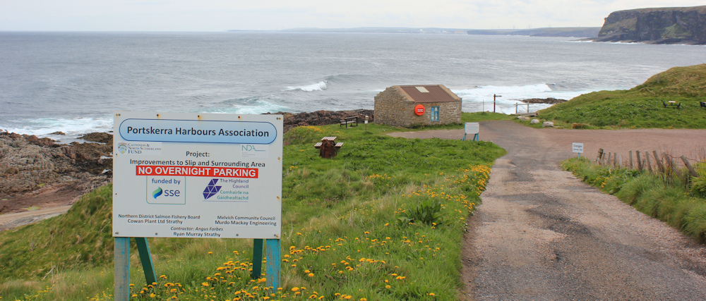
The little hut at the end carries a lifebuoy and dire warning signs. “Danger, steep slip”, “Your lifejacket – useless unless worn” and instructions on how to phone the coastguard.
I’m glad I’m not going sailing! Walking is dangerous enough for me.
Ah, here is the start of the Core Path, with another ominous sign, “Drownings Memorial 1/2 mile”. Crikey.
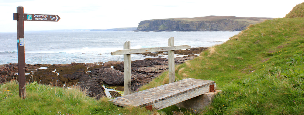
But look at those rocks. And today is a calm day in early summer. Imagine it with huge waves in a winter’s gale.
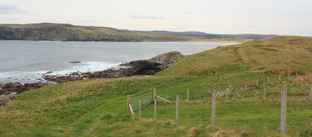
This route is lovely. It’s great to be off the road and walking on a proper path. There is Melvich Bay ahead, but the Core Path doesn’t get that far, and I’m anticipating having to finish the final stretch by road.
I meet an unexpected little track (I’m sure this wasn’t on my map!) with a parking area (which IS on my map, so I should have guessed a road would lead here!) And over the road is the Drownings Memorial, sitting in a fenced off square of gravel.

The large stone holds a roll call of the dead. Look at all those men with with same surnames. Seven Macdonalds. Were they all from the same family, or is it just a clan name that everyone has?

It is a quiet and sombre place. I think of the only member of my family lost at sea – my Uncle Peter, who I never met. He drowned when his merchant ship was sunk by a German U-boat somewhere in the Atlantic. He was only 16 years old.
Onwards.
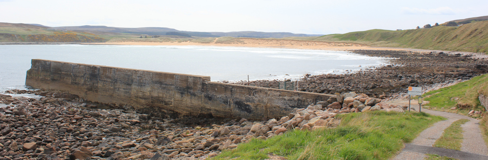
So, THIS is Portskerra Harbour, according to the sign. I thought I’d already been there, but perhaps this is the old harbour? Anyway, it’s not in use. The wharf is fenced off with a “Danger, no access” sign.
I had been anticipating rejoining the road at this point, but when I look ahead… yes, I’m sure I can get to Melvich Bay along the shore. There seems to be a path of some sort.
First, I walk past an old storage barn, empty aparts from some bits of old rope and a few rotting pieces of wood.

Later, the path disappears, and I walk across a slippery boulder field. Quite a scramble in places, but much better than a road.

The beach at the top of Melvich Bay is drawing closer. There are a few people out walking on the sands, but the beautiful beach is almost empty.

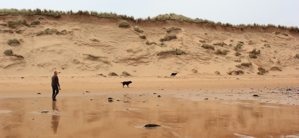
I pass a man with two dogs and can’t resist this photograph. Love the reflections of the warm, sandy cliffs on the wet beach. Positively golden.
I walk along the beach towards the end, where my way will be interrupted by the river that empties into Melvich Bay.

Round the corner, and I find the sands continue up the estuary, towards the bridge.

I knew this bridge was there. Not only is it marked on my map, but I can see it from my campsite, which is a little further upstream from here. However, the access steps look so delapidated from this side, that I wonder if the bridge would actually be open.
The big green gates are a little off-putting but, yes, it is open.

It’s a long bridge and the planks feel a little rickety beneath my feet, but I make it safely to the other side.
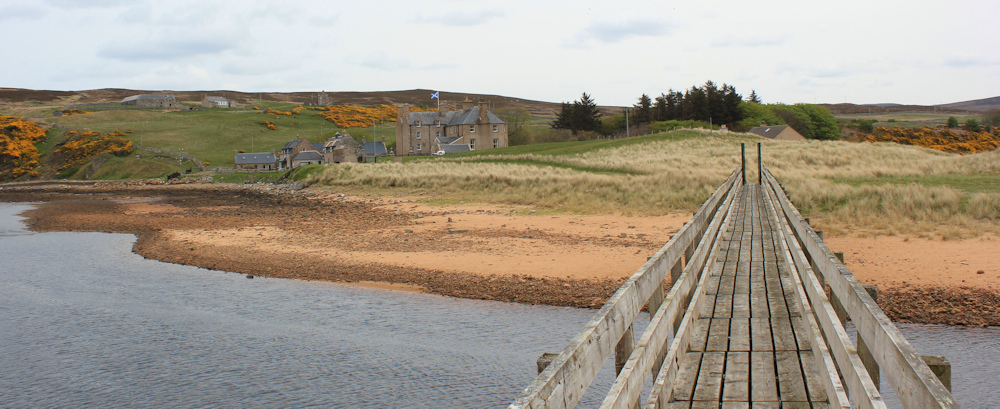
From the bridge, a path leads up to a big house, where it is supposed to join the end of a public road. For a moment, I wonder if I’ve wondered into a private estate by mistake. Look at those boats!
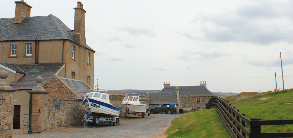
I check my Garmin. No, this is definitely the right way and – ha, ha, ha – the big house is actually called Bighouse.
Passing the big house, I’m now on the public road, and what a delightful road it is. Fragrant gorse. A wide, lazy river. Perfect.
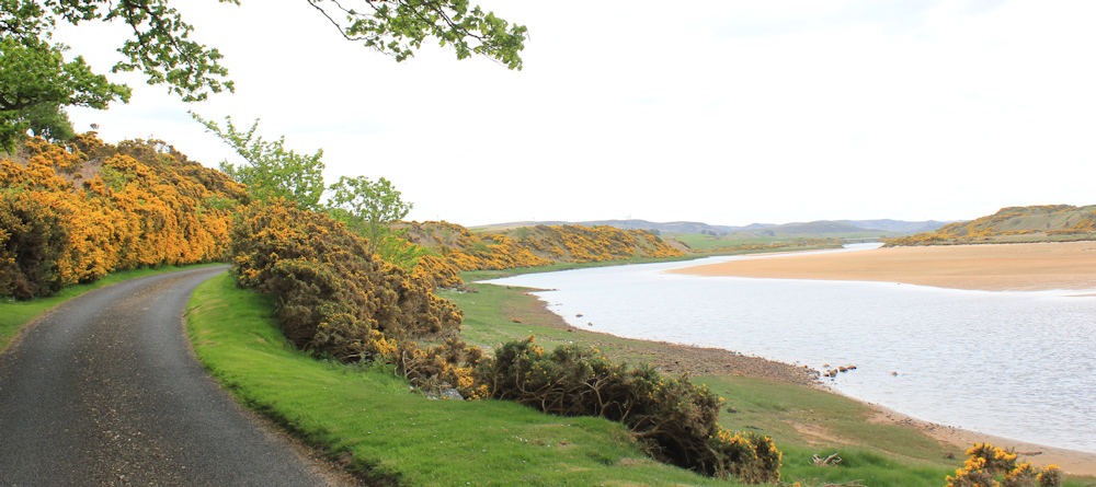
There is my campsite on the other side of the river, and a jolly good campsite it is too – with a dry, clean and heated shower block. Of course, my van isn’t there at the moment. He’s waiting for me somewhere on the A836.
Onwards.
[To be continued…]
You can read some interesting tales about the tragic wreck of the Snow Admiral on this Highland.gov page.
Route so far today:


What a delightful area! It looks like the most interesting places are off the main road, which of course, is the point of your whole walk.
Yes, it’s a lovely area, and I just love discovering new surprises as I walk the coast.
Heated shower blocks! The most luxurious of campsites. I stayed in one a few weeks ago, amid a downpour, which had a fan heater in the shower cubicle. I could have slept in there! 🙂
A lovely exploration off the main road. These are often so rewarding if you can spare the time.
It was so cold in Scotland – and most of the shower blocks are not only unheated but they also have open windows with a gale blowing through (presumably to try to prevent mould growing). This place was wonderful.
Hi Ruth – just to say that photo of the man with the dogs is superb technically but it’s also got an ethereal quality with the reflections off the water. Cheers Russ
Thank you, Russ. I can’t claim any credit for the technical aspects of my photographs – I just set my camera to autofocus, and point and click – but I did particularly like this photo.
Ooh, the big green gates on the Halladale footbridge are new! Or at least, they weren’t there in 2020, although a sign saying ‘bridge unsafe, do not use’ was (but only at the Bighouse end, which was a warning too late!).
No sign of any puffins, though, I note.
Told you would enjoy the coast ! You’ve got your Mojo back which is excellent. Hope you found the puffins. They really are wonderful little birds, and I love their frantic flight!!!
It’s all beautiful and in places dramatic with the rocky coast. I love that photo with the wet beach reflections.