
[This walk was completed on the 20th May, 2023]
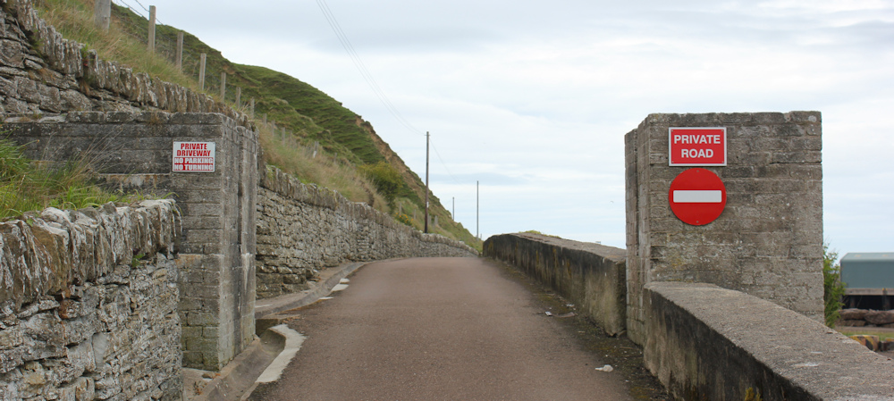
The public road – the infamous A9 – ends at Scrabster, but a private road continues up to the lighthouse. The signs are a little off-putting, but I’ve seen other pedestrians walking along here.
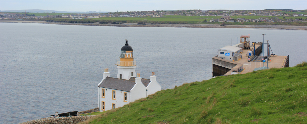
I soon reach the lighthouse. A strange building with a square tower, where apparently the old lighthouse keeper used to live (they usually lived in separate cottages). There seems quite a large extension tacked on the back, and the place is now a private home.

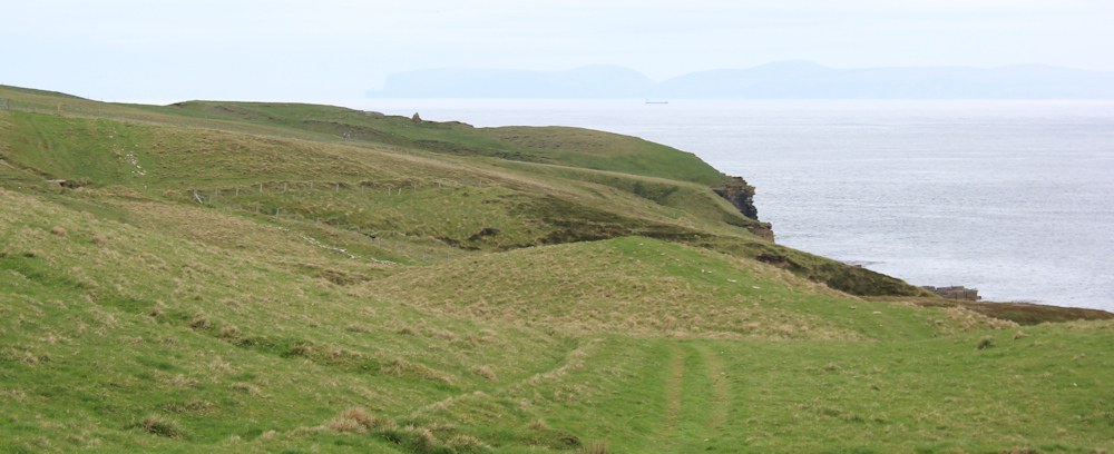
This is where the road really ends, but a footpath signs indicates the way to Holborn Head. It is quite a steep scramble up a field – but I get great views looking down over the lighthouse and the dock at the end of the port.
There must be a cairn on Holborn head. I think I can see it across the fields.
On the way, I meet a family heading back. The children are leading the way.

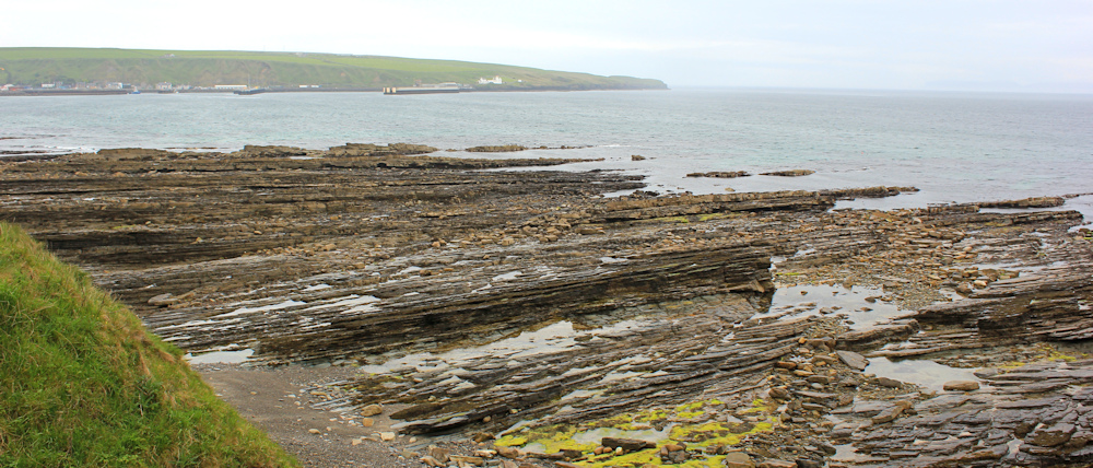
The rock formations here are terrific. Horizontal striations give the cliff a sense of unreality – it looks carved rather than natural, or formed by a giant who layered slabs, one on top of the other. Huge caves are chiselled underneath, where waves thump and foam.
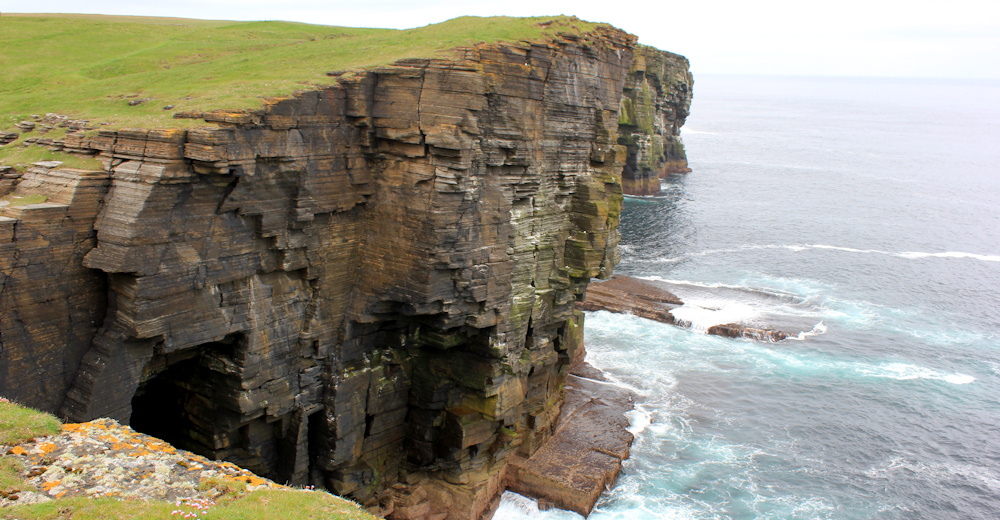
I reach the head itself, and take a photo of the wonky cairn. Great slabs of stone on the ground give the impression of a paved area, or maybe tombstones laid flat – but they seem to be perfectly natural.

Here is a closeup of one of the rock faces. Such perfect lines!

I perch the camera on a rock, set the timer, and take a self-portrait. Behind me is the headland of Dunnet Head. That is the most northerly point of mainland Britain, and I’m looking forward to reaching it.

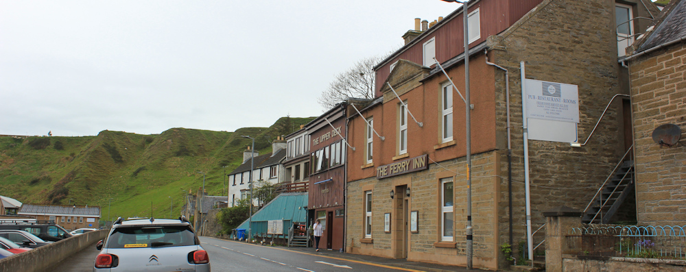
I make my way back to Scrabster and stop to take a photo of the Ferry Inn. What a shame I couldn’t stay here, but I would never have got here in time to take up the room I had booked.
(My mileages have really been very shameful and it has taken far longer than I anticipated to walk the north coast of Scotland.)
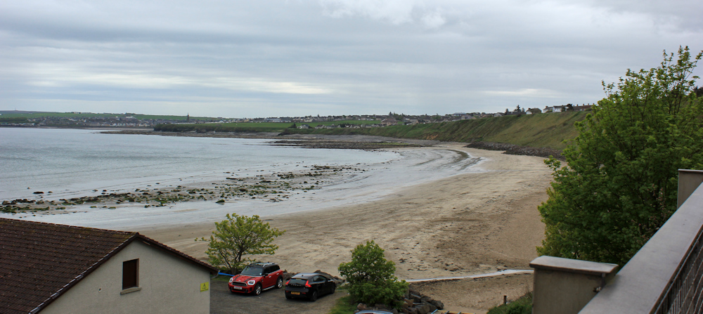
The tide is out, and the boats in the harbour lie well below the height of the quayside. A group of gentlemen have come ashore from a fishing trip (I presume) and are busily peeling off their waterproofs and packing them into a car.

It is a steep climb out of Scrabster as I continue walking up the A9, heading for Thurso. I can see the town quite clearly, just across the bay – and it looks as if I could walk there along the beach. But with no easy route down to the sands – or up again! – I decide to stick to the pavement.
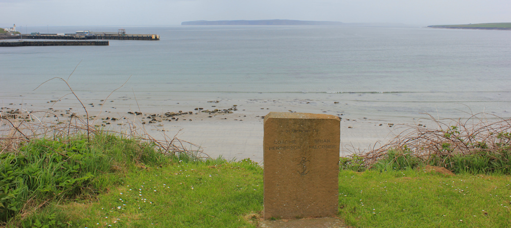
Pass a memorial stone. In memory of Coachie Henderson and Brian Falconer, with an anchor sign. Seamen, I presume. Wonder if they were lost at sea in some tragedy, or died as old men in their beds – the stone gives no indication.
At the top of the slope, a footpath leads away from the A9, following the coast, and this should take me all the way into Thurso.

There is one section where I have to walk through a housing estate, a deviation not made better by the fact that it now begins to rain!

I don’t bother to put on my rainproof trousers, but I do fasten my coat and raise my hood. Onwards.
Soon, I’m back on the coast again.
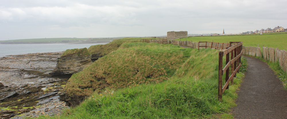
The rock formations here are quite impressive, but lie mainly longitudinally under the low cliffs. Over the bay is Scrabster and its harbour, with the stubby little lighthouse above it.
The path is lined with tombstones sorry, paving slabs! And here is my campsite, right on the coast itself.
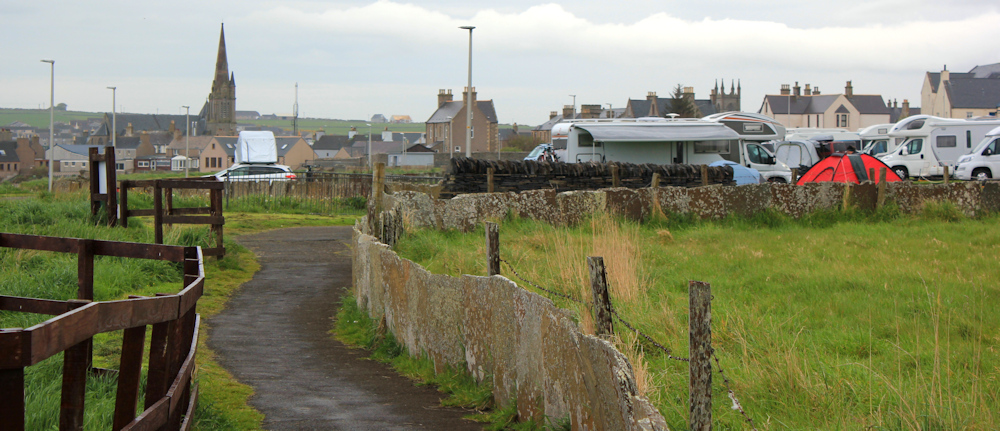
There is nothing more miserable than a campsite in the rain, but at least I have a nice dry van to return to. The man in the tent behind me is a cyclist. His cycle stands outside in the rain, and is covered, like a washing line, in damp pieces of cycling kit. He is going to have to set off tomorrow in wet clothes.
My van looks cheerful, despite the rain, with a paint job that seems made for sunny days and blue seas.

I promise my van that one day we really will go somewhere dry and sunny and warm.
Miles walked today = 8.5 miles
Total distance around coast = 5,028 miles
Route (morning in black, afternoon in red)


Hi Ruth ,I love the way ,PRIVATE ROADS etc dont put you off, the council in hastings have made part of the beach private in front of beach huts , I go out of my way to use it !!!!
That is very disappointing to hear. The Crown usually owns the land below the high-tide mark, so you are legally allowed to walk there. But no good if the tide is high!
The campsite looks to be in a bit of an odd place right by a populated area. Was it quiet?
It was fairly quiet, but the main road runs nearby and is pretty busy. This was the campsite with signs everywhere telling you what NOT to do. I’m sure one of them was about not making a noise, but I can’t remember now!
Those slabs are amazing. As you say almost like a man-made paved area. In some places on the north coast there are huge areas of it. I believe there are still two active ‘mines’ for Caithness Stone – they basically clear the peat off the stone and then just take slices of the rock. That is what you see lain around the fields like a ‘fence’. Quite a fascinating dare I say it unique place.
The slabs are gorgeous. So many impromptu paving slabs just lying about.
Wonderful cliffs.
I am that wet man standing next to his tent, dreaming of a warm and dry camper van. 🙂
Ha ha. Well, if you ever see my van just knock on the door and I will make you a hot cup of tea. I even have a little heater inside – so you can warm yourself up.
A dreary day but those rock formations are incredible. I am fascinated by anything like that, thinking of the age of them makes me feel very insignificant.
I feel sorry for people under canvas in bad weather – I’ve been there, done that. Now I like my comforts when I on holiday.
I used to go camping in a small tent when I was a young woman, but I don’t think I could crawl into one now!