
[This walk was completed on Saturday, 27th May, 2023]
After a late start, I cycle to Freswick, chain my bike up, and walk down to the beach. Today, I will be following the official John o’Groats Trail (JOG Trail) to a place called Keiss.
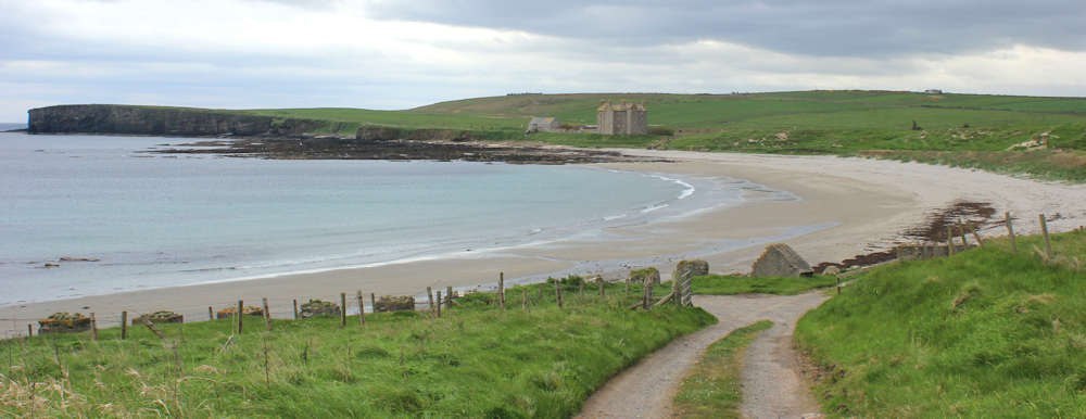
There are old tank-defences lining the top part of the beach. They create a handy surface on which to balance my camera and set up the timer for a self-portrait.

Love the walk across the beach but, as I get closer to the house/castle on the opposite side, I discover there is a river running across the sand. I balance, precariously, on seaweed strewn stones to get across, and then find myself mired in a field of the smelliest seaweed I’ve ever come across.
Safely out of the seaweed bog, I stop to take photos of the building. It is simply called “Freswick House” on my map, and is a tall, grim-looking edifice. More like a castle than a house. I wonder who lives there?

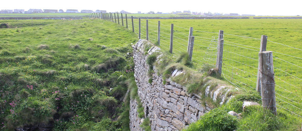
The JOG Trail continues below the building. It’s well signposted and the bridge helps to traverse a water-filled ditch.

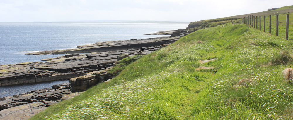
Now, I’m walking along the top of low cliffs. A dry-stone wall to my right. Below me, the sand is coming to an end and is replaced by ridges of rocks stretching out into the sea.

I reach a narrow cleft, or geo, that is nameless on my map. There are the remains of a ruined building on the headland beyond.

At first, I think I’ve reached Castle Geo, but a quick map check shows I haven’t come far enough. The wider geo on the other side is called Selly Geo, and I stop to take photos of the magnificent cliff. Love the striations and the colours. In the distance is Freswick Bay and the hazy outline of Freswick House.

I reach Ness Head, with another wonderful sea stack, covered in sea birds. The noise is tremendous.

The walking is easy, but my progress is slow, because I keep stopping to take photographs. Look at these amazing rocks – giant slabs slanting down into the water.

Ah, this is Castle Geo. What a dramatic sight.

The view of the old castle is even better from the other side, and the cliffs are staggeringly beautiful. Look at the colours! And the hidden caves below.
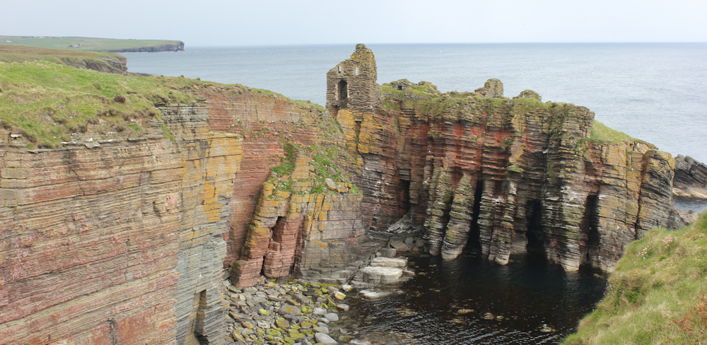
I’ve never fancied rock-climbing, but cliffs like these make me want to climb down and investigate. What secrets are hidden in those rocky crevasses?
Further along, and another impressive set of sea stacks – or they would be impressive if the tide was higher. Now they are surrounded by shingle and boulders instead of by the sea. “Black Score” says my map.

At this point, the wind picks up and I am suddenly caught in a hard, sleet-like downpour that is driven by a westerly wind coming off the land. It catches me by surprise and I stop to pull out my waterproof rucksack cover, but I don’t have time to put on my waterproof trousers. The right side of my body is already soaking wet.
The sideways rain, driven by the wind, passes straight through my waterproof jacket (recently reproofed!) and my trousers are so sodden that water runs down my legs in rivulets and fills my boots.
Urgh. This is horrible. I put my head down and squelch along.
The whole downpour lasts about 20 minutes, but it seems much longer. As the rain eases up, I pull my camera out to capture the windswept, rainsoaked path. Of course, it looks quite pleasant in the photo!

Ahead, through the drizzle, I can see a little car park, perched above another strip of dramatic cliffs. But first…

… I have to negotiate a wide stream. Pick my way carefully across some very slippery stepping stones, and wonder why the water smells so foul. It really stinks! Then I look upstream and see two dead and decomposing sheep lying beside the water. Yuck!
It’s a reminder that, although this section of the JOG Trail seems easy and tame when the sun is shining, it is really a harsh and cruel landscape.
Onwards.
The rain clears and the sun comes out. I’ve nearly reached the little car park, and am surprised to see a couple of monuments along the path. There are, in fact, three of them.
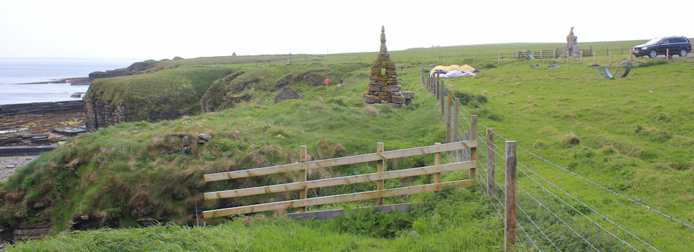
I pass the first monument, but stop by the second one. The wall gives me some shelter from the wind, and the stone slabs create a dryish seat. I strip off my wet boots and my sodden socks, and let my feet dry in the sunshine. Time for lunch.
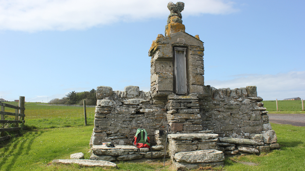
I never do find out why these first two monuments were erected. If there is a sign, I don’t spot it.
After 15 minutes of blissful rest, I have to slip my feet back into my damp socks, and then back into my cold, wet boots. Oh well. Not far to go now.
There is a pier, or maybe it is just a harbour wall, below me. No sign of any boats, but it does look inviting in the sunshine.

A notice tells me I am walking through an historic area, dotted with pre-historic brochs and other ancient settlements. The path leads to Nybster Broch, and the sign tells me this is “one of the most important sites in Scotland”.

The third monument marks the site of the well-excavated Nybster broch.
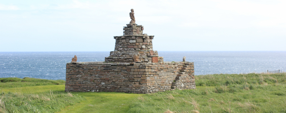
And here, on a little headland, are the remains of the broch. It really is quite impressive to see the well-defined circular outlines, and the stones in the still-intact lower walls – stones presumably placed here well over 2,000 years ago.

It’s not as impressive as the broch at Totaig, back on the Glenelg peninsula, where you could actually climb the internal staircase up to the first floor (although the floor had long disappeared!) Still, it’s pretty impressive.
From here, the path becomes less distinct, and passes along the seaward side of a fences. The rocks below remain interesting. Paving slabs.
And this, surely, must be a quarry? Or maybe it is a natural space? It’s hard to tell.

The path has definitely deteriorated. Getting across this little ravine proves quite tricky, as the earth has crumbled away and the whole area seems determined to slide into the sea. I cling onto the wire fencing and take a leap…

… and end up safely on the other side.
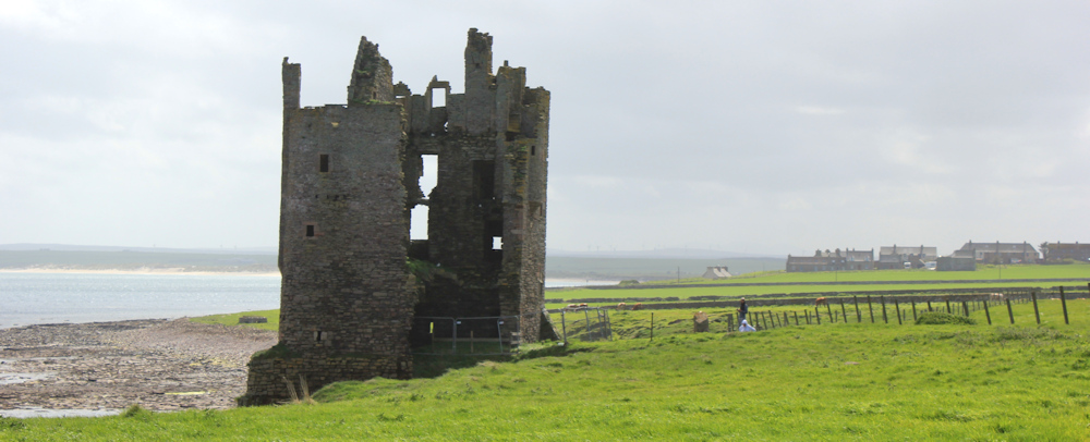
I’m approaching Keiss and there is another castle ahead. It is “closed”, but a couple are flying a drone around the castle, which looks like a great way to explore the building. They pack up as I approach.
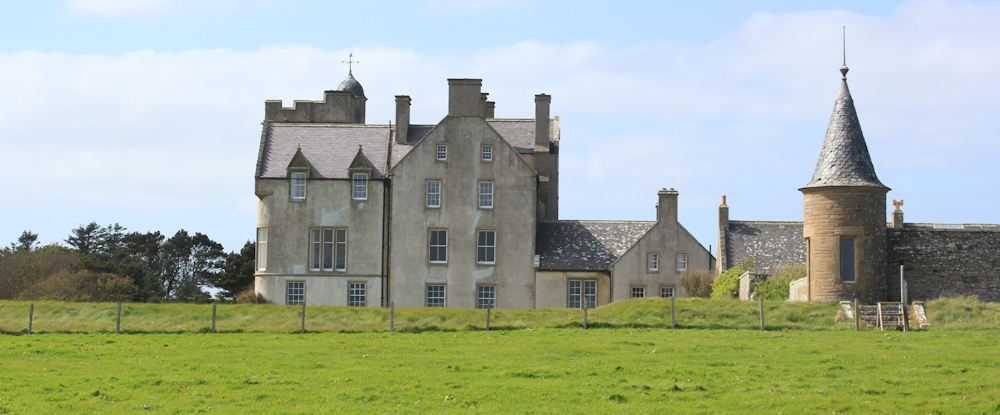
Inland is another “castle”. This one is modern. Castle Keiss, according to my map.
Beyond the ruined castle, the path disappears. I guess it would be possible to inch my way along this stone wall, clinging onto the flimsy wire fence. But the fence is unstable and the fall would land me on unforgiving rocks.
And the field ahead is full of cattle – I can see them in the distance. So, if I did find myself trapped with no way forward, the only way across the fields would involve negotiating herds of cows… and I really hate cows.
So, I turn round and walk back past the ruined castle, aiming to pick up a farm track that I spotted earlier. I climb over the first gate into an empty field but, as I approach the second gate, I meet a man on a quad bike.
“Better stand back,” he warns me. “We’re taking cattle through. They will be here any minute.”
I flatten myself against the fence to the side of the gate and wait. The cows arrive a minute later, as predicted. Mooing and lowing. Walking at a stately pace with their calves in tow. It’s really quite an impressive sight, but I don’t dare pull my camera up to take a photo. I don’t dare move in case they notice me!

Only after they’re safely in, and I am on the other side of the gate, do I dare take a photo.
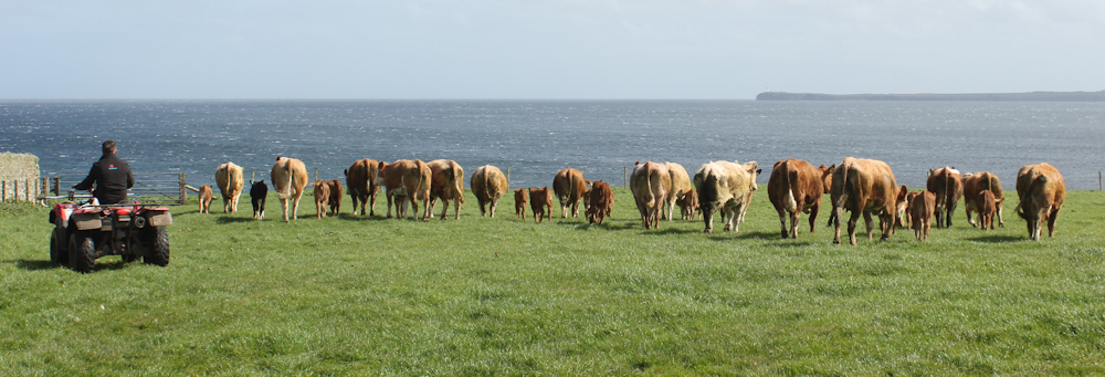
Whew. A few minutes later, and I wouldn’t have wanted to cross this field, and I would have been stuck beside the ruined castle!
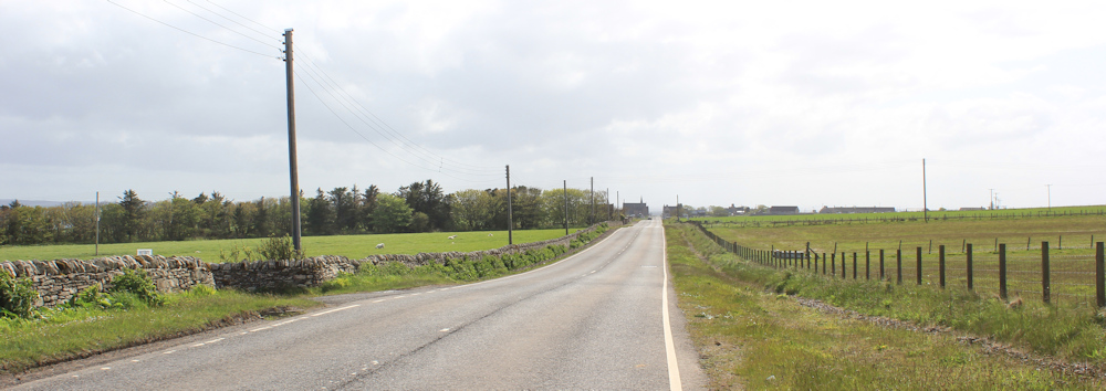
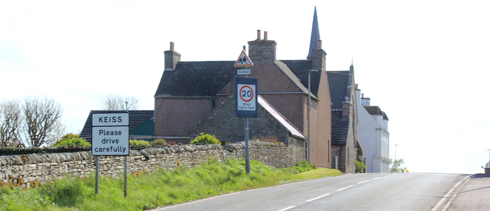
I walk up the farm track, where I have to climb over two more gates, and reach the main road. This is the A99. It runs from John o’Groats to a junction with the A9 at a place called Latheron. But I’m only going as far as the next settlement – Keiss.
Across the fields, I get a front-view of the modern version of Keiss Castle. It looks more impressive from this angle. And there is a great view of the old Keiss Castle too, which looks tiny in comparison.

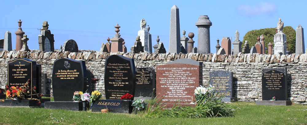
Old contrasting with new is the theme for this section of the walk, because I soon pass a cemetary on my right, where the new gravestones standing in stark contrast to the more muted-colours of the older memorials.
Past a war memorial, and the road rises up until I reach the main part of Keiss. There is a church on the corner, and a pub opposite.
It’s just about to turn 5pm, and the pub is open. It’s been a tricky day with smelly seaweed, a stream polluted with decomposing sheep, dangerously crumbling paths, a rainstorm causing my boots to fill with water, and I was nearly flattened by a herd of cows… so I reckon I deserve a cider.

The pub also does rooms, and has a space outside for campers and caravans to park overnight, although I don’t think it offers any toilet facilities. Anyway, a welcome stop for me and a place that deserves to thrive.
I’m not staying here though. I’ve rented an Airbnb just down the road, where I have my own room with great views and an ensuite shower. Fresh croissants are delivered every morning. Bliss! I’ve really had enough of camper-van living!
Post walk notes: Turns out the A99 is one of the most dangerous roads in the UK, according to Wikipedia. (Glad I didn’t realise that at the time!) The tall building in Freswick is called Freswick Castle and is privately owned, but available for weddings. The modern Keiss Castle (along with its ancient neighbour) was recently for sale for nearly two million pounds.
Interesting buildings seen = 2 ruined castles, 2 modern castles, 1 ancient broch, and several old monuments of indeterminant purpose.
Miles walked today = 7 miles
Total distance around coast = 5,076.5 miles
Route today:


Great photos Ruth
Thank you!
I am interested to hear your views of the JOG when you get south of Whaligoe and on towards Helmsdale. Particularly as you walked the section in May when cattle are with their calves. Back in 2018 when I walked it, it left a lot to be desired and in some sections it was downright dangerous so I ended up on the A9 in places. I am hoping you found it much improved because the guy who is behind the JOG (forget his name) did not take kindly to my comments, which were meant to be constructively critical and he abusively laid into me from a linguistic point of view. (He had actually asked me for my comments. Afterwards i wished I had never bothered as he was so offensive.) Anyway…. I await the next few installments with interest.
It still leaves a lot to be desired, Chris, and I had to resort to the A9 too. It’s obvious they’ve made great improvements and the web site is very honest about the problems.
Good progress. Glad you could use the now established path. My friend Bowland Climber: https://bowlandclimber.com/2024/08/10/the-telford-t50/ walked it a few years ago when work was just starting. He had a pretty tough time in the unconstructed parts. You and I now coincide at Keiss. I stayed my last night there on my LEJOG after emerging from The Flow Country. My B and B was called, would you believe, Dunroamin. My room was total tartan, carpet, wallpaper, and bedding. That was long before the coast path and I had to trudge up the A99.
It seems to be the law in Scotland that all B&B rooms have to have tartan carpets. Same in the hotels. Dunroamin is such a perfect name 😂
Stayed in that pub, the Sinclair Bay, for a couple of nights whilst heading north. Very friendly and comfortable.
Good to hear. I really liked it.
More incredible rock stacks and formations, and fabulous photos! I’m sorry you got soaked and glad you avoided the cows!
On the train home from Wick after a wintery trip and reading your posts on the sections I’ve just hiked, there are now stiles either side of the stone wall that allow you to cross safely through the field.
Good to know about the stiles. Also good to hear you survived the wintry walk. I saw the forecast and was quite worried for you!
Hello Ruth. Your blog makes for great reading and I am delighted to read that you stopped for lunch at a memorial bench during this days walk. We also stopped there for lunch and like you, were caught in a really heavy rain shower. Best wishes,
Bob W.