
[This walk was completed on Monday, 29th May, 2023]
After lunch, I pack up my ruck sack and hoist it over my shoulders again. Onwards, along the road. One last look back at Broadhaven…

…and then I turn off down a dead-end side road, following signs for the JOG Trail again. Notice how they helpfully tell you whether you are heading southwards or northwards. May seem unnecessary in places, but often turns out to be very useful.

This side road leads directly to the shore. I pass a couple of dog walkers, and a ruined building (a great renovation project – think of the views!).

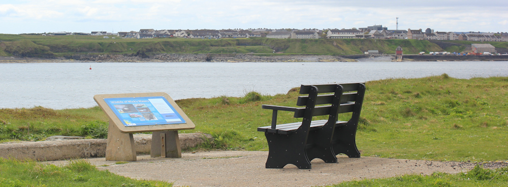
The road ends in a sewage works, but a pedestrian path continues onwards. This is North Head, and marks the northern entry to Wick Bay. I would love to sit on the nearby seat overlooking the water, but I’ve only just had my lunch break/rest.
I’m walking up the estuary, heading westwards towards the main town of Wick. Soon come across this interesting stone. Is it a memorial to a man called Iron Wellie? Or a memorial to a wrecked ship called Iron Wellie? It’s a mystery.
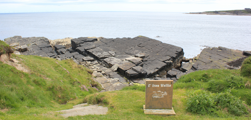
[Later, I learn Iron Wellie is the name of a nearby fresh-water well, with waters that taste… wait for it… like iron!]
I may have left open countryside behind, but this is a lovely walk. A good tarmac path, interesting rocks below a bank of pretty pink thrift, and Wick is straight ahead.

An information plaque tells me about the many ships that have ended up wrecked around this coast. What dangerous waters!

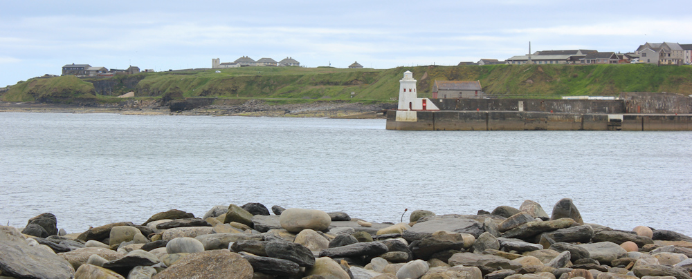
A sign warns me that these low cliffs, too, are dangerous. And what’s that strange square tower ahead? A lighthouse?
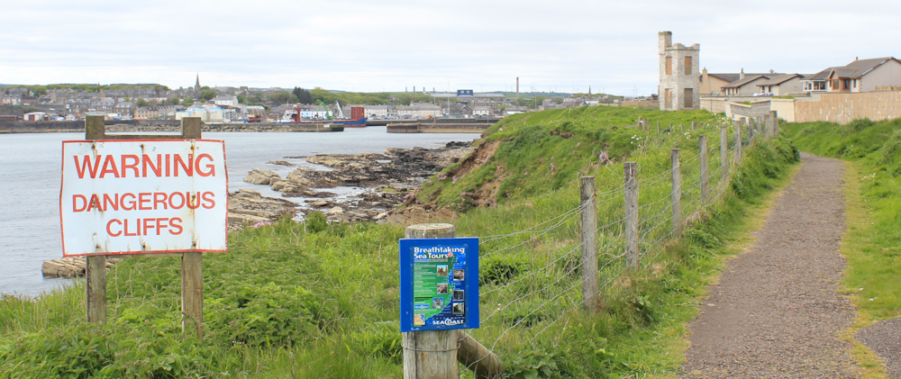
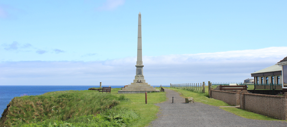
A carved stone in the tower holds a sequence of names. Waterloo, Toulouse, Lucknow… ending with Sebastapol. I have no idea why these names are there, until I go round the other side, where there is a poppy wreath. The square tower turns out to be a very old war memorial.
Earlier today, I passed rocky ledges containing pools, and wondered if you could go swimming in them. Well, with the help of a bit of concrete, here there really is an outdoor swimming pool. I wonder if it is still in use?

This section has turned into a very interesting walk. Just above the path is an old pill box, painted with graffiti in muted tones that resemble camouflage. If I wasn’t so tired, I would climb up and explore.
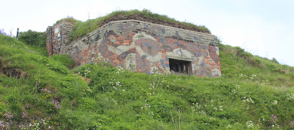
I must say, Scottish pill boxes look far more substantial than their English counterparts.
Across the water is a lighthouse. That marks the entrance to Wick’s inner harbour.
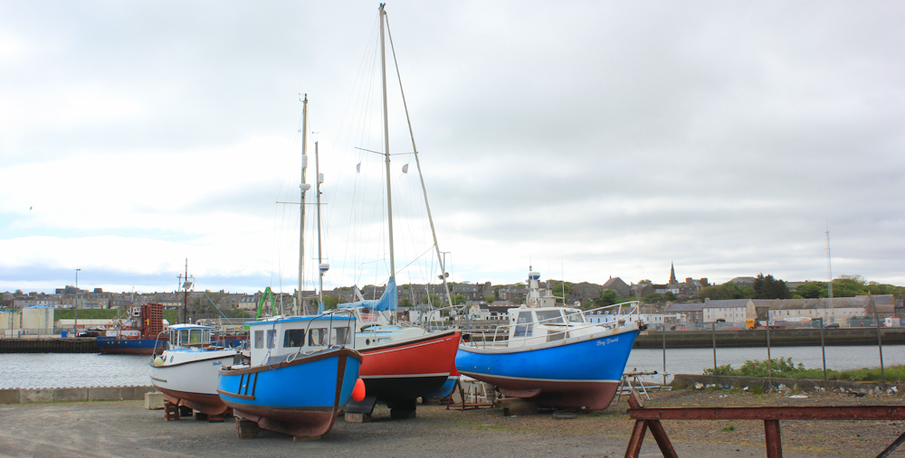
I pass an area where yachts and fishing vessels have been hauled up on the quayside. Boats can look so abandoned resting on their keels, but these are smartly painted and seem in good condition. Wonder if they will go back in the water for the summer season soon?
There are residential houses on my right now. I’m drawing closer to the town. There’s the bridge over the river.
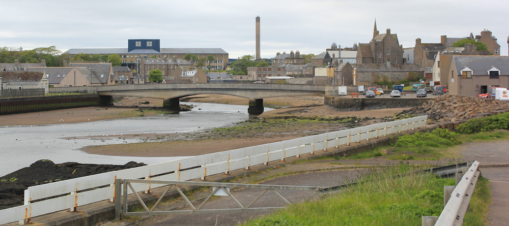
Pass an open-air food stall, and now I am in Wick itself. Sadly, the only real impression I have of the town is from driving and cycling through it, and the impression I have is of a baffling system of one-way streets and traffic jams. But these streets are spookily quiet.

I stop on the bridge and take a photo looking towards the harbour mouth. The harbour walls are impressive. They must take a battering in the winter storms.

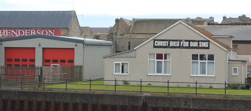
Next to a fire station, a sign on a building catches my eye. “Christ died for our sins.”
I turn left off the bridge, and walk up the southern side of the harbour. Here is a little marina. Nothing flashy, just fishing boats, a few yachts, and a variety of small motor launches.

I pass a canon. Rather threateningly, it is pointing directly at the town of Wick. Stop to take a closer look, and it turns out to be an old fog cannon. Presumably it was moved here from another position. Or, I hope, it only fired blanks!

Here’s a handy bench, given in memory of a professional diver called Gary Connor who, it seems, lost his life saving lives. I have another rest, but keep looking over my shoulder at the fantastic metal art that covers the recesses in the wall behind me.

Time to leave the harbour, and head off up the path, which rises to run along higher ground. The white building ahead is not a cafe, as I anticipated, but a “Healing Hub” and “Oxygen Therapy Centre”. Definitely not mainstream medicine.

I stop to take photographs overlooking Wick Bay. The sun is out and everything looks fresh and beautiful in the sunlight. The lighthouse at the end of the harbour wall is the one I saw earlier from across the Bay.

Love this statue. A man in a tunic, holding a fish in his outstretched hand. Turns out to be a memorial to all the local seafarers lost at sea. Beautiful and tragic.

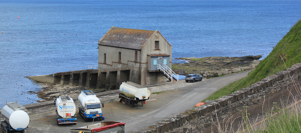
Below is a road, a car park, and an old building perched on top of a slipway. That must be the old lifeboat station. The new one is further back within the harbour walls, according to my map.
Another memorial. This one is dated 1903 and is in memory of James Bremner, “naval architect and harbour builder.” I presume he is responsible for building the old Wick harbour.
The path curves inland and rises higher still, to join a road further up the slope.
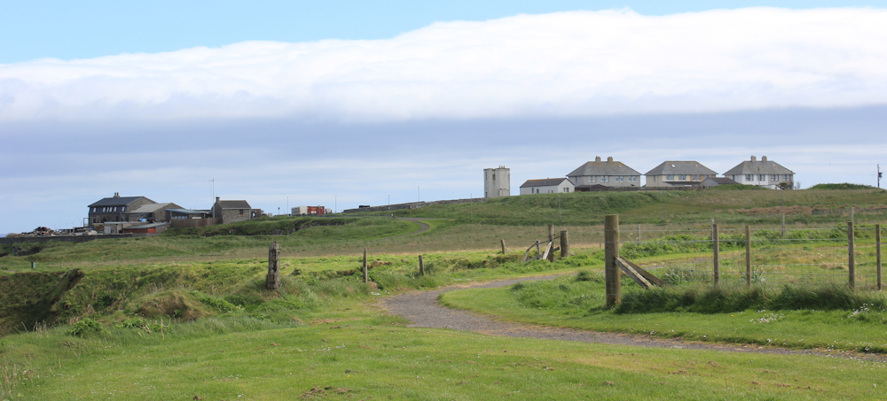
Reluctantly, I turn away from the coast, but not before looking down to see what I might be missing – and I’m surprised to see a road. A coast road? Maybe that’s the route I should have taken? What am I doing up here?
My walks are often full of “What if” and “Should I have…?” questions. But, when I join the road, I see the familiar JOG Trail sign. This must be the right route after all.

The road is quiet and soon curves around to the right, to follow the coast southwards.
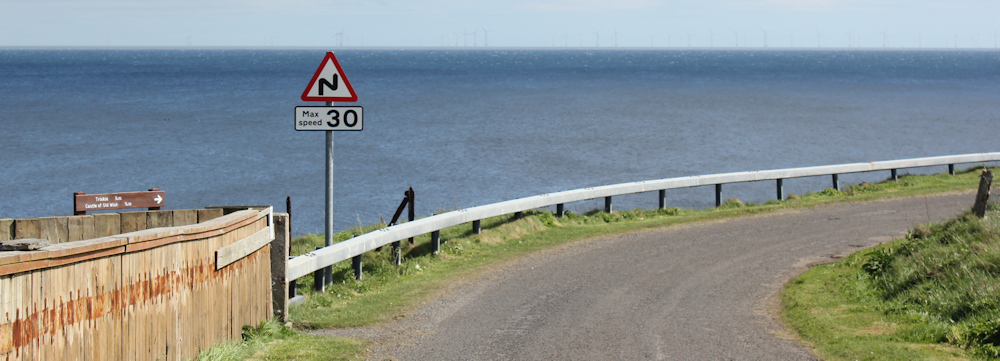
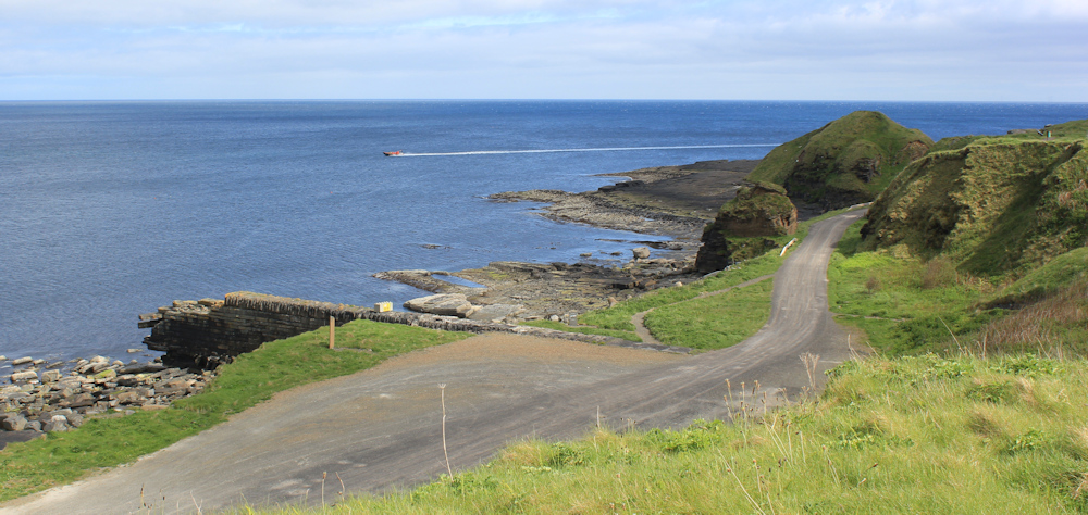
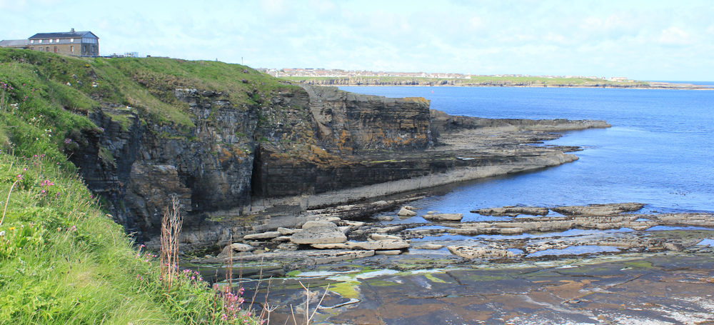
A wooden sign on the bend (just visible above the fence to the left of the photo above) indicates that to the right is the way to the Castle of Old Wick, and to somewhere called Trinkie. Further along, another sign on a rock points back the way I’ve come and holds one word: “CAVE”.
I stop to look back. Yes, there is a cave. And the coast road I saw earlier seems to have disappeared. Glad I didn’t climb back down to join it.
I’ve left Wick behind now. Further along, and here is another pool in the rocks. Again, the application of concrete seems to have formed an artificial basin.
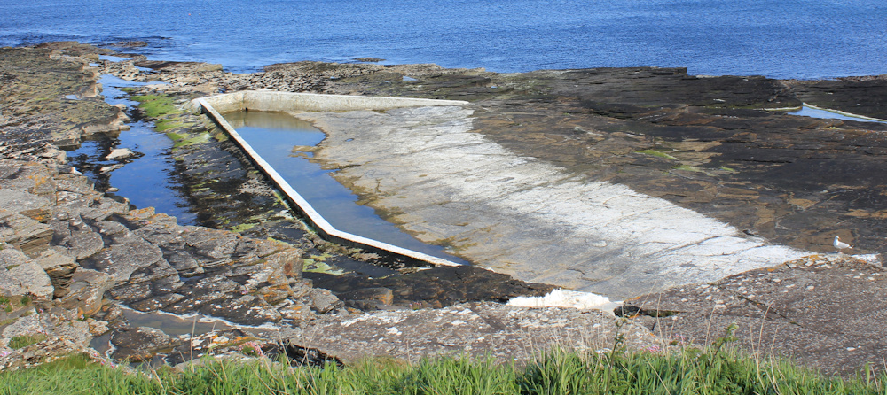
Painted on the rocks beside the pool, in large letters, is the name “TRINKIE”…
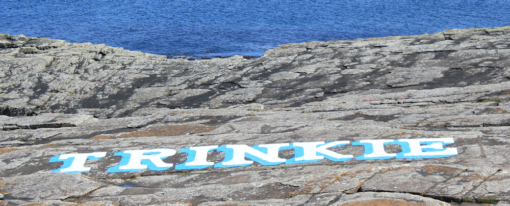
…and a nearby information sign explains that The Trinkie is an historic open-air swimming pool, created from the pit made by old quarry workings.

But now, fascinating though the story of The Trinkie is, I am beset by a personal problem. For about an hour I’ve been desperate for a wee. The problem with walking through built up and popular areas is that it is almost impossible to find a private spot in which to “go” and there are never any public toilets around.
Anyway, I’m nearing the end of the road, where there is a small car park. Several cars are parked there, but they are empty. I climb down the bank towards the rocks, find a screen of gorse bushes… whew, what a relief.
Climb up the bank again. This wall, at the end of the car park / turning area is, literally, the end of the road. A stile and footpath lead to the Castle of Old Wick. “We regret this monument is closed” warns a sign.
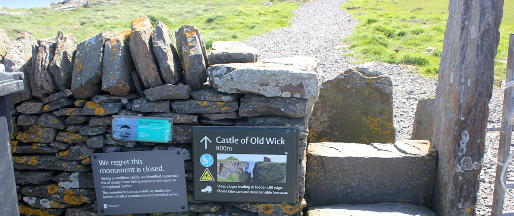
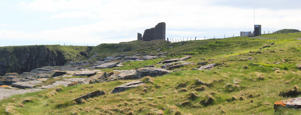
I look ahead, where the castle is silhouetted against the skyline. Along with another tower that looks suspisciously like a guard tower guarding the entrance to a military range.
I check my map. Yes, the area ahead is outlined with red triangles and is designated a “Danger Area”, while inland the map shows a “Rifle Range”. Oh, well. I’ll worry about getting shot another day.
This is the end of my walk. All I need to do is find the lane (as shown on my map) to take me back towards the streets… and here it is. More grass, than lane, to be honest. Hope I can find a way through.
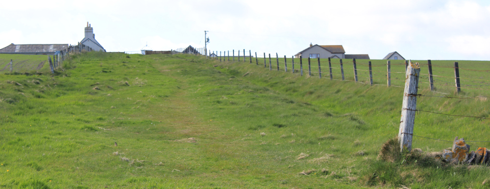
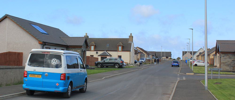
After scaling a gate, I do manage to find my way back to the residential streets of Old Wick (which look surprisingly suburban and modern). Here’s my van.
I have another two nights booked in my Airbnb, and I should really go walking tomorrow. It’s the last day of my trip. But I’ve felt so tired today, that I decide to have a day off.
Maybe I’m sickening for something? Maybe I’m just getting old? Or maybe I’m homesick? I’ve been up here for 5 weeks now, but I don’t normally get homesick. I like travelling.
I don’t know what’s wrong with me but, when I get back to my room, I forget about going out for an evening meal, take a paracetamol, and go straight to bed.
Post walk notes: You can read more about Iron Wellie on the Wick Society page. More information about the Caithness tower war memorial can be found on Imperial War Museums site. The swimming pool on the north shore of Wick Bay is called North Baths and, thanks to a team of volunteers, is still in use – here is a local newspaper article of the clean up in 2024.
Gary Connor was a professional diver on a treasure hunt expedition, and died from the consequences of “the bends” after saving a fellow diver. More information here.
You can see more photographs of the fantastic metal artwork on the south wall of Wick Harbour, courtesy of Stanley Eastwood, on his flickr account.
The seafarers memorial is a very recent addition to the south bank of Wick, and you can read the contemporary BBC report of its unveiling.
Miles walked today = 7 miles
Total miles around coast = 5,084 miles
Route (morning in black, afternoon in blue):


Yes – hope you did give yourself a well earned day off. Love the open air swimming pools.
I couldn’t help but chuckle at your comment regarding your loo stop! I’m glad it’s not just me that has to stop for ‘wild wees’ at times 😅
There is an ironic beauty about the warfare pillbox adorned with peaceful artwork. A message of hope?