
[This walk was completed on Saturday, 10th May, 2025]
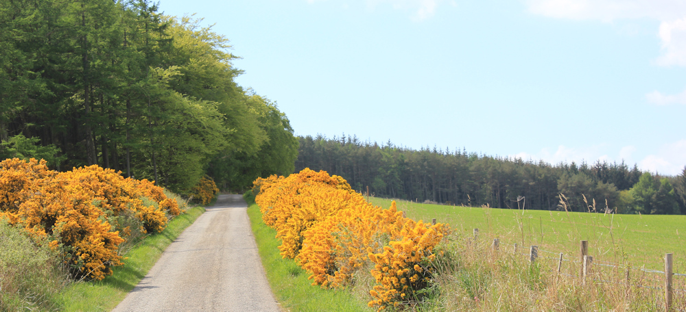
I leave my bike in the same spot as yesterday. But today I’m heading south, along the minor road that leads down towards Rosemarkie. It’s another beautiful day, and the fields are bright with gorse and rape seed crops.
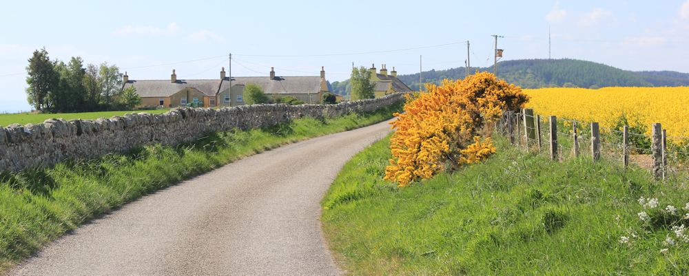
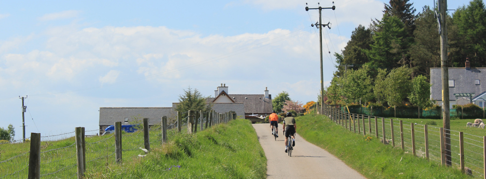
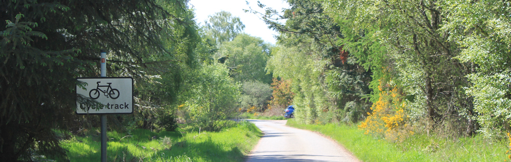
I pass through a little place called Navity, and head towards a low ridge. A cyclist whizzes past me – this quiet road is also part of National Cycle Network Route 1, which runs all the way down from the Orkneys to Dover. I wonder how far the speedy cyclist is going?

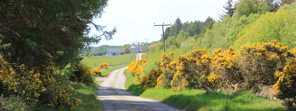
My walk today is mainly along this road and, although I usually resent road-walking, the little road is really very pleasant.
After running through open fields, the road curves down into a little wooded valley. This is where the little stream, Eathie Burn, dips under the road before heading down to the sea.
I take a photo of Eathie Burn, but it is narrow and shaded by undergrowth, so the resulting photograph is very disappointing. Here is a photo of some lovely roadside bluebells instead. These are native bluebells, not the Spanish invaders!

One of the great things about walking in northern Scotland in May, is that you get to prolong spring, as everything blooms a bit later in the year up here. (You also escape the midge season, beacause that doesn’t start until June or July.)
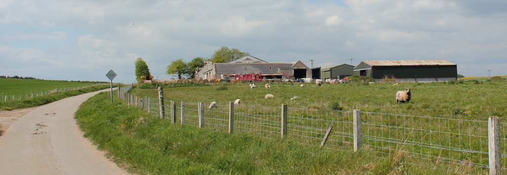
Coming out of the river valley, I’m approaching a farm called Eathie Mains. Fields of sheep on either side.
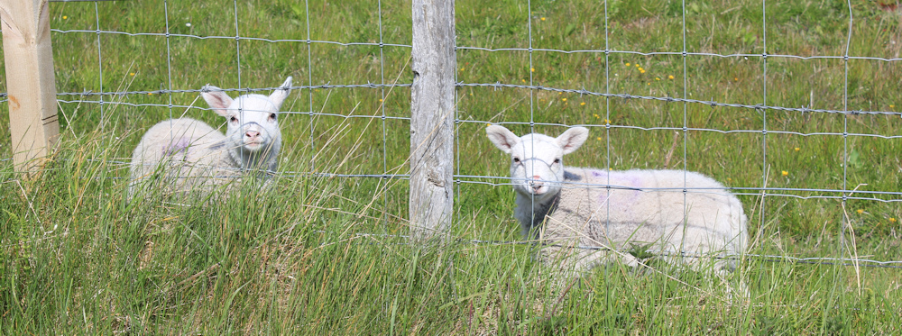
Another great thing about the late Scottish spring is you get to see young lambs playing in the fields. Hello, you cheeky things!
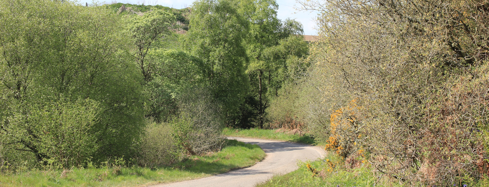
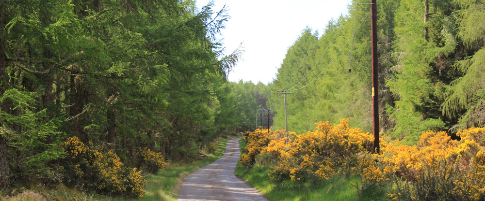
Beyond Eathie Mains, the road climbs up towards the low ridge, where native trees and fir plantations crowd the horizon.
At a bend in the road, a track leads off to the left. “Hugh Miller Trail” says a sign, because the track leads to Eathie Haven where Hugh Miller made some important fossil discoveries.
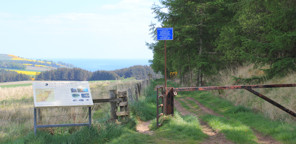
I hesitate, because I would like to go down and visit Eathie Haven, but I’m reluctant to to make a detour and add miles to my planned route. My fitness levels are really poor and I need to conserve energy.
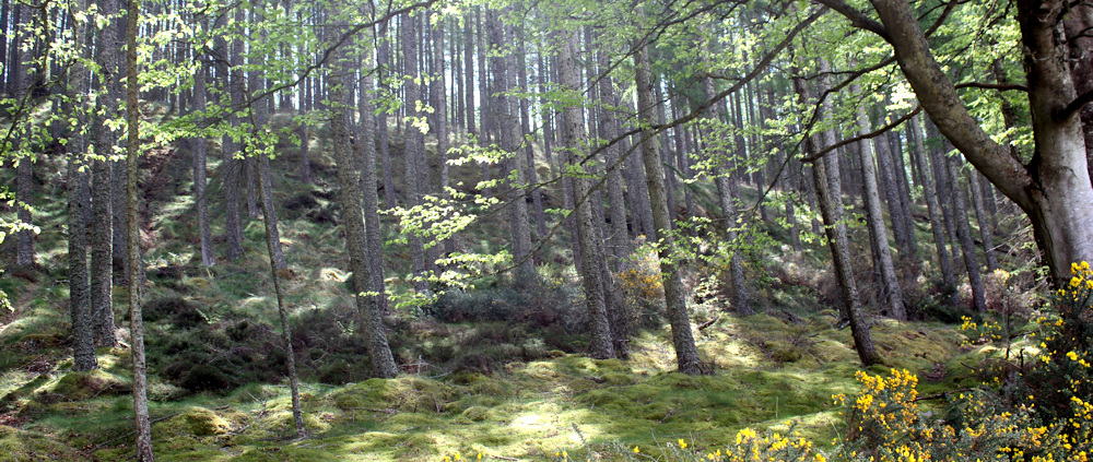
Onwards, along the road, where the route is now shaded by trees. Consider leaving the road to walk among the trees, where I can see narrow paths. But the ground looks too boggy and paths soon fade away into nothing.
To my right is open countryside – bright green fields lined by hedges of golden gorse, and the blue drift of hills beyond. Beautiful.

I’m walking through a mature fir plantation now. Will these trees by harvsted one day? I hope not. The resulting landscape is brutally bare and it hurts my soul to see the desecrated slopes laid bare by woodcutting machinery.
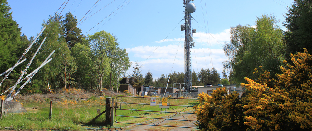
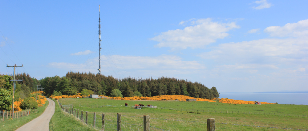
The road has been steadily climbing (why are all my walks uphill?!). I pass a tall, tall mast on my left – a “Radio Station” according to my map. It stands in a narrow clearing and it is hard to take a decent photograph to demonstrate the height of the mast.
Onwards. The woodland is coming to an end. Open fields and a building ahead – possibly Craighead Farm?
To my left are great views across a rolling slope of grass, down to the shining waters of the Moray Firth. On the far shore – Aberdeenshire – I can vaguely make out buildings, beaches and roads. One day I will be walking over there.
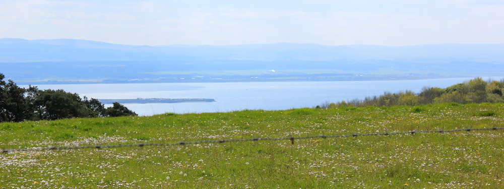
The light is bright when looking south, and so photography of this lovely view leads to disappointing results.
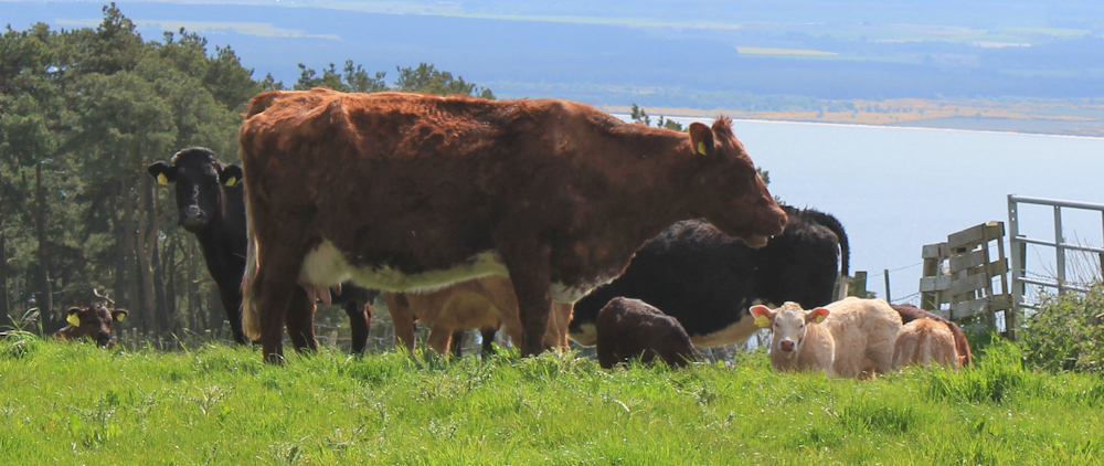
Part of me is always on the lookout for possible routes down to the shore, so that I can walk closer to the water. But, this is the sort of thing that prevents me being more adventurous in my choice of routes – cattle in the fields. Cows with some very young calves.
Whirring behind me, and I am overtaken again by a couple of cyclists. Another reminder that I am on National Cycle Route 1.
As I reach the top of the slope, I turn round, and take a photograph looking back at the mast. It is much more visible from this side and towers over the landscape. That thing is tall!
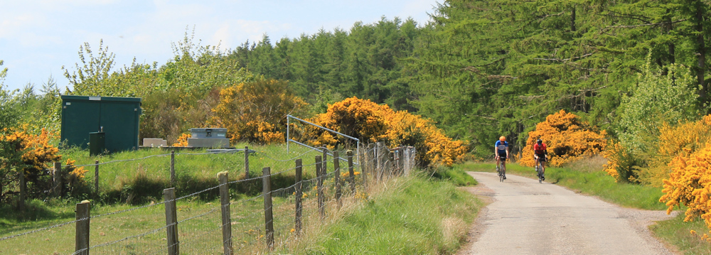
Dipping over the brow of the hill, the road descends gently. Two more cyclists are toiling up the slope towards me. I pass a water plant of some sort (the green structure on the left of the photograph below).
Shortly beyond this, I notice a track that seems to be running parallel to and just below the road. I drop down to follow this route, which seems very clear and easy to follow at this point.
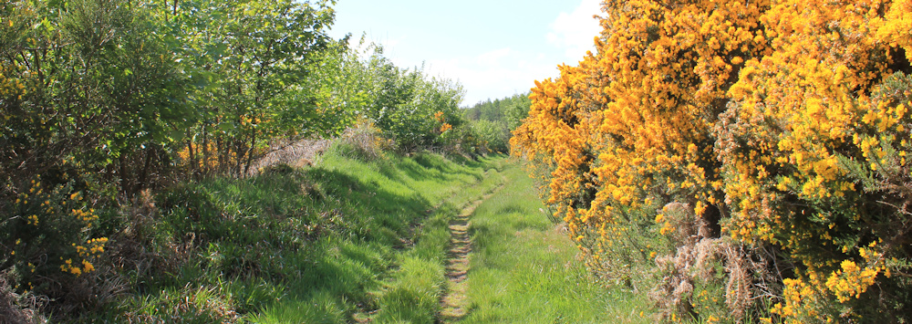
But, sadly, the track soon deteriorates. In shady areas under overhanging bushes, the ground becomes very muddy. I can see the hoof-prints of horses – adding to the general muck and deterioration of the ground.
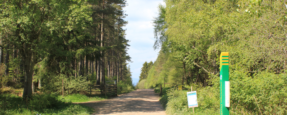
Reluctantly, I rejoin the road. Ahead is a turnoff where a car is parked.
The turnoff is a forestry track with a wide area that is obviously used as a car park for visitors to the woods. The track is firm and clear – and, in fact, I cycled up this track this morning on my bike.
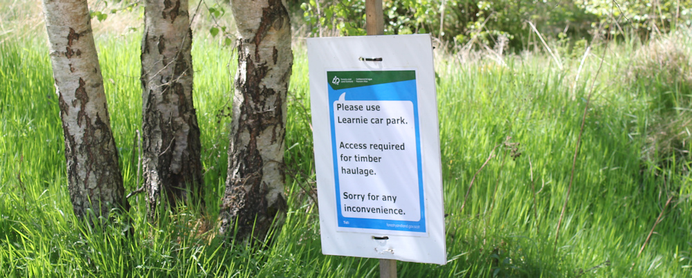
This morning, I was planning to park here in the van, but a sign told me to use “Learnie car park” because timber haulage lorries required this area to be kept clear. At first I was a bit confused by the sign – as I didn’t know where this official Learnie car park actually was, but I headed back to the main road and found a spot that seems to be where the track ends up. So that is where I parked this morning.
Anyway, I’m a bit disgruntled to see a couple of other cars are now parked in the wide area at the start of the track. I guess it is Saturday morning and haulage lorries are not operating today. I could have parked here after all!
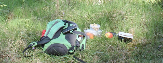
I walk down the track a short distance to find a place to eat my lunch. I’m really looking for a tree stump or a felled log, but instead I have to make do with a soft green bank in mottled sunlight. A perfect lunch spot.
[To be continued…]
Route so far today:


Not far now from Inverness, a dignificant milesdtone.
Yes, horses can really churn up bridleways. I’ve often felt for the poor, heavily burdened peasants in the past who were trying to walk along what passed for main roads in those days.