
 I walk through the graveyard of the church at Hoo St Warburgh. There are fresh graves with real flowers and little windmills. On a child’s grave there is a teddy and balloons. I refrain from taking photographs – it seems too intrusive on other peoples’ grief.
It may be a grey day, but I am glad to be alive.
I cross the road and join the Saxon Way. In front of me, Kingsnorth Power Station is belching steam, but I am not heading back towards it. Instead, I follow the path as it turns to the South and I walk briskly down the hill to the shore.
I am going to find a river, not the sea. Oh, I long for the sea but I have the River Medway to navigate first. I have only seen this river from the M2, whizzing over it on the way down to Dover or Folkestone, on family holidays.
According to the OS map, There are 2 Saxon Ways – one running close to the river, the other further inland, running along the top of a slight ridge. My husband advised me to take the top path as the views would be better. I am inclined to take the route closer to the shore – following my self-imposed rule of sticking as close to the water as possible.
 When I reach the river bank, turning right to follow the shore, I wonder if I have made a big mistake.
The path winds through unfriendly semi-industrial spaces and is, at times, hard to spot. Oh, here it is, hidden behind this fence and with unappealing barriers making sure I keep to the straight and narrow. Narrow it might be. Straight? I wish!
When I emerge from this unpleasant alley way, I find I am walking round the edge of a marina. Fences line my path and there are many signs telling me not to trespass, private property, keep off. There is a strange jumble of boats; some large ships that appear abandoned, a collection of houseboats, a few yachts and an assortment of small tugs and motorboats.
The marina has a slightly run-down feel to it, but at least it is used.


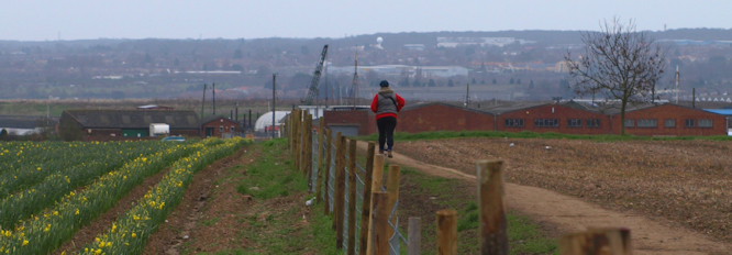
Emerging at the other end of the marina, the walk stretches ahead of me, hugging the shore line. This is the most pleasant part of the walk so far and, indeed, the most pleasant part of the walk for the rest of the day.
 The shore is typical estuary – a mix of mud and shingle. There are obvious signs of erosion along the bank. In some places I can see, above my head, large, exposed tree roots. Here parts of the bank (trees and all) look as if they could come crashing down at any moment.
Now I realise why there are two Saxon Way’s marked on the map. At high tide, this path would be covered.
 There is the obligatory, and collapsing, pill box.
Across the water are some nice looking, modern houses.
Looking at my map, I realise this must be a new residential development on St Mary’s Island, part of the town of Rochester. The brightly painted houses look somewhat surreal against the muddy estuary and the hulks of wrecked and abandoned boats.
As I approach Lower Upnor, I see ahead of me a castle on the river bank. It rises, imposingly above the water. The light is too poor for photography. Later I learn this is Upnor Castle built in the 16th Century to protect the Medway, on the orders of Queen Elizabeth the 1st.
My path now winds around the edge of an industrial area, some parts of which appear to belong to the Ministry of Defence. There is the usual assortment of unfriendly notices, telling me to “Keep Out”, “Beware, Guard Dogs”, “CCTV in operation” and, while I’m at it, “No parking”.
 A climb up some steep steps and I find I am walking around the back of the castle.
There is a high wall to my left, marking the perimeter of the castle grounds, while on my right are steep wooded slopes with glimpses of a road below. When I emerge from this leafy pathway, I find I am in a very pleasant village, Upper Upnor.


The street I am on is very pretty and the houses are well cared for. Lions guard some steps. There is interesting architecture.
I pass the front gates to Upnor Castle, but resist the temptation to go in.
Time is pressing and I have arranged to have lunch with my husband in Rochester.
 Upnor means, literally, “at the bank” in Old English. The High Street is perched above the river and is, really, just a footpath – leading down to the shore.
The shore itself is very muddy. I see a family walking down towards it. The children run ahead and begin shrieking with delight as the mud grasps their boots and they begin to slip and slide. The parents stop, horrified, and shout to them to come back. Too late! Mud – glorious mud – everywhere.
I am glad I have my walking boots on.
 From here the path turns inland and I see the busy dual carriage way that lead to the Medway Tunnel. I begin to worry about crossing this road, then, to my delight, I see there is a set of traffic lights for walkers and cyclists.
Once safely across, I scramble up a steep hill and walk along a road, approaching Rochester. From this high vantage point, there is a good view of Rochester. I see the bridge across the river, a fine-looking 12th century castle and a Cathedral.
As I near the bridge, I realise there are actually two bridges across the river; the nearest bridge being more modern with an attractive older bridge, guarded by imposing lions, on the far side.
Bizarrely, I spot a submarine in the river. It is badly rusted and listing to one side. I am surprised to see a hammer and sickle on the turret. Later, I tell my husband there is a Russian submarine in the Medway. He laughs and says someone must have painted the Russian emblem as a joke.

Later I find out it is, really, a Russian submarine; a Hunter Killer Class sub, called The Black Widow.
After lunch, I walk through Rochester (or is it Chatham), heading for the shore at Gillingham. I wish there was something nice I could say about this part of the walk. It is not possible to follow the shoreline (due to docks, wharves, industrial units, etc), so I follow the Saxon Way as marked on the OS map.
“It must be scenic, if it’s the Saxon Way,” said my husband. There was a shorter route I could have taken, but I believed him.
Chatham / Gillingham is a deprived area with massive unemployment following the closure of the naval base at Chatham Dockyards in the 1980s. Despite a marina and a new business park, there seemed little sign of prosperity. The Gillingham railway station is one of the scruffiest I have ever seen (come on Southeastern Railway – how much does a tin of paint cost?) and I walked along neglected and unloved streets with sad-looking houses with peeling paint, broken windows and concreted front gardens. The only nice, new building I saw belonged to Medway Council.
Maybe I am being unfair. Maybe it is the grey weather and the low clouds. Maybe.
Eventually, dispirited, I arrived at The Strand – a newly developed, much trumpeted, leisure area. I am looking forward to a cup of tea and a visit to the toilet. If I follow the signposts of the Saxon Shore Way, they should me lead here. The problem is, the signage is poor. I reach a main road and don’t know whether to turn left or right. I walk in both directions but see no evidence of a leisure park. Eventually I phone my husband, who is sitting in the car park at The Strand, and he directs me.
 “Head for the gasworks,” he says.
I do.
Here, in the shadow of the gasworks, is the Strand. There is a car park with a few people sitting in their cars, eating takeaways. Beyond some children’s play equipment, I can see the shore and the waters of the estuary in the distance, with Kingsnorth Power Station as a backdrop.
There is no cafe.
The toilets are shut.
Vital stats:
Miles walked = 10
Submarines spotted = 1


Hi Ruth
Stumbled across your blog while looking for some info on Upchurch. Got hooked and had to go back to the start of your mammoth walk. This was on Thursday (9-Feb-2012) and I’m already at Dover.
I totally agree with you about Gillingham. I recenly got the train to Gillingham and walked back to Rainham through some of the streets you mention. I was brought up around those streets and it is no longer the place I remember. I was quite a sad walk.
Good luck with your walk. I’m now going to carry on reading the Kent section.
Doug
Hi Doug
Thank you for your kind comments on my coastal walk blog.
You got from Kings Lynn to Dover in 3 days? 😀
Wish I had been as fast in my travels!
Yours, Ruth
I had to laugh at Doug’s comment about how quickly he’s reading your blog. I am going at quite a speed myself!
You’re certainly galloping along Karen 😆
Dear Ruth,
I was delighted to read your blog. My husband and I decided we would try and walk the Saxon Shore Way a few months ago. We started from Gravesend.
They used to say ‘Tis grim up north ‘ Well not nearly as grim as it is in some of these south eastern areas.
We did Gravesend to Cooling Street, (Band B) Cooling Street to Rochester , (Hotel )and Rochester to Swale station where we caught a train back to London. Despite the litter and the industrial mess there is a sense of history here which is fascinating.
We got very cross with a council footpath diversion just before Upchurch which took us through an unpassable section and dumped us in field where the less than friendly owners were running an illegal tip and had moved the footpath signs.
We found Raspberry Hill was used as a tip in parts.
I think we shall plough on. Sadly it is not really respected as a Long Distance Footpath by the Council or the locals. Only The RSPB looks after it’s section .
Hi Effie. Interesting to read of your experiences . I found Gravesend intimidating and Sittingbourne was very depressing. Well done for persevering. Sorry to hear of your problems around Upchurch. Sadly, unless the council takes a very proactive role in policing their footpaths, a few nasty landowners can make a route virtually impassable. I agree it’s a terrible shame they don’t look after this long-distance footpath properly. Not a good advert for the county.