
 We park at Nare Head and I check my iPhone before setting off.
I have bought a new portable recharger and I am planning to leave my phone tracking device on for the duration of the walk. Usually, this drains my batteries within a few hours but, with the portable recharger, I hope to be able to map the whole day. This will give me a more accurate estimate of my mileage than my usual knotted string + map method.
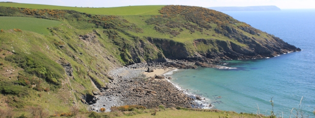
Today the weather is sunny. Last time we were here it was misty and visibility was poor, so it is nice to see Kiberick Cove in the sunshine. The sea is a lovely shade of blue-green and the gorse is golden against the green grass.
Off Nare Head is a rocky island called Gull Rock. The tide is high. I can just make out the rock poking through the waves to the right of Gull Rock – aptly called Middle Stone – and the tip of another rock beyond this one – Outer Stone.

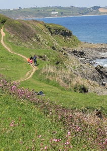
Nare Head is covered in low scrub, grassland and gorse bushes. The yellow gorse is in full flower. The scent of coconut and honey (such a lovely smell) fills the air.
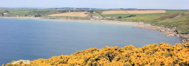
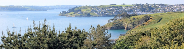
I walk northwards from Nare Head, along the edge of Gerrans Bay, heading towards Carne Beach and Pendover Beach. Across the bay, to the west, I can see Portscatho where I am meeting my husband for lunch.
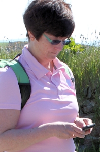
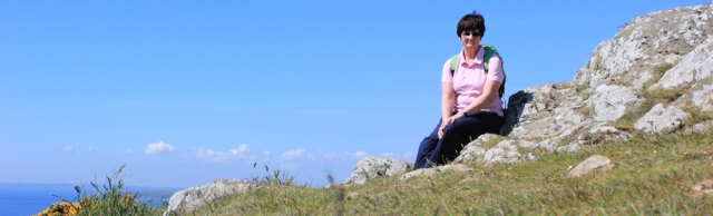
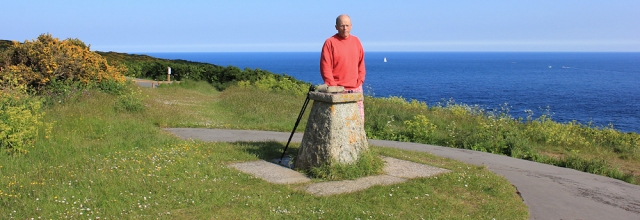
Before I leave Nare Head I take a self-portrait. I didn’t quite get the angle right and, in the resulting photo, I am missing my head.
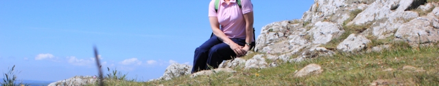
I have another go, and get it right this time.
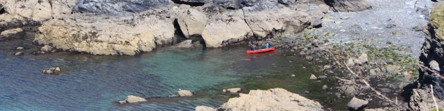
I pass along the top of a cliff, interrupted by a series of rocky inlets. The path dips up and down. In one of the many little coves, I see this brightly coloured canoe. The water is very clear and the sea is calm. A lovely day for a trip in a canoe.
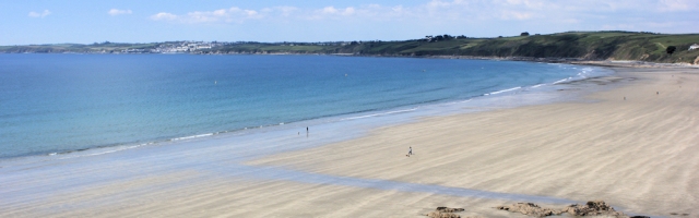
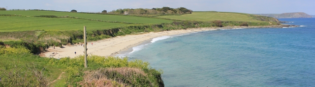
After scrambling up and down a rocky path, Pendover Beach comes as a nice contrast – with a long and unspoilt stretch of sand. If there is a demarcation point between Carne Beach and Pendover Beach, I fail to spot it.
I walk along the beach and enjoy the rare luxury of being able to continue this part of my walk close to the waves and on soft sand.
On the other side of the beach, I am forced to follow the road as it climbs out of the bay and passes behind private houses. If the official South West Coast Path did once follow the cliff edge, it has been eroded. After a short distance, however, a new-looking section of footpath leads down towards the cliff edge and I am back on the coast again.
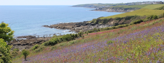
This section of the walk is truly beautiful. This area belongs to the National Trust and is called Treluggan Cliff. On my left the cliff drops down to rocks beneath and clear sea. On my right are wild flower meadows – covered in a mad profusion of blue, pink, red and yellow. Daisies line the path. What a treat.
After a while, the path leaves the flower meadows behind and comes down to another beach – Porthbean Beach.
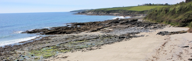
Porthbean Beach is a mix of sand and rocks and is deserted. Not a soul to be seen.
 I think you can walk along the beach and pick up the official South West Coast Path at the far end. However, I am not sure of the way ahead and so I stick to the signed path which winds along the side of the beach through foliage, before eventually dipping down to the sand.
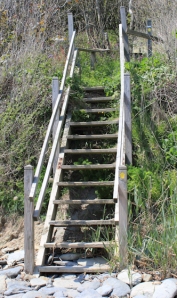
At the end of the beach, a steep flight of steps leads up the cliff. The path winds up through trees and is quite a scramble in places.
I meet a few groups of people coming down. The beach will not remain deserted for long.
As I near Portscatho, the walk becomes an easy stroll across an area of cliff belonging to the National Trust, called Pednvaden. At Pednvaden point there is a little lookout station with a fluttering flag.
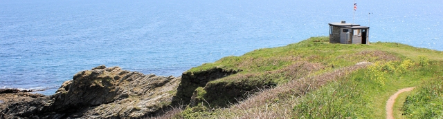
A group of people are sitting on a bench, just by the lookout station, admiring the view across the entrance of Portscatho to the headlands beyond – Pencabe and then Greeb Point.

Before I reach Portscatho I find another beach – Porthcurnick Beach. I would have liked to walk along this beach and all the way into Portscatho, but I can see there is a dividing barrier of rocks ahead. Not wanting to come to a dead-end, I follow the official path up and along the top of the cliffs instead.
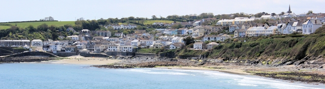
There is only one pub in Portscatho and I meet my husband there for lunch. The sun is shining and we sit out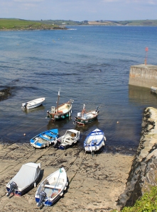 side to eat. Unfortunately the pub is within the village itself and has no view of the sea.
Portscatho has a pretty little harbour and, before I leave, I stroll around and take photographs of the small boats pulled up on the shore.
The path climbs up out of the village and heads south towards Greeb Point, Killigerran Head and Zone Point. Sadly, I have been spoilt by the beautiful flower meadows of Treluggan Cliff and find this part of the walk is not quite so beautiful. But it is easy-going – a gentle amble along a flat path over undulating cliff tops. I make good progress and meet a number of other walkers – strollers and family groups.
The fields adjacent to the path have been planted with trees, each one enclosed by anti-rabbit protection. I think this is a Woodland Trust project – part of the Trust’s Jubilee Woods project to mark the Queen’s diamond jubilee last year (2012). If so, then this new wood is called the Diamond Wood.
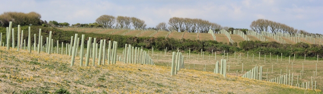
The planting is in long lines and looks rather more regimental than natural.
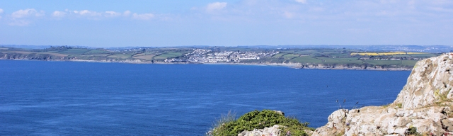
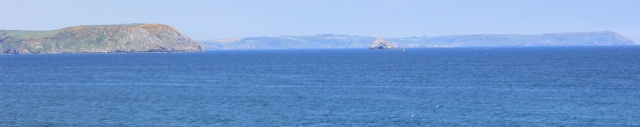
Across the water I can see back to Nare Head and Gull Island. Beyond is another headland. Ah, that must be Dodman Point, where I enjoyed a sunlit and breezy picnic 3 weeks ago.
After I round Greeb Point, I come across a number of families walking along the path and find another stretch of beach.
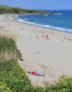 I have arrived at Towan Beach.
A group are playing beach volley ball. Some people are sunbathing fully clothed – although the sun is shining the air temperature is cold.
There is a strange wooden pole just above the beach, next to the South West Coast Path. At first I think it is a climbing pole, because there seem to be footholds jutting out on either side. What is it doing here? How strange. Then I notice a plaque at the bottom of the pole and the mystery is explained.
This wooden construction is a Wreck Post and was erected by the coastguard service. The pole was designed to mimic a ship’s mast. To simulate the rescue of a ship’s crew, a rocket and line was fired at the post and attached to the top. A breeches buoy could then be used to practice rescue attempts.
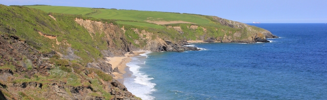
I continue onwards and reach Porthmellin Head. I realise I am growing tired now and looking forward to the end of the walk.
Beyond is another beach – Porthbeor Beach. I am not sure how easy it is to get down to the sand – I see nobody on the beach and the cliff seems to have suffered from landslips. I stop and take some photographs looking back towards the beach and to Porthmellin Head.
I reach Zone Point, at last. Just beyond is St Anthony Head and here there are the remains of 19th century artillery batteries.
My husband is waiting for me beside a marker stone on St Anthony Head.
From here we can see across the estuary. Falmouth lies on the far side. Just up the water is St Mawes. The sun is low and lights up the houses of St Mawes and the sails of the ships on the estuary. Before we leave, I take a few photographs into the evening light.
It is beautiful. I am looking forward to tomorrow’s walk.
I check my phone. The recharger has worked and my route has been accurately mapped for the whole 10 miles.
Miles walked = 10
Total from beginning = 1089
High points = the wild flower meadows.
Route:


Great post, thank you! I did around 5 miles of this walk a few years back and really enjoyed it. Bought back memories.
It’s a lovely area. Great for walking 🙂
I think I would have called it a day at Pendover Beach and just stayed there – it looks incredibly beautiful.
Beautiful, isn’t it. You have such treats to come!
It’s a lovely part of the coast and an area that I have visited, although the last time was about 40 years ago. I stayed in a delightful tiny holiday cottage in Portscatho, if I remember rightly we had a view right on to the beach. I did have a look on Google to see if I could place it exactly but it seems even Portscatho has changed since I was there!