I walk down the track from Morwenstow towards the sea, knowing I have 6 hours of good daylight in which to walk the 9 miles to Hartland Quay. I should make it easily, but I won’t have time for a pub lunch. In fact, there is nowhere to stop for lunch along this deserted stretch of coast.

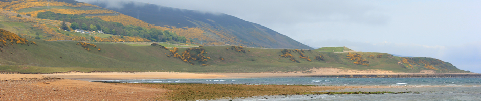
The sun is slanting low across the yellow-green fields. The sea is the colour of slate. The sight of this weirdly coloured landscape is both stimulating and rather unnerving.

After checking the map, I realise I am still in Cornwall and the county border is 3 miles to the north. I am keen to make good progress along the top of these cliffs, where the path is fairly flat.
 But I have hardly got going when I see a National Trust sign. “Hawker’s Hut”. Ah. So this is the famous hut!
A flight of steps leads down the cliff, curving away around the edge. I wonder how far downwards I will have to go, and my heart sinks at the thought of the climb back up. But I can’t resist seeing the hut.

I needn’t have worried.
The hut is only fifty feet or so down the steps, tucked just below the top of the cliff.
Robert Stephen Hawker, an eccentric clergyman and one-time Vicar of Morwenstow, built this hut from wood scavenged from shipwrecks. He was also a poet and opium smoker.
I can’t comment on the quality of his poems, but here is a sample:
They had their lodges in the wilderness,
Or built them cells beside the shadowy sea,
And there they dwelt with angels, like a dream:
The view, even with the cliff shrouded in shadow, is certainly poetry-inspiring.

I climb back up to the cliff and begin walking. The path looks deceptively gentle, rolling ahead across open grassland. This, perhaps in deference to Rev Hawker, is called Vicarage Cliff.

The first drop I come to is St Morwenna’s Well. The next one is Yeol Mouth.
Somewhere, on one of the descents, I notice a trio of young men walking a few hundred yards behind me. Their voices carry across the valley and they seem to talking about my equipment.
“You don’t really need poles,” one says confidently.
The next moment I hear the sound of stones slipping and sliding and see them flinging out their arms to steady themselves.
I hurry on, not wanting the embarrassment of being overtaken. Next time I look back, they have disappeared. Obviously they must have turned around or decided to find an easier route.
Taking out my map, I try to work out where I am. I think I am looking across Yeol Mouth and the next piece of flat land is Cornakey Cliff. Down at sea level, that lumpy finger must be Gull Rock with its Devil’s Hole, beyond is Knaps Longpeak and then another Gull Rock. The furthest headland must be Hartland Point. Somewhere, just before Hartland Point, is Hartland Quay.

Still a long way to go. The cliff tops look deceptively flat but I know the folds disguise the existence of a series of deep, narrow valleys. I have already done some steep climbs and have got this far in less than an hour of walking.
Up, somewhere between Yeolmouth Cliff and Cornakey Cliff, I meet some sheep.

From Cornakey Cliff, the next valley is Litter mouth and from there it will be steep climb up the other side and onto Marsland Cliff.

Once up on Marsland Cliff there is no time to relax. I am looking down at Marsland Mouth. I can see a single house, a stream meandering along the bottom of the dip, and a bridge. I try to ignore the massive climb up the other side.
The sun goes behind a cloud and the daylight dims. I take a photograph but have to enhance the light and saturation in order to show the details of this lovely valley.

I walk down, aware of an ache in my knee. When I get to the bottom and approach the bridge, I realise I am about to cross the border. There is no mistake this time. I even have photographs of the signposts on either side of the bridge, just to prove it.
Goodbye to lovely Cornwall. Hello, again, to Devon.


I both love and hate that stretch of path. I hated doing it, but loved completing it!
Congratulations on completing yet another county!
Hi David, I know what you mean. I found it really tough going, despite being very cautious when planning my mileage. But the scenery was staggeringly beautiful.
Congratulations, Ruth! I bet you’ll miss Cornwall…
I felt really sad leaving Cornwall behind. But North Devon ain’t bad 😀
What beautiful light you had. It seems you were walking in the golden hour. What a long way you’ve come too. Next comes my favourite bit of Devon coast.
i’ve just discovered your blog and I’m impressed with your efforts to date – you have done a good proportion and a lot of the hard stuff too. I have walked various chunks of the coastline on my walks. If you have enjoyed Cornwall wait until you do the Welsh coastline – it is arguably even more attractive.
I’m hoping to set off myself backpacking around 26th April, but a replacement knee and doubts about the other make for a bit of uncertainty. I will keep following your blog and best wishes for your continuation.
Thank you for your very kind words. Yes, everybody says this is probably the toughest section of the coast. And I am looking forward to Wales next. Hope all goes well with your backpacking trek and hope the knee holds out!
We saw our first adder today.. very early in the season to see one, no? but it was 16 degrees on Saturday It was right by the Bridge on the path by Marsland Mouth. We might have seen one behind Saunton Sands 2 years back, but we felt that was a slow worm, as it was more translucent. How many snakes have you seen so far.. as you are 1100 miles ahead of us