
Setting off from Porlock Weir, the first section of the South West Coast Path runs along Porlock beach for a few hundred yards.
I wouldn’t really call this a beach. Shingle! It’s my least-favourite walking surface, after mud. But the path seems well-defined and I certainly don’t want to walk along the road.

A warning sign tells me that I must be cautious of hidden underwater structures: oyster and mussel beds. And, more worryingly, that the path is liable to flooding during ‘very high’ tides.
 But this morning the tide is out. I should be fine.
I check my OS map. The South West Coast Path turns inland a few hundred yards along the beach. But I see another public footpath marked on the map, and this one continues along the shore for a couple of miles, turning inland to re-join the SWCP at the village of Bossington.
Providing the shingle is not too unbearable, I decide to ignore the official SWCP and continue along the beach footpath, thus sticking to my coastal walking rule number two.
I enjoy the walk, looking inland from time to time towards West Porlock on the higher ground.

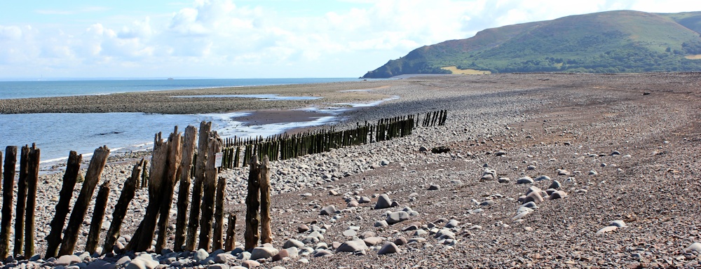
I reach the point at which the official footpath turns inland. Ahead I can see the shingle beach stretching in an unbroken sweep towards Hurlstone Point. Just over two miles away.
Decision time. So far, the shingle walking has been OK. Tiring, but not too bad. I decide to continue along the beach..
I really must learn to look at my map more closely. After a few hundred yards, I discover a break in the shingle bank, allowing the sea to flood the low-lying land and creating a marsh, crisscrossed by a maze of waterways.

The path seems to turn inland at this point. I follow in the footsteps of others. It is muddy, but there are makeshift bridges, and I am confident I am following a recognisable route across the marsh.
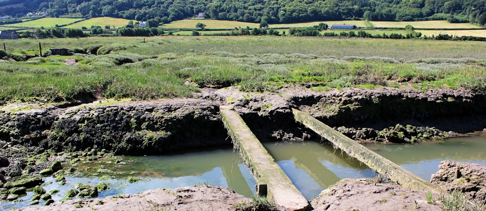
But, as so often happens in marshy areas, the footprints peter out and I reach a section of boggy ground surrounded by water and with no safe way forwards.
Defeated, I turn back. So I am going to have to walk back and join the official SWCP after all? What a disappointment.
But, when I regain the solidity of the shingle bank, I realise that the flow of water across the break is very shallow and, in places, only a few metres wide. And I see people in the distance, walking along the bank beyond the break. Can I wade across?
I check my map. The dotted line of the footpath goes straight across the gap.
Still I hesitate, arguing with myself. My boots are still faintly damp from yesterday, despite stuffing them with newspaper overnight. But does it really matter if I get my feet wet again? I realise I need to make my mind up quickly. Water is flowing inland at a great rate. The tide must be coming in.
I choose a section where the water looks only a few inches deep and reach the far side – with dry feet. Hooray!
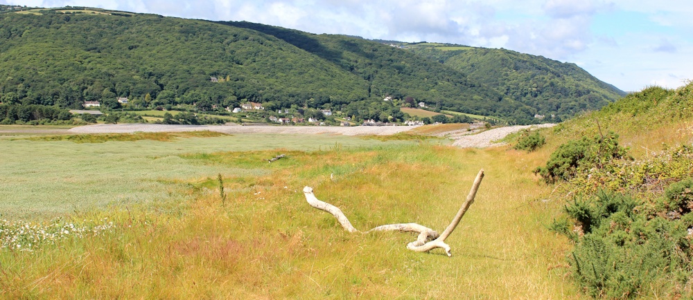
After a while, I come down off the shingle bank and walk along a grassy track. In the distance are agricultural fields, but down here there are only wild grasses, flowers, and the occasional piece of driftwood. I’m so glad I decided to cross the breach in the bank. This is lovely. Turning around, I take a photograph back the way I’ve come.
I pass an old pill-box and a ruined barn. Hurlstone Point still looks a long way away.

Then I come to a place where a stream forms a small lake. Here the official footpath leaves the shore and turns inland to cross the stream at the village of Bossington.
But I notice that the stream empties into the sea by oozing under the shingle bank, which continues unbroken all the way up to the base of Hurlstone Point.
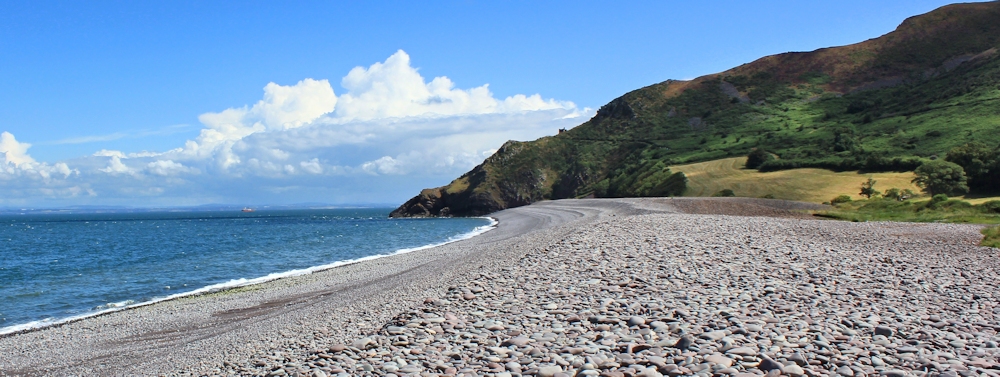
Having come so far along the shore, why should I turn inland? I see a couple walking in the distance, and right at the end of the beach, I see a fisherman. According to my map, I should be able to join the SWCP via a short footpath that runs up at the end of the beach.
The shingle walking is difficult, but not impossible. I have to watch every step. Now is not the time to twist an ankle. Slowly, the headland grows nearer. The couple walk past me. (It doesn’t look as if they are enjoying the shingle either.) The fisherman grows larger.
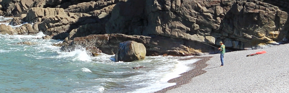
It takes me nearly half an hour to cover the distance and reach the far end of the beach.

 And I am very relieved to see the path really does exist, narrow and steep.
I climb it, taking many rests – or photographic stops, as I like to call them – along the way.
At the top I meet the SWCP. It is a popular stretch of path. I pass half a dozen people , making their way up and down to Hurlstone Point.
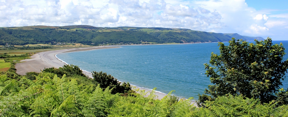
Here is a photograph taken on one of my photographic stops. Porlock Weir looks astonishingly close. It is, in fact, only 2.5 miles away. But it has taken me nearly 2 hours to walk this far.
There is a lookout tower on the side of Hurlstone Point and a bench. Several people are up here, enjoying the view. I wait patiently until the bench is vacant, and then sit and have a drink and a snack.

But I can’t linger. I have walking to do. Minehead is my destination today. And, sadly, that means, I am nearing the end of the wonderful South West Coast Path. Onwards…
[continued in the next blog post]
Route:


Shingle and mud are my least favourite things too. The shore here is shingle and it is so energy sapping to walk on.
Isn’t it just! Give me firm sand any day.
Did you get all the way round?
Yes. I walked along the shingle bank. There was one wide breach in the bank, but it’s possible to wade across in walking boots without getting wet feet! Not sure if it’s possible at high tide.
Hi Ruth, hope all well with you. we loved this walk Yesterday.. although we did it in the opposite direction. We took the marsh route.. well signposted .. and through village of Bossington, which is like a Thomas Hardy film set.. complete with shaggy sheep on the ground floor of an open barn! Spring lambs there already and Camelia flowering.. several weeks earlier than Hertfordshire! There is an amazing memorial to a B-24 Liberator that crashed on the beach in 1942 after getting lost in bad weather, clipping Holdstone Point and crashing on the beach.. All died except one… who I guess arranged for a lovely memorial cross surrounded by POPPIES etc.
Sounds like a great walk and how wonderful to see spring lambs. I love this time of year. Because I followed the beach when I did this section, I missed out Bossington and I missed the memorial.