
There are plans for a continuous coastal path to link Minehead to Brean Down. Until then, coastal walkers must find their own route. But I don’t anticipate any problems as I walk from Burnham-on-Sea to Brean. My map shows a footpath/cycle track running along the beach. And its a lovely morning for a walk on the sands.
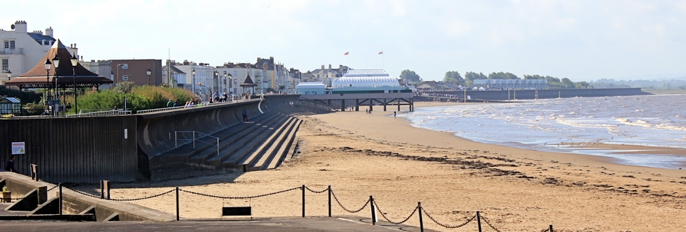
I wave goodbye to the shortest pier in Britain, and head northwards.
Brean Down is a finger of land pointing out to sea, just visible on the horizon. But my most immediate landmark is a weird white tower on stilts, standing marooned on the sand.
 Later I learn this is one of Burnham-on-Sea’s three lighthouses, and the only one still functioning.
Apart from the usual dog walkers, my other companions this morning are the wide sands and rolling brown waves. Behind the distant blocks of Hinkley Point Power Station is the high ground of the Quantock Hills – and I look back along the coastline of West Somerset towards Watchet and Minehead, both lost in the haze.

I pass an occasional fisherman. Such an active sport!

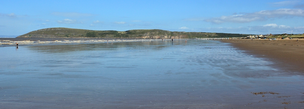
The beach is amazing. Long and wide and unspoilt. Behind the dunes, according to my map, is the coastal road with holiday camps, golf courses and caravans. None of this is visible from the beach.

The sands are called Berrow flats, and merge with Brean beach at the far end. It would be a great place for a holiday, if only the sea wasn’t so shallow, the tidal range so great, and the sand so brown.
The waves look as if they are made from frothy chocolate.

In places the sand takes on the consistency of mud, furrowed with strange patterns from the tide. Sandbanks provide resting places for gulls and wading birds.

With few distractions I make rapid progress. Slowly I draw nearer to Brean Down. And ahead on the sand I see a row of parked vans and someone on the beach is flying… a kite?

As I get nearer, I realise it is a model airplane. With the sun behind it, I fail to get a decent photograph. But when I draw level with the row of vans I can see there is a collection of remote-controlled planes. A gathering of enthusiasts. Some planes are huge.

Further along the beach and I see a group of walkers coming towards me. A rambling club on an outing? But they have a lot of dogs with them.

As I walk through them, I realise they are all beagle hounds. I wonder if this is regular get-together.

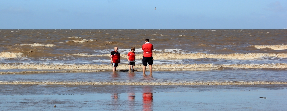
The northern end of the beach seems more popular with holiday makers. Or perhaps it’s just that people are waking up. Some brave souls are even prepared to paddle, although I think this trio would be more comfortable on the football stands.
The beach doubles as a car park and a bridleway.

Officially it is also a cycling route, but I have yet to meet a cyclist. My husband refused to cycle here, claiming the sand might damage his precious bike. The horses are enjoying it.

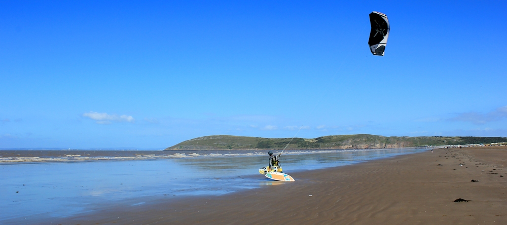
And, with the wind blowing stiff from the sea, I meet a solitary kite surfer. He is having trouble controlling the kite. I watch for a while, but he is still struggling to control the beast after ten minutes and I have walking to do.
But, first, I turn inland and come through the dunes to the beach road, to have a quick lunch of cider and crisps at the pub in Brean.
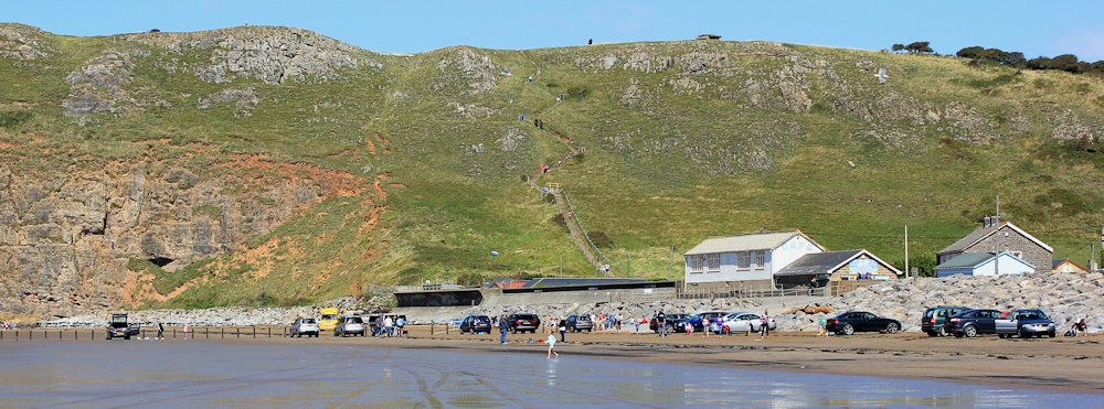
Then, onwards. I pick up my pace. Brean Down is looming ahead.
And as I draw nearer, I see a long and steep flight of steps. That’s the way to the top. I’m glad I had lunch first.


That lighthouse is really strange, I’ve never seen anything like it before. Despite the brown sand it seems a busy beach
Yes, it was a weird lighthouse. Replaces one they built inland that turned out to be too short! The beach was about 3 miles long. Deserted in some places, crowded in others 😎
This is my favourite stretch of beach within the local area – in fact, I think I once read that the full stretch (from Bridgwater Bay to Brean Down) is one of the longest in Europe! On some of the beaches around here, dogs are banned and so Brean is again quite a popular place to be.
‘Frothy Chocolate’ is by far the most pleasant phrase I have ever heard to describe the water that continues up and beyond ‘Weston-super-Mud’! 😉
That short inland lighthouse is now somebody’s home but I’m not sure if I’ve ever seen the third now, thinking about it. Those dunes also conceal a golf course and a rather pleasant nature reserve of green-ness. Somewhere between the light house and Brean is a Norwegian ship-wreck from a Century ago. It’s only visible during a low-tide and I’ve not yet been fortunate enough to have seen it.
Oh, and I swear that fisherman is ALWAYS there!!! 😀
Pingback: 156b Brean Down to River Axe | Ruth's Coastal Walk (UK)
Will the disabled be able to go along the coastal path ?
I guess it depends how disabled you are. It’s perfectly possible to go from Burnham-on-sea to the base of Brean Down by wheelchair, I think, as there are roads and paved paths, if I recall correctly. However, many of the existing coastal paths are rough and you have to be prepared for grass, sand, shingle and rocks. I’m not sure how accessible the final path will be when it’s complete.
There is not a path along parts of Berrow/Brean. It is very dangerous for a walker let alone a disabled person. The road is very busy in summer months . Also very narrow.
Oh dear, that sounds unpleasant. I wish ALL roads had pavements. 😐 Sounds like the only safe route is along the beach.
Hi Ruth,
I am developing a code of conduct for the Severn Estuary and would love to feature your photo of horse riders along Burnham beach. Would you be happy for us to use your image?
We would of course credit you for use of your image.
Many thanks,
Lucy Taylor
Severn Estuary Partnership
Hi Lucy. Very happy for you to use my photo. A credit and a link to my blog would be appreciated. Best wishes, Ruth
Many thanks Ruth!!
hello. Myself and my 2 daughters are holidaying in Burnham on sea in July. We are wondering how many miles it is to walk from Burnham to Brean and how long does it take?? My girls are 13 and 10 x