
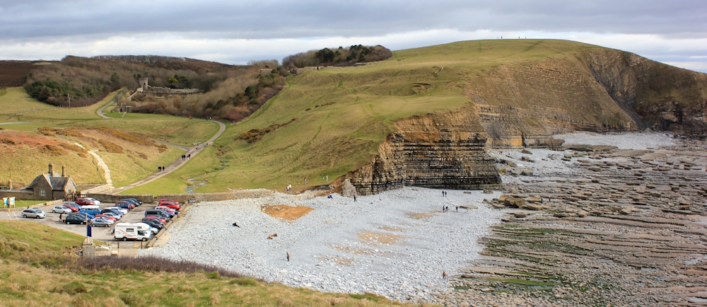
It’s Good Friday and the beginning of the Easter holidays. Nash Point car park is (almost) crowded. It cost us £2.00 to park here for the day. The view alone is worth it.
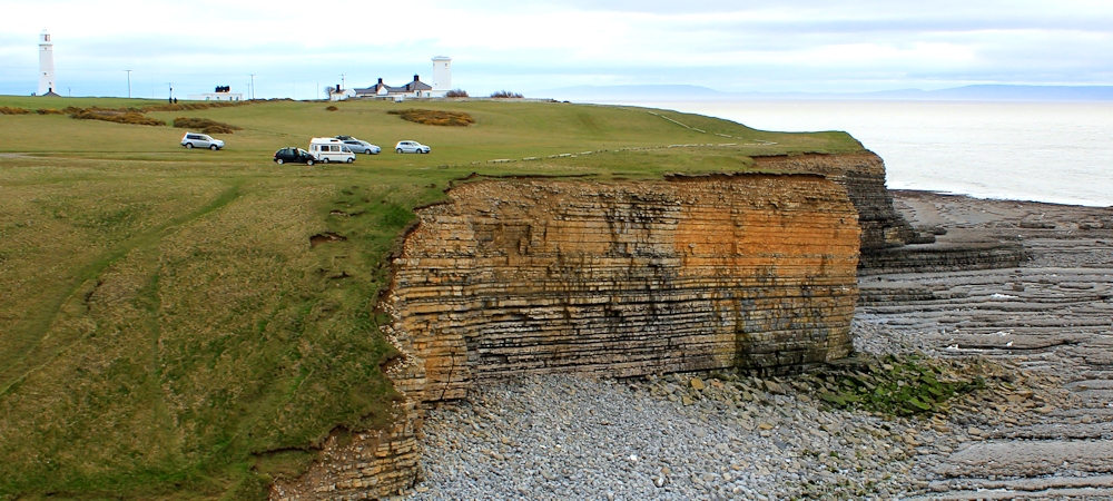
Last time I was here I believed I could see clear to the horizon. Now I realise I was wrong. There is land on the horizon. Somerset! And further along the coast is Devon. I can see Minehead, Porlock, Lynmouth… how wonderful to see their familiar outlines.
 After my last visit here, I sent a photograph of the Nash Point lighthouses to my talented Artist in Residence, Tim Baynes. From this he produced a beautiful pen and wash, watercolour painting.
I think he has captured the spirit of the rocky cliffs, the feeling of a great sky above, and has also managed to include some of my words in the painting.
[This is one of a series of paintings that Tim has produced to illustrate my coastal walk. You can see the others in the series on this page. And you can visit Tim Baynes art pages at www.timbaynesart.co.uk ]
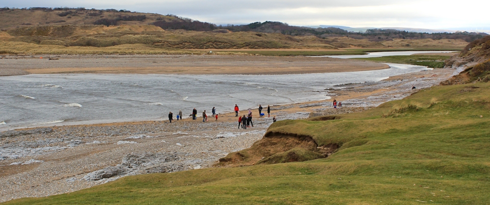
I stand on the top of the rocky outcrop at Nash Point and take several photographs of the incredible rock formations that cover the beaches along this section of coastline. Out to sea is the infamous Nash sandbank, exposed at low tide and responsible for many wrecks. It’s one of the reasons why the Nash lighthouses exist.

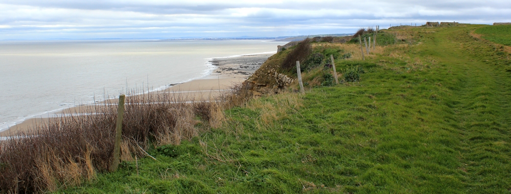
At low tide, I think it would be possible to walk along the beach itself – if you don’t mind scrambling over rocks occasionally. You could come inland where the land dips down in either of the next two river valleys. But, when I set off, I am not sure of this, and so I stick to the official Wales Coast Path which runs along the top of the cliffs.
Ahead I can see the sweep of Swansea Bay. Is that Swansea city in the distance? With The Mumbles and Gower beyond?
The sun appears intermittently. It’s very windy, and the patches of sunlight scurry across the waves and flash over the shoreline. Look at these amazing rocks!

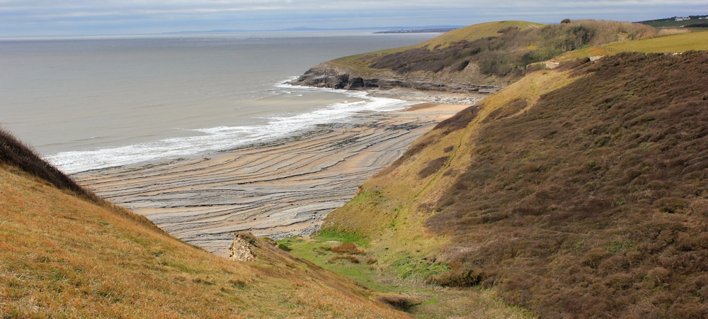
After a mile, I come across my first major dip in the cliffs. This is Cwm Nash, the valley where Nash Brook empties onto beach. I am fascinated by the rocks on the shore below – it’s as if someone has deliberately carved out a series of concentric circles.

There’s a tough climb up the other side, then I face a difficult walk against the wind, for a mile along the top of the cliffs, until I reach another dip. Cwm Bach. The valley walls are very steep, at this point, and so the path detours inland for a few hundred yards before heading downwards along a gentler slope to cross the valley.

And a short while later along the cliffs, and another dip. Cwm Mawr. More carved rocks spread their lines along the shore, and I see the black mouths of mysterious caves.
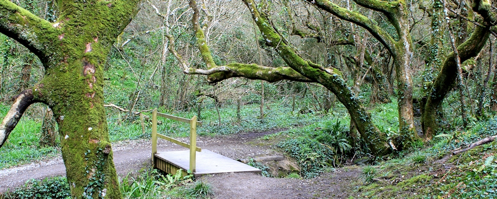
Later, I realise it is possible to climb straight down into this valley and up the other side. But at the time I didn’t know this – and so I follow the official Wales Coast Path as it takes me inland, down flights of steps through trees, and across the stream at the bottom of the valley.
Up the other side, and I’m soon back on the coast again. I stop and take a photo looking back along this wonderful shoreline. The far point is Nash Point. The lighthouses are invisible around the headland.

I’ve reached a low promontory, Trwyn y Witch on my map, more commonly known as Dunraven Park. It includes the site of an ancient fortress – a place where King Caractacus stood against the Roman invaders. The best view is from across the other side of Dunraven Bay.
From here onwards the wind becomes a major obstacle. It was fierce when I started out, but now has become a charging gale – blowing straight into my face.
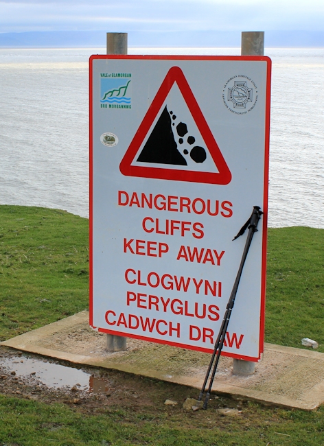 I see the largest cliff-warning sign I have ever come across. A series of them. I put my walking poles against one and take a photograph. It’s taller than I am!
The cliffs are not obviously precipitous. You can’t actually see the drop from here, because they have a gently rolling edge. But the slope becomes more and more convex as you approach the drop.
Now I understand why the warnings are there. I can imagine children and dogs, lured by the gentle-looking grass, setting off down the incline, picking up speed, and then realising they can’t stop…
Ahead is another dip and, on the far side of the valley, a mass of gorse in flower. When I get nearer, the smell is fantastic. Coconut. Vanilla. The smell of fresh sweat on clean bodies. The smell of summer beaches. So evocative.
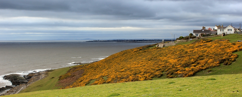
I walk along the shoreline approaching Ogmore-by-Sea. The path has become positively crowded. Everyone is finding it hard to walk against the wind.

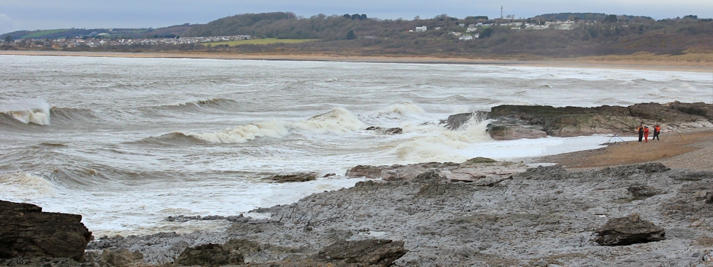
By the time I get to the other end of Ogmore-by-Sea, where the Ogmore River empties into the sea, the waves are rolling and furious. Only a few brave fishermen stand on the beach and face the gale.
I was planning to walk up the river and reach Ogmore Castle. It’s only a couple of miles upstream. And I discover where all the people are – on the river bank, rather than on the seashore. It is somewhat less windy here.
But I feel exhausted. It’s a month since I hiked any decent distance and the wind has sapped all my energy. I sit on a bench and eat a bar of chocolate, before phoning my husband to arrange a pick-up.
Welsh words learnt: Cwm is a valley, trwyn is a promontory or nose.
Miles walked today = 7.5 miles
Miles since start of coastal walk = 1,705.5
Route:


Hello Ruth
I’m new round these parts, but just wanted to say how much I’m enjoying your words and pictures, and to wish you all the very best. I’m really glad to have found you 🙂
Thank you Gerald. Happy to share some of my experiences 🙂
Classification: External Communication
Amazing
Great to see
Thanks Paul. The landscape has certainly improved since my dire slog around Newport.
Looking forward to this one, it looks spectacular. Shame about the wind though, I know how tiring it can be to walk into a gale all day.
I think wind is the walker’s worst enemy.
Oh wait… I forgot about cows.
I’ll rephrase. Wind is the walker’s second worst enemy!
Carol and I have started looking at wind maps to work out which direction to do your wonderful walk segments these last few months Several walks were a lot easier as we walked down wind in 30 mph gales.
That’s very wise, Paul 🙂
I enjoyed this walk, it is a spectacular stretch of coast. Having got there near low tide after a while of walking on the cliff tops and feeling I was not really making the most of those amazing cliffs I found a couple of rather precarious ladders attached to the cliff face I could climb down to the beach and follow for much of the rest of the way. It was lovely down there and it is amazing geology.
Wow! That must have been amazing. They were spectacular rock formations.
Amazing pictures – as ever. Thank you for posting.
And thank you for visiting 🙂
Beautiful views but what a shame about the wind. I walked across the Itchen Bridge in similar conditions last weekend and just that mile wore me out.
Very wearying. I’m always surprised by how it saps your strength.
Spent so much of my youth at Nash Point and even today it is one of my favourite places in South Wales. We always seem to walk to Llantwit Major Beach and back, which is a super walk by the way. Only on a couple of occasions have we set out from Nash Point in a North Westerly direction but only as far as the next beach. We usually then head to one of our favourite pubs, the Plough and Harrow for a drink and a bite to eat. Must now continue the coastal walk all the way to Ogmore as it looks well worth the effort!
Hi Gavin, it’s a beautiful area. Yes, well worth walking towards Ogmore. Just remember to choose a day without too much wind 😄
The rock formations are wonderful and Tim’s painting is lovely. What a beautiful stretch of coastline.