
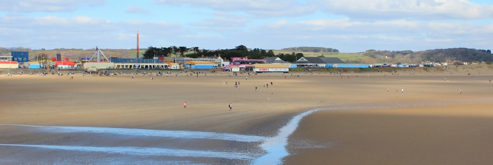
After lunch (a rather uninspiring prawn-cocktail) I head across the bay, turning to look back at the far side and to take a photograph of the area I’ve just left. This is probably the least scenic part of Porthcawl, with a fun fair and amusements lining the beach.
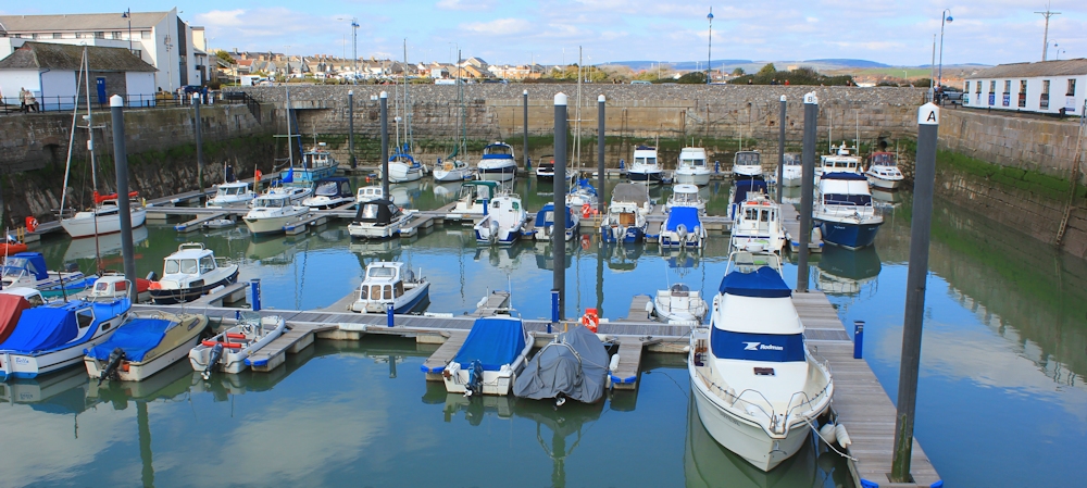
But I soon come to a pretty marina – well, ships on water are always pretty, even if the marina is simply a great concrete basin.
This section of the walk is rather spoilt for me by an unpleasant encounter.
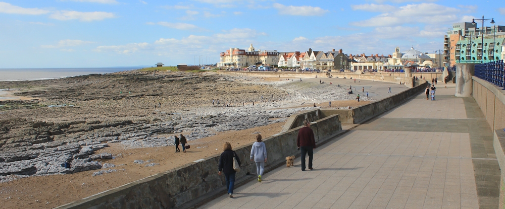
Eager to get on with my walking, I’m irritated to find myself tangled up with an extensive family group who are chatting mindlessly among themselves and taking ages to cross over the lock gates at one end of harbour wall. Finally, I give up waiting for the stragglers and mingle with the group as they amble along the gangway. The father is holding open the gate for the bridge and gives me a foul look as I walk through. ‘Thank you,’ he says, sarcastically. ‘Thank you,’ I respond automatically, and feel immediately guilty.
As I walk away I ruminate on this encounter. First of all, I’m upset that the father considers me rude – as I think politeness is very important. Secondly, I become convinced he was the rude one. I didn’t ask him to hold the gate open for me, did I? Wasn’t it his family who were blocking my way? And why bother to say anything at all, unless the intention was to upset me? Nasty man.
Then I get upset with myself for getting upset. Sometimes you can over think things!
The esplanade along the western section of Porthcawl is more elegant than on the other side, but the beach is rocky and less attractive to families.
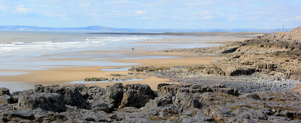
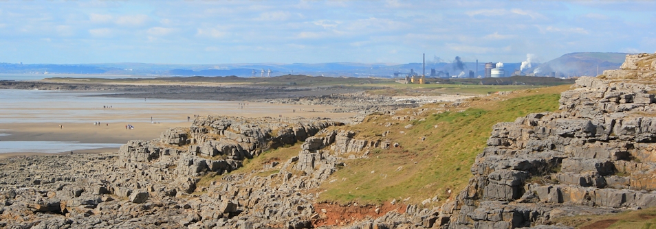
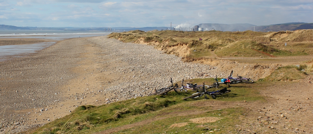
At the end of the bay is Hutchwns Point. From here I can look ahead and see the beach of Rest Bay, the promontory of Sker Point, and Kenfig Sands beyond – known by the locals as Sker Beach. On the far shore – Swansea!
As I round the point, I see something else: the industrial mass of Port Talbot. Gosh, it looks smoky.
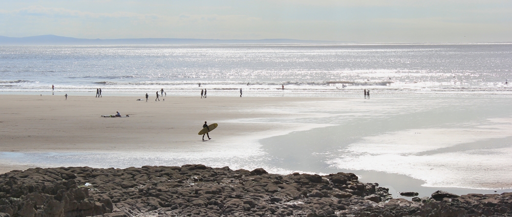
The next section of walk is very enjoyable. There is a newish wooden walkway along the top of the sands. The beach is wide and clean. I see a few would-be surfers despite the calmness of the waves. Over the channel is the coast of Devon, with the hump of Hangman’s Hill clearly visible.
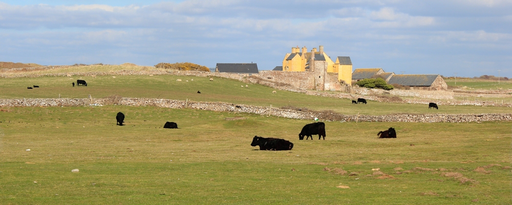
Past a golf course, and I reach Sker Point. Somewhere inland of here are the ruins of Sker House – the site of an old monastery and once an important house. But all I can see are some yellow buildings on the other side of a field of cows. Is that it?
I don’t know, but I soon have something else to think about. Ahead is Kenfig Sands.
I am about to enter an extensive area of vegetated dunes. Under here lies the ancient town of Kenfig, which had to be abandoned as the sand took over, until it became completely buried during the 14th and 15th centuries. I reflect on the irony of this. In some places, the sea is swamping the land with water, but here it has drowned a whole town under a deluge of sand.
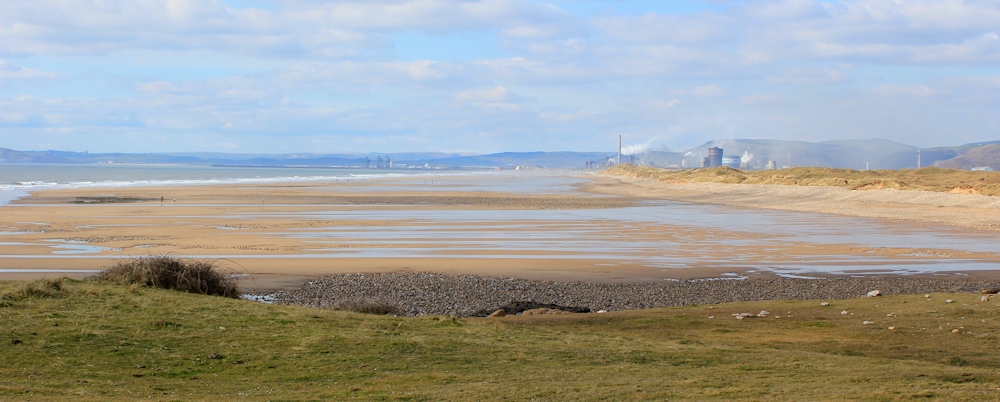
The Wales Coast Path follows a well-worn track through the dunes, skirting the coast. The sand hills block the view of the sea. Ahead are the smoking chimneys of Port Talbot.
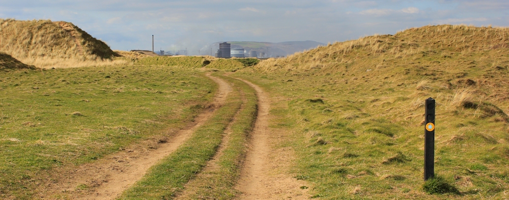
I would prefer to walk along the beach, but my plan is to turn off along a bridleway and walk inland across the dune system to reach the village of Mawdlam, where my husband is picking me up in an hour’s time. If I stick to the beach, I might miss the turn-off point.
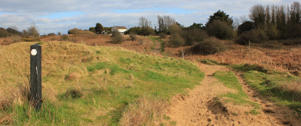
On my map, the bridleway I need is marked with orange lines, which means it’s a ‘permissive path’ rather than a public right of way. And, rather confusingly, it is also labelled as ‘Wales Coast Path’. This nomenclature is explained when I pass a sign that indicates the coast path along the edge of the dunes might become flooded during tidal surges. The bridleway provides an alternative route for walkers.
This information gives me the impression that my bridleway will be dry and easy to navigate. A false impression, as it turns out.
Here it is. A sandy track, winding up and down through the dunes, and marked with occasional stubby signposts. Easy.
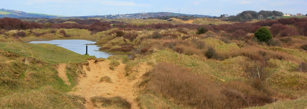
It isn’t long before the path disappears under a pool of water. It does this several times. Each time, I find a way around the water – horses seem to prefer to keep their feet dry too and have trampled out alternative routes. Each time, I wonder if I will ever find the path again.
The thing about dunes is this: when you’re down in a dip you can’t see anything else and it feels quite claustrophobic. When you’re up on top of a dune, all you can see are more dunes. It’s disorienting – easy to lose your sense of direction and hard to keep your eyes fixed on a distant waypoint. Too many dips and hollows.
One of my fellow coastal walkers, Andy, told me how he became lost in the these dunes, with night falling. It must have been an unpleasant experience.
As I get nearer to what I hope is the far side of the dune system, grass is replaced by bushes, and then by trees. My path becomes a stagnant river.
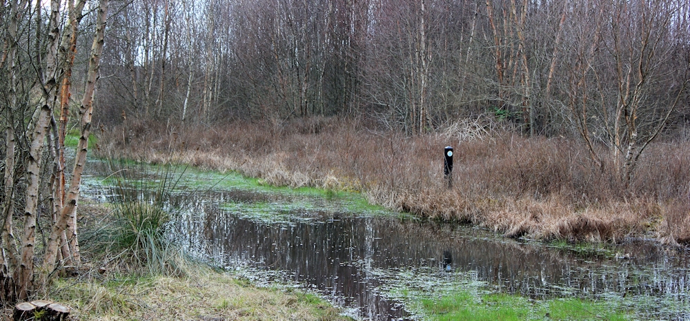
Who would have expected to find so much water? And so many trees? I was expecting dry sand and marram grass.
And then, when I feel I’ve been walking forever, I am out of the flooded woodland and into sand again. Ahead are houses. That’s my destination. Mawdlam.
I’d anticipated it would take me 1/2 an hour to walk through the dunes. In fact, it took me 45 minutes. Pretty good going, considering the various watery obstacles in my way.
You can read about the history of the town of Kenfig.
And about the BBC Time Team’s experience in the dunes.
Miles walked today = 15.5 miles.
Total miles = 1,721
Route:


Would your walks be possible just on your own with no one picking you up when you finish the walk? It seems to make it very convenient and easy not having to time buses etc.
Is that cheating do you think!?
I am enjoying your blogs and the descriptions where its horrible, comments about rude people and parts where you get lost! It makes me feel more normal when it happens to me!
Thanks
Mary
Glad you’re enjoying the blog 🙂
Some of the walks would be difficult but, although I like having my hubby as my support team, I often do go on my own. I’m travelling back to Wales later this week, for example, and will be using buses. But public transport involves a lot of research and extra walking into inland villages or towns. And there is always the worry of missing the last bus…
A great read as always, thank-you. There’s so much detail you must spend almost as much time writing the blog entries as you do walking.
Sorry to hear about the rude man. It had to happen in a town. I find that walkers ‘out in the wilds’ are almost unanimously polite and considerate, about the worst thing that ever happens is an ignored greeting.
Thank you Gary. Yes, I spend ages writing up the walks – but also get the chance to relive them again. It was silly to get upset about the rude man, but you can get a bit sensitive when you are walking on your own.
I love the coast, and miss it sorely now I live in the mountains, further away from the ocean. You are right, we should let our day be spoiled by people who don’t know how to behave!
Thanks for visiting. Mountains are lovely too!
I’m a new reader, having landed here via Susan Jones’ blog. What an adventure you’re having – and don’t let that man cloud your memories of this section of your walk.
Hi Julia and welcome to the blog. You are right, it is silly to get upset about somebody else’s rudeness… pfffff, he’s gone from my mind.
I have been reading your blog for a while and enjoy the posts and I love the photographs, but you should have thanked the man holding the gate!
Hi Nicola, thank you for your kind comments about the blog.
I’m not even going to think about that rude man any more… 🙂
It looks like you’re making good progress, Ruth. One of the things about walking in an ‘alien’ landscape is that you can’t always prepare yourself for the unexpected state of footpaths. But clearly, you’ve done well to persevere through parts of this walk.
I’m also with you on the incident with the man. I’m typical of over-thinking such social interactions/altercations when it’s usually only best to try to leave it behind and move on.
I’ve been meaning to ask about how you produce and share these maps at the end of your posts as I’d really like to do the same with mine.
Hi Olly. I think when you’re walking alone you become hypersensitive to things. This state enhances the enjoyment of the walk, of course, but also magnifies the negative aspects too – like unpleasant dog-poo covered paths, or rude men!
The maps are done through Google Maps: https://www.google.co.uk/maps
They keep changing the format of the site and not always for the better. I think you need a Google or Google+ account. Anyway, you need to log in and then go into My Maps and Create a Map. You can mark points of interest, but I just draw a line to mark my walk. When you’ve finished, you have to make the map public and then find the code to embed the map in your blog.
The downside with Google Maps is they don’t usually show footpaths (except they do show parts of the SWCP for some reason) – so the line I draw will always be an approximation.
I track my walks in real time too. Used to use a smart phone app, but that drained battery juice, even with a portable recharger, which was a real pain. So now I use a Garmin. I refer to the Garmin route when making my Google Map. I could simply show the routes through a Garmin link, but not everyone has a Garmin account or can be bothered to click the link, so I use Google Maps because they can be embedded within the blog posts and are easily visible to blog visitors.
Thanks, Ruth, I’ll certainly look in to it. Since reading your reply, I’ve remembered that Bing Maps allow you to view them in Ordnanace Survey as well so I’m wondering whether that could also be used for the same effect, if not one slightly better?
Haven’t tried with Bing. Would be interested to hear how you get on, Olly.
Large groups of slow walking people often frustrate me too. They seem oblivious to anyone else and, as you found, can be quite rude when you try to get past. It does seem to be a city or town thing though. Those dunes look difficult but the idea of a town under the sand is interesting.
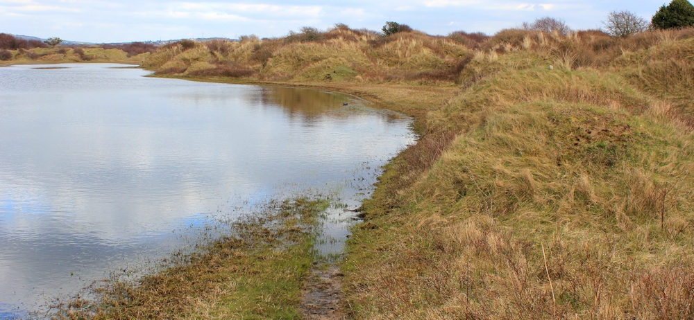
Apparently there is a buried castle and a church tower sticking up somewhere, I believe. Didn’t find them though. Also a huge lake, which again I didn’t find. When you’re in the dunes, all you see is the next dune 🙂
I’d love to explore there
Pingback: 173a Ogmore-by-Sea to Porthcawl | Ruth's Coastal Walk (UK)
I am dreadful for over thinking things and I can understand why the encounter upset you. There was no need for him to be rude. The buried city sounds interesting and I have saved the link to read it properly a bit later.
You could spend several hours exploring the dunes, and it’s a fascinating area.