
After lunch, I ask the bartender to refill my water bottles. Then I leave the pub and cross the road to walk next to the shore. I’m looking forward to reaching the next village – Amroth – and passing over the border into Pembrokeshire, because this will mean I’m finally joining the famous Pembrokeshire Coast Path.
It comes as a surprise to find a marker plinth and realise I’m already there! So this is the start of the official Pembrokeshire Path? I feel a tingle of excitement. I’d been looking forward to this moment. A photograph is necessary…
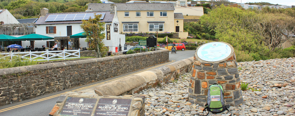
… and it’s also time to swap maps. I put away OS 177 and open up OL 36. Hello, new friend! The double-sided OL36 map should see me through almost as far as St Davids, by which time I will be more than 1/2 way along the Pembrokeshire Coast Path.
Reaching Amroth, I pass a pub where men in black suits are standing outside holding pints and cigarettes. Black suits? I remember the ladies on the bus this morning who were going to a funeral. This must be the wake.
At the end of the village the land rises up in a tree-covered cliff and the road turns away from the coast.

The path branches off to the left and runs along the top of the cliffs. Along with the bleak warning notice, ‘CLIFFS KILL’, it is wonderful to see the familiar acorn marker, a reminder that I’m back on an official National Trail. And another sign tells me I’m walking along the International Appalachian Trail. What?!
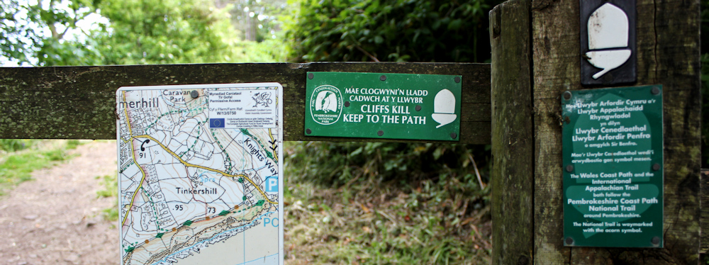
I’ve heard of the Appalachian Trail, of course. It’s a 2,000 mile trek along the mountain range that runs down the eastern side of the USA. I’ve read Bill Bryson’s account of walking part of the trail: A Walk in the Woods. But why is the Pembrokeshire Coast Path claiming to be part of the International Appalachian Trail? Strange.
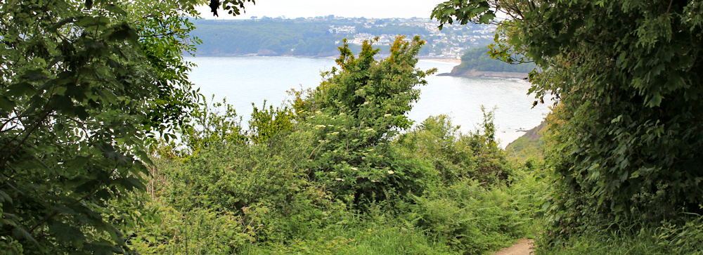
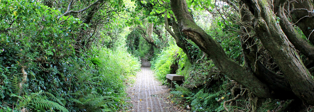
This section of today’s walk is particularly pleasant as I follow a winding footpath through woodlands.
I join the road again at Wiseman’s Bridge. A sign points to ‘Pleasant Valley’ and ‘Stepaside’. What wonderful names! But they’re not very Welsh-sounding.
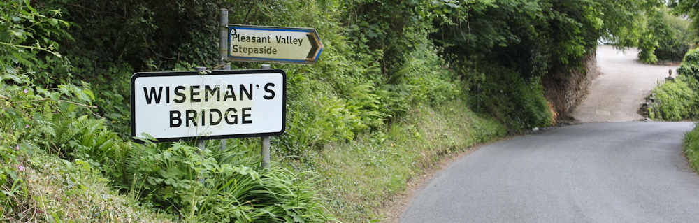
There is a pub, a car park, and a long pebbly beach at Wiseman’s Bridge. Ahead I can see a promenade winding around the coast towards the next village, Saundersfoot. This gentle path comes as a relief because I was anticipating a steep climb over the next headland.
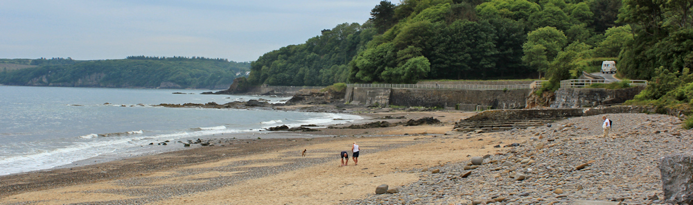
Groups of people are strolling along the pathway. I stop to take a photograph looking back towards Wiseman’s Bridge. Unfortunately, the sun is covered by clouds and the hot and humid air has created a thick heat haze, so visibility is poor, but it’s a lovely place.

The path unexpectedly dives into a tunnel. It’s long and lit by weird red lighting, so that it feels if I’m entering the portal to a hellish underworld.

Between the red patches of light, the floor is pitch black. It takes an act of faith to keep walking through the dark patches, but the path’s surface is flat and solid, and I pass through without stumbling.
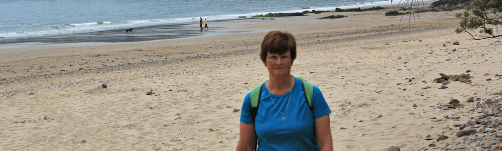
After the first tunnel there is a second tunnel, but this one is much shorter and less dramatic. And at the end of the second tunnel, I find myself in Saundersfoot which has a lovely sandy bay. I take an out-of-focus self-portrait.
I managed to rehydrate myself during lunch (with a combination of cider and water), but I’m still feeling hot and sticky. So I buy myself an ice-cream and sit on a bench for a rest, before setting off up the wooded slope on the other side of Saundersfoot. As I climb the path, I stop to take a photograph of the beach and the marina below me.

The path is delightful, weaving up and down through the trees. On a particularly steep section, I meet a group of walkers wearing orange charity tee shirts. They look hot and tired. Then I meet another group. And another group. These two men were puffing badly and were the last ones to pass me. I wonder how far they’ve walked?
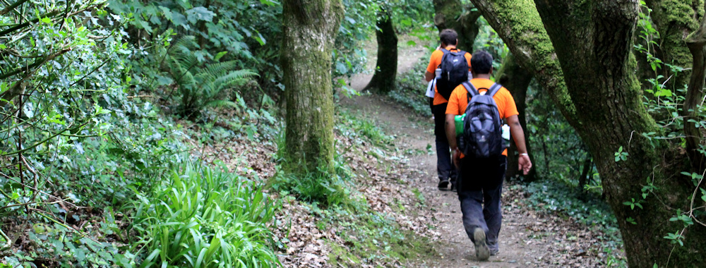
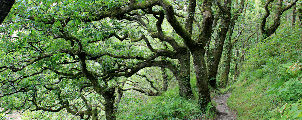
It makes me feel better to meet other walkers looking more exhausted than I do. Their discomfort perks me up, and I really enjoy this section of the walk through mixed woodland, where the tree branches twist and turn in corkscrew shapes around me.
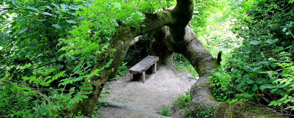
I walk down a steep hill and find an inviting bench, sheltering under the huge branch of an ancient tree. Time for another rest and a drink of water.
Down goes the path, steeper and steeper. Until the final few steps… and I find myself standing on a beach. This is an unexpected but lovely treat. The beach is a beautiful crescent of sand, cradled by rocks and cliffs. I walk up and down, looking for the continuation of the trail. But soon realise there is no way out. It’s a dead-end.
I realise I must have taken a wrong turn. I shouldn’t be here. Out comes the map. It’s Monkstone beach, named after the pointed rock that guards the end of the sand.

My heart sinks. But there is no alternative. I must backtrack and climb back up the steep path. Will I ever reach Tenby? I’m glad I’m staying in the town, and don’t have to worry about bus schedules.
Back at the top of the hill, I try to figure out how I made the wrong turn. The path I took – the wrong path – is the wide one on the left of the photograph above. The right path is much narrower and straight ahead. The finger-post is ambiguous, pointing unhelpfully at a point between the two.

The new path passes along the edge of fields, near to a radio mast and a caravan park. Across the water I can see the cheerful, coloured houses of Tenby. Not far now.

Today has been exhausting. What with unexpected steep climbs, the hot and humid atmosphere, and the wrong turn, I feel terribly tired and don’t enjoy the remainder of the walk as much as I should. It is just over a mile to Tenby, as the crow flies, but I seem to spend ages getting there.
I walk down into valleys, where trees are being felled to prevent the spread of ash dieback disease. I think this is Lodge Valley. Followed by the delightfully named Rowston Dingle.

More glimpses of Tenby. It doesn’t seem to be getting any nearer.

I go down into the valley of Waterwynch Bay and take a path that leads towards the beach. The land is privately owned, but the beach is public below the high tide line, of course. An information board tells me I can walk along the sand to Tenby if the tide is low. But, as I get nearer to the sea, I realise the tide is far too high still, and I’m forced to turn back again.
There is another steep climb out of Waterwynch Bay. The surface of the path is odd – corrugated concrete is the best way to describe it – and the hill seems to go on for ever.
Until finally I emerge into residential streets. I’m on a slope overlooking Tenby.
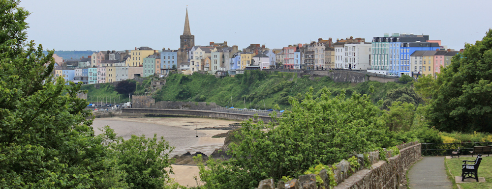
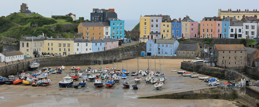
I make my way down towards the sands, which are punctuated by dramatic rock formations. The light is dull, but it’s a calm and warm evening. The houses around the harbour are brightly painted and attractive. No wonder this is a popular seaside resort. It’s beautiful.
Below is a wonderful painting of Tenby harbour, produced by my artist in residence, Tim Baynes, based on the photo above.

I wander around Tenby for a while, stopping at a café for a well-deserved fish and chip supper, before making my way back to my B&B.
Later I discover the International Appalachian Trail does indeed exist. It is an extension of the Appalachian Trail beyond the borders of North America. The promoters have the ambitious aim of connecting all the geographical regions that once formed a continuous range in the ancient super-continent of Pangea, before the movement of the earth’s tectonic plates drove the mountains apart and the sea flowed into the spaces between.
Miles walked today: 14.5 miles
Miles along Wales Coast Path: 303.5
Total distance around the coast: 1,910.5 miles
Route:


Very interesting, and you always take such good photographs – even when you must be tired!
I’d not heard of the Appalachian Trail either and I live locally.
Yes those red lights in the tunnel are weird aren’t they?
Hope you enjoy the next section.
Thank you for your kind comments about my photos. It was a dull afternoon and I had to tweak most of the photos on my computer to make them presentable. 😊
Red light should, in theory, preserve your night vision (for the unlit bits!), hence its use on yacht navigation tables and for the dashboards of the more pragmatically-designed cars.
Ahhh, that makes sense. I wondered why the lighting was such a weird colour. Thank you.
On getting to the top of the climb out of Amroth the path contoured on a grassy slope, but no path so walking with twisted ankles I found particularly uncomfortable. That was the start of several weeks of having a dodgy ankle.
I read on with your post with great anticipation wondering if you would mention that strange path going up to Tenby – here are the comments from my journal:
“Entering Tenby a steep path had been paved with some peculiar concrete sets which looked like oversize waffles with pointed corners; all I can say is that the guy who decided to put them there should be made to walk twenty miles on them himself.”
Sorry to hear about the dodgy ankle problems. Yes, the surface of the path was most peculiar. I can’t remember it being particularly uncomfortable, just rather hard underfoot. I suspect some of the dips between the ‘waffles’ had become flattened out with the passage of time, due to the accumulation of earth and dirt in the cracks.
Hi Ruth, Have just found this blog/site and have enjoyed reading of your progress. I too enjoy long distance and having completed the Munro’s and Corbetts of Scotland I have reverted back to National Trails. With just 21.5 miles to go between Lynton to Minehead (Which I intend to do later this week) I will have successfully completed the SW Coastal Path. My next challenge will be the Wales Coast Path, which I plant to start at Chester next week. Hopefully our paths will cross somewhere in Ceridigion over the next few weeks but I will keep an eye out for you! Fortunately, I completed the Pembrokeshire Coastal Path in 2006, which I enjoyed. Living in Shropshire means I can do the WCP in days out. Hope to meet you along the way and good luck.
Hi Alan, and congratulations on having almost completed the SWCP. I enjoyed that final section. Yes, we may meet on the Wales Coast Path – almost certainly when you overtake me! I’m a very slow walker 🙂 I womder if you are doing the Pembokeshire section again? I’ve reached Dale. Playing catch-up with the blogging now I’m back home for a few days.
Hi Ruth, I intend to walk north to south, so I doubt if I will overtake you, unless I sometimes reverse a section due to public transport availability. Hope to make use of the good train service along the North Wales Coast to get me from car to start. No I will not be doing the PCP again, as I rarely go back over old ground, however enjoyable. BTW when I reached Dale I ‘stayed’ there for almost 2 years having got caught up in Corbett bagging!! LOL. Take care. Alan
That hot, sticky weather was tough to walk in. Well done for fitting in so many miles even if some were detours and backtracks. I hate those signs that don’t really tell you where to go! Tenby looks lovely though.
Tenby was lovely. I’m not surprised it’s a popular holiday destination. Two excellent beaches. Pretty town.
It’s quite fascinating to learn that the Appalachian Trail continues all around the world. Have you seen the film Wild, which apparently features Pacific Crest Trail, along the west coast of North America? It’s on my watch list.
Also, this week, there was a programme on the BBC called the Pennine Way? It’s available on iPlayer and I highly recommend watching it.
Hi Olly. Yes, I’ve heard of Wild. Cheryl Strayed, I think (great name for a walker!). I keep meaning to read her book. She backpacked alone and in the days before mobile phones etc. Thanks for the tip re the Pennine Way. I will watch it. Want to walk it one day.
Really enjoyed this bit, Tenby is one of my all-time favourite places, brought back lots of happy memories. haven’t seen the film Wild, but have read the book. Won’t make any comments as I don’t want to spoil it for you.
Hi Theresa and finished reading Wild yesterday. Probably the best written book about walking ever, in my opinion, although much of what makes it good is nothing to do with the actual walking! I hear the film isn’t so very good.
Forgot to say, love the painting.
Thank you. Tim Baynes has produced some excellent artwork for me.
The approach to Tenby is very pretty with all the coloured houses. I love Tim Bayne’s watercolour.
I remember that period of hit, humid weather. it wasn’t pleasant to be out in it for any length of time.