
It is supposed to be raining today. The BBC has issued a travel warning: thunderstorms and floods are expected. But, as I climb out of Newgale, there is no sign of rain. The morning sky is covered in a haze of milky grey, the air calm.

Now my path winds around the top of the cliffs. I’m expecting a few steep slopes but have no idea how tough it’s going to be – or when the rain might start – so I’ve planned a couple of possible end points for today’s walk, depending on the severity of the terrain and state of the weather.
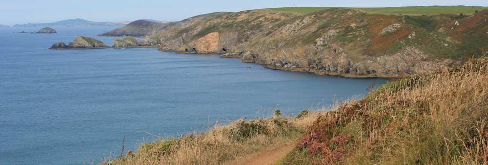
Around the headland, and there is a gentle dip down into Pwll March (Pwll means pond in Welsh, and March means horse, but I don’t see any sign of either). After this, the path drops into the long, deep valley of Cwn Mawr.
At this point I wonder if Cwn is a misprint on the map. Cwm is valley and Mawr means large or great. Large Valley would be a good name for this feature. Perhaps it should be called Cwm Mawr?
I’ve met nobody on the path yet, but the sea below is dotted with orange kayaks. This group keep pace with the progress of my walk for quite some distance.

An outcrop of rocks ahead is called Dinas Fach. (Dinas means city in Welsh, but I can’t find a meaning for Fach.) Moored in the lee of the rocks is a yacht and, as I get nearer, a couple of motorboats roar in and out of the little bay.
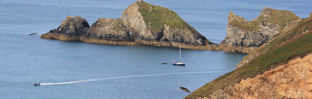
It’s the middle of August and the height of the holiday season. There might be nobody out walking, but the water is beginning to get busy.
While the southern part of the UK is dealing with flash floods, in Pembrokeshire, the sun starts shining. I can’t believe my luck!
I come to the brow of a slope which is dotted with brilliant-yellow ragwort flowers. The next headland is Pen Dinas (which means City Head) and the cluster of islands just off its tip have English names: Black Scar, Green Scar and The Mare. In the distance is the area around St Davids Head, and I can see Ramsey Island.
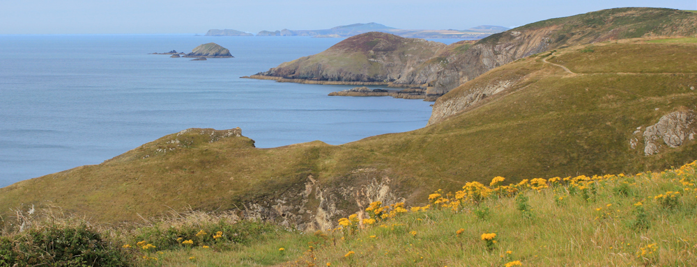
I sit down on the grass for a snack, surrounded by bright flowers.
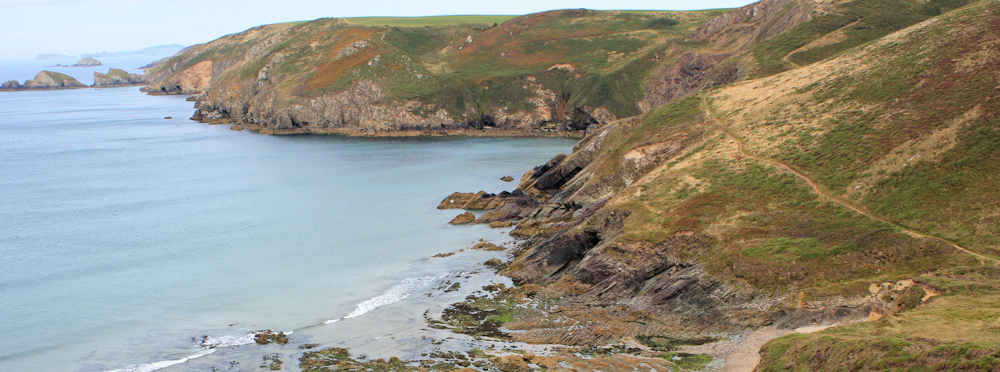
Beyond here, the path descends into a steep valley, where I slip and slide on loose stones.
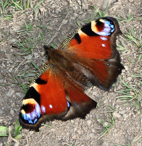 Some of my walking friends have noticed a lack of butterflies this year, but as I slither down into the valley I find plenty of them sunning themselves on the path. They are frustrating to photograph, as every time I get close enough, they flutter away.
On the way down I meet my first walker of the day. He waits patiently while I manage to snap a decent shot of a peacock.
And then he tells me about the adder he has just seen. An adder! A full-grown male. It was coiled on the path by one of the gates on the cliff above.
I am full of envy. It must have crawled onto the path just after I walked past. I’m tempted to go back. But I see other people are out walking now and the snake has almost certainly been scared away.
Up the other side of the valley and I’m heading towards the village of Solva. I parked here this morning before taking the bus to Newgale, and I plan on stopping in Solva for lunch. I might even end my walk at this point, depending on the weather.
But first I have a craggy section of coastline to negotiate. Although it doesn’t look far to Solva, the coastline is indented with numerous little coves, and it takes me longer than expected to get there.

As I draw closer, I begin to meet a steady stream of walkers, mainly strolling families.
From the Penrhyn headland, I look inland towards Solva. The landscape is dramatic and the topology slightly confusing, because the inlet to the estuary is formed from two converging valleys. On the left side, the muddy mouth leads up to Solva Harbour. On the right side a stream trickles across a shingle beach, where families are congregating. The hump of land between the two valleys is called The Gribin.

Below me in the sea, not shown in the photo, is St Elvis Rock. (I realise I’ve been a little obsessed with names today, but an Elvis Rock tickles my sense of humour!)
I come down off the headland, cross the shingle beach, go over a stream, and climb up onto the hump of The Gribin. This was the site of an iron age fort, and is now owned by the National Trust.
From The Gribin the Pembrokeshire Coast Path snakes down the side of the valley, past the remains of old lime kilns, and into Solva Harbour. The tide is out, and people are walking about between the stranded boats.

I have a ploughman’s lunch in the pub that overlooks (rather sadly) the car park. When I parked here this morning there was only a couple of vans unloading and I had to wait for the attendant to set up his kiosk and take my money. But now the car park is full.
A few drops of rain fall during lunch – but not enough to justify an early end to my walk. So I set off down the other side of the valley, heading back towards the sea. After nearly taking a wrong turn (thank you, to a kind gentleman, for putting me right), I end up on high ground with wonderful views over Solva Harbour.

From here I’m planning to walk another 5 miles or so to Caerfai Bay and then inland to St Davids, where I can catch a bus back to my car. Because Solva lies on the main route from St Davids to Haverfordwest, there are a number of possible buses and I don’t have to constantly worry about timetables.
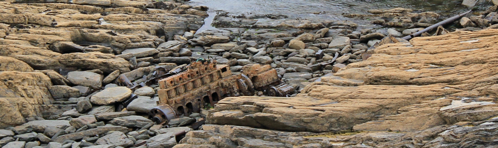
This section of coast is beautiful and dramatic. Below me, on jagged rocks, I see the metal remains of a wreck.

And further on, more wreckage.
The path is relatively crowded. Near Llandruidion I come across a family having a picnic. It’s not raining, but the sun has disappeared and the air is cool. They are well wrapped up. The father has taken his son for a precarious clamber on the rocks below.
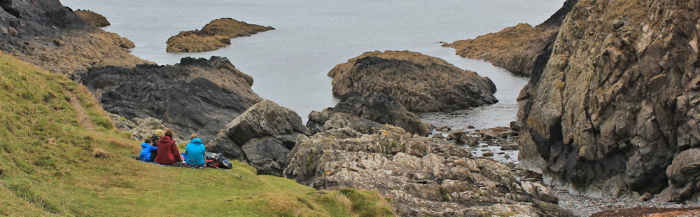
On the other side of narrow bay, I look back at the route I’ve just walked. The rocks have dramatic folds, and look like claws or fingers sticking into the sea. The hard stone surfaces mean there is little sediment and the water is very clear.

A local guide-book told me to watch out for seals in the rocky coves. But there are no seals today. Instead, every cove seems to be taken over by kayakers, or by coasteerers, or by rock climbers. I’m not used to sharing my coast with so many people!
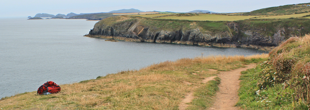
I don’t actually see many of the climbers, but come across their tell-tale backpacks, lying on grassy slopes above the cliffs.
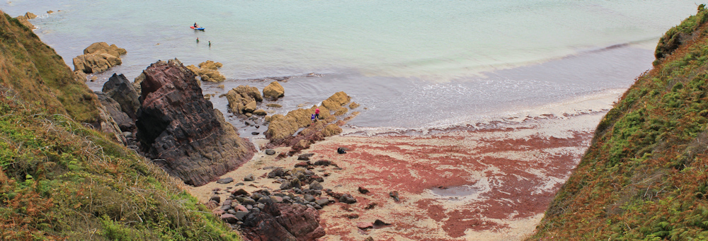
Two hours after I set out from Solva I reach Caerfai Bay. This is the nearest beach to St Davids, although it’s not the best beach. The slopes above are covered in tents. In the sea below are a couple of the ubiquitous kayaks.
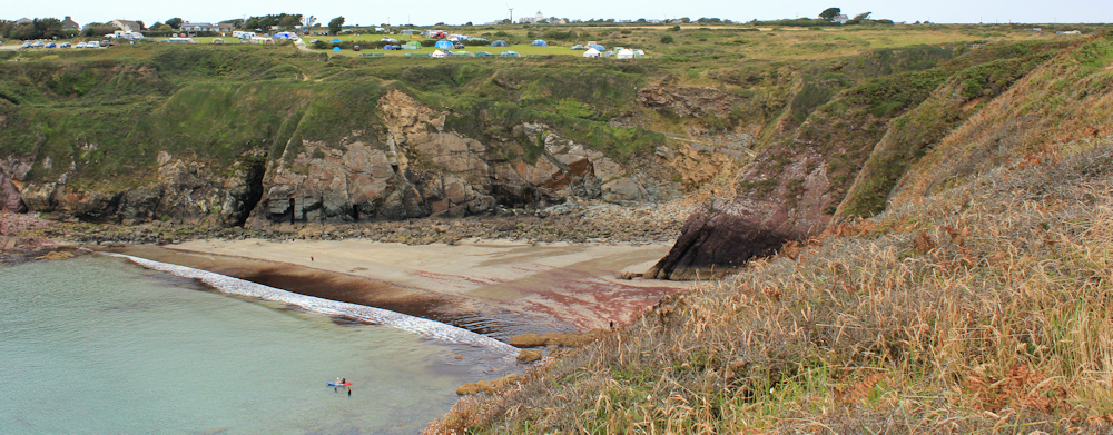
The beach itself is strewn with swirls of russet-coloured seaweed.
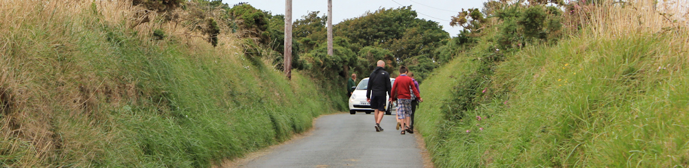
I don’t climb down to the beach, but head up to the little car park. From here a narrow lane leads into St Davids. I’m not the only person walking. There isn’t much traffic, thank goodness, because there isn’t much room.
St Davids is the smallest ‘city’ in the UK. But today it’s teeming with visitors. I have coffee and cake in a local hotel, while I wait for the next bus to Solva.
Miles walked today = 11
Total along Wales Coast Path = 439 miles
Total distance around the coast: 2,046 miles
Route:


I missed you somewhere whilst I was off in France when you arrived at Newgale and it was the source of my best anecdote during my circuit of Wales. I camped at Newgale and ate in the evening at The Duke of Edinburgh pub:
From my journal:
I’m eating in The Duke of Edinburgh which is also residential. I had
enquired if I could get breakfast but they said they didn’t do
breakfasts which I found difficult to believe. This place seems to
be staffed by, and frequented by, a caste reminiscent of Little
Britain; everybody seems weird – perhaps I have finally flipped?
Some examples: a small Bernie Ecclestone like guy who has just
come and complimented me on the way I ate my soup – “very few
people do it properly these days, nice to see”. A woman wearing a
black jacket and tight black trousers (Richard the Third), but with
hair like Worzel Gummage. An elderly couple – the man goes to bar
to ask for more lemonade in his lager – returns to find wife with
head in hands, “are you having one of your moods” he asks, and then
they move to another table. An elderly man on his own looking
depressed with head bent staring at a glass of lemonade which he
does not appear to be drinking. There are more but I draw the line
here. Amidst all this the hotel is presented as being reasonably
sophisticated but we are subject to a television showing Coronation
Street which nobody is watching.
Bravely, I am going to risk a dessert and hope to get out before I
end up in the loony bin.
Believe it or not a guy has just walked in who is over seven feet tall.
I’m off!
Ha ha! And I never went into the pub. Wish I had now 🙂
I believe Fach is small, whereas Fawr is big large, as in Arenig Fach and Arenig Fawr which are two hills above Bala.
I think I mentioned I stayed for a night in the Harbour inn in Solva, a few pints of Reverand James and being entetained by the Haverfordwest Male Voice Choir ensured a nice evening.
I’ve yet to come across a male voice choir, sadly. Fingers crossed. Back there next week, so we’ll see.
Fach is ‘small’. It’s actually bach but in some situations Welsh ‘mutates’ the initial b-sound to what in English would be a v-sound but is spelled with an f in Welsh. Mawr (large) can similarly become fawr.
Ah, thank you. There are limits to the translating powers of the Internet! That helps.
See ‘Sospan Fach’, or a translation of the chorus thereof. If you’ve ever heard it sung by a rugby crowd you’d never believe what it actually means!
Ha, ha, that was an interesting hour I just spent on YouTube, listening to various renditions of the song and its translations. The tune doesn’t seem to fit the words! Interestingly, my husband overheard the singing (from the next room) and thought it was Russian.
Hi Ruth, Thanks for another very interesting post! Just a quick one to say that I am a primary school teacher in Greenwich, London, and will be teaching geography (British Isles) this year. I will be taking pupils on long distance walks, and would like to ask for tips about how best to undertake it i.e. how to read Ordinance Survey maps etc. Do you welcome people to join you? Or do you lead groups on long distance walks? I’d be very grateful to hear back from you! All the best, Liza
Hi Zenit and what a fabulous idea to teach Geography by taking pupils on long distance walks. I don’t lead walks – although I’m flattered you asked. But I did walk some of the Thames Coast Path last year, and the path east of Greenwich is interesting with some historic sewage works (great for teaching about how we deal with waste) and the Thames Barrier -(great for teaching about how we deal with flooding).
Your main logistic problem is going to be organising transport to and from each walk’s start and end points, although a circular walk would be a good idea, and also judging how far children can walk without getting tired.
One idea might be to choose an area on the Ordinance Survey Map and identify landmarks – e.g. churches, pubs, toilet blocks, car parks, etc. Then go out for a treasure hunt with the kids and see how many of the landmarks you can actually find on the ground.
Anyway, I wish you all the best for your project and hope you all have fun 🙂
Hi Ruth, carrying on with the welsh translations.
You have been given the mutation lesson by others above.
March = Stallion or steed, for horse you will normally hear ‘ceffyl’.
Cwn mawr – Cwn = dogs so Cwn mawr ‘large dogs’. you are right that Cwm is like combe in English for small valley.
When i passed newgale, it was wet and deserted, carry on the great blog.
Cheers J.P.
Oh, so that valley could be the valley of the large dogs!? Tricky thing this Welsh language 🙂
Hi Ruth, So glad to see you’re enjoying our beautiful coastline. It’s interesting to read your experiences as a traveller through familiar places and to see them from another perspective. Hope the weather holds for you.
I’ve had another fabulous week in Wales. Just got home. So much to write about!
Wow, I always thought that Wells in Somerset was the smallest city in the UK but now, I’m wondering whether that is perhaps a record that is only ‘known’ locally. 😉
Ah, I had to look this up on Wikipedia. They say Wells is the smallest city in England, but St David’s is the smallest city in the whole of the UK. However, I’m not sure about the figures on the Wikipedia site, as the census information is 14 years old and St David’s looked larger than 1,800 people.