
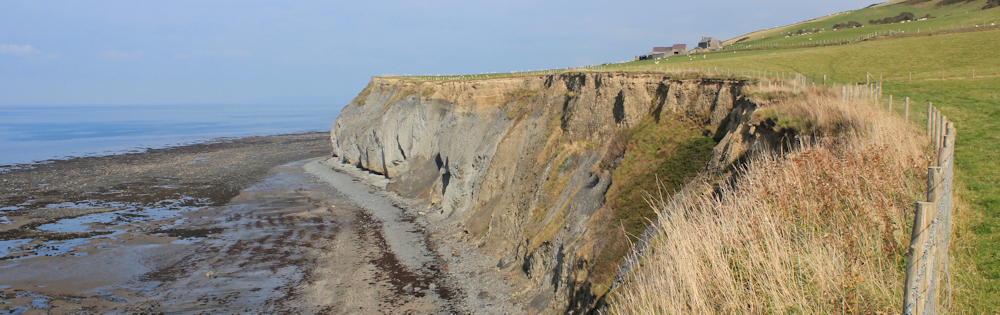
The Ceredigion Coast Path leaves Llanrhystud via the road to the caravan park. The signposting is erratic, and so at one point I nearly turn back, thinking I’ve strayed into private property.
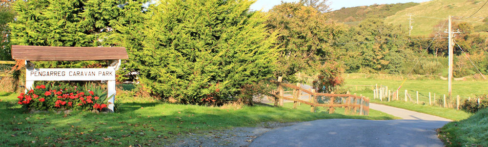
After checking my Garmin, I realise I am heading the right way after all. Soon I spot a proper footpath sign. Here the path leaves the road and climbs above the caravan park.
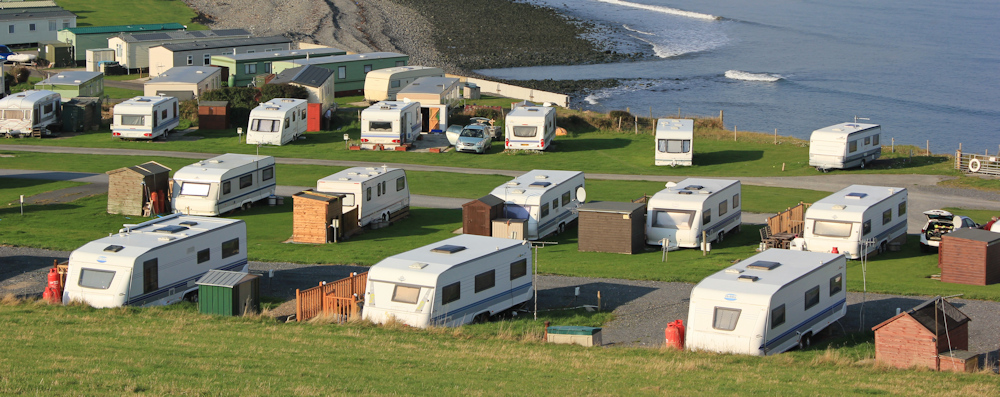
I have mixed feelings about caravan parks. On the one hand they provide a cheap way for people to spend a holiday in a beautiful place. On the other hand, they look as though someone has scattered a bunch of large tin boxes across some of the most scenic parts of our coast. Hmmm. As I said, mixed feelings.
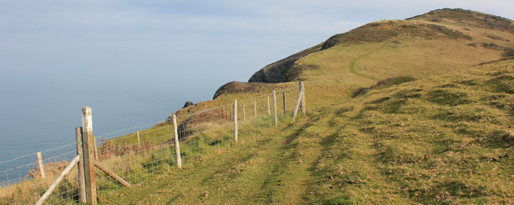
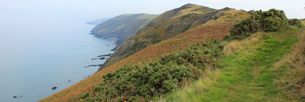
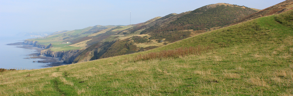
The path continues to climb above the sea. And it just keeps on climbing, and climbing. Every time I think I’ve just come over the final crest, I realise there is another one beyond.
I stop for a breather and take a photograph looking back. Despite the sunshine, a misty haze obscures the distance. Somewhere back there is Aberaeron, with New Quay on the furthest headland. I wish I could see them.
Onwards. I keep going up. (Later, when I look at the map, I realise there is a stretch of about 1.5 miles where the path climbs relentlessly out of Llanrhystud.)
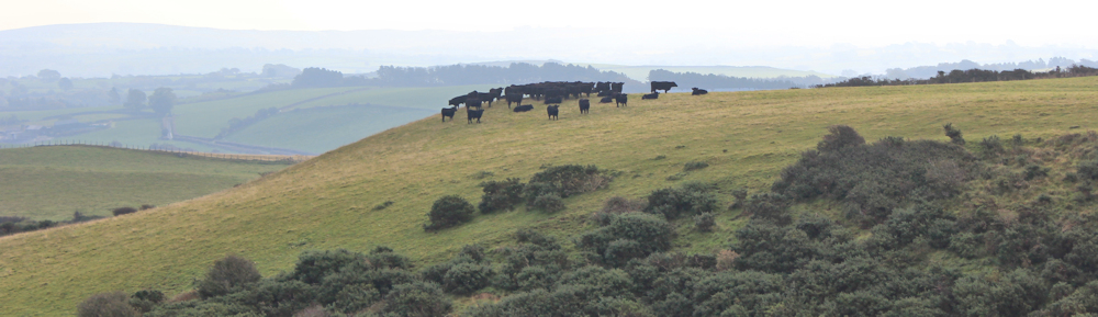
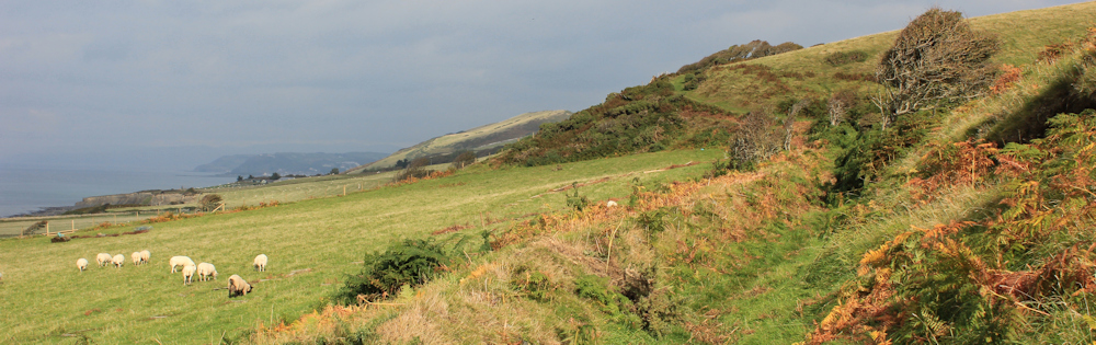
Inland the views are panoramic but, again, are obscured by haze. Across rolling farmland, I notice a sinister congregation of cattle in the distance.
I’m relieved to find no farm animals on my path. Only birds. In fact, I mistake a silhouette on the topmost ridge as a couple of walkers having a rest, but as I get nearer the two figures fly away. They were red kites.
Yes, I’ve reached the top of the climb. And can look ahead to where Aberystwyth, my destination today, is lost in the morning mist. And I spot another bird sitting on a fence post. I think this one is a young kestrel.
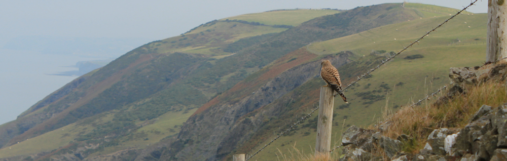
The bird flies ahead of me, resting on another post and waiting for me to catch up, before flitting on ahead. Teasing me.
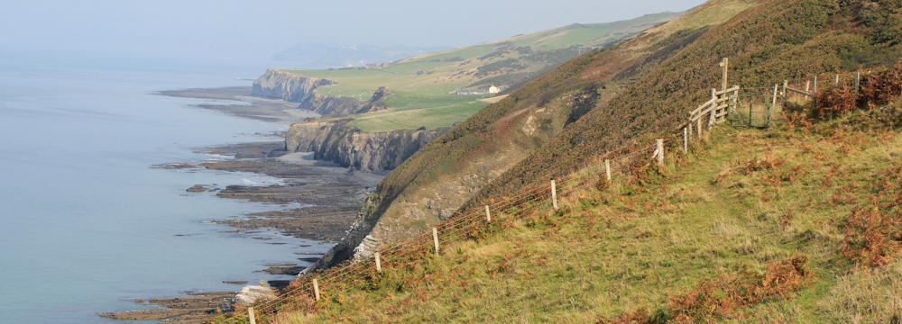
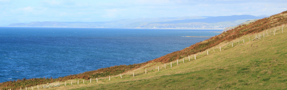
I’m walking on high cliffs now, and the sea is a long way below me. A dull grey colour. It’s surface is only disturbed by a solitary fishing boat.

Sound carries clearly above a calm sea. I can hear the engine of the boat chuffing as the fishermen move into a new position, and the gruff voices of men talking to each other.
I hear a splash. It sounds close. I look down and catch sight of a grey shape far below. I manage a quick photo (another blurry shot, I’m afraid). Was it a dolphin? Or a seal?
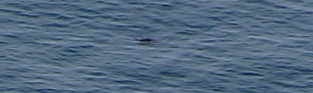
I stand still for some time, hoping to catch another glimpse of whatever it was. But the dolphin (or seal) has moved under the cliffs and is hidden from view.
Onwards. The path is heading more-or-less downwards now, along the side of the long ridge of hills.
The Ceredigion Coast Path has an excellent website, where there is a good description of this section of path. It describes the grade as ‘moderate / hard’. I’m not sure about the ‘hard’ part, but the rest of the description is spot on:
‘With no settlements between these locations and with ‘feeder paths’ being few and far between, this is one of the least walked sections of the Ceredigion Coast Path … dramatic, lonely and extremely worthwhile.’
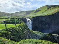
Lonely? Yes. Since leaving the caravan park behind, I’ve not come across a single person. And the tiny white house ahead (in the centre of the photo below) is the only sign of human habitation along the route so far.
It’s 1pm. I stop and sit on a tuft of grass overlooking the sea. Time for a snack and a drink. And then a couple of hikers walk past, taking me by surprise. They stop for a chat and tell me they’ve come from Aberystwyth and are heading for Aberaeron.
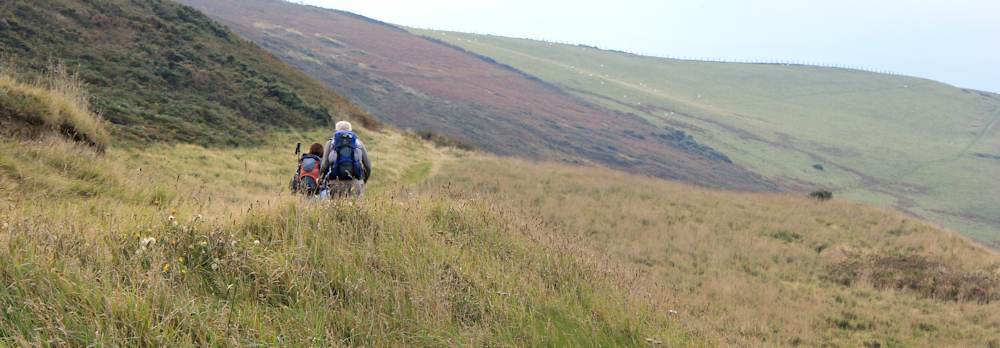
Their rucksacks are large because they’re carrying everything with them. I’m always amazed by other people’s stamina. I find my little day-sack heavy enough! And this couple are not only older than I am, but are walking further too.
Onwards. The footpath reaches, and passes right in front of, the white house. I would normally feel like an intruder at this point, but in fact the house is shut up and empty. From a distance it looked like a farmhouse, but it must be a holiday home. Shame. I wonder where the farmer lives?
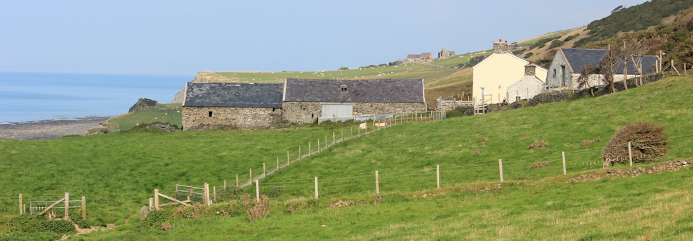
I walk along the edge of fields, high above eroding cliffs. There is another farmhouse ahead. Perhaps the farmer lives there?
The approach to this next house involves an inland detour, during which the path follows a wonderful sunken lane. It is lined with stone walls covered in vegetation, and arching overhead are the branches of wind-twisted bushes. An ancient byway. Magical. Like something out of a fairy story.

When I reach the farmhouse, I discover it’s a ruin. Most of the roof is missing. Windows stand as gaping holes. Another shame.
The sunken roadway continues and takes me further up the ridge. Despite some frustration at not being allowed nearer to the coastline, I really enjoy this section of the walk.
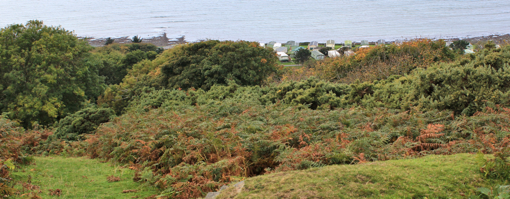
The reason for the inland detour is another caravan site.
By now the wind has picked up and blown the mist away. When I look back to the west, the sky is stormy. I hope the two walkers I met earlier aren’t caught in a rain storm.
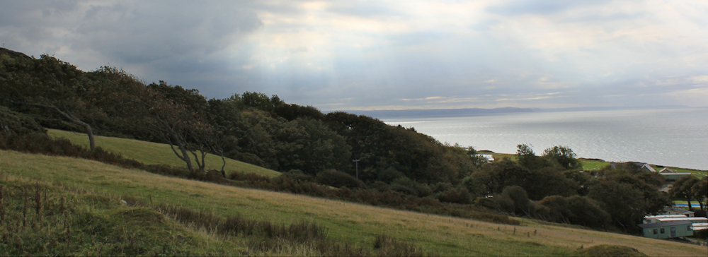
But in the direction I’m heading, to the east, the sky has cleared and the sea has changed from a dull grey colour to a vivid blue. It looks tropical.
Despite the sunshine, the wind is a problem. It blows fierce and fresh, straight into my face. It’s tiring as it continually buffets me and snatches my breath away.
I stop on a high bank for a rest and a drink, and to pull a warm fleece over my tee shirt.
Ahead I can see the path snaking slowly downhill towards Aberystwyth. And a couple of young people are sitting on the bank below me. At first I wonder why they have chosen to sit in a dip, and then I realise they are sheltering from the wind.
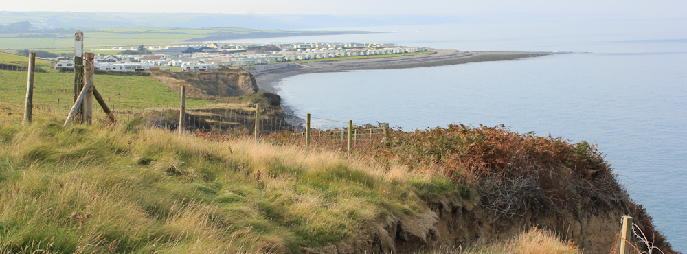
I’m surprised to see nobody else around on this lovely day. But I soon discover why this stretch of path is so empty. And I also realise why the Ceredigion Coast Path web site rates this section as moderate/hard.
I’m about to reach the ‘hard’ part!
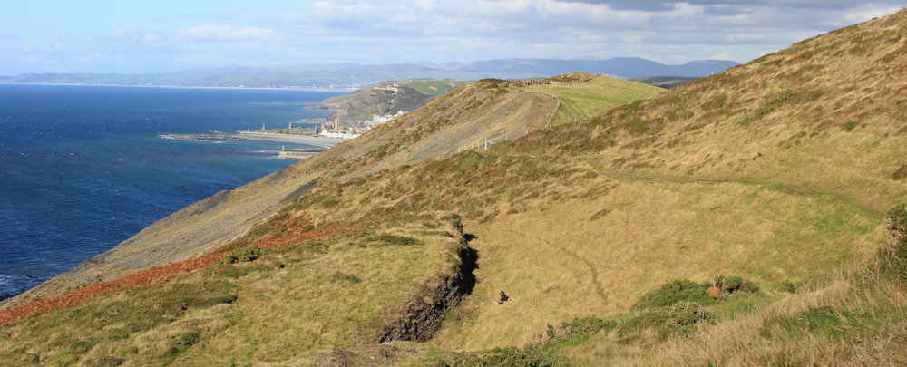
The ridge I’ve been walking along is gradually becoming narrower and narrower. On the seaward side the ground is crumbling and shows evidence of landslides. On my other side is another steep drop, guarded by an unfriendly barbed-wire fence.
Then, right in front of me, the land drops away, and the path appears to lead straight down a precipice to the beach below. The slope is 45 degrees in places. No steps. Just a heart-stopping scramble over loose stones and rutted earth. Wow!
It’s impossible to take a picture that adequately illustrates the steepness of this path. Firstly, the slope faces east and is in deep shade. Secondly, a two-dimensional photograph can’t properly demonstrate the vertiginous drop. And thirdly, I’m much too frightened to use my camera while slipping and sliding downwards.
But here is a photo I took near the top, looking inland. Despite my fear, I can appreciate how wonderful the landscape looks.
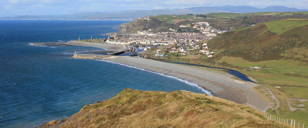
And here is another photo, looking down towards the sea and the swirling patterns of rocks on the beach.

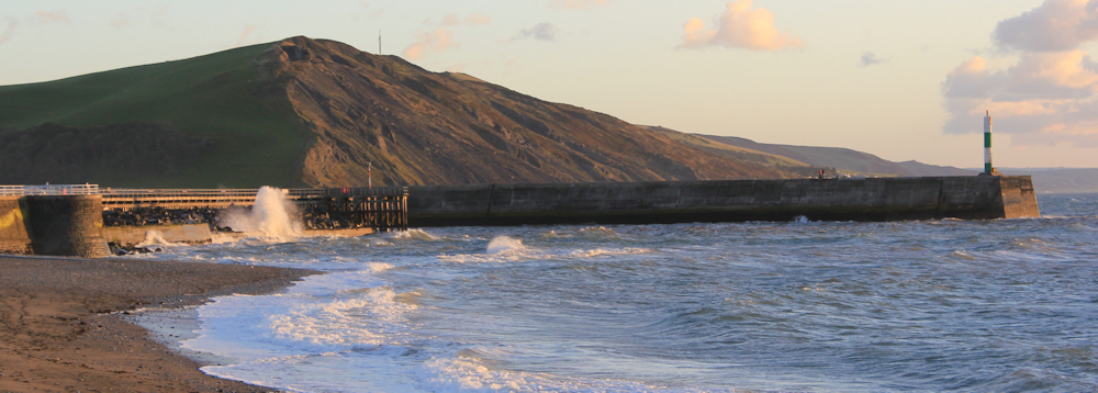
Luckily the wind – blowing in my face – acts in my favour, buoying me up. I reach the bottom in one piece, feeling intensely relieved to have made it safely down.
My map contains very few place names, but the pebbly beach in front of me is called Tanybwich Beach. The slope I’ve just come down seems to be called Allt-wen, although this may refer to the reef of rocks below, rather than the ridge.
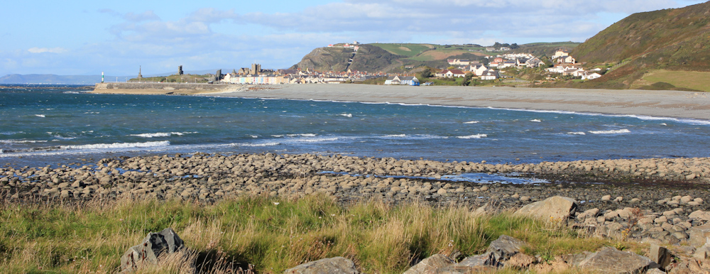
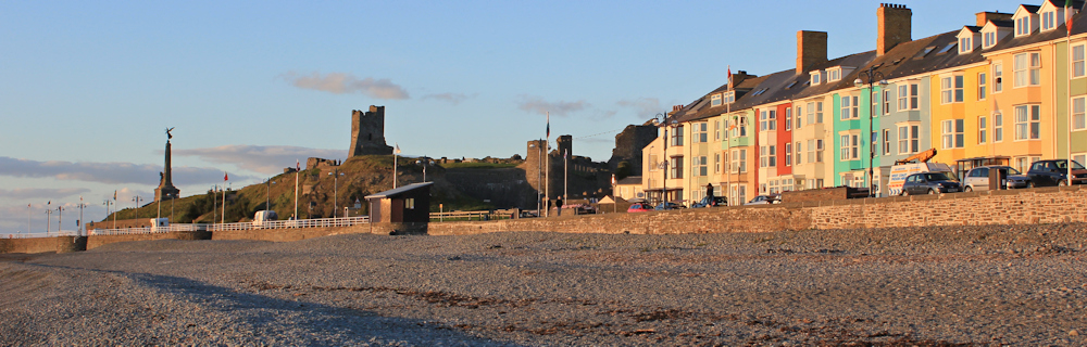
I walk along the beach, fighting against the wind, as the path curves around the shoreline towards Aberystwyth. To my right are fields of cattle and a tall mound of land – Pen Dinas. This is the site of an ancient hill fort and, for some reason, someone seems to have built a tall chimney on its peak.
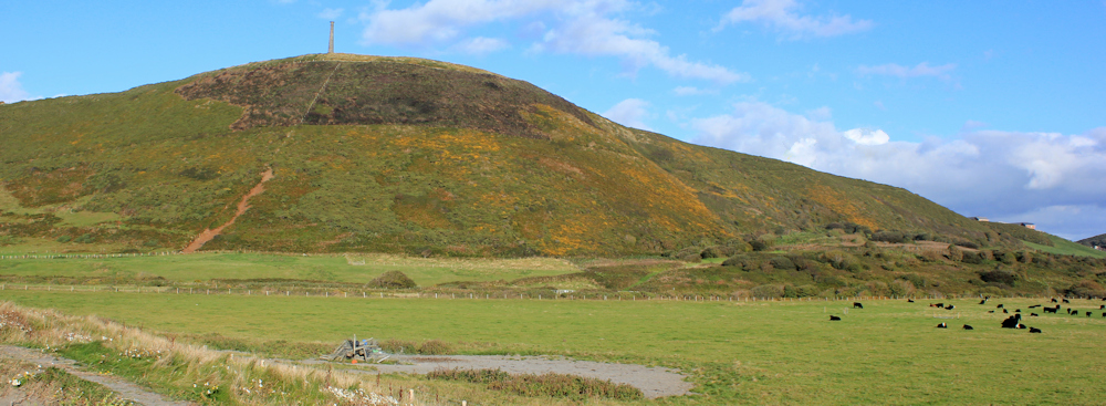
[Later I learn the chimney is a monument built in honour of the Duke of Wellington. Some say it was designed to look like a cannon standing on its end. Another, and more likely, explanation, is that it is simply a stone pillar and the intention was to place a proper statue on top, but the monument was never finished. ]
I continue along the beach, feeling very tired as I fight against the wind. There are some dog walkers strolling about, but they are sticking to lower ground, close to the river.
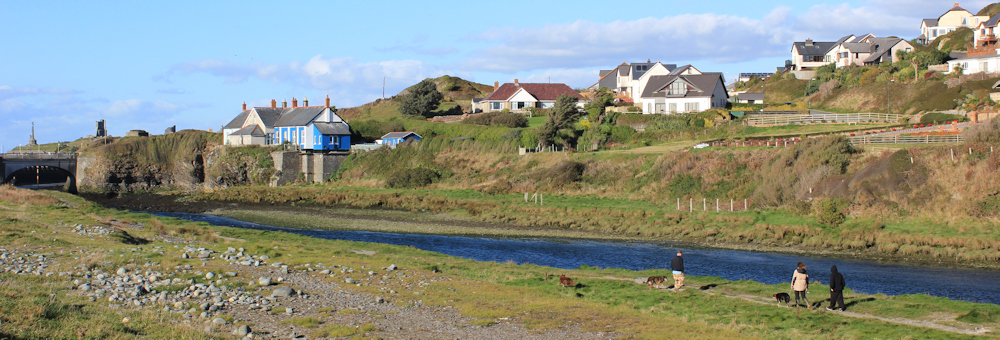
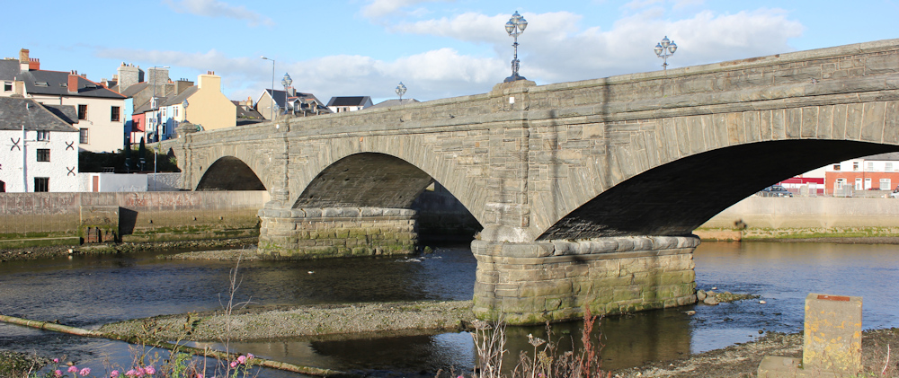
Two rivers meet in Aberystwyth. The one I am walking beside is called Afon Ystwyth, the other is called Afon Rheidol. They meet at the entrance to the harbour, where they fight against the incoming tide, creating an interesting swirl of competing currents.

I cross the first river and walk around a pleasant marina. There is new housing on my right, but I am grateful the planners made sure they secured a public footpath.
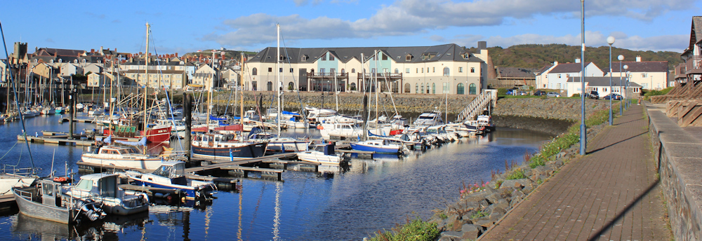
Then I join a road and cross the bridge over the Afon Rheidol…
… and walk through streets until I reach the railway station, where I find a Wetherspoon pub.
[I am a fan of Wetherspoon, a fact that horrifies the rest of my family. But the pubs are cheap, reliable, and you can order a proper meal at any time of the day. None of this ‘we stop serving food at…’ nonsense. Also, they show the calorie content of each dish, which is excellent if you’re on a diet!]
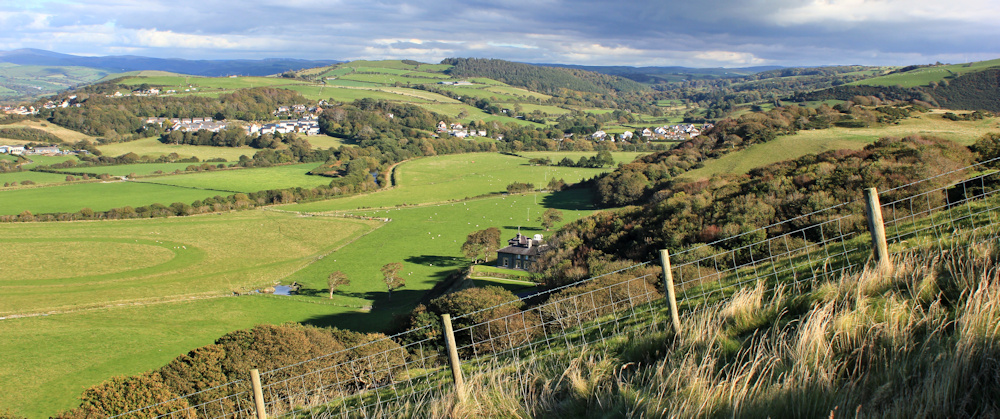
After the meal I walk along the esplanade at Aberystwyth’s sea front. The sun is low in the sky now – dusk has come surprisingly quickly – and I take a photograph of the ridge I walked down earlier.
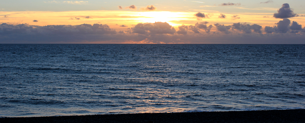
The sea front looks warm and lovely in the dying light of the sun.
I sit and phone my husband, to let him know I’ve survived another day, and watch the sun sink into the sea. The colours are not as dramatic as the last sunset I photographed in Aberaeron, but it’s a pretty good display.
Miles walked today: 11 miles
Total along Wales Coast Path = 572 miles
Total distance around the coast: 2,179 miles
Route:


Hi Ruth, ‘Spoons … snap! I rate Wetherspoons for the same reasons as yourself, same quality and prices wherever you go around the country.
Coincidently I visited the one in Carnarfon yesterday with my daughter, just after we had done the walk from Menai Bridge to Caenarfon. It was only a 9 mile jaunt and offered poor views with predominate road walking albeit on pavements. The next sections will see me well out along the Lleyn peninsular.
I love Aberystwyth, my daughter went to University there. which meant many trips running her back and forth to Shropshire.
Did you say that was your last walk for this year?
Hi Alan, another Wetherspoon fan! I thought I was the only one 🙂
This trip may be the last for the year. I got as far as Aberdyfi, and am still writing up the walks. I’ll keep an eye on the weather forecast because you never know. Last year I walked Peddars Way in the week leading up to Christmas.
Hi Ruth, I did the PW in the December of 2013. I think its very important to keep the muscles stretched and in trim over the winter. I would suggest that look at continuing sw from where you started the PW at Knettishall and continue on the Icknield Way Path which takes you through Cambs, Essex, Herts & Beds to end up at Ivinghoe Beacon in the Chilterns. This path together with PW, The Ridgeway and Wessex Ridgeway make up The Greater Ridgeway, reportedly the oldest road in England, starting at Holmes-next-the-Sea and running SW right down to Lyme Regis – The so called Chalk Road. I completed this Greater Ridgeway back in May of this year.
Another coincidence then: we were both mad enough to undertake a long distance walk during the short, dark days of December! Thank you for the recommendation. I noticed the Icknield Way when I set off from Knettishall. My only worry is mud, but will investigate it.
Hi Ruth
First of all, thank you for the warning about the steep descent. I came off a cliff when I was 10 and, 48 years later, I still can’t cope with the very steep downs…so I think this may be one I have to avoid!
And some info in exchange – we walked the Icknield Way Path in several stages (some one-day from home), in the same direction that Alan suggests above. We did the final section over three days in November 2011, and it was good for winter walking. I think there may have been some mud, but it was finding sufficient hours of daylight between accommodation that I remember more. See https://sites.google.com/site/jordanwalks/home/icknield-way-path.
It was a good walk though, and we too continued on to Lyme Regis. Inland Dorset is just as beautiful as the coast; highly recommended.
Sally
Thanks Sally. Definitely one to consider.
Hi Ruth
Glad “Aber” – as the locals call it – put on a good sunny welcome for you! Great pics, I can even see the house where I grew up high on the hill. Thanks for the trip down memory lane.
Sounds like you may have some quieter weekends ahead now. Enjoy!
Catrin
Hi Catrin and, yes, Aber was very sunny and beautiful. How amazing that you could see your old home! I was thinking of you as I walked through.
I rather liked that campsite at Llanrhystud, although mainly because they gave us a pitch which was about twenty paces from the coast path; perhaps not the best reason for liking an eyesore!
I hadn’t read anything about the coast path before embarking on it, so had no idea that the section from there is usually quiet, but I did notice it’s lack of use. Indeed, I even mentioned it in my post for that day when I said:
“Once again, solitude prevailed for the early part of the morning. The lack of a trodden path in places, combined with the apparent age of the cobwebs on some of the kissing gates, suggested that not many people venture onto the bit of path heading out of Llanrhystud, although it is well trodden again in the approach to Aberystwyth, which is where (again, just a few minutes before 10am), I met my first other walker.”
Hi Gayle, yes, I’ve got mixed feelings about caravan sites. Actually quite like proper camp sites – with tents and caravans that can actually move about. But the huge static parks are rather a blot on the scenery.
Interesting to read your observations about this section of the path. I wonder if you found the final slope down to the beach at Aberystwyth as terrifying as I did?!
That walk seems like a great test of stamina and nerves, not one you’d enjoy as much in less clement weather. Looks like your cattle encounter may have been with Welsh Blacks? If you enjoy eating beef they are famously tasty – probably won’t find it on Wetherspoon’s menu though! Weather still great in North Wales!
Wetherspoon’s serves Aberdeen Angus, but no Welsh Black that I remember. They did look very sinister on the hill, but I’m sure I’d enjoy them on my plate! Weather was incredible and most of September and October unusually sunny in Wales. Very lucky.
The sunken path was wonderful and that views the abandoned cottage really did look like a fairy tale. I’m not sure what I’d make of the steep path near Aberystwyth though. Climbing steep slopes is one thing, going down I find much harder,
Love ancient pathways. And you’re right about steep slopes. Going uphill is definitely easier than coming down.
The kestrel may have been hoping that you would disturb a small mammal.
The thing about Wetherspoons is that you know what you are going to get. More or less!
You can find pubs with better food and or atmosphere but if you are just passing through they remove the element of luck, or walking around looking in windows or research. They are cheap but the service at the bar can be slow when they are busy.
I just wish some of the better more individual pubs would club together so they would get some of the buying etc advantages of Wetherspoons so they could reduce their prices.
It’s the food-at-any-time service that I really appreciate at Wetherspoons. Interesting observation about the kestrel. Yes. Perhaps it was hoping I would flush out some prey for it.
Hoping to do this walk at the weekend. Just popping in here to see what lies in wait!
Hi Jon. The descent into Aber was tricky. Suggest shoes with a good grip and walking poles. Or a rope! Hope you enjoy it.
Did this walk today. Another stunning walk. I resolved the problem of going that steep hill by doing the walk in the other direction (starting from Aberystwyth, where I’m staying) to get that out of the way early on. I agree it is steep though and could really do with some proper steps. Some have been formed by walkers but i Imagine are very slippery after rain. A shame about the caravan parks too as you note. I agree it’s a surprisingly remote stretch, too.
I bet you had perfect weather yesterday and very sensible to do the difficult section first. And, going *up* a precipice is always easier than coming *down* one, isn’t it.
Did this walk today. Found your blog very helpful as we knew what to expect. As you described we found the last very steep stretch as we dropped down into Aber very tough on The olde knees, but apart from that very do able. Weather was glorious. Scenery amazing. Bus waiting for us for return after an ice cream. Perfect day.
Hi Lynn and pleased you found the blog helpful. It’s a very beautiful part of the coast and a gorgeous day when I walked it, Glad you enjoyed it too.
The evening light is gorgeous – it’s always the best light of the day.