
I spend a restless night, coughing and sweating, and in the morning realise I have no appetite for breakfast. I also realise something else. My terrible fatigue yesterday was not due to lack of willpower, nor lack of fitness, nor laziness. I’m ill. Whew! What a relief.
Fortified with paracetamol, I manage to find the bus stop where I ended my last walk prematurely, and resume marching along the B4547. I pass the gates to a grand estate.

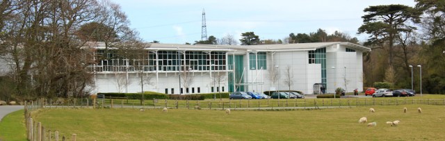
A short while later, the Wales Coast Path leaves the B4547 and heads into a newish industrial estate. Or is it a business park?

Here I am totally disoriented, as the roads through the estate don’t appear as roads on my map, and the Wales Coast Path signs peter out. There are new buildings, all bland concrete and blue-green glass…
… and old farm buildings and stable yards, now converted into small business units or, possibly, residential quarters.

More by luck than anything else, I find the right route and walk along a road that turns into a track, with open parkland to my left and the mountains of Snowdonia in the distance.

Then – while appearing to be in the middle of nowhere – I’m overtaken by a post office van. Dust billows up from its rear wheels, making me cough. But I don’t mind. These wonderful vehicles get everywhere and are such a reassuring sight. I love them.

The track takes me down to the shore, and I enter an area – Glan Faenol – which belongs to the National Trust. Across the water is another National Trust property, the stately home of Plas Newydd.

It all looks idyllic, and a great improvement on the road walking and boring cycle track of yesterday. I walk around a field of sheep and tiny lambs, and then enter a wood.

Where I spend some time going off the track and examining bluebells.

Most of the bluebells I find on my walks are Spanish bluebells, not native British ones. But I think these might be the genuine thing for 5 reasons:
- (1) The plants are hidden deep among the trees.
- (2) The flowers form narrow tubes, and
- (3) the flowers grow out of only one side of the stem…
- (4) … which pulls the stem over so it droops to one side.
- (5) The leaves are less than 1 cm wide.
I forget to check for scent (Spanish ones don’t smell) or for the colour of the pollen (our native bluebells have a creamy-white pollen). But, yes, I think these really are genuine native flowers. How wonderful.
Buried among the trees, overgrown and fenced off with rusty ironwork, is a little chapel. Well, actually, it’s a mausoleum, according to my map. You’re not allowed inside. It looks really spooky and would make an excellent setting for a gothic horror story.

I continue walking along the shore. On the other side I see church and a statue looking over the water. The pose seems familiar. Is that Nelson?

Onwards, and a bridge appears. This is the first of two bridges crossing the Menai Strait and over into Anglesey: the Pont Britannia. It’s famous for being built using an unusual tubular construction, but was substantially refashioned following a fire in 1970.

Passing under the path is a little stream, constrained within a concrete gully, which ends in a tinkling waterfall, called Paxton’s Cascade. It is hard to take a decent photograph as the light is dull and the cascade is overgrown.

I reach the base of the Britannia Bridge and walk underneath it, following the path through another area of woodland, where I come across this magnificent oak tree – a Lucombe Oak.

Apparently there are red squirrels in the area, but I don’t see any.
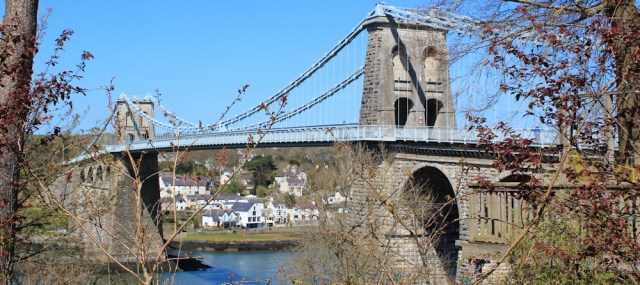
A short time later, and I reach the Menai Suspension Bridge, the second bridge over to Anglesey. It’s prettier than the Britannia Bridge, but the arched passages through the towers are very narrow and I’m amazed to see a bus just managing to squeeze through the gap.
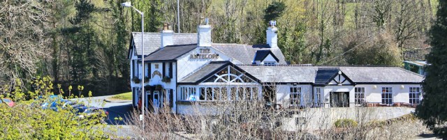
I’m about to cross the bridge when I spot a pub nearby. Today I promised myself I would take it easy, and so I decide to stop for a long lunch. I have an excellent meal with a great view overlooking the bridge.
The walk over into Anglesey is lovely, although it’s very windy on the bridge and too chilly to linger.

Now I’m in Anglesey. Yippee! I’ve been looking forward to this.
The first thing I come across is a lovely area with a walkway, called the Belgian Promenade and built by the Belgian refugees who were given shelter in area during World War 1. It was a thank you present to the local community for taking them in.
Nearby is a pretty island, linked to the mainland by a causeway, where there is a tiny 15th Century church, dedicated to St Tysilio.

I spend at least half an hour wandering around the island, which consists almost entirely of the church and its graveyard. It’s very peaceful and atmospheric.
Leaving the island, reluctantly, I continue along the Wales Coast Path which rejoins the road for a short distance. For the first time today I see a couple of proper walkers. They’re ahead of me, and I never manage to catch the up.

Down by the shore again, the path gives me a wonderful view over the Menai Suspension Bridge, with Snowdonia as a backdrop.

I walk through more woodland, where a boardwalk keeps me out of the mud.

And now I’m approaching the other bridge. I have to admit the Pont Britannia is not nearly as elegant as the Menai suspension bridge.

Under the bridge is a wonderful collection of graffiti, including these sinister faces, peering out from one of the supporting columns.

Then I see the lions. One on each side of the bridge, half-hidden by its structure. I climb up to take a better look. They’re magnificent beasts and strangely modern looking, despite being carved in the 19th Century when the bridge was originally built.

But who can see the lions now? The roadway is too high. The train track is lower, but trains would whiz past and passengers would only get a glimpse of the top of their heads, if lucky. And a pedestrian can only see them by climbing up underneath the bridge, as I am doing now. What a shame.
Onwards. The path takes me through another churchyard, where I stop to talk to a man on a motorised bicycle. He tells me he remembers the original Britannia bridge, and came to watch when it caught fire. There were no flames visible, just the metal tube glowing red-hot, until the iron melted and sagged.
Going down to the shore, I realise the statue really is Nelson. I know he had connections with Wales, but he just seems really out-of-place here.

I follow a ‘permissive’ path for a short distance. The landowner appears to be terrified of walkers and has built an impressive fence to keep us in our place.

This path leads to a collection of houses around a small cove, guarded by a jetty with a round, white house. Pretty place but with an unpronounceable name. Pwllfanogl.

Now the route turns inland and rejoins the road. I should turn left at this point, but instead I turn right and walk towards the town of Llanfair PG, where I parked my car this morning in order to catch the train into Bangor.
At this stage I’m heartily sick of road walking. Still, the view across the fields is magnificent with the mountains of Snowdonia.

By the time I reach Llanfair PG the light is too dull for photography, but here is a photo I took this morning while waiting for the train.
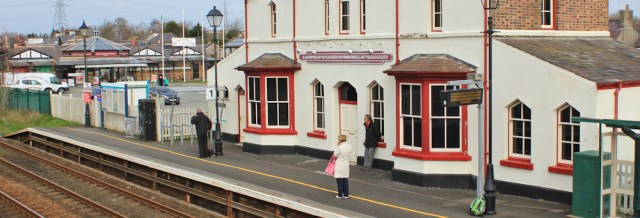
Llanfair PG is known by a different version of its name on my map: Llanfair Pwllgwyngyll. And it’s famous for an even longer version, as shown in the photo below!

Things I learnt later:
Paxton’s Cascade. Sir Joseph Paxton designed a nearby garden which included this little waterfall. He was a busy man, being head gardener at Chatsworth House, involved in the design of Crystal Palace, a director of railways, an MP, and a publisher of horticultural periodicals. He was also responsible for cultivating the world’s most widespread edible banana – the Cavendish banana.
The Britannia Bridge: The original railway bridge was built by Robert Stephenson and was the first of its kind – a tubular bridge made of iron, and supported only by a series of tall pillars. Unfortunately the bridge was partially destroyed by a fire in the 1970s. It was rebuilt, but the design was modified to carry road traffic as well as trains, and now includes an arched span.
Miles walked today = 9.5 miles
Wales Coast Path so far = 822.5 miles
Total distance around the coast: 2,329.5 miles
Route:


Hi Ruth, great to see you have finally made it to Anglesey. I agree the Menai suspension bridge is beautiful. I was also impressed with the full flow of the tide through the Straits when I passed along this section.
It is a beautiful bridge, isn’t it. (I confess to constantly falling in love with bridges – don’t know why. They’re just such wonderful things.) The Menai Straits was calm when I crossed over, but I know the currents are treacherous if you hit the wrong time of the tide.
Thanks for the titbits about Joseph Paxton. Lovely end to another typically interesting account of a day’s travel.
Thank you John. I’m glad I researched the name of the cascade. Fascinating that a lowly gardener (as Joseph Paxton would have been considered back in those days) could have achieved so much and risen so high. And he practically invented the edible banana too!
Nice post, Ruth. And super pics. Must check out your other posts. I prefer your map to the one I am using. Is it a plug in?
Thank you Charles. And I always love reading your blog too (http://charleshawes.veddw.com/ in case others are interested).
I don’t how you do your maps, but I use the ‘My Maps’ feature on Google Maps. It’s a bit tricky to find this section in Google, but this link should take you there https://www.google.com/maps/d/u/0/ Sadly, I haven’t discovered a way to import a GPX route directly from my Garmin, so I simply draw a line on the map to show my route. You can then embed the saved map in WordPress.
” I’m ill. Whew! What a relief.” I love your philosophical approach to a days walking – well done. Looking forward to your Anglesey trip, its on my list for this year.
I know that comment sounds a bit odd in retrospect! I just couldn’t understand why I found the previous day’s walk such hard work and thought it was old age creeping over me. So very relieved to find another explanation.
You’ll love Anglesey. There is some boring road walking (mainly on this stretch), but the rest of it is wonderful.
That was a good walk, lots of interesting things to look at. Hope you feel better soon.
Thank you Gill.
I remember when the beautiful old Menai Bridge carried the A5 (A55 now) across to Anglesey,and as a child it felt like you were entering a magical kingdom. The island is still a very special place as I’m sure you have discovered.
Yes, Theresa, I think you really are entering a magical kingdom when you cross that bridge.
I wondered if you were ill when I read the last post. It’s happened to me too. I’ve been walking, felt very lethargic and then the next day co e down with something. Well done for still getting out there and seeing Anglesey. It felt like I real milestone to me on my virtual walk,
One day you should visit Anglesey IRL Marie. It’s wonderful.
I love reading your blog and so admire your determination. Wales is a beautiful country and its coast line rugged and wild. It was lovely to see Mount Snowdon in your pictures, I climbed it last year with my son and husband, nearly killed me since I am not as fit as you😄
Hi Gilda and thank you 🙂 I really admire you for climbing Snowdon. It’s another thing I’ve added to my list of things-I-must-do-one-day.
I see you found the lions under Britannia bridge; I went in search of them last year after someone told me about them. There are two identical ones at the mainland end of the bridge too – it’s a shame they can’t be seen from the road.
I gather they considered raising them but decided it was too expensive. Shame.
Readers who, like me, use your blog when planning their own walks will be interested to know that there is now a new section of path that follows close to the Menai Strait shoreline between Plas Dinorwic, north of Y Felinheli and the Pont Britannia. Congratulations to the National Trust for facilitating this well-engineered and Wales Coast Path waymarked section, which cuts out the road walking along the B4547 and the Parc Menai Business Park. Although, walking between Llanfairfechan and Caernarfon at the end of June 2019 did make me wonder whether the National Trust couldn’t also do something similar to cut out the convoluted inland diversion around their Penryn Castle estate to the east of Bangor.
Hi Patrick. Thank you for the update on the route. A welcome improvement.