
I’m up early and catch the bus into Holyhead. It’s well over a mile from the bus stop in the centre of town to the marina on the western edge. I revisit the pub where I stopped for a drink yesterday. They also serve a decent breakfast.
After a ‘full English’ (called simply a ‘full breakfast’ in Wales) I set off along the promenade. Coast path signs are embedded in the tarmac, with the Wales Coast Path icon diplomatically alternating with the Isle of Anglesey Coastal Path symbol.
I reach a quaint little building which houses the Maritime Museum. I don’t go inside…

… but spend some time reading the various memorial plaques that are dotted around outside, some of which are attached to brightly coloured buoys. I feel a personal connection with sailors lost at sea, as my Uncle Peter drowned in the Atlantic after his merchant ship was sunk by a German U-boat during WW2. He was 16 years old.


I walk onwards, following the road, down into the main harbour area of Holyhead. To my left is a rather grim fence protecting the ferry port. To my right is the remaining side of what would once have been a pretty street.

I spot a sign to a Roman Fort, hidden behind a tantalising stone gateway, and decide to take a look.
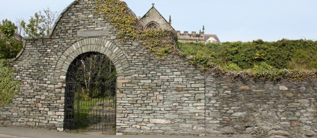
Rather unexpectedly I find myself wandering through a graveyard. The ruins of the Roman Fort have been built over by a church. I love old church yards and spend some time reading the gravestones. A number of sailors are buried here, but I’m relieved to see that most of these sailors died at a good old age.
I return to the road and find a bridge that crosses over the inner harbour. There are no coast path marker signs, but I can’t resist the bridge. It’s a rather ambitious construction of curving steel.
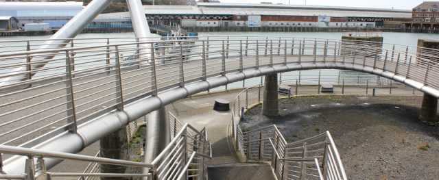
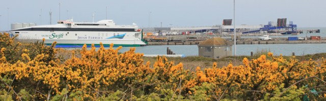
It takes me over the harbour and straight into the railway station / ferry terminal. I walk out the other side, leaving Holyhead via a road that ends in a carpark for ferry users.
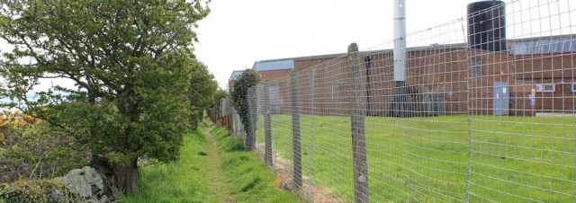
I’m pleased to spot a coast path sign. It leads off the road and up a hill. Not very pleasant. Tall wall on one side, wasteland on the other, rubbish blowing about.

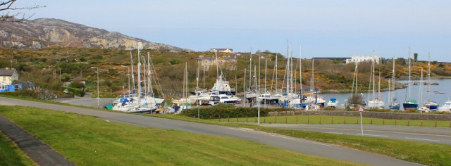
At least at the top I get a good view across the harbour. There’s the street I’ve just walked along – the one with the pretty pastel-coloured houses.

I think I was spoilt by the beautiful walk I did yesterday. This section of my walk is far from scenic. It’s a sort of alley way, with industrial buildings and tall fences hemming me in.
Every so often I get a view over to the ferry port. Why can’t I walk closer to the water?
Increasing litter and doggy poo on the path are signals that I must be approaching a residential area and, sure enough, the path soon deposits me on a wide playing field rimmed by some weirdly painted houses.
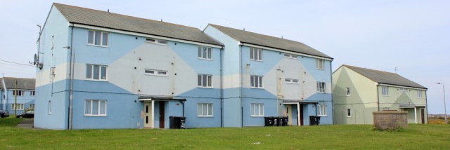
The doors seem to open directly onto the field and there is no division between common land and front gardens. I have to watch my feet. Dog poo everywhere. And beer cans. Yuck. [Later I discover this is Morawelon, one of the most deprived areas in Wales.]
At the end of the playing field, I see a coastal footpath sign and realise I could have avoided crossing this unpleasant field and walked closer to the shore. Ah well. Too late now.
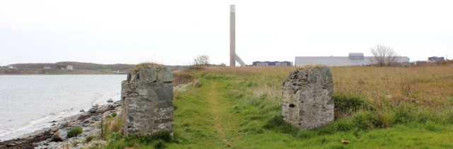
Onwards. My path passes between two demolished pillars. Ahead is a giant chimney. Knowing there is a hospital close by, I assume the chimney belongs to a crematorium.
Yesterday was such a wonderful day. Brilliant sunshine. Little wind. Gorgeous scenery. Today, in comparison is a disappointment. The wind has picked up again and tugs at my hair and clothes. The sky is dull and the sun, when it does appear, is shining in my eyes. The scenery, so far, has been lacking in beauty. But things are about to get better.
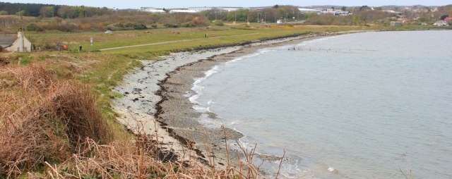
I come to a little beach – Penrhos Beach or Traeth Penrhos. Nearby are a couple of car parks, and this means there are people strolling about.
I pass a couple with a toddler. Overcome with excitement, he charges ahead of his parents and falls, skinning his hands on the gravel path. As he wails in pain, his mother reprimands him. ‘I told you not to run,’ she says. Telling a toddler not to run is a bit like telling a fish not to swim, I think.
Beyond the beach is a headland with the remains of an old battery. The wall appears to have been rebuilt, but the curving shape with its regular gaps is rather attractive.

Further along and I come to another ruined building with a large arched entrance facing the shore. There is a good view of Holyhead Mountain and several ferries are manoeuvring to get into Holyhead harbour.

Beyond this is another beach. It’s prettier than the first one and absolutely deserted, until a couple of greyhounds arrive. They run madly up and down the sand – moving too fast for a decent photo – and reminding me of the toddler in their excitement. Strangely, this pretty beach has no name on my map.
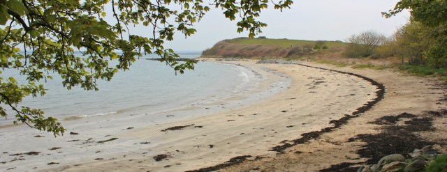
I walk to the point at the end of the beach and sit on a rock for a rest and a snack. There is a wonderful open view across the foreshore – an untidy mess of rocks and pools and seaweed. The land I can see on the other side of the water is the northwest coast of Anglesey.

It’s time to get moving. Today I’m leaving Holy Island and soon I will be walking along that far shoreline.
I climb up from the beach to the top of the headland (Gorsedd-y-penrhyn) where there is a rather ugly stone seat. It’s a viewpoint, according to my map, but I fail to be impressed. I remember the South Stack cliffs yesterday, and the wild slopes leading down to North Stack. Those were viewpoints.
Perhaps it would be better if the light wasn’t as dull and air was clearer? It’s so dull in the east it’s hardly worth taking a photograph. To the west I can just make out Holyhead Mountain, although I have to admit the beach below is very attractive.

I walk down the eastern side of the headland and the path enters an area of shady woods. It makes a nice change to be walking among trees. Here’s an interesting thing – a specially constructed bench with a sign saying ‘TUNNICLIFFE’S SEAT’.

Who or what is Tunnicliffe? No other information is given.
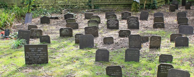
A little further and I come across another graveyard. The headstones are tiny and closely set together. Oh no. A children’s cemetery? How unbearably sad. Then I read one of the inscriptions – ‘Tiggy Puss’ – and the penny drops. Not children, after all. It’s a pet cemetery. Still sad, but not as tragic.
The path now runs close to the shore. I meet people out strolling with dogs and pushchairs. Ahead is a car park.

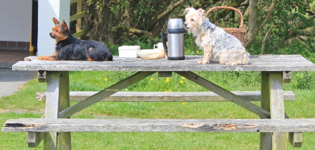
There are picnic benches and a van selling food. One old guy has brought his own lunch, which he is sharing with his two tiny little dogs. They’re very well behaved, even if they are sitting ON the table.
An information sign tells me this is Penrhos Coastal Park and the land has been given over for recreational use by the nearby aluminium plant. Ah! That explains the tall chimney. It’s not a crematorium after all.
Then I spot a proper walker – a young woman with a huge rucksack.
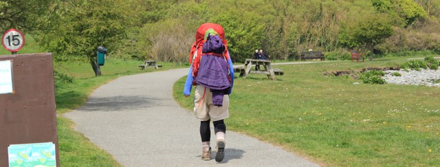
I’ve hardy walked any distance this morning but the sight of that rucksack makes me feel fatigued! So I decide to stop at a little café at the entrance to the park. It’s tiny. Used to be a toll house.
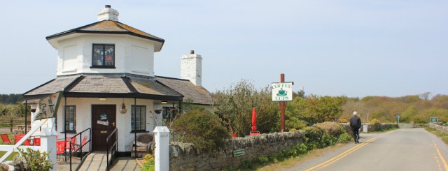
There is only one small room with tables inside, as far as I can see, but the owner suggests I could sit in one of a number of summer houses in the garden. I shiver and opt to stay inside. Can I have a cup of tea and a cream scone for lunch? Why not.
I sip my tea and ponder why I’m making such slow progress. It’s been a weird morning full of misconceptions so far:
- a roman fort that turned out to be a graveyard,
- a children’s cemetery that turned out to be a pet burial ground,
- and a crematorium chimney that turned out to be an aluminium works.
[to be continued…]


My opinion is that a huge rucksack suggests an inexperienced backpacker- there is just no need for it for normal backpacking in this country. Now that I have kicked out cooking equipment my backpacking rucksack weighs under 20 lbs. Admittedly it does cost to buy good lightweight gear, but carrying more than 20 lbs becomes a burden. We all learn by experience. I know my rucksack alone weighed very heavy even when empty when I walked the Pennine Way in 1980, and I must have been carrying over 30lbs in total.
I admire your back-packing expeditions, Conrad, Currently following your progress along the SWCP 🙂
The old stone building with the archway is an old boat house – if you’d gone down onto the shingle you would have seen the remains of the old slipway at the side. The stone seat on top of the headland is known as Arthur’s Seat – and I agree, it’s ugly. The food van in the car park – Pete’s Burger Bar – does brilliant food and decent coffee, all freshly cooked and at very reasonable prices. For anyone who likes cheeseburgers I can highly recommend getting one from there, they are the best!
Hi Eunice. Pete’s Burger Bar did look very enticing. Wish I’d had a cheeseburger now, instead of those scones!
It may not have been as scenic but it was certainly an interesting walk with lots of mysteries, most of which you solved.
I suppose you need to see some of the less-scenic aspects of ‘real life’ on Anglesey to properly appreciate the beautiful parts.
Indeed. The rough with the smooth.
I thought the name Tunnicliffe rang a bell so I had a quick “google”. Charles Tunnicliffe was a wildlife artist who lived on Anglesey.
Ah. Thank you. Mystery solves!
I never understand why being a deprived area is a reason to leave dog poop everywhere – surely it is as unpleasant for the people that live there (including the dog owners) as it is for anyone passing through.
The pet cemetery is sad.
Reading of your feeling of connection to sailors lost at sea I wonder if you have read Marie’s (I walk alone blog) recent walks to find the houses of sailors from the Titanic. Very interesting and moving to read their stories. So few survived the disaster.