
Today my walk gets off to a bad start and comes to a bad end. But the middle section is wonderful. Anyway, let’s start at the beginning.
I park in Banks Road and set off, passing a large granite boulder sat on the verge, which has a metal plaque set into the stone. Intrigued, I pause to read the inscription.
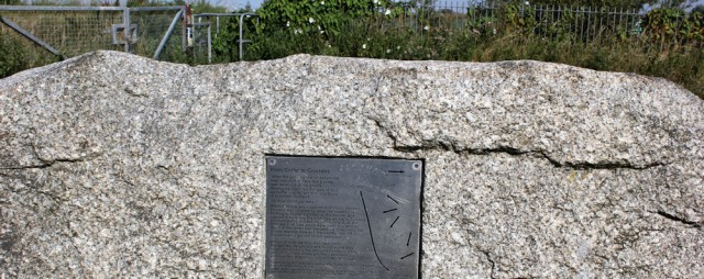
The boulder consists of Criffel granite, which is only found in the Dumfries area of Scotland. So how did it get to Southport? Apparently the rock was carried by a glacier and left, stranded, here when the ice melted 12,000 years ago. This type of boulder is called an ‘erratic’ and is useful in tracking how glaciers once moved across the landscape.
(This is what I love about coastal walking. You learn all sorts of things. Now I know about ‘erratics’ – and I’m amazed by how nothing on our earth is truly static. Even giant rocks travel around, whether riding on tectonic plates or pushed up by volcanoes, shoved around by the tides or carried – like this one – as passengers inside the icy grip of glaciers.)
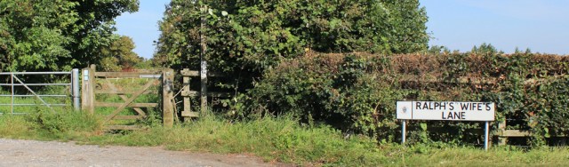
Onwards. Banks Road turns into Ralph’s Wife’s Lane. I’m please to find a road named after a woman, but the feminist side of me is irked. Why ‘Ralph’s wife’? Hasn’t she got a name of her own?
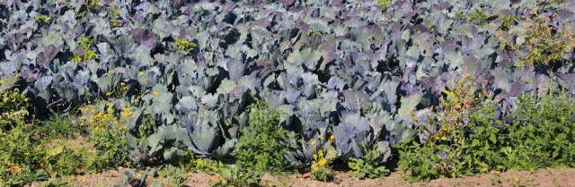
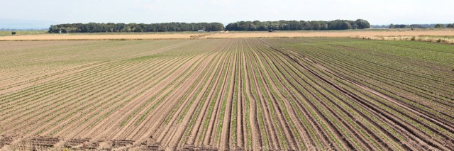
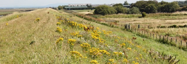
I find the footpath leading off to the left, and walk past fields of cabbages – or, maybe, cauliflowers. I love the colour combination: purple-grey foliage against the green and yellow weeds.
I’m expecting the path to bend round to my left and hit the bank, but instead it veers round to the right, and the direct route to the bank (straight ahead) is barred by a keep out sign. Oh! Not what I expected.
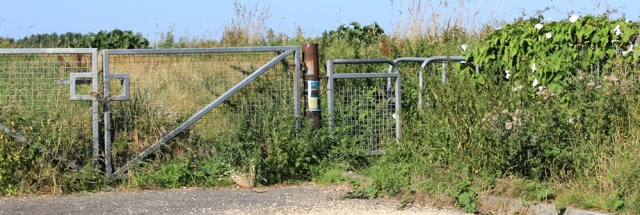
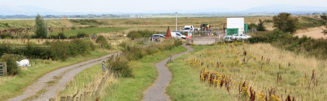
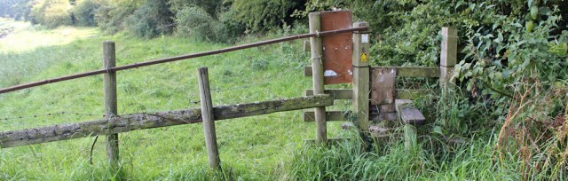
I check my map. I’ve missed the footpath to the bank. Now I must retrace my steps. Eventually I find the right path, directly behind the ‘erratic’ boulder, and with its entrance gate overgrown by weeds.
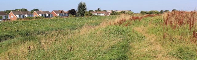
Now I’m walking down the other side of the inlet where I ended my walk yesterday. Suburban houses peek over the wall from across the ditch.
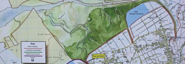
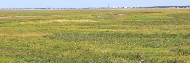
A sign welcomes me to the Ribble Estuary National Nature Reserve and, helpfully, provides a map. I’m relieved to see there is a definite footpath along the marsh wall, but rather concerned to see it apparently ends at the village of Hesketh Bank. My OS map shows the path continuing further down, to Tarleton Lock.
This is the first intimation that the day isn’t going to end as planned. But, for now I have some wonderful walking to enjoy.
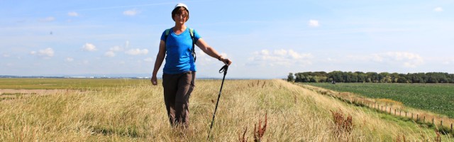
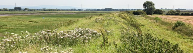
The flat landscape, with the raised bank, reminds me of the Essex coast where, against my expectations, I strolled for miles along endless sea walls in splendid isolation.
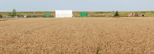
Inland the fields are flat and of industrial proportions.
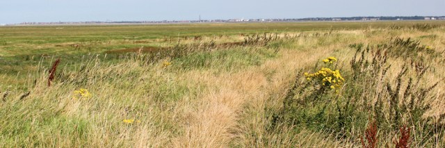
Out, across the marsh, are wild flowers, grasses, and then the mouth of the Ribble Estuary. That must be Blackpool in the distance – I can just see the tower – although the nearest houses are probably in Lytham St Annes.
The weather is pleasant, warm with just the right amount of cooling breeze, and the walking might be somewhat monotonous but luckily, living in Lincolnshire, I’m used to these sorts of walks. I use a gatepost to take a self-portrait.
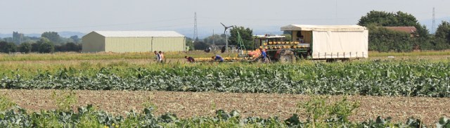
I pass a group of workers in the fields below. They are cutting something – cauliflowers? – and then loading them onto a conveyor rack, which takes the produce into the trailer. The tractor moves slowly across the field. The men work with methodical thoroughness.
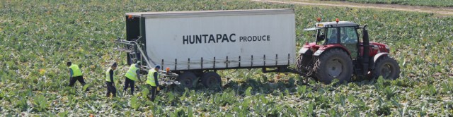
When I started as a young doctor, such workers would be local people, rounded up for seasonal work by gangmasters, who would arrive in the fen villages with their minivans to collect people – often women – and drive them out to work in the fields. One local gangmaster even had a sign on his van of a man with a whip. Despite this ominous logo, the women told me they enjoyed escaping from the house and spending summer days mucking about in the fields with their friends, even though they were only paid very small amounts of money.
Nowadays, all gangmasters must be registered and must pay their workers the minimum wage. Eastern Europeans have replaced local workers. I’m sure they earn slightly more than the fen housewives, but probably work considerably harder.
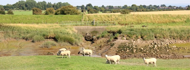
Onwards. After two miles of empty bank, there’s a farm ahead.
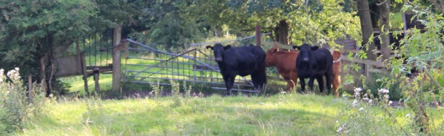
Now the lush marsh plants are replaced by trampled earth and grass. It’s a cattle farm. Some of the beasts – particularly the white loner (on the right of the photo below) – take a worrying interest in my progress. I’m glad of a protective fence.
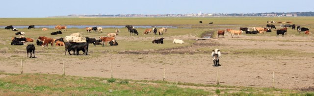
Another mile passes, and another farm, and then a little further – and I come to a locked gate. Locked?! Too late, I realise I should have turned inland a short time ago and I’m no longer on a public footpath.
But following the proper footpath would add an extra couple of miles to the walk. It leads down to a road about a mile away and then, literally, does a U-turn and arrives back on the bank a few hundred feet further along from where I’m standing now.
Over the gate I can see people standing on the bank ahead. They seem tantalisingly close. Why should I bother with the diversion? Although, rather worryingly, my map shows a ditch in the way – unromantically called the Hundred End Gutter – I’m hoping it might be empty, or shallow enough to wade across.
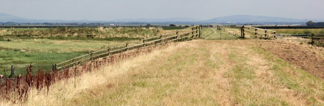
I climb over the locked gate, pass through two more (unlocked) gates, and find the bank continues straight over the Hundred End Gutter without a break. So I arrive safely back on the public footpath section of the bank without even getting my feet muddy.
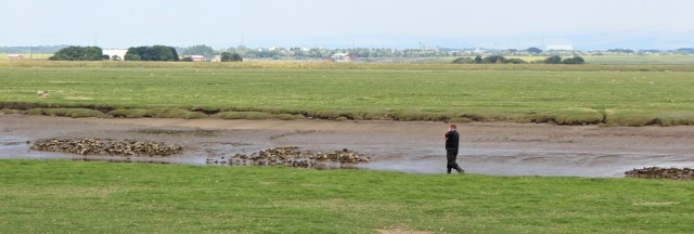
The people in the distance turn out to be bird watchers. Well, the man is a bird watcher. His wife has stormed off in a disgust at being targeted by biting insects. (You can see her disappearing into the distance in the photo below.)
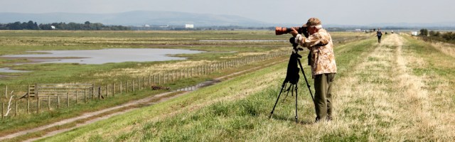
The bird watcher tells me there is redshank and greenshank out on the marshes. I nod wisely (I know next to nothing about birds) and pull out my binoculars – tiny compared to his apparatus. I think I spot a few red legs among the many waders. There are also whole families of egrets to look at too, one of the few birds I can actually recognise.
I sit on the bank and have a picnic lunch. The bird watcher packs up and, later, I find him and his wife sitting on a picnic bench in the little car park.
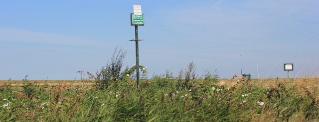
Here, at the car park, my walk along the bank comes to an end. The footpath is diverted inland, while they do some construction work on the bank. I see lorries and vans and machinery. And plenty of ‘No Entry’ signs. But no sign of any actual work going on.
I follow the lane towards a farm building (Hesketh Lodge on my map) and then follow diversion signs down another lane – which becomes narrower and narrower and progressively more overgrown.
Across the fields I can see the elusive bank, and the vans and machinery. Wonder what they’re doing and why they had to divert the footpath?
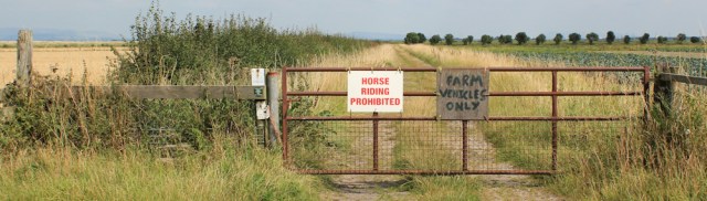
I cross over another road. My track continues, but I’m put off by the various signs. ‘HORSE RIDING PROHIBITED’ and ‘FARM VEHICLES ONLY’. Takes me a while to work out the footpath really does run down here too.
As I walk through the fields I see another gang of agricultural workers. These have loud music blaring. Jolly tunes. Foreign. I recognise French words, but not the tune. Then comes something in an unrecognisable tongue. Definitely eastern European.
At the end of the track I’m back on the raised bank. Another sign, just before the bank, tells me ‘NO PARKING’ while the land beyond the bank has ‘NO ACCESS’ signs – all written in the same handwriting by a very bossy landowner who clearly doesn’t like visitors on his land!
I walk in a southerly direction along the bank. The River Ribble is behind me. To my left is another river now, with two alternative names according to my map: the River Asland or the River Douglas. You choose.
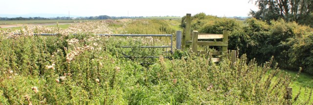
Some sections are very overgrown. I fight through nettles and thistles to reach this stile. Obviously the footpath isn’t well used…
… and so I’m surprised to see a couple of other walkers. The first one is walking close to the river and seems glued to his mobile phone.
Later I find his van parked further along the bank and a logo on the side – something to do with the drainage system. He’s working not wandering.
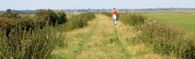
The second walker I meet is an elderly gentleman, stripped naked to the waist, and striding along at a fast pace. He’s obviously combining keeping fit with getting a suntan.
Other than these two gentleman, the bank is deserted. Except for the sheep. No cows here, thank goodness.
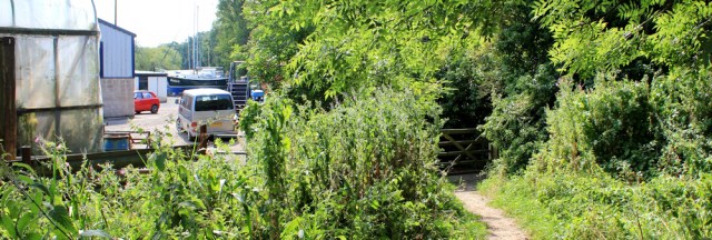
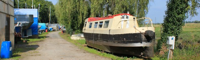
The path winds around, following the course of the river, until I reach a boatyard.
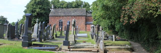
I’m not sure where the footpath goes next, so I follow some wooden steps upwards and – rather unexpectedly – find myself in a graveyard! By this time it’s 3pm and I’m hot, so I take advantage of a shady tree and a bench – time for a rest and a snack.
After the break, I wander around looking for the continuation of the footpath. A promising road ends up in a private estate. ‘PRIVATE ROAD. RESIDENTS ONLY.’
I go back to the boatyard and start walking along the track that follows the course of the river. There’s no obvious sign this is a public right-of-way, but plenty of notices telling me to stick to the footpath, from which I must infer there is a footpath along here.
Beyond the boatyard the continuing path is very overgrown and the bank has crumbled away in places. There is another signboard fixed to a stile – except the sign itself has disappeared. I wonder what it said?
Onwards, walking along rough grass below a bank of trees, I enjoy this section of the walk, until… until I meet my nemesis. Cattle. Bullocks, I think. They’re guarding the way ahead and take a great deal of interest in my progress towards them.
I stop. Turning up the slope – and scrambling on hands and knees through nettles – I try to find a way around the obstruction. But, after considerable effort, I simply end up slightly higher up the slope, with the cattle still barring my way. Perhaps if I walked towards them waving my stick they would scatter? But I can’t even see a stile or gate in the fence beyond them, just a series of makeshift barricades which seem to be held in place with rusty chains and nylon ropes.
Maybe the footpath is closed? Maybe that’s what the missing sign said?
One of the bullocks starts coming towards me. Head down. Threatening.
I disappear back into the bushes and clamber down to rejoin the path further along and further away. Then I tour the edges of the field – an irregular patch of land – part grass and part marsh. My map shows several little roads that come to dead-ends just short of the river. Perhaps I can find my way over a fence or gate and onto one of them? But I can’t find a way out.
Defeated, I head back through the boatyard and rejoin the road by the graveyard. Next I follow a quiet lane into the village of Hesketh Bank and then an endless road that runs through the village, down into the neighbouring village of Tarleton, where I plan to catch the bus back to my car.
It’s a dispiriting end to a great day of walking. And the bus seems very expensive. £5.00 for a ticket! It’s the most I’ve ever paid for a local bus journey.
This walk = 13 miles
Total distance = 2,662 miles
Route:


Rural walking can be frustrating!
Indeed. Vanishing footpaths and intimidating cattle are all-too frequent.
Hi Ruth, I think the fare depends on the bus number and route. I paid the same (£5) going from Tarleton to Southport, but my fare was cheaper coming back from Preston to Tarleton on a different bus number. Well done for nipping over those gates to get 100m further along the seawall
Hi Alan. Yes. And I got the impression the routes were zoned (a bit like the London underground) so more expensive if you travelled over into another zone. The cheapest way to travel is to buy tickets in advance for a day, or a week, or whatever. But if you just want a one-way single ticket, they work out quite expensive.
Hi Ruth, yes indeed, the Mersey Travel region is broken up into Areas, which in turn are broken up into Zones. Tarleton,however, is not within the Mersey Travel region and you like myself were catching a bus with a start point outside (Preston) of this region.
That hasn’t improved then. When I got to that bit where you had the cattle I too found those gates. I climbed over them, but not long after there was huge amounts of slurry all over the river bank and what I took to be the path. There was no way through without sinking (at least) ankle deep in it, so I also had to head back. So perhaps the cows saved you even more wasted time! I wonder if that sign was a closure notice about the footpath? It was not there when I walked here. I did report the problem with that footpath to the Council but I never got a reply and it does not look like they did anything (except perhaps put up a “closed” sign, if that is what the missing sign said).
It is a shame there is no bridge left where the railway used to cross the river, it would save a few miles! I did manage to rejoin the river bank on the path further down and you can actually follow the towpath of a canal from Tarlteton to Canal Bridge on the A59, which saves you walking through the street of Tarleton and is a bit nicer and well maintained. It is not a right of way so not on the map, but you can walk that way. But probably too late for you now.
Now you have to brave the busy A59 and then head into Preston – I did not enjoy the next stretch much.
Hi Jon, and perhaps just as well I was forced to turn back by the cattle. I did wonder if I could rejoin the bank further down, but felt too tired and disheartened to try in case it was another dead end. Useful information for others, though, so thank you for posting.
The next section ended up quite pleasant (just about to write it up). I think there might be a new footpath there, which means you can avoid most of the A59 now.
Oh I hate having to walk through cow fields too and will always try and find another way around them even if it adds miles to the walk. My heart was in my mouth when you described the cattle approaching you, I would have been terrified!
I used to think I was a coward, Gillian, but now find most other walkers share our fear. (I’ve written a page on killer cattle here: https://coastalwalker.co.uk/killer-cattle/)
Hi Ruth
Am still following your posts and enjoying them all very much. It’s getting even more interesting now you are heading further north as it’s not an area I know at all. Good luck with the book which I am looking forward to reading.
Am still walking my trails in the summer months, although on a much smaller scale to you of course!
I am interested in the discussion about the cows, they terrify me as well and I would do the same as Gillian and do anything to avoid them. It is something that needs to be taken more seriously, as public footpaths should surely be safe areas to walk as regards any livestock in the vicinity.
Keep safe Ruth and keep inspiring us to with your stories!
Hi Debbie. Hope you’ve had a good summer of walking.
I certainly think cows with calves should be banned from public footpaths. But I have had nasty experiences with bullocks and heifers too, so that wouldn’t be the complete answer.
My book is now on sale on Amazon, if you’re interested. But in a couple of weeks, I should have a couple of signed copies up on Amazon too, under the ‘more buying choices’ option, where I will be listed as a seller.
Best wishes, Ruth
I too have a fear of cows Ruth, I feel sick when I have to cross a cow field, and why do the always congregate around the exit or entrance to the field ?? 🐂🐄🐮🐃😁
I’ve yet to meet a serious walker who actually likes cows. And, you’re right, they always hang around near the stiles or the gates. I think they smell our fear!
I came up this way last summer. Then there was definitely a sign on the Douglas, shortly after Hesketh Bank, that said ‘path closed owing to erosion’ or somesuch. I then managed to scramble up a rough field – now cows then – and reach as little gate, very well tied up with string leaving into on the cul-de-sacs off Hesketh Lane. I managed to untie most of this but the final knots, in orange binder twine, defeated me, till i lost patience and used the house keys as a hacksaw to cut through it. After Tarleton I found I could escape to the canal, as one of your other correspondents has pointed out.
The real joke is that the comedians at Lancashire Council ran a competition to design a bridge over the Douglas here, even though they had no money to build the grandiose winner. http://dkfsblog.blogspot.co.uk/2008/09/river-douglas-bridge-1st-prize.html. If the time and effort put into this had gone into a simple wooden footbridge the entire problem would be solved.
Ah, so the path *was* closed. Shame. And you’re right – all they need is a simple wooden bridge!
Apols for typos! Didn’t proof-read closely enough D
All those annoying signs! How frustrating, especially the having to turn back. I hate when that happens. I also hate running into cows or bulls.
Defeated by cows 😦 Always frustrating.
I would always be defeated by cows!
Actually you were lucky you did have to divert off the path next to the River Douglas. I walked that route yesterday and ended up knee-deep in cow slurry just after the point that you diverted off!!! – described in my blog. 🙂
https://5000milewalk.wordpress.com/
Yes, it seems I was lucky to escape without sinking knee-deep into slurry! Great blog, by the way 😄
I shared every up and down along the way with you! Very entertaining. Boo to the obstacles that you encountered!
Hi Donna. Yes, there were lots of obstacles on this particular walk!