
Today I face a long trek – much longer than my usual walking distance – in order to get from Arnside to Grange-over-Sands. If you could walk over the railway viaduct, this walk would only be about 4 miles long. But you can’t.
I start from the railway station in Arnside. It’s a windy day, with dark clouds chasing across blue skies, and the trees are just beginning to turn golden with their autumn colours. It’s perfect weather for some dramatic photography.
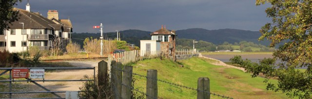
I was anticipating a stretch of road trudging, but found a walking blog that described a route along the river. The trick is to cross over the railway at the station, and from there you can follow a permissive path along the marsh bank.
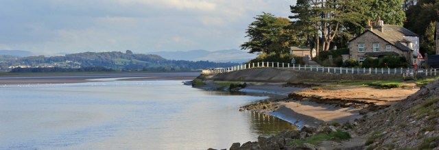
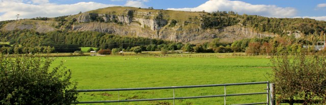
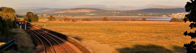
The bank loops around in a shallow semicircle. After a mile, I could look back at Arnside and see the viaduct across to Grange-over-Sands. So near… and yet so far away! It’s going to take me all day to get there.
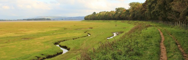
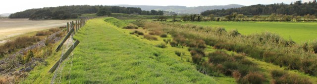
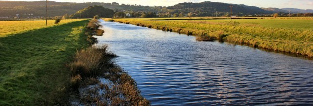
Onwards. I follow the bank. The tide is going out, but at the moment there is plenty of water in the River Kent.
I reach the beginning of Sandside and run out of bank. It’s time to join the road.
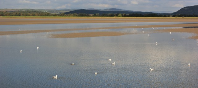
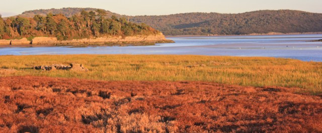
The views are lovely, and the river is full of sea birds of various sorts. Gulls. Egrets. Waders. Various sorts. (I’m still hopeless at identifying birds.)
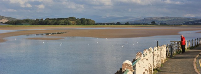
As usual, I take far too many photographs. The constantly changing light creates a series of constantly changing vistas. I’m so glad I have a decent lens on my camera again. And I’ve got another addition to my photography kit – a polarising filter. I think it makes for better shots across the water.
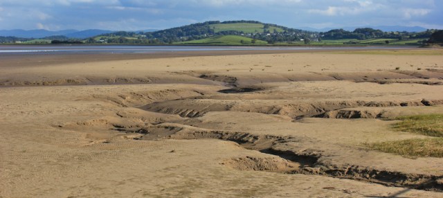
Farther along and the water has retreated away from the bank, leaving exposed mud. I love the patterns the water has carved.
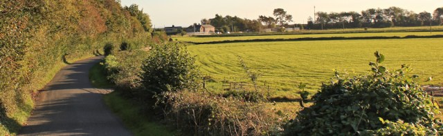
I run out of pavement and have an unpleasant mile of road walking. (I could have turned inland, where a quieter road runs parallel with this one, but I missed the turn off.)
Opposite a new industrial estate the road rises, and a footpath leads off to the left. Thank goodness! I can leave the traffic and walk along a very pleasant route, down through trees and then close to the shore. Here I meet a couple out walking with their dog. (They turn out to be the only other walkers I meet all day.)
The river bank is interrupted by a tributary, the River Bela, and the route turns to run along its bank. I pass a frothing weir…
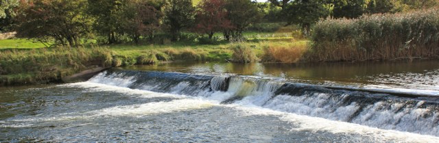
… and then reach the Milnthorpe Bridge to cross over the River Bela, from there I turn off along a minor road on the other side to rejoin the River Kent.
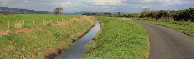
This is Marsh Road. Aptly named. And, although I can’t actually see the River Kent over the high bank, it makes pleasant walking.
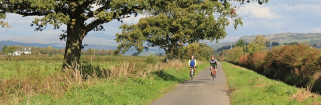
I meet a few cyclists.
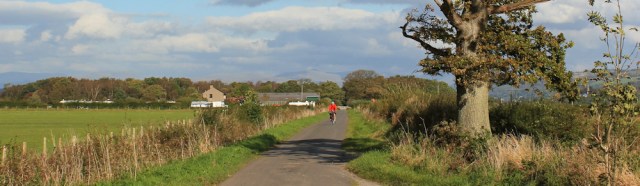
And a few more.
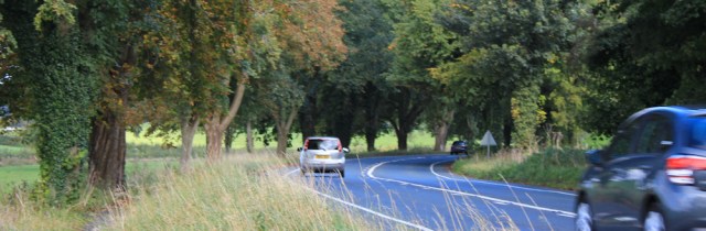
And, after three miles or so, arrive back on a major road – the busy A6. It’s not so pleasant, but at least there is a separate footpath for walkers.
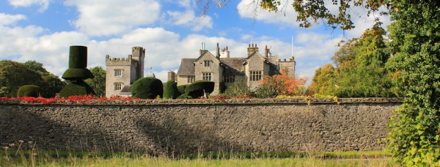
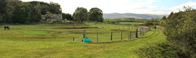
I pass Levens Hall on the left. Great topiary. The grounds are open and I’m tempted to pop in for a cup of tea… but decide to carry on. It’s almost lunch time.
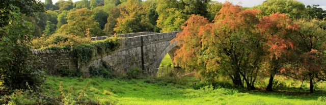
Just beyond Levens Hall is Levens Bridge. This bridge, finally, takes me across the River Kent. It’s the apex of the walk. Hooray!
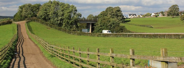
A slip road from the A6 branches off to meet the A590. There is no pavement, so instead I follow a narrow and very overgrown footpath that runs parallel with the road. The path is unpleasantly sandwiched between a hedge and a fence.
After a short stretch of road walking, I turn off down a quiet country lane. There are two possible routes. Strictly speaking (keeping closest to the water) I should follow the lane as it continues down to a tiny place called High Sampool. But after that the route is interrupted by yet another river (the River Gilpin) and so I would have to take a bridleway to double back up to the road and the nearest bridge crossing.
Instead of this tortuous route, I choose to follow another bridleway. This one is going to take me up and over the A590, to the village of Levens.
The pub in Levens looks very tempting, but I’ve promised myself to keep going to the next pub. So, onwards, and now I’m heading to a village that has a confusion of possible names on my map. Gilpin House. Or Sampool Bridge. Or Gilpin Bridge.
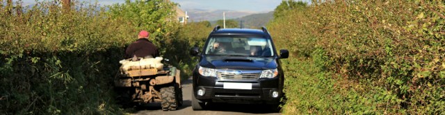
The road is narrow, and I only meet the occasional tractor or 4×4. And, of course, bicycles. This is part of National Route 70, a long-distance coast-to-coast cycle way.
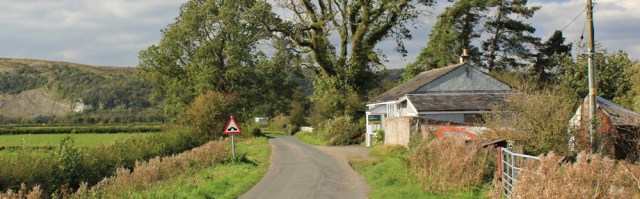
The approach to Gilpin/Sampool Bridge is lined by car dealerships. And car scrap yards. But the village itself is quite pretty and, most importantly, it has a pub. Lunch time!
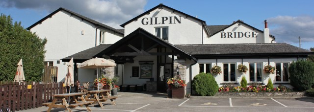
I have my standard pub lunch, lasagna and salad. It’s surprising and disappointing to discover there are so many British pubs that think it’s acceptable to serve undressed salad, which I find pretty inedible. But this salad comes with an excellent dressing. And the lasagna is good too.
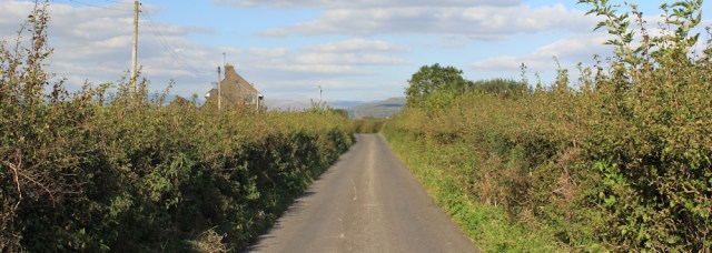
After lunch I cross the A590 and head down a country lane. It’s signposted as a dead end. ‘No access to Foulshaw Moss’. Uh-oh, that doesn’t look promising. Now I’m really hoping the footpath on my OS map still exists, and hasn’t disappeared along with the official Cumbria Coastal Way.
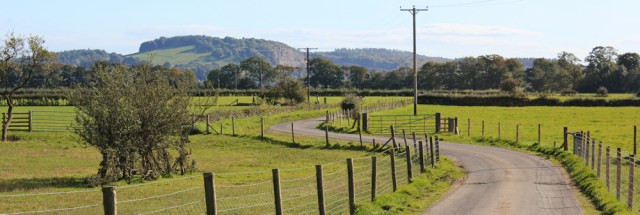
The road is long and straight. After a mile I come to the first buildings on the road. Foulshaw cottages.
To my left are fields. And somewhere nearby is the official nature reserve of Foulshaw Moss. The raised land behind is, I think, Wakebarrow, which is also the Whitbarrow National Nature Reserve.
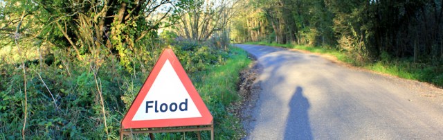
I meet a farmer on a buggy. He stops for a chat. He farms sheep, although most of his flock are currently on the salt marshes at Silverdale. I wonder if I saw them yesterday? He talks of the flooding problem. And reassures me that I’ll be able to find a way through at the bottom of the road, although he’s not sure if it’s a proper public right of way.
We might have stayed chatting for some time, but a 4×4 interrupts our conversation, and my farmer has to zoom off to negotiate a passing space.
Onwards. The road develops a little kink and I come across the second building: High Foulshaw. (You will notice an unfortunate pattern to the names in this area. Everything has to include ‘Foulshaw’!)
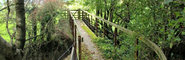
Just beyond High Foulshaw is a footpath, leading off to the left and heading towards the river bank. Yippee! I’m going to be walking beside the water again…
… but my excitement is dashed when I find the river bank is fenced off and, instead, I have to walk along a horribly boggy road. The photo doesn’t demonstrate how every inch of this road is either covered in water or several inches of sticky mud.
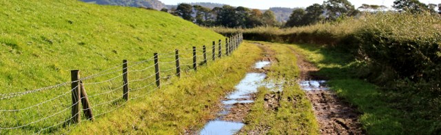
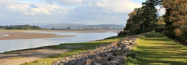
After splashing along for a while, I’m very relieved to hit a section of bank without a fence. Now I can walk along the grassy top. This is much better.
Unfortunately, the sun decides to disappear at this point. In fact, despite a furious wind blowing in from the east, the clouds above are hardly moving. They seem to be stuck in a trough above the river valley.
Rather irritatingly I can see sunlight in the distance. But I remain under a stubborn dark cloud for the next hour or so. There’s sunlight on the Cumbrian hills inland…
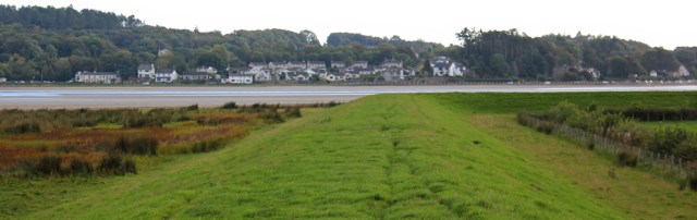
… and sunlight on the slopes above Sandside across the water.
It isn’t until I’ve nearly reached the end of the bank that the sun breaks through.
Ahead is a small area of open access woodland, Crag Wood. If I had the time, I would have liked to explore it. But instead I must hurry on, and so I make my way around the curving bank, past Crag Cottage…
… and then nearly miss the footpath turnoff on the other side. Actually, I think it might be possible to follow the farm tracks through Meathop Marsh as an alternative to the footpath. They’re not marked ‘PRIVATE’. But I don’t want to come to a dead-end, so I stick to the footpath instead.
It crosses a very deep ditch. Main Drain.
And then strikes off across fields of… not sheep… but goats. Unfortunately they are too far away (the goats) for decent photographs.
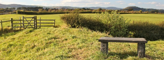
I walk along a raised bank and, close to a farm at a place called Ulpha, discover a memorial bench. It’s a perfect spot to sit and enjoy a snack and a drink.
At this point, I’ve reached the limit of my comfortable walking distance. So the next few miles are quite difficult. And I’m heading west, so the sun is in my eyes.
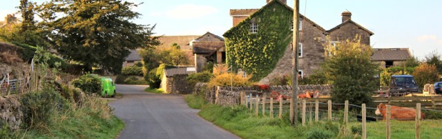
I join a quiet lane and follow it uphill and into the village of Meathop. (Do you pronounce it Meath-op or Meat-hop? I don’t know.)
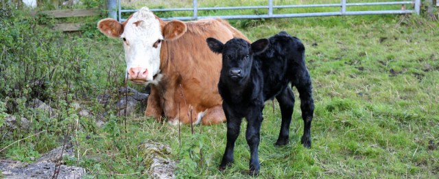
Just outside the village I spot this tiny, beautiful, new-born calf. It totters unsteadily. Mother looks on warily and gives me a warning grunt, but doesn’t get up.
Meathop is a pretty place but has a dead feel to it. A commuter village, not a real one. Many of the houses seem to be new developments, converted barns maybe, although sympathetically done. There is no pub, no shop, no school.
I follow the road towards Low Meathop. It plunges down through woods, and I notice much of the woodland is for sale. How wonderful to own a wood!
As I reach Low Meathop, I meet a car. They stop and ask me directions. Luckily I can remember the names of some of the houses I’ve passed, so I can tell them they’re heading the right way.
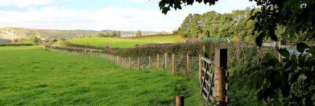
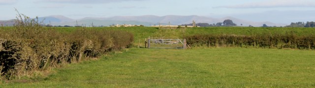
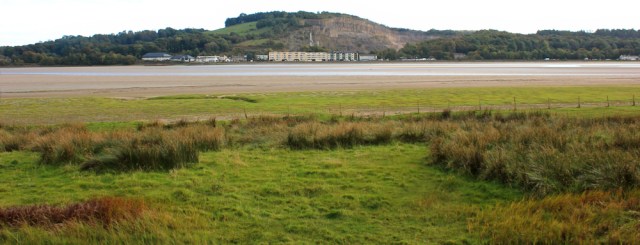
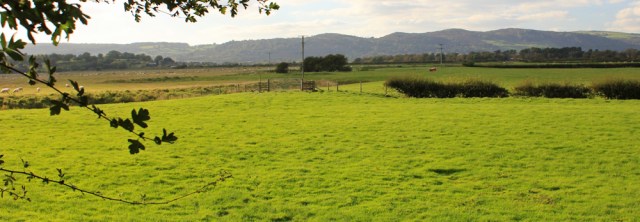
The road flattens out. To my left is a steep and rocky slope. To my right is Low Meathop Marsh.
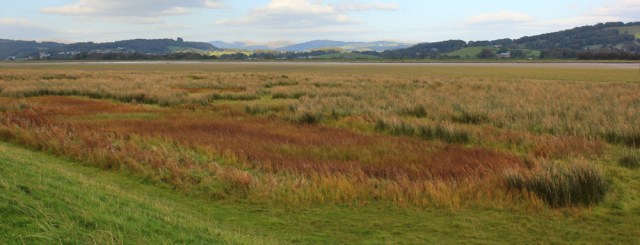
The scenery today has been an odd mix of fen-like marshes and drains, and glorious Cumbrian hills. Lincolnshire on steroids!
Now there is one last river to cross. The River Winster. Although it looks more like a drain, or a canal, than a natural river to me.
The road here bears evidence of recent floods. Sump holes have been dug in places. And there are still warning triangles along the verges.
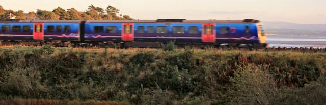
The sun is low and glaring in my eyes. I can barely see a thing in front of me, but I hear the rumble of the train, and manage to catch a blurry shot as it shoots past. It’s just come from Arnside too, but its journey has been much shorter than mine!
This last stretch of road walking is really hard. I’m tired and my feet ache and I’m glad to reach the point where the promenade begins. It runs along the entire shore of Grange-over-Sands.
First I must climb over one last bridge – over the railway. There’s Arnside in the distance.
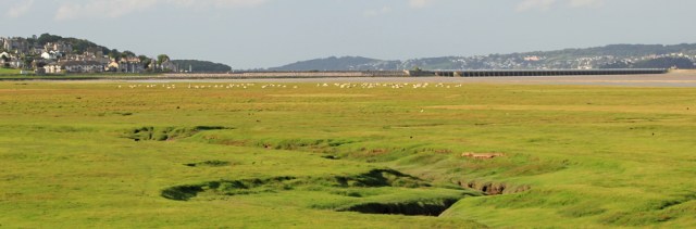
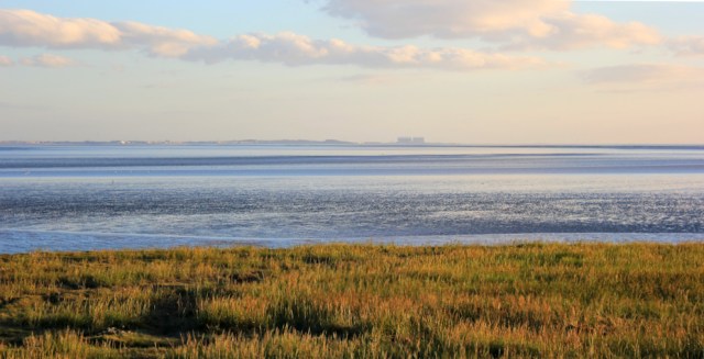
Grange-over-Sands might once have been a seaside resort, but now it sits beside a marsh. The sun is low and the colours across the grasses are wonderful. Almost unreal.
The promenade is well kept and has flowering borders. But I’m more interested in the view out across Morecambe Bay. There’s Heysham Power Station! Time for one last photo in the fading light.
I’m staying in an excellent B&B in Grange. But I stop off for fish and chips first. It seems a long time since lunch.
Walked today = 17 miles
Total distance around coast = 2,794 miles
Route:


I love the colours in these pictures, the scenery is certainly upping its game as you go into Cumbria. 17 miles – ouch! Very impressed.
And there was an additional mile in the morning to the railway station. So 18 miles that day in all. Tough! And the colours were sensational. Thank goodness my camera was working perfectly with its new lens 😀
You certainly captured the skies beautifully – whether that was the new lens or your own skill! Re comment below, I have also been wondering how you will get on in Scotland where settlements become very sparse and public transport disappears. See, you have got us all worrying about you!
As ever, Ruth, thanks for the lovely pictures. and the lovely prose.
However, after all these years of following your blog, I finally have to disagree with you…. in my rambling life, I’m always disappointed to discover how many British pubs think it’s acceptable to serve “pre-dressed” salad. After all, you can add as much dressing asyou wish to an undressed salad, but the reverse is a bit more difficult….
Final point: you’re in Cumbria now. Any advance worries/thoughts about coping with the long coastal indentations of the Highlands?
Good point about the salad dressing, Colin. I guess what I long for is a proper vinaigrette dressing – oil and vinegar + herbs, in the French style. Usually if I ask for dressing I get offered salad cream. Yuck.
I’m trying not to think about Scotland yet. I’ve had advice that part of the coastline is too rough to attempt on foot, so might have to compromise and stick to roads in some places. I have a plan that involves my husband and a campervan… but I’m trying to introduce that idea gently to him 😀
tell him it’s a second honeymoon- a month in bonny Scotland, campervan with a bike strapped on the back. During May would be nice, so he’s got time to plan!
Well done Ruth, 18 miles, blimey.
I’m pleased to report he’s got quite excited about the campervan idea. Been researching them online. 😀
What a glorious walk and the pictures are stunning in the autumn light. Thank goodness you didn’t have to retrace any paths – 17 miles is a long way.
Hi Jacquie. Yes. It’s always a worry when you’re pushing yourself to your limit, because you really can’t afford any ‘wasted’ walking if you have to turn back. Luckily it all went well.
Wow. All in one go – impressive! Getting across the Leven estuary will be a doddle by comparison 😉
There were no convenient buses, Mike. I’m hoping for a few shorter walks from now on.
It is very tempting to try to walk across that railway bridgd, isn’t it? I didn’t if course and I heard that the signalman in the box at Arnside has to keep a look out for people that try it. it is a long walk this one, I agree. Looks like you had a lovely day for it and I particularly like the sunset ones at Grange over Sands. Though as I said begore, Grange over Marsh would be more appropriate now. it is a nice town, though. The railway often seems to have tge best river crossings in Cumbria compared with the roads. I must admit to being tempted to cheat here and take the train across rather than walk around but I did walk around and followed more or less the same route as you.
Very tempting, Jon. But dangerous too, I would imagine (not sure how much space there is on that bridge), and lots of trains use that crossing: fast and slow passenger trains, and freight trains too. I really liked Grange-over-Sands/Marsh, and one of my favourite places so far.
I did a lot of this route yesterday, Silverside to Heversham (met up with Conrad at Arnside too which was nice 😊). At Sandside where the apartments are I saw someone paddling in the river, so I took my boots and socks off and waded across the river to the footpath the other side! My jeans were too tight to roll up so they got pretty wet, but only up to my knees 😂. Unfortunately my car was still parked at Heversham so I had to come back across again and do a further 3 miles or so to collect it. But it does mean that the next stage I can start from near Ulpha, missing out that nasty bit of the A6 you describe here. Woohoo, well worth a bit of a soaking!
I think I might try wading across rivers more often, it could save miles 🙄
How lovely to meet Conrad. I had a lovely evening with him when I passed through – but in those days we could go to the pub for a meal! Well done for wading across the river. Saved you many miles, and you avoided that horrible road too.
Yeah he said that you had a nice meal together. Unfortunately I couldn’t even shake hands with him! We walked together a couple of miles through the village and along the permissive path, and had a good old chat which was really nice – the first human I’ve spoken to face to face for a few weeks!
Wow you were very lucky to be able to get across the river there. Probably helped by the fact it hasn’t rained for months so the river will be lower. It’s a tedious walk around via the A6. You’ll soon be at Grange-over-Marsh (as it should be!).
What a shame the sun wasn’t more cooperative. It looks like a wonderful walk with calm cows and calves and pleasant farmers. Anything over fifteen miles feels like proper long distance walking to me. They are the tough miles I think.
Hi Marie. Yes, I totally agree. 15 miles seems the magic limit. After that it all becomes a bit of a slog.
I have taken to reading your account of the walk stage ahead of us attempting it ourselves. It is very useful preparation. We did this walk a couple of weeks ago (although we were able to split it across two days). After passing Foulshaw Cottages a tractor came along the road, the driver opening his door in advance and then turning off his engine before engaging us in conversation. He told us about his sheep, the flooding problem and many other things. He was extremely pleasant and must be the same farmer you came across. Again he only drove off because a vehicle coming the other way needed to get past. Fortunately the track at the end of the road was much drier than when you used it.
Hi Nick. Yes, it must have been the same farmer! I’ve always thought it seems a lonely job, because they’re on their own all day, and the days are very long. He must enjoy coming across the occasional walker. I’m glad the ground was drier for you, and luckily we’ve had some wonderful walking weather recently.
Pingback: 16. Sandside to Grange-Over-Sands – A 5000 mile walk
Hi Ruth, yes, it’s a super walk (accomplished this week), but to advise Cumbria Coastal Way walkers that the drainage ditch crossing behind Crag Cottage on Foulshaw Moss which is designated part of the CCW isn’t easy to locate.
This is due to the very many ‘Private – Keep Out’ notices on farm fences, plus similar notices bolted up around Ulpha pumping station.
Once across there’s not much to go on in the way of a CCW sign either.
So to get there take a bearing on Ulpha Farm ( not the farm houses at Meathop) – keep slightly to the left of Ulpha Farm and you will connect to Cycle Trail 72 which is part of the CCW.
Maybe it’s a farmer conspiracy to confuse walkers or maybe it’s just an oversight!
Pingback: 16. Sandside to Grange-Over-Sands – A 5000 mile walk
I found your page after wondering out loud if it was possible to walk from Arnside to Grange – what a lovely piece you wrote! Thank-you for that 😊