
Today is going to be one of those weird days when I “walk the coast” without being anywhere near the coast. It’s also going to be a longish walk (for me), because I’m determined to reach Scotland before I have to return home this evening.
Yes. Today it’s Gretna Green or bust!
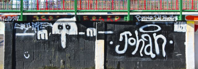
I park my car in Carlisle, near the castle, and set off towards the river. The skatepark is empty at this time in the morning, so I can take plenty of photographs of graffiti without feeling awkward.
I walk through Bitts Park, a pleasant tree-lined area running alongside the river Eden. It’s also the course of Hadrian’s Wall, and I would like to think these large hunks of stone are leftover parts of the Wall.

Ahead is the road bridge where the A6 crosses the Eden. (I could have crossed the Eden slightly earlier, using the new A689 bridge, but public transport logistics make this second crossing the easier one.)

I’m about to leave Hadrian’s Wall Path behind, and feel surprisingly sad. It was good to follow a proper National Trail again. One day – I promise myself – I’ll be back and will walk the whole of Hadrian’s Wall from end to end.
On the other side of the bridge I follow a little footpath that leads downwards, circling around a cricket pitch.

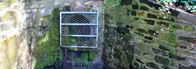
At the bottom of the slope is a grate set in a wall. An old, moss-covered stone tells me this is Hyssop Holme Well. Another, more recent sign, warns me the water is unsuitable for drinking. I must say, it doesn’t look very appealing. More like a drain than a well!
My footpath joins a road and I wall along residential streets, through the Etterby area of Carlisle…

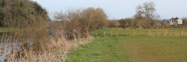
… and very quickly I leave the city behind. Here’s the riverside footpath.
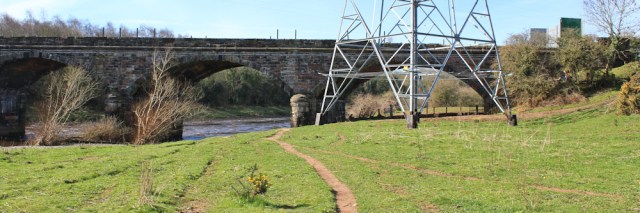
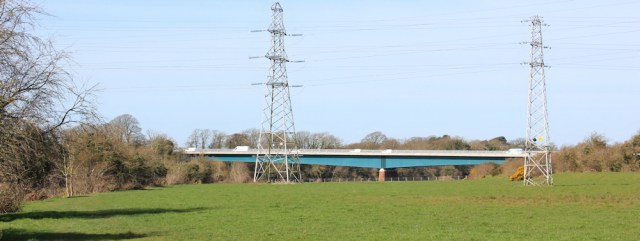
I walk under pylons and under a mysterious bridge. I’ve already passed over the railway bridge, and I know this is not the new A689 bridge. What is it? The ends are blocked by huge barriers (you can see one on the right hand side of the photo below). Maybe an old railway bridge? Or disused roadway?
On the opposite bank, screened by trees, is the Hadrian’s Wall Path I followed yesterday, and I catch a glimpse of the occasional hiker. I meet nobody walking on my side of the bank.
Further along, as expected, I walk under the new A689 bridge.
Here I find a lovely footpath sign, although they don’t give this path a name. I like the illustration on the post. At first I think the men waving swords are marauding Scots. Later, I realise they’re probably Romans (I guess) defending the wall.

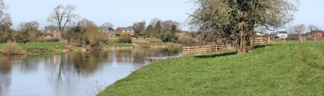
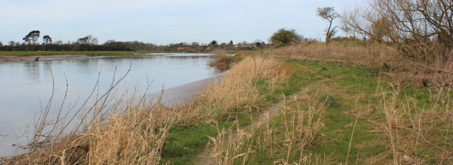
Now the river is peaceful and very quiet. Ahead – and on the opposite bank – is Grinsdale, the village I walked through yesterday. The river loops around it.
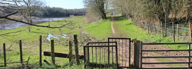
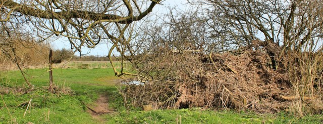
Despite the fact I’m not on a recognised long-distance trail, my footpath is well signed and maintained, with frequent stiles.

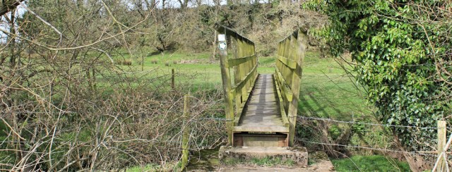
For a while I walk high above the water, before coming down again to cross another little bridge. I’m somewhere near a village called Cargo (weird name). The bridge crosses a tiny tributary, Carhead stream.
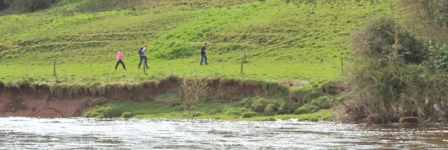
I’m approaching the village of Beaumont on the opposite bank. This is where the original Hadrian’s Wall Path is deviated away from the water, due to landslips. But I can see a group of young people walking along the far bank. They seem to be having no problem.
Perhaps I should have ignored the deviation signs? I sometimes think the local officials are too keen to re-direct walkers away from paths, especially from the National Trails. Anyway, too late now. Onwards.
I pass a man with a springer spaniel. He throws a lure into the river and I watch, with some anxiety, as the springer hurls herself into the water after it. The current here is very swift. But the springer seems to cope with the pace of the water without a problem and soon emerges again with the lure in her mouth.
Here’s another pretty post in the path. This one shows ducks. And a nearby bench. How civilised!

I stop for a drink, but don’t eat anything. I’m hoping to find a pub in the next village I come to.
A short while later I meet a man out walking. He is dressed in paint splattered overalls and looks like he’s a painter or decorator.
“Have you caught anything?” he asks.
Does he think I’m fishing? No. I realise he’s pointing at my camera.
“Only a few landscapes,” I say.
“I’ve just seen Mister Otter up there.” He points back the way he’s come. “Thought it was a floating log, but then realised it was an otter.”
Oh. I would love to see an otter. Never seen one in the wild yet. The man tells me to look out for the “cormorant tree” ahead, where there are always a few birds drying their wings, he says. The otter is somewhere in that area.
I find the tree and hang around for several minutes, scanning the bank and the water. See several cormorants. But no sign of the otter.

Disappointed, I walk onwards. I should have taken more notice of the logs floating in the river. The otter probably glided straight by me, and I never noticed.
Ahead is a white house, the first building I’ve come across on this side of the bank since leaving Carlisle. What a lovely place to live. You could go otter spotting every day.
But the land around here is very flat. Strung up in a hedge, near the house, I see a mass of debris left by flood water. Last year or this year? It’s certainly a mess. Perhaps I wouldn’t want to live in that white house after all!
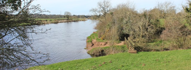
Beyond the house, the river curves across a grassy plain. This is open access land. Carr Bed, according to my map. Must be a flood plain. On the other side of the bend I can see a huddle of houses. Good. There’s the village of Rockcliffe.

I speed up, thinking of lunch. But it takes me some time to make progress, because a series of small streams interrupt the bank and force me to detour to find the footbridge.
After crossing the bridge, a sign appears to suggest an inland diversion across a field, but the sign is so badly weathered (perhaps damaged by flood water) it’s impossible to read. In any case, the field looks far more boggy than the bank!

Onwards. There’s a well trodden path here, although at times I have to pick my way over flood debris.
And eventually I arrive in Rockcliffe. Across another marshy field, I see a welcome sight. The pub!

It’s a bit of a battle to get there – well, it involves wading through a bog and fording a stream – but I arrive in time to order lunch. Meat balls and pasta. Tasty, cheap and very filling.
After a good lunch, I feel ready for anything. Just as well… [to be continued…]


I did this walk a few months ago (in fact, it was my last new coastal walk of 2016). I think we followed the same route. I also wondered about that old bridge and so looked it up and it is indeed an old railway bridge. Not sure why it is so throughly blocked off, though. I seem to recall having a few issues later in the day and a fairly unpleasant walk along a minor road right next to the motorway, though I am not sure there is a better route.
Wondering if you found the Cadbury Factory Outlet shop in Gretna Green too. That was a delight!
Oh no! You shouldn’t have told me about that chocolate outlet- I’m such an addict. Yes, the second half of this walk was a bit of an ordeal. Just about to write it up.
I was rather hoping for some otter photos, what a shame you didn’t see it 😦
Hi Eunice. Yes, it was a disappointment. Maybe one day.
I love your description of the springer “hurling” itself into the water. I had the family springer Barney for sixteen years and then looked after daughter’s springer Jake. They are always, happy, full of fun and uncontrollably attracted to water AND MUD.
I love springers. My daughter has one. It took her some time to enjoy going into water, funnily enough, and even now she will only go in to retrieve sticks (the dog, I mean, not the daughter). But she has always enjoyed MUD!
If you keep going at this rate, you’ll catch me up in no time!
That bridge was part of the Waverley Line between Carlisle and Edinburgh, which fell victim to the Beeching Axe in 1969. The Scottish Government reopened the northermmost 31 miles of it in 2015 but the rest of it remains abanodoned. The bridge has seen little or no maintenance since its closure and is fenced off to stop people using it as a shortcut. I read that there was talk of opeining it up as part of a cyucle route but that’s obviously not happened.
What a shame. It would make a good walking/cycling crossing point.
How cruel. I’ve been so impatient for you to reach Scotland and now I have to wait while you eat your lunch in a pub!
Apologies. And the lunch break has lasted several days. Nearly there… 😀
So close to Scotland! I’m sominterested to learn how you got on there, I really must catch up.
Thank you so much! So useful, I’m in Carlisle and planning to do this tomorrow. Your directions will be really helpful.
Hope you enjoy your walk, Joanne, and hope it’s not too muddy!
Some very pretty parts to this walk. I’ve never seen an otter in the wild but did have the privilege of having a couple running over my feet when I did a photography day at the British Wildlife Centre.