
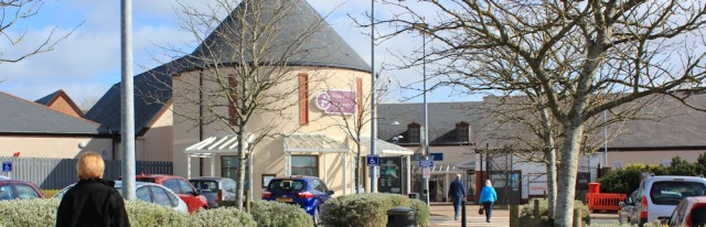
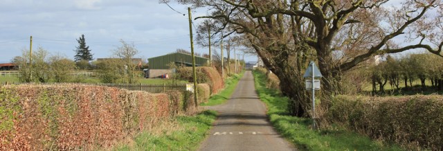
It’s my first proper walk in Scotland, and I’m freaked out by the absence of public footpaths on the map. First thing to do is visit the tourist centre (as suggested by Alan Palin). Rather bizarrely, the centre is located in Gretna’s large retail park.
A very helpful lady gives me an excellent map showing bus routes, and an equally excellent leaflet full of bus timetables. But she seems perplexed when I ask about walking routes.
OK. I’m on my own, then. But I’ve looked at David Cotton’s website and Alan Palin’s blog, and I know they both followed the shore all the way to Annan.
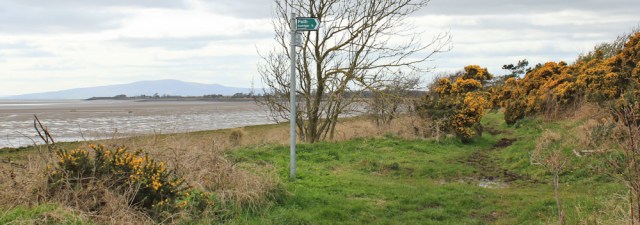
I head back to the Sark Bridge and find a path sign pointing along the river bank. So they do have marked paths in Scotland, after all. Over there is England. But I’m in Scotland! (I still can’t really believe I’ve made it this far.)
The path starts off well, but then I come to a section where the bank is crumbling away. I tread a precariously narrow strip between barbed wire and muddy slope.
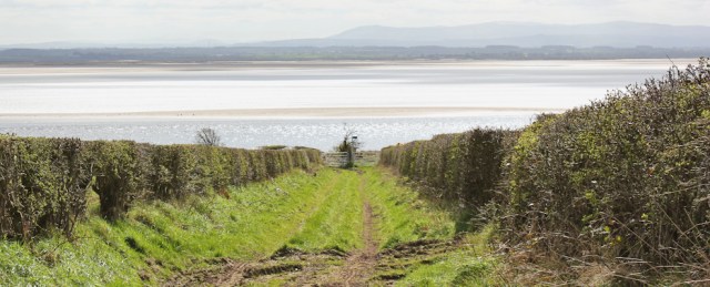
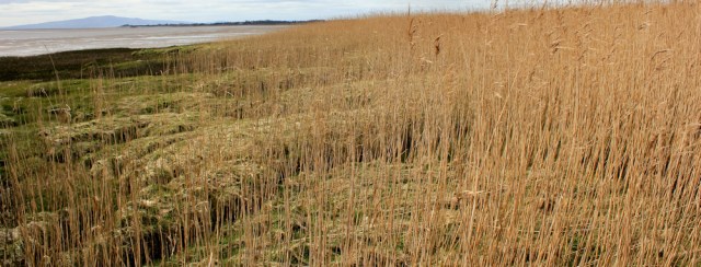
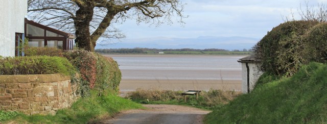
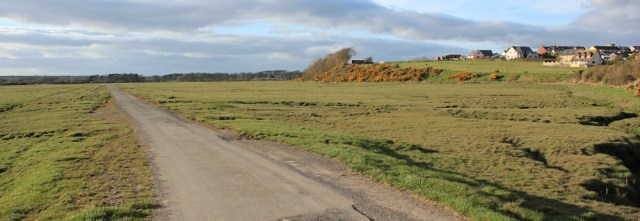
I reach the mouth of the River Sark, and begin walking along the bank of the Solway estuary.
Gretna is soon left behind and I reach the little hamlet of Stormont. Here I find another footpath sign, pointing back to Gretna. Information boards tell me about local wildlife, and also mention the famous Lochmaben Stone, which lies nearby

I continue onwards along the shore for a few hundred yards until I reach the mouth of the another river. Kirtle Water. Over there, across the estuary, is Cumbria.

I follow the river bank and look across the fields, searching for signs of a big stone. There it is… in the middle of a ploughed field. To get to it I must scramble through a barbed wire fence and then plod up a little hill.
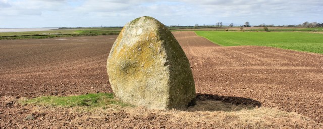
This is all that remains of a prehistoric stone circle. In the 19th century a tenant farmer attempted to clear the stones out of his way by burying them, but his excavations were discovered in time and the largest stone – the Lochmaben Stone – was saved. It has served as a local landmark and a meeting place for centuries.
I love finding these ancient monuments, and I place my hands on the granite surface and think of all the history this stone has seen. It’s an ‘erratic’, which means it was carried here by a glacier many millennia ago. It certainly seems very alien in this landscape of ploughed fields and river mud.
After taking photographs of the stone from every angle, I continue with my walk, traipsing back along the field towards the river bank, which I follow until I find the road bridge.
A mile along the road and I turn left into Rigfoot. It’s a tiny village, but in a garden I see two boys of about 10 years of age playing with a group of younger girls. One of the boys lines the girls up, making them lie down in the grass in a row, and then takes a running jump over their little bodies. Like Evel Knievel – but, luckily, without a motor bike!
I would like to take a photo of their antics, but am reluctant to photograph other people’s children without permission.
Onwards. Through Rigfoot to tiny Redkirk…
… and then along a farm track. Here’s another footpath sign. I’m surprised that Scotland actually seems to have proper, signed footpaths after all. What was I worrying about?
I follow the track through farmland until, after a couple of miles, it turns down towards the shore again.
This is very pleasant. I walk along a raised bank, covered in flowering gorse bushes, and pass through another little hamlet – called Browhouses.

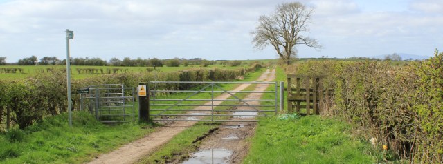
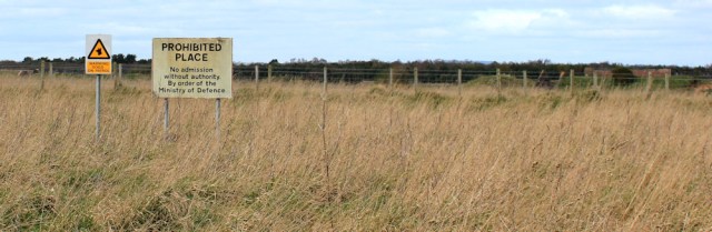
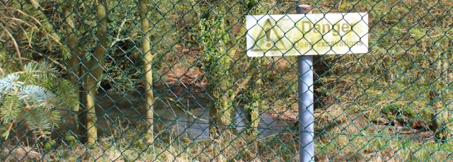
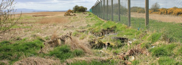
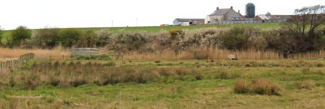
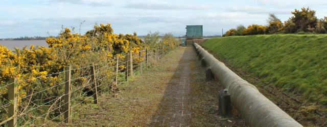
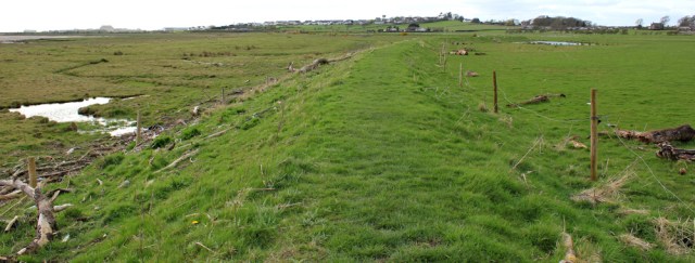
From here, a good track runs along the edge of MoD land. Behind the fence is a large area where ammunition was stored during the war. I’m not sure what happens here now, but the fence is obviously still in place and well maintained.
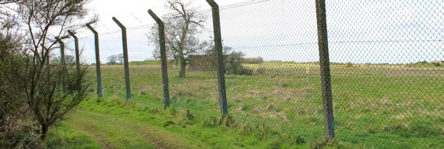
Notices tell me the MoD land is a PROHIBITED PLACE and warn of guard dogs. I don’t see any dogs, nor security cameras, nor anybody… it’s a lonely and deserted landscape.
I make good progress along the track until it abruptly comes to an end and my way is blocked by a fence, beyond which is an overgrown patch of land. Oh no! Am I going to have to turn back?
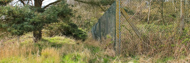
I force my way through some brambles and gorse bushes, picking up several scratches, and find a narrow passage between two high fences. One fence is protecting the MoD land. The other fence is encircling a deep pit of water.
Beyond the pit is a crumbling mess of deserted buildings. Their foundations are slowly slipping down the bank and the shore is littered with tumbled bricks and smashed concrete.
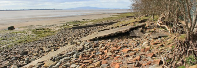
This is Torduff Point. A place I had hoped would be pretty and scenic, but isn’t. Ah well. Onwards.
The MoD fence continues, but the ground beside the fence is now too overgrown for easy walking, so I take to the mud instead. There are footprints here – something I find very reassuring to see. And I wonder if these might be Alan’s prints. He walked this route a year ago and it’s possible the tide hasn’t reached this far.
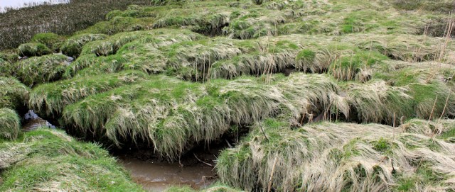
After a while the mud turns to marsh. I climb back up to the fence, but the ground is very chewed up and difficult to walk along, and eventually becomes obstructed by a mess of driftwood and debris, so I head down to the marsh again.
This turns out to be a mistake. The bank disappears under a forest of tall grasses, making it difficult to see the ground underfoot…
… which is a problem because the ground is threaded through with deep water channels and picking my way from clump to clump of dry grass is not easy. One false step and I could twist an ankle. Or even break a leg… oh dear.
After fighting my way along the bank for some time, I head back to the fence again. There is a narrow path here, and even some handy planks of wood that someone has placed over the little streams.
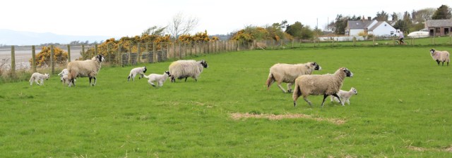
Eventually, and to my relief, I reach the end of the MoD land and a pleasanter landscape of fields. I love this time of year – baby lambs are leaping about!
Following the shore, I find another footpath sign. Good news. It means the route will be easier now, I hope. And what’s that hill ahead in the distance? My old friend, Criffel.
Criffel reminds me of Black Combe. It, like Black Combe, is impressive enough to look like a mountain, but doesn’t quite make the grade, being 40 metres too short.
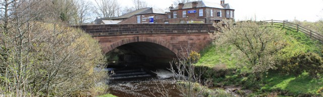
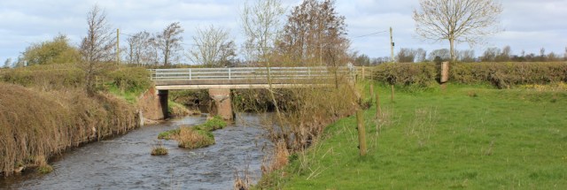
Onwards. I’m close to the village of Dornock, and I know David Cotton had difficulty crossing a little river here, but I’m relieved to see there’s a proper bridge.
Further on and I reach a ford. A sign warns me of deep channels. Oh dear… but there is a handy bridge here too, and I cross the ford without even getting my boots wet.

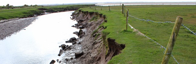
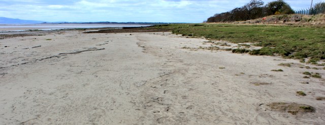
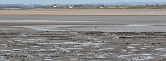
From the bridge, I take a photo looking back along the shore where I’ve just walked. There’s Torduff Point across the bay.
Looking over the estuary, I can make out familiar landmarks on the other side. Cumbria. Those white buildings are in Port Carlisle. And the long, low structure (to the left of the photo below) is the remains of the harbour wall. I smile when I remember meeting the young couple who thought they’d actually found Hadrian’s Wall.
Now I reach a collection of houses, a place called Battlehill, and the path along the shore seems to come to an end. It might be possible to continue along the bank – I know Alan did – but I’m fed up of fighting through reeds and marshes, so I take the easier route and follow a quiet road as it makes a circuit inland.
After a mile or so, I turn left at a T junction and am soon back on the banks of the estuary. This is Whinnyrig.
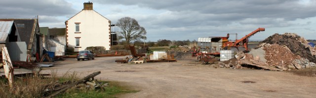
An easy track takes me to next tiny place – Seafield. It looks like a scrap yard, with a motley collection of buildings, machinery, piles of rubble, and several skips full of junk.
Here is an old railway embankment where a viaduct used to carry trains across the estuary to Cumbria, and I remember seeing the other end of the missing track when I walked through Bowness on Solway a few weeks ago.
I stand at the end of the embankment. The wind has picked up and is blowing hard and cold. I look across a bay of mud. On the other side is Barnkirk Point – I should get there tomorrow. And beyond, a blue hump on the horizon, is Criffel.

I follow the embankment inland. It’s tempting to keep going, as the path along the top will take me all the way into Annan, and I’m feeling tired…

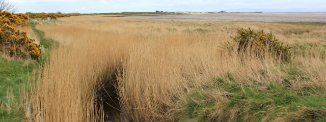
… but instead I turn off to the left and follow a footpath along the shore. I was worried this path would be marshy and muddy, but it follows a raised bank and is surprisingly dry.
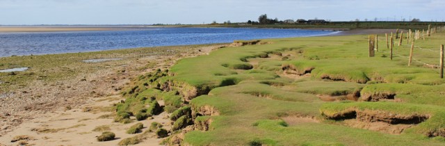
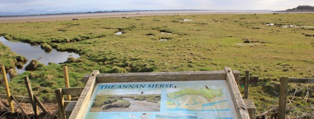
The marsh to my left is called Annan Merse. I know these wetlands are supposed to be teeming with wildlife, but they look rather bleak and desolate to me.
After a while, my nice, dry bank disappears, and I’m picking my way across marsh, leaping across waterways and balancing on dry tussocks. Occasionally I find a handy bridge, but most of the time it seems to be a matter of finding my own way.
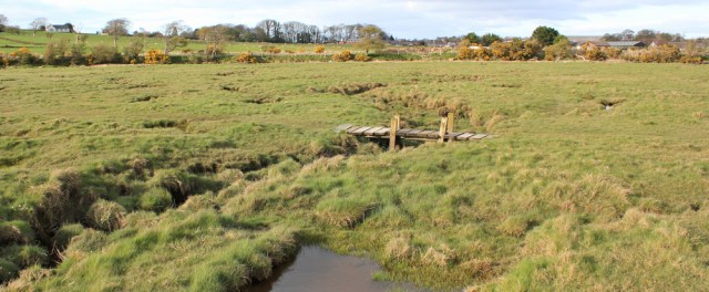
It takes a surprisingly long time to cross the Merse. Impossible to walk in a straight line.
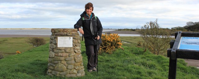
Finally I reach the other side of the marsh and another raised bank that marks the mouth of the River Annan. Here there is a memorial cairn to Robert Burns (every significant place in Scotland, I’m soon to discover, will host a memorial to Robbie Burns!). I balance my camera on a bench and take a self-portrait.
From here I follow a quiet road all the way up to Annan. The river is somewhere on my left, but I don’t see much of it until I reach Annan itself.
Well, I’ve survived my first day of Scottish walking. Some of it was easy. Some of it was hard. But I’ve been surprised to discover there is a network of paths in this area, after all, and I’m optimistic about making good progress tomorrow.
Additional info: You can read more about the Lochmaben Stone on Wikipedia. The networks of paths is shown on the Dumfries and Galloway Council’s website: as Core Paths.
Postscript: I arrived back in my B&B to find an email from Chris Elliott, who walked this section of the coast in 2015, and he warned me the path along the MoD land was non-existent and the route was dangerous in places. He was ‘lucky not to break a leg’ and suggested following the road instead. Great advice. But too late for me!
Miles walked today = 15 miles
Total around coastline = 3,060 miles
Route:


That looks like 15 miles of very tiring walking. A lovely picture of the silvery mud with bird tracks. Glad it went well.
Hi Jacquie. Yes, it’s always tiring when you can’t find a proper path. But I made it to Annan.
I am so pleased your blog has emerged from the Scottish mists and that you have not been dragged off by a rampant haggis.
😀 Yes, I’m glad to have survived. But now you’ve got me worrying about rampant haggis…
Glad you are back on the trail Ruth – yes, Scotland is weird when it comes to paths, it all seems a bit half hearted, like they bothered to install a sign, but didn’t walk the route to see if it was navigable! I can assure you there are spectacular and well marked trails in Scotland, but as we both know, not necessarily along the coast!
Hi Gemma, and I’m sure I’ll find my way through, somehow. Wouldn’t it be great to have a proper Scottish coastal path? Maybe one day.
Glad you enjoyed your first Scottish walks. I will find these post useful when I come to walk this stretch of the coast (probably next year). Sounds like you got the authentic Scottish coastal walking experience! Namely, barned wire fences, paths not marked on maps, paths that come to a sudden and unexpected dead-end and paths that are really hard to find on the ground! But at least there were some proper bridges to cross the streams and rivers.
Still I’m glad you made it in the end and good to see there are at least some paths that are signed.
Hi Jon. I always feel nervous when other people say they find my paths useful for plotting routes, as I’m sure half the time there MUST be an easier way, it’s just I didn’t find it! Knew Scotland would be a challenge, but so far so good.
What an adventure Ruth! Scotland is the section I have the most concerns about completing but it will be a while before I get there so for now I am studying you so that I can be prepared!!
I feel flushed with confidence now. But then I keep reminding myself I’m still in the ‘soft’ lowlands. Still got all the tough bits to come. Have you started your walk yet?
Well done Ruth on the first leg of your Scottish journey.
Fantastic to finally be in Scotland. I’m in a process of catching up with your blog as I’ve been busy lately. Particularly love a couple of the pictures of the beach with the Criffel in the background – very atmospheric
So pleased to have got this far. Hope you get some good walking in this summer,
We have got 4 days from Easter to write up still – it’s a different process when there’s two of you sharing not only the walking but the also the writing! The only thing that is done solo is the generally the planning – which I’m more than happy with! Then another four days to look forward to in the summer.
Making a start on the west coast of Scotland and so did this walk yesterday. I followed the same path from Gretna Green to the road leading to Old Graitney (didn’t see that stone). Then I followed the road to Redkirk and onwards (as it became a track) to Redkirk Point. As the tide was out I was able to make it almost the whole way on the mud and sand at the edge of the marshes. Just a couple of places where I had to go onto the marsh or pebbles/rocks at the back of the beach. Thankfully this made the part around Torduff Point easier than you had. Having said that the mud was still a bit squelchy in places, you sink about 2cm into it in places. it wouldn’t be possible to go this way at high tide, of course. Then I managed to follow the shore and marshes all the way to Waterfoot other than the old railway embankment with that odd pipe on it. Annan was a pleasant surprise at the end.
Hi Jon, and welcome to Scotland! Yes, it does sound as if you had an easier walk than I did. I have no idea why I didn’t walk on the mud too. Perhaps the tide was in. Can’t remember now. Annan is a nice place. Look forward to reading your write-ups in due course.
Hi Ruth. I discovered your blog recently and am enjoying it. I walked from Land’s End to John o’ Groats in stages, finishing just before you started your walk , funnily enough. I covered some of the same ground as you have or will have walked and later wrote a blog about it called ‘Walking Land’s End to John O’Groats the easy way’. My trickiest test was in the section you describe here and I was interested to see what you made of it. It seems that not much has changed since my walk. I look forward to seeing what happens when you get to the other overlapping parts of our walks. Good luck. Robert Milnes.
Hi Robert. Would love to read your blog, but can’t find it on Google search. Could you post a link please?
Hi Ruth. The link is https://apersonalendtoendwalk.wordpress.com/ which should get you there. I hope you enjoy it. Rob
The Lochmaben Stone is an incredible ancient stone. If the farmer was excavating to buty the other stones, presumably they are under the ground somewhere in the vicinity.
The walk along the stretch of MOD land looked awful but parts of the rest of the walk very lovely.