
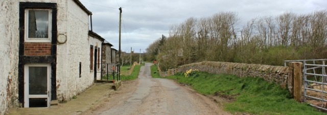
It’s a dull morning. I cross the River Annan via the road bridge and join the tail end of the Annandale Way. There are relatively few long-distance hiking trails in the area, but this is one of them.

Contrary to my expectation, I find plenty of clear footpath signs. In fact, Dumfries and Galloway has an good network of walking routes they call Core Paths.

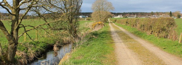
I begin to make my way down a track on the opposite bank of the river. The long distance cycling way – Route 7 – also follows this track. (The Route 7 signs will soon become familiar, as I end up playing tag with Route 7 during my walks over the next few days.)

I pass under a railway bridge…

… and walk alongside a disused railway line.

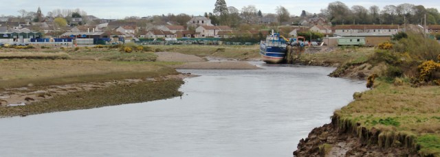
To my left is the River Annan and the town on the other side – Annan – was once a busy trading centre with a fishing and shipping industry, but it’s now a quiet place. I only see a single boat sitting tied up at a wharf.
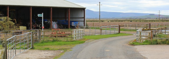
At a place called Newbie I am forced to deviate away from the water and walk around the edge of an industrial site. On the other side of the complex, another well-signed footpath takes me back towards the river.
I have a strange feeling I’m being watched, and so I glance over towards the ramshackle warehouses on my left – and get quite a shock. Is that a bull?
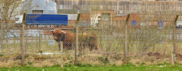
Yes! Luckily he is safely on the other side of a high fence. I walk through an avenue of gorse bushes and reach the river bank again…
… where I startle a wading heron.

Ahead is the mouth of the Annan and, on the opposite bank, is the place I stood yesterday alongside the monument to Robert Burns, and took a self-portrait.
This side of the river is littered with rubble and flotsam, including a rusty bicycle. I’m not sure if it was dumped here, or washed up by the tide.

Across the estuary is a familiar sight. The tall masts of the VLF transmitter station stand on the other side of the Solway Firth.

While ahead is another familiar sight. It’s my old friend, Criffel. Most of my walk around Cumbria had been dominated by this tall hill, and I can’t believe I’ll soon be walking around its lower slopes…

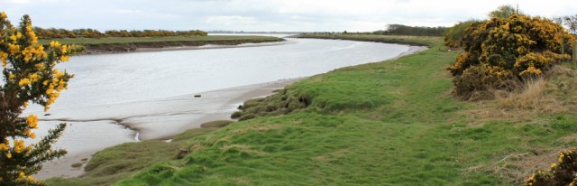
… but not today. I have several more estuaries to navigate before I get to Criffel. This section of coast looks straightforward on first glance of the map, but in fact it is cut through by many rivers. This means I’m going to spend a lot of time walking up river banks to find the nearest bridges.
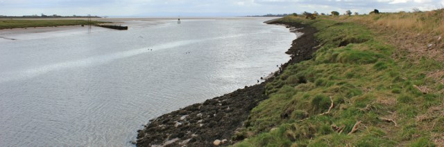
Ahead is Newbie and I’ve come to the end of the Annandale Way.

I don’t know if I can walk along the shore through Newbie, but most other walkers seem to follow the road around the hamlet, and so this is what I do too.
I love this time of the year, when the fields are full of little lambs. I see a pure white sheep who seems to have produced two pure black lambs. How does this happen?

I’m soon back on the shore again…

… but the route isn’t as easy as I anticipated. The beach is basically marsh with a rocky rim, and the foreshore is littered with rubble. Not just stones and pebbles, but bricks too.

A rather nice white brick has come all the way from Stourbridge in the West Midlands.

While this Sanquhar brick is locally produced, I think, but the brickworks is now shut.

The Buccleuch brick is in better condition, a rich terracotta colour, but again I think it comes from the same defunct brickworks.
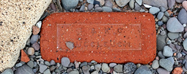
As I continue along the shore, I find whole sections of wall lying on their sides, and fenced off foundations of crumbling concrete. Clearly once buildings stood here, but now all that remains is rubble. Is this the sea’s destructive effect? Or are these just abandoned buildings that have been left to rot? It’s a mystery.
Progress is slow, because of the difficult terrain, but eventually I reach Powfoot, and cross the River Pow via a little arched bridge.
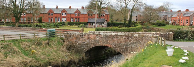
Powfoot is pleasant, with lawns and seats along the water front. It has the air of a seaside resort, although the village looks over the Solway estuary rather than the open sea.

I walk past a row of white fishermen cottages and discover the Powfoot Hotel. Wonderful to find somewhere open – and it’s lunch time too! The hotel is fairly smart inside, but they don’t seem to mind my walking boots and scruffy trousers.

The menu is interesting and I choose a light salad with strips of beef and quails’ eggs. Lovely. After lunch, I climb down to the shore and take a look back at Powfoot and the white cottages.
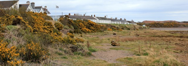
The shore is covered in rough grass and marsh, and so I take to the tarmac and follow a quiet road. It leads through a couple of holiday parks.

The tide is out. On the exposed mud of the estuary a couple of riders are taking their horses for a canter. Beyond, on the other side of the water, is a low finger of land. I check my map. It’s Skinburness, just above Silloth, in Cumbria.
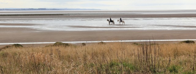
It seems a long time since I walked along that shore, although it’s really only a couple of months ago. I’ve covered so much ground in the meantime. (I can remember looking across the water and wondering if I’d ever get to Scotland. Here I am!)
I reach the final holiday park and the road comes to an end. It may be possible to walk further along the shore from here, but the map suggests the track peters out into a marsh, so I decide to turn inland and follow a minor road.
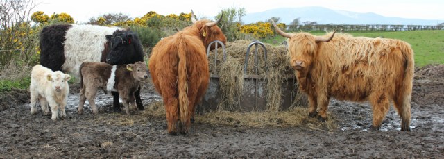
A group of cattle stare at me from a muddy field. The shaggy horned beasts are Highland Cattle. The black and white cow is also a breed I recognise, from watching the BBC’s Countryfile. It’s a Belted Galloway, with a distinctive white hoop around its middle. And it has a couple of beautiful little calves in tow.
I settle into a steady rhythm of walking, knowing I’ll be treading the tarmac for the next 4 miles or so.
The countryside is flat. The fields are swampy and full of standing pools of water. The landscape reminds me of the Fens near my home, but the Fens are drier than this because they were drained by Dutch engineers in the 17th century, and the Dutch knew how to drain land properly.

Most of the fields are empty meadows, with the occasional herd of sheep. This stocky mother gives me a long hard stare as I walk past. (Some sheep are definitely braver than others. I think this is a Texel.)

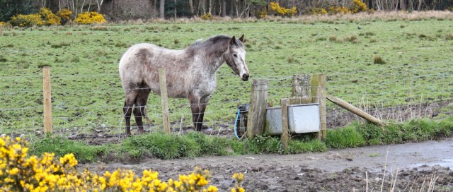
I meet a few horses too.
Although I’m making rapid progress, I do find road walking boring and tiring. This stretch seems to go on and on and on…

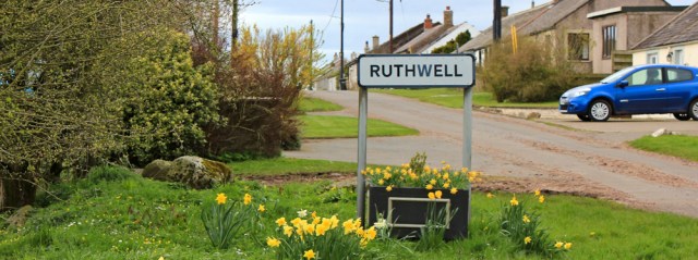
…until I reach a small village called Ruthwell. Since my name is Ruth, I feel absurdly pleased to be here, and take several selfies alongside the Ruthwell sign.
The village feels like an old-people’s enclave, because the buildings consist of rows of small bungalows — the sort you find in warden-assisted complexes in England. Only later do I realise that many of the villages in Scotland are populated with cottages just like this.
Beyond Ruthwell, I start looking for signs for another Core Path. There it is, by the barn ahead.
This path loops down to the marsh and forms a semi-circular walk from Ruthwell to a place called Brow Well. Following the road would be much quicker, but I’m sticking to my Rule Number Two, and keeping as close to the coast as seems reasonable.

It might be my imagination, but Criffel appears to be growing larger. I must be making progress.
The path’s route through the marsh is vague in places, although from time to time I do come across a helpful post with the familiar yellow arrow sign.

The marsh bank is the easiest place to walk. It swings around the edge of yet another river estuary. There’s Brow Well ahead.

I pass a sculpted metal bird, perched upright on a pole. What is it for? A piece of artwork? Or a bird scarer?

Brow Well is… well, it’s an actual well. In fact, I’d read up on it ahead of time, thanks to Alan Palin’s blog. The landscaping around the Well has been finished since Alan walked this way last year. It’s pretty, but with an antiseptic look to the clean paving…
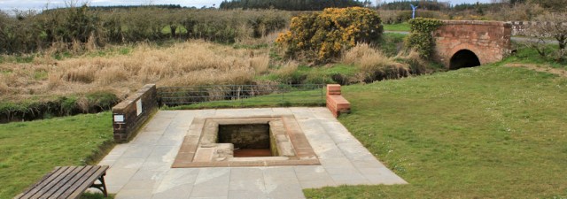
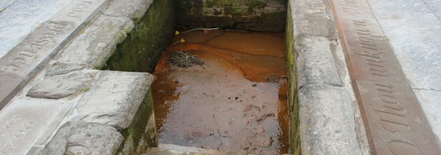
… antiseptic, that is, until you peer into the Well itself. Yuck. Red slimy water.
A nearby notice board points out why this Well is important. It was visited by Robert Burns in 1796 when he was ill. What the sign doesn’t point out is that Robbie Burns died soon afterwards.
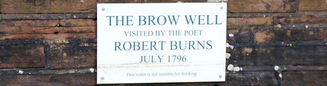
The sign does point out, however, that ‘this water is not suitable for drinking.’ !
From Brow Well, I take another Core Path which follows the course of a small stream. I’m heading inland to Clarencefield. Why? Because that is where the bus stops.

I always find the last mile of any walk surprisingly tiring. (It doesn’t really matter whether the walk is 7 miles or 15, it’s always the last mile that seems the longest!) But this part of my walk is very pretty and, even more so when the sun comes out for the first time today.
When I get back to my hotel (the excellent Woodland House Hotel) the landlord asks where I’ve been. I’m reminded I’m really in a foreign country when he politely corrects my pronunciation.
Disappointingly, Ruthwell is pronounced Rothel (rhymes with brothel). And, most confusingly, Brow Well is pronounced Brew All. Who would know that?
Walked today = 12.5 miles
Total distance = 3,072.5 miles
Route:


Looks like interesting varied walking- love the bricks. With your background I’m sure you know about that guy beginning with L and his famous research with peas. Your rhetorical question re black lambs was worthy of me, one who finds scientific explanations difficult to take on board; I know they must be correct, but just find it difficult to comprehend, for example, atoms whizzing round nuclei, or is it the other way round? Having said that there is no way I am a fundamentalist.
Greetings from Ward 33, Darlington hospital.
Hi Conrad, and so sorry you are still stuck in hospital.
Half the science I learnt at school now turns out to be inaccurate! Yes, did wonder if the black sheep gene was a recessive one. Or do the lambs turn white eventually? Because you rarely see fully grown black sheep,
I wouldn’t have known these pronunciations either! They followe no rhyme nor reason. We were in Dumfries and Galloway recently and I confess I did half look out for you, but I think we were too far west for you yet (Isle of Whithorn area).
Hi Anabel. I’m not so far west as that yet, but hope to continue to make good progress. The forecast looks promising.
Hi Ruth, Powfoot is where I parked on my first leg of the Scittish section, so as I close to my car at the end of the walk I claimed one of the Stourbridge bricks ( i think they may be fire-bricks but are not certain) , it is now a useful door-stopper back home!
Ruth cannot believed you did not mention the TSB bank in Ruthwell! BTW the pronunciation for Ruthwell was new to me to.
I wondered why the Stourbridge bricks seemed to have survived better. Yes, firebricks, makes sense. When I walked through Ruthwell I was so excited about having a village named after me, I forgot to notice anything else!
I did this walk on Saturday, though sadly mostly in the rain. It is possible to walk on the shore from Newbie to Powfoot, though it’s not especially easy. The beach near the high-tide line is mostly pebbles, bricks and shingle, so it’s hard to walk on. Nearer the shore it is a mixture of sand and mud, but quite a lot of areas of soft mud, so you have to be careful. There is a stream part way along which you have to cross. It was just about possible to step on some of the pebbles in the water to make it across with dry feet.
Like you I followed the roads most of the rest of the way, though I didn’t do the “loop” you did on the footpath, as it’s not marked on the map (should have re-read this first!) and I didn’t realise you could get to the coast there. It’s annoying the Ordnance Survey won’t mark Scottish footpaths/core paths on the maps. I also walked to Clarencefield for the bus.
Yes, the famous Scottish right-to-roam has unintended consequences, including a lack of proper legally-protected public rights-of-way. Have you found the Core Paths website yet, Jon? I use it to plot routes and I actually mark the paths on my OS map. (The problem with that is not all the Core Paths actually exist – some are work in progress, and others are just wishful thinking!)
I would have pronounced Ruthwell as it looks! I do like Belted Galloways and Highland Cattle, both very attractive breeds.