
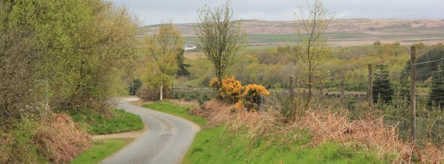
I catch the bus from Creetown to Gatehouse of Fleet (apparently, the locals just call it ‘Gatehouse’) and start off down the street from the Murray Arms Hotel, where I ended my last walk.
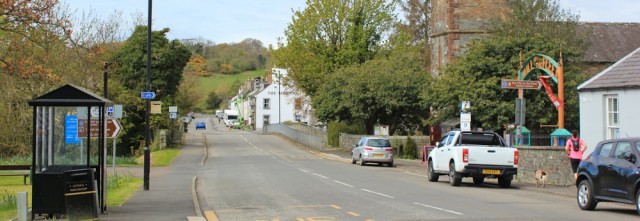
Today I have two routes to choose from. The most obvious route, and the one that sticks closest to the coast, is the A75. But, other coastal walkers warned me how awful this road is, with no pavement, and a stream of heavy lorries heading for the Stranraer ferry port.
I’ve plotted an alternative inland route. It follows an old military road, involves an extensive detour around a mass of hills, and takes me several miles away from the sea. This looks far more attractive than the busy coast road, but… I’m not sure. Will I be breaking my rule number two?
During the bus journey along the A75, watching the lorries trundle by, I make my mind up. I decide to invoke the ‘reasonable’ clause in rule number two – and head for the hills.
At the far end of Gatehouse, I spot a footpath sign. This path will take me over a small hill to the village of Anwoth, where I should be able to pick up the track of the old military road.
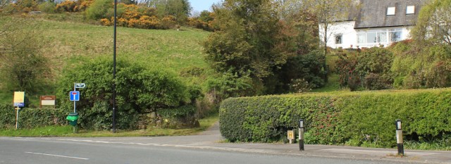
Rather confusingly, a Scottish Heritage sign refers to Venniehill. But my map gives the area a different name. Boreland Hills.
I walk through a rather nice – and rather posh – housing estate. The path is signed but sometimes the route is hard to spot. There it is… sandwiched between a private drive and a private garden.
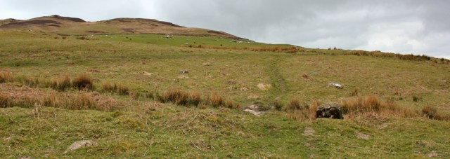
I emerge onto the hillside. It’s a rough and tumble area, covered in gorse and bracken, and there are several paths to choose from. I startle a deer… and then decide to head for the highest point on the hill…
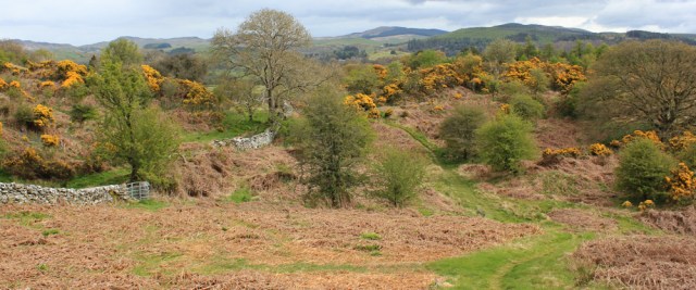
…where I find a trig point. And great views.

Just south of the trig point is a tall needle, Rutherford’s monument according to my map. And nearby is a smaller, squatter memorial to the ministers of nearby parish churches.
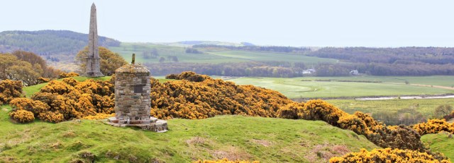
[With my science background, I assume Rutherford’s monument is built in tribute to the physicist, Ernest Rutherford, who described the structural model of the atom. Later I discover it’s actually a memorial to Samuel Rutherford, a 17th century Presbyterian minister, a radical thinker and writer, who was accused of high treason but died before he could be put on trial.]
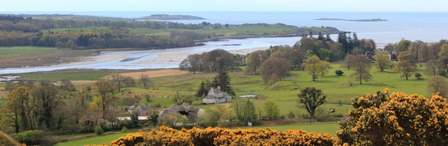
From my high vantage point, I look down on Fleet Bay and the Islands of Fleet. The air is much clearer today, and I really enjoy the view.
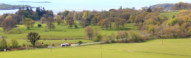
Closer, at the foot of the hill, is the dreaded A75. It doesn’t look too busy. Perhaps I should go down and walk that route after all?
But the hills ahead look very inviting. No. I’ll stick to my original plan. Onwards, and down to the village of Anwoth. I can see the village church below me.
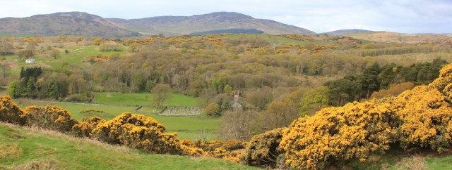
When I get down the hill, I realise the church is in ruins. Surrounded by graves, it looks rather sad, and very atmospheric.

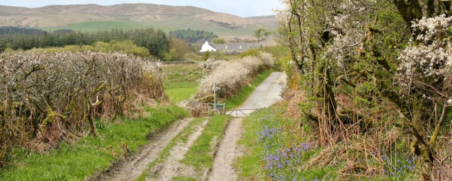
Anwoth consists of a small group of houses, and I soon spot the track I need. ‘Unsuitable for Motor Vehicles’ says a sign. It’s a gated road, through woodland.
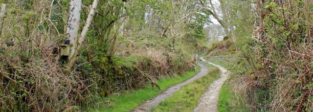
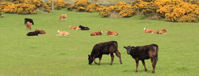
I smell something unpleasant. Surely there isn’t a sewage farm up here? And a short time later I discover the cause – a group of cows. They are, of course, lying right across the track, and they have a number of very small calves with them.
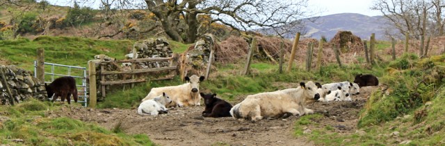
They stand up and start bellowing as I approach, but show no sign of moving away. Oh dear. I clamber over a stone wall, and stumble through the adjacent field. It appears to be empty, although I keep an eye out for bulls.
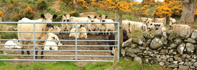
As I make my way around the other side of the wall, the cattle congregate together in a great mass and stare at me. They’re a breed called British White (I look them up later) and are actually rather pretty , with their black ears and noses, but also rather scary.
Safely beyond the cattle, I climb back over the wall and onto the track again. It becomes muddy, while continuing to climb steadily, and I make slow but steady progress.
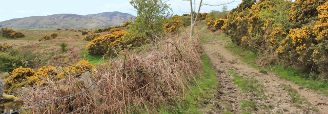
To my left is Kirkbridge Hill. To my right is Ardwall Hill. Ahead the track drops down and joins a lane.
I pass a few cottages, where a collie dog barks menacingly – I’m glad I’ve got my pole with me – but he stays in his garden. On either side are more cattle. Youngsters. These are safely behind fences.
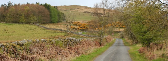
I cross a stream and the road meanders through farming country…

… before beginning to climb steadily uphill. At this point, according to my map, I’m following the ‘Corse of Slakes Road’. Why ‘Corse’ and not ‘Course’? Don’t know.
Ahead, just off the road, are a group of masts – the Cambret Hill transmitter station. I’d actually noticed the masts above me from several miles back, and assumed my road wouldn’t be climbing so high – but I was wrong. Up and up I go.

As I approach the turn off to the transmitter station, a white service wagon pulls out. It’s the first traffic I’ve seen since leaving Gatehouse.
The road reaches a summit (274 metres), crosses a cattle grid, and begins to wind downhill again. I climb up onto the bank above the road and sit on a soft grassy mound. Time for lunch.
It’s a great picnic spot. The view below is wonderful, despite the fact that clouds are streaming in from the south, and the sky has turned darker.
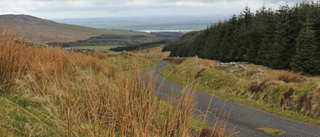
After lunch I follow the road down. Creetown can’t be far away now.
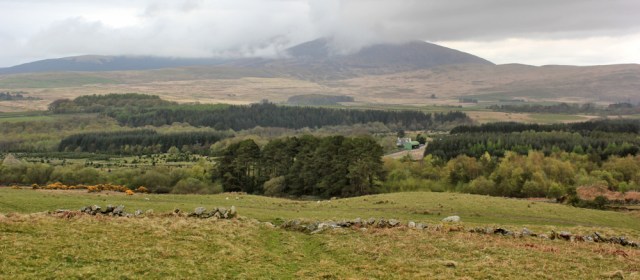
To my right is a plantation of pines, and beyond is an impressive hill, or mountain. It’s majestic, but slightly menacing too. I watch the clouds drifting across its slopes.

I check my map, but the hill/mountain is just off the edge of the sheet, and so I can’t see its name. [Later, I work out this is Cairnsmore of Fleet. At 711 metres, it is indeed a mountain.]
My road is coming down into a gentler landscape. Nearly there…
… and then I spot a ‘Public Path’ sign. It leads off to the left. ‘Larg Hill 1. Creetown 2 1/2.’ Well, that’s tempting. And the route would go closer to the coast, so is entirely in keeping with my rules.

I follow a track, and then footpath arrows lead me up a slope and into an enormous, open field. But the signs fizzle out. It’s difficult to know if I’m following a footpath or a sheep trail. I keep going. That must be Larg Hill in front of me. How could I possibly go wrong?
I reach the top of the field and come to an obstructing wall. It’s made of dry stones, and I could climb over, but there are barbed wire strands among the stones and the wall itself looks fragile and unstable. Oh dear.
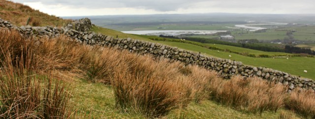
I follow the wall to the right, and reach a dead-end corner. I turn back, and follow the wall to the left, and reach a similar dead-end corner. No stiles. No gates. I must have gone wrong.
The sky has turned darker, and a few drops of rain begin to fall. I decide I’ve had enough of plodding around this enormous field, and I don’t fancy getting soaked up here. So I retrace my steps, heading back down to the road. Ahead, the mountain is smothered in clouds now.
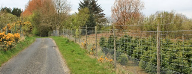
Back on the road, I pick up my pace. To my right is a plantation of baby firs. Christmas trees? They’re protected by a high anti-deer fence.
I reach a pond on the edge of an area of woodland. Ballochanamour Wood says my map. Balloch wood says the sign.
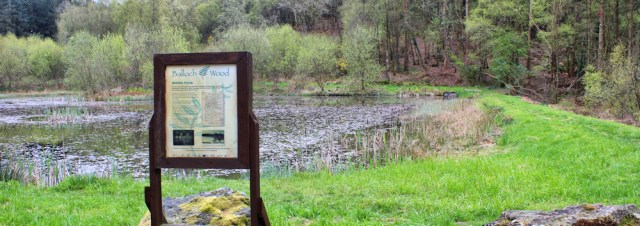
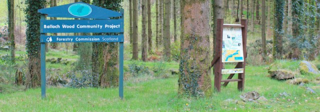
An information sign says the wood belongs to the Forestry Commission, and has a network of footpaths, provided as part of a community project. I study the map on the board.
Despite my recent abortive attempt to find an alternative route to Creetown, I decide this path is worth risking. And so I set off through the trees.
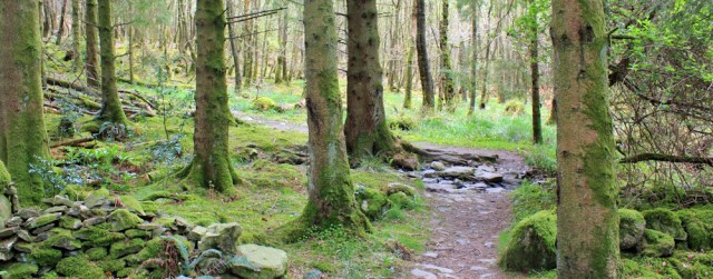
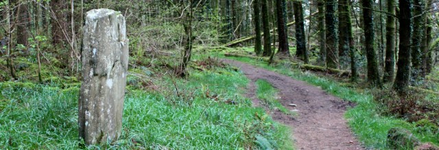
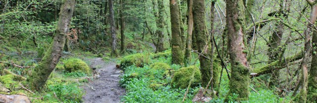
It turns out to be a gorgeous walk, through a woodland of broadleaf trees, with bluebells just beginning to flower, and a strange standing stone (not shown on my map, so I don’t know if it’s truly ancient or not).
The path follows a stream – Balloch Burn. Very pretty.

And, despite the fact the ground looks well-trodden, I don’t meet a single person.
Eventually, after just over a mile of lovely woodland, I come out into a field above Creetown’s church…
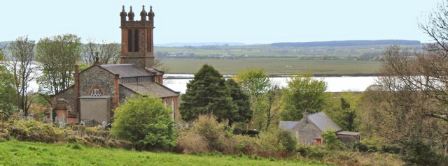
… and soon join the main road into the village. Time to go and find my car, which is parked in a little square by the clock tower.
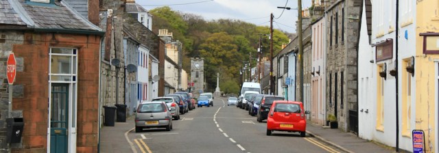
As I reach the square, drops of rain start to hammer down. I’ve finished my walk just in time.
Walked today = 12 miles
Total around coastline of Britain =3,224 miles
Route:


Hi Ruth, rather envious of your high route which was a lot more scenic than the blood and thunder of the A75. I stayed in the pub just by the Clock tower.
It was a lovely walk, Alan. Your description of walking the A75 was helpful in prompting me to find an alternative route.
Dear Ruth. What a pleasure to see photos from your walk. The landscape is endearing!
Hanna
Thank you 😊
Corse = cross (and yesterday Mains = Main Farm). You’ll probably come across lots more Mains and Corses!
Ahh. Thanks for the translation Anabel. Makes sense now.
3,224 miles 🙂
Yes. Can’t quite believe I’ve come so far!
lol
I would have no qualms about the inland route. this is YOUR route, and having come so far it is beyond any doubt you are sticking to the spirit of the concept. I’m now back from my trip to big brother and wife in Hereford and can see your posts with the photos again – great! The iPad didn’t always permit that.
Hi Conrad, and hope your arm continues to heal. Yes, in retrospect I’m sure it was the right thing to do. No point in risking my life, or being miserable. And I mustn’t forget this is MY walk and MY rules too!
Apart from your abortive diversion to Larg Hill, you followed the exact same route I took (Old Military Road and then footpath through Balloch Wood). Not only did the A75 have a few too many roaring lorries for my comfort but I’m a real sucker for anything labelled “old military road.”
You might like to know that when the military road was constructed in 1763 (to better move troops to Ireland via Portpatrick) the War Department actually forbade farmers to use it for moving cattle. Quite apart from the manure and their general refusal to get out of the way, their hooves would churn its surface up and ruin it. As they have. (I walked it in march of last year and that part was basically a quagmire).
What a lovely walk, despite the scary cows and the slight detour for Larg Hill.
Pingback: 47. Gatehouse to Mossyard – A 5000 mile walk