
I drive to Drummore and catch the morning bus back to Sandhead. When I get there, the kite surfers are already out on the water.

I’m heading southwards, along the shore, walking first along a tarmac path and then along the shingle, following the Mull of Galloway Trail.

An information board tells me about an old ruined church and some old standing stones, at a place called Kirkmadrine. Sounds interesting. Unfortunately, it would involve a 4 mile detour, so I decide to give it a miss.

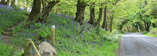
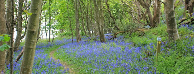
The path leaves the beach and runs along the lower slopes of a wooded bank. More lovely bluebells to enjoy.

Then a wide gravel track takes me upwards and towards the road. Why? I think the purpose of the deviation is to avoid a private house further along the shore. Shame.

At the top of the slope, a sign depicts the Scottish flag, and tells me I’m on the INTERNATIONAL APPALACHIAN TRAIL. Since the Appalachian Trail is a long-distance route that runs down the eastern side of the USA, this sign could come as a bit of a shock!
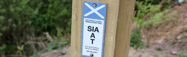
But I’ve seen the sign before. The Wales Coast Path is also part of the IAT. So is the South West Coast Path. And so, in fact, are all the National Trails in England. (Basically, the IAT will happily incorporate any long-distance walking trail that has a loose geological connection to the Atlantic rim!)
I walk along the road for a short distance, while contemplating how this section is completely unlike the genuine American Appalachian Trail – where there are no roads at all.

I soon regain the shore. Actually, walking on the road was much easier. Shingle really is hard work!

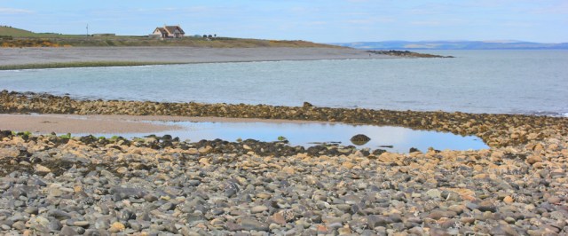
But it’s nice to be beside the sea. Just me and the cormorants. And sometimes there’s even a patch of sand to walk along.

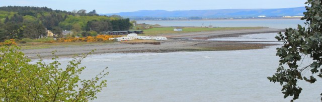
A map explains that the bay in front of me is part of the MOD West Freugh Danger Area. Access can be restricted and buoys mark the boundary of the dangerous area.

I believe this stretch of water is sometimes used for bombing practice. But it’s all quiet today.
I’m approaching the next village along the coast from Sandhead. Ardwell. It’s dominated by a large caravan park – touring vans, not statics.

I must turn inland to avoid the caravan park, and I walk along the main street. It’s very attractive and lined by pretty white bungalows.

At the far end is a caravan shop, and then a pleasant parking area next to the shore, with picnic tables and a small portable toilet (quite a nice one, I discover). Here I rejoin the beach…

… but only for a frustratingly short distance, because the path heads back onto the road again. I check my map. Oh dear. Looks like I’ve got about a mile of road-walking ahead of me.
But then I’m delighted because the path veers off to the left, up the slope of the hillside, threading between the trees, and passing through more glorious displays of bluebells.
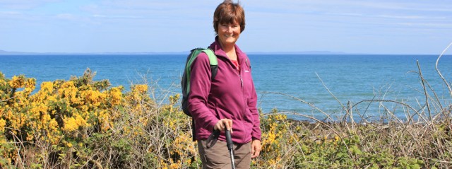
It runs roughly parallel to, and above, the road. A very pretty stretch, although a little uneven underfoot. Glad I’ve got my walking pole.

Back on the road again, and I walk past a grand white house that incorporates a tower into its structure. Called Auchness, according to my map. In the field in front are a collection of ponies, cows, and very young calves.

Just opposite the tower house, the path turns left off the road again and follows a track up into woodland. I follow a mysterious blue pipe, that snakes along the verge.
After a while, I hear a strange mechanical sound, a kind of thudding noise – and then I discover the reason for the pipe. The farmer is watering his field. The thudding noise is coming from the rotating mechanism of the giant sprinkler.

It’s only May, and seems a little early in the year for crops to need water. We’ve had a run of 6 days without rain – this is the 7th dry day in a row. Perhaps that counts as a drought in Scotland?
Onwards. The track is lined by wild garlic, just beginning to smell delicious. And then the footpath leads up and into the woods.

I catch glimpses of the sea below the slope, and can look down across a little bay to Ardwell. Oh. I haven’t got very far, have I? In fact, I’ve doubled back on myself.
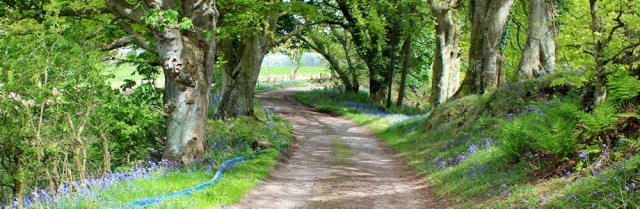
From here, the path takes a more straightforward course. It sticks to high ground and runs through wonderful bluebell woods…
…before dropping down to the shore again. Ahead are a number of rocky coves and a place called Logan Mills.

There’s a strange tower at Logan Mills. When I check my map… I discover it was once a windmill. Somebody has added fake crenellations to the top.

There’s nothing much at Logan Mills. I pass some abandoned and ruined buildings, a few isolated houses…

…and a wonderfully eccentric beach hut. Love the rusty corrugated iron panels and the brightly coloured buoys. Also, the lifebelt might come in handy if there’s a very high spring tide!

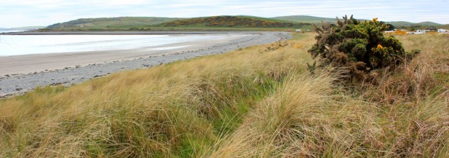
The shore beyond here is a mix of sand, seaweed strewn rocks and shingle. It isn’t as scenic as some of the areas I’ve walked along, but has a wild charm of its own.

I walk along a series of low dunes, and approach a curving bay. This must be New England Bay, and is taken up almost completely by a caravan park.
There are people walking on the sands. I reach the other side of the bay and take a photograph looking back. Caravan parks always look nicer from a distance.

Then, onwards, along a path lined by bracken, bluebells and gorse. I didn’t think native bluebells were supposed to grow out in the open and take a close look at them. Are they Spanish bluebells?
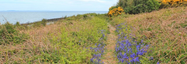
No. They seem to have most of the features of our natural flowers – drooping stems, curled petals, yellow stamen… maybe they’re hybrids?
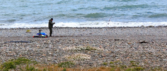
I pass a fisherman with his line set up on the shingle. You don’t see many fishermen around here. Wonder why not.
Another pretty bay, Terally Bay. I take a photograph of the view looking back.
And a little further on, at Terally Point, I find a picnic bench. Excellent. Time for a rest and a snack, and also time to take a self-portrait. Luckily the sun comes out and the colour of the sea looks wonderful.
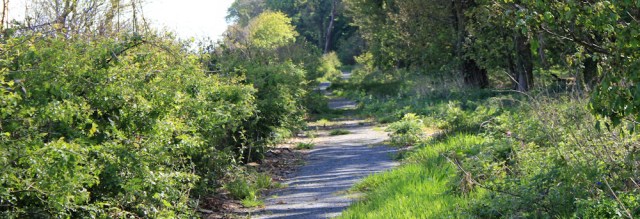
Beyond Terally Point, the beach becomes a rough scramble and the path leaves the shore. It crosses over the main road and runs between the roadside hedge and an area of woodland, apparently following the route of an old roadway. It’s pleasant enough, but with no view of the coast.
Beyond the woodland, the path decides to detour even further inland, heading up and over the top of a low hill. I don’t know why it does this – maybe to avoid traffic – but the road is quiet and I decide to stick to the tarmac instead.
The road curves around and down. “Road liable to flooding” says a sign. That’s Kilstay Bay ahead and, beyond that, is my destination – Drummore.

It is possible to walk along the beach at Kilstay Bay, but I stick to the roadside verge. I’m growing tired and, with Drummore in sight, I’m keen to make rapid progress.

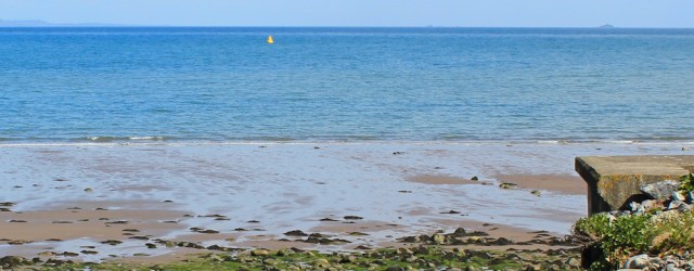
I spot a yellow cone in the water. Ah. That’s one of the Danger Area marker buoys, I presume. The MOD controlled area really does stretch a long way. On the horizon (just visible to the right of the photo below) I think I can see a large ferry. On its way to Ireland from Stranraer?
Onwards and Drummore is growing closer.

I follow the road up and over a low headland. A roadside sign advised me to turn right in the village for “Scotland’s southernmost store”. It’s a reminder that I’m nearly at the southernmost point in Scotland – the Mull of Galloway. I’ll get there tomorrow!

The tide is going out when I reach Drummore Bay. It’s a pretty sight, with a wide expanse of exposed sand and a harbour at the far end of the bay.

A pleasant path runs down and along beside the shore. Palm trees create the illusion of a tropical resort.

Alongside the path are numerous weird little objects. Painted stones and crude little sculptures. All very colourful and amusing. I forget my previous desire to hurry, and I stop and take far too many photographs.

Further along I come across a familiar plant. The dreaded Japanese Knotweed. Oh dear. I hope they get this under control soon, or this lovely little path will become a jungle. It’s a handsome plant, but terribly invasive and destructive.

The light is difficult when I reach the town, because half the main street is in deep shadow, so I don’t take many photographs. But I can’t resist snapping a shot of Scotland’s southernmost shop, the Drummore Stores.

It’s been another relatively short walk today. But an enjoyable one with no snakes, no bogs, and no dramas!
You can learn more about the International Appalachian Trail on the IAT website.
Miles walked today = 10.5 miles
Total distance around coast = 3,321 miles
Route:


I love the beach hut, it’s very quirky, and the view over Drummore Bay is nice. I wonder if maybe the painted stones by the path are in memory of someone, a bit like Sambo’s grave near Heysham?
There were many painted stones, Eunice, over a long stretch of the path, I think it was more of an informal display of local art. Whether one person, or many, I’m not sure, but maybe one person started it and other people added their own pieces. There were quite a few references to fairies… 😄
Well whatever the reason, I imagine it must have looked quite attractive and colourful 🙂
All this walking in Scotland and you are further south than when you crossed the border! A very ‘up and down’ stretch of coast.
Fab photographs Ruth. I live in Sandhead and found this really interesting thank you 😊
Glad you enjoyed it, Jacqueline, and thank you for your kind words. A beautiful area.