
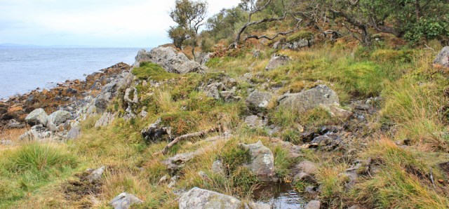
The walking is easier now, along a flat strip of land between hills and the sea.
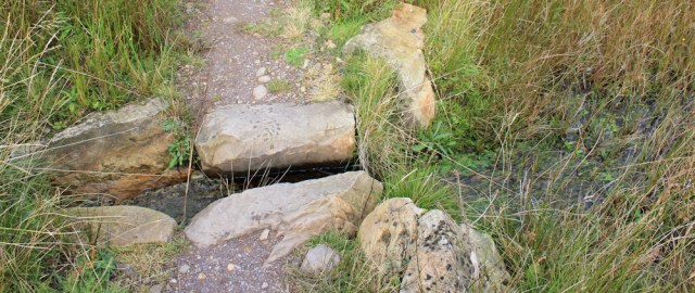
Small streams cross the path at frequent intervals, but someone has created channels lined with rocks, and the streams are easy to step over.
I reach a couple of ruined buildings. Farm buildings? I check my map. It mentions pits (mines?) and old salt pans. And here I meet another group of walkers. A man (in the photo below) is leading the way.

The other walkers are a bedraggled group of middle-aged people. They warn me the path ahead is tough. I ask them if they’ve walked from Sannox, but it seems they’re doing a circular walk from Lochranza. So they must have come over the hill to get here.
They don’t seem particularly fit or used to walking, and I wonder how they’ll cope with the rocky scramble ahead. I open my mouth to warn them it’s tough… but then decide I better not dishearten them at this stage.
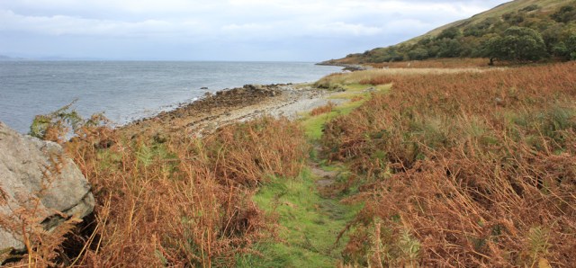
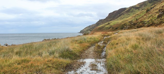
Onwards. Along a rocky slope. Past groups of twisted and stunted trees…
… until the ground flattens out again. Here is a deserted cottage – what a wild and beautiful place! I check my map. The building has a name. Laggan.

The map suggests the circular route turns inland at this point. But I’m continuing straight on along the coast, towards Sannox.
The rain clouds I saw earlier over Kintyre have finally caught up with me. Rain drops splatter my back, and I stow my camera away. Onwards.
I meet one solitary walker – a man with a dog. The rain is blowing straight into his face, which must be most unpleasant. And then, as quickly as it started, the rain stops and the air clears. I pull my camera out again.
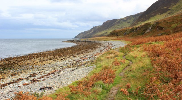
There are very few landmarks along this stretch. Ahead is Millstone Point. The path has turned into a rough track.
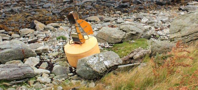
A yellow marker buoy has washed up on the shore. Wonder what it was marking, and hope it wasn’t too important.
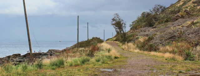
There is a line of telegraph poles running to my right. It seems odd to see them, in the middle of apparent wilderness. The section of shore ahead of me is marked on my map as ‘fallen rocks’ and the path is forced to make an inland detour for a short stretch.

Past the fallen rocks, and I come across a fence and a gate. Whether the fence is keeping something out, or keeping something in, isn’t clear. Anyway, it’s reassuring to see a familiar footpath sign.

Now I reach a definite track. The telegraph poles continue to keep me company, marching in a line on my left. The slope to my right has been logged, leaving an ugly jumble of felled vegetation.
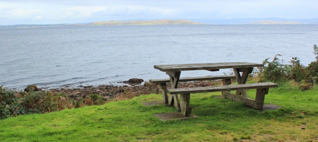
I take a rest on a handy bench. It’s made of hefty planks, set rather high, as if for giant men. I sit with my legs swinging, feeling like a young child, while across the sea patches of sunlight fleetingly light up the landscape. Is that the Isle of Bute over there?
Onwards. Trees to my right now. ‘Navigation Beacon’ says the map… and there it is, a little further down the track – all white, shiny and high-tec. No old-fashioned lighthouses here.
![]()
I reach a concrete jetty with warning signs. What is its purpose? Logging operations? Quarrying? No idea.

The track makes for easy walking, and now I’m surrounded by trees. Lovely, and makes a change from the open landscape I walked through earlier.

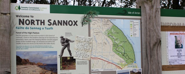
The track leads to a car park, with a toilet block (closed) and a sign saying “Welcome to North Sannox.” I learn this is Forestry Commission land, and open to the public.
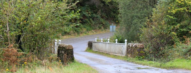
There is nobody about. No cars in the car park. I walk down to the shore, but discover I can’t continue any further, as my route is blocked by a river – the North Sannox Burn. So I head along the road, and cross the river via the bridge.
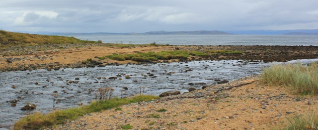
On the other side, a path heads down towards the shore, following the bank of the burn.

I stand at the mouth of the river and take a few photographs. Shame the light is poor and everything looks murky, because this is my last day on Arran, and I would really love to do the island justice. Ah well. Can’t change the weather.
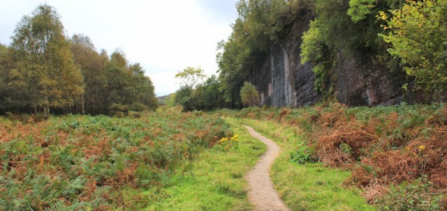
The next section of path is surprisingly beautiful. To my right is a dramatic cliff…
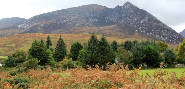
… which soon peters out, with the landscape opening up to give me a great view of Sannox ahead, with the mountains behind.

I check my map. I’m looking towards Goat Fell, but the feature in the centre of my view is a lower peak called Cioch na h-Oighe (wow, no idea how that is pronounced). The depression in front – looking like a volcanic crater – is called ‘The Devil’s Punchbowl. Great name.
Onwards. I’ve reached Sannox Bay, and here I drop down off the path to walk along the beach.

I reach Sannox Burn, and turn inland, following the sandy shore of the river…

… to discover some stepping-stones. Yes, there is a bridge only a few hundred feet away, upstream, but can’t resist using the stepping-stones!

Over the river, and back on the road, and I reach the bus shelter with the seats inside. My car is parked in the little car park behind the bus stop.

This is where I started my walk yesterday, and where I end my walk today. It’s been a taxing hike, and I feel physically very tired. I also feel a burden of sadness. Arran has been extraordinarily beautiful, and very kind to me, and I hate the thought of moving on.
POST WALK NOTES
Normally I walk the coast in strict sequence, and I struggled with the concept of breaking that rule. But I believe I was right to save the northern shore until today. First of all, the weather yesterday was terrible, and the north-easterly gales would have made this particular walk very treacherous. Secondly, today’s stretch has been the highlight of the Arran Coastal Way, and I’m glad I saved the best for last.
The Arran Coastal Way is officially 65 miles in length. As usual, I managed to walk substantially more than that – 76 miles – proving that the miles under your feet always turn out to be more than the miles measured on the map!
Miles walked today = 11 miles
Total around Arran = 76 miles
Total distance around British coast = 3,595 miles
Route:


Perhaps the concrete jetty is for the Red Princess that shows on Google Maps. The vessel that uses it might be http://www.marinetraffic.com/en/ais/details/ships/shipid:402395/mmsi:341189000/imo:8748828/vessel:RED_PRINCESS
It is currently docked near Prestwick. Of course, I could be entirely wrong.
ray
Ah. Yes. I guess it would have been used to transport some sort of cargo – either logs or stones. And a very interesting site at marinetraffic.com Thank you.
Don’t be too concerned about the yellow buoy. Yellow marks “have no navigational significance. They are used as race buoys, to define swimming or water-skiing zones, firing ranges, but not to mark a hazard to navigation”. Looks a bit sophisticated, with its light and solar panel, for a racing mark, mind.
Oh, that’s at relief to know. Yes, it did look sophisticated.
Hee hee – looks like you parked in the bus shelter!!
Ha ha, I see what you mean 😀
I was very fond of that bus shelter!
I’m glad you liked Arran so much. It’s beautiful and i’ve enjoyed reading about it through your eyes.
It’s one of the places I’ve visited that I plan to go back to. Yes, beautiful. And it makes some pretty good whisky too.
Can’t pretend I haven’t noticed that!
I can’t resist saying this – your posts are like buses, you wait for ages then two come along at once! 🙂 It’s good to see you back on the road again even if you are only catching up from last autumn. It looks and sounds like that was quite a strenuous and difficult walk in places but the scenery made up for it – I love the view of the river near the stepping stones 🙂
Thank you Eunice. I have some posts from February to write up now too. Very behind – shame on me.
You have finished walking on Arran and I have finished your 2017 walks! One day I will catch you up and be reading your walks as you post them.I’ve very much enjoyed your Scotland walks to date. Btw did you know that there is also a Devil’s Punchbowl in West Sussex?
Well done for your perseverance, Karen! I can’t remember coming across a Devils Punchbowl in Sussex, although if it wasn’t on the coast I wouldn’t have seen it. Great name, of course.
No, it’s not on the coast, it’s just north of Haslemere (West Sussex)