
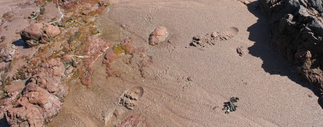
As I feared, from Polliwilline Bay there is no obvious path along the shore, nor along the neighbouring fields. But I’m reassured when I see footprints in the sand. Somebody must have come this way recently. Another coastal walker?
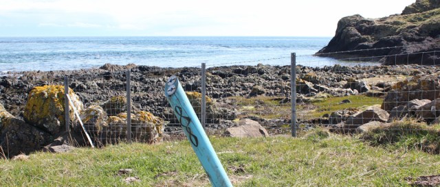
And, there’s one of the blue markers of the Kintyre way. It looks a bit weather-beaten, and is lolling at a drunken angle, but this MUST be the right way.
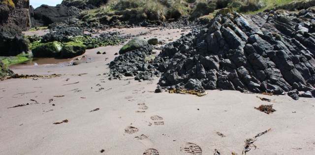
More footprints. It’s definitely this way.
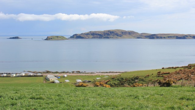
I round the rocky headland and now I’m in Macharioch Bay, where there are yet more caravans.

The beach, however, is beautiful. Love the waves and the interesting rocks. I stop and take far too many photographs. Yes, those are definitely rain clouds in the distance over Ayrshire.
Further along, following the path over grass, I see a memorial cross on a headland. I assume this is a war memorial, but soon discover it is a memorial to George Douglas, Duke of Argyll. He died almost exactly on this same day in the year 1900. Below his details, the inscription simply says, ‘His wife has erected this cross.’
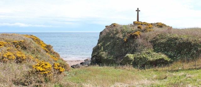
The path wanders over the headland, with good views of Sanda Island…

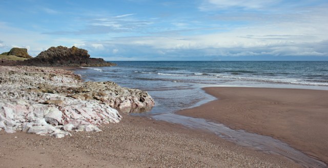
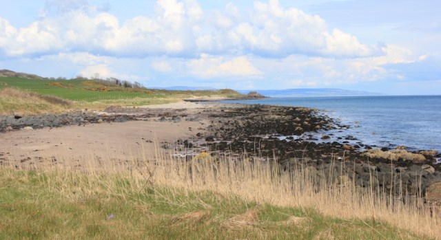
… before dipping down to another beach. This stretch of sand has no name on my map, but it is very beautiful.

Almost a mile in length, I walk along this wonderful beach, and I meet absolutely nobody.
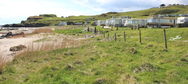
Beyond here is Kilmanshenachan Caravan Park – large and sprawling. It’s still early in the year for holidays, but a few families are sitting by their caravans and chatting in the sun. At this point the Kintyre Way turns inland again.
(It might be possible to follow the shore a little further, as the beach continues for another mile or two, but my map shows there are low cliffs beyond this, and then a golf course. So, I’m not sure if you can get all the way through to Southend.)
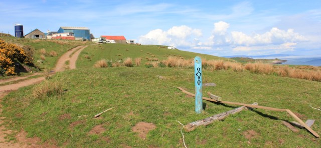
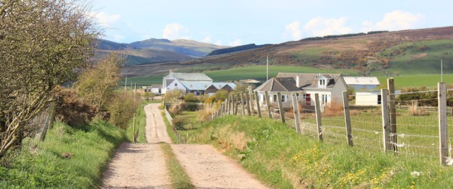
I follow the Kintyre Way up through the caravan site, and then up the farm track.
For some reason, at this point in the walk, I begin to feel very despondent. It’s been an easy walk, I had a moment of near ecstasy earlier this morning, and the weather has been incredible, but suddenly… suddenly I feel intensely lonely. I’m missing my family very much, and there have been some personal stresses and worries recently… oh dear. I begin to feel quite sorry for myself.
Anyway, to my retrospective shame, my eyes fill with tears. Silly really, because this turns out to be the most beautiful part of the walk, with the slanting evening light making everything glow. And – despite my tear-blurred vision – I manage to take some of the best photographs of the day.
Sanda Island looks wonderful.
Aisla Craig remains majestic and mysterious under the dramatic (and advancing) rain clouds.

Unexpectedly, I meet a couple walking down the track. They stop to say hello and we exchange comments on the weather. It’s the first proper human contact I’ve had all day, and I immediately feel better.
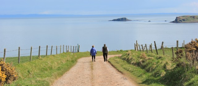
Funny how just a few kind words from strangers can cheer you up.
Onwards. The farm track joins a road – well, a sort-of road. No tarmac. The landscape is unspoilt and everything looks beautiful.
A cloud of midges dance in the shadow of the hedge. Oh dear. Scottish midges are notorious, although I’ve not yet had a bad encounter with any.
Suddenly the critters head towards me and surround my face. I wave my arms around and wonder if my insect spray is still tucked in the bottom of my rucksack. How fast can midges fly? Somewhere I read 6 mph, but somewhere else claimed their top speed is only 4 mph. I’m not sure if I can manage 6 mph, but I might be able to manage 4 mph, and so I begin to jog down the road.
These midges are large – mosquito-like in size – and later I realise they’re not the infamous, tiny ones that cause so much trouble. Anyway, I escape with no bites at all.
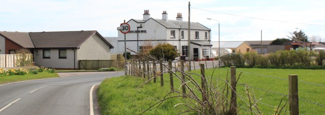
The track joins a road and, eventually, I reach the main B842.
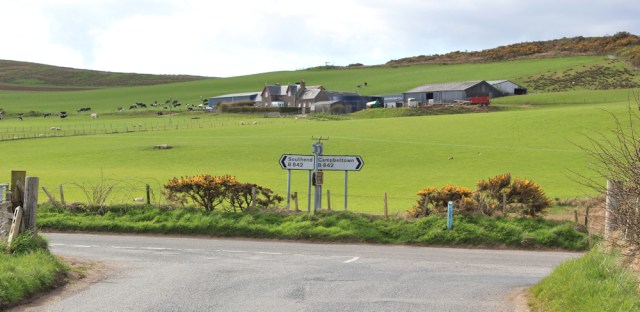
I’m only a mile from Southend now, and I plod along the verge until I reach the village. The pub might be open… but it looks closed and I don’t stop to investigate. My car is parked only a little further along the road and I want to get back to Campbeltown and my hotel.
Low points = caravans and unexpected tearfulness.
High points = unspoilt beaches and wonderful views.
Distance walked today = 16 miles
Total distance around coast = 3,667 miles
Route:


I have always had low points on all my long walks but invariably they have vanished by the next day. I am impressed with your attempts to stay close to the shoreline – without paths on the map it is a gamble if a particular section will go. If you have a smart phone you could do Facetime with your family or friends?
It’s funny how emotions can swing around so quickly. Yes, I should use FaceTime more. Good idea.
That feeling of melancholy is familiar to me too from my solitary walks. I think the more spectacular the location is the more there is a yearning to share it with loved ones or even strangers so when there is absolutely nobody around it is possible to feel a sense of isolation. Thank you so much for sharing your adventures with us and all the fantastic photography; we are all with you in spirit!
That’s interestimg Mike, and reassuring to know I’m not the only one to get the occasional walking-blues. Yes, I agree about the yearning feeling.
I agree with Mike that it can be the most beautiful places that trigger a moment of despondency and emotion. Nothing to feel shame for.