
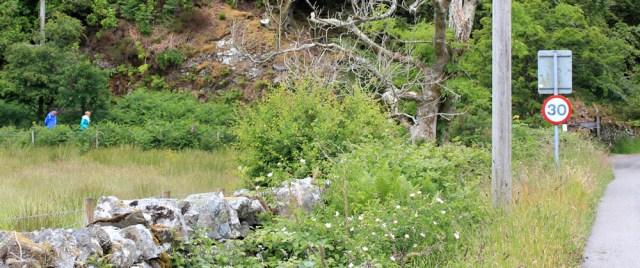
Walking along this quiet road is fine. But a road is still a road. So when I spot the opportunity to follow a track, and walk closer to the coast, I decide to take it. There are only a couple of gates to navigate, and they’re easy to open.

Through the trees I get a great view over Loch Creran. Shame the weather is dull, and the photographs I take are poor quality.

The track becomes less and less obvious. Fallen branches obscure the way. Still, it’s definitely a track… of sorts.

Another gate poses more of a psychological barrier than a physical barrier. “Airds Gardens. Private.”
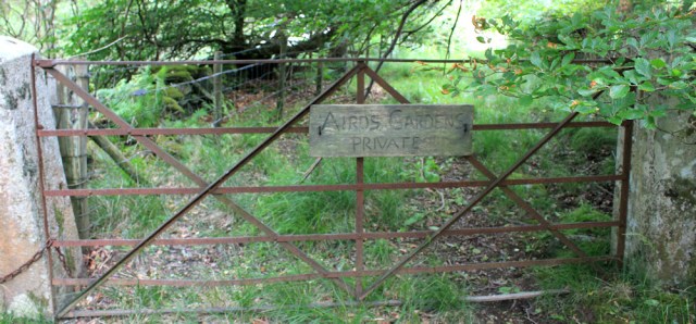
I check my map, but can’t see any sign of Airds Gardens, although there is an Airds House further along, and it looks as though the track runs right past the house. Oh dear. Well, I’ve come this far.
I climb over the gate and carry on, only to discover a couple more gates a few yards later. The second one is the most impressive so far.

The nearby fields are full of cattle. I hesitate by the gate. Climbing over farm gates is fine, but this one is formal looking. And, if I end up in a private garden… it would be embarrassing.
Like many walkers, I fear the embarrassment of being challenged for trespassing more than almost anything else! So – coward – I turn back.
Well, the road is very pleasant really.

Sometimes, I even catch sight of the sea. Oh. What a view. And what am I looking at? So many islands!

I walk past a number of grand-looking houses and think mean thoughts about their owners. Why can’t I walk nearer to the shore?
I’m getting close to Port Appin, when I see a couple of walkers coming down a path towards the road.
I stop to ask them if there is a way through along the path. They’re German, or Dutch, and we have a stumbling conversation. Yes, they assure me, you get all the way round to Port Appin via the path. And it’s very pretty.
During the two minutes we’ve been standing still, the midges have surrounded us. The tourists start flapping their hands about. Hurriedly, I thank them for the information, and head down the path at a fast pace.
Luckily, my Smidge seems to be working, because I’ve escaped without any bites. I even have the courage to stop and take some photographs. Yes, it is very pretty along here.
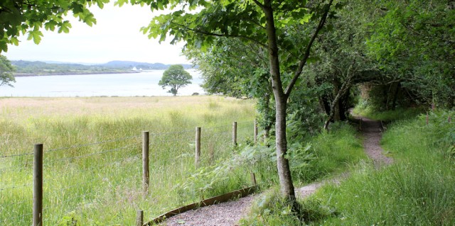
I’m walking down one side of a peaceful little bay. Airds Bay, according to my map. There’s a farm overlooking the water, and the path leads to a holiday cottage, where I pick up a track along the shore. It’s a beautiful spot.

I leave the track and head along a path that runs beside the water. It turns out to be a dead end, but I perch on some rocks and eat a snack lunch. A great place for a picnic.
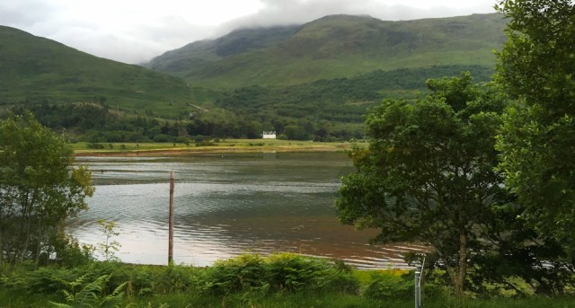
What a view. I’ve left Loch Creran behind, and those far cliffs are part of the mainland on the other side of Loch Linnhe. They look a little intimidating.
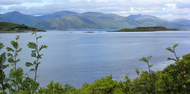
I open out my map and follow the track I will take – one day – along the far shore. Oh good. There is a minor road over there, running along the bottom of the cliffs, so I should be able to manage that section OK. But what about further on… oh, dear… it’s very rugged countryside over there.
No! Put the map away. My philosophy is to not look too far ahead, or to worry about walks I’ve yet to do. If I start doing that… well, I might give up altogether!
Onwards. I continue along the track as it winds around the little peninsula, and begin heading in a vaguely northerly direction towards Port Appin. I must be nearly there. Ah, yes, there’s a slipway where a ferry leaves for one of the islands.
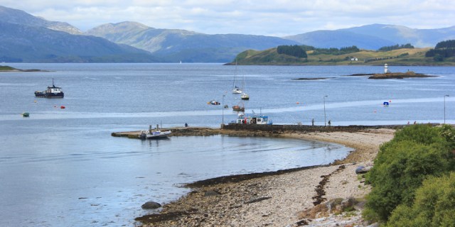
Now the track becomes a lane, and there are houses ahead.
A wooden plaque tells me the land has been donated to the Appin Community Trust in memory of a lady called Hersey Gordon-Duff. What a lovely idea. That explains why I could walk around this part of the coast. I wish more Scottish landowners were so accommodating.

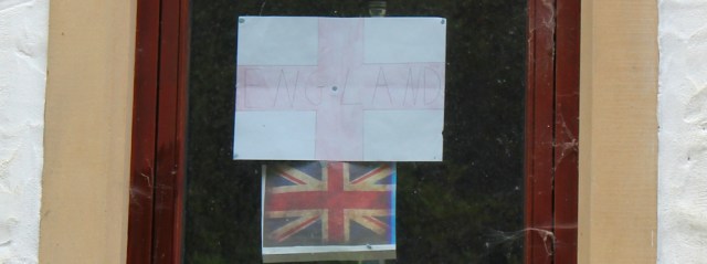
I walk past a house where someone has stuck an English flag and a Union Jack in the window. It is a small window, and they are small flags, but a brave thing to do in Scotland.
Port Appin is larger than I anticipated, with quite a collection of houses. And a pub! It’s a pity I’ve just eaten, but I stop anyway, sit outside overlooking the loch, and enjoy a pint of cider.
The ferry leaves hourly from here to the Isle of Lismore. One day, I must come back and visit some of these islands.

I can’t stay any longer at the pub. I’ve still got two or three more miles to walk. Onwards, along the road and through Port Appin.

This road is fairly busy, and I have to keep my eyes and ears open for traffic. The views are wonderful, and the sun has come out. It makes such a difference to the landscape.

There are new houses going up here too. I hope they’re not just second homes or holiday properties. One thing I’ve enjoyed about Scotland is the thriving community atmosphere. I would hate to see these places turn into ghost villages, as has happened to too many places in Devon and Cornwall.

I spot one of those circular mirrors, designed to help a car driver pull out of their drive safely. And, I realise I haven’t taken a successful self-portrait for some days. This seems like a good opportunity. I hold my camera away from my face, and click the shutter.
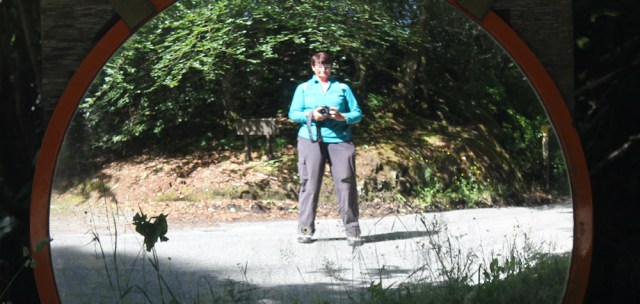
(It actually took several goes before I managed to snap the photo above!)
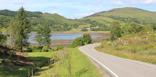
After a mile or so, the road runs alongside a marshy area of estuary. Of course, every body of water in Scotland is called a loch, and this muddy patch is a branch of Loch Laich.

I follow the curve of the shore, knowing I will have to walk back on myself, and away from the coast, to get back to the centre of Appin, where I’ve left The Beast. The views are lovely, and I stop to take plenty of photographs… not realising the best is yet to come.
Yes. There’s a castle at the entrance to the loch. And another staggeringly beautiful view. I check my map. This is Castle Stalker. Great name. Slightly menacing.

A nearby information board tells me that the castle once belonged to the Stewart clan, but was lost in a drunken wager to the Campbell clan, and changed hands several times after that. It is now privately owned, and only open to the public at certain times of the year.
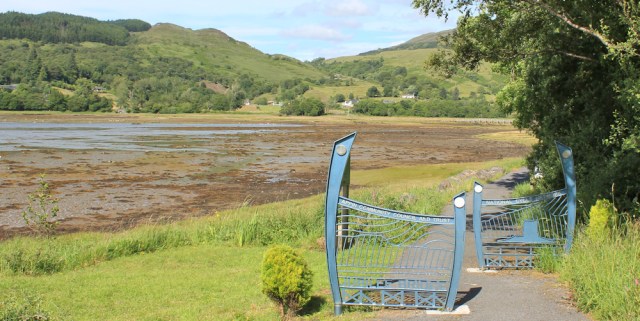
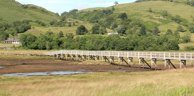
I’m only a mile away from Appin. But I can leave the road at this point, because a footpath leads off towards a pedestrian bridge over the river. The path has a set of attractive barriers to prevent vehicular access.
The bridge is called the Jubilee Bridge, and looks modern. So I assumed it was built to commemorate Queen Elizabeth II’s golden jubilee in 2002. But, a nearby sign tell me the bridge was originally built to celebrate Queen Victoria’s golden jubilee in 1887, but fell into disrepair. It has been recently renovated, and a mighty fine bridge it is too.
From the bridge, I get an excellent view of Castle Stalker. With the evening sun behind it, taking a decent photograph is challenging, but I manage to get several good shots.

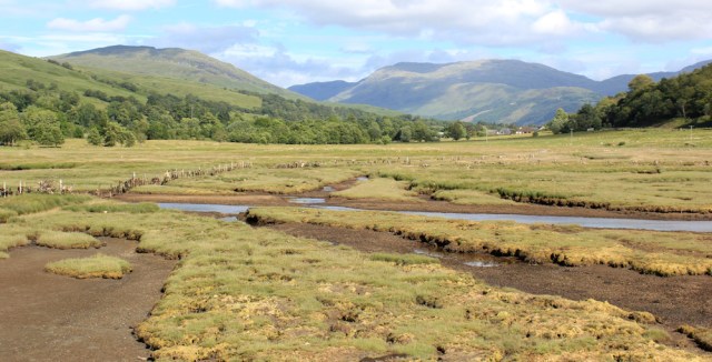
On the other side of the bridge is another excellent view. This time, looking up the salt marsh towards the hills on the far side of the river valley.
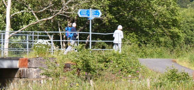
After crossing the Jubilee Bridge, I rejoin the Caledonia way. Here I meet several walkers, including an elderly couple, with whom I exchange a few words.
(Some days later, I meet the same couple in a pub. I don’t recognise them, but they remember me as “the lady who was taking lots of photographs”!)
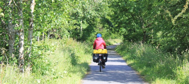
It’s a mile along the cycle path to Appin. I’m feeling tired now, and so am rather envious of the occasional cyclist whizzing by. But then I look at the amount of luggage some of the touring bikes carry… crikey, the Monster is heavy enough without an extra load.
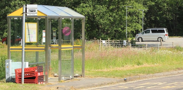
I reach Appin, and the bus stop where I started my adventure this morning. There’s the lovely Beast, waiting patiently in the nearby community car park.
It’s been a long day. I drive back along the A828 and find the pub I spotted this morning, the Creagan Inn. It’s not yet 6pm, but I’m hungry and, yes, it does do hot meals all day.
Afterwards, I drive around the top of Loch Creran and find a wonderful place to camp for the night, overlooking the loch. I sit on the step of The Beast, and watch the water turn to gold as the sun goes down.
Miles walked today = 15 miles
Total distance around the coast = 3,901 miles
Route: (morning in black, afternoon in red)


That’s a spectacular walk. Such impressive scenery and it sounds like despite all the hills around, it was actually fairly flat.
That castle is in such a beautiful location too. I hope you will be able to get a closer view when you get round there.
Where do you get that Smidge stuff? I looked in Boots and Superdrug and could not find it. I’m going back to Scotland in a few weeks and it might come in handy!
We swear by it too – although we took 3 cans to the Hebrides and didn’t use it once. Midges don’t like wind! Outdoor shops sell it.
Yes, it was a great walk, and fairly easy too. I bought my Smidge online from the company (they have a website that also provides a Midge Watch service wth a map showing the risk of midges). Most of the little shops in Scotland seem to sell it too.
I have done the second part of that walk, past the Jubilee Bridge and Castke Stalker, quite recently when we stayed in Airds Hotel in Port Appin. I didn’t know the area at all before that, it’s beautiful.
Hi Anabel. It’s another of those secret areas that few people seem to know about. Very beautiful.
That’s a lovely section of coast. We got the little ferry across to Lismore last year.
Castle Stalker is an ‘almost’ tidal island. You can walk to it at very low tide but not without getting wet feet. It features in the final scenes of Monty Python and the Holy Grail. There’s a good view from the other side where there’s a café & gift chop, but it’s a tourist magnet and gets very busy.
Ah, that’s interesting Peter. Does it qualify as a tidal island? And did you include it in your book? (I’m away from home at the moment and can’t check.)
I included it in my list of ‘nearly tidal islands’ because it didn’t meet my definition of being able to walk to it with dry feet at least once a month and being cut off at least once a month (plus a few other criteria).
I spoke to the chap who lives there and he said that people do walk out there but it is never completely dry – hence a nearly tidal island. It has a very interesting history which I wrote about in No Boat Required.
Generally I take being accosted by landowners as a challenge. The technique is to be humble, and then find something to compliment them about – their beautiful landscape, their dog, or whatever. Pretty soon I find I am talking about their grandchildren (a sure fire subject) and where they are going or have been for holidays, and local history can also be effective.
You are now getting into the real mountains – wonderful sights in your photos.
Hi Conrad. You’re braver than I am! Although it’s funny that I worry about being challenged, because I’ve never yet had a bad personal encounter with a landowner. I must catch up with your blog… been an eventful summer and haven’t had much time for reading, I’m afraid.
Not sure if I’m brave but I do quite often ‘pretend’ not to notice private signs.
As you say, don’t worry too much about the path ahead. I’ve looked at many hills from afar that seemed sheer or unclimbable, but on arrival I’ve found an easy path up. It’s impossible to judge from a distance.
Did you walk this during the World Cup? That’s the only reason I can see for the England flag, otherwise he really should think about moving (back)!
Great photos and views, I always think how much nicer places look with some sunshine and blue sky 🙂
Beautiful views, splendid barriers and a fine bridge! Castle Stalker has an interesting name – I looked it up and found this ‘Castle Stalker – in the Gaelic, Stalcaire, meaning Hunter or Falconer’ – an excerpt from the offical website.
I did this walk today too and I think we followed the same route. I came from the other direction and tried to follow the other end of that track but chickened out and turned back as it looked like it was going to head into a garden and/or farmyard ahead. Perhaps I should have re-read this first when you found that couple that had done so without issue.
I found Port Appin too busy. Wherever I tried to stand it seemed there was always someone in a car wanting to drive exactly where I was standing! The car park was full and also cars all along the road. I guess the ferry must generate a lot of traffic and there isn’t enough parking for it. The walk around the headland is lovely though, a couple of small caves along there too. Fortunately it seemed only the direct road from Port Appin to the A282 was busy the other roads were far quieter.
Oh yes I also met a lady sitting on the shore near the castle (castle sadly not open). She told me she was looking for sea otters because they can be seen here but she hadn’t see any today. Having said that the tide was out so either she was looking a long way out or otters wander about on the rocks (which I’d be surprised is the case).