
[Note: This walk was completed on the 26th June 2018]
The Corran Ferry is a busy little ferry. The website gives precise crossing times, but in fact the ferry simply shuttles back and forwards continually, carrying traffic across Loch Linnhe. If you travel by car, the short crossing is ridiculously expensive, but if you travel by foot… it’s free!
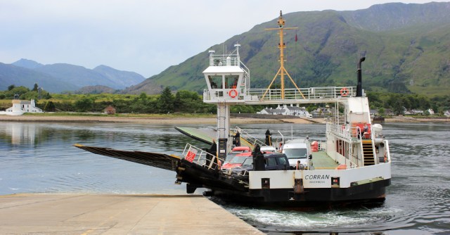
The ferry arrives on the west shore at a place called Ardgour, although my OS map doesn’t show anywhere called Ardgour. (I’ve discovered it’s not unusual in the Highlands for places to have several names. There’s the English version, the Gaelic version, the name the locals call it, and then the name identified on the OS map, which may be completely different. Needless to say, I find this all slightly confusing.)
Anyway, here I am in Ardgour and today, according to my rules, I should simply turn left along the coastal road. But… well, Fort William seemed a big milestone and I thought it would be a shame to miss it out. So, instead of turning left, I’m turning right and heading back up Loch Linnhe.

The route I’m walking is part of the official Caledonia Way, the same long-distance cycle way I’ve been following, off and on, since I left Oban. By crossing over on the Corran ferry, the Caledonia Way avoids the busy A82 and follows the much quieter A861, which runs along the western shore of Loch Linnhe up to a tiny place called Camusnagaul. From Camusnagaul you can catch another ferry back over the loch to Fort William.
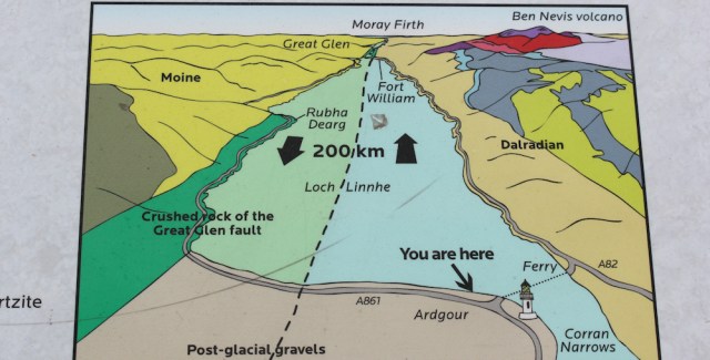
A nearby information plaque gives more details of the geology of the area. Loch Linnhe marks the rift formed when two tectonic plates collided – causing the Great Glen Fault – and I am now walking on land which should, in fact, be part of Canada. It got left behind a few hundred million years ago.
It’s rather a dull day, and I feel strangely unsettled. I’m acutely aware I’m walking the wrong way, away from my coastal route. Yes, I’d planned to do this – to walk up towards Fort William – but now I’m wondering if I’m just wasting the day.
Oh well, it’s too late to change my mind. My wonderful van – aka The Beast – is parked up by the Camasnagaul ferry. I must go this way. Onwards.

On the shore, a group of children are receiving instructions on how to operate canoes. Or maybe they’re kayaks? I don’t really know the difference. The water looks calm.

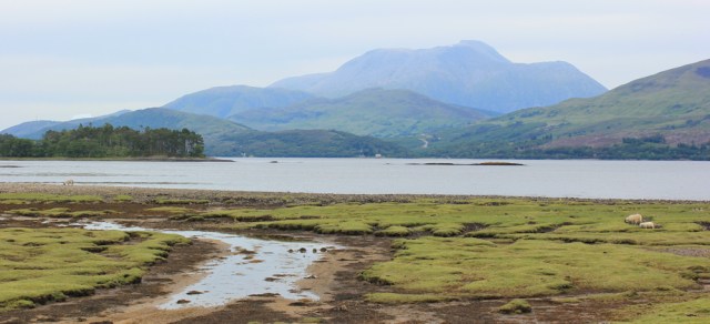
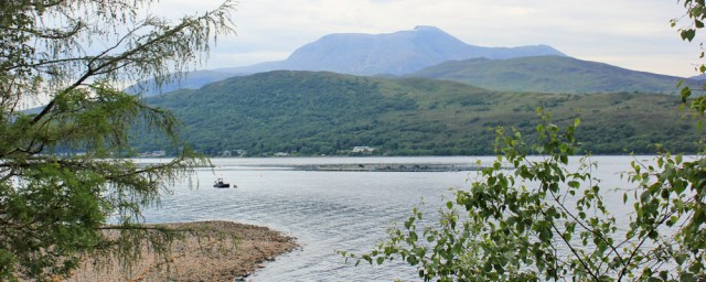
Nearby is yet another fish farm. Scotland is full of them. And what a fabulous view up Loch Linnhe. Such a loooong stretch of water.

I knew the A861 was going to be quiet, because I drove along it earlier. In fact, it’s a single track road, hardly an A road at all.
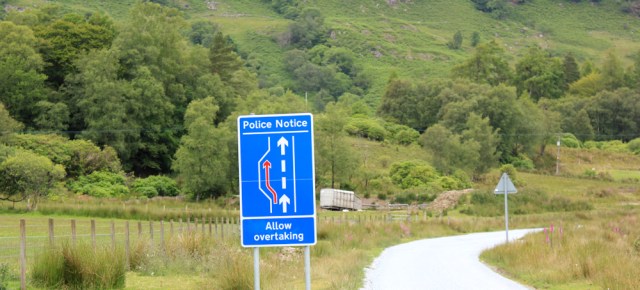
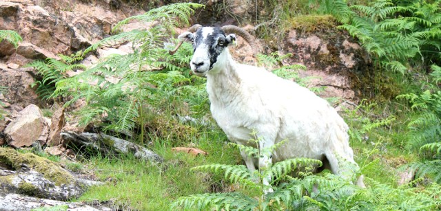
I only meet the occasional car, a few cyclists, and quite a lot of sheep. Sometimes the three things combine… and I managed to catch a mini episode of traffic congestion in the photograph below.

A post office van comes by. I do love these vans. The postal service in the UK is amazing – and we all take it for granted – but there are thousands of these little vans bustling about the roads and carrying mail to the most isolated areas. I just love spotting them.

A nearby rock is painted with a disturbing face, Banksy style. A screaming woman trapped in stone?

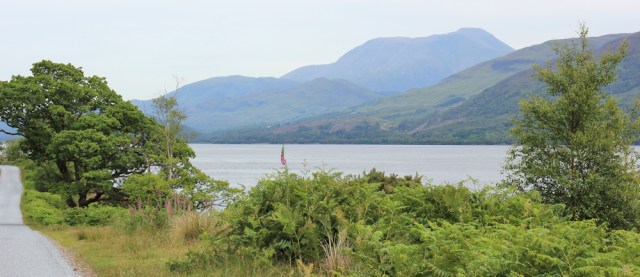
The landscape doesn’t suggest anything so sinister. Loch Linnhe is serene and… is that Ben Nevis across the water? I think it is.
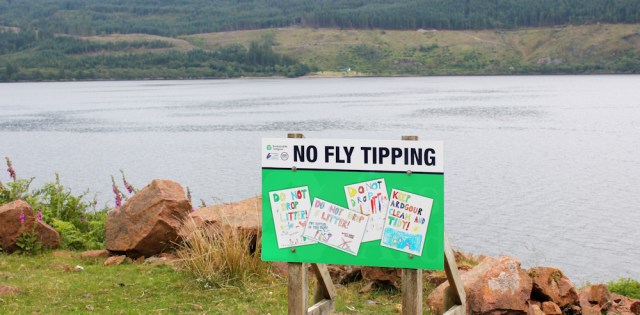
In a layby, local school children have contributed their art work to a notice board. “NO FLY TIPPING”. Who would spoil this lovely area by dumping rubbish? Obviously somebody must have in the past, or they wouldn’t need the sign.
The road is very quiet and I begin to feel a bit lonely. Ah, here’s a friend. Hello sheep.
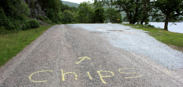
Somebody has painted the word “Chips” on the tarmac, along with a helpful arrow, directing me into another layby. Chips? Yes, please. But, sadly, there is no sign of a chip van today.
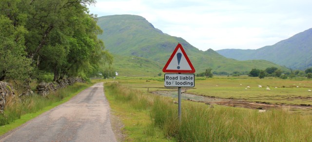
I reach a place called Inverscaddle Bay, where the road swings in a wide loop around the edge of a marshy area. Apparently this road is liable to flooding. Fortunately it’s dry at the moment.
There’s a great view over Loch Linnhe. Shame the weather isn’t more cheerful, but that’s definitely Ben Nevis.
I’m getting fed up with tarmac walking, and a track off to the left looks inviting. Twenty miles to Strontian. Hmm, I think I’ll be heading there one day, but not just now. Another sign warns me to ‘TAKE CARE’, because the path goes through remote and potentially dangerous mountain country. Oh dear.

I’m sticking to the road anyway.
Inverscaddle Bay is where the Inbhir Scaddail river empties into Loch Linnhe. Despite the marshy surroundings, the shallow waters at the river’s mouth are crystal clear. Beautiful.

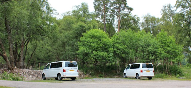
I pass two identical vans parked together, but not quite together. In fact, it looks as if they’ve had a tiff and aren’t speaking to each other.
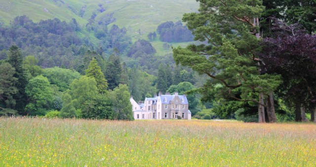
Further along the road, I spot a large house across a meadow full of wild flowers. Check my map. That must be Conaglen House. Looks impressive. Apparently you can rent it as a holiday let.
Onwards. This road seems to go on for ever and, disappointingly, I have no view of the loch at the moment.

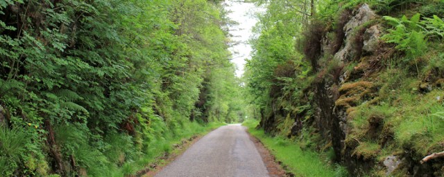
It is pleasant enough. Sometimes I walk through rocky cuttings, which may or may not be natural. The day is gloomy, it’s late afternoon, and I begin to worry about midges.
I begin to walk faster, wishing the day was over. Perhaps this detour was a mistake and I’ve not only wasted a day going in the wrong direction, but I’m going to be eaten alive by midges too.
Ah, here’s another view of Ben Nevis to cheer me up. And another fish farm in the loch.
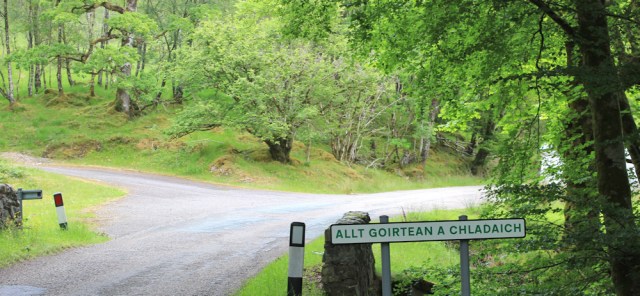
In Scotland, they seem to signpost every bridge with the name of the river it crosses. This creates useful way markers for walkers, and helps me work out where I am. Yes, I really am making good progress now.
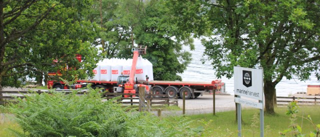
I hear the rumble of a truck, and realise I’m walking past the fish farm, which turns out to be a salmon farm run by Marine Harvest. It’s a familiar name as they seem to run multiple farms in the area. Well, we all like a piece of tasty salmon, don’t we?
Another river, another bridge, and another signpost. Allt Ruadh. Only a few more miles to go.

Ben Nevis is clearer now. There’s snow on the top! What a shame there’s no sunshine and the photos I take are very dull.
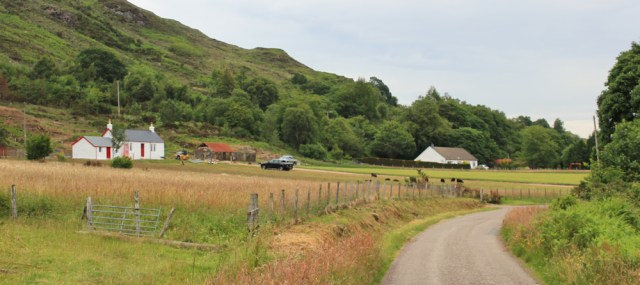
I come to a place signposted as Sron A’Chreagain or Stronchreggan. As so often the way, it’s not really a village at all, just a collection of buildings.

Onwards. The woods are lovely, dark and deep, but I… well, I’m worrying about midges and, to be honest, a bit fed up with all this road-walking.

The A861 has a few cattle grids. Luckily, I’ve seen no sign of cattle. Only sheep.

Just beyond the cattle grid, a sign tells me I’ve nearly reached Trioslaig (or Trislaig). Good, I’m nearly there. Only a mile or so to go.
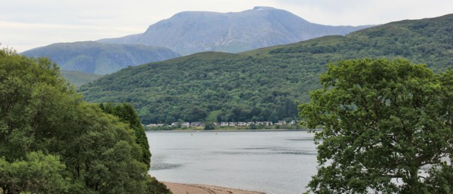
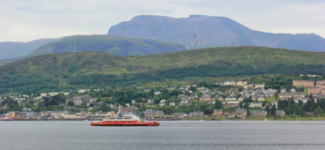
Now the road runs close to the water again, and I get some great views of Ben Nevis – and there’s Fort William, just across the loch.
Trislaig is a scattered collection of cottages, nestling up against a steep bank of hillside, and all set back from the road. Maybe once they were crofters cottages?
There are sheep in the surrounding fields. Rather bizarrely, a woman is mowing one of the fields. Maybe she is trying to get rid of the coarse grass to allow the softer grass room to grow? Or maybe there aren’t enough sheep to keep the grass down?

She seems to have a very small mower for such a very large field.
Beyond Trislaig, and the road runs close to the water again. There is Ben Nevis, and Fort William below it.

At last I’m approaching Camusnagaul, and the end of my journey.

The last few hundred yards seem very long. Why am I so tired, and why have I been so negative about today’s walk?
Camusnagaul is a tiny place, with just a handful of houses, a bus stop, and the jetty where the tiny little ferry runs across to Fort William. It’s where I parked The Beast this morning. Oh, he’s such a welcome sight.

Unfortunately, the ferry service here is very infrequent and the last ferry over leaves at 4:30pm. (It is now nearly 6pm.) Knowing I would spend the day in a state of anxiety about missing the last crossing, I actually caught the ferry over this morning, and wandered around Fort William for a while, before catching the bus to the Corran ferry.
So I’ve done this walk back to front, so to speak.
Actually, I didn’t think much of Fort William. Crowded, packed with tourists, and full of twee shops selling overpriced shortbread and tartan. Not a good experience, especially as the bus station was unsigned and it took me some time to find it, and even longer to work out which bus to catch and which bay to catch the bus from. All very frustrating.
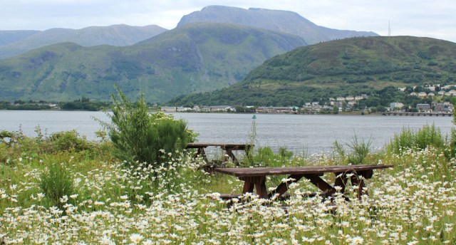
Never mind. The walk is finished now. I make my way to a picnic bench and sit for a while, admiring the view of Ben Nevis, surrounded by enormous daisies.
Next task is to find a place to park The Beast for the night. I’m going to drive back along the A861 because I’ve spotted a few potential places on my walk…
[to be continued]
Miles walked today = 10.5 miles
Total around coast = 3,937.5 miles
Route:


Hi Ruth,
My husband was brought up in Fort William when it a very different place. As you say it is a bit of a theme park now.
I have just started walking again after a long illness – blog posts to follow. I do admire you for taking on Scotland – the logistics of transport and accommodation would be too much for me. Good luck with it 👏
Glad to see you are walking again, Tricia, and look forward to catching up with your blogs.
Your opinion of Fort William is the same as mine, I wasn’t impressed with the town at all though I did like the municipal gardens which run alongside the A82 and the loch side.
Wow, you have just taken me on a wonderful ‘memory lane’, thanks Ruth!
A long time ago a good friend lived near Camusnagaul, and as often as possible I would drive up, taking my little car across the Corran Ferry and turning right. Fort William was tired back then, but there were far less tourists. Easy to mock the gift shops, the tatt and the twee, et al, but it brings money into an otherwise very sparse economy.
Hi Ruth.Thanks for this.i felt I was walking with you.i live here and I am planning walking this route as I have been walking route 78 ballachulish to oban.it was good to know the milage.i cycled it many years ago and loved it.
Hi Catherine. Good luck with your walk, and what a lovely area to live in. I’m jealous. If you’re planning to use the Camusnagual ferry, please remember you need to check the ferry times carefully. Best wishes.
I’m staying in Fort WIlliam and your assessment seems accurate. Finding somewhere to eat is a nightmare.
I am going to count the Corran Ferry as my crossing point. I did drive that road however so I know what it’s like. The Corran Ferry is £9 each way (it’s only 500 metres) so decided to drive back to save the money, but it takes a long time to go around.
Hi Jon, and it’s perfectly acceptable to turn left at the Corran Ferry and miss out walking this section – which I only did as an optional extra so I could say I’d walked through Fort William. As you may have gathered, I found this walk a bit tedious, despite great views of Ben Nevis.
Regarding the name Ardgour I was also a bit confused by that the pub being the Ardgour Inn, for example. However I believe it is actually the name of the eastern part of the peninsula (so like Ardnamurchan for the west and Morvern for the south, Ardgour is the eastern part). See the map here for example. https://www.westhighlandpeninsulas.com/about-the-peninsulas/ardgour
That might explain this confusing seemingly duplicate name.