
[Note: this walk took place on the 27th June 2018]
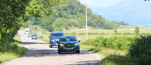
We’re having an unusually warm summer this year in the UK, and in Scotland I wake up to a beautiful, sunny day, with barely a cloud in the sky. I start my walk from the ferry slipway in Ardgour.

I turn left, away from Fort William this time, and resume my coastal trek. First I must take a photograph of the little lighthouse at Corran Point. It’s short and stubby, a pattern that most Scottish lighthouses seem to follow.

I look back to watch the ferry arrive, and I’m surprised to see an ambulance coming off the ferry. I guess it’s a much quicker route than the alternative of travelling all the way round the end of Loch Linnhe by road.
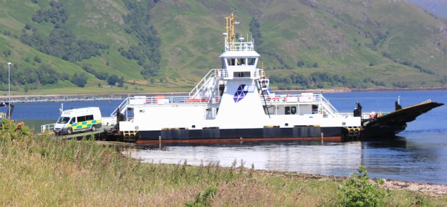
The ambulance pulls up beside another ambulance waiting nearby, and I realise they’re about to transfer a patient between the two vehicles. I wonder how often this happens. In such a remote area, journey-times to the nearest A&E must be very long.

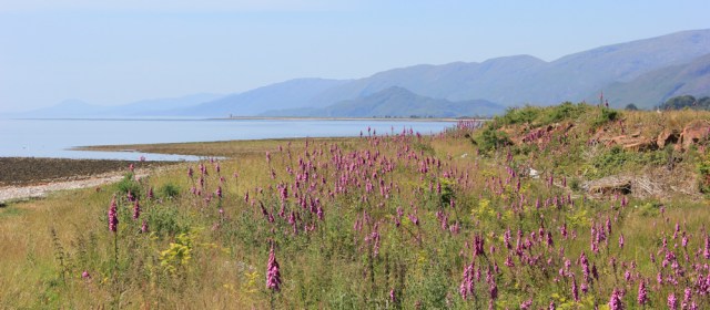
I continue onwards, past the lighthouse. After a tiring road-walk yesterday, I want to give my feet a rest from tarmac and so I stay close to the water, walking across rough ground dotted with wild flowers.
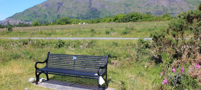
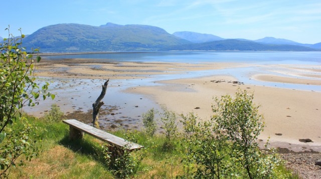
Here’s a memorial bench. You don’t see as many of these in Scotland as you do in England. This one is dedicated to Murdo John Mackillop – a wonderful Scottish name.
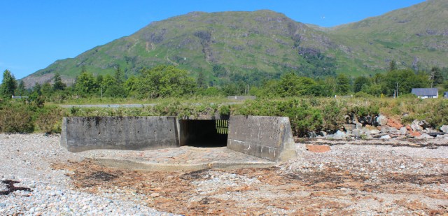
The road is close to my right, and I’m about to navigate a little river. But I’ve no need to wade across, because there is no water flowing. Wow. Such a warm dry summer, and even the Scottish rivers are running dry.
Along the shore the rough shingle is tough underfoot, but I don’t mind because it’s wonderful to be off the road and walking close to the loch. Sallachan Point is my next waypoint, with another lighthouse. I can see it as a tiny dot in the distance.

I make slow progress, partly because I have to watch my footing on the rocks, and partly because the views across Loch Linnhe are so beautiful, and I keep stopping to take photographs. There’s the bridge at Ballachulish, in the distance across the water, with Glen Coe beyond.

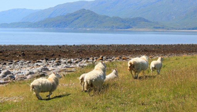
The lighthouse at Sallachan Point is growing nearer. I walk along the grass, following what might be a footpath…

… or it might be just a sheep trail. Sorry ladies, I didn’t mean to startle you.
The “lighthouse” at Salachan Point turns out to be a daymark tower. It has an odd geometric shape, hexagonal I think (I forgot to count). Unusual. What a beautiful location.

The daymark sits at the apex of a promontory of flat land, jutting out into the water. I begin to make my way down the other side, around a wide bay called Camas Shallachain.
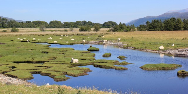
This is where the River Gour empties into Loch Linnhe, and here I find a flock of sheep sitting on a series of grassy islands.
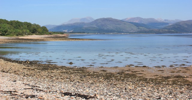
The bay itself is a mix of mud and sand. On a fine day, it looks like a lovely beach, but the ‘sand’ is actually quite thick and sticky.

I can’t get any further along the bay, because of the river, so I must join the road again and use the bridge to cross over the River Gour.

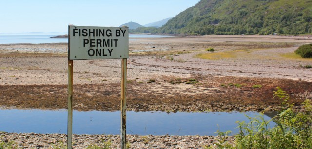
There is a little parking area close to the bridge, and a number of signs. Apparently fishing here is by permit only.
And no overnight parking or camping is allowed. Oh, what a shame. This would be a lovely place to spend the night with The Beast.

From here, the shore becomes difficult to follow, and I stick to the road.
I had a late start this morning, and it’s nearly one o’clock, so I’m pleased to find a picnic bench overlooking the bay. Time for lunch.
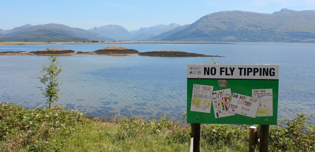
A nearby noticeboard informs me that this is one of the few places where you can see both Ben Nevis and Glen Coe at the same time…

… and, yes, you can! Ben Nevis is on the far left hand side of the photo, and Glen Coe is the peak on the far right. (I think I’m correct, but no doubt someone will tell me if I’m not.)

Sadly, another noticeboard tells me I shouldn’t be fly tipping. I can’t believe that people would dump their rubbish here, but I guess the sign is there for a reason. Look at the beautiful clear waters and the incredible view. Who would spoil this place?
After lunch, I continue along the road. It turns away from the coast for a while, and I lose sight of the water, but I don’t mind the change in view. There are some spectacular mountains ahead.

The bridge over the Ghearraidh river is functional, and it would be easy to miss the river if you whizzed past here in a car.

Shame, because there’s a much prettier (and far older) bridge hidden in the foliage.

The road has brought me back close to the water again, and a sign warns me there are cows ahead. Yikes! Cows for three miles. Triple yikes!

I decide to leave the tarmac and walk along the shore. Not only is this more attractive than the road, but hopefully my route will be cow-free.

Everywhere I look the views are stunning. There’s Ben Nevis again, our highest mountain. I know I’m going to lose sight of him shortly, so I stop and take more photographs.
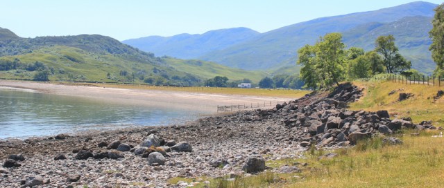
I’m approaching Inversanda Bay, and I wasn’t expecting such a pretty beach.
To avoid a scramble over rocks, I follow a rough track above the shore, and through some trees. After this I was hoping to pop down to walk along the beach, but the fence puts me off.

I would have to cross the beach under the scrutiny of a large house that overlooks the bay, and in the middle of the bay there is a river to cross, so I would have to come inland at that point anyway. OK, I’ll follow the road instead.
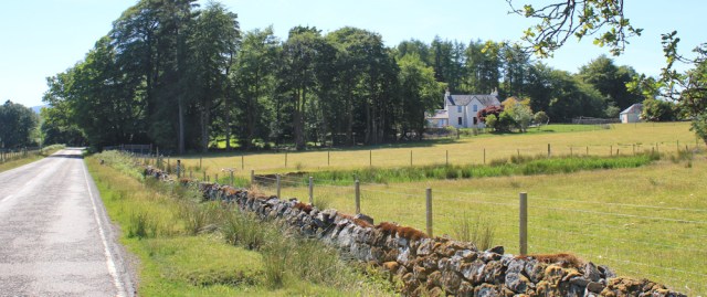
I’ve nearly reached Inversanda. The road swings around a shallow curve, away from the bay. It’s hot and I’m getting tired. There’s a nice, white house, across the fields. Maybe there’s a café here?
When I researched the bus route, I noticed the bus stops at Inversanda and so I thought Inversanda would be a biggish place. Should have known better.
Well, this is definitely Inversanda. Love the rustic sign, although it doesn’t look as though it will survive too many Scottish winters.

No café, of course, and I can’t even see a bus stop. Just a driveway, a few parked cars, and an old telephone box.

Basically, Inversanda is just a couple of houses and a bend in the road!
I hear the sound of traffic behind me, and a sudden flurry of cars and vans drive past. I realise a ferry must have landed and released this batch of vehicles.
Onwards, through Inversanda. I’ve a little further to walk before I finish for the day.
Ahead is the turnoff for Kingairloch, and I’m going to walk a mile or so up this road, and pick up my bicycle from where I dropped it off earlier. The sign for the B8043 is large and impressive…

… but the road itself is small and insignificant. Single track, with a 10mph speed limit, and no trucks allowed. My kind of road!

A little metal post beside the road turns out to be a “traffic count installation”. Really? I’ve never seen one of these before. Is it still working? Does it count me? Will it count my bike? Why is it there?

Maybe they will close the road if nobody uses it? But there are hardly any roads in this area anyway. So maybe they will widen the road if they find plenty of people are using it? Who knows the purpose of the little grey box? It’s a mystery.
I cross over the River Tarbert. In Gaelic, Tairbert means a crossing point, and it’s a common place name in Scotland.
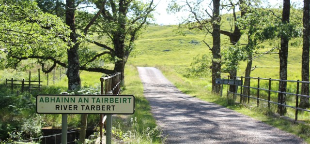
Beyond the river, the road winds and rises through grassland. I’ve left my bike at the top of the hill. Onwards and upwards. Whew, it’s warm.

I’m rewarded at the top by a great view looking back down at Inversanda, Loch Linnhe, and the mountains beyond. Ah. I recognise a couple of those peaks. So this is another place where you can see Ben Nevis and Glen Coe, both at the same time.

This morning I stopped in a gravelled area, and left my bike – my heavy monster of a bike – resting in the grass. Where is it? Perhaps someone has stolen the horrible thing?

No such luck. I spot some handlebars poking through the grass.

Perhaps it’s just as well nobody has stolen The Monster. It would be a long walk back to the Corran ferry where I’ve left my van. The bike ride back along the road is surprisingly pleasant, with only the occasional bit of traffic to contend with. It’s mostly downhill or flat, so I get to ride all the way.
It’s always a relief to get off the Monster. I’m getting better at riding the blasted thing, but I really must buy a padded seat.
Miles walked today = 9 miles
Total around coast = 3,946.5
Blisters = 0
Miles cycled today = 7 miles
Saddle sores = 0
High points: the amazing views and gorgeous weather
Low points: none
Route:


Gorgeous views, and I love the sheep on the little grassy islands 🙂
Yes, I was surprised to see sheep on such damp land, because they usually don’t like wet ground. Maybe the grass is especially tasty there 😄
Another enioyable read Ruth. How far north are you now? I’ll be heading back to Ullapool (where I’ll be staying) very soon to continue walking, but heading south. I’ve got as far south as Lochinver (north of Ullapool) so far. I expect we’ll soon cross as I don’t think you are far from Ullapool now? It will be very useful for me to read your posts again to work out the exact routes your took as I go south.I have 3 trips planned to the north west of Scotland this year, this trip will be my first. I don’t have the luxury of a bike or camper van however so might end up walking some of the walks there and back as you have done, which almost halves the distance I can cover in a day.
I’ve also made a trip to Northern Ireland so far this year to walk the Causeway Coast way (stunning, by the way), but undecided if I’ll do the rest of Northern Ireland. Actually I discovered there is a path there called the Ulster way which goes all around Northern Ireland so probably am decided … but still in denial about it…! I might right a “special” about that in the mean time.
Also I doubt you have to worry about anyone stealing your bike. People are very friendly and pleasant up there. In fact I’d be surprised if anyone had even noticed it there!
You’re right it’s unlikely anyone would steal the bike, but I live in hope 😆
I’m not much further north, I’m afraid Jon, as it’s taken me a long time to get round all the ins and outs of the area, and it’s so beautiful here I’ve been taking my time. So I’m still on the Ardnamurchan peninsula. To be honest, I’m worried about how I’ll cope with the coast north of Mallaig, so will be reading blogs for inspiration and planning tips.
Lovely views, Ruth – best of your trip so far, I think.
That little grey box must be at least 24 years old. The phone number on the label shows the Inverness dialling code as 0463, but that changed to 01463 on 16th April 1995, when we moved to having ’01’ dialling codes everywhere! I would guess that it probably stopped counting traffic a long time ago…
That’s interesting information Peter and good detective work. Thank you. So that box now represents a little bit of history.
I am so pleased to see your posts again – you are now on what for me was the greatest stretch of UK coast all the way to Kyle of Tongue beyond Cape Wrath. Yes the going will not be easy, but not impossible – lack of public transport and roads will require more camping, although there are a few well placed bothies. Don’t miss out on Knoydart, take the ferry to Inveree from the far end of Loch Morar (not from Malliag) as it is almost impossible to walk onto Knoydart from the south. The walk along that Loch is great – it is the deepest in Scotland, more than twice the depth of the North Sea and is reputed to have its own monster – Morag!
I am so pleased you are blogging again Ruth after your recent problems. Your photos are some of the best I have seen of Scotland.
As you say yourself “onwards and upwards” and may your way be cow free.
Well done for getting as far as Ardnamurchan which is achingly gorgeous, have you gone past Loch Sunart yet? Just wait until you get up to Arisaig . . . you’ll go even slower then!
When I used to visit the area I remember a lot of fly tipping – and from what was dumped it was definitely locals who just could not be bothered to take large amounts of houshold items to Fort William or wherever the amenity waste places are. Yet those people could always manage to transport their unwanted belongings to somewhere remote and away from nearby houses? Grrrr
What a pretty walk and a very enjoyable read. I am very ignorant as I didn’t know that Ben Nevis and Glen Coe are both ancient volcanoes.
We get fly tipping in the New Forest too, it makes me very angry when I see piles of junk dumped which is not only unsightly but dangerous for the wildlife of the forest.
I did this walk today. Looks like I parked at the same place that you left your “monster” bike! I walked from there up to the A861 and then took the once per day bus to Ardgour Inn at the ferry to save the need for any cycling!
The Ardgour Inn has closed down I’m not sure if it’s just temporary or for good but the sign says there has been a fire (though no damage I could see from the outside) which I believe happened at the end of July.
It turns out (reading this again after) the I followed the same route as you including out to Sallachan Point and as the tide was out along the beach with the sheep on the marshy islands (still sheep there) up to the road. The dried up river was dried up today.
The part of the walk beside the A861 from there was very wet, I didn’t have such good weather as you. But it stopped raining just as I got to Inversanda Bay so went down onto the beach for lunch. It is a nice beach. There is a gap in the fence now and a stile from the road so I didn’t find the beach too unwelcoming.
The Inn looked pretty busy when I was there, so what a shame if it’s closed down permanently. Inversanda Bay was lovely. I spent a night in The Beast overlooking that beach.