
[This walk was completed on the 19th June, 2019]
After another rainy night, I wait until the morning downpour eases before I set off in the car. About half way along the road to Glenelg, I spot a convenient layby and decide to park here. I’ll do today’s walk in two stages.
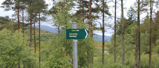
Near to my parking spot, a track leads off the road and heads down towards the shore along a forestry track. “Sandaig” says the path sign. Hmm. Sandaig? The name seems familiar for some reason.
The track looks tempting… but the rain could restart at any moment, and I’m determined to make good forward progress today. No time for diversions.
Before I can start today’s walk properly, I must use my Monster bike to return to the spot where I ended yesterday’s walk. The road rollercoasters up and down, and there’s a steep slope to negotiate at the beginning – so, I’ve left the bike at the top of the first slope.
I walk up the road and, as I climb higher, get a wonderful view across the Sound of Sleat. That’s Skye over there.

At the top of the hill, I pick up the Monster, and speed off – freewheeling down slopes, sailing round curves, and praying I won’t meet any oncoming traffic along the single-track road – until I reach the shore of Loch Hourn, where the road flattens out.
After a couple of miles of gentle pedalling, the road begins another steep rise. I’m forced to get off the Monster, and decide to leave the thing under a tree and walk the rest of the way.
Must be nearly at Arnisdale… now, where did I stop yesterday?
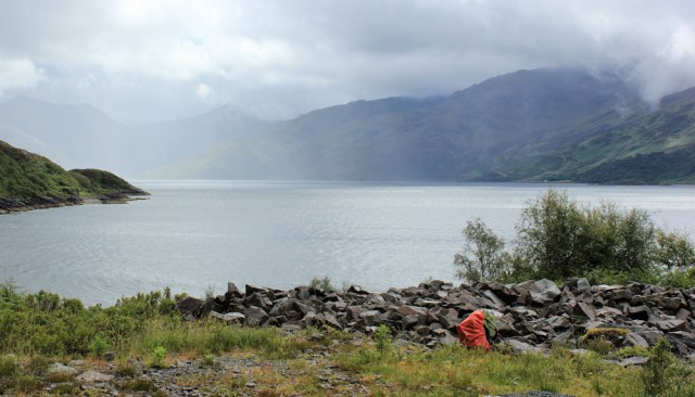
Ah, here’s the spot. I’ve reached the flat area where I turned back before. Shame it’s such a dull day and the view is veiled by mist. I take a few photos anyway, then realise it’s past 1pm and I’m hungry, so I perch on a stone and begin to eat my lunch. I might be uncomfortable and damp, but it is still a fine view.
I’ve just tucked into my sandwich when, right on cue, the rain starts falling again. I quickly pack my food away, pull on my waterproofs, and set off. Of course, almost as soon as I’ve started walking, the rain stops!
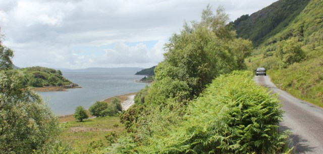
The road runs a few hundred feet above and inland of the shore, with a good view of the loch. That little island must be… I check my map… Eileen Mhairtein.

Round a gentle curve in the road, and I reach a place called Rasaidh. It seems to consist of a single house. What an incredible view the residents have – looking down towards the mouth of Loch Hourn, over another batch of pretty little islands, and across the water to Skye.
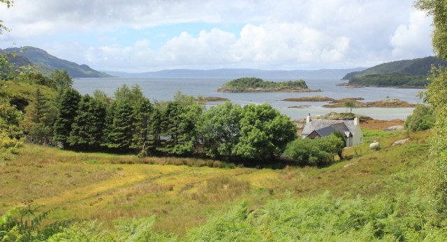
Further along, the weather lightens a little, and I get a better view of the islands. Stop to take more photographs and check my map again. Eilean A Chuilinn, Eilean Rarsaidh, and a flurry of low-lying rocks in the foreground – Sgeirean Rarsaidh. What tongue twisters.

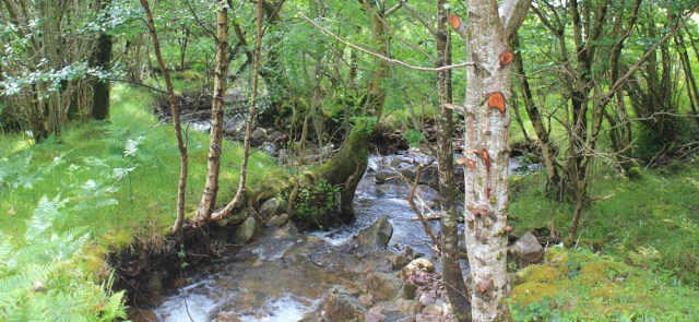
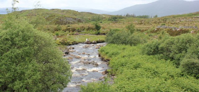
The road enters a patch of woodland, and I lose sight of the loch. But there is still plenty of water around. After several days of rain, multiple small streams thread their way down the slopes, and the established burns are full of bubbles and froth.
I’m passed by a post office van. Traffic has increased along the road as the day has progressed, from one car every 10 minutes this morning, to one car every 5 minutes now. Not exactly busy.
I noticed this silver van when I walked along here earlier. The driver had parked close to the cattle grid and was brewing up a cup of tea. His van is still parked here, but the driver is nowhere to be seen – perhaps he’s out walking too? From my map, it looks like you can follow a track inland and go over the hills, rejoining the road further along.
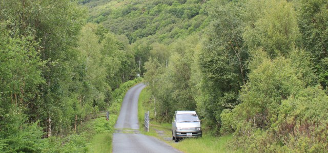
Following my rules, I must, of course, stick to the road. I cross the cattle grid, and wonder if the grid is there to keep cattle in, or to keep cattle out. Or, maybe, it’s there to keep deer in, or to keep deer out?
A short while further along, I pass my bike, which is leaning casually against a tree. Hello, old Monster, wait here. I’ll come back and pick you up later.

The sun peeks out through the clouds, as the road slowly rises and the trees thin out. I’ve nearly reached the end of Loch Hourn. The mouth of the loch is just ahead.
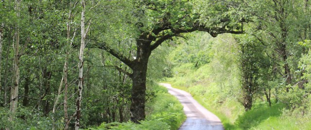
I’ve begun a long, slow climb. This is the hill I free-wheeled down earlier, and it seems much, much longer now that I’m actually walking up it. It curves away from the shore too, but I enjoy walking through woodland, surrounded by native trees – silver birch, humble ash, and the occasional mighty oak.
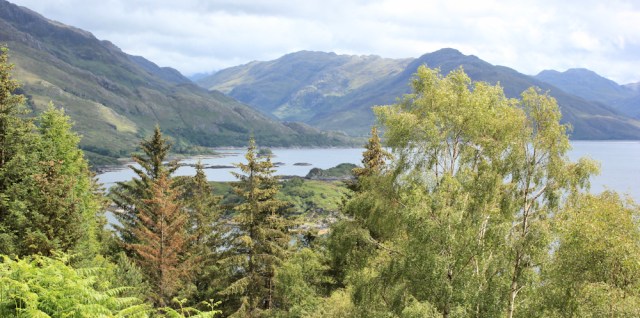
As I get higher, the view gets better. I can see over the top of the woods below. The clouds have lifted a little, and there’s a fabulous view across to the dark mountains of Knoydart, with sunlight picking up splashes of greenery on their slopes.

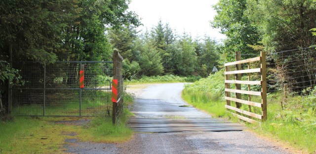
I pass through another cattle grid, hoping I won’t meet any cows today…
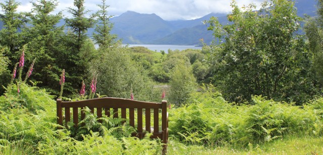
… and then walk past a bench, which is almost swallowed up by the surrounding bracken. Great view.
Nearby, a sign lies on the ground, apparently defeated by the slope. “11%” – yes, the hill is about to get steeper.

From higher ground, I spot a ship out on the water, over on the far side of Loch Hourn. What’s it doing over there, in the middle of nowhere?
Ah, I can just make out the tell-tale rings on the water in the shadow of the mountains. Even the remote and mysterious Loch Hourn can’t escape from this scourge – yes, it’s another fish farm.

I’m almost at the end of the loch, and from here my road will swing around, in a series of shallow curves, and I’ll begin to head north. It will be good to be heading in the right direction, for a change – I seem to have spent forever travelling east and west along the shores of long lochs – but I’ll be sorry to leave this incredible area behind me.
Stop and take some final photos, looking back up Loch Hourn. That cleft between the mountains is Glen Arnisdale. I seem to have walked a long way, but have really covered no distance at all!
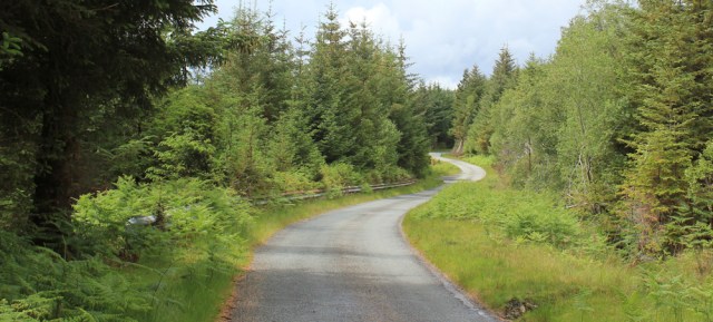
The road continues upwards, and runs through rocky cuttings, while tall pine plantations loom above me. Impromptu waterfalls tumble down the slopes, and disappear into gullies beside the road.

The sun is shining weakly through the clouds, lighting up patches of the tarmac. The road begins to flatten off, and I realise I’ve nearly reached the top of the climb.
I go past the spot I left my bike earlier, climb a further slope, and swing round another bend. Those mountains ahead – covered in drifting clouds – belong to Skye.

When I walked along here earlier, I spotted a beautiful layby with a picnic bench, and I planned to stop here for a rest and to finish my half-eaten lunch. So, I’m really disappointed to see a car parked up in my spot.

The driver is out of his car. He’s not admiring the view but, apparently, standing and staring at the uninteresting bank on the other side of the road. It takes a moment before I realise – he’s stopped for a toilet break!
I slow down – dropping my speed from tortoise pace to snail pace – to allow him to finish. By the time I reach the layby, he’s driven off.
A plaque on the picnic table instructs me to ‘Sit and Enjoy the View Like Chris Griffin Did.’ Yes, I’m happy to obey. Sit down and eat my lunch while staring out across the Sound of Sleat and the mist-covered hills of Skye.

But the sun has disappeared again, and it’s too chilly to sit still for long. After a quick lunch break, I set off again.
The road runs high, through open countryside, heading northwards towards Glenelg. I pass through another cattle grid…

… and then down a long, slow slope through an undulating landscape. I’ve already walked this stretch this morning, but you get a different perspective walking the same road in the other direction. The dark hills (or maybe mountains) in the distance are actually not on the mainland at all. They’re on Skye.

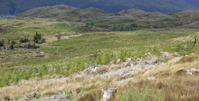
Around me, the land is open and untidy. Clearly this area was once covered in fir trees, which have been felled, and it’s now a mess of scrappy branches and bleached stumps. New trees, green and hopeful, have been planted lower down the slopes.
I cross over a noisy stream – Allt Mor Shantaig.
There’s a cottage ahead. It looks rather sad and lonely, sitting in this isolated spot on the felled slopes, and crowded by ferns. There’s a trampoline in the ‘garden’, which is overgrown with more more ferns and long grass. I can’t work out if the place is occupied or not.

Just beyond the cottage is a flat area with a back drop of tall pines. It’s so green, it takes me a while to realise I’m actually looking over a large pond covered in reeds and weeds – Loch Drabhaig.

On a sunny day, Loch Drabhaig is probably delightful. Today it’s just lives up to its name. Drab.
My car is parked a little further along the road, close to this dull little loch. Other cars have joined it in the layby, but there is no sign of the occupants.

I wonder where everybody has gone, but guess they might have walked down the track – the one that leads to somewhere called Sandaig – and briefly wonder if it’s worth a visit.
My plan today was to drive back towards Arnisdale, pick up the Monster bike, turn around and drive on until I reach the village of Glenelg, park somewhere, then cycle back here, and begin the second part of today’s walk. Now I feel my heart sink. The logistics of this walk seem really far too wearying. And the thought of a curling up on a soft sofa beside a warm fire seems really far too irresistable.
So, I decide to return to my cosy cottage in Corran and do just that.
Afternote: The next day, I drove back to Mallaig and took a ferry over to Inverie, and completed the section of Knoydart I hadn’t yet done – walking over to Barrisdale and back. [I’ve already written up that walk, inserting it into this blog at the point I would have walked it if I hadn’t messed up the planning!]
Things I learnt later:
- I looked up the name ‘Drabhaig’ in an online Scottish Gaelic dictionary, and discovered it means dregs, lees or faeces. What a horrible name. Poor old Loch Drabhaig!
- Later, too, I realise why the name ‘Sandaig’ seemed so familiar. It’s the place, of course, where Gavin Maxwell lived with his otters, made famous by his book, Ring of Bright Water. Definitely worth a visit.
Miles walked today = a measly 5 miles walking in the right direction (and an additional 5 miles of walking and cycling in the wrong direction!)
Total around Britain = 4,269.5 miles
Route:


That’s a lovely stretch of coast. It’s a shame you didn’t get to Sandaig. It’s a beautiful spot with tidal islands. I visited when writing No Boat Required.
I’ve since been back and visited Sandaig, Peter. Yes, it’s a beautiful spot and a special place.
I. Was looking forward to your visit to Sandaig. Rather disappointed, will hav e to go mods elf sometime. Gavin Maxwell was a great interest of mine, a very complex person. Would like to visit his final resting place.
I did go down to Sandaig, Barry, on my next visit to Scotland. Just writing it up now.
I am glad you did. I have just read your report. The area is rather appropriate to his life, I definitely must go. There is a very good biography by Douglas Botting worth a read. Another good read is Maxwell’s Ghost by his friend Richard Freire. Far more to him than the otters. Thanks for the blog. Barry
For anyone who would like to know more about Gavin Maxwell, his books, or books written by other people who knew him well, there is now a Facebook Group “The Gavin Maxwell Society.” New Members welcome!
I have now joined. Some useful contributions here. Another good book is White Island by John Lister Kaye which covers the last months of Gavins life. There is a small museum devoted to the Maxwell era at Kyleakin where the last days of his life were spent on Kyleakin island, now under the shadow of the Skye bridge.
You had a lovely view sitting and eating your lunch. I do agree that Loch Drabhaig (knowing the meaning) is an unpleasant name.
Yes, poor old Loch Drabhaig.