
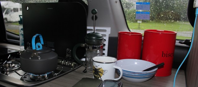
It’s another rainy morning. The weather forecast promises it will cheer up later. Difficult to believe at the moment, but the Met Office short-range forecast is rarely wrong. I make myself a late breakfast in The Beast.
This morning the campsite has been busy, with motorhomes and campervans on the move. Most people only seem to stay here for one night. They’re either on their way up to Skye, or on their way back from Skye.
After packing up The Beast (a task I’ve now got down to a mere 30 minutes), I head off towards Skye too, along the A87. Despite its exotic name, the Kyle of Lochalsh seems a very ordinary town. It is the biggest place I’ve passed through since Mallaig, and I feel a bit overwhelmed by all the bustle.
In Kyle, I park the van in a free car park (yippee!) and catch the very expensive bus (boo!) back to Dornie. It is still raining. Heavy rain. So much for the Met Office forecast being always right!
When the driver stops at Donan Castle, I almost don’t get off. It looks horrible out there. But, where else would I go? Come on, Ruth. It’s only water falling from the sky.
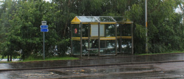
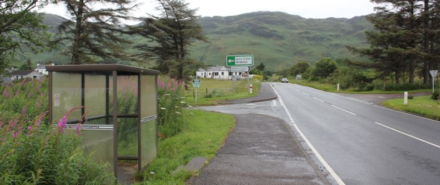
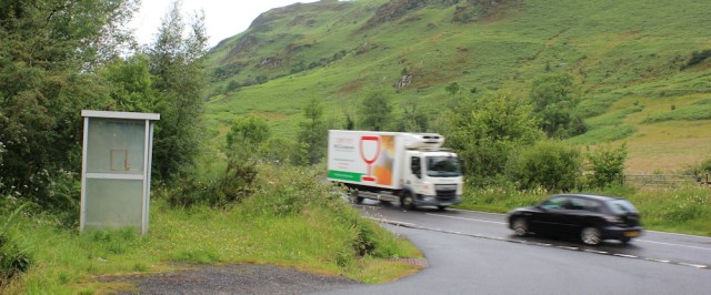
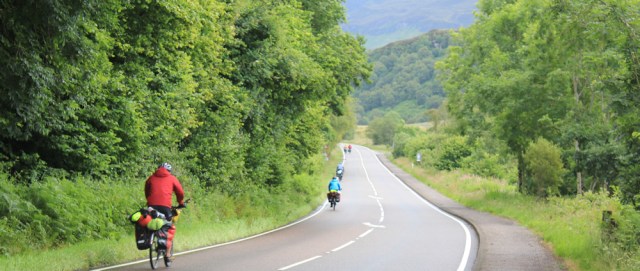
I shelter at the bus stop for a while, and the worst of the downpour eases. A van stops beside me, and offloads a couple of hitchhikers. They stash their rucksacks in the bus shelter, and go to stand on the pavement in the drizzle, holding up a sign.

I can’t see what it says. Fort William, maybe? The road is fairly busy now, with a steady stream of vans and cars heading south. I hope they won’t have to wait long.
It’s only 9 miles from here back to Kyle of Lochalsh. Much of it will be road walking, unfortunately. I’m not looking forward to walking next to the traffic and getting constantly sprayed with dirty water from the road.
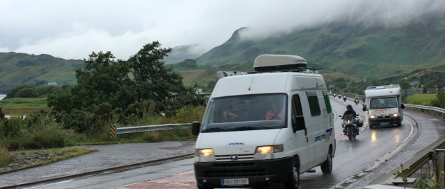
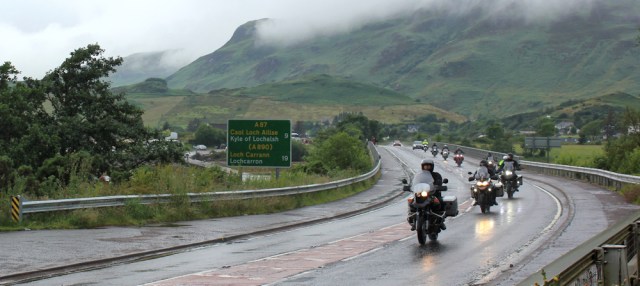
A long procession of motorbikes come whizzing by. Must be miserable riding a bike in the rain too.
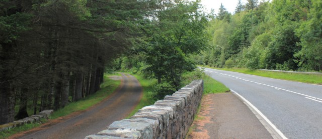
But the rain has almost stopped. I set off along the pavement, and cross the bridge over the mouth of Loch Long. Stop to take a photograph of the pretty houses lining the bank.
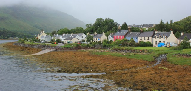
On the other side of the river is a car park with ‘PC’ marked on my map. Toilets. It seems very busy, with several cars, campervans, a few large motorhomes, and a couple of coaches parked up.
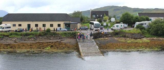
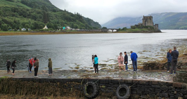
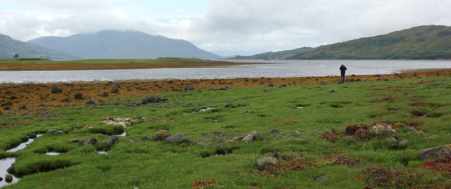
I turn into the car park and suddenly understand why the place is so popular. Not just the toilets, but a wonderful view too. I take photographs of people standing on the slipway taking photographs of Eileen Donan and the castle.
All sorts of nationalities are here. I hear French, German, Dutch (I think) and there are quite a few Chinese, or possibly Japanese, tourists too.
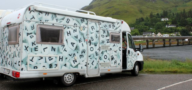
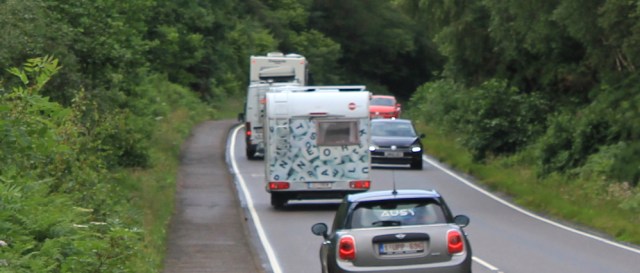
One of the mobile homes in the car park is painted in an interesting way. Scrabble? No. Boggle, probably.
The car park is sited on a peninsular of land that sticks out at the junction of three lochs. Loch Alsh, Loch Duich, and Loch Long. Of course, I can’t resist walking round the peninsula.
Another solitary visitor is standing by the edge of the water, and we both take photographs looking up Loch Alsh. The large mass of land on the left is… I check my map… Skye.
The ground is boggy underfoot, and I pick my way carefully round the peninsula, before trying to regain the road. You think I would have learnt from yesterday. Again, I have to fight my way through a mass of dripping vegetation, getting my trousers and boots thoroughly sodden in the process.
There is a road nearby. Just through here… Somewhere.

Back on the road, I’m grateful to find a decent pavement. And I soon reach the turn off to a little village called Ardelve.
The main road bypasses Ardelve, running in a loop around the landward side, but the side road provides a nice, quiet shortcut for me.
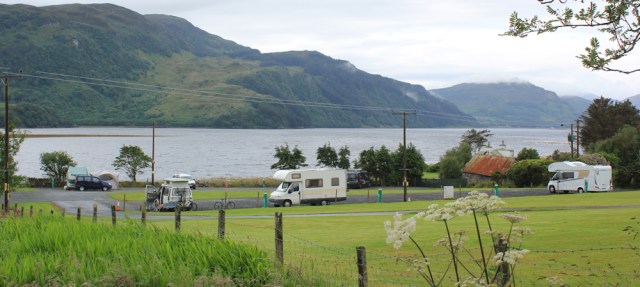
There’s a campsite here too. Very pretty place to stop, being very close to the water of Loch Alsh. I feel a twinge of envy. Wish I’d stayed here last night.
Ardelve is a cute little place. As well as the campsite, there are several B&Bs and even a pizza restaurant.
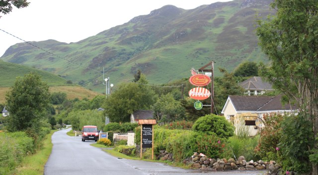
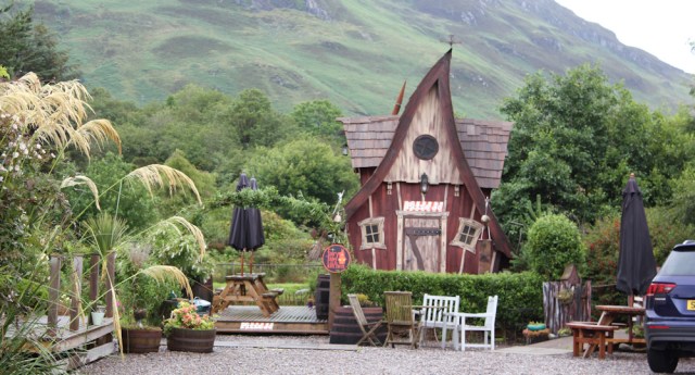
I walk past a little twisted cottage, straight out of a fairytale, which seems to be part of the pizza place.
Love the name of this B&B. Salty towers!

I really like Ardelve. It’s full of quirky little things. There is even has a lovely old red phone box, and it seems to be in working order too.

Sadly, I’m soon back on the main A87.
No pavement now, so I have to walk along the edge of the road. Keep my eyes and ears tuned for traffic, so I can leap onto the verge if I need to.

It’s not very pleasant walking. No views. No sight of the sea. And constant vigilance is needed. The road isn’t very busy, but the traffic tends to come in bunches and most of it travels at high speed.
I reach the turn-off for the next village, which is called Nostie, and am surprised to see a pavement ahead. Well, that helps me with my next decision.
I examined my map yesterday, and discovered the little road into Nostie comes to a dead-end after a mile or so. After that, the map shows a track along the shore for a mile, which turns into a path for another mile, and then that seems to come to a dead end too.
If the main road was horribly busy, my plan was to turn into Nostie and to try and find a way through and back to the road eventually. If all went well, I could miss out a couple of miles of road walking.
But, if I couldn’t get through, I would have to turn back and would end up walking an extra six miles with no forward progress.
The sight of the pavement makes my mind up for me. I’ll stick to the road.
Onwards, past a driveway and a sign for an Episcopal Church.

What’s that on the post? A little teddy bear. Or maybe it’s a polar bear? It seems to be missing its eyes and is probably much loved, and now, probably, much missed.
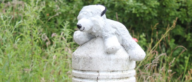
Poor little bear. It’s even wetter than me. I hope it soon gets reunited with its young owner.
Onwards. A couple of touring cyclists whizz past.
And, as a long line of traffic rumbles past, something catches my eye. A mobile home with letters? Boggle letters again. Are there two of them, or is it the same one I saw earlier?
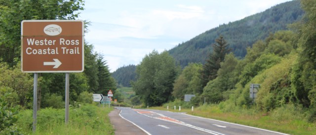
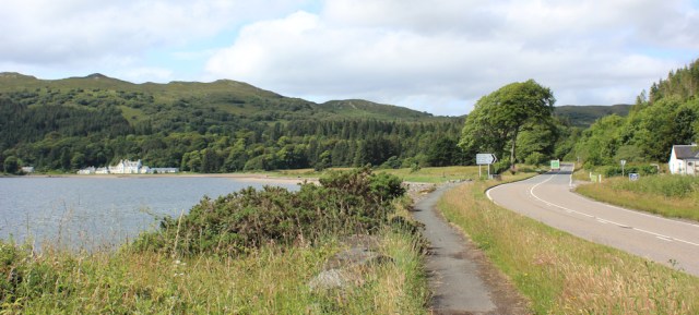
A mile past Nostie, and past the tiny Nostie Bridge Power Station, I come to a major turning, where the A890 forks off from the A87. Apparently, this is part of the ‘Wester Ross Coastal Trail’, which seems a bit of a misnomer, as the A890 road actually bypasses a whole section of coast.
Luckily, the A890 seems to cream off a fair amount of the traffic from the A87, which becomes quieter for a while.
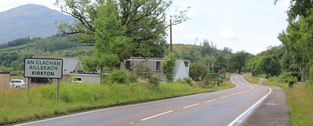
I walk past the optimistic Lochalsh Business Park (looks very low key), past a field of grazing white horses, and reach the next village after the junction , a place called Kirkton.
Beside some pretty white cottages, local residents have erected their own speed reduction measure – a dummy dressed in a hi-vis jacket with the words ‘SLOW DOWN’ printed across it.
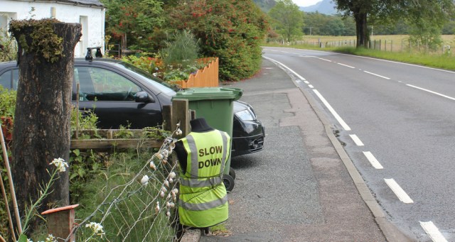
They must be fed up with speeding traffic too.
And here is something weird. A blue door, set in a white wall decorated with sea shells, which purports to be a Police Public Call Box. Really?

Do such things still exist? Or is it a joke? Or has Doctor Who taken up residence here?
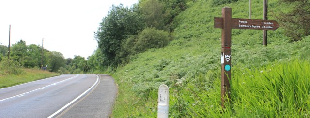
From Kirkton, a public footpath goes up into woodland and would take me over a hill and into the next village of Reraig. (I’d researched this option in advance, using the Core Paths Map, in case the A87 road was too dangerous to follow comfortably.)
But there is no need to take the footpath. There’s a good pavement beside the road, and the footpath would take me further away from the coast than the road, and so would not be in keeping with my coastal-walk Rule Number Two.
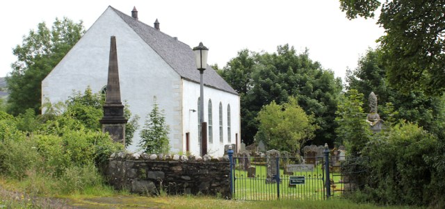
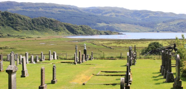
Just opposite the footpath, is a delightful old burial ground. It looks like a good place to stop for lunch, as cemeteries usually contain benches to sit on, or, if the worst comes to a worst, you can usually perch on a stone wall somewhere among the graves.
This one has a couple of benches side by side, and an opportunity for a quick self portrait.
I perch the camera on the arm of one bench, trigger the timer, and rush back to the other bench. Pose nonchalantly. Wait for the click.
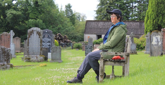
Looking at this photo afterwards was a bit of a shock. I look quite porky. You would really think all this walking would keep me trim and fit – especially as I’ve been unable to find any decent pubs for lunchtime cider and meals! Oh dear.
Never mind. While I’m eating my picnic snacks, the sun comes out. Yay! And the view from the bench is quite lovely.
I slip off my boots and let my damp socks dry in the sunshine. Bliss.
My break is interrupted when a middle-aged couple appear through the gates. They are carrying flowers, and are clearly coming to visit a grave. Feeling I might look a bit disrespectful, I pull my boots back on, and pack up my rucksack again. Time to go.
A bus stop on the road has a message scratched on the side. “Still waiting for a safe bus stop for our kids.”
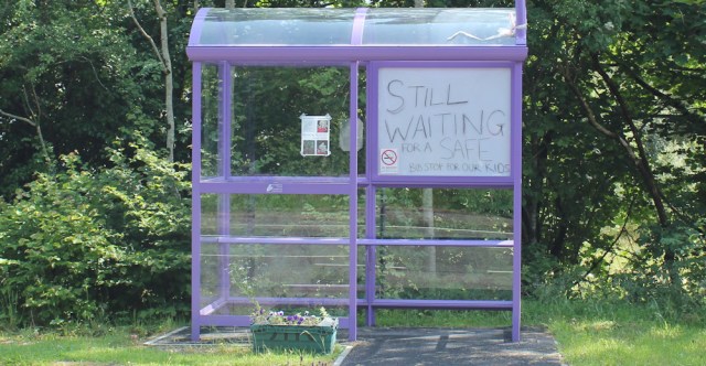
I wonder what a ‘safe’ bus stop is? One with proper seats, maybe? I’m not sure.
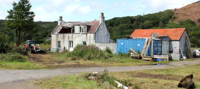
Onwards. Here’s a house in need of some TLC. Or maybe it just needs complete demolition!
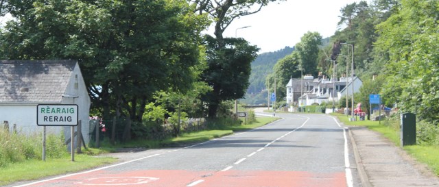
I reach the village of Reraig. My old campsite is just off to the right. Although it wasn’t as pretty as the site by the shore at Ardelve, it was cheap and did not take advance bookings – so that pretty much guarantees a space if you turn up early enough.
Beyond the camp site is a hotel. Looks lovely, doesn’t it? I nearly had a meal here last night, but read the online reviews, and bought some sandwiches from the Spar supermarket next door instead.
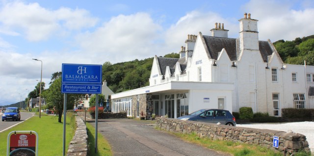
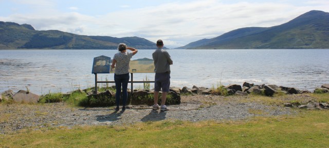
Opposite the hotel, a couple of cars are parked in a layby, and visitors are looking at an information board. I stop to take more photographs.
Onwards. Off to the right is the Balmacara Estate, a crofting estate owned by the National Trust for Scotland. I was thinking of visiting the estate, but it is off my intended route. Maybe I’ll come back another day. Ahead is Balmacara Bay, with the white shape of Balmacara House visible on the shore.
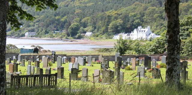
I pass by another cemetery, and this one has a great view too.
The drive to Balmacara House leads off to the left. I walk down it, hoping I can walk around close by the shore, but the drive seems to end right in front of the house itself, so I backtrack and rejoin the road… where the pavement is about to come to an end.
After dodging traffic for a few hundred yards, I spot a sign that promises ‘Woodland Walks’ and so I turn off to the left and into a little car park. There’s an information hut (closed) where a map displays the walks.
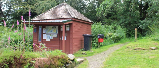
But they all seem to be circular walks. Not what I want.
A couple appear. They have just completed one of the walks and are returning to their car. I ask them if any of the walks follow the shore and rejoin the road further along, but they confirm all the walks will simply bring me back here.
Oh, well. Time for plan B.
Route this morning:


I do love the way you just go out there and see how the land lies as you go along! I have everything planned out beforehand (it still goes wrong mind, mostly due to my stupidity and recklessness!) – I’d be well scared of trying a route that might mean an extra 6 miles – that’s so brave!
Your campervan looks lovely inside by the way, I’m very jealous!
…oh, and you don’t look porky at all!
Thank you x
I like the look of Balmacara, very pretty and great views. The hotel looks nice but the reviews certainly are not – I don’t think I’d want to stay there 😦
As far as I can make out, that hotel owned by a Spanish company. They make their money from coach trips stopping overnight. If you book a single room, you are likely to be bumped out if a coach trips books after you. And it’s clearly in need of redecoration and refurbishment. Outrageously expensive too.
In the picture with the hitchhikers, the cream building above the campervan is where we stayed last year (Eilean Donan Apartments). We went to Pizza Jo’s one night – it’s also a bakery and gin distillery! We left with a bottle of gin as well as our pizza (which was delicious).
What a lovely place to stay, and Pizza Jo’s sounds perfect.
We loved it there. We were at the back so had a fabulous view over the Loch to Dornie – some beautiful reflections at sunset.
Hi Ruth – Massive pat on the back for doing all the road walking – it is really tough – If you do not have any now, please get a couple of “Hi Vis” Flashes to wear on you or your pack just for safety. On a lighter note – you don’t look Porky at all !! Cheers Russ
Hi Russ. I have a high-vis vest, but a couple of flashes on the back of my rucksack is a really good idea. Thank you for the suggestion.
Ruth, Glad to see another few updates. I’d begun to think that your walking was ended for 2019. It won’t be too long before you resume your walks in 2020. All that road walking would seriously cause me some despondency, but I know it has to be done to make progress. I agree with Russ. We are looking at bulky clothing not porky!
Robin
I’ll take the ‘bulky clothing’ comment, thank you!
I wouldn’t enjoy all the road walking but the views you got were still beautiful, especially Eileen Donan Castle. I loved the quirky cottage too.
Every walk has it’s downsides. Sadly, not much choice along this stretch.
Enjoyed reading about your walk. Just wanted to point out that ‘safe bus stop for our kids’ is obviously nothing to do with seats. The kids in the village have to wait on a school bus on the grass verge by a 60mph road. You’ll have experienced what that’s like yourself, but imagine it on dark winter mornings. The bus stop was put up and the bus drivers refused to stop as it was apparently unsafe due to the traffic speed and visibility. Years and £8k later the kids are still picked up from the grass verge.
Also, you can go past Balmacara House, up through Glaick and into the woodland walk trail, bringing you out at the car park further up. There are some amazing views of Kylerhea. Well worth it. It also adheres to your rule #2.
All the best
Hi Stewart. So sorry to hear of ongoing problems with the school bus pickup. Yes, that road is horrible and unsafe. 😒 Hope a solution is found soon.
Also, thank you for the tip about walking past Balmacara House – would have cut out a section of road walking. I should have been braver and tried to find a way through. Too late for me, but a helpful tip for others.
I did this walk today and did follow the path to Nostie. It was a good path until it came to a dead end on a cliff top. I found a lower route that just ended at some rocks. I managed to slip and slide over the rocks as the tide was just low enough but the rocks were covered in sea weed and very slippery. I did slip once but managed to avoid falling over. From there I could walk along the salt marsh behind the beach and pick up a footpath back to the road. Not an easy route that bit so I think you were wise to skip it.
OMG I love that cottage. Its gorgeous. And this post is the reason why I’m going to stick with walking the coast of England and not the UK 🤣🤣🤣👏 rain!!! Urgh. I know it rains in England, but rain in Scotland is a particular type of hell. Love the photos and I see that you also take random shots of random things…..makes for a more interesting read….as for road walking…my pet hate. Asphalt is hell on the feet