
[This walk was completed on the 11th August 2019]
I am determined to cover a good distance today, and make up for some of the ‘wasted walking’ I’ve been doing along dead-end paths at the bottom of the Applecross peninsula.
But, the narrow, twisty single-track road along the coast is hard to navigate. When I pull into a car park, believing I have travelled miles, I discover I’m only half way to my intended destination.
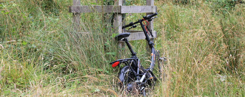
Decide I’ll do the walk in two sections, and set off cycling back the way I’ve come. Leave my Scooty bike beside one of the newly planted trees along the shore road in Applecross.
Time to begin the first part of today’s walk.
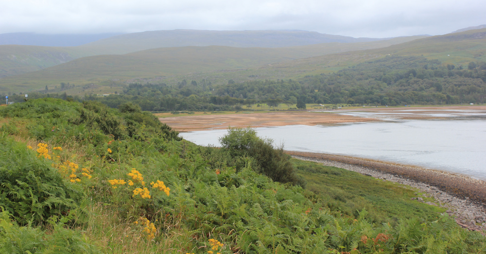
Applecross Bay is a wide semicircle of brown sands, ringed by the tree-lined shore and the dark-green mass of surrounding hills.
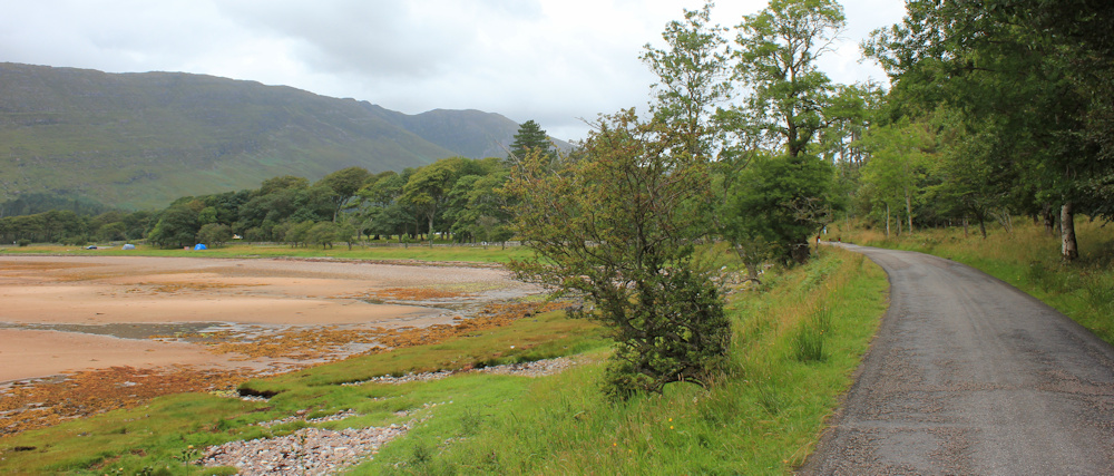
I can understand why people travel here to enjoy the place, and why it is such a popular stopping-off point on the NC500. Although most of the overnight campers have moved on, there is still a smattering of tents on the green sward in front of the beach.

The tide is out, and the distant views are obscured by mist, but it is still very beautiful. I stop to take numerous photographs.

I wonder what the locals think to all the campers? This van, for example, has an awning attached and it looks like these visitors will be here for more than one night.
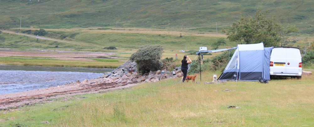
There are public toilets near the Inn in Applecross, with a sign declaring the toilets are free. I wonder what all these ‘wild’ campers do with all their waste. Do they use the toilets? Or do they (like me) have a trowel for digging holes? Or do they just leave deposits on the shore?
Yuck. I really don’t want to think about it.
Near the end of the beach, the Applecross River empties itself across the sands, leaving multiple trails of running water. I stop for more photos. Shame about the haze. Is that Skye in the distance?

The road swings away from the shore, temporarily, and heads up the river towards the bridge. I pass yet another van, parked beside what was probably another impromptu camping spot.

Off to the right is Applecross House, with a Walled Garden which is open to the public, and an attached restaurant. I plan to eat there tonight.
The bridge over the Applecross River is not the prettiest bridge – solid and functional – but I guess it serves its purpose.

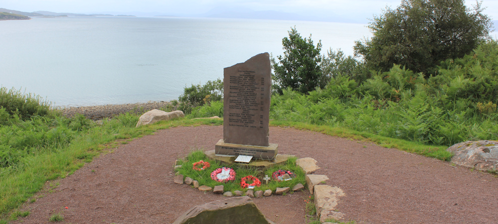
Past the bridge, the road runs along the shore again, and starts to rise. Here, I come across a stone with a plaque attached. At first, I think it’s a war memorial but, on closer inspection, it turns out to have been placed as a dedication to the opening of the coast road.

I’m surprised to learn that this 14 mile stretch of road, running from Applecross to Shieldaig, was only opened in 1976. The opening was done by the Queen’s younger sister, Princess Margaret. Back in 1976, I was still a medical student, and Princess Margaret was a glamourous, chain-smoking, heavy-drinking lady in her forties.
What did they do before this road existed? All travel must have been over the notorious pass – the Bealach na Ba – or by sea. What an isolated place Applecross must have seemed in those days.
Further along, and here is another memorial stone. This one is a proper war memorial.
The road climbs higher and begins to swing northwards, away from Applecross Bay.
I stop to take more photographs, looking back across the beach. Beyond, in the distance, dark clouds curl over the mountains where the Bealach na Ba pass lies.
When I walked over the pass a few days ago, there was nothing to be seen because of thick mist. I was hoping for a few clear days, and wondering whether I could risk taking The Beast for a ride up to the top, just to see the views.
No point going today. There would be no views to be seen.
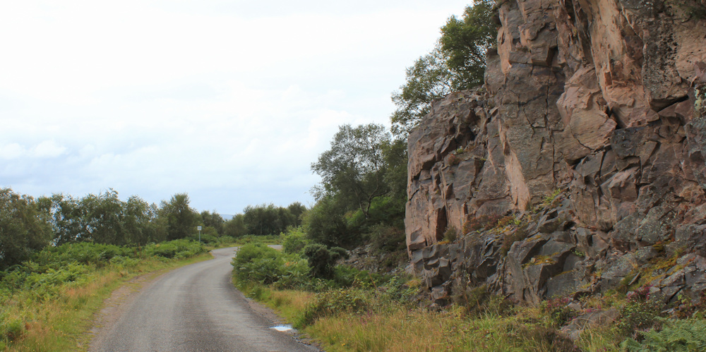
Onwards. The road is flanked by rocky cliffs on one side, and a steep slope down to the sea on the other. It is dramatic scenery, and I really enjoy this section, although I have to keep a constant ear open for traffic.
There is some sort of industrial yard built into the side of the cliff. At first I think it might be the remains of a small quarry…
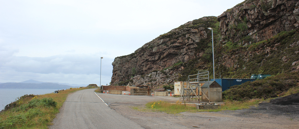
… but a tumbling waterfall nearby leads me to think it is something to do with water.
Of course, it might be just some sort of storage area. I don’t know, and there are no obvious signs to inform me.
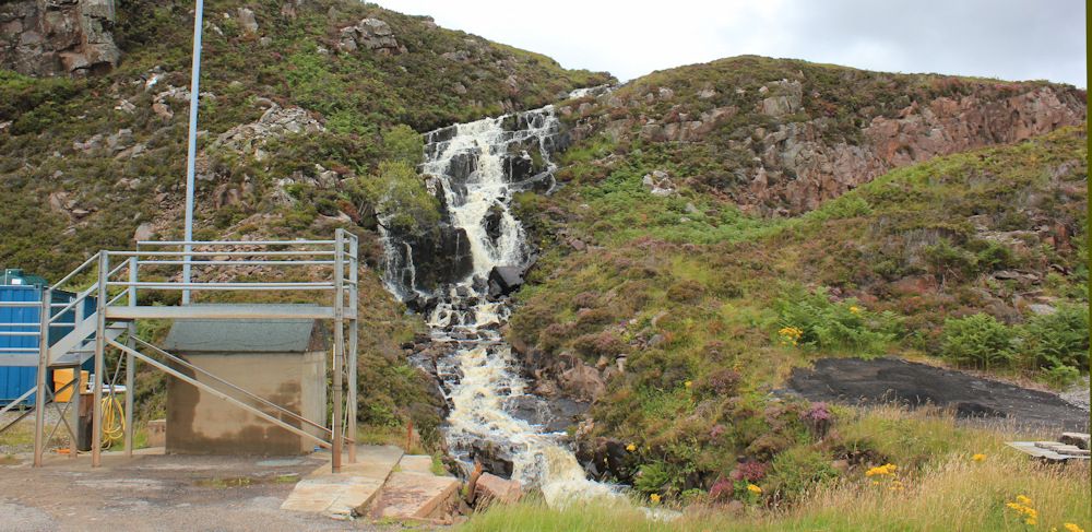
The water is channelled under the road, and hurtles down the slope on the other side. It’s frothy race is in stark contrast to the serene calmness of the sea beneath.

Swinging further around the point, the road is heading north now. Out of the shelter of the bay, the breeze has picked up – good, no midges – and a few white-sailed boats are out in the sea. Wonder where they are going?
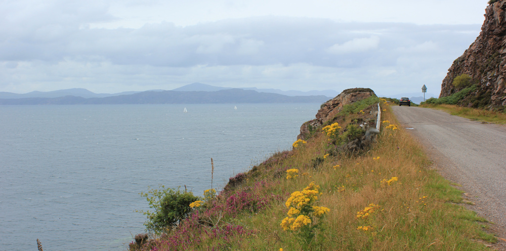
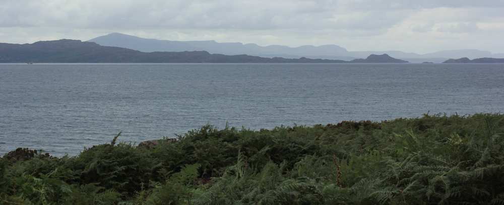
The cliffs flatten out, and the road gently undulates along, keeping high above the water. Looking ahead, I can see a cluster of houses on a finger of land.

I don’t need to pull out my map, I already know that I’m looking at a place called, somewhat unimaginatively, Sand.
The road passes over another waterfall. Look at that beautiful view. Although my OS map doesn’t reach that far, I think that is definitely the Isle of Skye.

Over the brow of a rise, and I can see the car park ahead, where The Beast is waiting for me. Nearly there.

One more waterfall to cross over. Ah, so many beautiful falls along this road, all unnoticed by the passing motorists. In England, people would flock to places like this.

When I reach my lovely Beast, I decide to brew up a cup of tea, before returning to pick up my Scooty bike and complete the second part of today’s walk.
Sitting on the doorsill of the van, I feel a contented lethargy settle over my body. Soon, I’m conducting an internal argument with myself, while sipping my tea and admiring the view.
‘You’re on the the right road now. Only 14 miles from Applecross to Sheldaig, and you can finish this today.’ My ambitious voice is impatient. ‘Come on. You can do it.’
‘Yes,’ my lazy voice replies. ‘But what’s the rush? Look at that view! And I’ve just remembered there’s a packet of chocolate biscuits hidden somewhere in the van.’
No, I don’t do any more walking today.
Miles walked today = 4 miles (and 4 miles cycled)
Total around coast = 4,419 miles
Route =


Nice scenery Ruth ! I admire your nice walkings in the beautiful Scottish countryside !
Hi Sam, and thank you for your kind comment. It is a beautiful place.
Hi Ruth, Thanks voor your comment, I’m from Holland, but there is almost every area flat, only in the south are hills… We have been 7 times in the UK for holiday, in 2016 we were in South Devon en did 2 costal walks, near Brigham and Kingswear, very beautiful over there and it was very nice to do! But I see on your pictures that Scotland is very beautiful to!!!
A year later and you might have encounters our illustrious PM! He is holidAying in Applecross apparently.
Yes! I wonder if I’ve managed to catch a photo of his residence. I passed it on my walk the next day.
It has been a terrible year for irresponsible campers. Hope the backlash can be contained.
The land in the distance in the first photo out to sea is Raasay, not Skye. The flat top of Dun Caan is very distinctive.
Ah, thank you David. I’m very bad at orientating myself.
Hi Ruth – I don’t know if you mention it in your next walk but Sand really annoyed me. The cluster of white houses that you mention above is a Naval Testing site where they test torpedos. The thing that really annoyed me was that Monty Halls the television presenter had a documentary on television that he made where he spent a year staying in a croft just north of the beach in Sands. He made it sound like an idyllic place on Applecross but just north of him which was never shown on television was the hideous testing site. I was so annoyed to see all those naval white testing buildings right on the headland. A private individual would never have got planning permission to build such a complex right on a headland but of course the Navy did. I’m still seething about it. Applecross is such a wonderful place but Sands has been ruined by the military. The public can access the beach but no one is allowed past it. The road just has no access signs and there are not even any signs to tell you why it is no access. As you can tell I have something of a bee in my bonnet about this. Bloody military – they must own 1000’s of acres of the UK and half the time they’r not using it. Grrrrrrr !!!! (Rant over – all the best Chris)
I didn’t realise it was a military site, Chris. I was planning to walk down to the end, because I assumed it was some sort of lighthouse and surrounding holiday cottages, but the unfriendly signs put me off. Now I’m glad I didn’t try 😄
Yes I used the same car park and did the same walk as you by cycling from the car park to Applecross and walking back along the road. Like you there were a lot of people camping about and I suspect it must annoy the locals. I didn’t finish with chocolate biscuits, however! Weirdly I didn’t even know it was named Sand (though I can see why) but I see the name *is* marked on the 1:50000 OS Map but not the 1:25000 one which is odd. I did think it strange a nice beach like that one had not been named.
Did you go down to the beach Jon? I wish I had now, but I just stayed on the road.
Yes I did, it being one of the few sandy beaches in the area. You have to walk past the no entry sign at the other car park, the no entry applies only to vehicles I think. It’s a nice beach.
Yes – its no entry due to the military. Unlike other military establishments there is nothing to tell you this. I guess it is top top secret. I only found out through the locals when I stayed in the Applecross Inn. Chris
On our memorable tour of Scotland with my late wife before she was diagnosed with MND we visited Applecross. Ann would not let me take the caravan over the Bealach and I caved in and drove round that coast road. In retrospect I think that was a wise decision.
Yes, it probably was. 😄
You’re right re the 1976 Road. Back in 1971 with a friend, we cycle toured for 3 weeks in the Highlands. I well remember when we got to the top of the pass, my friend smoked a cigarette and waited while I road down to Applecross, turned round and rode back up and we carried on our tour. I was very for then!
Hi Andrew. You must have been fit to cycle down and back up again. Don’t blame your friend for waiting at the top. Hope you got a better view than I did!
How awful that the military have ruined part of this beautiful area. However your photos show only the prettier parts. I don’t blame you for stopping at 4 miles with the views and the chocolate biscuits enticing you to spend the afternoon relaxing.