
[This walk was completed on 3rd July 2022]
The little road to Mellon Udrigle is “unsuitable for coaches”, which suits me fine. I’ve parked my van at the end of the road and cycled back to the junction at Laide. The weather forecast promises a mix of sunshine and showers, and I set off in good spirits.

I haven’t gone far before I spot a turnoff to a burial ground and a ruined chapel. Of course, I must go down and investigate. Love the curly metalwork on these rusting old gates.

I don’t understand why the little chapel has been left to go to ruin. Warning signs tell me the structure is dangerous and to keep out. It’s a beautiful spot. What a lovely place to be buried!

There is a mix of tombstones, most are old, but a few look new. One of the graves, standing alone in an enclosed area, is of little William, aged 7, who died from drowning in 1866. How very sad.
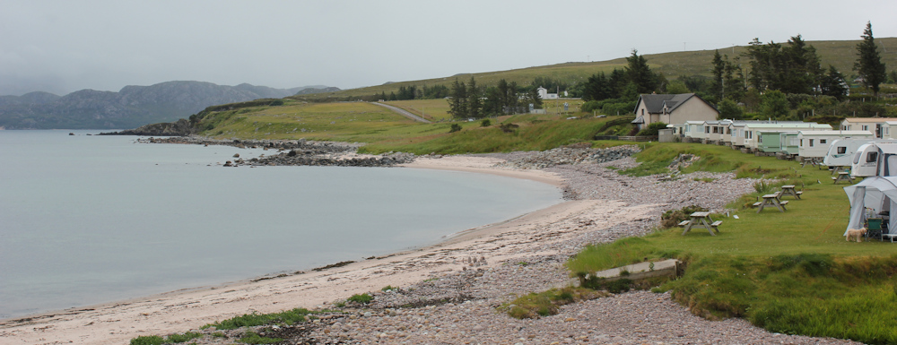
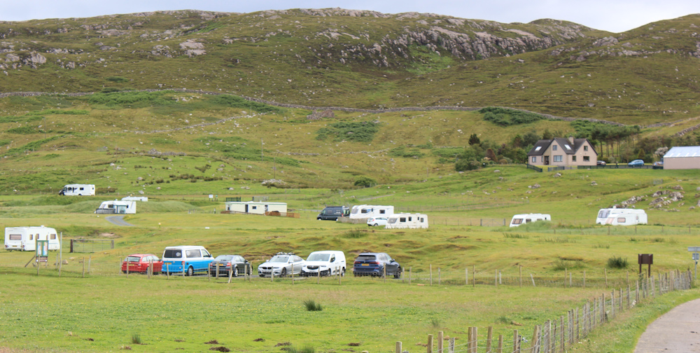
From one side of the burial area, you can look out on Laide’s beach and the caravan park which fringes it. I was thinking of staying here last time I was in Scotland, before the rain and the cold made me change my mind.
Onwards, along the road that curves and twists, following the coast line. Traffic is very light and I relax and enjoy the walk.
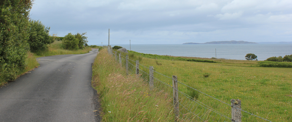
Across the loch (Gruinard Bay) I can see distant mountains. One peak is particularly impressive, but remains capped by clouds for the duration of my walk today.

I’m walking in sunshine and ahead is a hill. Meall nam Meallan, says my map.
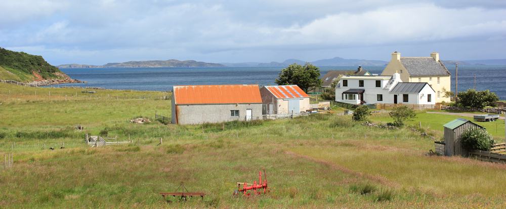
I reach a place called Udrigle on my map. This seems to consists of one large house and a couple of neighbouring buildings. I wonder where the name “Udrigle” comes from? Sounds Viking to me.
Here, there is a turnoff to a small settlement called Achgarve, but I’m sticking to the main road, which begins to climb.

As the road climbs higher, I get some great views looking across at Achgarve. Presumably it was once a crofting settlement, but looks like many of the crofts have been turned into holiday homes.

A little further up, and I come to another turnoff. I was planning to walk along here – a Core Path – as it heads across the peninsula for 3-4 miles to a beach on the opposite side called Slaggan Bay. “Unsuitable for motors except rough terrain vehicles” says the sign.

The path looks surprisingly good – a proper track. But the weather has suddenly changed, and it has begun to drizzle. I dither for a while. Let’s say 3.5 miles there and back, that’s 7 miles. Or, I understand I could do a loop around the top of the peninsula and meet the road further up – although that path is described as a bit “vague” which probably means “non-existent”.
It would be nice to see Slaggan Bay, which I hear is very pretty, but I’m not sure I have the energy. I have one of those internal arguements with myself, where adventurous Ruth says, “Stop dithering and just do it.” Meanwhile, timid Ruth continues to hesitate and think of a million reasons why it’s not a good idea.
The rain comes down harder and timid Ruth finally wins the arguement. I pull my hood up and fasten my waterproof cover over my rucksack. Maybe I’ll walk to Slaggan another day.
Onwards. Up the hill.

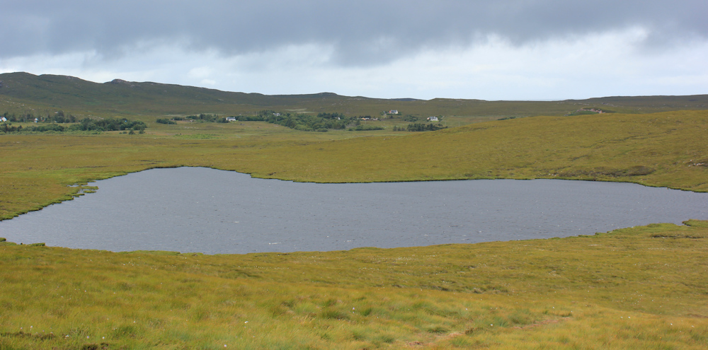
At the top of the rise is one of those strange things you often find in Scotland – a high loch in the middle of nowhere. Loch na Beiste. Sounds weirdly sinister.

[Later I discover Loch na Beiste is Gaelic for Lake of the Beast – definitely sinister!]
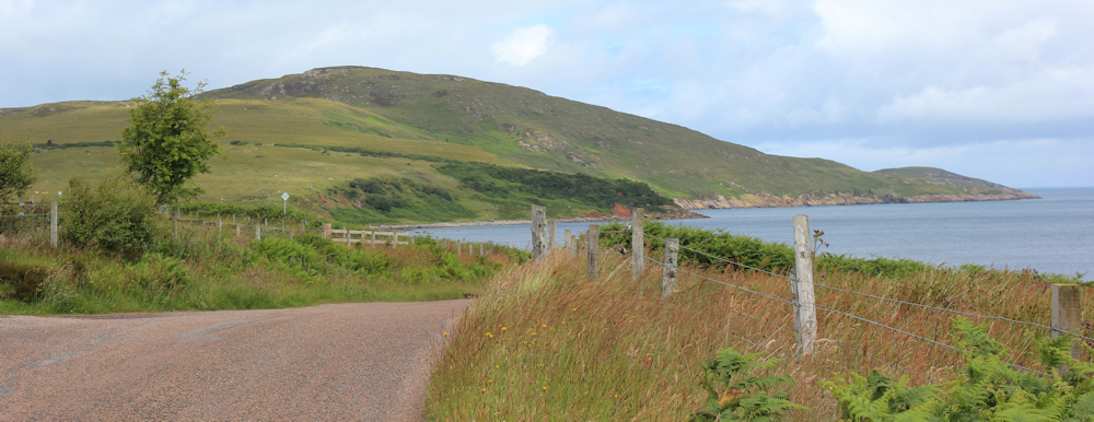
On my map, the road down to Mellon Udrigle looks straight. In fact, it twists and turns around the upper slopes of Meall nam Meallan. And the sun comes out again. Love this road.

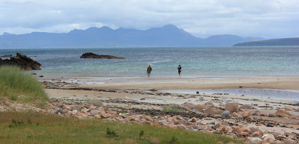
It’s a steep descent down into Mellon Udrigle. A much larger place than poor little Udrigle, and a prettier place than Mellon Charles, its sister settlement on the other side of the peninsula.

Prettier – because it has an amazing beach. I can see a stretch of gleaming white sands below a swarth of green meadow – which houses the obligatory campsite. The cloud-tipped mountains on the other side of the bay make an impressive back drop to the waters of Gruinard Bay, which have a deceptive tropical tinge of torqouise and green.

I spend ages coming down the hill, as I keep stopping to take photographs of the beautiful view.
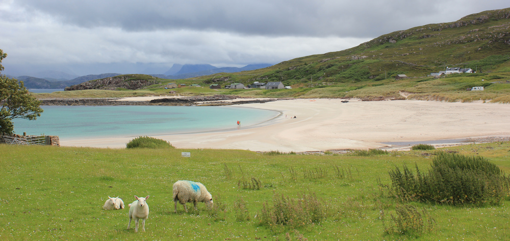
Near the end of the road is a small car park where my van is parked, and a narrow path leads from the car park to the beach. I walk down to the sands and sit on the rocks for a while. Watch people paddling. Eat my picnic lunch. And think how lucky I am to be enjoying this fabulous view.
Rain clouds are gathering to the south. I pack up my rucksack and head further up the road, which comes to an end among a group of houses. I stop to take photos looking back across the sands…
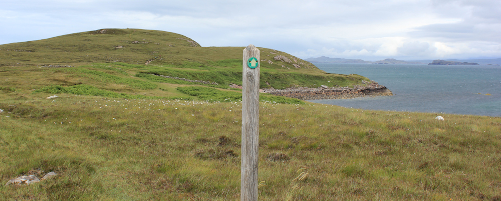
… before finding the footpath. This is another Core Path, which leads to the eastern tip of the peninsula (Rubha Beag) and then circles around and back to Mellon Udrigle.
Great view across Gruinard Bay. That mountain is really impressive – but I still can’t see the top.

I’m not the only person walking this path. A couple stride past me, and the woman pauses to take a photo looking back to the beach. Yes, it really is a photogenic place.
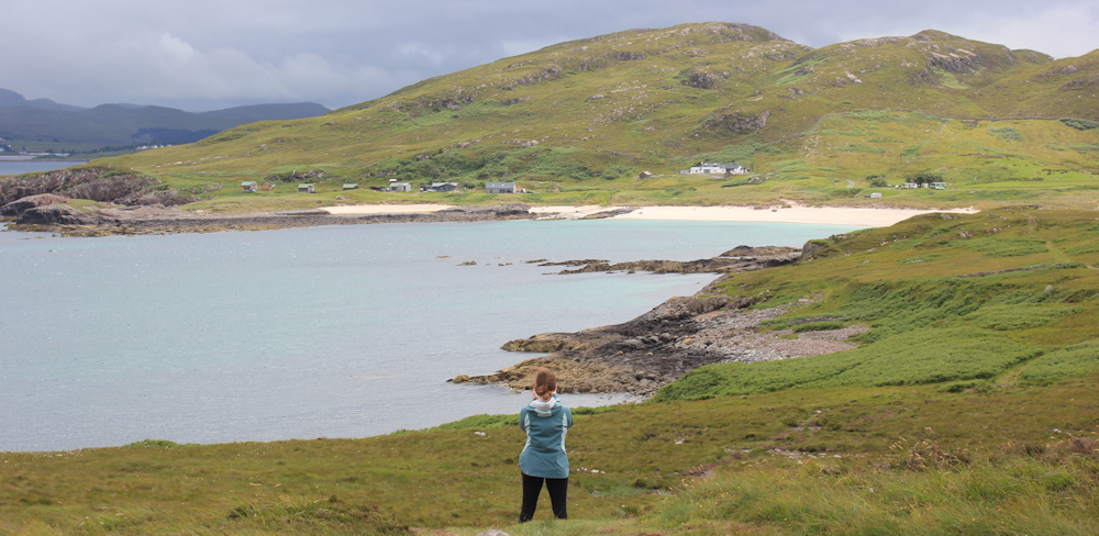
Here is another high little loch. Two of them, in fact. By now, dark clouds have streamed across the sky, and the water in the lochs are a steely grey colour. I can see houses on the other side. Ah, that’s Opinan, another small settlement at the top of the peninsula.
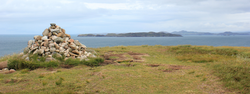
Climbing further up, I reach the top of the hill, where there is a cairn. I’m at the northeastern tip of the peninsula. The islands out there are… the Summer Isles?
I turn around the cairn and follow the path down the hill. I’m walking north westerly now, and the sky is getting darker by the minute.

This is a beautiful section of isolated coastline. I would have enjoyed it more if the rain hadn’t caught up with me – you can just see the rain-storm sweeping across the sea in the photograph below.

I stow my camera away and trudge on. The walkers I saw earlier are no longer visible. Even the path seems to have disappeared. My mobile phone has lost signal, and I suddenly feel terribly alone. But I reassure myself with the memory of packing my personal locator beacon in my rucksack this morning.
The rescue beacon is something I hope I will never have to use, but it is comforting to think it is there if I really need it.
The rain is driving straight into my face, making it hard to see anything and almost impossible to work out the route ahead. Eventually, I spot what looks like a footpath post in the distance, and head towards it, skirting round a few streams and splashing through a couple of bogs to get there.
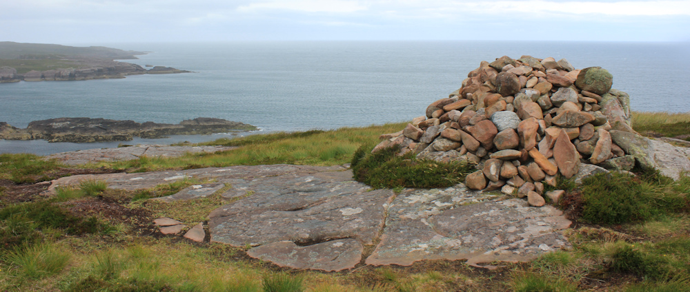
Yes, it is a footpath sign. Thank goodness! And there’s another cairn ahead – or have I managed to come full circle and return to the one I saw earlier?

No, it’s definitely a different cairn. The weather clears a little, and I can see the view properly. Ah, this must be Rubha Beag.
Down there is Opinan. I shelter my camera under my raincoat and manage to take a few photos of the view before the rain closes in again.

I make my way down the slope, losing sight of the path completely, until I eventually get to the bottom of the steep hill and join a rough track. No photographs for a while, because the rain is coming down in torrents. In retrospect, I’m glad I didn’t set off for Slaggan Bay – that walk would have been thoroughly miserable in this weather.
The track leads me round the base of the hill, and the rain eases off slightly. Ahead are houses… must be Mellon Udrigle.

The track widens and the houses grow more distinct. I’m nearly there.
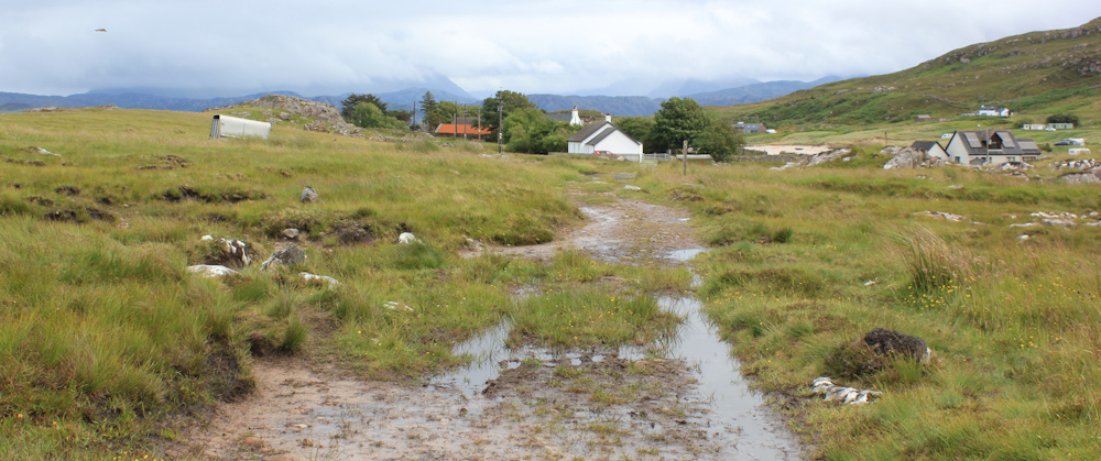
Coming over a small crest, I walk past a few residential houses, and can see the car park below. There’s my beautiful blue and white van. It’s good to see him again.
The sun has come out when I reach the car park. I stop to take a few more photographs of the path leading to the beach.

Such a beautiful place. Technically, this was a day of “wasted walking”, because I didn’t have to walk down the dead-end road to Mellon Udrigle. But I’m glad I did.
You can learn more about Laide’s ruined church here: Chapel of Sand of Udrigil
Miles walked today = a measly 6 miles, some of it in a circle.
Total around coast = 4,747 miles
Route taken:


Looking forward to more views of Skye and the Western Isles or were you too far North by that point in your circumnavigation?
Hi John, I’ve definitely left Skye behind now, but the Outer Hebrides are still visible when I’m heading in the right direction and the weather is kind. The nearest islands at the moment are the Summer Isles.
Yes certainly an area worth exploring, so certainly a good decision to go down that road. Some really strange named places in that area. I suspect that track would have been fine (I didn’t follow it either though so don’t know for sure) as if it was at least accessible for 4×4 vehicles there must be some sort of track.
It’s difficult to know how to balance time – between making progress and exploring. Yes, as Chris says below, that track is easy to follow apparently.
Hi Ruth – Slaggan Bay is wonderful and the walk down the track is an easy stroll. I walked around the whole peninsular from Mellon Charles. There are some interesting slabs of rock north of Slaggan that are worth seeing and some wonderful heather on the cliffs if the right time of year. I had an amusing incident with a large group of seals which I accidentally disturbed as I had not seen them. Slaggan Bay was once on the market not so long ago. The Council were considering re-developing it. That was the first time I went there walking along the track you used. I personally love the place. Not as good as Sandwood Bay, but not far behind and a lot more accessible. If you have the time I recommend a visit in summer, but make sure you walk north to the north eastern corner of the peninsular as the rock slabs (more like sheets) are really impressive. (I’m a closet Geologist at heart.)
Sorry ‘passed’ not ‘used’.
Sorry north western not eastern!
We really do need an ‘edit’ function, don’t we?! Thank you for your comments Chris, and sounds like I missed a real treat. I have a number of places I want to revisit, and Slaggan Bay is one of them. I did think of tackling the whole peninsula from Mellon Charles – stared down the farm track and tried to work out if it was passable. But it was raining so hard when I was there – the weather in Scotland was truly atrocious this summer!
The first bit from Mellon Charles would have been quite hard in bad weather. From Slaggan north it is easy. Sorry the weather was poor – I was so lucky in Scotland with the weather (well 69 days wet out of 232 i.e. 30% which actually doesn’t sound lucky!) – maybe I forgot the bad days!!!.
The name Loch na Beiste does make me wonder what beastie lurks in the loch whereas the name Summer Isle is evocative of warm and gentle breezes on summery days – probably not that likely in Scotland.
I find the names intriguing. They sound very poetic. But, when I look up the Gaelic meanings, they often just translate into something like “the big black rock” or “the little green bog” 😂