
[This walk was completed on the 5th July 2022]
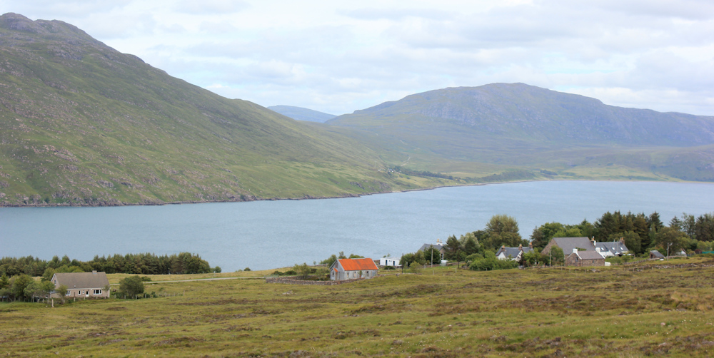
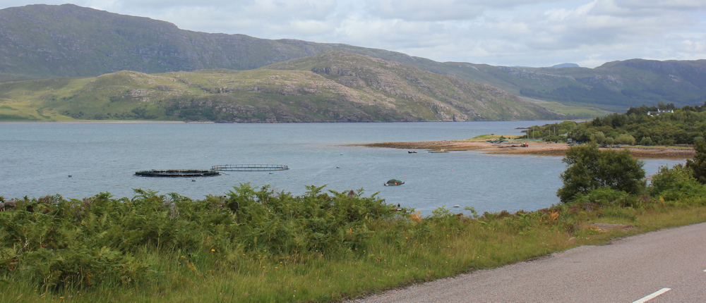
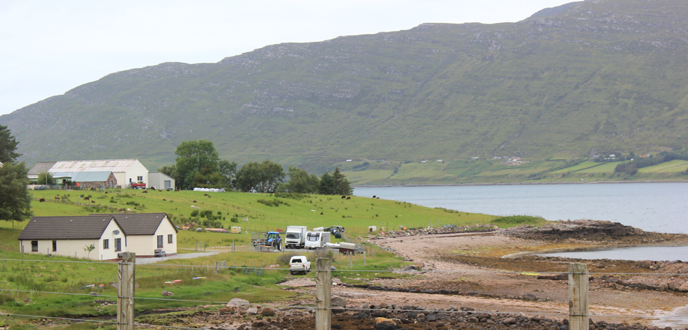
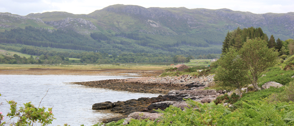
I start from the spot I ended yesterday’s walk – a nondescript lay-by on a corner of the road, overlooking Gruinard Island, near a place called Mungasdale.
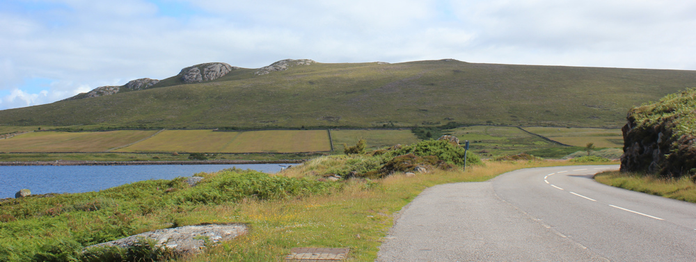
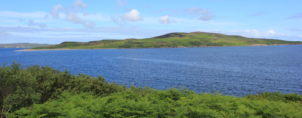
It’s a sunny morning, with virtually no wind. Gruinard Island looks lovely – a gently-rounded green hump of an island, treeless and enticingly tranquil, lying less than a mile away across the blue waters of Gruinard Bay. I wonder if anybody lives there?
[Several commentators on this blog have asked if I knew the history of Gruinard Island when I walked this section. No, I didn’t! I had, of course, heard of the experimental release of anthrax across a Scottish island during WW2, and the subsequent efforts over several decades to decontaminate the soil – but I didn’t realise that this was the contaminated island. Somehow, I presumed it would be a more isolated place and further away from the shore!]
Turning away from the coast, the road winds gently up a valley. I begin the slow slog upwards.
A pretty little river runs to my left, just beside the road. Allt Mhungasdail, according to my map. With the sun in my eyes, it is hard to take decent photographs looking ahead. Instead, I keep stopping and turning around. With the light behind me, the fresh green of the fields, the pebbly stream, and the blue waters of the bay beyond, provide a much more photogenic view.

Mungasdale itself consists of a small collection of buildings and is, I think, basically just a farm.
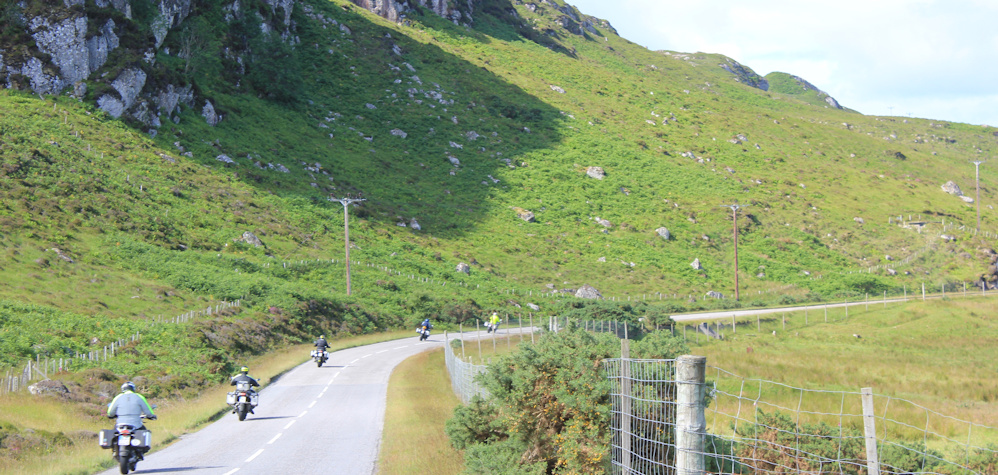
The sunny day has brought out the motorcyclists. A bevy roar past me, revving hard as they begin the climb up the road.
This is the A832, and part of the N500. The traffic is otherwise light.
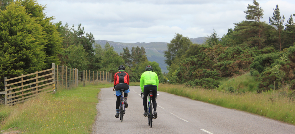
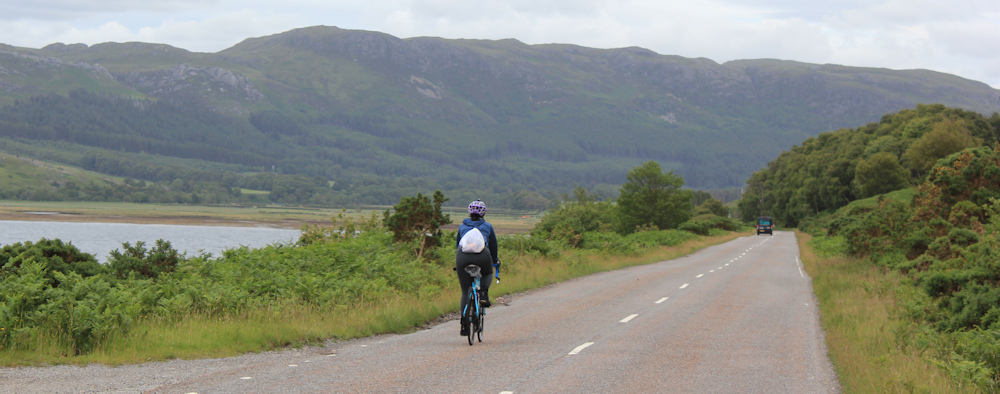
On the steepest part of the road, I am passed by a couple of cyclists who shout “hello”. They are moving very slowly and soon stop – ostensibly to check their tyres or gears – but I think they just need a rest. I pass them – glad I’m walking and not cycling up – and a few minutes later, they get back on their bikes and pedal slowly past me again.
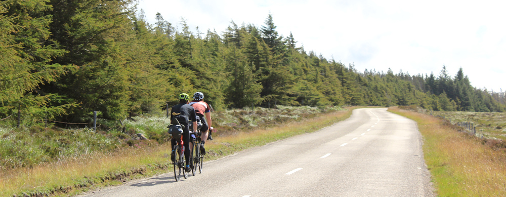
We exchange greetings for the second time. I feel we are kindred spirits because, earlier this morning, I parked at the viewpoint on top of the hill and cycled down this same road. (Well, to be honest, I just sat on the bike and freewheeled all the way down!)
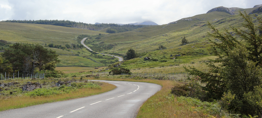
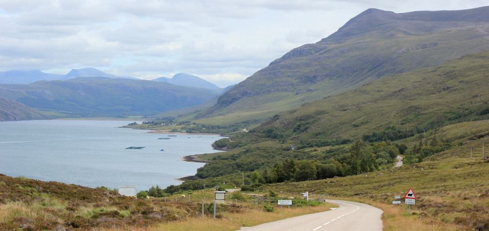
It’s a long road. Much longer going up than I remember coming down. More cyclists pass me. There is a strip of pine trees to my left, but then the landscape opens up into a sweeping green plateau. Look at the views.
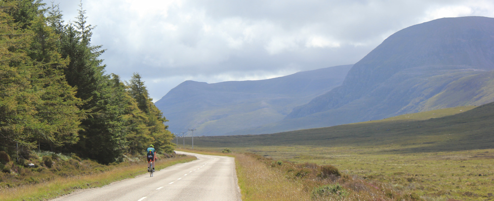
Finally, I reach the top of the climb. Just over the crest of the hill is a wide parking area / viewpoint, with further magnificent views over a loch. And here my van is parked.
My B&B doesn’t do breakfast, so I stop and have a late breakfast in my van – coffee and cereal – and think how lucky I am to be in this beautiful place, with such incredible views.
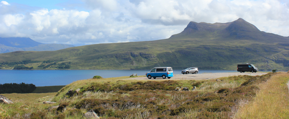
I had breakfast here yesterday too. But, yesterday, the view was obscured by horizontal rain, the wind was ferocious, and the van was shaking so hard that I decided I couldn’t risk cycling in the gale – and so I drove back down to the more sheltered shore near Mungasdale. Hard to believe how grim and frightening this place felt just 24 hours ago. It seems completely different in the calm sunlight of this lovely morning.
After breakfast, I drive back to pick up my Scooty bike – hidden behind bushes near Mungasdale – and then continue further along the A832 where I park in another layby, heave my bike out the van, and set off cycling back to the viewpoint.
It’s a hard cycle – despite being on an e-bike – because it is uphill all the way. The slope is gentle at first, but gets steeper and steeper. Within a period of about 5 minutes, my battery indicator drops dramatically from 4 bars to 2 bars. I’m just resigning myself to having to push the damn thing the final few yards – when I realise I’ve actually reached the top!
I stop for a rest. Time for another snack and a drink. And more photographs.

I chain up Scooty and lay him down, half-hidden, among some ferns. I don’t like leaving him in such an exposed place, where cars and vans are constantly stopping to look at the view, but I don’t have much choice really.
Now for the next stage of today’s walk. Downhill all the way.
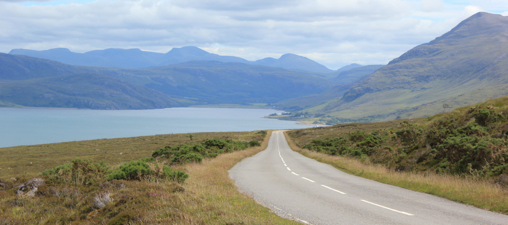
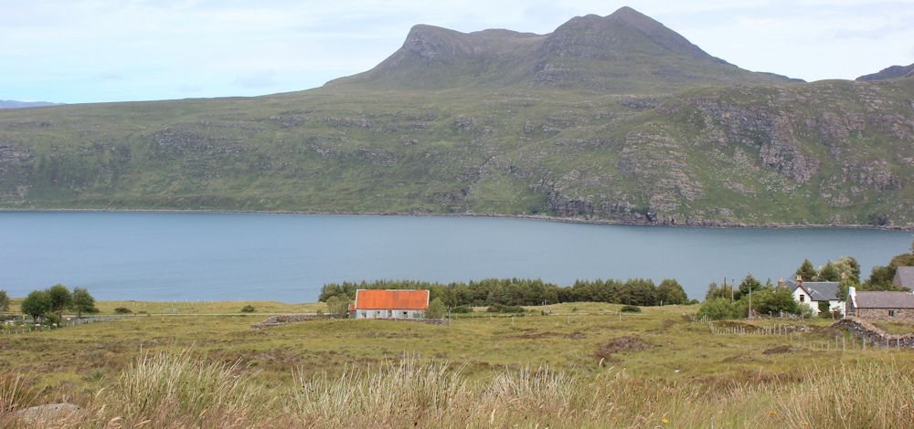
The views continue to be specatcular for the remainder of the walk. This beautiful inlet is called Little Loch Broom. (I will come to Loch Broom, its larger cousin, soon.) I keep stopping to take photographs. Love the red roof of that little building – a zing of colour against the soft green of the fields and the pale blue waters behind.
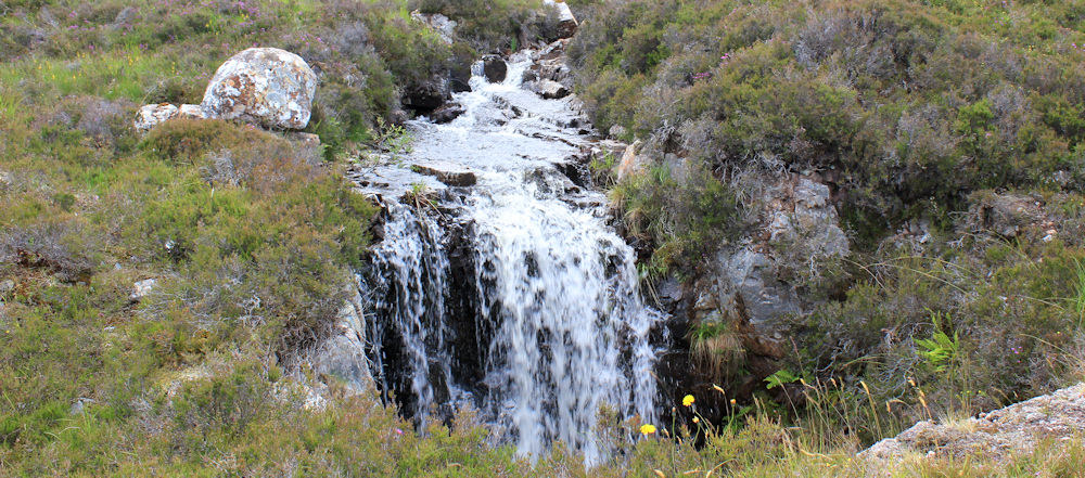
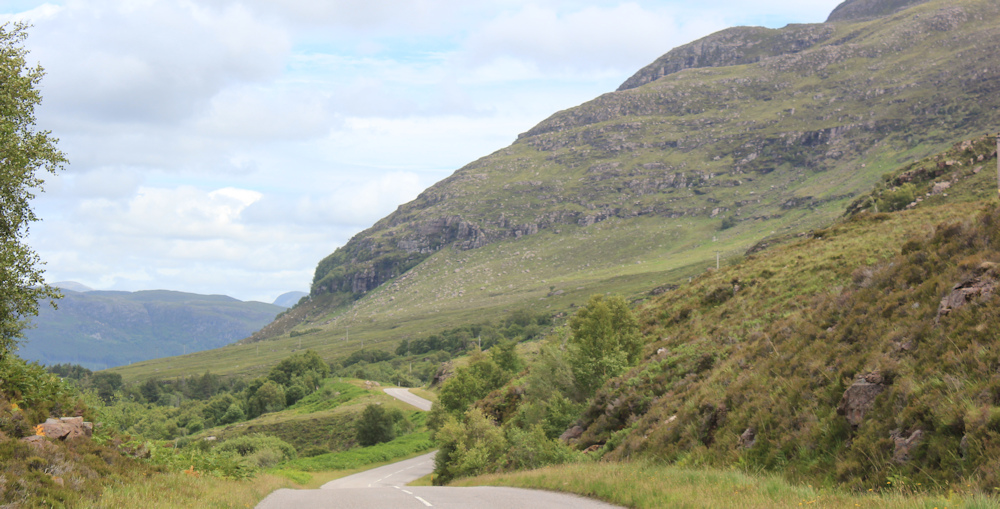
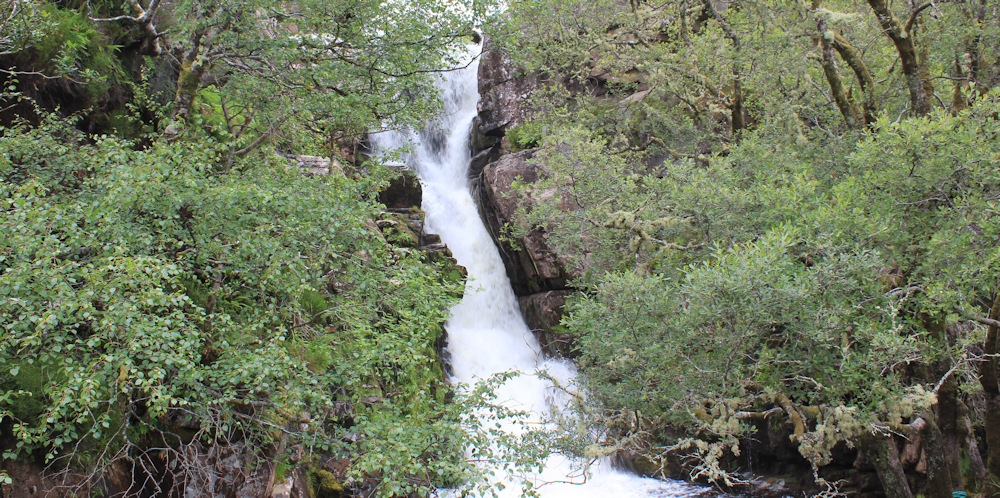
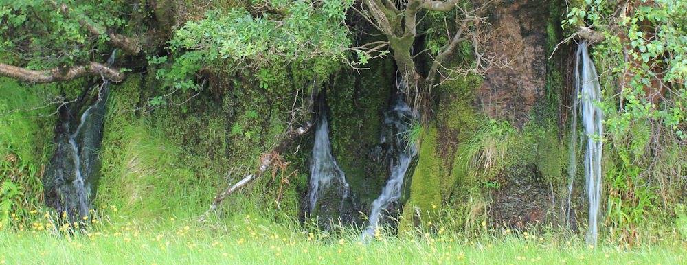
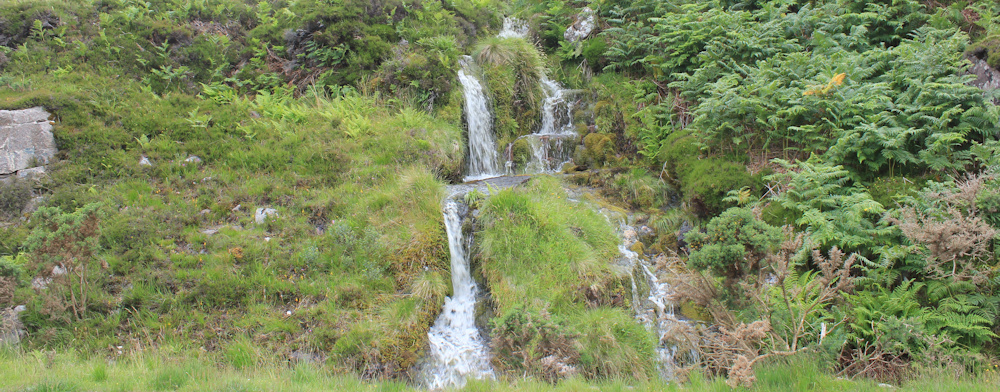
The views inland are also spectacular, but in a different way, with green slopes leading up to purple peaks, and the wide landscape is dotted with tumbling waterfalls.
The peninsula on the other side of the loch looks forbiddingly empty. My map suggests there is a track and crofts over there, but I can’t see any signs of either tracks or buildings.
I reach a little place called Badcaul, where a turnoff leads along a dead-end road to a smattering of houses and a primary school. There is a bus stop near the corner. I wonder how often buses run? (I assumed there were none in the area, and I didn’t investigate.) A sign warns me to look out for cows… no, sheep… thank goodness.
I walk past the turn-off and continue down the hill, round a few more corners, past a few cottages, and past a camp site (the Northern Lights Campsite – what an enticing name!).
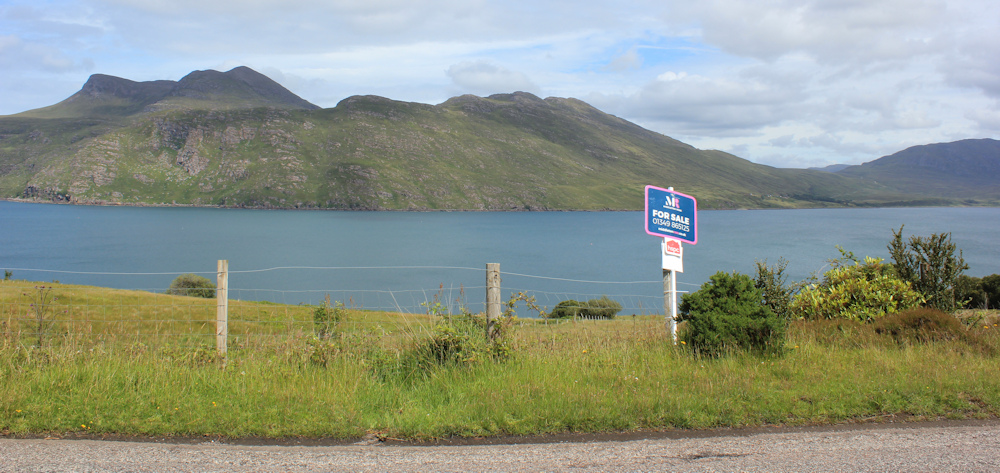
“For Sale” says a sign. I can’t see a building. Maybe it’s the land that is for sale? I have a momentary fantasy of building a little cottage here – with wide glass windows and a great view overlooking the lovely loch… but I really couldn’t live in such an isolated area… and I dread to think what the winters are like!
I reach a place called Badbea, which seems to consist of a layby and a post box.
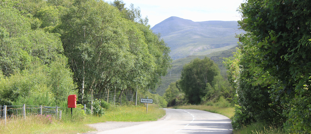
The road dips and bends, and a sign warns me of more sheep (although, I can’t actually see any). Where is Badbea? Oh look – a lovely white cottage with a bright red roof, set in the slope with mountains behind, and the blue waters of Little Loch Broom in front as a view.
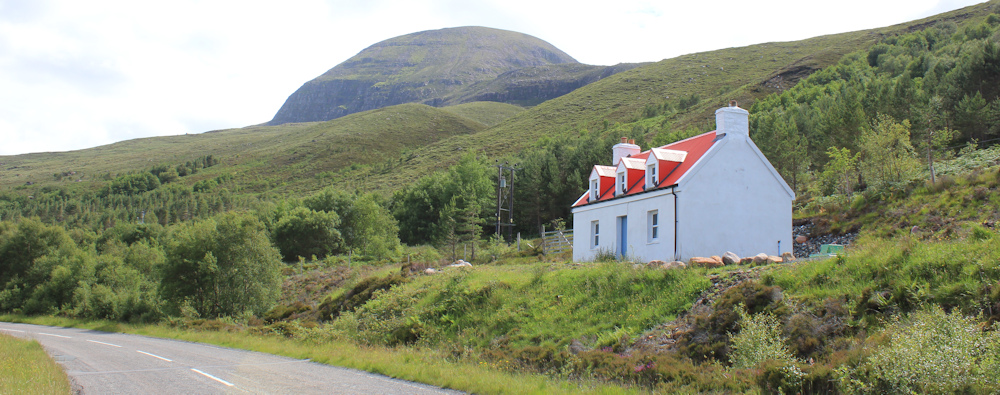
Is that all there is to Badbea? To be honest, I suspect it’s a holiday rental or a second home – it has that clean un-lived in air.
Onwards. Down the hill, with the road winding and bending and dipping.
Cyclists pass me. I’m approaching a spit of land sticking out into the loch, with a fish farm close by. “Ardessie”, says my map.
More beautiful waterfalls – I stop to take photographs, aware of how hard it is to capture the magnificence of the torrent of falling water in a still picture. And the noise!
A couple of motorcyclists stop on the bridge to look at the falls. To my left, through trees, I can see hints of green lawns and residential houses. More cyclists pass me.
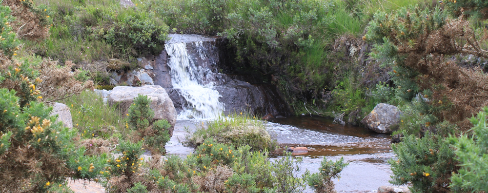
I walk past an art gallery, and another sign warning of sheep. This is Camusnagaul. To my right is another waterfall – not so dramatic as the previous one, but collecting the water coming down off green slopes and emptying into a pretty pool. The water is brown and peaty.
Past a guest house, a post box, a B&B sign.. and then the road descends further and bends to run beside the shore. I look back to where a collection of buildings and vehicles lie closer to the waters of the loch. That doesn’t look like a touristy place – more workmanlike.
More cyclists pass me. This one catches my eye. Unusual to see a lone woman cycling – and she has come prepared for bad weather – just as well, because it is beginning to spit with rain.
The road runs straight and flat. A whole series of small waterfalls line the route – each a mere couple of meters high. I’m not sure if they’re permanent, or just a reflection of the unusually wet summer Scotland is suffering.
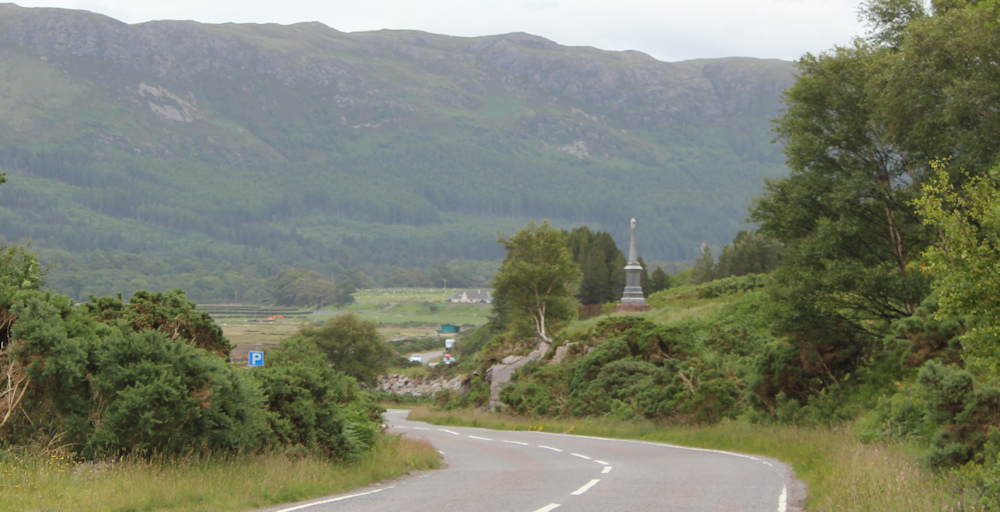
The road dips and curves – one final downhill section. The rain begins to fall harder. There is a parking place ahead, and a war memorial perched above on a small rise.
At this point, a van pulls alongside me. It’s a little delapidated, and I get the impression the occupants have been living in it for some time. They ask me the way to Dundonnell, which I tell them is just a little way ahead. They set off again, with a roar of engine and clunk of gears, and then stop again. As I draw alongside, they kindly offer me a lift.
No thanks. I’m walking!
Onwards. The rain continues heavy – so I decide not to climb up to look at the war memorial – but pull my hood down and carry one. I’m reaching the top of the loch.
Here’s yet another waterfall. The rain has eased again, so I stop to take more photographs.
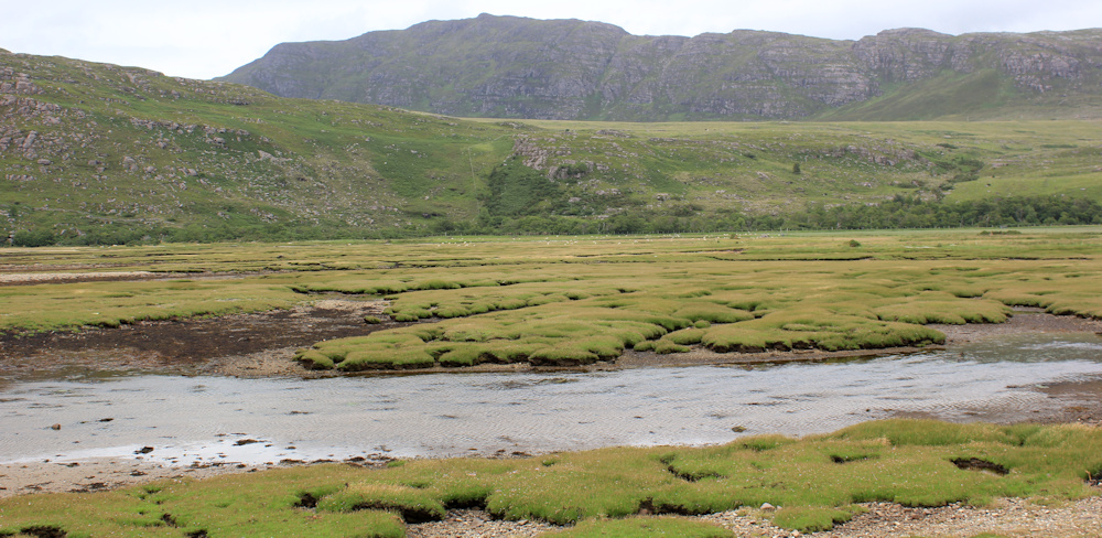
The pale waters of the loch have given way to a brilliant green basin of marsh, with a slow-flowing tidal river running lazily through the middle.
I reach a stretch where a row of buildings line the right-hand side of the road. This is Dundonnell. The orange wall is jarring, and belongs to the Broombeg Bar, which looks closed at the moment. It’s just gone 5pm. Perhaps it will open later? Next door is the Dundonnell Hotel with large windows, which also looks dark and closed.
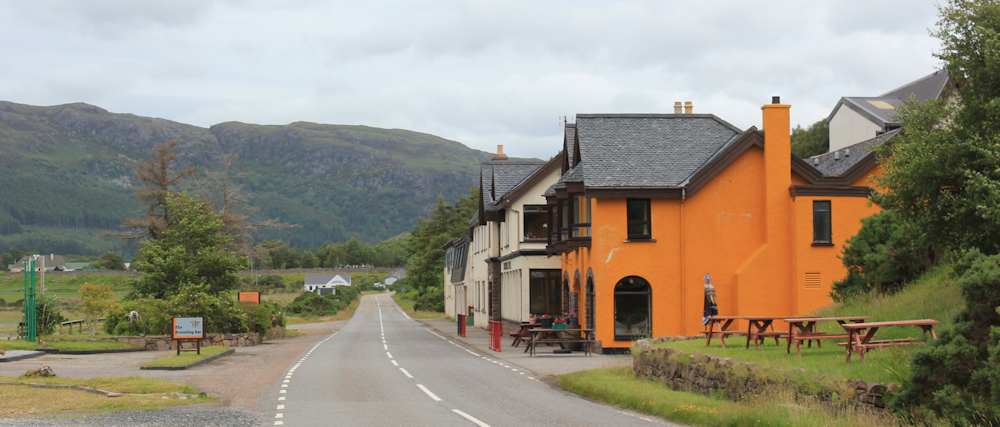
Despite the buildings, there is nobody in sight. In front of the hotel, beside the loch, is a parking area, with a cairn of stones, benches, and a green space where you can camp, apparently. “Book at reception,” says a sign with a picture of a tent.
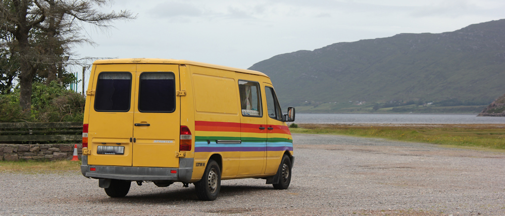
I stop in the parking area to take some photographs, and a yellow van with rainbow stripes pulls up beside me. I can’t see who is driving, and I wonder if they plan to stay here tonight?
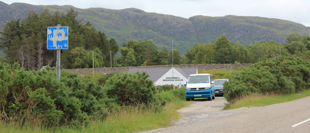
I walk onwards. The last stretch of any walk seems the longest, and I’m growing tired. But its only a hundred yards or so the the next layby, where my van is parked, next to the Mountain Rescue Centre.
Later, in my van, I pull into the viewpoint / parking spot above Little Loch Broom to pick up my Scooty bike. There are several campervans parked there now, some of which look as if they’re settling in for the night. One of the vans is the same yellow van with rainbow stripes that I saw earlier. It seems occupied by a lone woman – and I would like to engage her in conversation, but she climbs into the van and is busy doing something inside, so I drive away instead.
Briefly, I regret staying in my B&B, because it would be nice to camp here in the company of other van-travellers. But, I return to find that my hostess (who doesn’t provide breakfast) has made some tasty soup. She offers me a bowl, along with a large slice of homemade cake she bought at a local fete. I watch the rain falling outside, and am glad I’m inside after all – with hot soup and yummy cake to eat.
You can learn more about the disturbing history of Gruinard Island on Wikipedia. And also the dramatic fire that burned across the whole island in March of this year, and explains why it is currently treeless.
Miles walked today = 9 miles
Total around coast = 4,762.5 miles
Route (first section in black, second section in red):


If your B&B doesn’t do breakfast it’s not really a B&B is it – could be disappointing for anyone who might just turn up on spec. You picked a good spot for breakfast in the van though, the view looks lovely. That was one heck of a fire on Gruinard Island – I suppose being uninhabited it was just left to burn itself out but I feel desperately sorry for any wildlife on there at the time 😦
Hi Eunice. No, it’s only really a B-B! The place was a tiny 2-bedroom bungalow, and she rents out her own bedroom too in the summer, and sleeps in the lounge. There is only a tiny kitchen. Not really space for breakfast, I suppose. I knew all this when I booked it, but felt sorry for the various motorcyclists who arrived, cold and wet, with nowhere to dry their things and no food. There isn’t anywhere to eat in the evening either, not for miles around!
Yes, apparently they just left the island to burn. No human lives or property were at risk, and difficult for the fire service to reach it anyway.
Hi Ruth, I love this area. We toured it in our camper van years before the NC500 was a glint in anyone’s eye.
As I’m sure you will tell in a future episode, on the peninsula the North side of little loch broom is the off-grid village of scoraig.
We camped at a rather “alternative” campsite at Badrallach and walked the coastal path put to scoraig.
The residents use a boat from one of the jetties you passed.
They even get tesco deliveries to the jetty, which rather defeats the object of being off grid I would have thought.
Amazing area.
That sounds amazing Ali. I regret I never got to Badrallach – for some reason I missed that whole peninsula out! Will return and do it properly… one day.
That was interesting about the island, but I wonder how the vegetation would burn so ferociously in such a wet climate.
Yes. The news reports show an amazing conflagration – hard to believe given the weather.
I’m looking forward to hearing about where you go next after Dundonnell. Are you going to Scoraig for instance? A very interesting place with an interesting history. Will you then walk the peninsular via the old Altnaharrie Inn to Logie or continue down the road? For many years the Altnaharrie Inn was the best hotel in Scotland and the only way to it for guests was a ferry across Loch Bloom from Ullapool. Sadly now a private house.
I’m afraid I really messed up this section, Chris, and managed to miss out Scoraig entirely. I was so flabbergasted by discovering how far it was to Ullapool (and I didn’t have that particular OS map so felt I was walking “blind” – which is ridiculous when you have internet access!). Jon Combe described his walk there and I remember thinking how wonderful it would be… anyway, I WILL return and tackle that route on another trip.
Hi Ruth, your mention and photo of the Dundonnell Hotel reminded me that I stayed at that hotel in 2017! It was just for one night on our way back from a trip to Handa Island (boat from Tarbet) to Nethy Bridge in the Cairngorms, on a group wildlife holiday organised by a company called Heatherlea. It was a wet night but cleared after breakfast, giving us all lovely views of the birds on Little Loch Broom, including a summer-plumaged Great Northern Diver. I noted “We continued west along the A832 stopping at Gruinard Bay, First Coast, Laide, Mellon Udrigle, Aultbea and Gairloch where we had lunch”. No mention of Second Coast! We saw Red-throated and Black-throated Divers, Eiders, Mergansers, Gannets, a Black Guillemot and both Harbour and Grey Seals, and I photographed a Northern Marsh Orchid. We were in a minibus, I think there were about 7 of us with a local guide/driver. The next day we went up Cairn Gorm and saw lots of mountain specialities. Yes, Scotland is a wonderful country once it stops raining! Great to read your blogs again – keep going, it gets very wild up in the far north-west.
That sounds like a wonderful trip. I’m afraid my knowledge of sea birds is pretty poor – although it has improved during my trek around the coast. Scotland is the most beautiful country in the world – when it stops raining for long enough to see the scenery!
A pretty walk. I do love the sounds of waterfalls. A shame you did not get to chat with your fellow van travellers. Often interesting people.
I follow your walks on my OS maps app and wonder whether I’ll be able to avoid the roads when I get there. We shall see.
One of the advantages of a B&B is that you get a comfortable night away from the weather, but you do miss out on the social side of vanning, especially when your B&B doesn’t even do breakfast, so there is no chit-chat over the table either!
That’s a lovely section, great photos! I have the same quandary about my eBike. I normally resort to locking it up in full view, to a post or bench, my theory being that if it’s in full view of lot of people someone wouldn’t try breaking the locks.
It’s a sad story about Gruinard Island isn’t it? I did know the story by the time I got there, so for once it was an island I was not so keen to visit.
I did this walk mostly in pouring rain so didn’t see it at it’s best, but still beautiful scenery.
For this walk I was staying in Ullapool and did look at staying in the hotel in Dundonnell but the reviews suggest it was just as run down as the Caledonian Hotel in Ullapool where I was staying, but also considerably more expensive. Despite this, it looked quite busy, but it sounds like that wasn’t the case when you passed.
A lovely walk with so many wonderful views and pretty waterfalls. I agree that the orange wall is too much, though the white buildings with red roofs are delightful.