
[This walk was completed on the 7th July 2022]
Today, I’m filled with a sense of urgency because I want to get to Ullapool before the end of this trip – and I discovered yesterday that Ullapool is much further away than I realised.
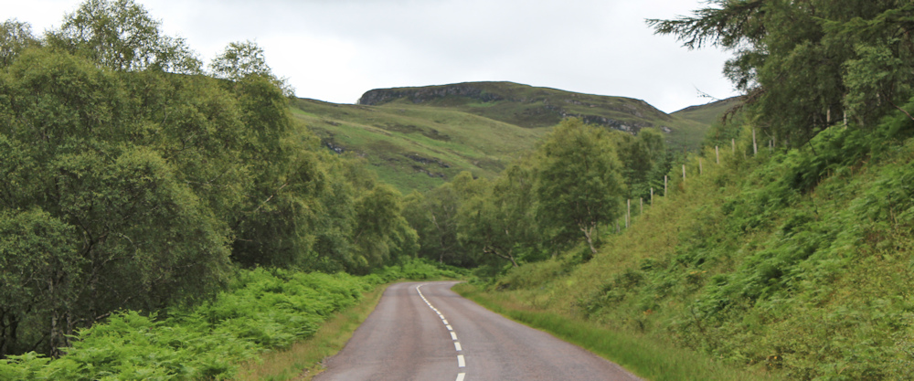
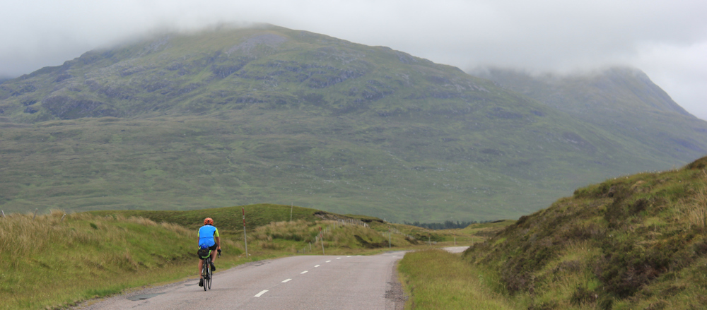
Its a dull sort of day, but at least it isn’t raining. I hide my bike in the bracken, and begin my plod along the A832
Some time ago, I bought all the OS maps that covered this section of coast, but failed to realise that to get to Ullapool I had to venture several miles inland and navigate around the top of Loch Broom. (Sometimes my lack of forward planning gets me into trouble!) So, today, I will be walking “off the edge of the map”. This always creates a mixture of excitement and anxiety.
Perhaps because of my self-induced urgency – and my anxiety about lack of map coverage – I failed to realise that I could have turned off left along the side road towards Scoraig, and done a lovely looping walk over the top of the peninsula and down to the shore of Loch Broom. This route is partly covered by the OS map that I am currently holding. Jon Combe did this walk 3 years ago, and it looked delightful. An opportunity missed.
Anyway, I’m also distracted because close to my start point is a signpost for the Core Path to Poolewe. Poolewe? Crikey – it seems ages since I was at Poolewe

I spend some time looking at my map and trying to work out the route to Poolewe. It’s a fruitless and pointless exercise, because that Core Path is definitely heading in the wrong direction.
Onwards. Along the road. It’s a quiet morning. Light traffic, and the occasional cyclist.
The road runs inland, following the bank of the Dundonnell River. Ahead is a parking spot – one of the places I had planned to get to yesterday – if only I hadn’t given that lift to the stranded lady, and if only it hadn’t been raining so hard.
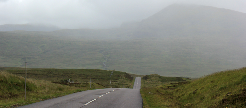
The road begins to climb. I’m heading up a river valley. Pine plantation to my right, the tree-lined river to my left, steep crags towering above – all very dramatic.

Round the corner, and I’m in an open landscape, following the twisting road as it gradually climbs upwards along the shallow valley. “Yes” says a blue and white sticker.

This section of road seems long and tiring. I’m painfully aware I’m heading inland, away from the sea, and feel a sense of frustration. Will I ever get to Ullapool?

My mood is not helped by the sight of a deforested slope to my right. I hate to see these tree-graveyards – although I know it is good to use home-grown timber. The logging sites are such an eyesore. One small grove of pines remains at the top of the slope.
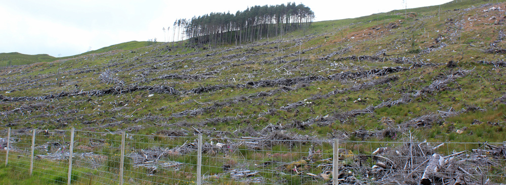
I wonder why that group of trees was spared? It will take years before the rest of the slope is re-forested again.
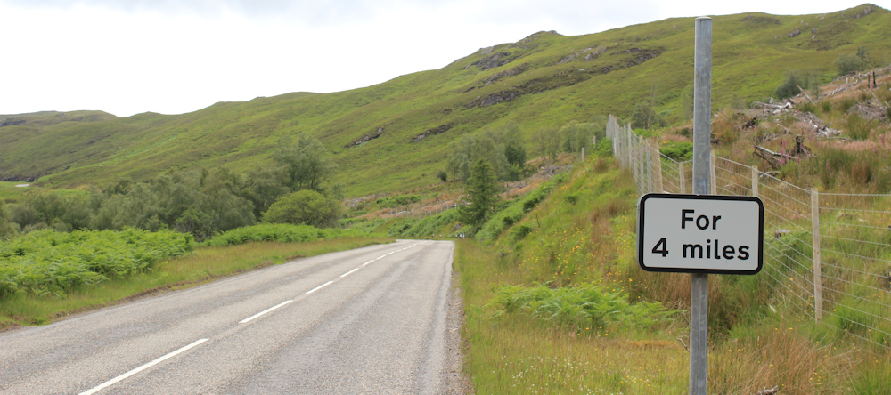
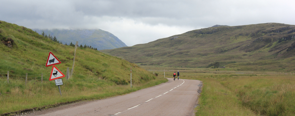
This road sign is missing. Something happens “for 4 miles” ahead, but I have no idea what.
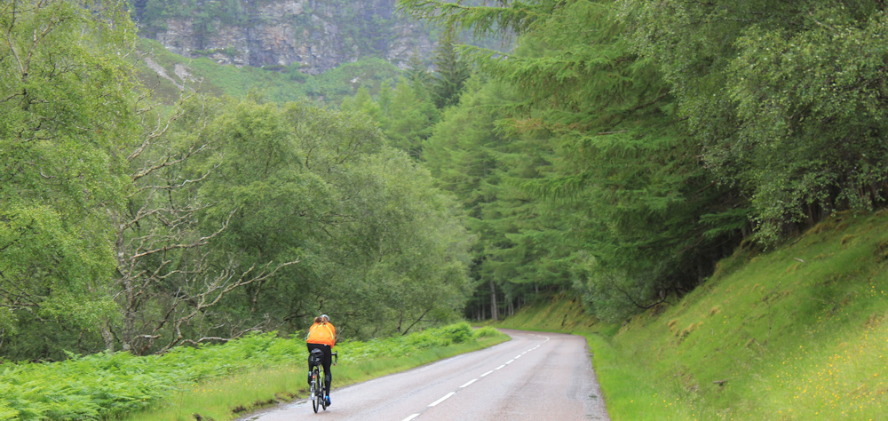
Traffic is beginning to build, with an intermittent stream of campervans, caravans, cars, motorbikes and the occasional cyclist. But what is this? Looks like an army truck – blocky and black in colour. Whatever it was originally, it seems to have been converted into a mobile home!

I don’t swing my camera up in time… and only manage a shot of its disappearing back end.
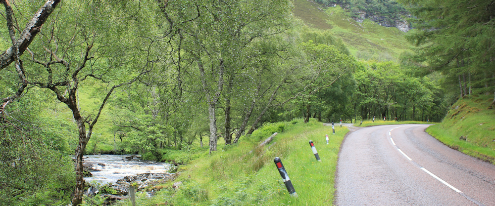
To my left, the Dundonnell River is tumbling down the valley in a series of small waterfalls and rapids. No one section is particularly dramatic, but taken together it is quite an amazing and beautiful sight.

I keep stopping to take photographs.
The road begins to steepen as I reach the final ascent to the top of the valley. Beware of falling rocks, says a sign that has been peppered with shot.

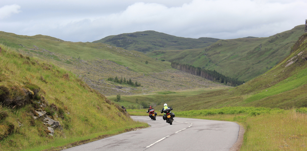
A line of motorbikes roar over the brow of the hill (I hear them long before I can see them) with their paniers laden. They must be doing a trip around the NC500. I envy them their speed, and snap a shot as they zoom past me and begin their curving descent down into the valley.
At the final bend in the road, I step onto the grass verge and stop to take photographs looking down along the river. I may be miles away from the sea now, but this is a glorious view.

The final few steps to the top… and I hear a clanking and a puff-puff noise behind me. It’s a group of cyclists, strung out along the road, each one pedalling slowly and breathing hard with the exertion of the climb. Looks like very hard work. I’m glad I’m walking!
The cyclists disappear, one by one, over the brow of the hill, and I quicken my pace. Beginning to feel a thrill of anticipation… because once I reach the top I’m expecting a great new view ahead. And…

… it doesn’t disappoint me… beautiful.
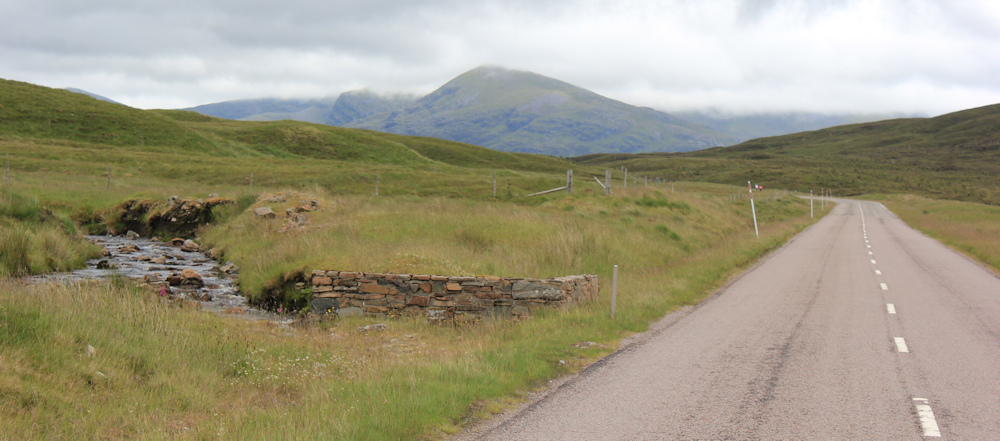
Straight ahead is Fain Bridge, a workmanlike structure which doesn’t bother the flat surface of the road, and is only marked by a couple of low walls. So, the bridge is barely noticable if you’re driving. Beyond the bridge, the road hugs the gentle slope of a wide valley, where the grass is fresh and vivid. Tall mountains in the distance are a darker blue and green, topped by clouds.
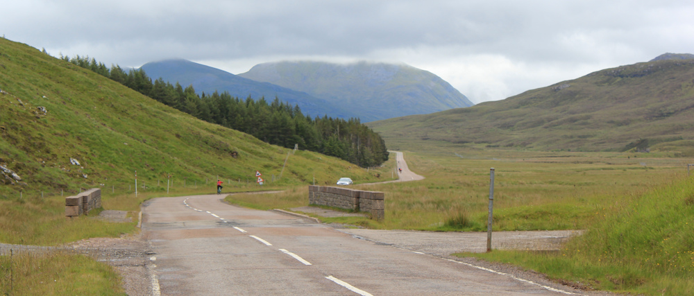
At Fain Bridge the road passes over the Dundonnell River and there is a small parking area. I stop to take more photographs.

The river has been my bubbly companion for some miles, but now it deserts me, and meanders off into the centre of the broad valley, where it is soon lost among the waving grasses.
Later, when I look at my map, I realise this area is called “Dundonnell Forest”. A misnomer. There is barely a tree in sight – just a couple of fenced pine plantations to my left.

There are more bridges carrying more streams beneath the road. Each one is marked by low stone walls. There are no seats along this route, so I sit down on one of the walls for a breather and a drink.

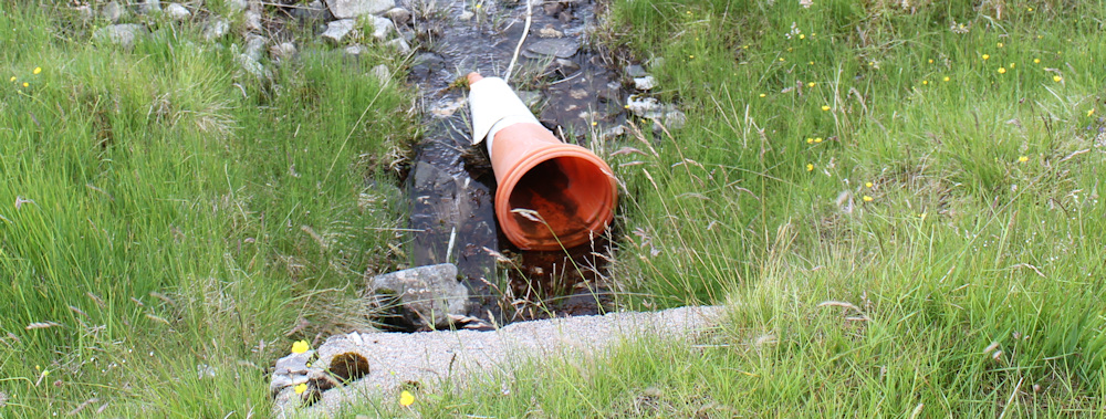
Onwards. I’ve left the pine plantations behind. The road rolls on. Another narrow stream and bridge ahead.
A traffic cone is lying in the water. Where do all the cones come from? You see them everywhere – ditches, hedges, ponds, streams… but rarely on the actual road!
The valley has flattened out, and the skies are getting darker. Rain-clouds gather on the mountains ahead, which begin to take on a sinister look. I’m pleased to see a red-roofed building ahead.

I noticed this place earlier when I first drove, and then cycled back, along the road – it’s marked as “Fain” on my map, and is presumably how Fain Bridge got its name (or vice versa). Anyway, the building marks the 2/3 point of my walk. I’m really tired now… and it’s beginning to rain… so I pick up speed and hope the building offers some sort of shelter.
As I get closer, I realise “Fain” is just an abandoned barn – no, with a fireplace and windows, it must be an abandoned house. Sadly, the place is a mess. People have obviously had gatherings here, and left their rubbish behind. Shame.

I heave my rucksack off and sit down on the only clean place I can find – a big stone just inside the door. Time for lunch. The view would be good… if only it would stop raining.
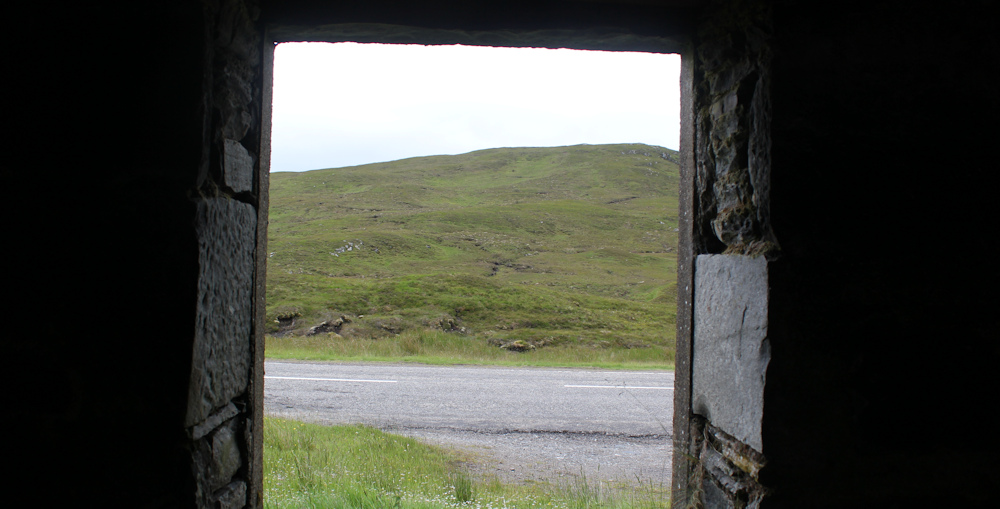
A few rain drops begin to plop down onto my knees. I look up, and realise I’m sitting under a large hole in the roof. Oh well, there is nowhere else to sit. I pull my hood up and make the best of it.
“Hello!” The sudden voice makes me jump.
The voice belongs to a large, friendly woman, looking in through one of the back windows. “This would make an excellent shelter if we cleaned it up,” she says, in a soft Scottish accent. Turns out she is a “ranger” and her job is to make sure the area is hospitable for tourists and walkers. We discuss walking routes, and I think she is slightly disappointed to discover that my walking route is, more or less, confined to the road. Anyway, we both agree this would make an excellent shelter and then she leaves me to finish my picnic.
I’m growing uncomfortable on my rocky perch, and a little damp, but the rain is clearing up. So, it’s time to pack my lunch away, pull on my backpack, and venture out. Ah… love the dramatic landscape.

The last few miles of any walk are always the longest. The road seems in no hurry to get to the end of the valley – with lazy twists and turns. The mountains ahead are covered in shifting clouds.

Where does everyone go when it rains? Where are all the cyclists and motorbikes? It’s a mystery. The traffic has virtually disappeared – just the odd car.

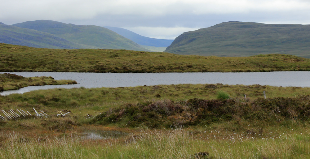
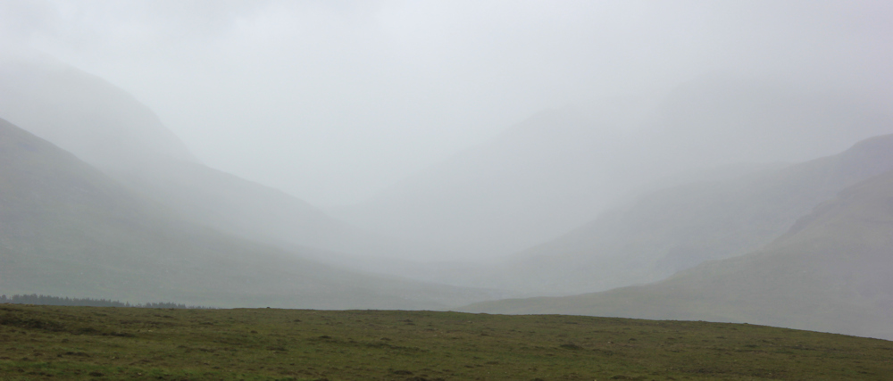
In the gloom, and with the dark clouds covering the mountains, the valley has taken on a bleak, almost sinister air. I bet there are gales and storms here in the winter. A dilapidated fence bears testimony to the power of the wind.

The sky is filled with water, but so is the land. Lochs and lochans. More tumbled fences. Distant mountains. It is really beautiful, in a harsh, wild, wind-swept way.
A lone cyclist passes me. I can’t see beyond the bend ahead, but the mountains are definitely nearer now. I must be nearing the end of the valley.
Round the corner, and the road continues on, up and down, in a series of waves. A misty cloud has covered the mountain completely… oh dear, rain is coming my way.
Luckily, by some miracle, the rain seems to be stuck, literally, on the top of the peaks and their lower slopes. Look at it – bucketing down over there. Only a mild drizzle here.
Onwards. Another brow of a hill ahead… what is on the other side?

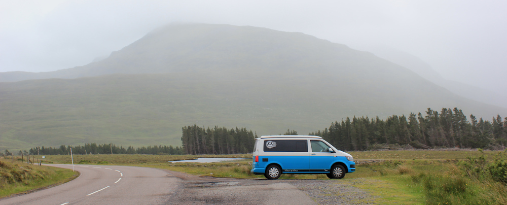
More road. I look across the landscape to where the next curve will lead me. There, among the grey veils of rain, is a little blue and white blob. (You can just see it – on the far left of the photo below, right in front of the line of trees.)

It’s my van. I’m nearly there.
With the distant view obscured by rain, I take some photos of the bright pink foxgloves growing by the side of the road. There really has been a lot of lovely summer flowers to enjoy on this trip – despite the miserable weather.

Nearly there. Hello van. Always such a welcome sight.
I jump inside the van, and brew up a quick cup of tea.
Was planning to walk a little further today, and to reach the end of the A832 and the juction with the main road to Ullapool. But, as so often happens, my warm welcoming van is just too tempting. I drink my tea, stare out at the mist and the rain, and decide to finish my walk for the day.
Miles walked today = 7.5 miles
Total around coast = 4,772.5 miles
Today’s route:


I followed your route on my OS maps app and was struck by how much water there is everywhere, which you mention. Gorgeous scenery and your photos are suitably moody, capturing the change of weather. Jealous of your van at the end for a cuppa. I would be busy pitching my tent first! 🙂
I love my van – but it does make me lazy! I admire you carrying your tent… because I find my day pack heavy enough. Great respect for all you wild campers.
With the mountains and mist, it’s just what Scotland should look like.
Good morning
Lovely to see you articles flowing again
Carol and I have nearly finished our walk of the ENGLISH coast
We have 37 Miles left
We could not have done it without your excellent guides… despite the sea on the left, surprisingly easy to get lost !!
We are going to embark on the islands of England after this… that we have not done..
Scilly isles
Channel Isles
Lundy
Good luck with the rest of your walking
Our favourite walk so far remains Yarmouth to Ventnor on the Isle of Wight… Tennyson Down in particular
Take care
Paul and Carol Sennett
Hi Paul and Carol – well done on your English coastal walk. Your island plans look interesting! I’ve explored St Mary’s, St Agnes/Gugh and Tresco; each can be walked round in half a day, the same I’m sure for St Martin’s and Bryher. Local boats from St Mary’s to all these 5 inhabited islands. Most others are inaccessible (protected nature reserves and/or no landings – there are over 100!). Check whether the Scillonian runs in the winter; maybe better to fly? Guernsey is glorious for walking with frequent very cheap buses to all parts from St Peter Port. Boats from there to Herm and Sark which can be done easily in half a day. Haven’t been to Jersey, Alderney or Lundy. Best of luck and good walking!
You are amazing one. Not us
Take care in the land of
Midges
In the scillies. We thought we would base ourselves in st Mary’s. And take
Daily ferries to the various islands
I hope your Lyme disease has cleared up
My wife is still recovering from an awful reaction to withdrawing from pregablin
So sorry you missed ‘a’ the walk to Scoraig, but also ‘b’ the walk over the top to Altnaharrie which would have probably shortened your walk to Ullapool by 10-15 miles. Hope you are able to do Scoraig another time.
I have been following your progress with interest for a while (you were on Arran when I found you). I love the style of your blog with so many photos.
I was looking forward to these sections around Ullapool where the company I work for owns a holiday let property you have probably walked past by now. I laughed when I saw the photos of the deforested area and read your comments. It belongs to our managing director personally, was mature and suffered devastating blow-downs whenever there was a storm, and the income from selling the timber barely covered construction of the access track for the contractor and the costs of restocking. It will take time and the scar looks ugly at the moment, but the new forest will be a much more attractive mix of native species for future generations.
Have you seen the entry in Wikipedia about the A832 road which gives a little history?
Well it’s nice to see a different route from the one I followed. I drove along this road a few times but of course you don’t really get the opportunity to enjoy the scenery so much when driving, so it’s good to see your photos and hear your experience of the road route around. I do remember how long it took to drive to places which were physically close to Ullapool because of getting round Loch Broom.
Your lunch spot sounds spooky to be interrupted like that! So many abandoned buildings all over Scotland, I often wonder their history. Thanks for mentioning me and the route I took, too!
The rain and mist changes the views from delightfully pretty, to dramatically bleak. Your smart van getting closer and closer at the end of the day’s walking must be just the thing to keep you going the last few hundred steps – and no wonder you don’t want to get out again.
It’s such a shame people leave their rubbish behind them to ruin places for others.