
[This post was completed on the 11th July 2022]
Yesterday was full of gorgeous sunshine and warmth. This morning, I wake to a gloomy sky. Never mind – it’s perfect walking weather. This is the view from my camping pitch.
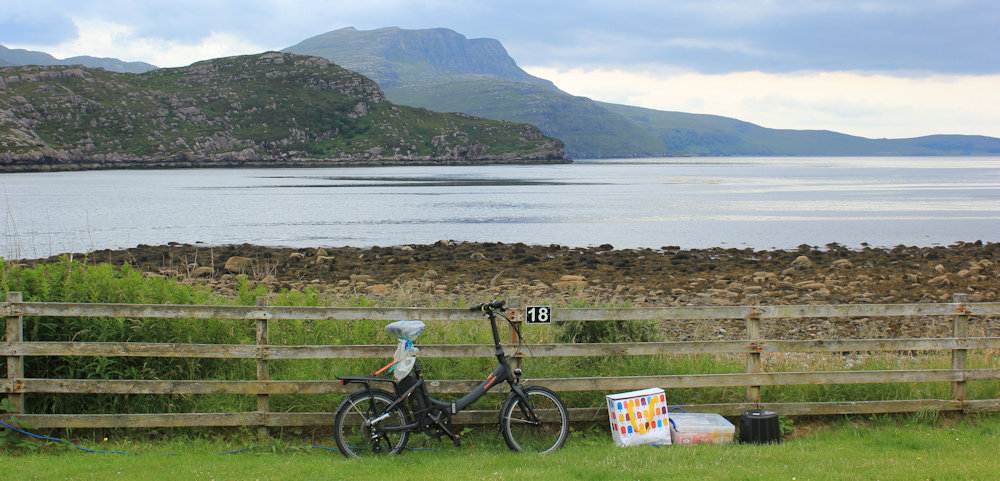
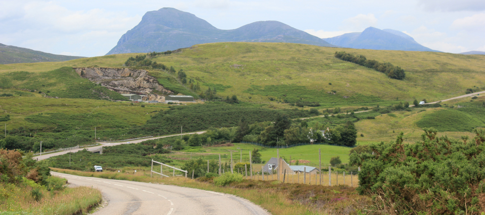
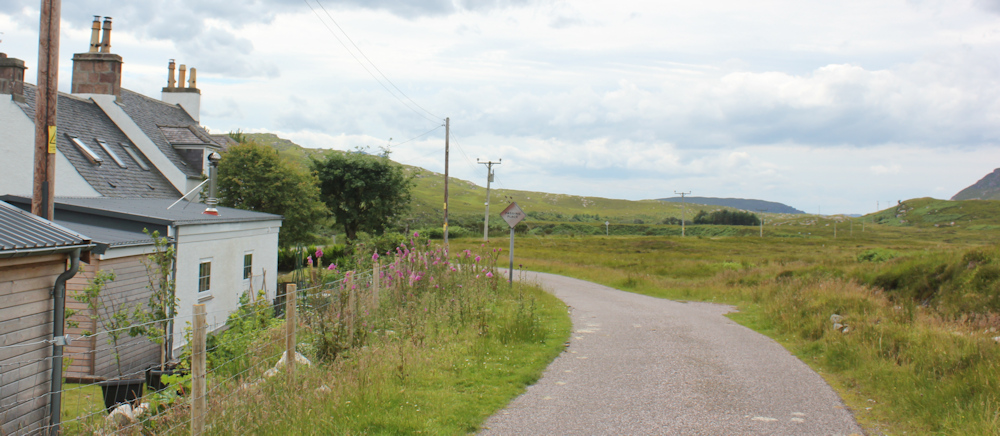
I drive to my end-point for the day (more on that later) and cycle back to the campsite, chain up my Scooty bike, and begin my walk, starting along the A835.

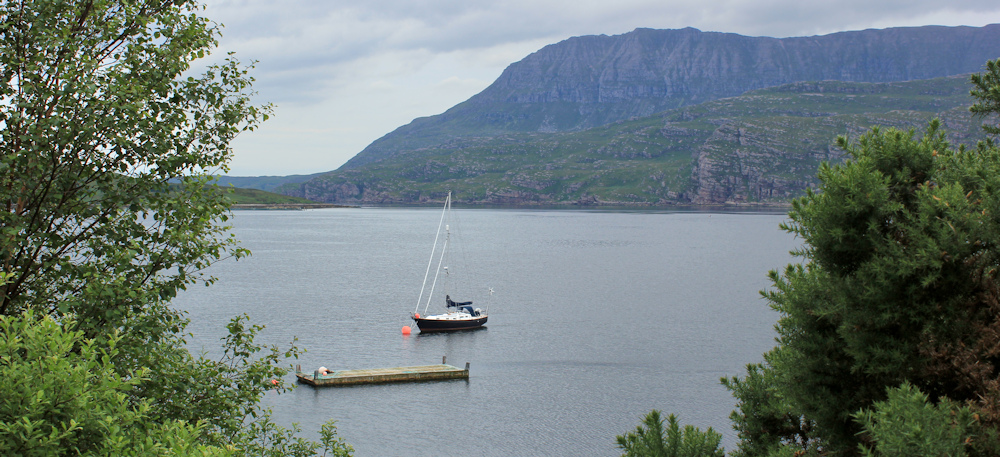
The first section is, of course, uphill. Below me is Loch Kanaird, which isn’t really a loch but a strait between nearby Isle Martin and the mainland. There are a few boats moored, and some fishing paraphanalia. Ardmair Sea Farm, says a sign.
Climbing higher, and looking back, I get a great view over Ardmair Point and the camp site. What a beautiful place.
Apart from the views, the road is really quite boring. I plod on, aware of how slowly I walk and how little progress I’ve made this summer, despite spending many days up in Scotland.
I begin to ruminate on the pointlessness of my trek. It’s taken me 12 years so far (I anticipated 3-4 years when I started – I was so ignorant back then!). Will I manage to finish before old age or some unexpected illness catches up with me? What’s the point?
Perhaps it’s the thought of the next bit of my walk that’s worrying me. I’ve researched it – something I rarely do, and the path looks promising… but… wild, isolated, and a bit scary.
Downhill now, and I quicken my pace.
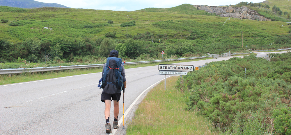
Round a bend, and I see the settlement of Strathcanaird ahead. Oh, the joy of being back on the map again, and knowing where I am and what I’m looking at. (My route into Ullapool wasn’t covered by a map because I’d not realised how far inland I would have to detour to cross over the top of Loch Broom, and I’d only brought the coastal maps with me!) Anyway, it’s good to be back on the map.
At some point on this final descent, I hear a clack-clack sound behind me. A quick turn around… it’s another walker. A young man with a walking stick and a large backpack. My foolish pride means I don’t want to be overtaken, so I quicken my pace further. I’m nearly jogging (or what passes as jogging for me). It’s no good. I can hear the clack-clack sound getting closer.
He overtakes me just as we get near to the sign for Strathcanaird, and he slows down to keep pace with me so that we can have a chat. He has been walking the West Highland Way, but this ends in Fort William, which is miles away from here. I ask if he’s lost, but he tells me he enjoyed it so much he is now walking onwards to Cape Wrath. Camping as he goes. His walking stick doubles as a tent pole.
I watch as he strides off ahead of me, and admire him greatly. I find this walking malarky hard – and I have an easy time in B&Bs (even though they don’t do breakfast) or sleeping comfortably in my campervan.
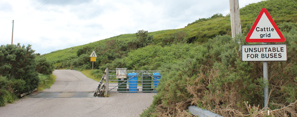
Soon after this, I reach the turn-off to Blughasary. “Unsuitable for buses” warns a sign.
And, a few yards further on, “Unsuitable for motorhomes”. That second sign worried me earlier when I drove my van up this road, but luckily there was no other traffic and we didn’t have a problem.
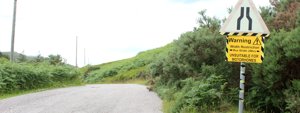
Anyway, I have a neat little camper van, not a monstrous motorhome. (I should point out that my ex-husband has bought a motorhome, and so my previous antipathy towards those beasts has turned into positive animosity – not that I’m petty minded or anything!)
This is a lovely little road. I’ve already driven down it, and cycled back, so there are few suprises. But you do get a different feel for a place when you actually WALK through it. Very quiet. Just a few cottages and the odd house.
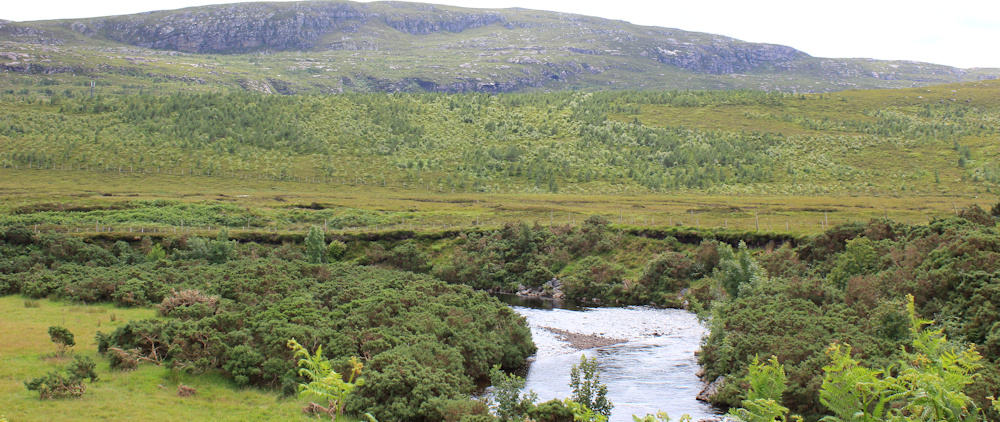
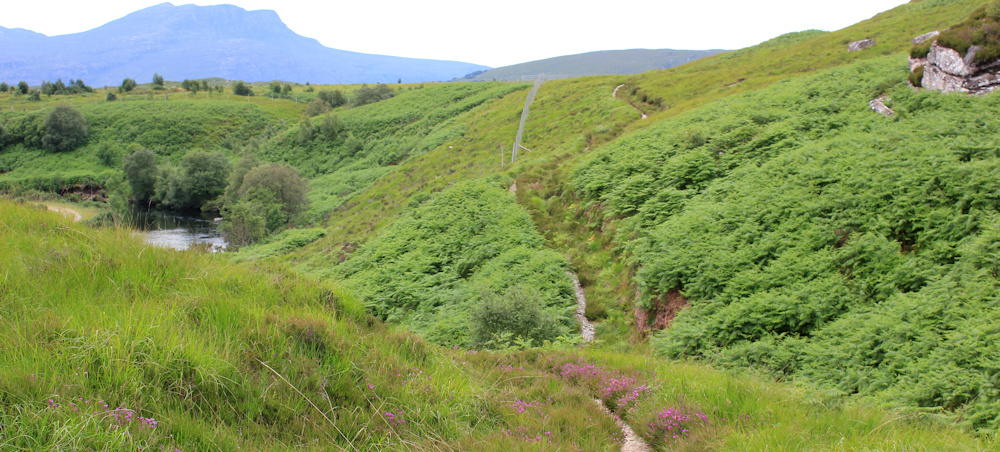
I stop to take the map out and get my bearings. By following the road to Blughasary, I’m almost doubling back on myself. I look over the river – the River Canaird, according to my map. Across the valley is the ridge where the road runs – the good old A835. The slope ahead has been logged, but fresh green sprigs of fir-trees are beginning to re-populate the cleared area.
Shame it isn’t natural forest. Oh well. Onwards.
This section of road is very empty. I begin to feel nervous about the walk to come.

A dead adder! Looks as if it has been run over (hope it wasn’t by me). I can only see its underbelly, so can’t tell if it was male or female, but it is quite small. Maybe a foot in length.

Past another couple of cottages. I can see the end of the road, and the parking place where I left my van this morning – but now a few other cars have arrived. A sign on the nearby gate is faded, with missing letters. It says “stie’s Path, ar ar”, which I interpret as “Postie’s Path, Car Park.”

It’s reassuring to see the sign. Yesterday, looking up the details of the Postie’s Path, I discovered it was repaired and improved recently – a project that was finally completed only last year. So, I am fairly confident that even a very unfit and timid walker (like me) will be able to complete it.
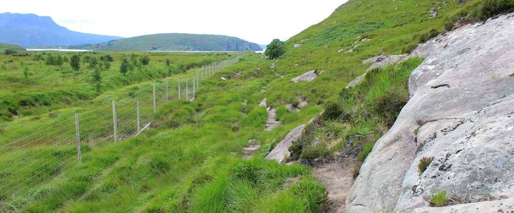
Through the little car park, over a bridge, and I meet a wide track, and my first dilemma. Do I turn left or right along the track? My map suggests I should take a path straight ahead, but there is no path visible, and a fence with a hedge are in the way.
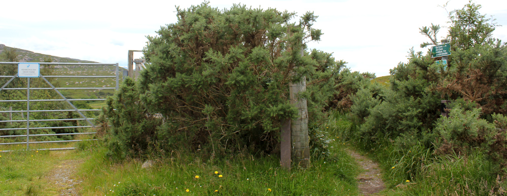
I turn left (which seems the right direction) but haven’t got far when I reach a large gate blocking my way. “Keanchulish Deer Farm” says a sign, but to read it properly I have to get closer… and then I spot a path off to the right.
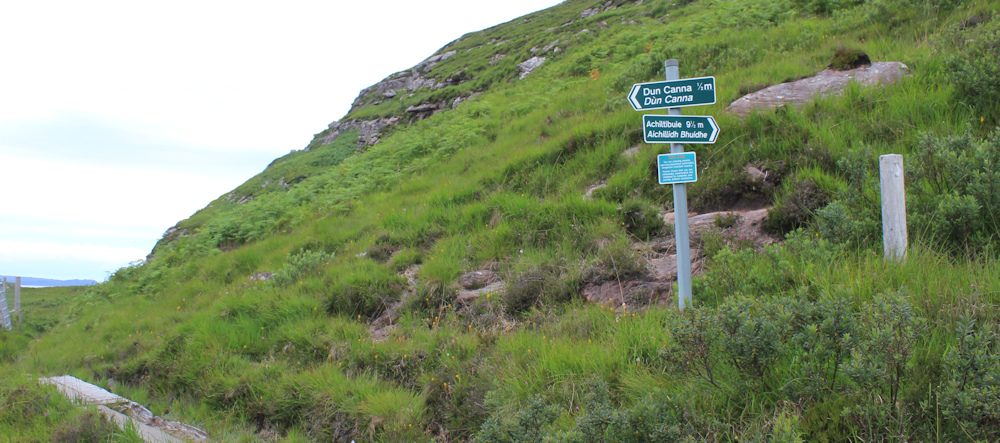
This path has a proper path signpost, to somewhere called Dun Canna, and somewhere else called Achiltibuie, which is 11 miles away. Under that is another sign, of the sort I’ve seen before, “TAKE CARE. You are entering remote, sparsely-populated, potentially dangerous mountain country…”
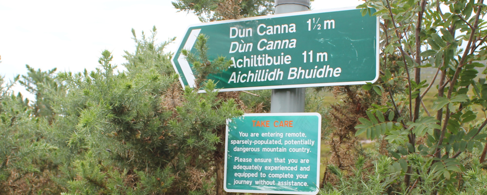
Feel anxiety rising. I’m trying to traverse along the side of the mountain to get to the end of the public road on the other side, at a little place called Culnacraig (a croft probably) . It surely isn’t 11 miles away? Where is Achiltibuie and why does the path go there? How confusing. What’s going on?
Out comes the map. I discover Dun Canna is the site of an old fort on the shore nearby. Achiltibuie is over the other side of the mountain, and a further two miles along the road from Culnacraig. Whew. I thought I’d lost the plot completely. That’s a relief. But it’s not a good start.
What with my confusion over the path’s destination – and the ominous “TAKE CARE” sign – I’m now in a state of high anxiety.
Well, actually, the path looks surprisingly good. Have they laid these rocks down as part of the project to improve the route? Or, more likely, simply cleared the vegetation away to make the route more obvious?
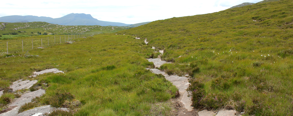
Basically, the path follows the boundary fence of the deer farm. Sometime rocky, sometimes muddy, but always clear. After the anxiety-ridden build up of a few moments ago, this Postie’s Path seems positvely tame.
I meet a couple walking back. They don’t look equipped for high mountain walking. Perhaps they’ve only been to Dun Canna?
When you feel relaxed about the route, you are more likely to make a mistake. I know the path must turn uphill at some point, and reach a spot where it does. I follow the clear rocky path uphill… only to discover it isn’t a path at all, just a long stretch of bare rock.
Back down I scramble, and discover the path continues on the other side of the rock. Still following the deer-farm fence.
Ah, here is another sign post. Dun Canna is straight ahead, but the path to Achiltibuie turns off. THIS is where I start going up the mountain.
The next section is a hands-and-knees scramble. I stow my camera away and set off, trying to avoid the worst of the prickly gorse. I thought there was supposed to be a path here? I follow a few trails – not sure if they’re sheep trails or just places where the slope is ridged – but mainly the path is indistinct. Actually, more accurate to say the path is invisible.
Whoever planned this renovation project, I have a simple message for you. “This is NOT a path!”
I begin sweating, despite the coolness of the day. If it starts raining, this path will be treacherous. Going up is always easier than coming down, but I’m planning a there-and-back walk, so I will have to come back this same way.
Spot a stone marker above me, and clamber up. Hands-and-knees scramble has now become a hands-elbows-and-knees crawl. I’m getting muddier and muddier, but it’s a relief to find the stone marker. And, is that an arrow?
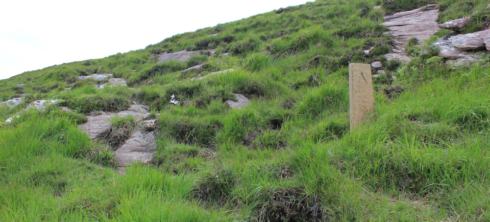
I’m so heartened by finding this stone, that I pull my camera out and take the photo above. If that is an arrow, then this must really be the path. I follow what looks like a trail, but it becomes less and less obvious. Oh dear.
Ah, I spot another marker – a pole – above me. Onwards. Upwards. Keep scrambling.
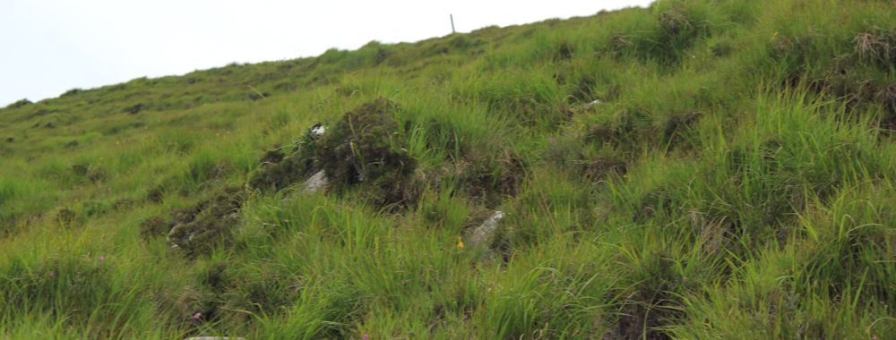
I reach the pole. It’s not particularly helpful. Just a pole. And then spot another stone marker with another arrow. Here the path becomes more obvious and the ground begins to flatten out.
Stop for a breather, a drink and a snack. Wish I’d brought more food with me. Check my watch. It’s over an hour since I left the car park and, to be honest, I’m exhausted and I don’t seem to have got very far. I was hoping to reach the half-way point, at least, towards Culnacraig.
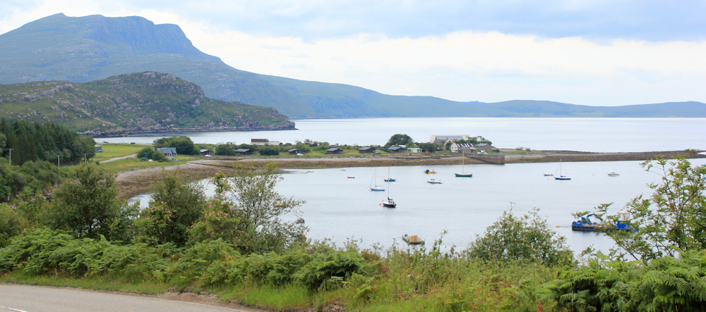
But, look at the view. Fantastic. Takes me a moment to realise what I’m looking at. Thats Ardmair Point sticking out into the water. I can actually see my camp site!

I’ve walked for miles, but hardly travelled any distance at all. It’s a beautiful view, but I feel somewhat defeated.
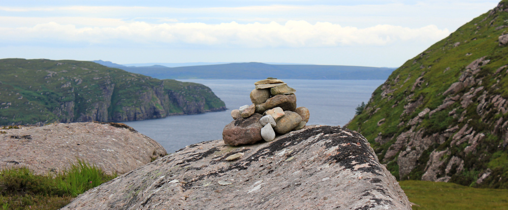
Carry on up the slope for a further hundred yards or so. I know I must turn round shortly, but I need to find a spot which I will recognise when I complete this walk from the other end tomorrow. Ah, is that a cairn ahead?
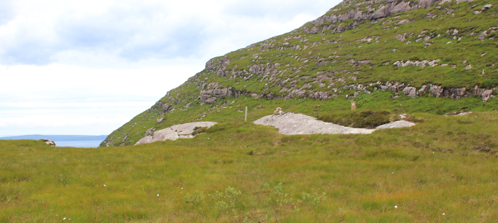
I’m not very fond of cairns. Don’t understand the need to rearrange the landscape by moving stones about… but I’m grateful for this one. It’s only small, but it’s very pretty, and should be easy to recognise tomorrow.
The route down seems suprisingly easy. One thing I’ve learnt about following difficult paths… it’s much easier to spot them when you are climbing down and can actually see the path below you.
I also find the reason for the inconsiderate lack of marker posts lower down. I come across a wooden post, near the bottom of the slope, which has been battered down in a winter storm. It’s lying broken on the ground – easy to spot from above, but impossible to spot from below.
Someone is whistling at me. Cheeky! Nobody has whistled at me for a good few years – actually, not since southern Scotland. I look around. About a mile away, over on the deer farm, someone is riding a vehicle and whistling… at his dog. Not at me.
Onwards. Back down to the van.

You can read more about the Postie’s Path here: https://www.coigach-assynt.org/project/posties-path/ All I can say is that the postie must have been very fit indeed. Apparently, in the 1860s he walked the 14 miles from Achiltibuie to Ullapool, and back, twice a week.
Miles walked today = 7.5 miles (not including vertical scrambles!)
Total distance around coast = 4,802.5 miles
Route today:


As I like to follow your journey, the OS map appears to show a coastal path from the A835 at Buaile Ghlas round to where you finished, bypassing Blughasary and the long road walk, but no idea if that is accessible?
I hope you find the resolve to return to Scotland. I think you’d miss it all if you stopped now, but it has to be fun. 🙂
I can remember I was vaguely hoping to follow that path, Tony, but I think it was the access road to a house and then tracks through the deer park. Probably wouldn’t have been able to make much progress. Anyway, I forgot about it at the time – being completely focused (and anxious) about getting to the Postie Path!
I did follow those tracks, though I couldn’t remember exactly which ne. I managed to avoid walking right past a house but I do remember having to climb right up and over a deer fence, which was at least twice my height, so it wasn’t an easy route. That’s not to say there isn’t a gate somewhere – but I didn’t find it.
Thanks both. Very useful.
Well done for tackling the posties path. I did find it pretty tough though it was actually better higher up (albeit very close to the edge, as I expect you have found out). I was lucky to be able to do it in on day via the bus between Ullapool and Achiltibuie but I don’t think the bus runs any more. (In fact I remember the bus driver warning me it was a tough walk). I seem to remember when coming down I didn’t particularly find a path either and wanted to just get to the river where it was flat and onwards to the road (as the posties path had taken me far longer than I expected).
You are doing well and the tough west coast is nearly done. I hope from your early comments about the coastal walk taking longer than you expected you aren’t thinking of giving up. You have done very well and the east coast is much easier, honest!
I hope you have a lovely Christmas and New Year.
The Postie’s Path has defeated me, Jon, I’m afraid. Too much of a coward to try it again, but maybe one to add to the list of things I plan to do “one day”.
Sorry to hear it did defeat you (and it certainly was tough). But better to know your limits than try and push yourself and end up having an accident, which can be serious in remote places like this. Something I could do with learning myself sometimes! I’m sure it won’t stop you carrying on, whether that means missing this section or taking a longer way around.
I tend to share your ruminations about old age, illness and the point of it all but we carry on nevertheless
Aha! Well, it was one of those days. Walking gives you a lot of time to think, which is sometimes not a good thing!
Your disdain for motorhomes is appropriate. They are a blight on the highways, and worse still on the byways.
Yes! I’m with you, Tony. Vile things.
Your hands-and-knees scramble sounds dreadful – well done for continuing, I think I would have given up!
It was not easy, Eunice, and I did give up really. Best wishes to you and hope you have a Happy Christmas.
Back in 2013, I did the Coast to Coast and enjoyed it immensely. Nine years later with a triple bypass and a statin-induced nasty disease called Necrotizing Autoimmune Myopathy, I can’t complete even part of one day of that walk. Fortunately, I get an IVIG treatment every four weeks which means I can walk a few miles on the level. What saved me from life in a wheel chair was all the walking I used to do which means I am still quite fit for my age of 75, much fitter than the other people I see at the infusions.
So please keep doing the walk. Not only are you giving pleasure and inspiration to so many people, but the exercise will pay off when you are older. As your own personal doctor, you should give yourself a good talking to.
Oh my word. I had no idea about your past troubles and health problems. Thank you for sharing and, I agree, I’m sure all that walking has stood you in good stead – it does keep you fit, while not being too strenuous on the joints. Glad to hear you are managing a few miles, but it must be immensely frustrating for you. Yes, I will keep doing the walk. I’m feeling very positive about it at the moment (from the comfort of the armchair in my sitting room!).
Hello Ruth, your posts are always eagerly awaited and I always marvel about quality of your photography – I don’t think I would ever find the time to take as many photos when out on a walk.
Can I make some suggestions to ease your concerns in this sort of terrain:
Walking Poles (2) – very good in maintaining balance and moving some of the load to your upper body – bit of a pain on the roads but your photo of the long distance walker showed he was still using his stick! Better to have them longer than just a walking stick length though (for more benefit).
I wonder if you are stowing your map in your rucksack? – how about making photocopies of the relevant section of the map and putting then in a A4 plastic pocket and keep it folded up in your pocket (keep map in rucksack) . Then you can easily refer to it as you walk along to reassure yourself that you are going in the correct direction – having a compass to hand and learning to take a bearing off the map to confirm you are pointing the right way is also useful. My experience is in even very rural walking is that it is all to easy to convince yourself about a direction to take so the compass does help in double checking things and maintaining a direction. I’ve walked coast to coast across Scotland a few times and this is so much easier to do than struggling with a large map.
The other benefit of the map /compass is that it gives you something to do when taking a breather or mopping up the sweat!
In Scotland, always expect the worse so always carry wet weather gear and some backup scran (food).
Please don’t give up the walk – you’ve covered so much already and once you reach Cape Wrath it will all be downhill from there….
Excellent advice and thank you. I think I need bigger pockets! I do hold a small garmin with the maps loaded – useful for showing where I am, but too small for easy planning or for looking far ahead. Also carry a compass – but I think it’s somewhere at the bottom of my rucksack, and I’ve never had to use one in the wilds, so not very confident about my ability.
Don’t worry. I won’t give up!
I always buy the paper OS maps (as I think you do) and if you have bought one in the last few years you can also put the maps you have bought into the (free) OS Maps phone app. This then does show exactly where you are, overlaid onto the OS map which can be useful. Of course it’s not substitute for a paper map because it only shows a small area at a time in any detail, but I do find it useful. Having said that it does drain the battery more quickly and of course most phones aren’t waterproof but it’s basically a no-cost option if you already have the paper map. I expect your Garmin is better suited to being outdoors in rain etc, but not sure how it works with getting the mapping data on there (my own is incredibly basic and I mostly use it just to get the grid reference).
Oh and glad to hear you won’t be giving up! I enjoy reading your write ups and they have been very useful for me too (and I’m sure will continue to be).
I await your next post with bated breath. I crawled up that path on all fours with 18kg on my back. Later near Achiltibuie I ended up losing the path and edging around a ledge with my pack trying to topple me over off the ledge and me clutching bundles of heather to remain upright to prevent myself falling 30 foot down onto the rocks below. I hope your experience was better than mine as I am scared of heights and I was absolutely terrified. Cape Wrath is a cinch (?) by comparison. This is the worst part of the entire coast.
Oh wow, Chris. Luckily I’m reading this months after the event – because I may never have started the attempt if I’d known in advance! Actually, I was lulled into a false sense of security when I found out that the path had recently been restored and upgraded – but it only takes one Scottish winter to wash the ‘restorations’ away, as I discovered on this walk.
PS Please please please don’t give up. You will regret it. Cape Wrath is easily do-able in there and back walks and that is the next most difficult after the Postie Trail. You can do a there and back walk to Sandwood Bay and as far north as you can manage. Then get the bus to Cape Wrath and stay with John Ure and Ange if you have to in the bunk house and walk there and back to where you got to north of Sandwood Bay. The next day you can walk back to the Kyle of Durness along an eleven mile track and get the ferry or walk around the Kyle. The rest of the cost particularly the east is easy and has a path nearly all the way to Hull. You will whizz down it. Whiten Head is very remote but again you can do it in two there and back walks. Parts of the John O’Groats trail are dangerous and depending on the time of year you might want to walk inland south of Wick due to the cattle / and bracken. Chin up!!!!!!
I’m not sure how I’ll tackle Cape Wrath, to be honest Chris. 10 years ago, I’d have done the overland trek, but I’m having second thoughts… I didn’t realise there was a proper bunk house at the lighthouse. I’ll investigate further.
Like Tony I follow your routes on a OS map & spotted the path he mentioned too. Maybe you or someone who follows your blog can advise?
I must admit I do worry whether I will be able to complete the Scottish coast … It’s been a few years since I have done SWCP which is the toughest route I’ve ever done. Anyway we’ll done Ruth….Great photos as usual. Hope that you have a great Christmas
I could be wrong but I think the path you and Tony are referring to is the path through the Keanchulish Estate. I scouted this briefly in 2018 when I walked this section of the coast. I could be wrong, and it may have changed anyway but this goes right by the front of the house and could be very invasive. I know there is a right to roam but not to invade privacy. I am not aware of any coast walker who has done this. The other trouble are the deer fences. When I looked back from on high towards Ullapool, I could not see any way through the maze of deer fences. It almost looked as if they had been put up to deter walkers from the estate. I’m not saying there is no way through, but I would recommend the way Ruth went unless you have a very long brass neck, and are prepared to retrace a long way back if you find your way blocked. Maybe it might pay to telephone the Estate Manager and ask if there is a way through, and if they mind. In my experience landowners can sometimes be surprising amenable (and sometimes not). I once trespassed through the Holker Estate in Cumbria. The person who caught me was understanding with a little politeness and pleading. But he warned me if the gamekeeper found me I would be shot. I don’t think he was joking.
I think those are indeed tracks through the deer farm Chris (the Postie’s path follows the perimeter fence of the farm at the start). I’m not sure you can get through, and I didn’t check to see if that gate I passed was locked or not, but may be worth asking in advance, I guess.
To be honest, I think the SWCP is the toughest continuous section of the walk because it is tough day after day. Some sections in Scotland are equally difficult – but they tend to only last a day or so. If you need to, you can stick to the roads in Scotland (surprisingly pleasant) and avoid the really tricky bits. Happy Christmas to you, too, Mike.
Dear Ruth , I have covid and have time to catch up with you, I first came accross your walks when I started walking the sussex coast with a BF, we fell out of love at portsmouth !!! you inspired me to keep going on my own , I walked place to place with rucksack and loved it unfortunately I had to stop at Plymouth because my knees have failed me , but I am 71 now and have had a great time , and done many long distance walks , I have just seen your latest blogs !!! Well done you are amazing , I see also that your marriage has ended , I felt the stress when you were undecided , You are wonderfully strong . thank you for all your help on my shortish walk, very best wishes , Sue
From my blog -August 2010:TUESDAY, 24 AUGUST 2010
From Ardmair
Yesterday I went for a walk on The Postman’s Path. The walk started at Blughasary NC 136 021 near Strathcanaird. The path is supposed to be one taken by a postman twice a week to get to Achtilibuie for 2s 3d per trip. The path follows the coast line but very much up and own across the cliffs and has a real mountaineering feel. I followed this to Geodha Mor and then turned inland to follow the stream that skirts the south eastern flanks of Coigach to arrive at Loch Easar dha Bheinn and then by track back to my starting point. From the coast inland my route was pathless over rugged terrain. The whole route was about 9 miles and took 4hrs 45mins. I met one other couple coming the other way.
Today I went for Stac Polaidh. The ridge is a series of rock pinnacles and the last of these guarding the summit pinnacle has a rock climbing move which is not graded. I looked at this and then watched some agile youths scale it, but not without some difficulty. I reckon the hard move was v. Diff verging on severe and I jibbed at it. I seem to have totally lost all appetite for rock climbing, especially if not protected. Perhaps ex rock climbers are wise people? although I used to second with very few problems at HVS until about six years ago I think I always had too good an imagination to be an enthusiastic leader.
POSTED BY SIR HUGH AT TUESDAY, AUGUST 24, 2010 NO COMMENTS:
Well done for attempting the Postie’s Path! I didn’t – I was feeling pretty anxious about it on account of what I’d read and I figured it was going to trigger my crippling (if annoyingly inconsistent) fear of heights. On the day it was raining, so I chickened out on the basis that that was too dangerous and walked the twenty-something miles to Achiltibuie by road instead.
So you’ve done better than I did by attempting any part of it at all!
The Postie’s Path sounds positively terrifying, but I really hope you have decided not to give up on Scotland as (very selfishly) I love reading your blog and all your adventures.
Oh, I kept going Karen. This was one of those “off” days, but my negative mood soon passed. Thank you for your encouragement!