
[This walk was completed on the 12th July 2022]
I’m back at the turn-off to Blughasary. But I’m not attempting the Postie’s walk today.

The brief Scottish summer seems to be over before it really began. I was kept awake last night by pelting rain, and I had to pull the pop-up roof down as the van was shaking in the wind. This morning it was too wet to walk, and certainly too wet to attempt the Postie’s Walk over the mountain side to Culnacraig. Perhaps I’ll try again tomorrow… depending on the weather.
Tomorrow, whatever happens, I’m moving my base from Ardmair Point to a place called Lochinver, and I have no idea if there will be any shops open when I get there. So, this morning, instead of walking in the rain, I drove into Ullapool to pick up some much-needed supplies at the supermarket.
But this afternoon, as the rain seems to have drifted away, I’m back on my old friend – the A835 – and heading north through a place called Strathcanaird. Up the hill… towards a bus stop.
I’ve stopped checking on bus routes up in the northwest of Scotland. Unfortunately, Covid seems to have given the authorities a great excuse to close many of the rural routes. And it is now the school holidays, so even the school buses (usually 100% reliable if you can find one) won’t be running.
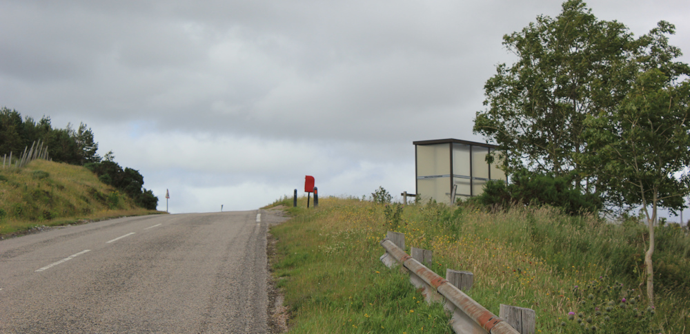
There is a blue box in the bus shelter, weighted down by a stone. Sometimes the local buses act as delivery vans for parcels, and I guess this might be a parcel drop. Perhaps the bus is running after all? Well, too late now.

Strathcanaird is below me. A spread-out type of place, with houses perched along a side road.

I stick to the main road, reaching another turn-off to a place called Langwell – which seems to consist of only a couple of houses, acording to my map. There’s a working phone box here, a circular layby, and a sign about the Rock Route.

When I read up about the Postie’s path, I discovered the intrepid postie in the 19th century walked from Achiltibuie to Ullapool, and back, twice a week. The dangerous section over the side of the mountain was called “taking the Rock”. But I don’t think that the Rock Route sign is referring to the Postie’s route – he wouldn’t have gone this way round. It’s a mystery.
Below me is a homestead – ah, that must be Langwell. Beautiful setting.

Onwards. A strange pole by the side of the road catches my attention. A yellow can seems to be perched near the top.
When I get closer, I realise it must be some sort of radio transmitter. It’s an odd shape, but a sign on the post implies it belongs to BT.

[At the time, I thought this was a local mobile-phone mast. But now I wonder if it was something to do with a small hydroelectric station nearby.]
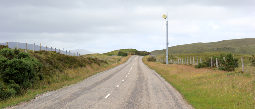
The road cuts across open country side, running on a fairly high plateau between mountain ranges. There are spectacular views, despite the low cloud and the dull weather. Look. Rain ahead.

Traffic is very light. Just the odd van, truck, car, or mobile home trundles past. Here come some cyclists.

The ascent is not particularly steep, but it is very long. The cyclists are riding proper road bikes, not touring bikes. I don’t like to take photographs of their faces – the climb makes them sweat and grimace – but I catch a shot of their backs after they’ve passed me.
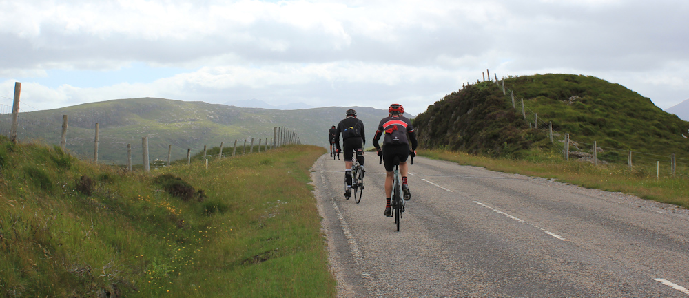
Here come some more. Keep pedalling lads. I’m glad I’m only walking. Looks like hard work.

Actually, I cycled along here earlier, before I started this walk. But I was riding Scooty, my e-bike, and the effort needed for this section was fairly minimal.
The cyclists pass in dribs and drabs. Must be an organised outing. The last one puffs by, and now I have the road to myself.
Looking to my left, and slightly behind, I can see the mountain the postie called “The Rock”. I should be walking on the other side of that mountain. It looks OK. It’s not raining – look, there is actually sunshine over there!

I feel regretful that I didn’t attempt it now, but then I remind myself of the rain this morning, and the steepness of that slope yesterday… Anyway, it’s now nearly 3pm. Too late to think about it today. Onwards.
What a great view ahead. I’m look slightly to my left again, because the next section of my walk (if I stick to the road) will take me over in that direction. Look at that weirdly shaped mountain – looks like a volcano that’s just blown the tip off its top.
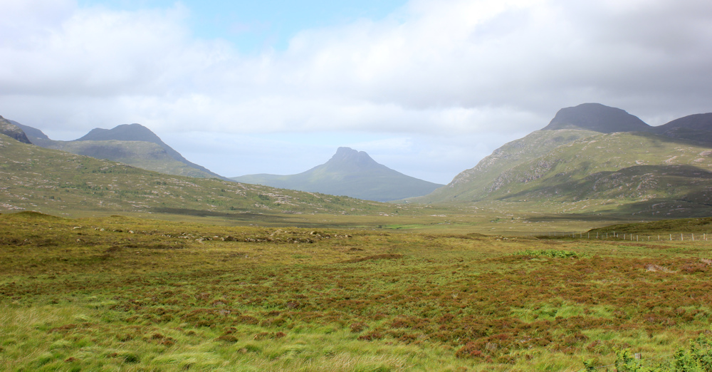
The mountain reminds me of Mount Doom in Lord of the Rings, as viewed from the dangerous plain of Gorgoroth, across which Frodo and Sam must make their way to destroy the ring. Slightly sinister, but enticingly mesmerising at the same time.
The sky ahead is very dark. I catch the smattering of a shower, but this road seems to be blessed with brilliant sunshine. I’m approaching an layby with an information sign and am looking forward to having a good read, so I’m slightly annoyed when a car pulls past me and parks in the layby. Was hoping to have the place to myself.
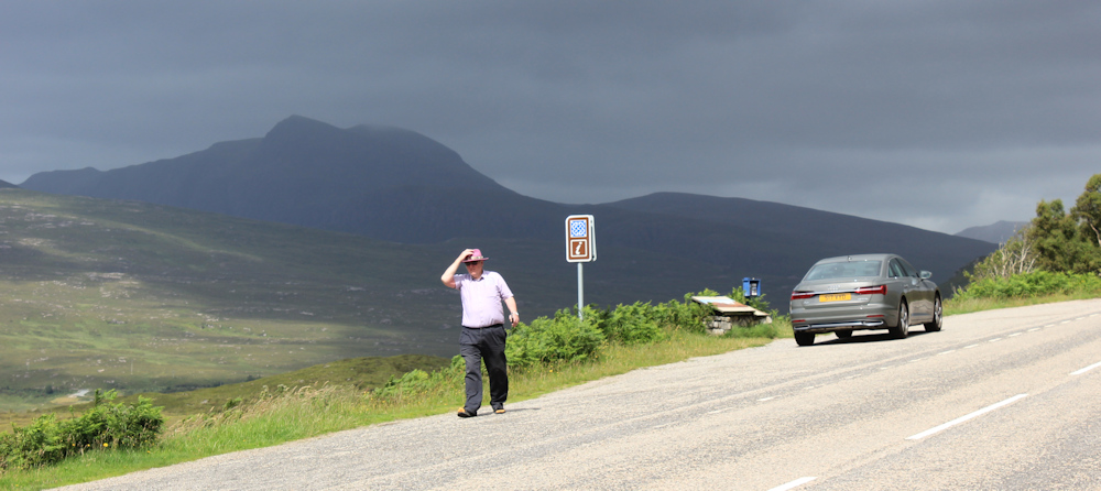
I get chatting to the car driver, of course. He used to come here regularly as a young man, and talks of the places he used to visit. He explains the “Rock Route” is a newly constructed tourist route to celebrate the fact that the area is now a vast Unesco Geopark.
This information booth is called a Geopod, and a sign shows me the route – all designed for car drivers – with main routes on the main roads (called Rock Routes) and little deviations down side roads (called Pebble Routes). I take some of the information leaflets to read later.

Another nearby sign, an older one, displays a photograph with a mountain in the distance. It’s labelled “Stac Pollaidh” and looks vaguely familiar…
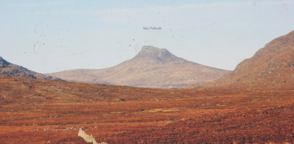
… ah, of course. Stac Pollaidh is Mount Doom! Definitely the same mountain.

After taking too many photographs of Mount Doom / Stac Pollaidh – which looks different every time the light changes – I decide it’s time to get on with the rest of my very short walk.
I’m approaching an area of woodland. A very enjoyable section of the road because, despite the wonderful uninterrupted views across empty moorland, I do prefer to see some trees in the landscape.
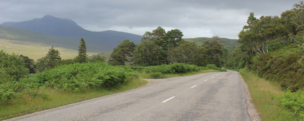
To my left is a patch of water, and actually the only water I pass close to on this day of my “coastal walk”! The loch is nameless on my map. Just look at the shifting light on those mountain slopes in the distance. The landscape here is utterly beautiful.

Love these trees. Scots Pines, I assume. Very impressive.

Round the next bend, and I’m approaching the turn off to “Achiltibuie and the Summer Isles”. Just love that phrase – the Summer Isles. Sounds very evocative.

Another sign welcomes me to the Geopark. They really are plugging it as a tourist route.

And here is my van, parked in a layby just beside the turn off. It is now nearly 4pm and that means it’s tea time.

I had planned to walk further – heading out along the road towards Achiltibuie in order to complete the link if I don’t manage the Postie’s Walk tomorrow. But, while I’m brewing tea in the van, it begins to rain again. And I decide to call it a day.
Miles walked today = 3 miles (oh dear!)
Total around coast = 4,805.5 miles
Route:


I like the first photo with ‘Mount Doom’ in the distance – that and the other mountains remind me of certain areas you see in cowboy films.
It was a really magical view, Eunice. I took literally 20 or so photos of that same mountain. It wasn’t the highest around, but it seemed to draw my eye like a magnet.
I remember seeing a few of those Geopark notices, but nothing about “Rock Routes”. Must be new. You did very well to match up / edit your photo exactly to the information sign of Stach Pollaidh. It also shows how much the view changes with the season – the photo on the information board sign looks like it was taking in late autumn when the vegetation has all died for the winter and gone brown.
The photo only needed some minimal cropping to match it up. Yes, the change in colours is quite impressive.
Ruth – I think with hindsight you were probably wise not to attempt the Postie Trail. I don’t know if it is still there but when I walked it there was a battered sign in the car park where you started. It read something like this -“Although this walk is a low level trail, it should only be attempted with full mountaineering gear”. It is definitely not for the faint hearted. When I did it there was a huge gully near the end where the entire mountain side had been washed away making it even more tricky. Maybe this is the bit they have repaired. All the best for the rest of your walk.
I think the path has been improved, Chris, although it didn’t feel like it when I tried to climb up that steep slope. Certainly there was a warning sign – the usual one about entering a wild and remote area, remember to go equipped, etc – but nothing about mountaineering gear. Anyway, I didn’t give the path a second go, because I’d kind of lost my nerve. Perhaps just as well.
Mount Doom is a dramatic sight and could easily be straight out of Lord of the Rings. Definitely just as well you didn’t go back to the Postie’s Trail, much too risky and difficult.
Isn’t it a fantastic and dramatic mountain!