
[This walk was completed on the 2nd September 2022]
I have had a hairy cycle ride to get here, with gusty winds pushing me from side to side, and some punishing hills. So, I ‘m grateful for this bench…

After a drink and a snack, I feel much better. Time to take a self-portrait in front of Loch Glencoul. It’s a beautiful spot.

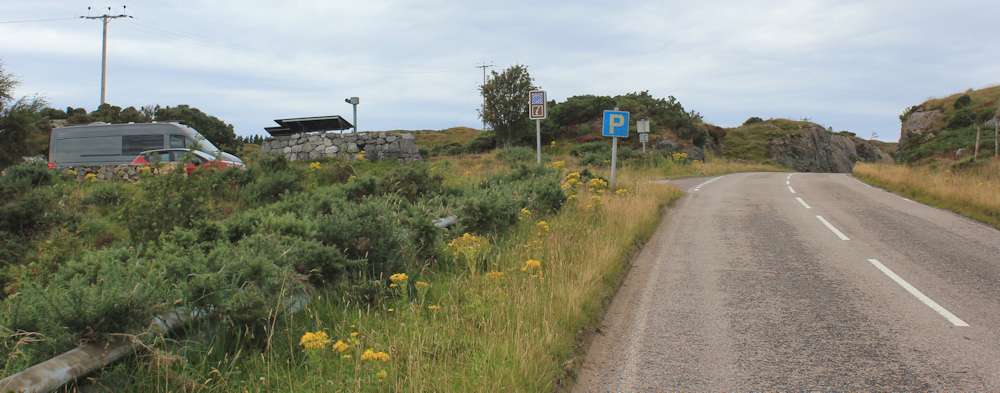
After a brief mental debate, I leave my Scooty bike chained up behind the information board. This is a busy little parking area and I would prefer it to be better hidden, but there is nowhere obvious, so perhaps leaving the bike in plain view is the best thing to do.

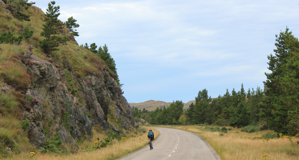
It is all road-walking today, but the traffic is light and the road has a pleasant grass verge. There’s Unapool ahead.

Unapool is tiny, but it does have a cafe (too early to stop) and a sign proudly proclaiming this is all part of the Unesco North West Highlands Geopark.
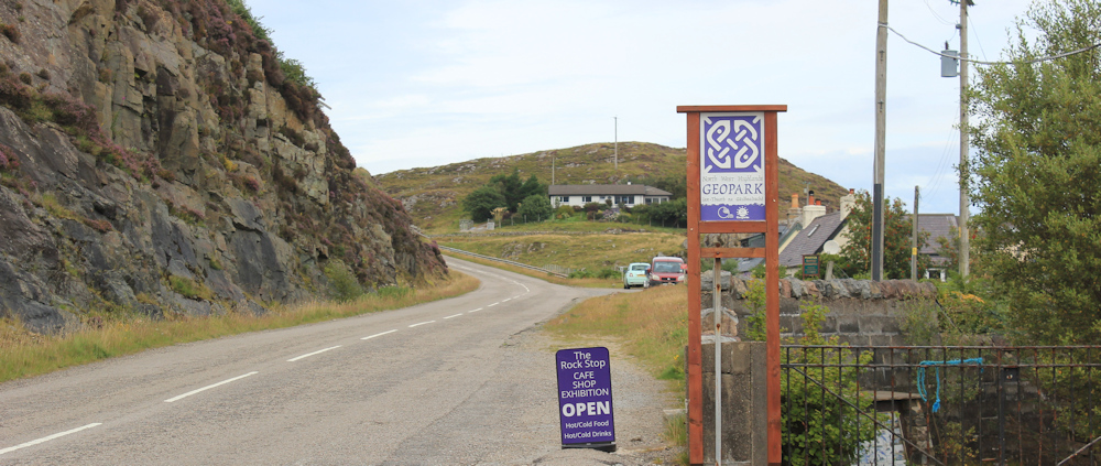
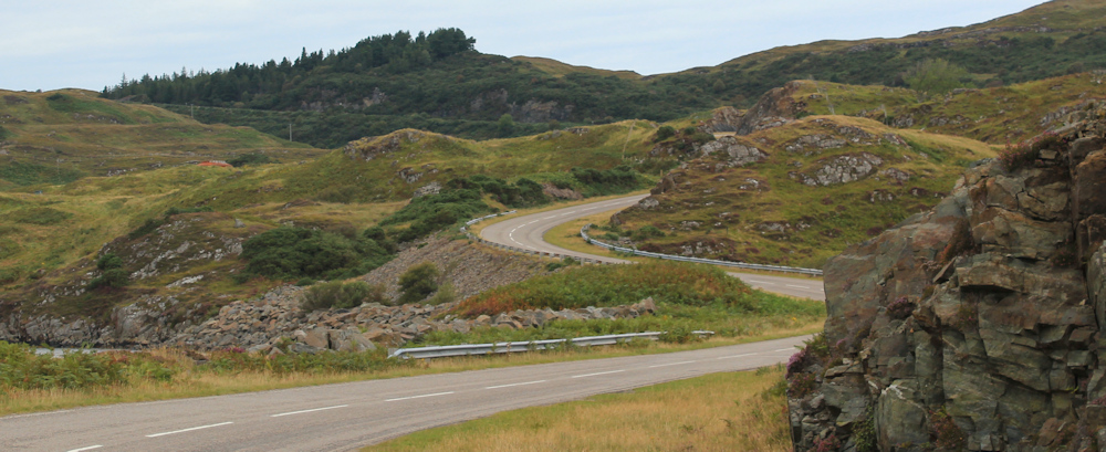
The road climbs and then plummits again. I may not be on the “Wee Mad Road” anymore, but the views are still lovely. The little loch ahead is Lochan Dubh, and opposite the loch is a turn off to Kylesku.

Kylesku is a small hamlet with a slipway. Apparently you can take a boat trip up the loch, see seals, dolphins and eagles, and view the UK’s highest waterfall. It also has a hotel and a restaurant, where I ate last night, and watched seals on the rocks by the slipway while eating a very expensive plate of lamb.
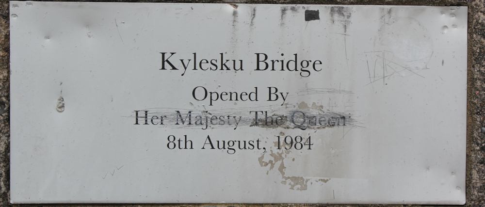
I soon reach Kylesku bridge. This magnificent structure carries you over the entrance to the inner lochs – over the narrow watery passage connecting Loch a Chairn Bhain to Loch Glencoul and Loch Glendhu. I can remember seeing the bridge in the distance yesterday, while I was walking the final stretches of the Wee Mad Road.

I stop to look at the plate that commemorates the opening of the bridge in 1984. I guess before then there was a ferry. Sad to see that the words “Her Majesty The Queen” have been defaced, presumably by someone who resents being part of the United Kingdom.
[I should point out that her Majesty died a few days after I’d finished this walk. I’m not a royalist – and am not really in favour of a hereditary monarchy – but there is no doubting she was a great woman who served this country with all her heart and soul. I was unexpectedly moved to tears when I heard she had died.]
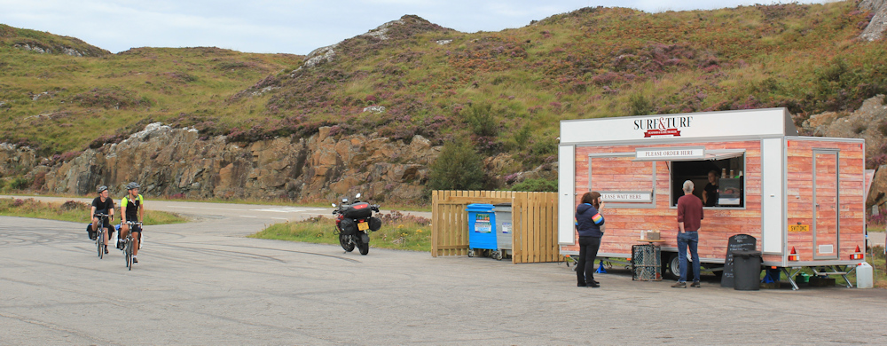
On the other side of the bridge is an extensive parking area, used by a constant procession of cars, vans, motorhomes, motorbikes and pedal cylists. There is also a very upmarket foot trailer, giving off delicious aromas. I regret bringing a packed lunch now!
From the end of the car park is a war memorial, and a magnificent view over the Quinag range. I wonder if this will be my last glimpse of those peaks? Next to the road is a modern stone obelisk which tells me I am entering “Mackay Country.” I thought I was in Scotland, so this is news to me!

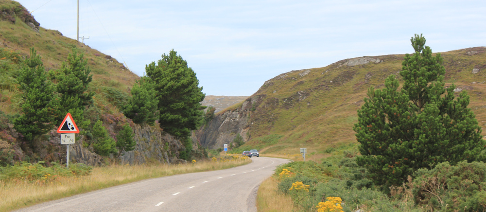
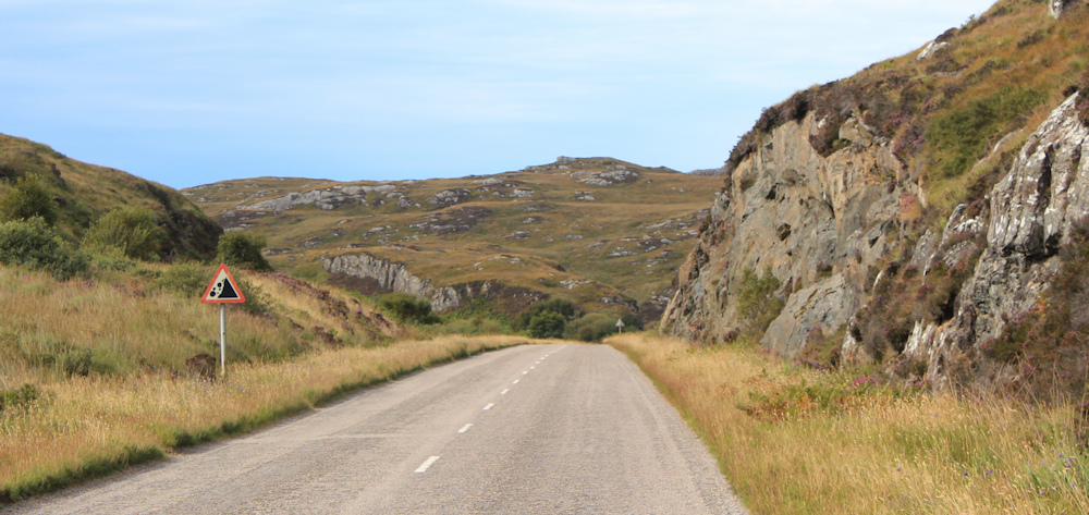
Onwards. Back on the road, there are constant indicators that Mackay Country is a dangerous place. Danger of falling rocks, warns a road sign. The smaller, yellow sign tells me to drive on the left.

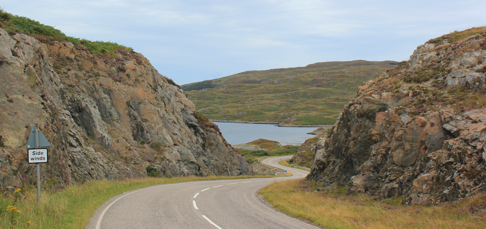
Further along, over the brow of the hill, another sign warns me of side winds. Yes, it really is windy. The cuttings through the rock appear to act as channels, and force the wind directly into my face.
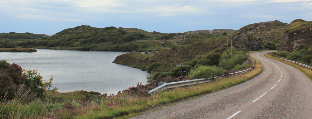
The road dips down to run close to the water. I’m on a narrow isthmus of land separating Loch a Chairn Bhain from the inner lochs. Across the water is the little settlement of Kylestrome. I stop to take photographs of the views.

And then I notice something close to the water – a pair of antlers. It’s a large deer – a stag I think – sitting on the shore and overlooking the loch. Take a photo of him with my camera on full zoom.

[Only later, when looking at the photos on my computer, do I realise that I’ve captured two deer in the photo. There is a smaller one lying nearby, and almost hidden in the bracken.]
Here are some tamer animals – grazing horses. I wonder if they get ridden?

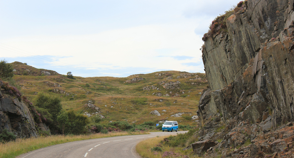
The road winds up again. It’s a walk full of twists and turns, ups and downs.
At the top of the next rise is a parking spot with a “viewpoint” sign on my map. I puff my way up the slope to reach it.
Yes, it is a lovely view. An information board tells me that the area I’m looking over is called Assynt – the Viking word for rocky ridge, and a reminder that the Vikings colonised this area about 1,000 years ago. The photo on the board shows the peaks ahead and points out their names, which are Gaelic in origin.

History is a messy business.
I perch on a stone wall and unpack my lunch. It’s a dull day today, and I soon get chilly. I’m just finishing off my meal, when this cyclist arrives, sweating heavily from his slog up the hill on his heavily-laden bike.

I congratulate him on making it up the slope, but he turns out to be a foreign tourist and doesn’t understand a word.
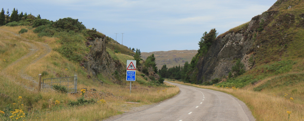
Set off again, and the road begins to curve downhill. Another sign warns of falling rocks…
… followed by a sign warning of skidding and telling me the road is “liable to icing”. Not today, but I can imagine this could be skating rink in the winter.
A cyclist zooms past me, enjoying the speed he picks up going downhill.
I pass a little loch on my right – Lochan Fhuath – and am approaching an area that is marked as covered by forest according to my map. Duartmore Forest. Unfortunately, the slopes around the lochan seem to have been extensively and aggressively logged.
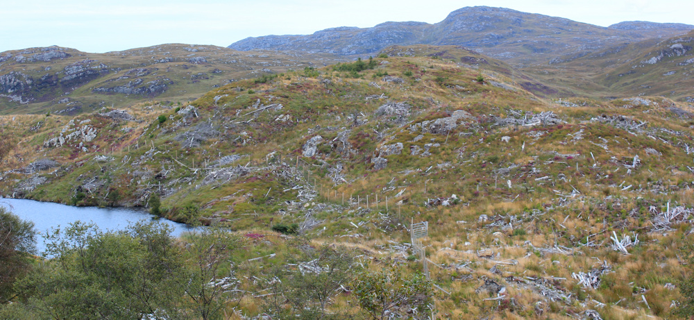
Scenes like this – with shattered fallen trunks lying everywhere – look apocalyptic. I hope there will be some proper regeneration of the landscape. It’s such a shame to see everything levelled and no shelter left for wildlife or birds.
The road dips down to another bridge. I’m about to cross over a narrow part of Loch Duartmore. It’s good to seem some trees are still standing here.

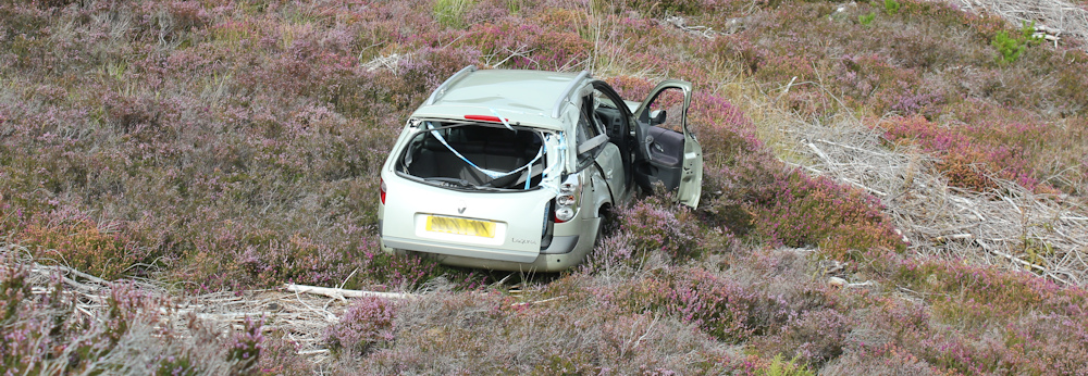
On the way up the next hill, I see tape festooned around a damaged roadside barrier.

Look down into the valley – and see a shattered car. Oh dear. Yes, these roads really are dangerous in Mackay Country.
I’m growing tired. The constant battle against the wind is taking its toll. So, when I see a parking sign my heart lifts. Here’s my van… but, oh no. It’s not there!

That’s strange. I feel a little confused and disorientated, until I remember leaving my van at the bottom of a slope, not at the top. Must be in the next parking spot – although I can’t see another one marked on my map.
Onwards. Round the corner and down the hill. Watch out for fallling rocks.
Now, I was hoping to get off the road for a brief spell. My map shows a track that leads down towards the shore, and eventually joins up with a dead-end road at a place called Duartbeg. But there is an off-puting sign at the start of the track. “No unauthorised access.” Oh dear.

I hesitate for a moment, but don’t want to risk being challenged or being forced to turn back. So I decide to stick to the road.
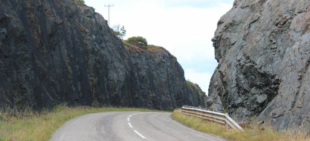
Now I’m passing through a narrow gorge – an artificial cutting, I think. Definitely need to watch out for falling rocks here.
Safely through the pass, the road dips down again. Nothing but empty landscape around. And it really is windy.

Pull out my map. Where’s my van? This is Loch a Chreagain Daraich.
Up another slope, through another cutting, round another bend, and… there’s my van. At last.
Funny that this parking spot is unmarked on my map. Never mind. I open up the van and brew myself a cup of tea.
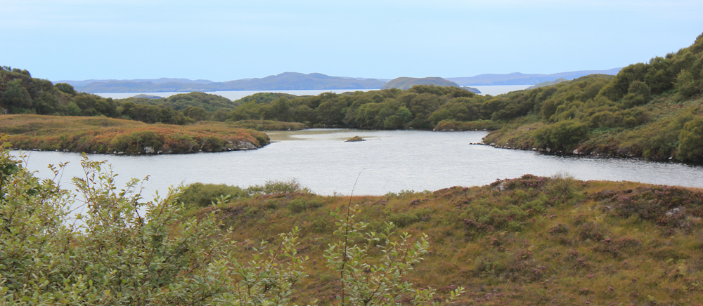
The view is stunning. Loch a Chreagain Daraich again, and beyond that is another hidden loch, and beyond that is the open sea, and beyond that is the shore with Drumbeg… such a vast and empty landscape.
After walk note: Later, the wind really picked up. I had a bad night in my campsite in Scourie, and woke up with the van shaking. So, I pulled the roof down in the middle of the night, but I didn’t bother to fasten the straps because I was tired. A huge bang woke me again later in the night. In the morning, I discovered the wind had actually lifted the roof back up while I slept!
The next day, I did set off on my bike, only to turn back as the wind was too ferocious for safe cycling. So, I cut my visit short by a couple of days, and headed back to Manchester, where the city was at the start of a heatwave. I arrived to find the air sticky with heat, and temperatures well into the 30s centigrade (80s fahrenheit). Quite a shock!
Mackay Country does exist, sort of. http://www.mackaycountry.com/
Miles walked today = 7 miles
Total around coast = 4,864 miles
Route:


I travelled that road on a motorbike in about 1977, there was a little ferry at Kylesku. The whole area was quite economically depressed back then. Tourism hadn’t really taken off and our camps were ‘informal’ to day the least. It was very wet and there’s a very grumpy photo of me at Durness.
We got to Ullapool, thoroughly soaked. Pooled all our money for 1 night b and b, just kept enough money back for the fuel to get home to lincolnshire.
Crossed again in 2015 on the new bridge. In a nice warm camper van this time. The roads and the communities, although still not what you’d call prosperous, have obviously benefited enormously from European investment.
I guess the NC500 will have made it yet busier.
Yes, even if one is not a royalist, Queen Elizabeth was a dilligent worker who has a semi-constant feature in and for most if not all of our lives. A pity you were too early at the Rock Stop Cafe – I enjoyed my visit there with my dad.
Re Ally F above. I first went to Durness on holiday from Kent in 1968. Between 1968 and 1984 I spent every one of my summer holidays in Durness bar two, 1969 when we had a family holiday in Switzerland and 1981 when I went to Australia. The changes I have seen between 1968 and 2017 / 2018 when I walked this section of the coast on my first coastal walk have been quite marked to say the least. Back in 1968 the only petrol station in Durness was run my a Mackay – Dickie Mackay. I remember when we first filled up with petrol there (it was not self service in those days). My mother was I guess in those days an attractive 39 year old woman and it became something of a family joke because Dickie Mackay said to my Mum – Aye you’re a marvellous lass!!! One of the biggest changes has been the journey time. In 1968 we travelled by caravan. It took three days to get to Durness from Kent – first night Scotch Corner / second night Crieff / 3rd night Durness. In 2018 it took me 13 hours to drive from Thurso to my house in Kent – a record time for me. I remember when the Kylesku Bridge was first opened as it was the last year (1984) that I had my annual holiday in Durness. The Mackays still control most commercial activities in Durness, even to this day. It is still very much Mackay Country. Although Anders Holch Povlsen is by far the biggest landowner these days.
We love travelling in Assynt and the far north in our van, wonderful country and this brought back some memories
I remember my first map of Scotland had petrol stations marked in more remote areas. The experience was renewed when we travelled from Kent to Skye across to past Inverness and back hoem via the Lakes almost 8 years ago in our first EV. Your reports bring back some lovely memories Ruth and the pictures are a great bonus. Mnay thanks for sharing your journey.
Hi Ruth
David here. We met at sandwood bloomsbury10@hotmail.com
Love the blog
H David, yes, I remember you well. Congratulations on a successful expedition. I’m currently heading toward Tongue… on my way to John O’Groats.. one day. I am a very slow walker!
Amazing views but horrible to be walking against the wind, the only thing worse is wind AND rain. The wind overnight must have been quite scary especially when your roof lifted back up – but at least it didn’t rip the canopy part.
Last year’s heatwave was awful, I don’t do well in hot weather now and had many days when I wasn’t fit for anything but sitting doing nothing.