
[This walk was completed on the 28th April 2023]
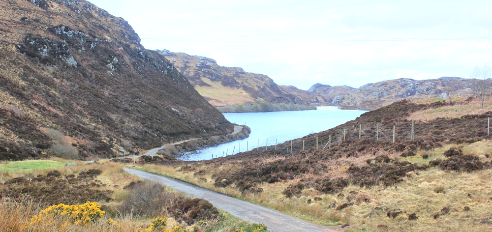
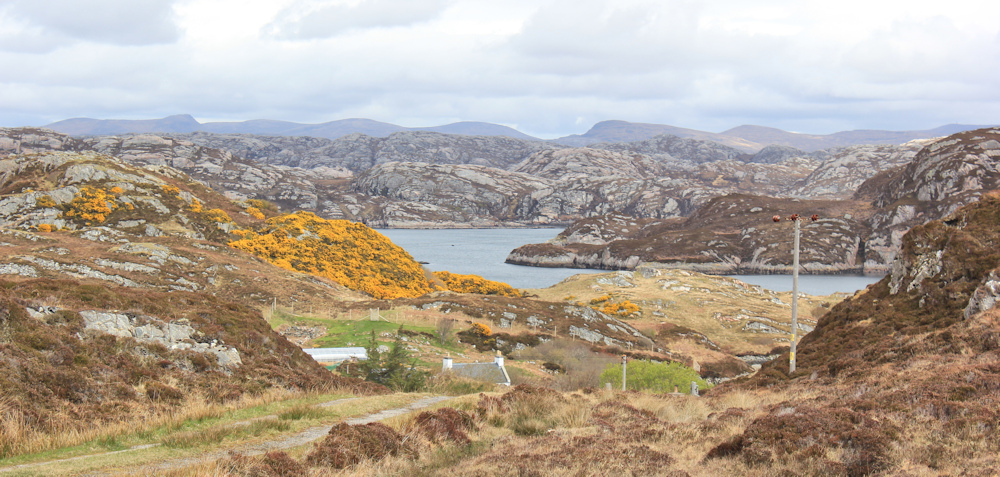
I set off walking along this beautiful stetch of road, which drops down to run beside the shore of Loch nam Brac. Soon, I forget all about my doubts, and settle down to enjoy the day.
Doubts? Yes. I was in two minds about today’s walk. On the one hand, I was looking forward to an easy circular walk along country lanes. On the other hand, I’m already a day behind my self-imposed schedule – because I meant to complete this walk yesterday. So, it was tempting to stick to the main road and give this diversion a miss altogether.
But, I’m here for a month. What’s the rush?
The drizzly mist of yesterday has lifted. The sky isn’t exactly clear, but there are blue patches of sky poking through and the promise of sunshine later. What a beautiful road.
I come across Cedric and William – two boats, pulled up on the shore. They look well-cared for. There must be fish in the loch.

Beyond the loch, the road rises steeply to pass over into the next valley. It was fun careering down here on my bike yesterday…
… but not so much fun coming up the other side. So steep (15% says a sign) that I ran out of gears on my bike and had to push the wretched thing up the last 100 yards. Doesn’t sound very far, but that bike is heavy!
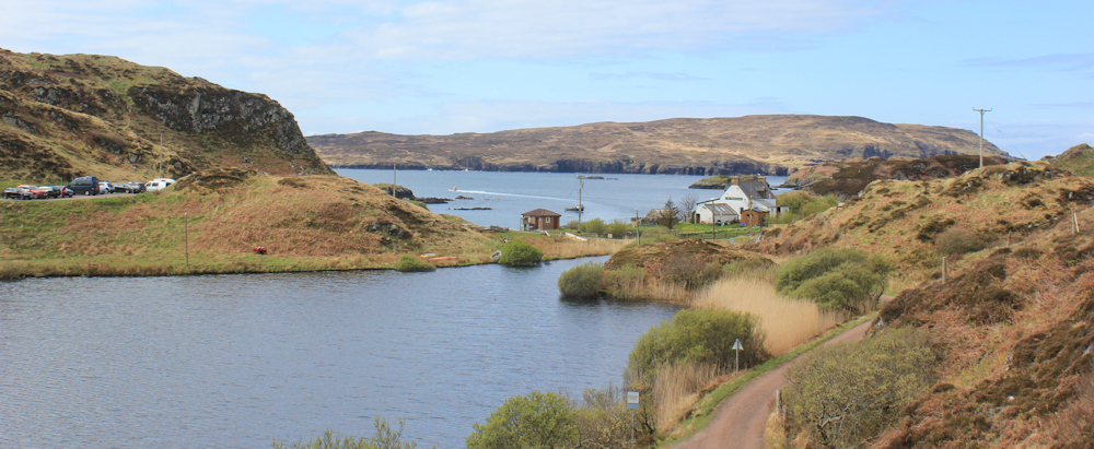
I walk down the hill towards a cattle grid and the sign for Tarbet. Lovely view across the valley. I’ll be climbing up the other side shortly.
There are cars in the car park at the bottom, and people milling around. They are waiting for the ferry to Handa Island. I contemplate going into the cafe for a drink and waiting for the ferry to leave so that I can take photographs. But it’s much too early to stop for a break.
Tarbet has everything you need to survive in this remote spot: a cafe, public toilets, a working telephone box, and a defibrillator!

It even has its own little loch – Loch Dubh. There are several Loch Dubhs in Scotland – it just means Black Loch in Gaelic – and whenever I see that name on the map, my brain starts chanting the nursery rhyme “rub a dub dub, three men in a tub.” Ah, here’s the tub – another little boat on the bank at the bottom of the loch.

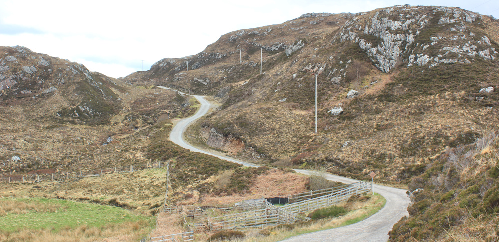
The road basically circles round the bottom of the loch and rises up the other side of the valley.
My way is barred by a couple of noisy geese, who hiss at me in an alarming manner. Gate keepers! I wish I had my hiking pole with me, but there didn’t seem much point bringing it as I am walking solely on the roads today. I stomp forwards in a determined manner, and they back off.

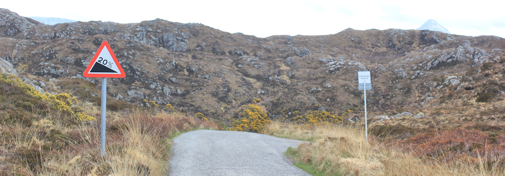
A huge motorhome lumbers past me, and climbs the road slowly, with a roaring engine and much thrashing of gears. I don’t manage to catch a photo of it. The road on this side is even steeper than the road on the other side of the loch. A 20% incline.

I pass a little old tree whose branches are fluttering in the breeze. Literally fluttering, with many tiny scraps of paper. Thinking it must be a Prayer Tree, I stop to take a closer look and to take some photographs.
Not prayers. Sell-by stickers. How bizarre!
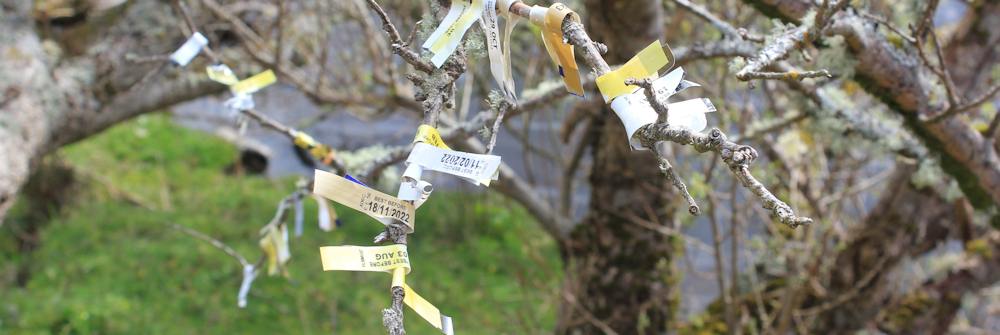
[Later, I post a photo on Twitter and ask why would someone stick dozens of sell-by stickers on a tree? Nobody has come up with a plausible explanation so far!]
I climb the slope, stopping to catch my breath from time to time. Turn round when I hear the roar of an engine, and manage to catch a photo of a little boat speeding out of Tarbet harbour. Was that the ferry? I can’t tell from this disance.
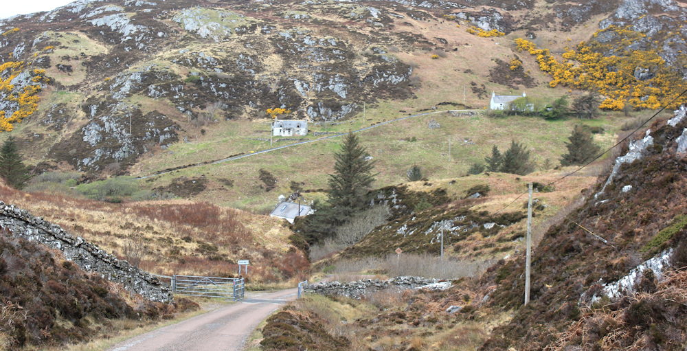
The road flattens out. I pass a derelict cottage. Ripe for renovation. I guess this was once a crofters cottage, but it seems very forlorn and lonely now.

Past another cottage, this one well-renovated but standing empty and probably now a holiday home, and over another cattle grid. I seem to be heading deep into the mountains.
Actually, I know there are no mountains in this area – but it just feels that way.
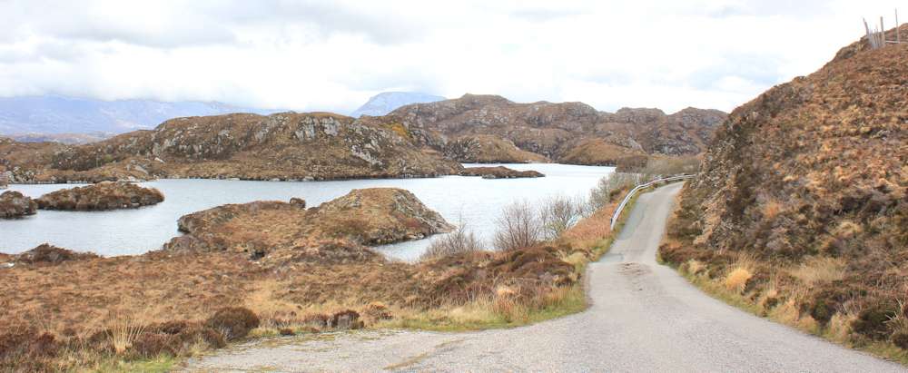
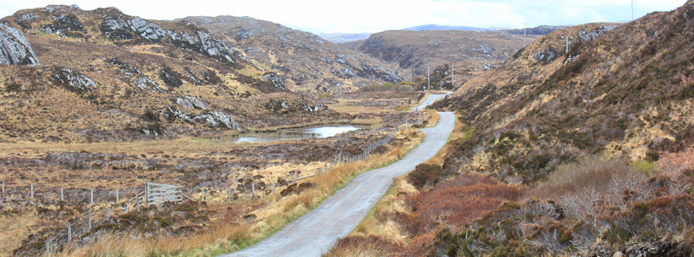
Round the corner and through the pass, and here is another loch. How beautiful. Look – proper mountains in the distance!

This loch is called Loch Gobhloch, according to my map. A strangly ugly-sounding name for a beautiful loch.
[Later, I look up ‘gobh’ to see what it means in Scottish Gaelic. I find ‘gobha’ which means blacksmith and ‘gobhar’ which means goat. Could be named after either of these, I guess.]
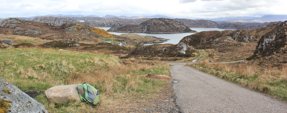
I don’t meet anybody – neither in a vehicle, nor on foot – and stop at the top of the rise at the far end of the loch. I’m entering Fanagmore. Not much here, just a few houses below – and a fantastic view over lochs and hills, and mountains beyond.

A large stone provides a handy seat. I stop for my picnic lunch, and enjoy the view. Pull out my map and try to work out what I’m looking at. The water below is Loch Laxford, a sea loch, but the distant mountains are off my map.
Setting off again, my little road ends at a T junction. I don’t turn left to go down into Fanagmore, deciding there wouldn’t be much to see. I could carry straight on down a rough track, because the map suggests I might be able to rejoin the main road a little further along. But I decide to stick to the road instead and turn right.
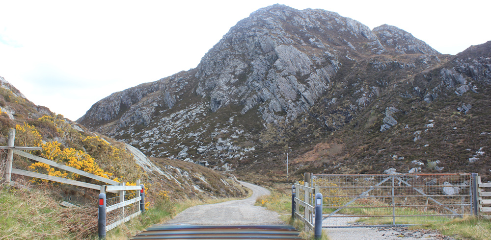
A steep climb! Of some concern is the sign near a bend. Cattle!

I really don’t like cows, having heard too many horror stories and been involved in some near-misses myself. (Visit Killer Cows to see why!) Glad I didn’t go down the track… but hope I don’t meet any cattle up here on the road.
I look down the track I might have taken, and am blown away by the view. It suddenly strikes me that the next OS map covers Cape Wrath. Those mountains are on the next map, and so they might actually be on the Cape Wrath peninsula!
I feel a cool breeze blowing towards me, and take in a deep, fresh breath of air. Has this breeze come straight from Cape Wrath? Must have. It’s been my goal for so many years now (“Maybe this year I’ll get to Cape Wrath.”) I’m filled with a sudden elation and also a twinge of fear.
Cape Wrath. I’m tasting it on the wind. So close I can almost touch it.
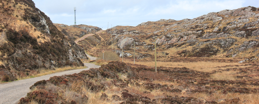
But, I have to finish this walk first! Onwards. The road loops down the other side of the hill, past a series of sheep pens, and winds up the other side of a little valley.
Look at this little hut. Seems the right size for a bus shelter, but I don’t think any buses come along here. Must be a storage shed. I stop to peer through the circular window – circular? A strange design choice for a shed.

It’s full of the usual junk, but somebody has written something on the side wall near the window. In neat black capital letters, “MONEY iS THE POWER. POWER iS THE DiSEASE. ANARCHY iS THE CURE.”
Well, I didn’t expect to find an anarchist in this remote corner of Scotland! Take another look. Below this, somebody has signed their name, with the word Holland and the date, 5-5-90. Ah, a tourist must has broken in. I try the door, but can’t open it.
On the other side of the valley, the road runs close to a stream. I hear a sound like the rush of oncoming traffic, but realise it’s the noise of a little waterfall.

Up the slope, following the little stream, until at the top of the rise it opens out into a pretty loch. No name on my map.

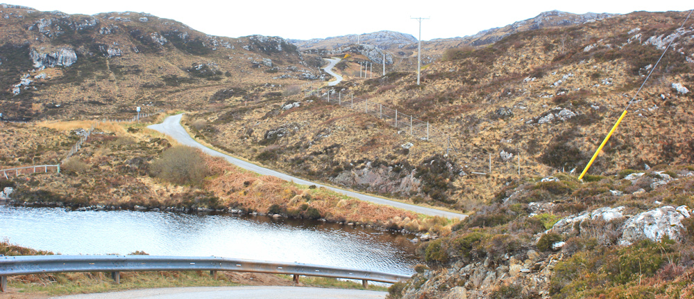
At the end of the nameless loch, the road climbs steadily, following another stream, until it opens out into another loch. This one is much larger and complex, with multiple parts and some islands. It even has a name – Loch Druim na Coille.
I find out, later, that druim na coille means ridge of the wood. But where was the wood?
The road bends round, following the contours of the slope on my right, with the waters of the loch below on my left. A mountain peak is visible ahead… aha, it’s my old friend Ben Stack.
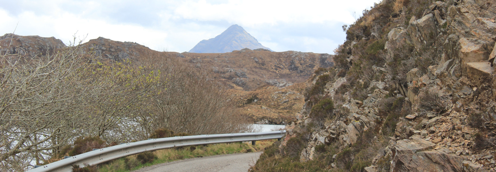
Ben Stack can be seen from Scourie, an unmistakable peaked shape towering over the surrounding hills, and I only know the mountain’s name because my neighbour told me.
My neighbour at the campsite is a woman in a camper van. She is single since she was widowed a few years ago, and is much fitter and braver than me. Yesterday, she rode her mountain bike to the foot of Ben Stack and climbed to the top. I was worried about her because the weather yesterday was bad and the top of Ben Stack was hidden in the clouds. It was a relief when she arrived safely back at the site, but she seemed surprised at my concern.
What goes up, must come down. Here is another 20% slope, but luckily I’m walking downhill now.
The next settlement along the road is called Fondle. I was looking forward to taking a photo of the sign for this place, which seems to belong on a naughty postcard – along with some of the other names I’ve collected over the years, like Bottom. So, it’s both a surprise and a disappointment to find that Fondle is, in fact, called Foindle.
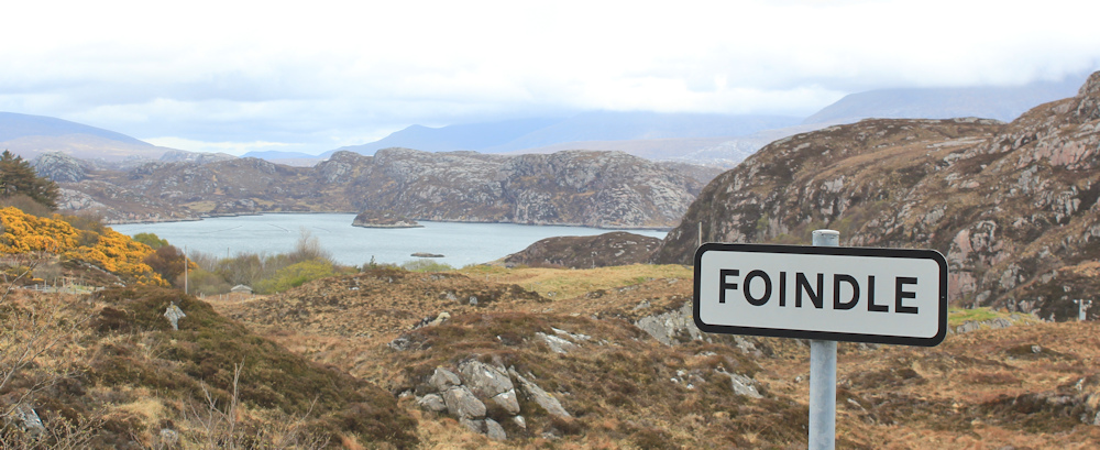
That’s what comes of reading your map without your glasses on!
Oh well. Never mind.
I pass a large house, newly built or extended, with a palm tree and a fountain in the garden. It looks like something you would find in the Cotswolds and seems strangely out of place here.

The real village of Foindle is reached via a side road, which I don’t go down. It seems to consist of a few scattered houses, but with a great view over Loch Laxford, and a fish farm.

In my head I’m nearly at the end of my walk. In reality I have another couple of miles to go. Why do the last few miles always seem the longest? This really is a road of ups and downs.

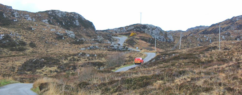
There’s a vehicle coming along the road! Ah, a post office van. I step into the grass by the side of the road, and manage to pull my camera out in time to take a photo of its back end.

The Post Office as a national institution has lost some of its charm for me, since I found out about the great Post Office scandal with the wrong convictions and false accusations that blighted the lives of so many hard-working post masters and mistresses around the country. But I remind myself that the corruption was at the top of the organisation, not at the bottom. I still love to see the vans.
Round a bend and down again. Clar Loch at the bottom. According to my map, the landscape to my right should be forested. What happened to the trees?
I descend and start climbing again, and am overtaken by the same red Post Office van. It’s been to Foindle, or possibly Fanagmore, and is now returning.
Over the next rise… finally, I’ve nearly completed the circuit! One last dip down, and the road to Tarbet is off to the right. I’m carrying straight on though. And I can even see the green space beside the road where I’ve parked my bike.

It’s always a relief to discover my Scooty bike has not been stolen. I lock it with a huge, heavy D lock, but it would be all too easy just to lift it up, put it in a van and drive away. Anyway, here he is.
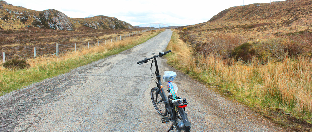
I’m wheeling him along the next section of road, in order to complete a continuous walking trail, and to avoid having to walk back along this same road to collect him later. Tempting to just hop on and zoom along – but that would be cheating.
Actually, this section of road is nice and flat. Loch a Phreasain Challtuinne to my left. Ben Stack for company.

The only problem with my walk at this point is the traffic. The road isn’t exactly crowded, but there are five or six cars that come towards me, and later a stream of cars that come up behind me. I realise the timing must coincide with a ferry sailing to Handa Island.
One car stops beside me and a very nice lady asks if I need help. She has seen me wheeling my bike and thinks I might have had a puncture. I guess this is the natural assumption to make. I assure her I’m fine, but thank you.
Funny how I needlessly worry about people stealing my bike, but most people I meet are invariably kind and helpful.
I’m approaching the end of the road, where it meets the main road. At this point, I am allowed to hop on my bike and cycle the three miles down to Scourie. Downhill most of the way. Wheeeeeh!

The single lady in the camper van next to mine has left, and her little van has been replaced by a huge white motorhome. I know she has gone to stay with friends in the campsite in Durness. I feel strangely lonely.
Miles walked today = 6 miles (final mile pushing bike in red)
Total around coast = 4,880.5 miles
Route:


All good stuff. Perhaps this was the record number of lochs in one day?
Hi Conrad. There were certainly an amazing number of lochs. So many, they seemed to have given up naming them!
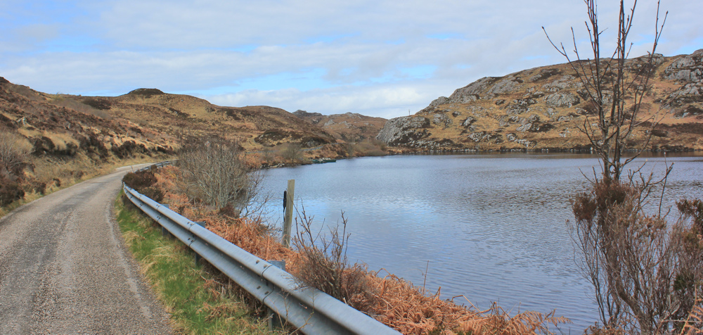
You’re certainly in some wild and rugged terrain up there Ruth. Favourite photo is the second one – there’s nothing there but it’s a lovely view 🙂
The photos don’t capture the depth of view, to be honest, and the sheer emptiness of the landscape. It is certainly wild!
Looks like it was a good decision not to skip the circuit. I have the horrible feeling that I’m going to be so tempted to explore the surrounding areas (e.g. Handa Island) that I may be in NW Scotland for many years. 🙂
I was tempted to go to Handa Island, but also keen to actually make progress. It’s difficult to know how many diversions to make.
We all have our own paths. I see this as my life’s journey now, interspersed with other trails in the UK and the world. It may never end. 🙂
Hi Ruth – Well you are obviously on the road to Mordor, as can be seen in the mountainous views over Loch Gobhloch – Stay safe from any Dark Lords you meet !!!
Cheers Russ
Hi Ross, I always think of Mordor when I’m in Scotland 😀
Lovely post Ruth and great pics. Followed you from somewhere near the start I think!
I’m sorry you find it difficult to embrace cattle but over 50 years of walking and in many remote places I have had more problems with dogs (many) than cows (one, resolved easily) and statistically you’re more likely to be killed by the former than the latter!
Hi Paul, I suspect the people killed by dogs are usually little children. Terrible, of course. I was once bitten by a dog on one of my local walks in Lincolnshire, but they don’t scare me as much as cows!
Hi Ruth, great blog as usual. I should just point out that the post van you saw is a Royal Mail van, it is an seperate company from the Post Office, so please don’t be so hard on the Royal Mail, your anger should be towards the Post Office. Just thought you might like to know that.
You are absolutely right, Gordon. I keep forgetting the two have been separated. So I can go on enjoying the post vans!
What a wonderful walk with those spectacular views, I could almost breathe in the lovely Scottish air. I had a chuckle and Fondle really being Foindle. Lucky that you didn’t have to ask anyone where Fondle was, I can imagine their puzzled expression. Tee hee.
Hi Ruth As always I’m enjoying your walk. When I take my bike out and leave it at a station or somewhere else I’m always worrying about whether it will be stolen up to the point when I park it up and lock it. Once I’ve walked away or get on a train I completely forget about it. No worry until I go to collect it. Strange how the mind works.
Yes. I usually hide my bike, or make it less obvious, by lying it down behind a gorse bush or something. I don’t use it when I’m in Manchester because it would be stolen in a flash. Bike thieves carry bolt cutters and are brazen.
I’m always split when it comes to parking my bike before a walk. Do I leave it plain sight where everyone can see it and people would notice someone trying to nick it, or hide it somewhere where hardly anyone will see it, but if they do can comfortable nick it in peace? I still haven’t decided. It hasn’t been stolen yet though.
You’re right about Manchester of course, it wouldn’t last two minutes. There were loads of bikes stolen from the underground bike pound in my apartment block in Ancoats, all the time. They use freezer spray to make the U-locks brittle and hit them with a hammer. And bolt cutters like you say. It made me so angry, I just wanted to catch someone doing it, but never did.