
[This walk was completed on the 5th May 2023]
There is a regular bus service between Durness and Rhiconich. What a relief to leave my bike behind and catch a lift – in a comfortable minibus – because the weather has been blowing a hurricane, and cycling would have been tricky in the gale.
It takes me some time to explain to the driver where I want to be dropped off. “It’s just before a bridge called Drochaid Mhor, in the middle of nowhere, where there is a layby with a phone box.”

Yesterday, I moved out of my friendly hotel in Richonich. I had a short circular walk planned, but first needed to check into the campsite in Durness. They were “fully booked” when I enquired a few days ago, but they accept a few un-booked campers from 12 midday – on a first-come-first-served basis. So, desperate for a place, I was waiting in a layby outside the campsite at 11am. Still managed to be second in the queue – a giant motorhome managed to sneak in before me – but was allocated a nice spot overlooking the sea.
By the time I’d settled in, visited the local Spar (surprisingly large and well-stocked for such a small place), and had lunch, I lacked the energy for a serious walk. It was horrendously windy too. So Thursday turned into a REST day.
This morning, I caught the 8am minibus, along with two women cyclists (their bikes strapped to the back of the bus) and a male walker. But I was the only person who got off here. Not surprising, really. It’s the middle of nowhere!

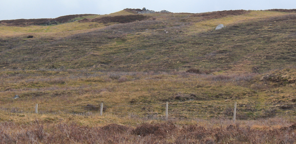
I follow the road back towards Durness. On the ridge to my right, my map promises cairns and ancient hut circles. My plan was to climb up and take a closer look. But there is a fence in the way and, despite my day of rest yesterday, I’m feeling unusually tired.
Is that a cairn up there? A hut circle? Or just a ruined sheep fold? I will never know for certain.
After a mile or so, I come to the head of an inlet, where the River Dionard joins the sea loch – or, more specifically, empties into the Kyle of Durness. There’s a farm across the river and a footbridge, and my map promises an ancient broch too. But, again, I feel too tired to explore.

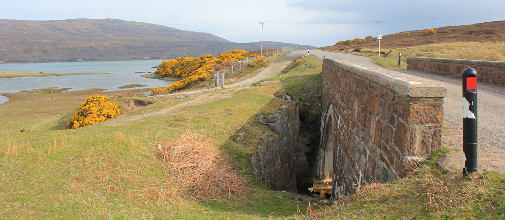
The road crosses a nameless stream via a modern bridge. You can still see the remains of the old road and the old bridge right next to it. It’s another one of those “ghost” roads – so common in this part of the highlands.
The sun disappears and my photographs fail to do justice to the next section of the walk – which hugs the bank of the Kyle of Durness and is very scenic.

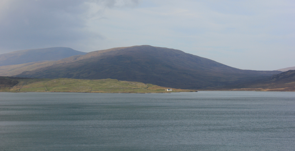
Acorss the Kyle of Durness are some magnificent hills. I realise I am looking towards Cape Wrath. The clouds and the patches of sunlight create some spectacular landscapes. Look at that tiny little white cottage over there, silhouetted against the moody darkness of the hill behind. Just glorious.
I pass a field of sheep with their delightful babies. Stop to take more photos and watch the little lambs playing about.

Onwards. I must be nearly at Durness now. The outskirts are ahead.

I reach a flat area of grassy land that juts into the water – Rubha an Tigh Shaille, according to my map. Earlier, when I was riding in the minibus, I saw a gaggle of campervans and motorhomes parked here, presumably making use of the open space for an impromtu campsite. I’m glad they’ve moved on.
This is also the spot where a minor road branches off towards the Cape Wrath Ferry.

I stop to read the information signs, and learn why the waters of the Kyle of Durness are beautifully clear. The rivers that feed into the Kyle pass through either hard rocks (on the Cape Wrath side) or limestone (on the Durness side). As a result, they don’t carry the peaty sediment that turns the water of so many Scottish rivers a murky brown colour.
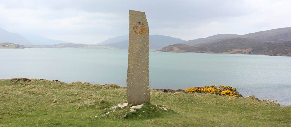
Although it looks like a recent addition to the landscape, I love this monument. An exclamation point standing proud above the water.
I know the ferry to Cape Wrath isn’t running yet, but I walk down the little side road anyway. It curves around the edge of the loch, past a few renovated residences, a farm and a rather posh looking “Cape Wrath Lodge”.

The ferry car park turns out to be just a layby. And there is no sign of the ferry… where is it?

I walk further along the road, past a “No parking beyond this point” sign and, there, at the end of the road is a large turning area, and a slipway leading down to the water.
So this is the famous Cape Wrath ferry terminal. No ferry in sight. Definitely not running yet.
The Kyle is narrower at this point. Across the water is a road and a house. I wonder if the house is inhabited? On this side, there is a bus shelter – possibly intended for waiting ferry passengers but currently being used as storage space for a cement mixer.
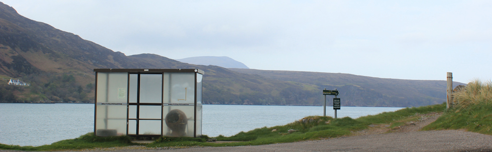
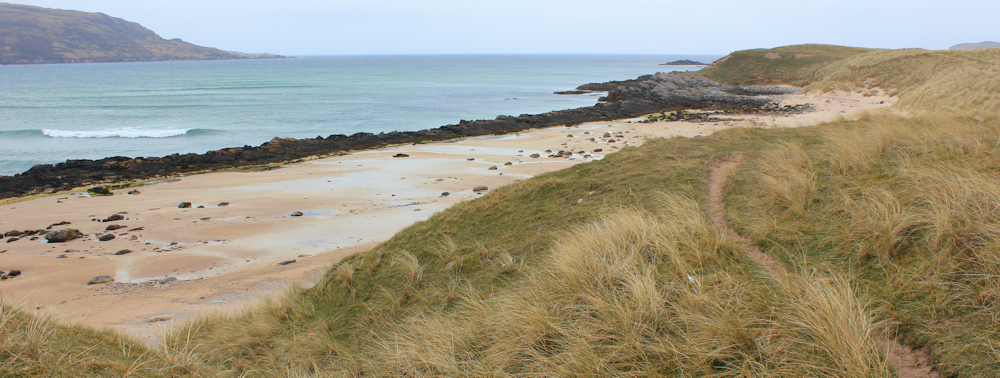
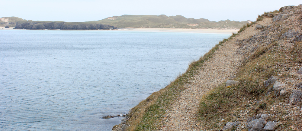
My plan is to follow a core path from here. This follows the edge of the Kyle and, eventually, takes me to Balnakeil Bay. (You can see the signs for the path in the photo above.) From Balnakeil Bay, I will follow the road back to Durness and my campsite.
I set off along the path. Hello, Mrs Sheep. That’s a fine lamb.

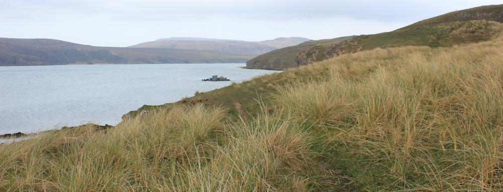
I was relieved to see the Core Path signs, because although my map indicates a path, you’re never quite sure in Scotland whether the path actually exists on the ground, or not. But, this seems a good path, running high above the edge of the water. I look ahead. Still can’t see the mouth of the loch.
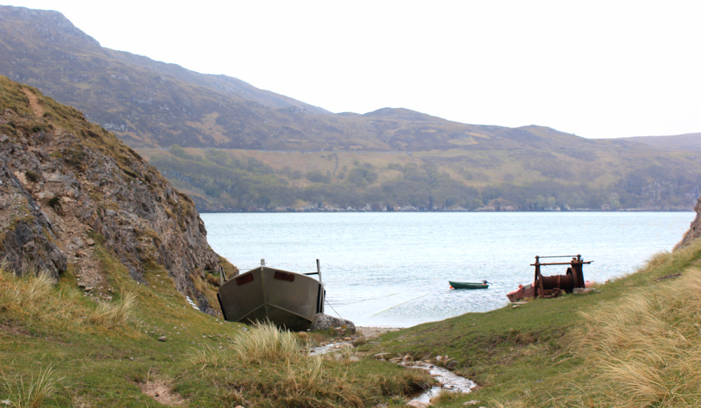
The path takes a steep dip down into a little gully, where a small stream joins the waters of the loch and a boat is pulled up on the pebbly shore.
The path deteriorates after this, and I have a tough scramble up the other side of the gully. The path climbs higher, becoming narrow and crumbly, with a steep slope below.
The trouble with coastal landscapes (and one of the reasons why they are so enticing) is that coastal areas are in a constant state of change. And so, it seems, is this path, which appears to be literally slipping into oblivion. I stop to catch my breath and take some photographs, while considering my options.

I decide to abandon the treacherous path, and clamber higher up the slope, holding onto grasses as the soil tries to slip away under my feet.
Finally, I reach a more solid surface, but my way is blocked by a group of rather aggressive sheep. I’m not scared of sheep, but have no desire to be tussling with them on a treacherous slope, so I take a wide detour inland – wider than I would have preferred.
Now, I have lost sight of the water and I am surrounded by undulating hillocks covered in long, tufty grass, with no obvious landmarks. Must be vegetated dunes? I get the same experience of disorentation I’ve experienced among dunes before – when you can’t see more than a few meters ahead and quickly lose all sense of direction.
I pull out my Garmin, and use it to navigate back towards the water. What a relief to climb another slope and see… the mouth of the loch and the sea!
I walk down through the dunes with diffculty. The grass obscures the uneven ground and I have to pay attention to where I put my feet. Progress is slow.
When I get closer to the water, the path becomes clearer again. Until my way is blocked by another obstruction – a long fence topped with barbed wire. Oh dear. How annoying. I follow the fence inland until I come to a point where the wires are sagging and there are some big stones to stand on. Other people have clearly used this point to cross over too.
I climb over and stop to take a photograph looking down along the obstruction.

Why do farmers do this? There was an obvious path and the fence cut straight across it. Providing a small stile or a gate would be easy.
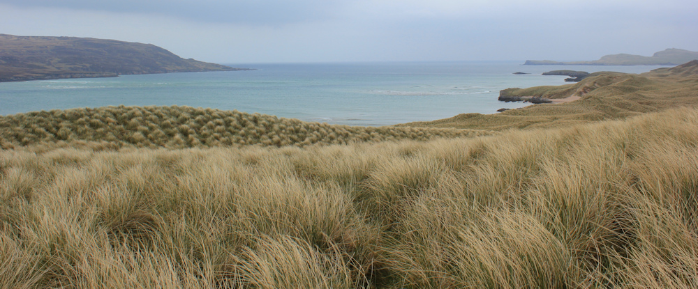
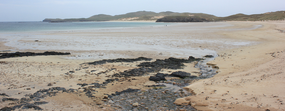
But I have a treat in store. And all my frustration is forgotten. Look at this gorgeous beach!
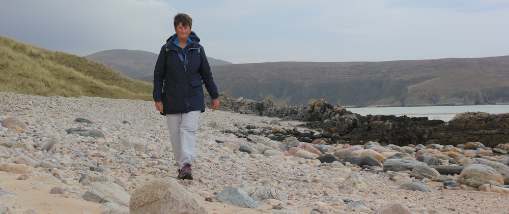
The beach even has its own little reef. I walk along the sand, and perch on a rock to eat my lunch. The high dunes inland provide a buffer to the wind. A perfect picnic spot. Later, I use the same rock to balance my camera and take a self portrait.
At the end of the beach, a group of rocks separate the sand from another little bay. Looking back, you can clearly see the rocky reef between the sand and the water – although I imagine the waves crash over at high tide. The sea is beautifully clear too.
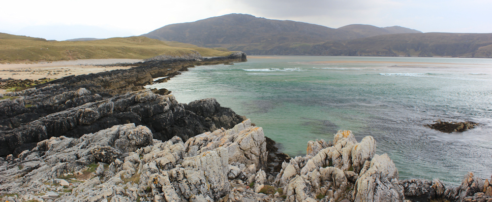
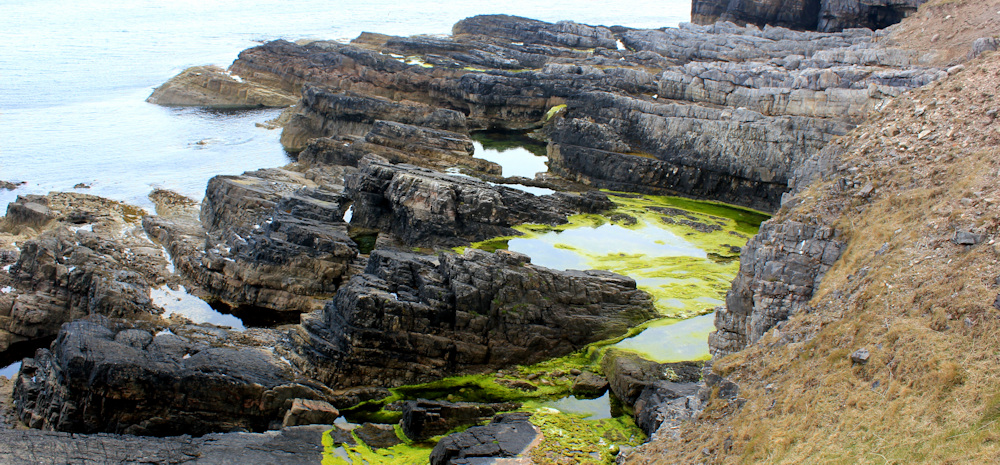
The next bay has an angular, geometrical look. Almost a perfect square, as if delberately carved out of the rocks by a giant machine.

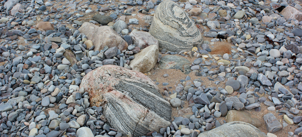
The stones here are fascinating. Clearly huge geological forces have been at work – firstly to create all these layers in the rock, and then to carve the rocks up into smaller lumps. Beautiful. Nearly every pebble seems a work of art.
I climb a slope at the far end of the bay, and stop to take photos looking back. This square bay, and the pretty beach where I had my lunch, have no names on my map. They are secret, mysterious places. Over the water is another mysterious place… the hilly landscape of the Cape Wrath peninsula.

Will I ever get to Cape Wrath? Fate (and the ferry timetable) seem to be conspiring against me!
Onwards. I follow a grassy track above wonderful rock configurations, the shoreline draped in bright green seaweed…
… until I eventually round the corner at the mouth of the loch, and begin travelling eastwards towards Balnakeil Bay.
This marks an important transition. No longer am I walking northwards up the WEST coast of Scotland. I’m now walking eastwards along the NORTH coast of Scotland. I have, literally, turned the corner!
I have to confess that from here the path becomes slightly boring – an obvious gravel track. And the landscape of fields and grassy dunes gives way to a sparser landscape of bare rock and short grass.
I pass over the remains of an old quarry (I think, it’s not marked as such on my map) and reach the edge of a golf course. The wind has remained strong during the course of my walk, but became really fierce when I rounded the corner. I’m surprised, therefore, to see a lone golfer on the green.
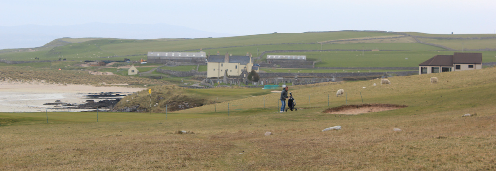
From a safe distance, I watch as he wacks a ball over a narrow inlet. But the wind is so strong, the ball seems to stop in mid-air, and drops like a stone into the sea. His shoulders sag. As I pass him, he explains in a strong northern-european accent, “The wind is too much.” I agree and sympathise.
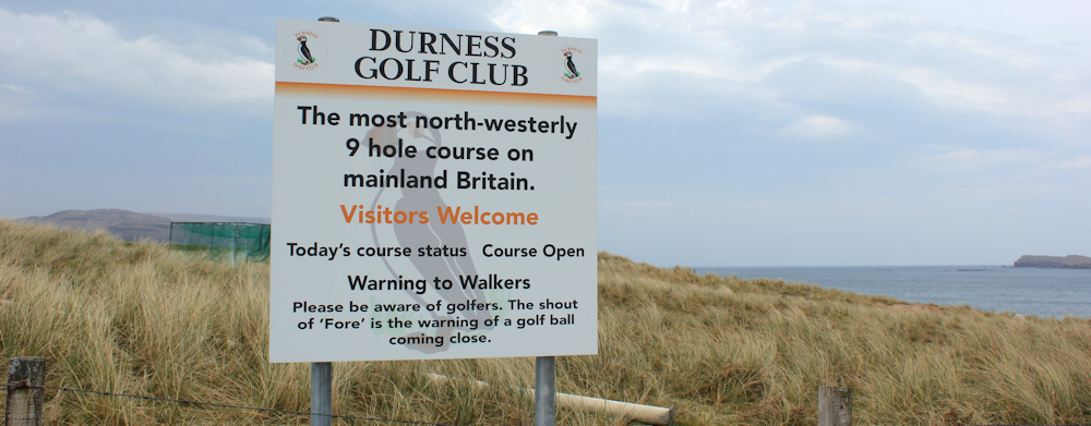
As I leave the golf course, I pass this sign. “Durness Golf Club. The most north-westerly 9 hole course on mainland Britain.”
Balnakeil Bay is absolutely stunning. A huge, curving expanse of sand, with creamy-blue waters in the distance, and the north-pointing finger of the An Fharaid peninsula at its far end.
I was planning to walk along the sand and do a circuit of the peninsula, but I feel strangely tired, despite my day of rest yesterday. And I don’t fancy battling against the wind any more. So, I decide to head straight back to my campsite instead.
Joining the road, I pass an old graveyard and a ruined church, reach a car park for the bay, and follow the road as it turns vaguely southwards towards Durness. This impressive building stands overlooking the bay. I wonder if it’s a farm house or holiday lets? Huge, and what a view!

Just off the road is a “motorhome stop over” site. I will come across a few of these along the north coast -basically they provide official overnight parking places for motorhomes, with no amenities except for electric hook-up points. They are also cheaper than established camp sites. This one charges £20 a night.

I remember that the Durness campsite is full, and I guess these places are a good idea. You need your own onboard water and toilet facilities, though.
Beyond the motorhome site, is a weird “craft village”. I visited this place yesterday, on my rest day, so I don’t explore it again today…
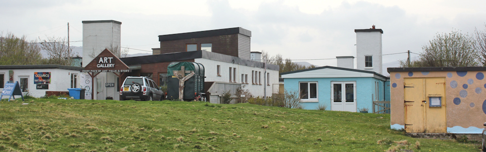
… but I do stop at the Cocoa Mountain cafe, which has a “for Sale” sign on the front lawn. The cafe seems strangely out of place in such a remote and rustic setting. It is also popular and crowded, and they seem to have run out of proper food, so I have to make do with a trio of “tasting chocolates” and a big mug of hot chocolate – bliss!
With renewed energy, I walk down the road and into Durness.

The Balnakeil road joins the main road through Durness. There is the bus stop where I caught the minibus this morning. And the wonderful local Spar, that sells good coffee from a machine and warm croissants.

Opposite the Spar is a petrol station, and this creates a busy little spot, with vans and motorbikes stopping for fuel or food, or both. Just beyond the Spar is the camp site.
I have a wonderful spot on the edge of the site, overlooking Sango Bay. But, because of the wind, I have been unable to pop up my roof. Even with the roof down, the van rocks and rolls.

My poor Scooty bike has been blown over by the wind. I’m glad I didn’t have to cycle today. And, with a bit of luck, I can avoid cycling tomorrow too… but that’s another story.
Post walk update: the large house in Balnakeil Bay was built by the Mackay Clan on the site of a former monastry, and is called Balnakeil House. Sadly the Cocoa Mountain cafe appears to have closed down. The “craft village” – which you could accurately describe as “rustic” and seems mainly inhabited by aging English hippies – has an interesting history as a never-commissioned MOD early-warning station.
Miles walked today = 9 miles
Total around coast = 4,930 miles
Route =


Your description has brought back some great memories of our trip up there nearly 10 years ago, before the NC500 was invented.
We stayed at Sango Bay in early March when they were only kind of half-open. Electric and cold water only. Looks like we had the same pitch. It was so windy that stuff fell off the worktop in our van while we were out for a walk.
Looking forward to your progress ‘across the top’. You’ve some great bits to come!
I bet it was cold in March! It’s a nice campsite – but very windy. The views are fabulous.
Lovely to see your write ups back just as the weather has turned very autumnal, I was wondering if you had continued this year.
I have fond memories of this area. Having walked up the east coast I had headed onto the more remote north coast, but now reaching the far north west I knew things would get much harder on the west coast, where it is far more remote with few towns and even few villages. I was looking forward to it but also apprehensive.
I think I stayed at the same campsite (Sango Sands?) but in a tent. I remember it was a beautiful location and good facilities but for me a bit spoilt by the inconsiderate fellow campers who were very loud – possibly because I was there in the school summer holidays.
The beaches there are absolutely wonderful aren’t they? I think that posh looking lodge near the Cape Wrath ferry was once the Cape Wrath hotel.
Sad to hear the path has been blocked up, farmers in Scotland just *love* fences topped with barded wire – even ones that don’t keep animals for some reason.
Durness has good facilities for such a small place I agree, the Spar was good and there was another food shop there I think too. Though I don’t remember the craft village, it sounds a bit strange!
I guess now you have rounded the corner things should get a little easier, certainly the north coast is easier than the west and the east coast easier than the north.
Yesterday I booked what might be (if things go to plan, the timings are a little tight) my last trip to walk the coast of mainland Scotland. I have mixed feelings about reaching the “end” because for me it won’t really be the end. I plan to continue and do Northern Ireland and all the islands I have missed.
Very windy for tents at that campsite, Jon. People were pitching behind any available bush when I was there. I was so glad I had my van! Can’t believe you are coming to the end of your walk around the coast – you’ve done so much better than me… but pleased to hear you are doing the islands and Ireland. Look forward to your continuing posts.
Congratulations Ruth! Bill Bryson elevated the status and interest of Cape Wrath, so I hope it feels like the achievement it is. So impressed with your tenacity 😊
Hi Catrin. Are you my old friend from school? If so, please reply, would be lovely to catch up!
Yes to both terms – old and friend! 50 years ago, gulp!
I think you have my email here so feel free to contact me that way. I am especially intrigued by your home on Anglesey, I love that part of the world.
Great to read about your walks again Ruth, so brilliantly narrated with stunning photography! I’ve been laid low for a year or so, after the long Covid era, but have just completed chemo and now itching to restart my coastal path walks. I had walked from Hunstanton as far as Dover so have a fair few miles to catch up with your brilliant score of 4,930 miles! Chris
Hi Chris. So sorry to hear about your ill health. Hunstanton to Dover is a fair stretch, and you have the best to come – with the South West Coast Path n your sights. Hope you enjoy many more days of happy walking. Best wishes.
That looks like a stunningly beautiful bit of coast… really looking forward to that. The crumbling path certainly looked treacherous, not a great place to walk with angry sheep knocking about!!! Sheep can get aggressive apparently, but I wouldn’t have thought they could hurt you that badly… unless they knock you off the cliff.
When I see stones like that with swirling patterns I always want to take them home, but can’t imagine how uncomfortable it’d be with a rucksack full of stones.
I always end my beach walks with pockets full of stones and pebbles!
My ex-hubby and I once had a small holding with a small flock of sheep. They can pick their victims and were always knocking the children over to eat whatever was in their hands – food for the ducks, sandwiches, sweets, etc! And they terrorised our soft Labrador! They’re not as daft as people think they are.
Hi Ruth – Good to hear from you once more. A several hundred milestone of “turning the corner” must be a very good feeling. As ever the beach and bay photography is marvellous – Best Russ
Thank you, Russ.
Great to hear of your adventures again Ruth & congratulations on another milestone. Intrigued to discover how far you travelled in the summer.
I’m hoping to finish English coast next year & then the big decision of whether to tackle Scotland – tempting, but so far from Devon! Perhaps it’s wiser to discover the beautiful trails we have on our doorstep.
Scotland is incredible, but a long way from Dover. Even from the north of England, it takes me a full day of driving to get up there. Maybe go for some of the lovely trails nearer home – that’s a good idea.
Great to hear from you Ruth – 9 miles is quite a way when feeling tired! Well done on the change is direction too!
I feel old age is catching up with me. There was a time I wouldn’t have got out of bed for less than 12 miles!
“Is that a cairn up there? A hut circle? Or just a ruined sheep fold? I will never know for certain.”
Looking at Google Maps Satellite view, there is a feature where you mention, and it says Laid Wheelhouse, which looks like a derelict stone dwelling. There are a few photos of it too.
Ah, thank you Robin.
What gorgeous photos you took on this walk. You have a great eye for composing landscapes.
Hi Ruth, I’m reading this after getting lost in the same dune system today (while out running). It reminded me of the Braunton Burrows back in Devon. Also, by chance, we’re two pitches away from one you had at Sango Sands. You won’t be surprised to hear it’s really windy in Durness today, with pulses of horizontal rain. Comedy scenes as people try to erect tents, I’m glad we’re in a vehicle.
Your wonderful blog continues to bring me much pleasure, thank-you.
Hi Gary. It’s amazing how easily you can become lost in a dune system, isn’t it. Glad you found your way out. And that campsite is always windy – I remember running to help a woman who was trying to put up her tent, but it kept taking off like a kite. I was glad to be in my van, even if it did shake about in the gale.