
[This walk was completed on Friday the 19th May, 2023]
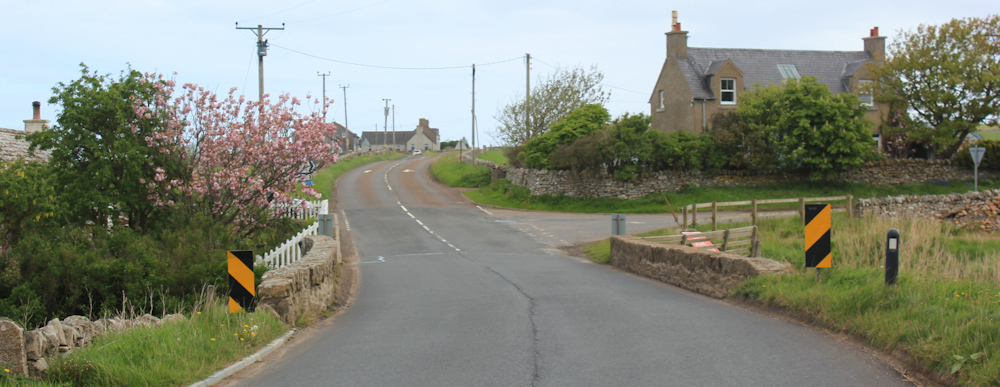
Here I am in Reay, back at the Bridge of Isauld, and I am surprised to note there really is a bridge here. Somehow, I missed seeing it yesterday – although I must have crossed it.
I had a really ominous feeling about today. A bad feeling. It started when I parked the van at a place called Crosskirk, and continued as I cycled back to Reay – battling the wind and rattling over the terrible surface of gravel and broken tarmac that passes as an A road in Scotland.
So strong was this feeling of impending doom, that I moved my Scooty bike, twice, to less obvious places, before leaving it chained up in long grass on the verge of a quiet road.
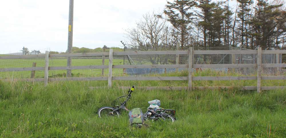
(I never worried about anybody stealing my previous bike, The Monster, but I really do need my Scooty bike. There are virtually no buses here and if someone stole Scooty I would end up doing a lot of there-and-back walks – effectively doubling the distance I was walking.)
Saw something odd as I drove up this road this morning in my van. A man on a skateboard, carrying a bright yellow surfboard, or bodyboard, on his back, seemed to be holding up traffic on the opposite side of the road. I thought he must be heading for the waves in Sandside Bay.
But why was he on a skateboard on the main road? There was quite a queue of cars behind him. An inconsiderate young man, I thought to myself.
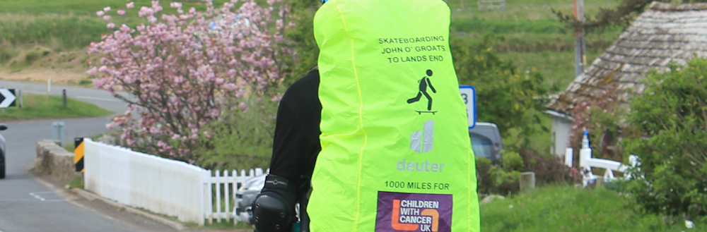
Later, as I pedalled furiously against the wind on Scooty, I came up behind the same guy, still on his skateboard. But, now I realised the yellow surfboard was in fact a gigantic yellow backpack. According to the lettering on the pack, this man is skateboarding from John o’Groats to Lands End for children with cancer.
He was making very slow progress, having to propel himself with one foot despite going downhill at this stage. (The wind really was ferocious and the surface of the road so gritty that I imagine it was like having brakes permanently applied.) By pedalling as fast as I could, on full power, I managed to overtake him on my Scooty Bike.
Now, walking, I meet him again. This time, I am facing him and I realise he isn’t a young man at all. Possibly in his 50s. He is still struggling along and looks really fed up.
Waiting until I am safely past, I take this photo of his back (and later I crop a close-up shot of his back pack, which I’ve put above so you can see the lettering).
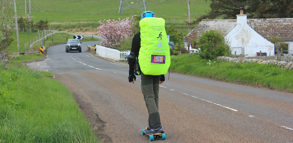
People do crazy things. I wonder when he left John o’Groats – today? or yesterday? – and whether he is regretting this self-inflicted torture.
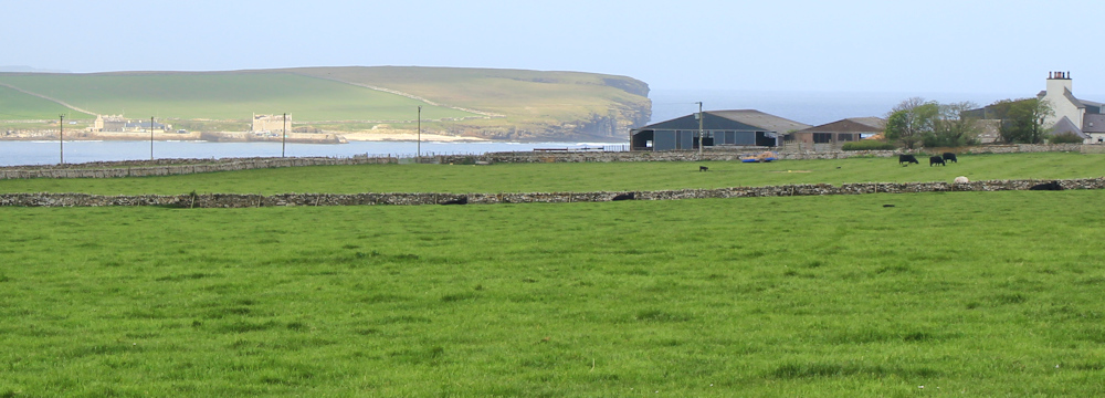
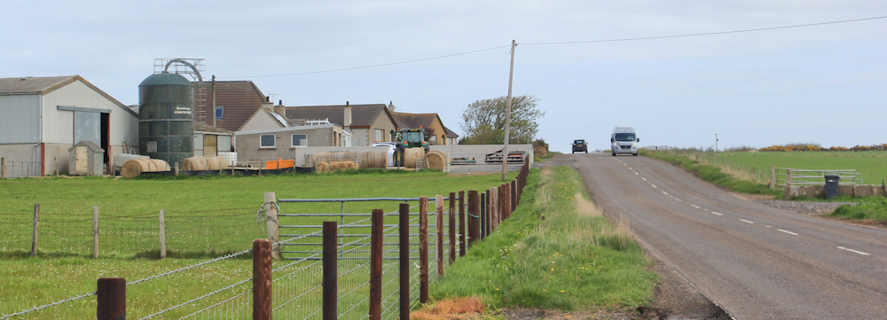
I climb steadily, and pass some modern-looking houses on my left. “Isauld Farm Cottages” says my map. Looks like they have been renovated!

From a higher point on the road, I can look across green cattle fields to Sandside Bay and Sandside Head where I walked yesterday. It is positively glowing in the sunlight. Wish I was back there.
Now, I am nearing Dounreay. The great white ball looks strangely small from this distance, and completely innocuous. Who would have guessed it has contaminated a whole bay.

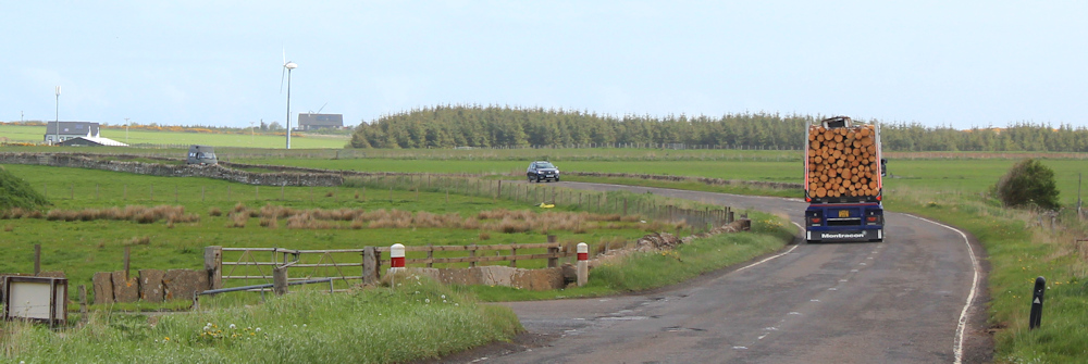
The road goes on and on. It isn’t particularly busy, but the traffic that does whizz past me is going frighteningly fast. I walk on the tarmac because the verge is uneven and treacherous underfoot, but have to keep jumping out of the way of cars, vans, and lorries.

I’m in a funny mood today. Ruminating over my marriage and how badly my husband (who I loved dearly) had let me down. In my head, I was explaining it all to an imaginary friend, including all the warning signs that seem so obvious to me now, but of which I was blissfully unaware at the time.
Must snap out of it.
Here is a sign I haven’t seen before. “Police firing range.” I’ve seen plenty of army ranges of course – but a police range? It’s a new one. I stop to take a photograph, and realise I can see bunkers in the background. Are they to stop the bullets flying all over the place?

A deep rumble behind me makes me jump. It’s only a lorry laden with timber.
Here is another unusual sign. “No drone zone”. I wonder why?
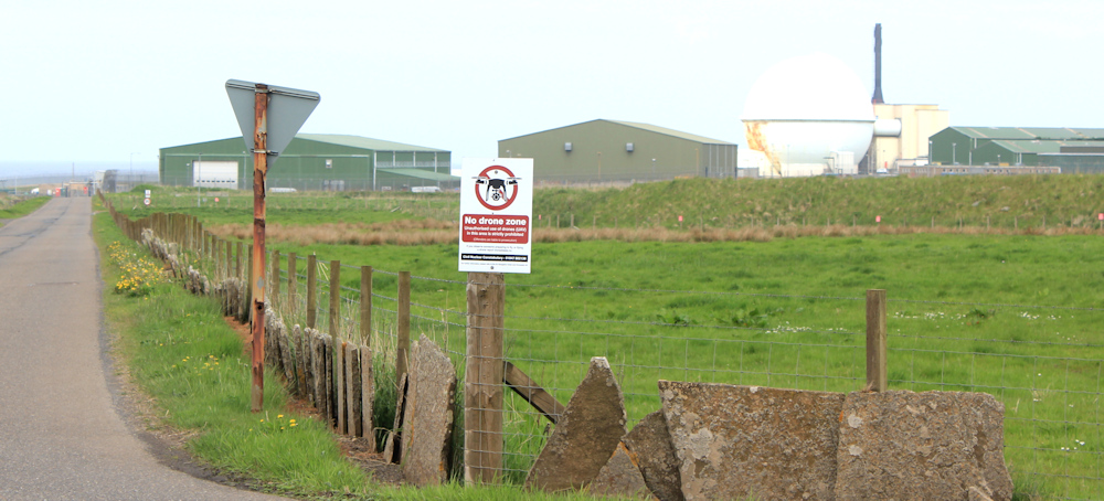
Dounreay is a large site, but I finally reach the official entrance driveway. “Welcome to Dounreay… Dealing with the past, protecting the future.”

I knew Dounreay was being decomissioned, but I didn’t realise it was a place where scientists experimented with nuclear materials and processes back in the 50s and 60s, so it has become something of a testing ground for radioactive clean-up processes. More information: Dounreay:Office for Nuclear Regulation
The surrounding countryside is farmland, and seems almost exlusively devoted to cattle farming. These inquisitive creatures bound up to the fence to watch me walk past.

They decide to keep pace with me, which they do for some time until they give up, trotting along – on the other side of the fence, thank goodness. I’m really not at all fond of cattle.
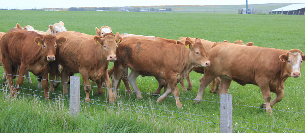
Bullocks. Not dairy cattle. I wonder if I would be happy drinking milk if I knew it came from the Dounreay area? Or eating Dounreay beef?
Onwards. Dodging traffic. Walking past neat farms.
There are ruined buildings on my left. My map doesn’t mention them, but there is a disused airfield nearby, so I wonder if these abandoned buildings were something to do with the airfield?

A bus stop, in the middle of nowhere. And a turn off to somewhere called Achreamie. But I’m continuing straight on towards a place called Forss. (May the Forss be with you!)

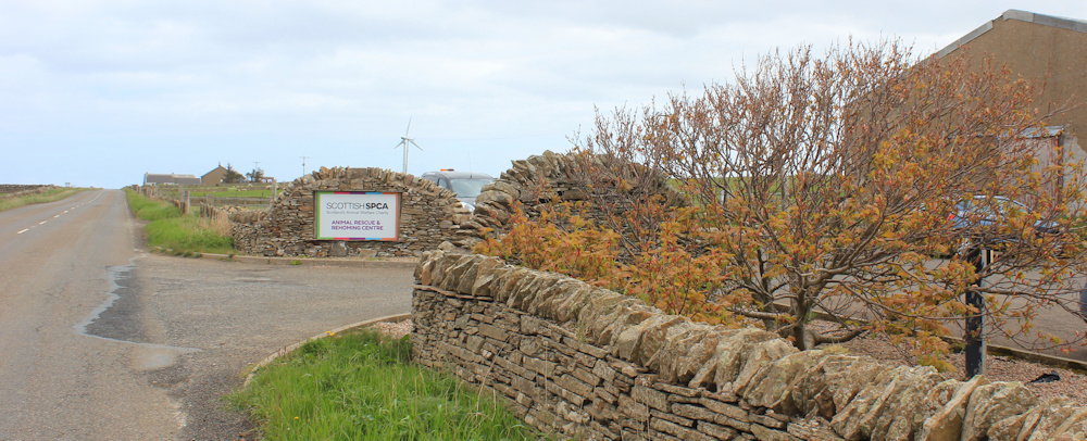
I pass an animal sanctuary on my right, run by the Scottish SPCA. Scotland’s equivalent of the RSPCA, I assume.
Finally, after a never-ending straight stretch, I come to a bend in the road. Here you can turn off for the Forss Business and Technology Park.

I was thinking of taking this road. It’s a dead end, but I may be able to get across the river and back to my van at Crosskirk… but if there are modern developments designed for busineses there are likely to be high fences and keep-out signs. It’s a mile down the track, and a mile back – a two mile detour if I can’t find a way across the river.
Stick to the road.
Here’s a property ripe for development – perfect if you don’t like neighbours and don’t mind living in spitting distance of a huge experimental nuclear site.

An alternative to nuclear power is wind power. A track leads off to my right, where the ridge in the distance is dominated by a bevy of these huge, and elegant, wind turbines.

I wonder if one day there will be a new industry based around the decommissioning of old wind turbines? Nobody would have predicted, back in the 1960s when they built the Dounreay reactor, that wind-power would replace nuclear-power.
We really don’t know what the future holds.
[to be continued…]
Post walk note: The skateboarder’s name was Gary Walker and he was 50 years old. He did, eventually, make it to Lands End – skating 25 miles a day. It took him 6 weeks. You can find his photo and brief details here: https://archive.ph/tigED (scroll to near the bottom of the page). It is not clear how much he raised for charity.
Route so far today:


Decommissioning of wind turbines will shortly begin. Tens of thousands of turbine blades will need to be sent to landfill. Cost per turbine will be upwards of $114,000, according to the US Department of Energy.
Wow! But easier than decommissioning a nuclear plant, I suppose.
The wind turbines can be recycled, they’re starting to do it now. Newer blades can be made so they are easier to recycle too.
$114k is a lot, but that will drop as the business becomes more common, just like the cost of the wind turbines themselves did, but decommissioning Dounreay is estimated to cost £2.9bn… that’s a lot of turbines 🙂
I used to work with someone called Gary Walker but I checked and it isn’t him. That newspaper link seems to have a few oddball characters, the person underneath has a rubics cube over their head, for example! Certainly an unusual way to do LEJOG or JOGLE as it in this direction.
I didn’t have any problems at Dounreay but I remember reports of another coastal walker being stopped there and questioned so I’m glad you got past it with no problems (as did I). It is a large employer in the area though, I happened to pass at “shift change” time one day. There was (at least when I did this walk) a few buses a day along this part of the road (and one as far as Bettyhill) which I think was mostly to cater for workers there.
I did walk down the dead-end road to the business park but it is an odd place and most of the buildings looked dilapidated and unused. Certainly not a recent development and it was surrounded by those wind turbines. For walkers however it isn’t a dead end. There was a path from the end of the road there to the end of the next road at Crosskirk and a bridge over Forss Water.
There are an awful lot of people called Gary Walker, as I found out when I tried to do a search to find more details about him! Thank you for the information about the business park – I should have gone down there!
That property near the end just needs a lick of paint 🙂
Yes. Who needs a roof! 😂
Many years ago I met a woman on the London / Inverness sleeper. She was on her way to John O’Groats to meet her son and two of his mates who were ‘long-boarding’ from Land’s End to John O’Groats. As they were only young (I think 14-15 year olds if i remember correctly) they had a responsible adult cycling along the way behind them in case they got into trouble. I believe they were the first people to ever skate board from Land’s End to John O’Groats. Apparently they were getting through lots of shoes as that was their only way of braking!!!
I never thought of the braking problem. The poor man I saw couldn’t get up enough speed on that awful Scottish tarmac – he didn’t need brakes… yet!
Gary Walker raised £6602 for his charity. I didn’t know of his fundraiser at the time but he’s actually reasonably local to me (Stubbington, which is just 23 miles away).
Wow. He did well. Mind you, I would pay £6000 to NOT have to skateboard from JoG to Lands End! What a coincidence that he is local to you.