
[This walk was completed on Friday the 19th May, 2023]
Forss turns out to be an oasis of trees – a welcome change after the tree-less agricultural land I’ve just walked through. It even has a pretty river.

The big building by the river is a hotel, I think. The Forss House Hotel. (May the Forss be with you.) I walk past the driveway to the hotel and long for a warm bed and fluffy towels… I love my campervan but I do miss the comfort of a proper bed and an ensuite shower!

This section of the walk is disturbed by a cacophony of noise from the branches above my head, accompained by the plop, plop of bird excrement. A colony of rooks is in residence. What a noise!
I manage to avoid the bird poop, and hurry on towards a junction. This is the turn off to Crosskirk – my final destination for the day.

After dodging traffic on the main road, this quiet lane is bliss. Only a few old tractors to dodge.
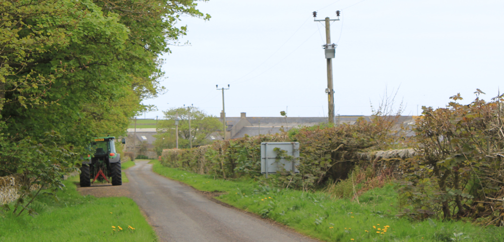
I walk past a farm (well, the road actually seems to go through the farmyard!) and leave the trees behind. Bales of hay. Gorse in full bloom. Lovely.

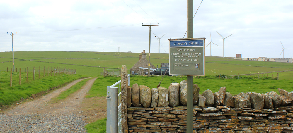
At the end of the road is a cottage and a car park. This is the buzzing metropolis of Crosskirk!

There isn’t much room to park, to be honest, because the farmer is using the car park as a storage yard – so I felt like an interloper when I left my van here this morning. Now, a few other vehicles have joined mine.

A notice in the car park explains that here is the start of the footpath to St Mary’s Chapel. “Cross the footbridge. Keep dogs on lead.”
I walk along the track, past a cottage (a holiday cottage, I think), and then onto a signposted path that leads down the hill between gorse bushes, towards the river. There is the footbridge ahead.

The river is lovely. Just below the bridge, the water tumbles over a low waterfall and curves past a rocky cliff to join the sea.
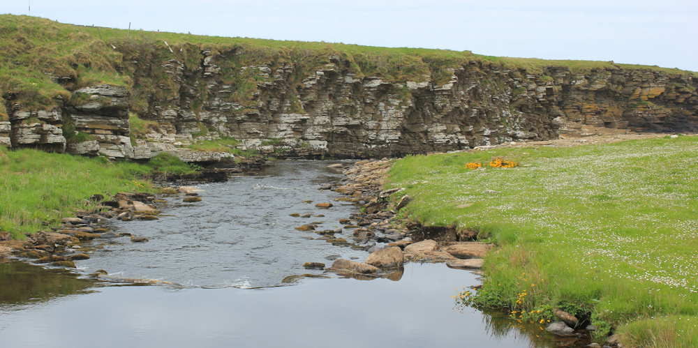
On the other side of the bridge, I stop on the slope to take a photograph looking towards the mouth of the river and the sea. There are some ruined buildings here – perhaps another old abandoned farm? A notice warns you to keep out.

Up the slope, and another ruined building. At first I think this must be the old chapel, until I see the track leads further on and there is another ruin dead ahead.

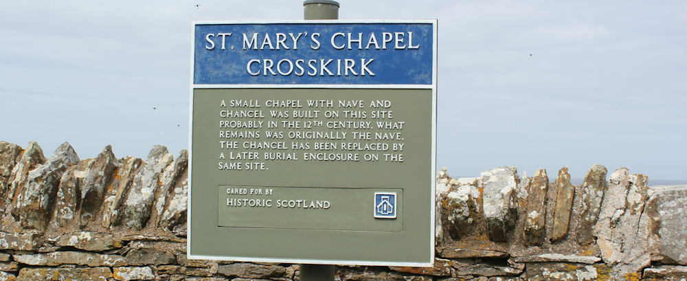
Yes, this is St Mary’s Chapel. Finally. It seems to have become a cemetery.

A sign tells me the original nave dates from the 12th Century – 900 years ago!
I perch my camera on a handy tombstone and take a self-portrait. I look like a proper walker. Or a lost zombie in a graveyard.

The cemetery area is enclosed by a beautiful dry stone wall. It even has an ancient stile of stepping stones to climb over the wall, although if you are less adventurous you can use the gate.

On the seaward side of the chapel is the most precarious cairn I’ve seen so far. Looks like one of those Jenga towers. One misplaced stone could cause the whole stack to topple.

(I’m not very keen on cairns in the first place – why go to a remote natural place and shift stones around?) I give this one a wide berth.
I sit on a rock beside the shore and shrug off my rucksack. It’s gone 3pm and definitely time for lunch. Funny that I now have to eat according to the clock, as I seem to have lost my natural good appetite.
Anyway, its a beautiful spot for a picnic. Just look at it.

In front of me is a sheltered rockpool with clear water. Beyond, large breakers swell and crash against the outer rocks. The noise of the water has no competition and seems stupendously loud.
I take a photograph of a lone oyster catcher perched on a rock. He poses for a good 10 minutes before flying off.

What a beautiful place. I could stay here all day.
Post walk note: later this afternoon I moved into the campsite in Thurso. It is NOT a pleasant place, with “DO NOT” instructions plastered everywhere. Very unwelcome feel to the site. My first pitch was unsuitable because my electric lead wouldn’t reach the distance between the electricity point and my van, but I was given another pitch and that was better. The site staff seem to work in the cafe too, but the cafe was only open at odd times – which I never got the hang of. And access to the toilets/shower block was via an access code, that I kept forgetting! Wish I was back in Melvich.
Miles walked today = 7 miles
Total distance around coast = 5,019.5 miles
Route: (previous post in black, this post in red)


I must admit I’m not a lover of cairns unless they are official ones like the Prince’s Cairn just off the A830 between Fort William and Arisaig – most of them seem to be completely pointless. I think if I saw this one I’d be tempted to pull a stone out from the middle to see if it collapsed😀I like the sheltered rock pool but the camp site doesn’t sound very nice. You may have thought about it by now but one of the best things I ever did was get an extension for my hook-up cable – it’s come in handy more than once when my pitch has been a long way from the hook-up point.
I needed to borrow an extension lead once – in Scourie I think. Yes, I should probably buy one. Good suggestion.
Ah so you did get to that church and cemetery! That is the one the path from that business park goes to that I commented about on your last post, so I am glad you did get to see it.
Cairns are useful in uplands to mark the route of a path (especially if it gets misty), but at ground level, like that one, then I agree with you.
Sorry to hear about your campsite. Was it the Thurso Bay Caravan and Camping Park I wonder? I stayed in Thurso twice and for one of them I stayed at the Weigh Inn, which was an odd sort of place (more a Motel than Hotel) and I stayed in one of their “lodge” rooms in a separate building. It also wasn’t especially welcoming with a big list of things not to do left in the room! It was very close to that campsite. The next time I stayed at the Royal Hotel which wasn’t great then but I see now has the dubious privilege of being the worst hotel in Thurso, according to trip advisor. I guess it hasn’t improved!
Ha ha, what has poor Thurso done to deserve two bad hotels and one bad campsite? I think it must have been the Thurso bay park – it was in a nice position right on the coast, but you were made to feel like a criminal with all the “do not” signs!
I reckon the oystercatcher was weighing up whether it should build another cairn or give up on attempting to communicate with the mammals, who just don’t seem to get the message!
(I don’t know what the message is either. Mammal, me.)
That poor oyster catcher must be exhausted from shifting all those stones around!
Campsite with too many ‘do nots’ aren’t at all welcoming. Surely the owners must realise how off-putting it is.
I seem to remember have seen St Mary’s Chapel on a tv programme at some point, but don’t know when or what was said about it!
At some lodges we stayed at recently there was an access code for the gate into the dog walking field. The first time I tried it I used my code three times before I realised that what I’d written ended in a Z not a 2. My terrible writing!
I had a smile at your ‘lost zombie in a graveyard’ remark. Though you definitely look like a proper walker.
I read an article somewhere about how to write “do not” notices without using the words “do not”. Instead you focus on the positive message. So “do not play loud music after 10pm” becomes “quiet time starts at 10pm” etc. Don’t know about you, but whenever I see the words “do not”, I immediately want to do whatever has been forbidden.
Absolutely I want to do what I’m not allowed to. Btw, this walk was completed on my 65th birthday (2023), so yesterday was my 66th, and I am now officially a pensioner. I can’t say I feel like one but it will be nice to have some extra money coming in.
Don’t forget your free bus pass, Karen!