
[This walk was completed on Sunday, 21st May 2023]
I set off walking from the campsite in Thurso. First along the cliff top, later along a rather sad promenade, and then down onto the beach.
This morning, I parked my van in Castletown and cycled back to the campsite, where I had left my rucksack alongside my food-boxes. Always a gamble, because my rucksack contains my camera and you never know… but I needn’t have worried. The rucksack was waiting for me, untouched.
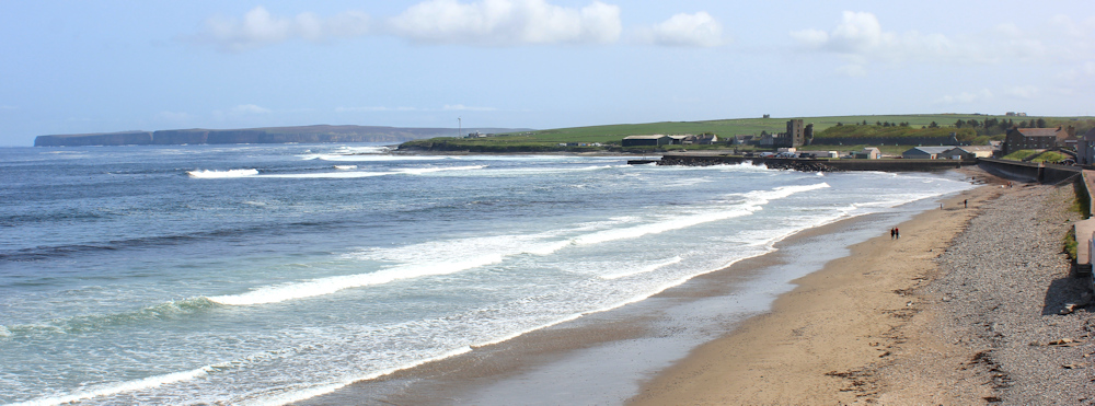
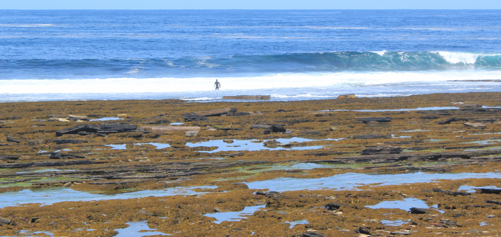
Thurso breach is sandy, but with rather smelly seaweed in places. The sun is shining, and I can see surfers in the waves at the far end.
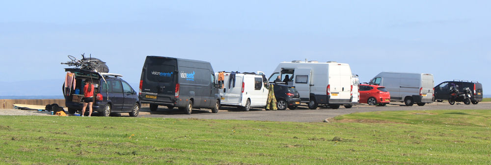
When I reach the far end, I find a raised area of grass and road. Here, dozens of vans are parked – obviously belonging to the surfers because their wetsuits are hanging from the vehicles.
I stop for a while and watch the surfers. Like ants in the water. They seem to spend a lot of time lying down and paddling furiously, and not much time actually standing up on their boards.

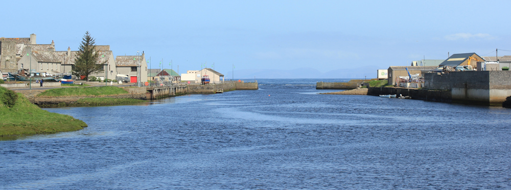
On the far side of the raised area, I can look across the mouth of the River Thurso, and see the far shore where I will be walking shortly. And in the distance is Dunnet Head. I won’t be getting there today… maybe tomorrow… or the day after.
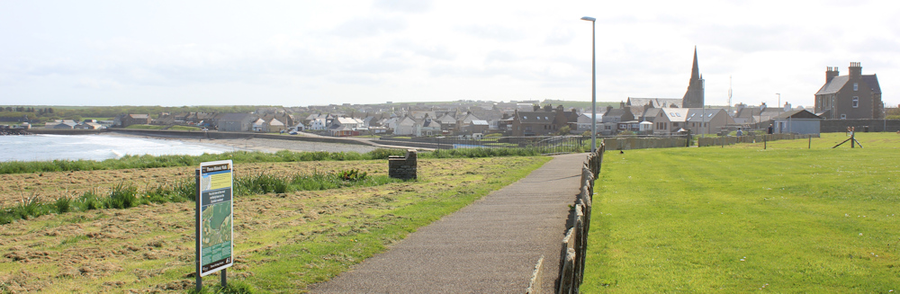
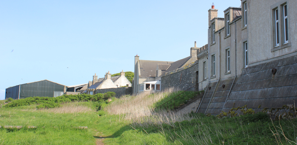
First, I need to walk down the river to find a bridge. This side of the river bank is lined by an odd mixture of shops, residential houses, and industrial yards.
I suddenly realise I don’t have my walking pole with me! Oh, dear. I must have left it behind when I stopped to take photos of the surfers. It’s not worth much, but would be very inconvenient to lose it. So, I hurry back… and there it is. Exactly where I left it. Silly me.
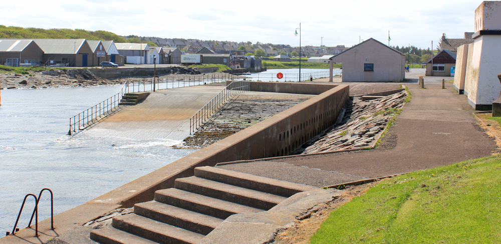
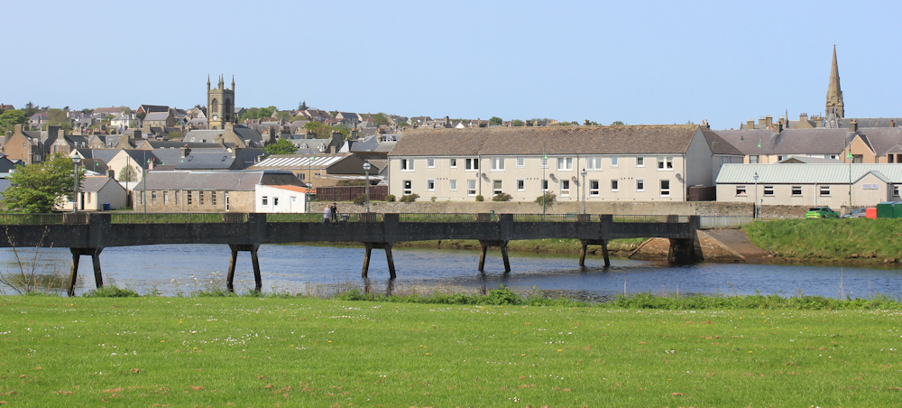
Onwards. I find a footbridge that crosses the river and stop on the bridge to take photographs overlooking the town of Thurso. It looks rather fine in the sunlight.
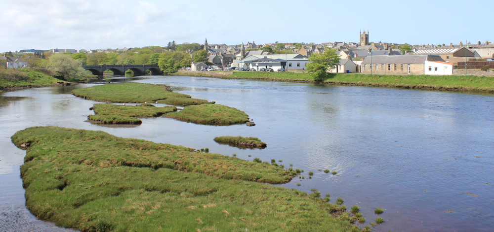
Turning, I take photographs of the view from the other side of the bridge. There’s the mouth of the river, and you can just make out the blue hump of Dunnet Head in the distance.
After crossing the river, I turn left to walk back towards the coast, and I stop to take a photograph of my footbridge. It’s an ugly, functional structure – but I am glad it was there.
This area is called Thurso East. I walk past a scrap yard and a large warehouse that sells agricultural supplies, products for your pets, and outdoor clothing. Of course, everything is shut and there is nobody around. It is Sunday.
I reach the end of the road, and am pleased to see a very definite track that leads further along the coast towards something that looks like a castle. How odd – there is no castle marked on my map!
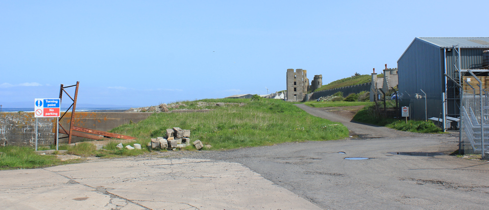
I drop down onto the beach and draw nearer to the castle. It looks fairly modern. Maybe Victorian.
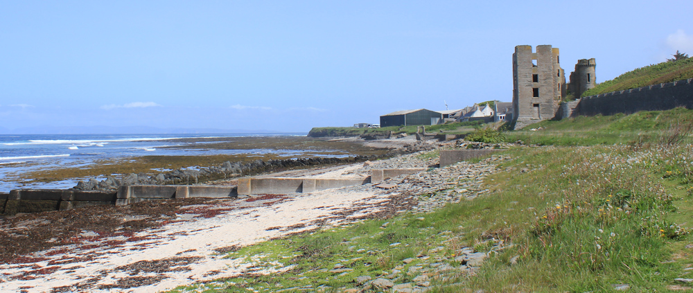
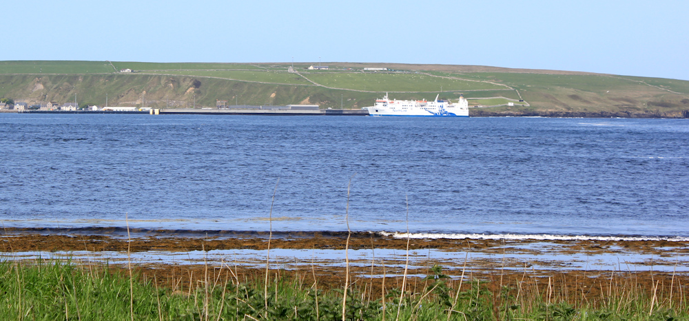
Across Thurso Bay, I can clearly see the port of Scrabster where I walked yesterday. Today, there is a large ship docked in the harbour. That must be the ferry that goes to the Orkney Islands. I didn’t realise it would be so huge.
I’m walking underneath the “castle” now. It’s an odd mix of ruin and smart residential buildings. People live here. Further along, it seems to merge into a working farm.
The coast path leads up to a road, where an array of vans are parked. Here is another surfing area, but with fewer people in the water.
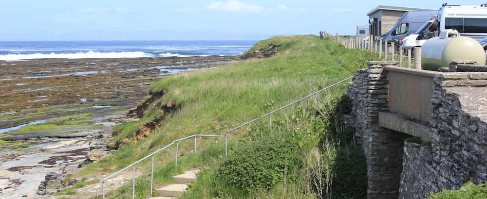
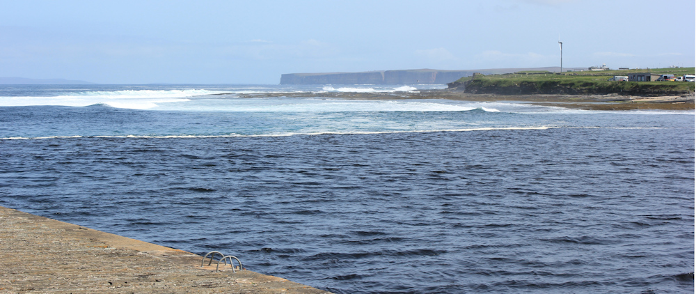
I watch the surfers with some anxiety. This is a much rougher area than the tamer section I walked past before. First you have to cross some slippery, seaweed-strewn rocks to get to the water, and then you have to battle against fearsome rollers.
I pass some sort of hut, which the surfers seem to be using as a changing area – so, I don’t peer too closely. It stinks of sewage though. Not very pleasant.
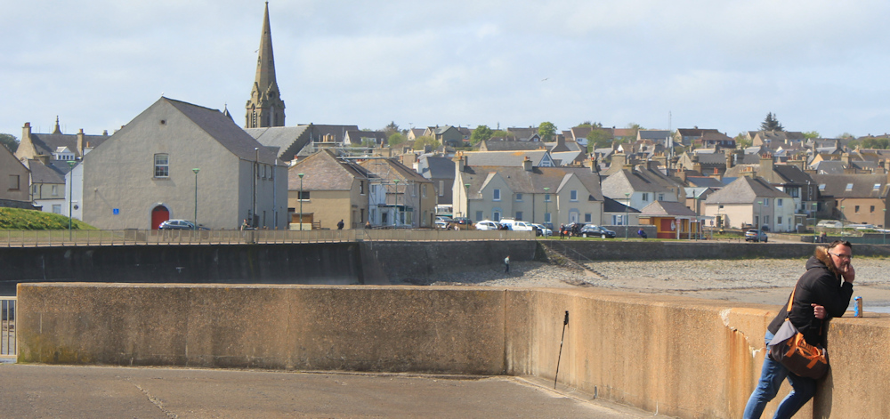
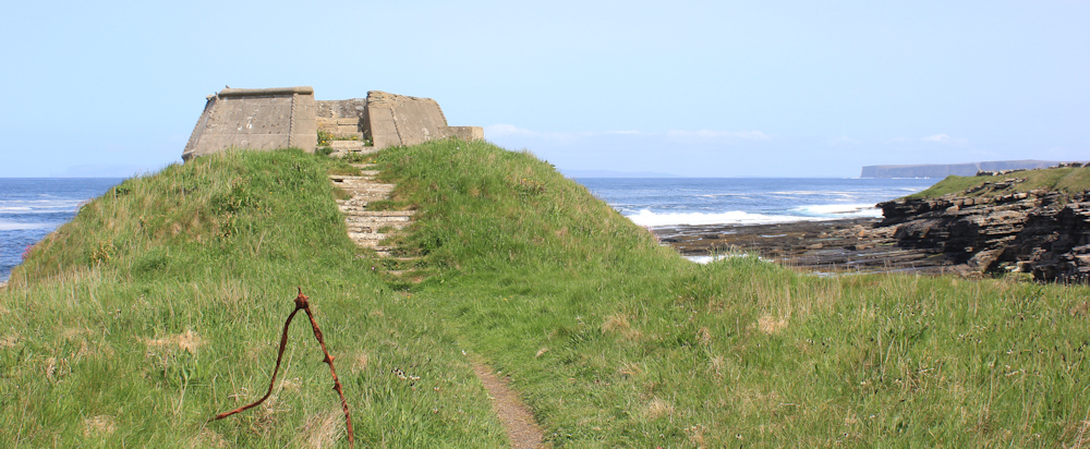
The path continues. Further along is a concrete structure. Maybe the remains of an old look-out post, but now converted to a viewing area. I climb up and sit down. Time for a breather and a snack.
It’s good to hunker down below the concrete surround and get out of the wind. But I haven’t walked any distance yet, and still have miles to go before I reach Castletown. Onwards.
I soon stop again to take photos of the lookout point from this new angle. Looks definitely like an old castle from this side, although the walls are too well-preserved for it to be truly ancient. Maybe it was built at the same time as the other fake “castle” I have just walked past?
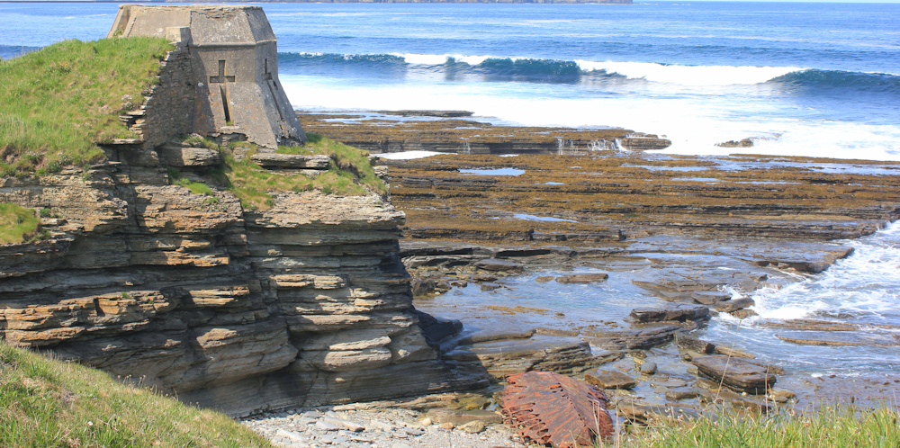
So busy photographing the lookout point, I only just spot the remains of a shipwreck on the rocks beneath it. Oh, dear. A reminder of how dangerous this rocky coastline really is.
I’m pleased to see a definite path continues along the shore. I did have an alternative plan that involved road walking, but I won’t have to use that plan now. This is bliss.
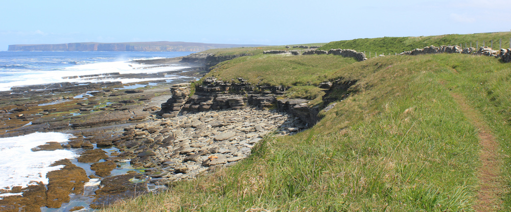
I meet a couple out strolling, and a solitary male walker. Otherwise, I have the place to myself. This reminds me of the South West Coast Path – a good path and fantastic coastal views.

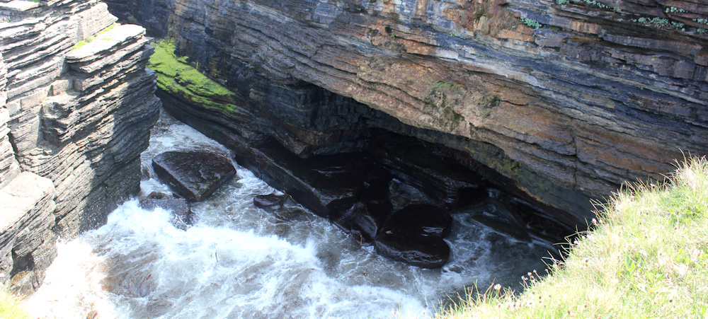
I pass a cave (marked on my map) and step off the path to get a better view of its watery mouth. But the photos are disappointing.
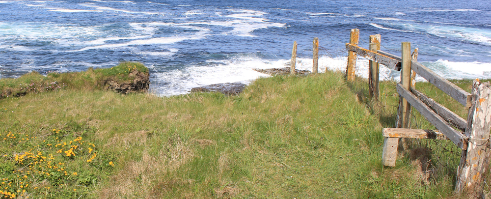
What a wonderful path. There are even a series of stiles to help you over the fences.
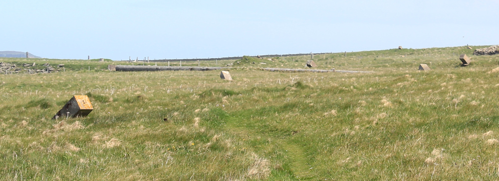
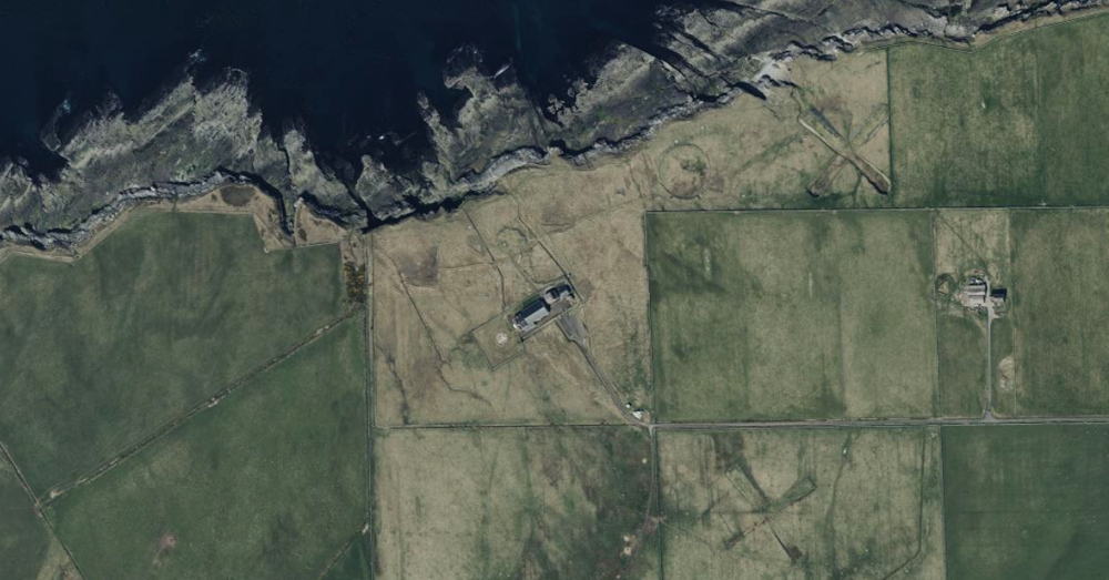
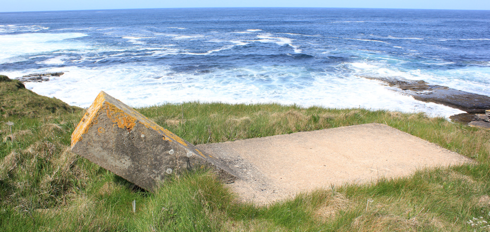
Just beyond the cave, I come to an open grassy area. Weirdly, it is littered with stubby little concrete pillars set at odd angles. Anti-tank defences? Remains of some sort of industry? It’s a mystery.
[Later, on the satellite image of the area, I see strange markings on the ground – a large circle and two large X shapes – none of which were visible to me at the time I walked here.]
Here is a handy arrangement. Not a gravestone – which it resembles – but another one of those little concrete pillars, but this one has a concrete slab at its base. A perfect spot to relax in the sun and have a rest.
I get tired very easily these days – old age, I guess, and it is very frustrating. I also seem to have lost my appetite and have to remind myself to eat. Just gone 2pm, so definitely lunch time.
[To be continued…]
Route so far this morning:


Thurso Castle is indeed Victorian, but it’s the latest building from a sequence of rebuilding and remodelling that goes back to the 12th century, so it’s a real castle, just not the original. Oh, and it’s ruined because it was blown up by a naval mine that washed up next to it in 1943!
The lookout is a deliberate folly, though.
I was as perplexed as you by the weird angled pillars. I assume its left over from some sort of WW2 emplacement but I couldn’t confirm that for certain. Odd looking, though.
Thanks for the info about the castle. Strange that it’s not on the map. And I’m glad I’m not the only one perplexed by the weird concrete pillars. I wonder if the X marks on the satellite image are the remains of old gun placements – but they seem rather too large. Again, there is nothing marked on the map.
You might be able to find out what the strange features are by looking at the historic maps in the National Library of Scotland online resource – every OS map and council map is on there up until the most recent that are still under copyright.
Thank you. That’s very useful information.
Wonderful views and some interesting finds with the castle and the strange pillars.
The waves look dramatic and just what the surfers are after. Not my idea of fun!
Surfing looks terrifying.
The oddly angle blocks of concrete are anchors for masts. At Scarborough GCHQ there are several sets still in use.
Oooh. Thank you. I assume telecommunications masts?
There was a wireless station at Clardon Hill.
https://her.highland.gov.uk/Monument/MHG47567
This is one of the mast anchors at Scarborough wireless station, (GCHQ), aligned at an odd angle but without the horizontal base.
[cid:7AB21441-DBCE-4181-A2A3-CA8E7E25469E]
The “X” constructions look like these blast shelters.
https://www.google.co.uk/search?q=blast+shelters+arial+photos&client=safari&sca_esv=9b23b06c2ff3b9a3&sca_upv=1&hl=en-gb&ei=dPdjZpeTE5GihbIP_puvmAk&ved=0ahUKEwiXner0rcuGAxURUUEAHf7NC5MQ4dUDCA8&uact=5&oq=blast+shelters+arial+photos&gs_lp=Egxnd3Mtd2l6LXNlcnAiG2JsYXN0IHNoZWx0ZXJzIGFyaWFsIHBob3RvczIHECEYoAEYCjIHECEYoAEYCkiLVFCFEFiVR3ABeAGQAQCYAXagAZUIqgEEMTIuMbgBA8gBAPgBAZgCDqAC_gnCAgoQABiwAxjWBBhHwgIFEAAYgATCAgYQABgWGB7CAgsQABiABBiGAxiKBcICCBAAGIAEGKIEwgIIEAAYFhgeGA_CAgUQIRigAZgDAIgGAZAGCJIHBDEwLjSgB6JC&sclient=gws-wiz-serp#vhid=1xaIwirW_P-I_M&vssid=l
Sent from my iPad