
[This walk was completed on the 21st May, 2023]
After lunch, I set off across the grassy area alongside the shore. Notice an upright pillar on a mound – check my map – could be Rossy Hillocy Cairn. Why is it there? No idea.

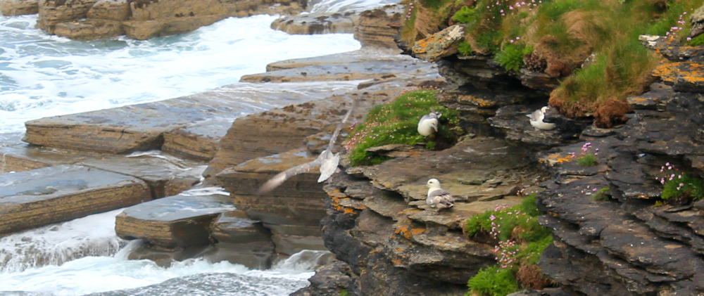
The rock formations continue to amaze me. Look at these cliffs, and the huge sheets of stone that look like enormous paving slabs.

Sea gulls are sitting on the ledges. I tiptoe closer to get a sneaky photograph. Are they nesting, or just resting?
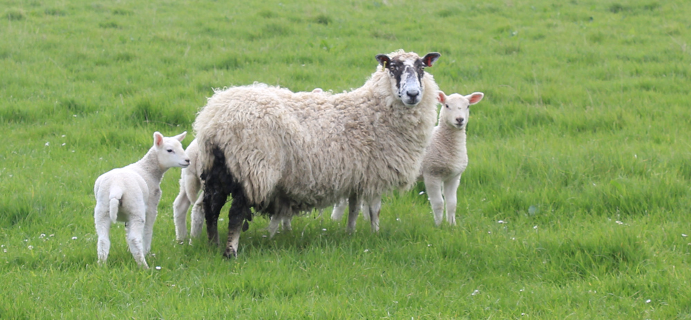
There are sheep with young lambs in the fields. This mother has a very dirty backside, while her babies look spotlessly clean.
The coastline curves round to form a rocky bay. Clardon Haven, according to my map. This suggests a harbour, but the shore looks too rocky to be safe, and huge rollers are washing across the stones.

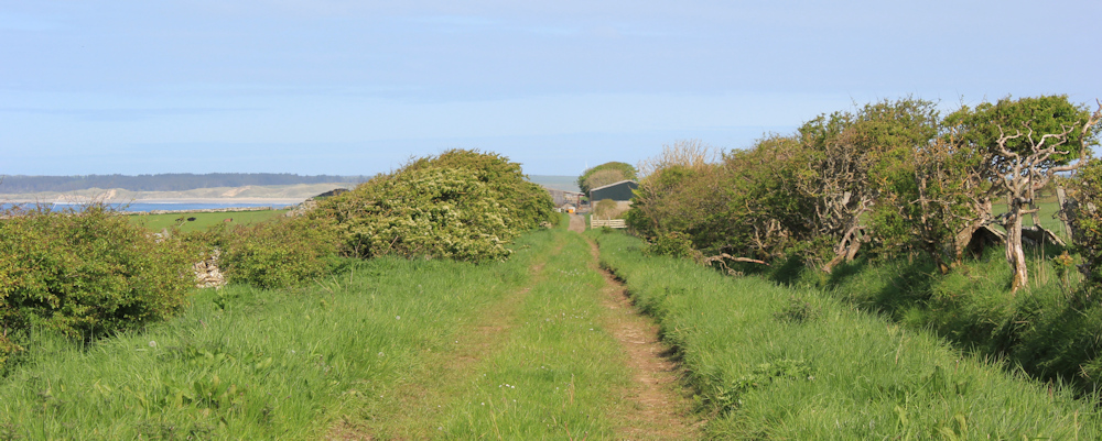
My path has joined a track. Easy walking. This section is a designated as a “core path”.

Although, to be honest, the path soon deteriorates. Never mind. I’ve passed the half-way mark on today’s walk and I’m sure I will find a way through to Castletown. Onwards.

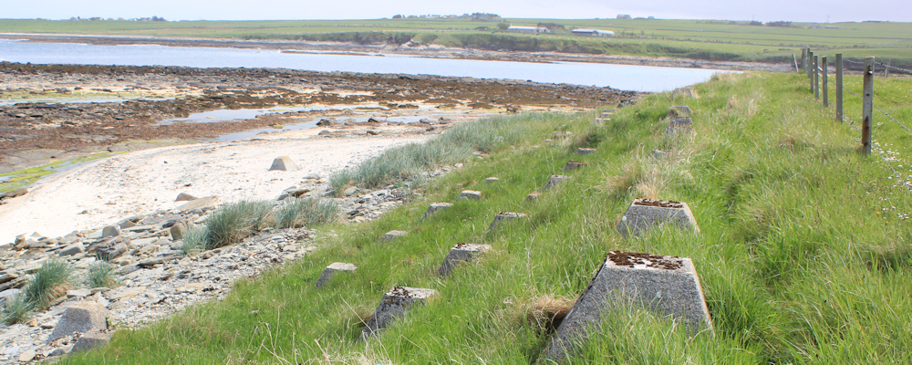
I come to an area where concrete cones litter the beach. Looks like a giant smashed-up his egg box. But I know what these are – anti-tank defences left over from WW2.

There are concrete cones on the path too. I pick my way around them, and realise I’ve neally reached Murkle Bay.
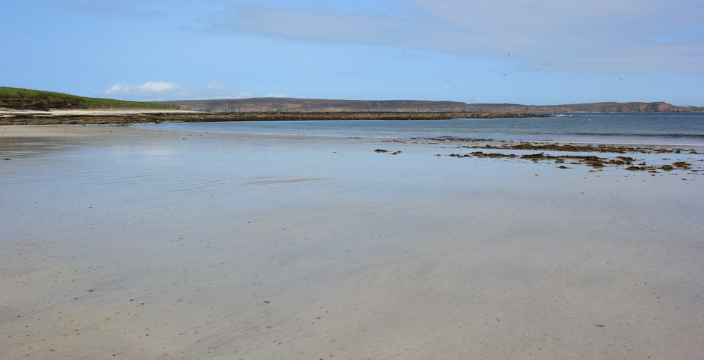
Murkle Bay looked enticing on my map – a large hemicircle of yellow sand, apparently. The reality turns out to be somewhat underwhelming, because the sand is a grey colour and has an unpleasantly sticky texture. It didn’t help that the sun went in at this stage.

The texture of the beach reminds me of Par Sands in Cornwall, where the beach was actually formed from particles used to make china clay.
After crossing the beach, I turn to take a photograph looking back across the sands. It looks prettier from this aspect, with the strange grey sand hidden under the sheen of water.
On the far side of the beach, a track leads inland, but a clear path continues following the shore. It passes around a stone that stands in the dunes – whether its an artificially placed stone, or an erratic boulder, isn’t clear.

The path soon deteriorates. I find myself edging along a steep grassy slope with a steep drop below me, and only a rickety barbed-wire fence to cling on to. Oh dear. This is dangerous…

… I turn back and decide to follow the track instead. It takes me inland, unfortunately, but I should soon be able to turn off to the left along a farm track.

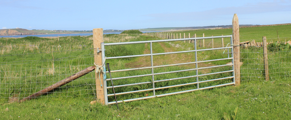
Yes. Here is the farm track. I have to climb over the gate, but after that it is great walking. Flat and straight.
Unfortunately, it ends up in a farmyard. I feel nervous. Will I be challenged for walking down a private farm track? More importantly, will I be able to get through? The first gate is open…

… and there is nobody in the yard.
To get out of the yard, I must squeeze through the narrow opening of a second gate, whose hinges makes loud protesting noises. The only person I can see is a man mowing his lawn in a nearby garden. The mower is making too much noise and he doesn’t hear the gate – in fact, he is so intent on pushing the mower that he doesn’t see me at all!
A track on the right leads up towards the main road, but I carry on walking along the farm track that continues to run roughly parallel to the shore.

Uh, oh. There are cows in the fields. This one is very interested in my progress, and I’m very grateful for the tombstone slabs and the barbed-wire fence. I really don’t like cows.

The track comes to an abrupt end, and there are two gates to choose from. Which way? The field in front of me contains cows (they are hiding round the corner). The field on my left is full of sheep.

Of course, I take the field on my left. This leads more directly towards the sea anyway, but, more importantly, doesn’t involve going near any cows!
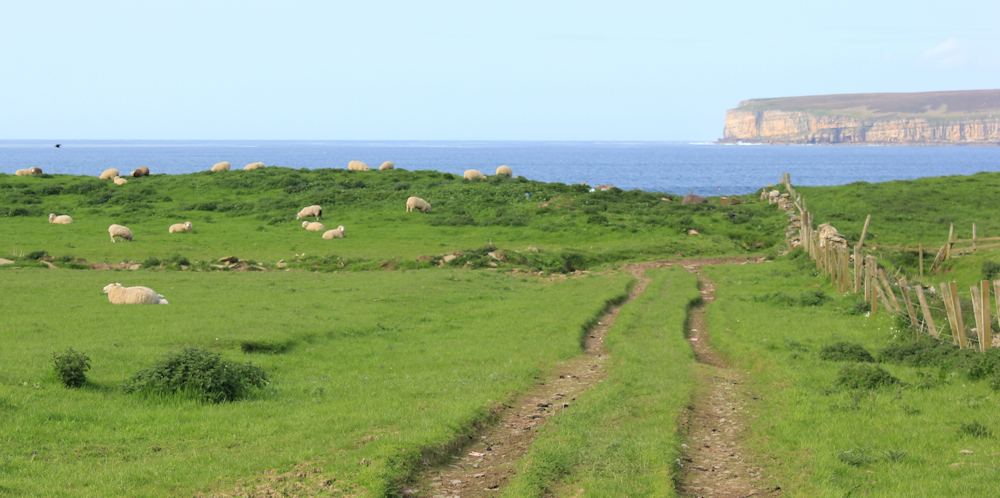
The sheep just ignore me. There is a clear track through the field, and it soon swings round to the right, passing through the remains of an old stone wall.
I walk past some ruined buildings and leave the field by another gate.
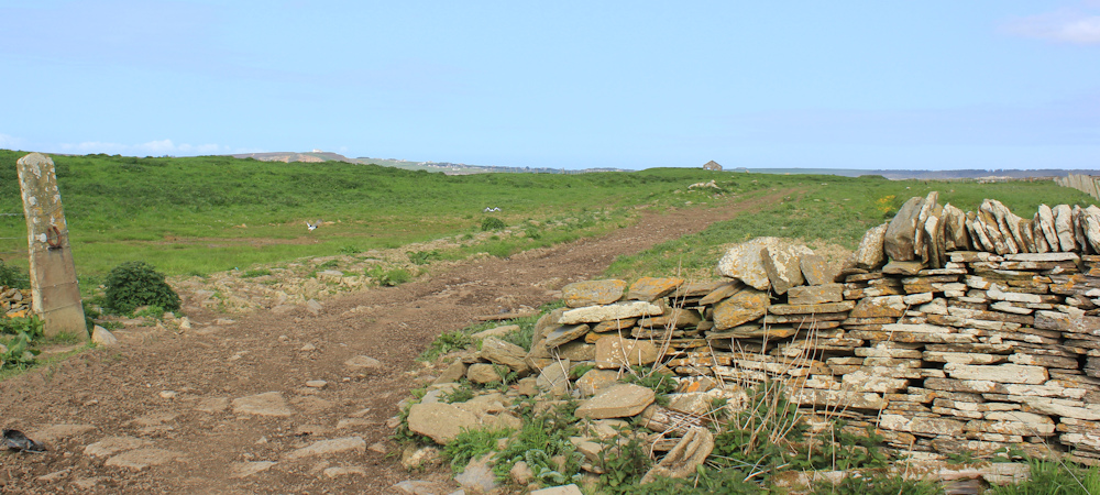
Here the track is joined by a rough road. A very, very rough road!
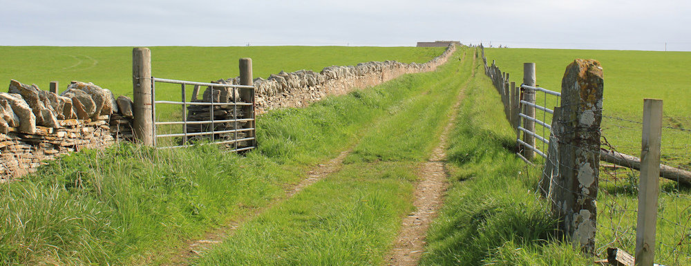
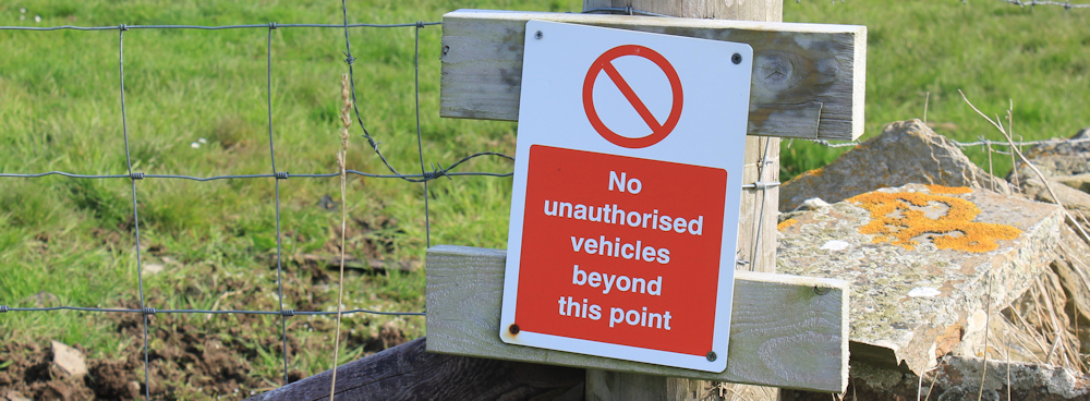
This is actually marked on my map as a core path, and from here I realise I can follow the core path all the way to Castletown. The sign on the next section warns me not to drive an unauthorised vehicle beyond this point.
The sign on the next post also surprises me. It’s always reassuring to see a walking waymarker. But this one proudly declares I am following the “North Coast Trail”. The implication is that there is some marvellous walking route along the north coast – but this is the first sign I’ve seen! Where have you been hiding, Mr North Coast Trail?

This section of the walk is really lovely. I’m walking along the shore again, with Dunnet Head shining in the sunlight on the far side of the bay. Stunning rock formations. Crystal clear rock pools.

Ahead I can see a vast expanse of sand, fringed with tall dunes. That is Dunnet Bay beach, and I should be walking across those sands tomorrow. Looking forward to it already.

I’m growing tired now. The track has become more obvious, and there are buildings ahead, most of which are in a state of decay.

I walk past the buildings – too tired to explore. And, finally, there is the car park ahead and my camper van waiting for me.
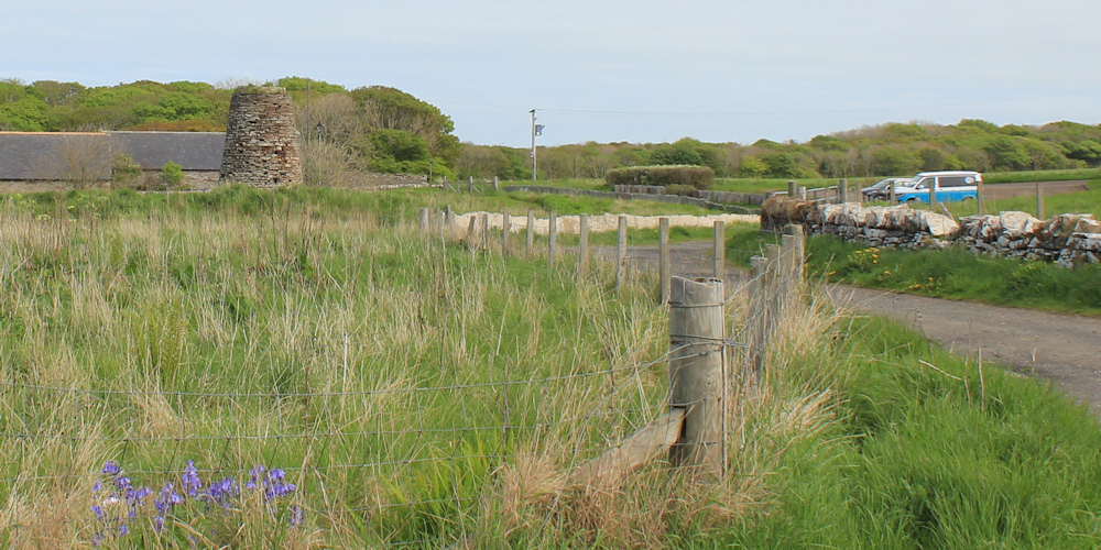
The car park and the nearby buildings are all part of a heritage area. There is an ancient broch (on the left hand side of the photo above), a little museum, a cafe, and a heritage trail that promises to tell me everything I need to know about the local flagstone industry.
But, I’m too tired to follow the trail today. That will have to wait until tomorrow.
Miles walked today = 8 miles
Total around coast = 5,036 miles
Route (morning in black, afternoon in red):


I really like your writing style Ruth, it felt like I was there on that walk
Thank you, that’s very kind.
You are most welcome