
[This walk was completed on the 22nd May 2023]
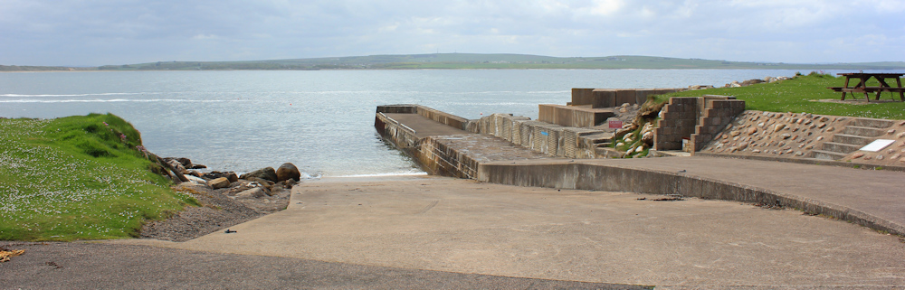
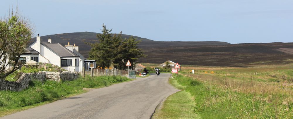
What a lovely place this is. West Dunnet – just a handful of houses and a little museum called Mary Ann’s Cottage. Here is a pretty little harbour too, with an old pier, and a deserted car park. Only one vehicle parked.
My plan is to follow a core path from West Dunnet, walking across open countryside, and joining the road to Dunnet Head somewhere near the village of Brough.
I chain up my bike and look at the signpost. Looks like a steep climb – up and up – to somewhere called Peedie Sands.
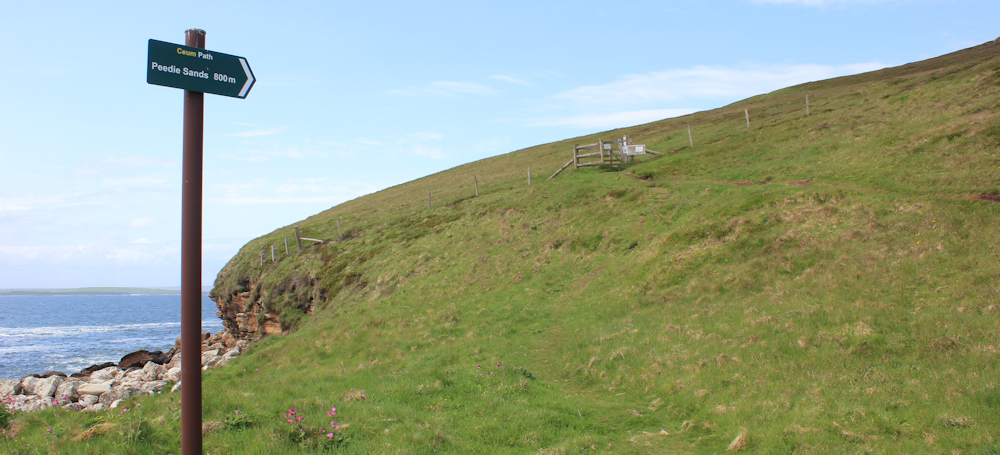
I check my map – nowhere called Peedie, or Peedie Sands, to be seen on the map. How confusing! But, there is only one path, so this must be the correct route. Up I go.
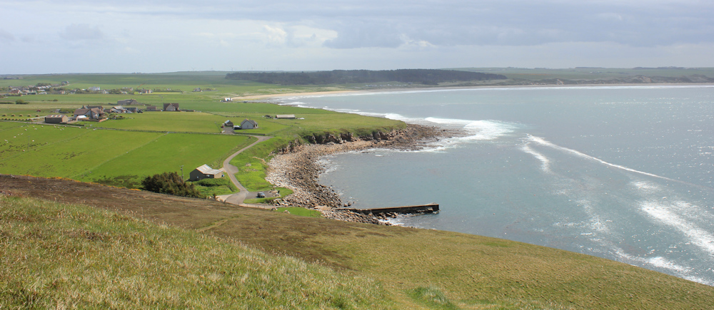
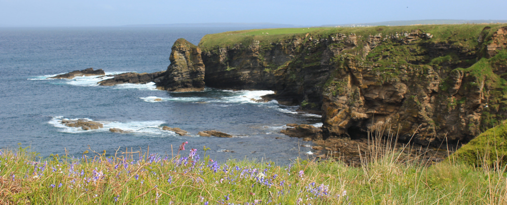
It’s a very steep climb. I huff and puff – but the views from the top are worth it. There is the little pier below me, and Dunnet Bay beyond that. Look at that wonderful curve of sandy beach – I shall have to do that tomorrow.
I could look at this view all day, but I must get on with my walk. So, I turn my back on Dunnet Bay and look ahead. Now, where are the mysterious Peedie Sands?

Today hasn’t gone exactly as planned. When I left Castletown this morning, my plan was to park somewhere in the little village of Brough and bike back to Castletown, saving Dunnet Head for tomorrow. But, in Brough there were just the usual narrow Scottish roads and no car park to be found. I kept driving… and driving… and eventually ended up on Dunnet Head itself!
Once upon a time, I would have done the walk from Castletown to Dunnet Head without thinking twice about it. But, I have been feeling unusually tired – old age creeping up, I guess – so I decided to bike back to the almost-half-way point at West Dunnet pier, walk to Dunnet Head today, and fill in the section between Castletown and West Dunnet tomorrow.
This is a most beautiful place. The path is sloping down gently now. The sun is shining. A perfect day for walking.
Ah, that must be Peedie Sands below me. Wonderful clear water, but hardly any sands. What a tiny beach! Maybe more sands are visible at low tide.
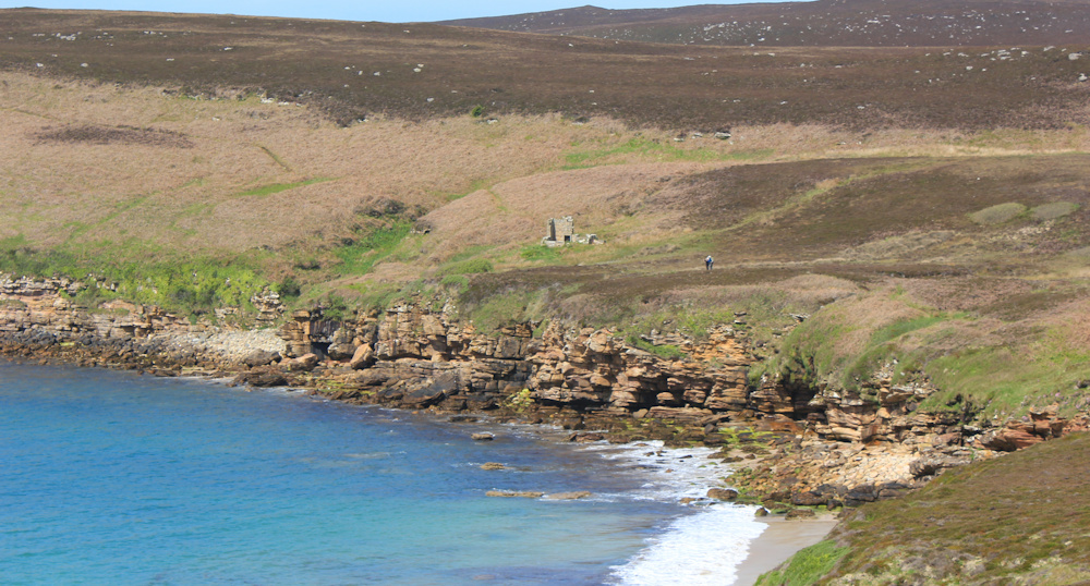
There are a couple walking ahead of me – oh, and I can see seals swimming in the bay. Pull my camera up … but, they too far away, and too quick to dive, and I don’t manage to take any decent photographs.
Across on the other side is a ruined building. A castle? I head towards it. Not a castle after all, just an old, ruined house.
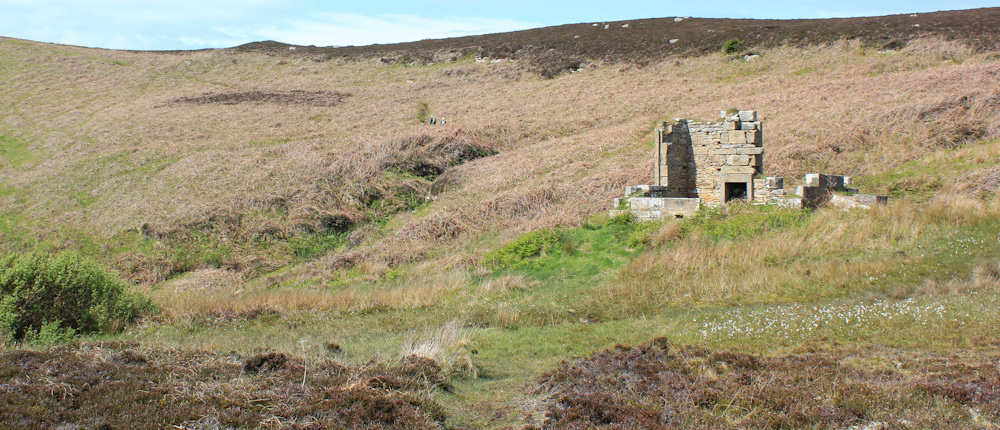
I sit on the tumbled stones beside the ruined building and have a snack. Then I look around. The couple ahead of me have disappeared and I am not sure which direction they went in. The path seems to have come to an end. Oh dear. Where do I go from here?
My map suggests a track turning inland and going uphill, but there is no sign of one. I stumble around in the heather, gradually making my way uphill, until, more my luck than anything else, I come across the path.
How could I miss this track? It’s very clear when you’re actually standing on it – but almost completely hidden from view by heather-covered banks when you are below it.
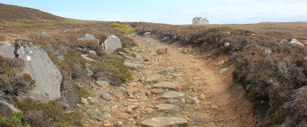
The track appears to be heading towards a rather large house. When I reach the top of the slope, it joins a tarmac driveway with metal gates, and a sign that tells me this is the “House of the Northern Gate”.
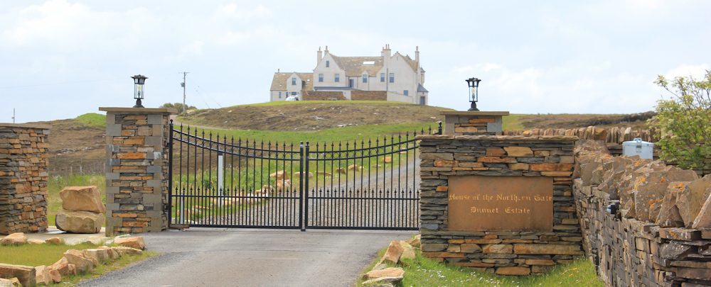
Love Scottish place names. Not “Northern Gate House”, because that is far too ordinary, but “House of the Northern Gate”, which sounds like something out of a gothic novel, or Game of Thrones!
I am now walking along a narrow lane, and soon spot a core path sign pointing up a new lane. The signs says, “West Dunnet Link Paths”. This must be the right way to go.

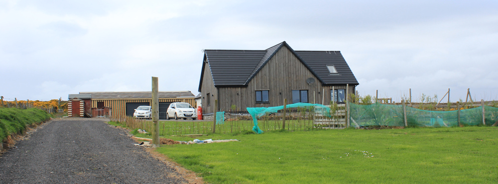
The new lane comes to an end at a rather lovely house, with wooden cladding. A new build I guess. It’s not marked on my map. Uh oh. Have they actually built a new house right over the old core path?
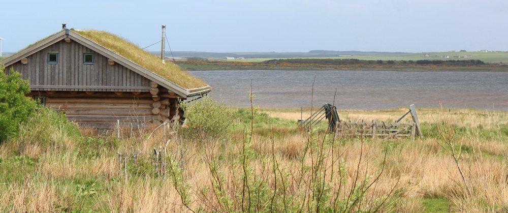
I can’t see a sign post, but spot this track – perhaps this is the right route to take? I can see a ruined cottage ahead and something that looks like the sea… pull out my map… not the sea, but an inland lake.

Onwards. Past the ruined cottage, the track takes me to another lane, where core path signs miraculously reappear. I cross over the lane to walk down what looks like someone’s private drive, but straight ahead is a farm gate and another core path sign.

A sign on the gate warns me my dog can kill, and another sign proudly proclaims “Tup’s at work”. The apostrophe is misplaced, but I know what a “tup” is – a ram. There are ewes and lambs in the field, but I see no sign of the tup at work. Maybe the poor chap is worn out and having a rest? Onwards.
The path across the field is faint but visible. I’m heading towards another house. None of these modern buildings are shown on my map, so they must all be new builds.
Through another gate, and down to the road. Ah. This is where the core path ends. I have reached the main road to Brough.
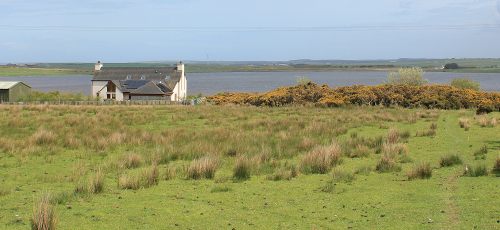
I turn left to follow the road, and soon have some lovely views to enjoy. This inland loch is called “St John’s Loch”, and a few residential houses are dotted about along the route. I particularly like this house – with grass growing on its roof!
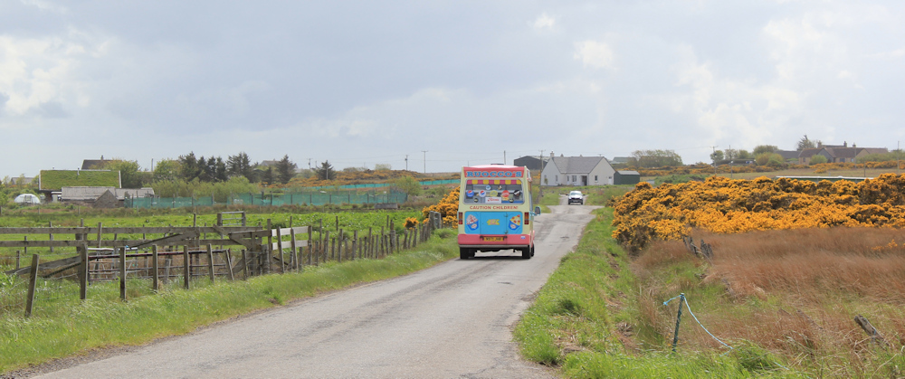
The road I’m on is not particularly busy, but busy enough to keep me hopping onto the grassy verge to let vehicles go past. Hello, an icecream van. Wonder where you are heading?
Later on a bus overtakes me – not a tourist coach, a proper bus. A rare sight on the north coast of Scotland.

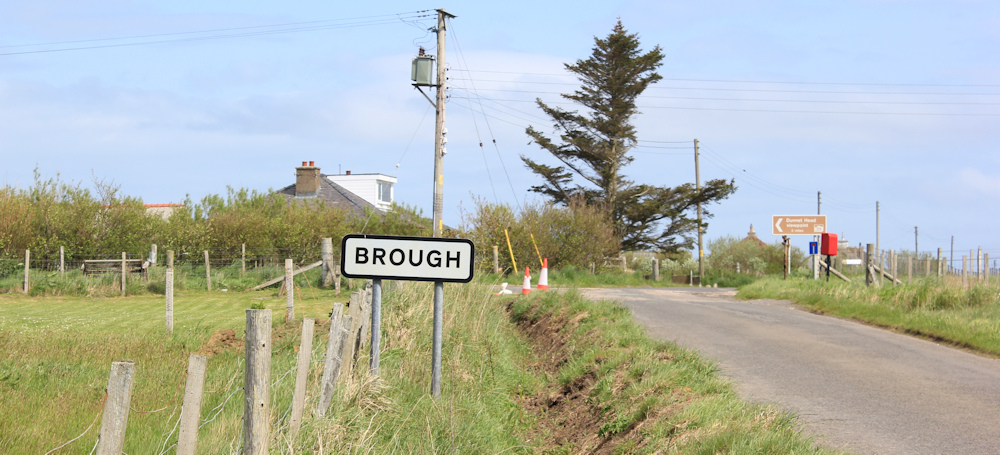
I reach the village of Brough, and take the left hand turn into the village. This road will lead me all the way to Dunnett Head – where my van is parked.
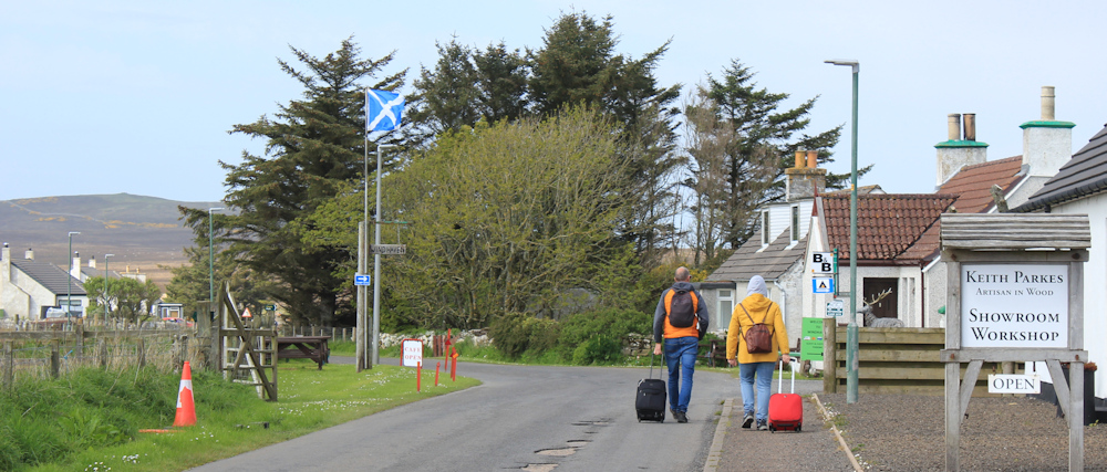
Brough is surprisingly large. The first thing I pass is a bus stop, then a woodworkers workshop, and then spot a B&B ahead. I am following a couple trundling suitcases behind them – and I suspect they got off the bus. Wonder if they are staying in the B&B?
Next to the B&B is the Windhaven Cafe. It is open! Another rare sight in northern Scotland – a cafe that is actually open! It proudly boasts of being the most northerly cafe on the UK mainland.
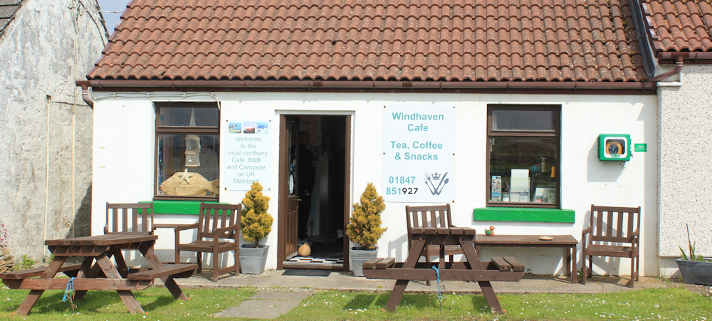
I’m tempted to go in, but I don’t seem to have much of an appetite these days, and I’m worried that if I sit down I might never get going again. Onwards.
The road meanders on. There is Dunnett Head looming ahead – I am anticipating a long climb.
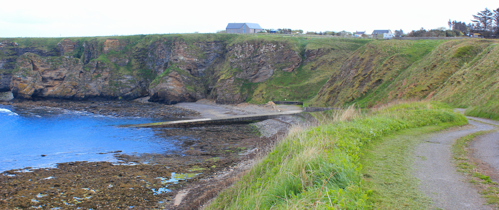
But, before I turn inland for Dunnet Head, the road runs close to the sea and I have a lovely view over a delightful little bay.
A side lane leads down to an old slipway, but a sign warns me, “Due to erosion the cliff road is unsuitable for use by heavy vehicles.” I wonder if that includes camper vans?
I don’t go down to explore the bay, but carry on up the road. Soon, I’m leaving Brough behind.
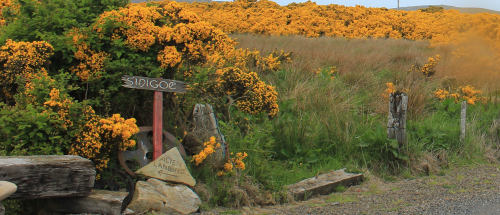
Sadly, at this point, it begins to rain. I stop to put on my waterproofs and attach the rain cover to my rucksack. Nearby is a driveway with a house sign, and the small carved stone beneath it catches my eye. “ALIEN LANDING” – makes me smile.
People who live in Scotland have a great sense of humour. Along with the many road signs depicting sheep that have been turned into monsters or unicorns, I have also seen a large rock painted to represent a monster midge at Ardtoe, and a full size manequin dressed as an extra from a Queen video in Mellon Charles.
I turn to face the road ahead. Shame about the rain. Onwards.
I take a photo of what I believe is the most northernmost house on the UK mainland – (turns out not to be the most northern house, but I don’t realise this at the time). I can’t actually see the building because it is surrounded by trees. The bit I can see looks like the usual Scottish scrapyard.
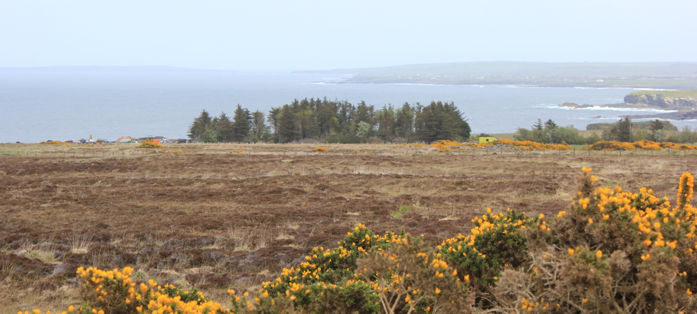
In the distant mists beyond the hidden house, the north coast of Scotland stretches away, all the way to John o’Groats and… hang on… is that one of the Orkney islands? Wow! Shame about the weather. My photos are disappointing.
Onwards. Up the road towards Dunnet Head. Although now, inexplicably, the road appears to be going downhill!
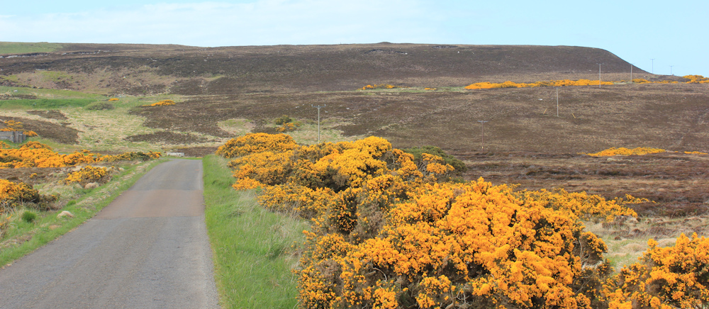
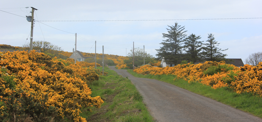
It continues raining off and on. The landscape is bleak, without a tree in sight, but at least some colourful gorse bushes line the road and add a bit of cheerful colour to the view.
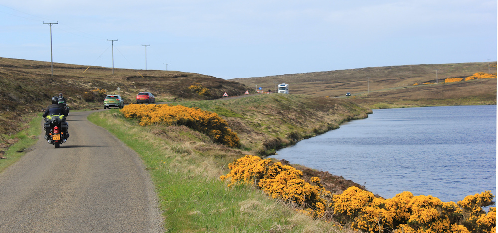
There are a series of inland lochs just to the left of the road, and I pass paths that lead down to fishing areas. “Many Lochs” says my map. (I’m not sure if that’s the real name of one of the lochs, or whether the OS people just couldn’t be bothered to name them all!)
The road swings close to another one of these inland lochs. This one has a name. Long Loch. Traffic has hotted up. I’m continually having to step aside to let vehicles get past me – a procession of motorbikes, cars, and the inevitable huge motor homes.
Is it just my imagination, or have motor homes got larger since I started my Scotland walk?
The road winds slowly up hill until, finally, I reach the top of the climb and the end of the road. This is Dunnet Head, and there is my lovely little camper van. I’m always pleased to see him.
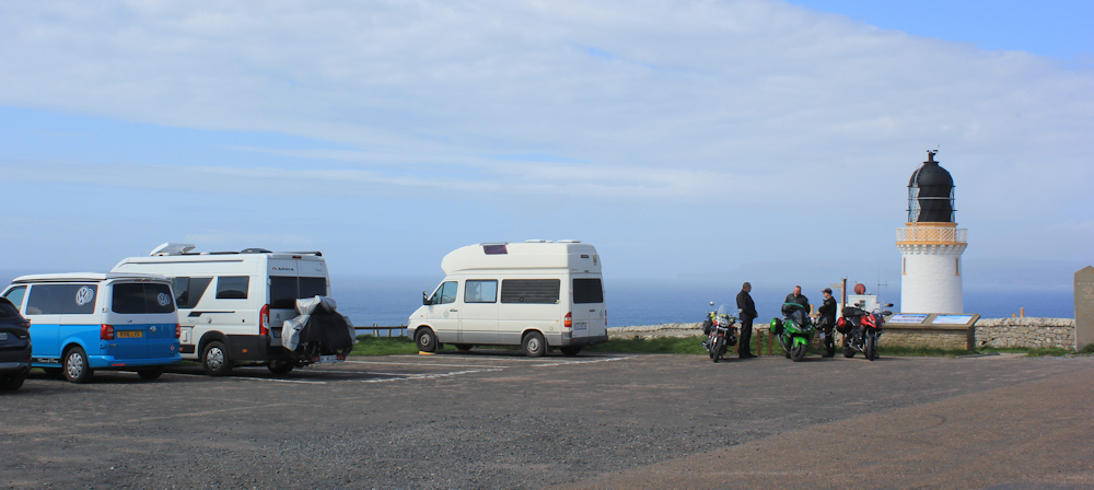
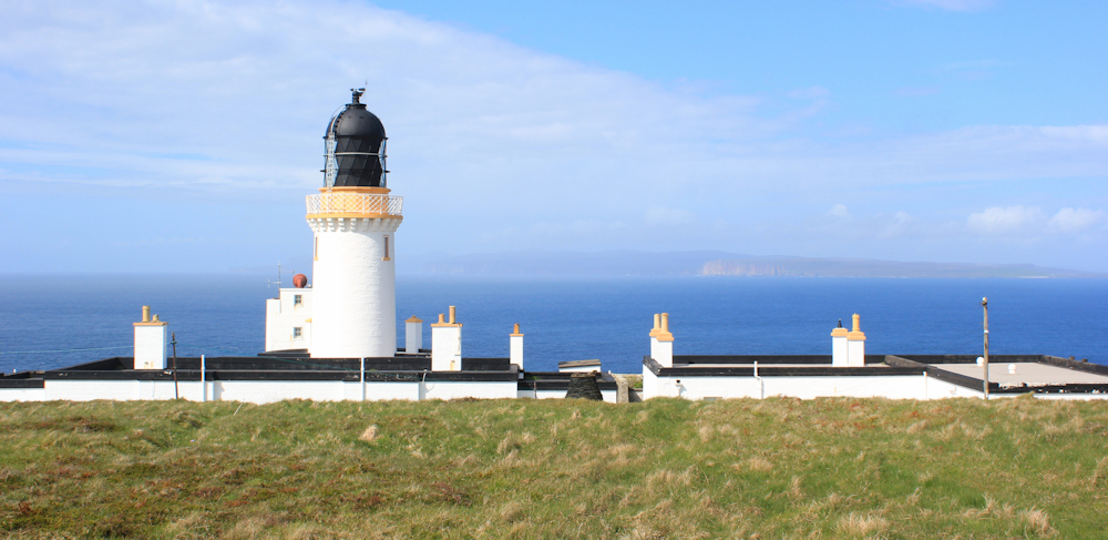
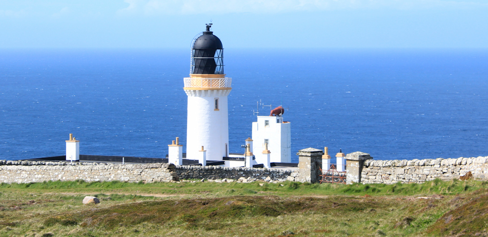
Miraculously, the rain has cleared and the view has improved. I can take some great photos of the lighthouse, and that is definitely the Orkney Islands in the distance.
A carved slab of stone proudly pronounces that I have reached Dunnet Head, the “MOST NORTHERLY POINT OF MAINLAND BRITAIN”. A kind man offers to take my photo in front of the stone.
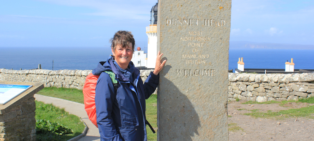
I think I drive him mad with my demands. “Please make sure you get me in it. And include the writing on the stone. But I’m not bothered about the lighthouse.”
The lighthouse is now a private residence, along with the nearby lighthouse keeper’s cottages. Turns out that these are the most northernmost homes on mainland Britain.
I walk up the hill behind the lighthouse and look at the map on the plinth, which points out the names of the islands that lie just across a stretch of water known as the Pentland Firth.
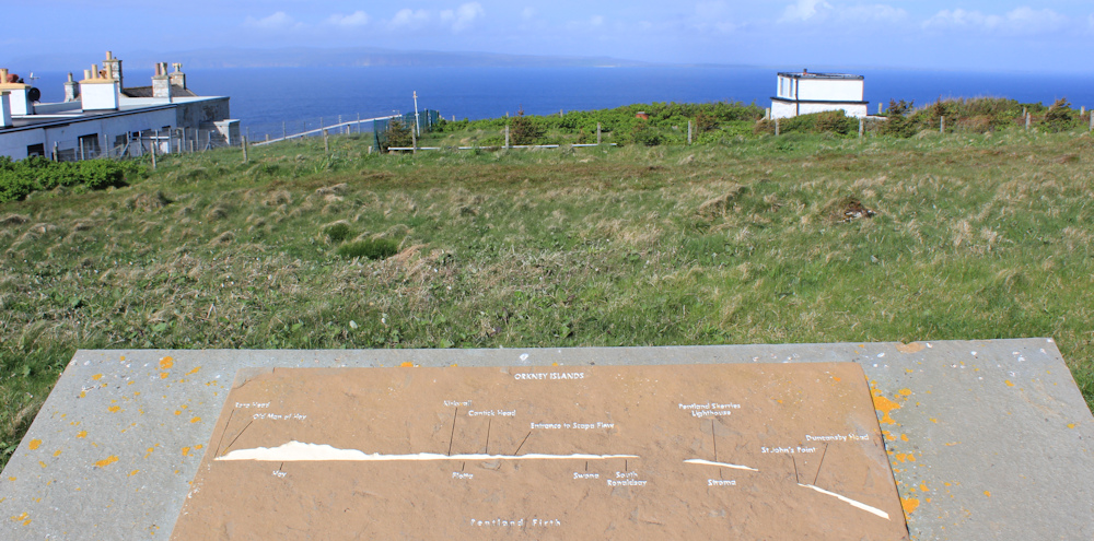
I’ve heard of the Pentland Firth (a name almost synonymous with wild waters and shipwrecks), but I didn’t realise exactly where it was until now.
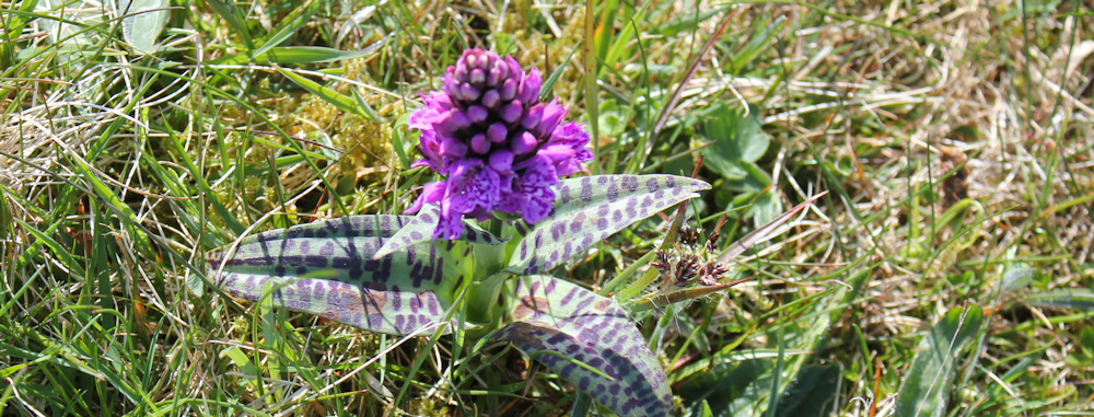
Not many people bother to climb the hill. I enjoy the peace and take photographs of wild flowers. I wish I could remember the names of these orchids.
Near the top of the hill is a trig stone. Rather strangely, it isn’t actually sited on the highest point – that is taken over by an area of seating.
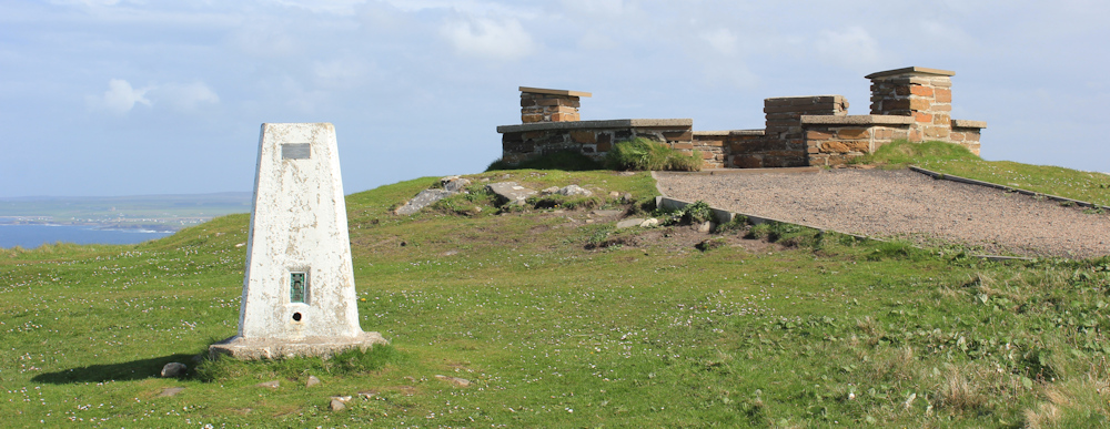
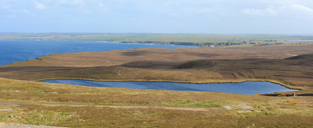
I enjoy the rest. An opportunity for a drink and a snack… and to admire the view. That’s the Loch of Easter Head below me. Strange name.
Coming down, I take some more photos of the lighthouse. It has a foghorn too. Wonder if it still works?
Today, despite the botched logistics of this walk, I feel an immense sense of achievement. I’ve reached the northernmost part of mainland Britain, and so have successfully navigated all the main cardinal points of my walk – Ness Point in Lowestoft, Lizard Point in Cornwall, and Corrachadh Mor on Ardnamurchan Point (although to be fair, I kind of cheated on that one!)
Tonight is my last night at the horrible campsite in Thurso. Tomorrow I’ve booked into a hotel – another cause for celebration!
Miles walked today = 6.5 miles
Total around coast = 5,042.5 miles


Congratulations on reaching the northerly point of the UK. Can I ask how many weeks you walk a year, roughly ? Also, is it easy in Scotland finding places to park the Campervan overnight? Carol
Hi Carol. When I was working I took long weekends and perhaps a couple of full holiday weeks. But now I’m retired I can do what I like. This particular trip was 4 weeks long – longest I’ve ever done. It’s such a long journey up to north Scotland (10-12 hours drive) that it hardly seems worth going for less than a couple of weeks. I’ve just been up for another two weeks! I now park in proper campsites because I need an electric hookup to charge my e-bike. But, before I had the bike, I often used forestry car parks and the occasional secluded lay-by.
I love reading your blogs, find them
so interesting and informative . I have never walked alone for any distance, so feel particularly in awe that you are doing this journey solo. It must be a wonderful journey , and you must discover so much about yourself, meet wonderful people and have an enormous sense of achievement. Have you found following the Scottish coastline challenging as far as finding routes? Carol
Thank you for your kind words. Scotland is incredibly beautiful, but finding decent walking routes is hard because they don’t have the same public footpath network as in England and Wales. So, there is a lot of road walking. But the roads are relatively quiet (in most cases) and the views are still fabulous. I use Core Paths where I can find them, and some sections do actually have a proper coast path – although most don’t.
Well done! There is something so satisfying about accomplishing a long difficult task.
This did seem like a huge milestone.
Hi Ruth – Congratulations for this time last year 🙂 – Cheers Russ
Thank you Russ. Can’t believe this was a year ago!
Hi Ruth
Congratulations! You must have had a real sense of achievement & I hope you enjoyed your night in the hotel. I’m guessing that a year on, you’re now on the ‘home straight’, albeit a very long one!
I’ve just finished the English coast, so having now done England & Wales, I’m still debating whether to attempt Scotland. What little coastal walking I’ve done in Scotland to date, seemed to be mainly on roads, which isn’t much fun. Would you say that there’s a lot of road walking on the Scottish coast overall?
I’ll make a decision sometime, but after many years of walking the coast, (like yourself), it’s a part of my life & difficult to give up, despite the challenges!
I hope you’ve enjoyed your walking this year. Well done on your fantastic achievements so far.
Rita
Hi Rita. You have done so well and I’m sure you would love Scotland. Most of the Scottish roads are very quiet, and often single track, so walking on them isn’t much of a hardship most of the time. But, yes, there is a lot of road walking to do – unless you are happy to tramp through bog and uncharted wilderness, which some of the braver coastal walkers have done!
Thanks Ruth. I’m definitely not brave enough to tramp through bog & uncharted wilderness, even though it’s happened accidentally at times! Maybe Scotland will be calling me in the autumn….
Love this Ruth, thought of you last week when I walked a few miles, 20,
Ahhh, thank you Sarah. Hope all is well with you.
Well done Ruth. I think Dunnet Head is better than John O’Groats, so I am glad you liked it. Many years ago when I cycled from Land’s End to john O’Groats I arrived at JOG to find the hotel and cafe closed for redevelopment and the only thing there was a mobile caravan selling revolting coffee. I was so disillusioned I looked at my map and decided to celebrate my achievement at Dunnet Head. Hence I have always had a soft spot for it. Re the Pentland Firth – when I walked the coast I met 4 canoeists near Wick who had just canoed through the Pentland Firth at 04.00 in the morning as it was the only time they could get through it. They were doing their own North Coast 500, canoeing from Fort William to Cape Wrath and around to Inverness and then along Loch Ness back to Fort William!!! They were very bedraggled when I met them due to how hard the Pentland Firth had been. Sometimes even the Orkney Ferry goes backwards!!! due to the currents. Some of the strongest in the World.
Hi Chris, that must have been very disappointing for you. I hated Lands End – so I was expecting something similar at John o’Groats, but I have to confess I liked John o’Groats. I think it probably has changed for the better since you walked through it.
I couldn’t agree more and yes John O’Groats is very tasteful and nice now.
Well done Ruth, congratulations on a great achievement!!
Thank you. It was a really happy moment.
Hello Ruth
I’m in awe of your achievement – wonderful! The orchid you ask about is a spotted orchid – the leaves are the clue. Best wishes, Elizabeth
Oh, thank you. Hopefully I will remember this!
Congratulations Ruth… all four extremities! I love that rugged landscape with the gorse flowers, trees are so last century 😊.
I’ve found a couple of new flower identification apps that are much better than the one I used to use (Plant Snap)… “Flora Incognita” and “PlantNet”. They’re both free. They both reckon that flower you saw is a Broad Leaved Marsh Orchid. It explains why my walks have slowed down, stopping at every little flower I come across, and my blog posts are now tediously full of wild flowers. I forget the names within a few minutes, so repeat the process over and over on my walks, takes ages.
Belated congratulations on reaching the most northerly point of mainland Britain. It’s a fantastic achievement. A super photo of you with the stone! More lovely scenery on this walk and I like the lighthouse too, what an amazing place to live.
Your orchid contains a lot of Northern Marsh (Dactylorhiza purpurella), based on colour and shape of lip. However the leaves are very heavily spotted, which is wrong for D. purpurella, so likely to be a hybrid, probably with Heath Spotted (D. maculata). Since the hybrids are fertile you then get back crosses and much confusion! Like most things that grow in Caithness it’s stunted by the wind.